106 Ascent Passport
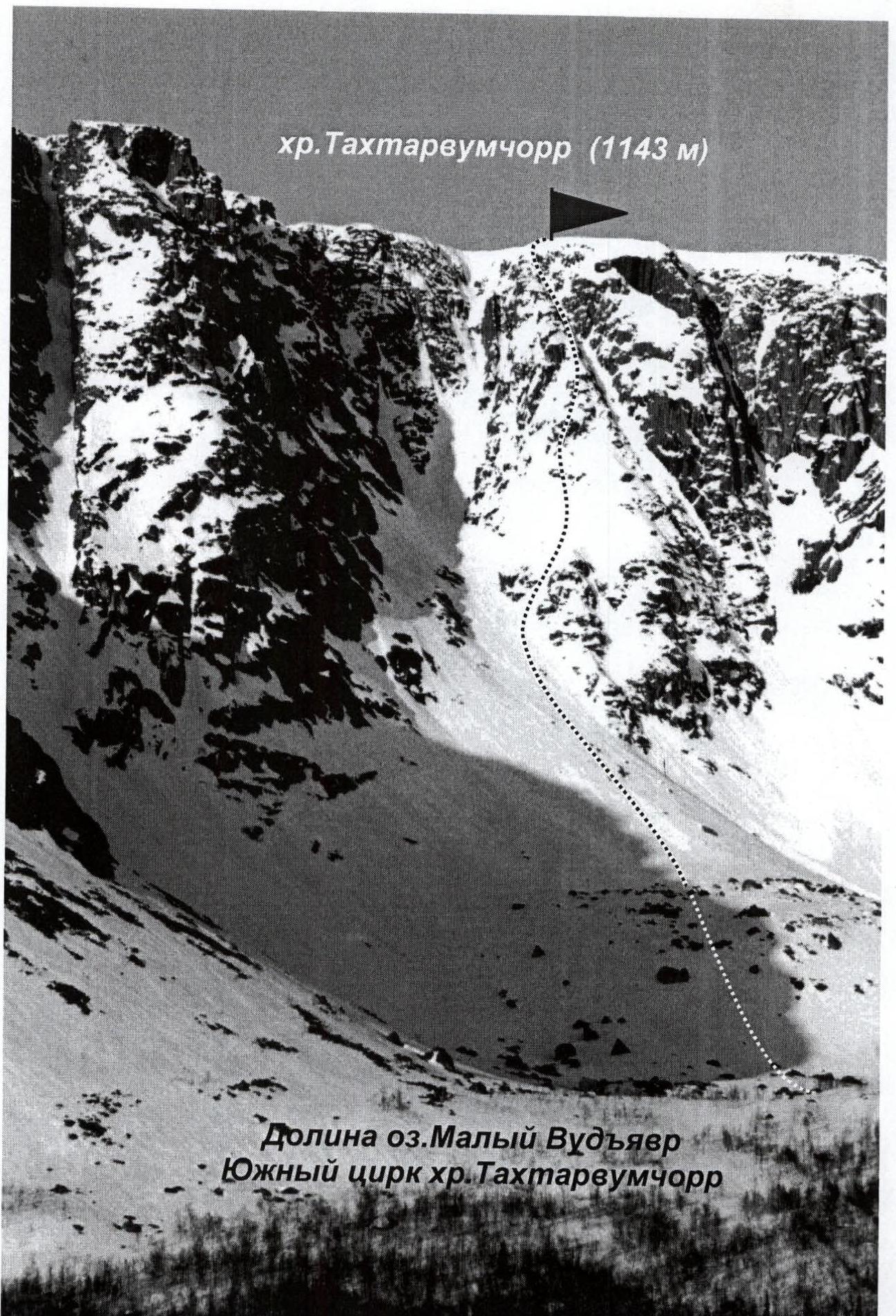
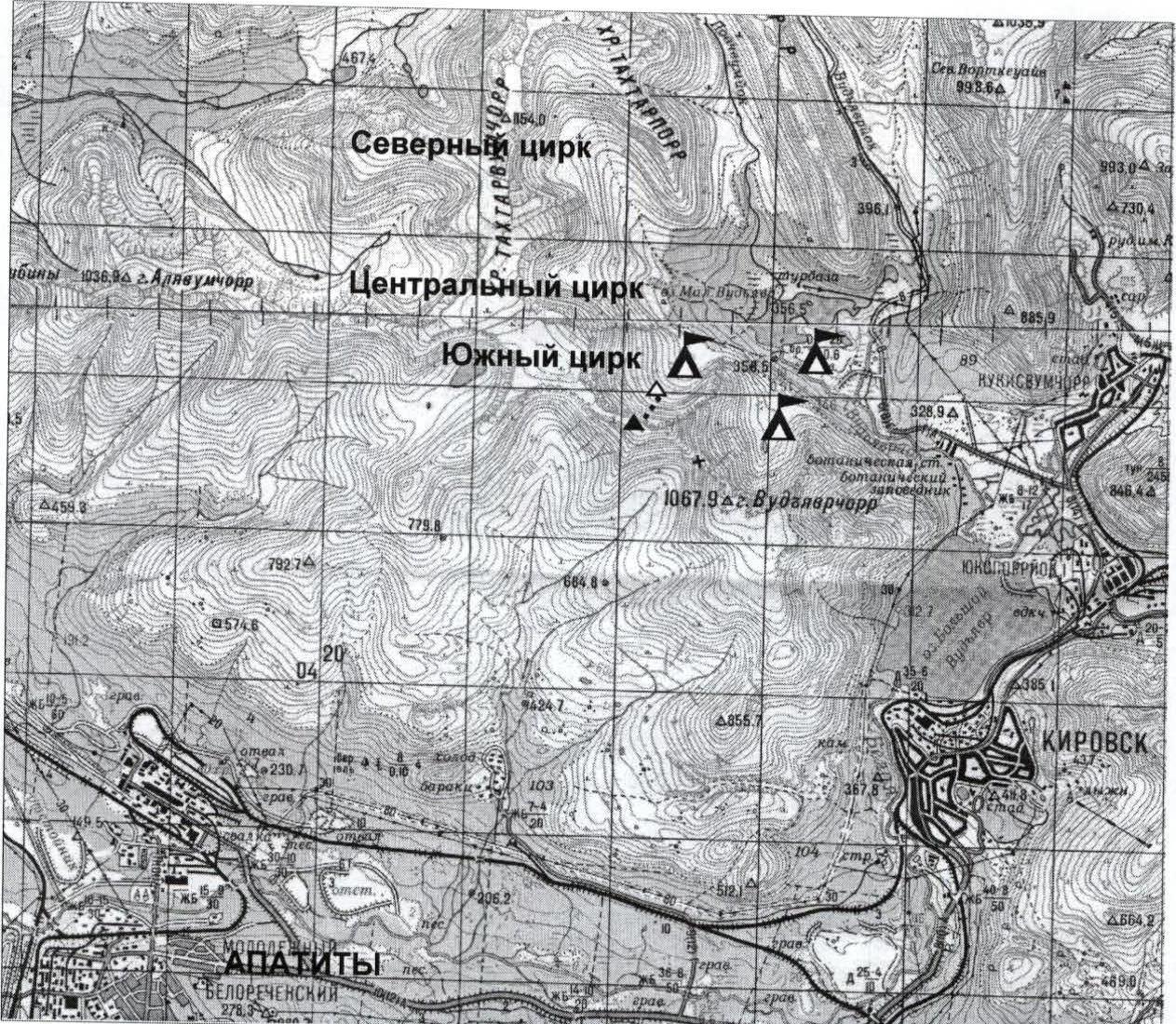
- Region: Khibiny Mountains Valley: valley of Maly Vudyavr lake, southern cirque of Takhtarvumchorr ridge Section number according to KMGV-2001: 8.6.
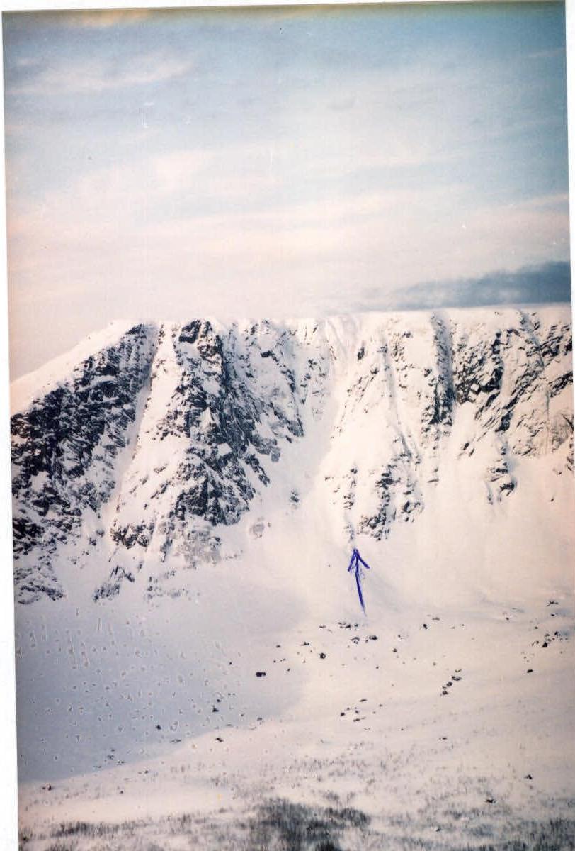
- Peak name: Takhtarvumchorr ridge, height: 1143 m Route name: via the left part of the central counterfort of the eastern wall of the southern cirque
- Proposed: 2B category of difficulty, first ascent
- Character of the route in winter: combined Character of the route in summer: rock
- Elevation gain of the route: 500 m (by altimeter)
Route length: 800 m
Length of sections:
- 5th category of difficulty — m
- 6th category of difficulty — m Average steepness:
- main part of the route — 55°
- entire route — 45°
- Hooks left on the route: total: ; including pitons: — Used total on the route: rock hooks: 17, chocks etc.: 5 Used pitons stationary: — , including ITO pitons removable: — , including ITO
- Team's travel hours: 5 hours, one day.
- Leader: Serebryakov Yuri Alekseevich, sports rank, title: Candidate for Master of Sports Participants: Vashenyuk Eduard Vladimirovich, sports rank Master of Sports
- Coach: Shumilov Oleg Ivanovich, sports rank, title: Master of Sports
- Departure for the route: 9:00, April 24, 1993 Reach the summit: 14:00, April 24, 1993 Return to base camp: 16:00, April 24, 1993
- Organization: Alpine Federation of Murmansk Region
Route Description
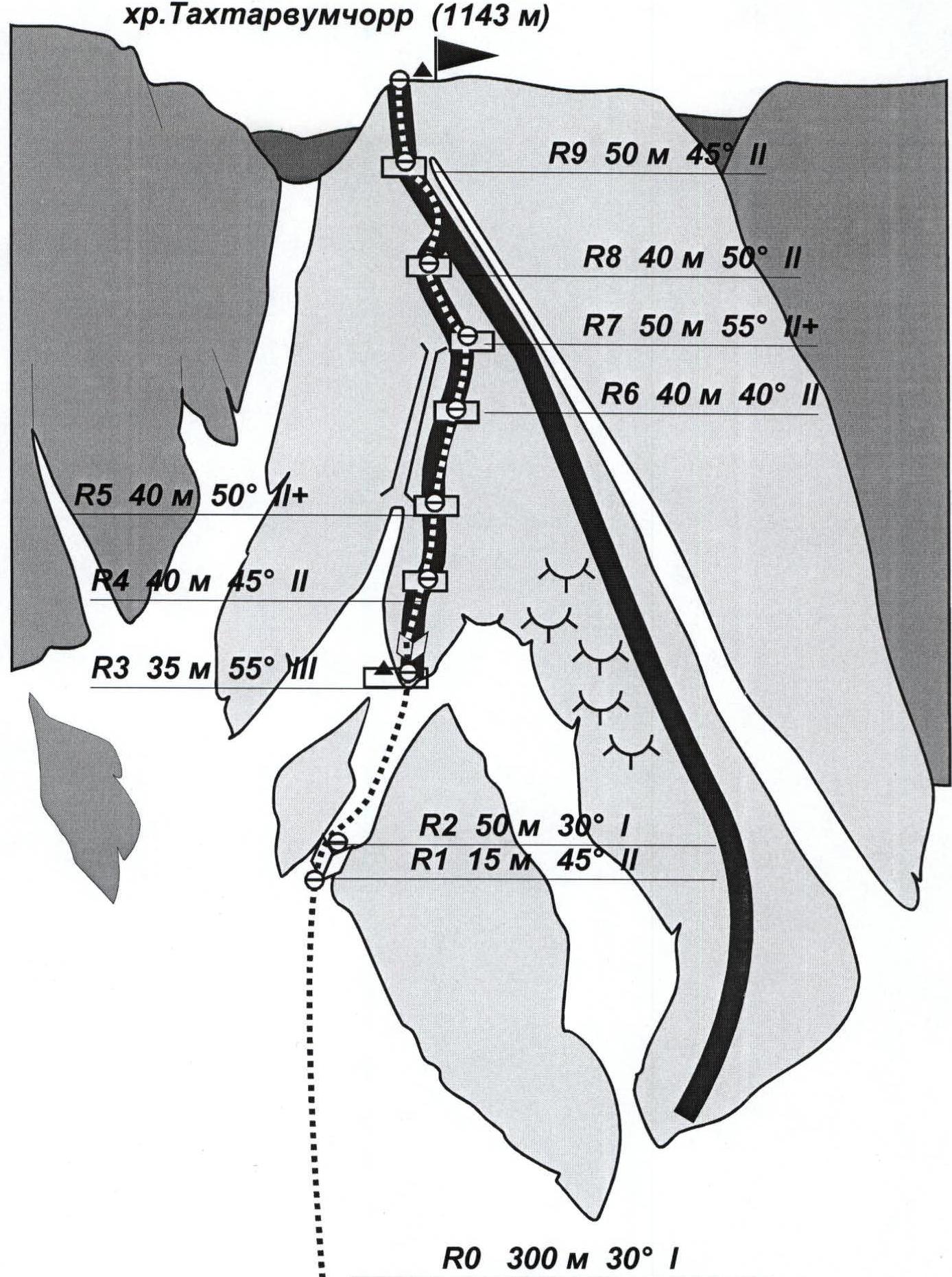
R0–R1: ascent via scree (in winter via snowy slope) 300 m 30° to the couloir under the rocks. On a ledge under the counterfort, control cairn 1 (can on a hook). R1–R2: via the inner corner (15 m 45° 2nd category of difficulty) R2–R3: via the couloir to the edge of the counterfort (50 m 30° 1st category of difficulty) R3–R4: through the inner corner (35 m 55° 3rd category of difficulty) exit to the edge of the counterfort, ascent to a horizontal ledge R4–R6: along the ridge of the counterfort 120 m 50° 2nd category of difficulty. Rocks partially destroyed, many cracks for chocks. R6–R7: along the ridge of the counterfort 50 m 55° 2nd category of difficulty. On the ledge, control cairn 2. R7–R8: via the traverse (15 m 20° 2nd category of difficulty) exit to the neighboring ridge. Further along the ridge 25 m 50° 2nd category of difficulty to the ledge. R8–R9: via partially destroyed rocks 50 m 45° 1–2 category of difficulty exit to the summit (plateau). In summer, the entire route is traversed using chocks.
Descent from the summit:
- via the southern slope of the eastern spur of Takhtarvumchorr ridge
- to the cirque under Geografov pass (Ganeshing cirque)
- further to Maly Vudyavr lake
Emergency exit from the route:
- via the ascent path
- or via the descent path
Places convenient for setting up a base camp
Start of the route
Route
End of the route