Report
On the Ascent
via the central counterfort of the "Otkola" cirque, Takhtarvumchorr (S) (1058 m), "Olympic" route (first ascent by Ivanov D., 2010), cat. 3A, Takhtarvumchorr ridge, Khibiny (15.06.2014, 2nd ascent)
Apatity
2016
Ascent Passport
-
Kola Peninsula. Khibiny mountain range. "Otkola" cirque. Section number in the classification table: #8.6.1.
-
Name of the route — "Olympic", Takhtarvumchorr South, 1058 m, via the central counterfort of the "Otkola" cirque.
-
Proposed category of difficulty: 3A (first ascent: 24.07.2010, Ivanov D.E.);
-
Route type: rock.
-
Height difference — 320 m;
route length — 400 m; length of sections: cat. II — 144 m, cat. III — 225 m, cat. IV — 31 m.
Average slope — 50°; key sections up to 80°.
- "Quick releases" used on the route:
- friends and stoppers — 48 pcs;
- left behind — 0 pcs.
- Team's walking hours: 6 hours (excluding approach and descent).
- Leader: Pochivalov S. — instructor 3rd cat.;
participants: Goloborodko A. — 2nd sports category; Shcherin I. — 2nd sports category.
- Coach: Ivanov D.
- Time on the route:
exit to the route — 9:30; reach the summit — 15:30; descent to the Maly Vudyavr lake valley — 17:00
Descent from the summit:
- across the plateau to the south
- then along the NE spur of Takhtarvumchorr (S) "by lifts" into the Ganesha cirque
- then into the Maly Vudyavr lake valley.
-
Organization: Apatity-Kirov Federation of Alpinism.
-
Responsible for the report: Goloborodko A., goloborodkoalex@gmail.com
Area Map
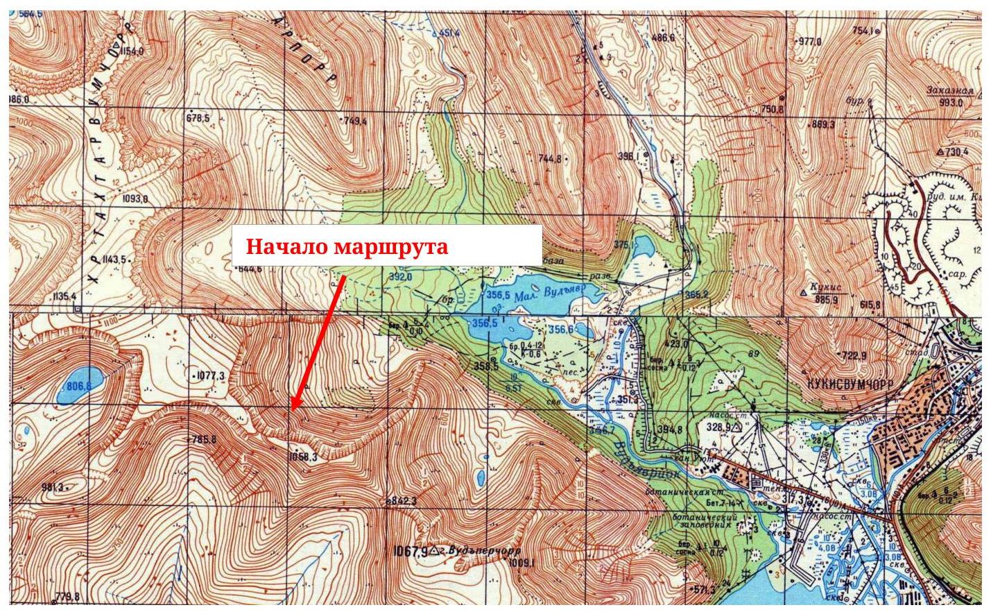
Fig. 1. Area map (fragment, scale — 1:50 000)
Panorama of the
area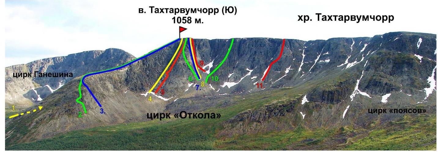
-
1B, to "Otkol" via Geographers pass, Shumilov O., 1992
-
2B, "Roga", Shumilov O., 1992
-
2A, center of E wall in the ridge, Shumilov O., 1992
-
3B, 2Bz, "Otkola" couloir, Shumilov O., 1992
-
3A, to "Otkol" via E wall, Shumilov O., 1992
-
3B, "Olenevody", Proklov V., 2011
-
5A, "Otkol" via center of NE wall, Timoshenko D., 1993
-
5A, "Otkol" via center of N wall, Afanasiev V., 2004
-
2Bz, "Otkola" couloir from the north, Balagurin S., 2014
-
2B, "Pravee Otkola", Shumilov O., 1992
-
3A orig., "Olympic" via central counterfort, Ivanov D., 2010 Fig. 2. Ganesha cirque, photo from the southern slope of Takhtarporra
Orographic Scheme of the Area
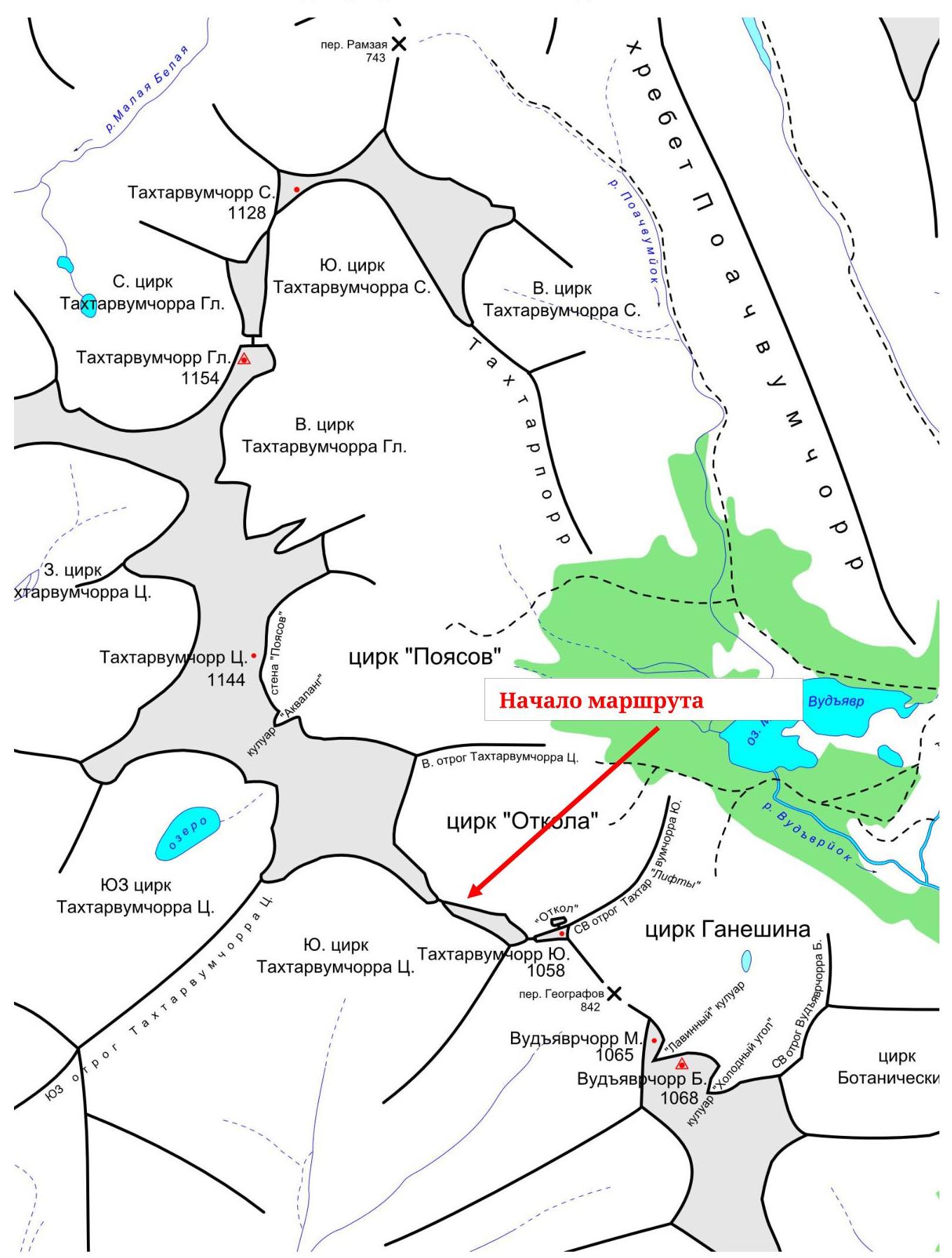 Fig. 3.
Orographic scheme of the area General photos of the
route
Fig. 3.
Orographic scheme of the area General photos of the
route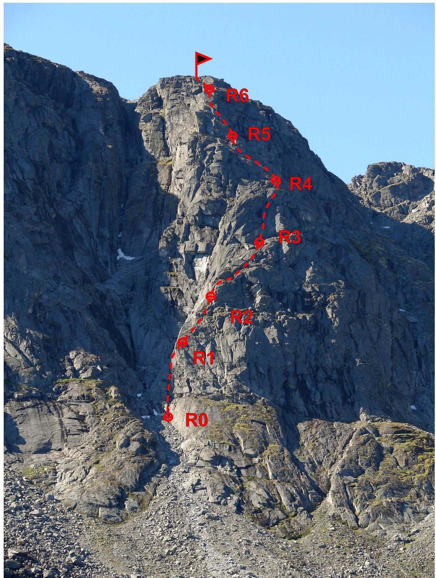 Fig. 4.
Photo of the route from the side of Maly Vudyavr lake (end of
summer)
Fig. 4.
Photo of the route from the side of Maly Vudyavr lake (end of
summer)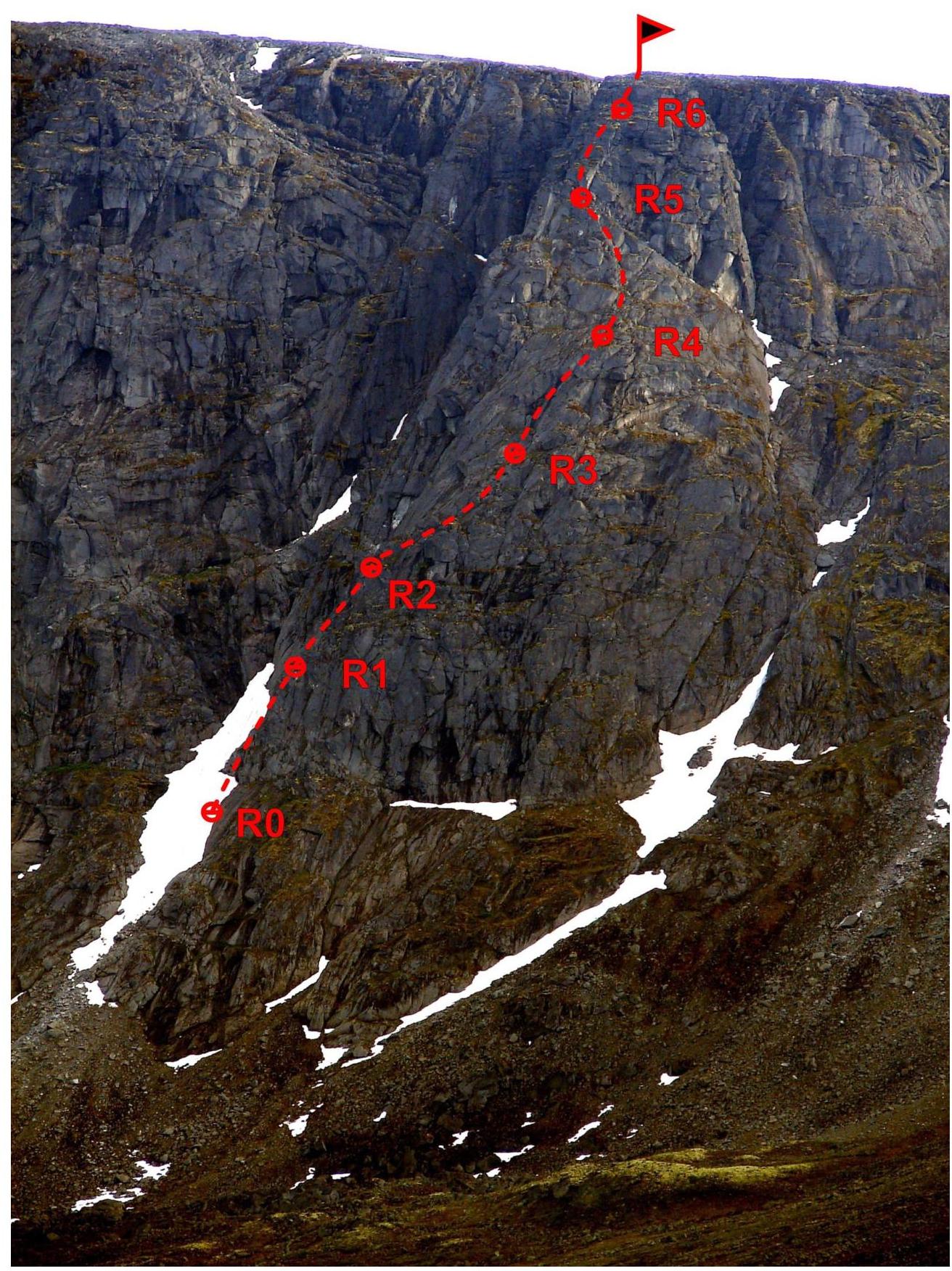 Fig. 5.
Photo from the side of the northwestern end of the lake (mid-summer)
Fig. 5.
Photo from the side of the northwestern end of the lake (mid-summer)
The "line" of the route has an S-shaped character, and therefore the profile of different parts of the route is viewed from different angles, with sections closest to the actual profile being:
- R0–R4 on Fig. 5
- R4–R7 on Fig. 4
Route scheme in UIAA
symbols
| 2 | - | 5 | - | 60 | 45 | III | ||
|---|---|---|---|---|---|---|---|---|
| 5 | 45 | III | ||||||
| 15 | 70 | IV | ||||||
| 1 | - | 13 | - | 40 | 50 | III |
Route Description
Approach: from the crossing of the Vudyavryok river along the dirt road to the "Otkola" cirque, then along the trail under the central counterfort of the cirque (about an hour), along the talus of the left couloir from the CF, we pass above the belt of "ram's foreheads" to the beginning of a wide crack — a chimney, going to the right from the couloir
R0–R1: along inclined cracks, 40 m, 50°, cat. III, exit to an inclined shelf under overhanging rocks, then along two internal corners, 15 m, 70°, cat. IV, exit to smoothed "ram's foreheads", 5 m, 45°, cat. III.
R1–R2: through "ram's foreheads" and destroyed rocks, heading "to the right", following the principle "where it's easier to go", exit to a series of narrow inclined shelves, filled with water, 60 m, 45°, cat. III.
R2–R3: along a series of inclined rock shelves to the right, 60 m, 35°, cat. II+, then exit to a wide shelf at the base of a large oblique internal corner, to the right continues the internal corner — an inclined slab, ending with a ridge — the center of the counterfort.
R3–R4: along the internal corner (center of the internal corner is filled with water), movement along the inclined slab to the right is possible with a large number of cracks, exit to the center of the counterfort to the next belt of "ram's foreheads":
- 60 m
- 45°
- cat. III+
R4–R5: along the center of the counterfort without a pronounced ridge part under a small wall:
- 60 m
- 45°
- cat. III
R5–R6: along an alternation of small walls
- 10 m, 60°, cat. IV
- 6 m, 80°, cat. IV and horizontal shelves — exit to a weakly pronounced ridge, under a belay, to the right is a rock wall, station on a stone, 44 m, 40°, cat. II+.
R6–R7: along strongly destroyed rocks along the rock wall, exit to the plateau, 40 m, 35°, cat. II.
Descent: across the plateau to the south and then along the NE spur of Takhtarvumchorr (S) "by lifts" into the Ganesha cirque, then into the Maly Vudyavr lake valley.
Emergency descent: along the ascent route. Photo illustrations of the
route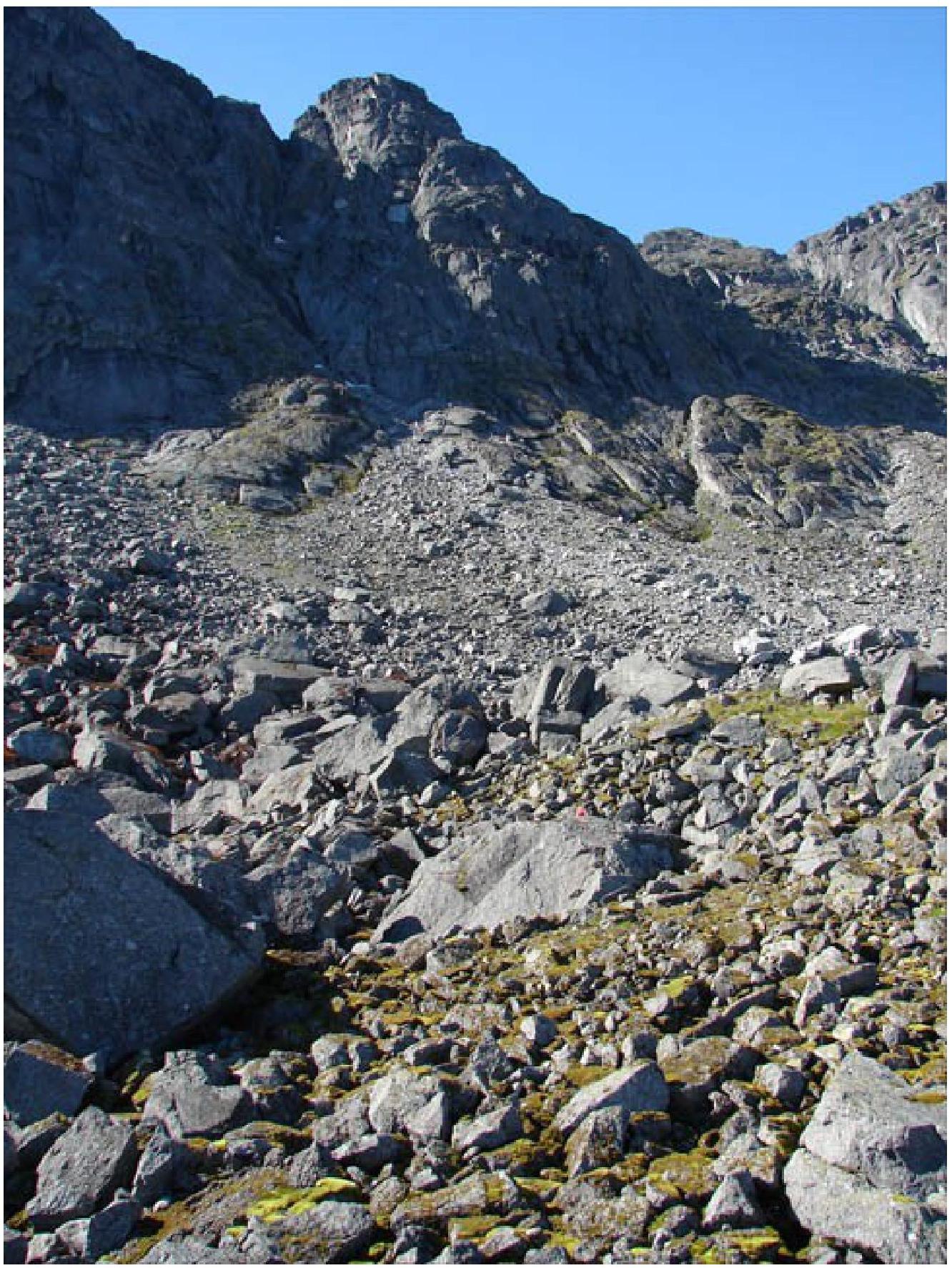
Photo 6. Approaches
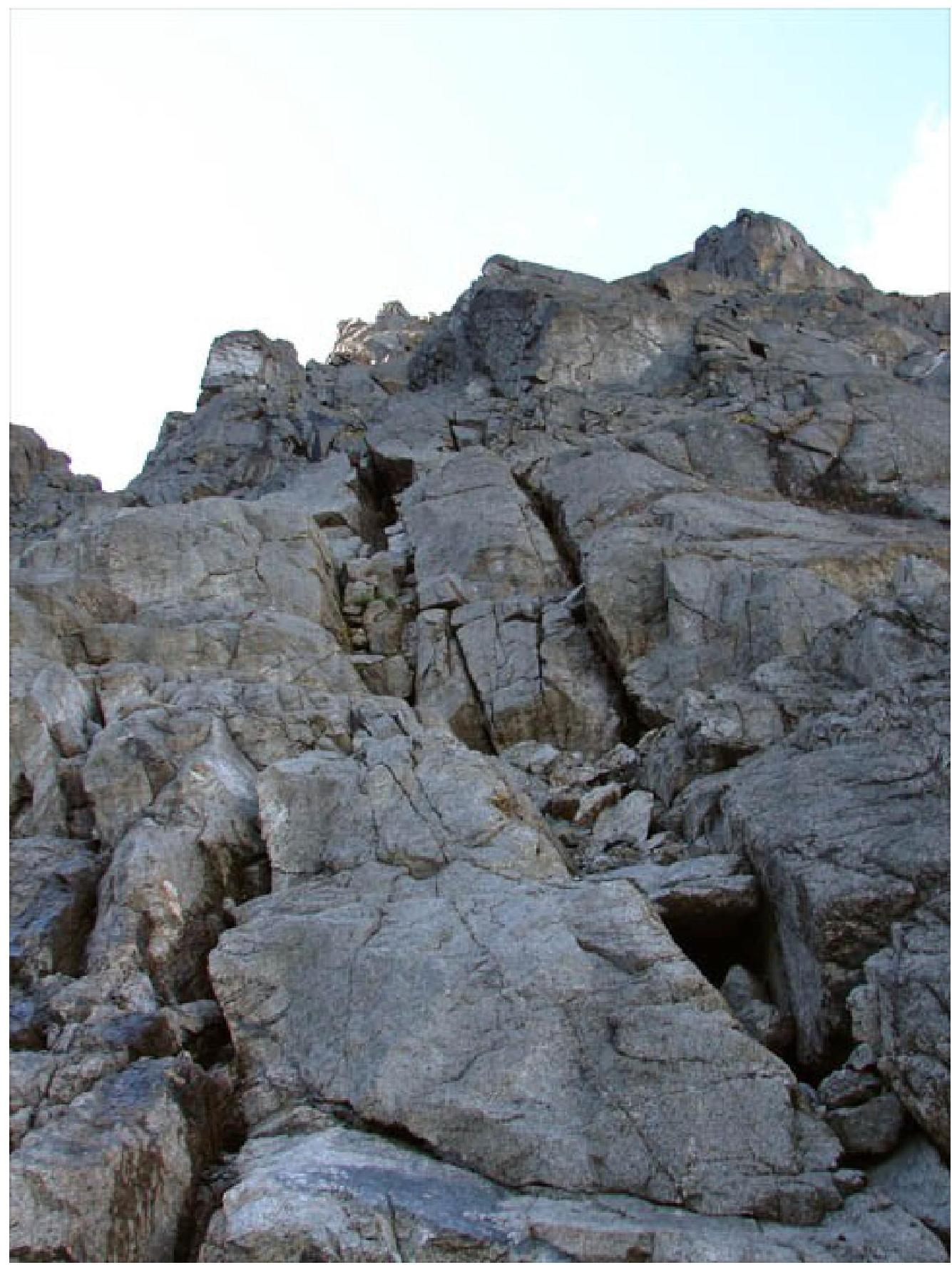
Photo 7. Beginning of the route (R0–R1) — along an inclined crack-chimney under overhanging rocks

Photo 8. Upper part of section
R0–R1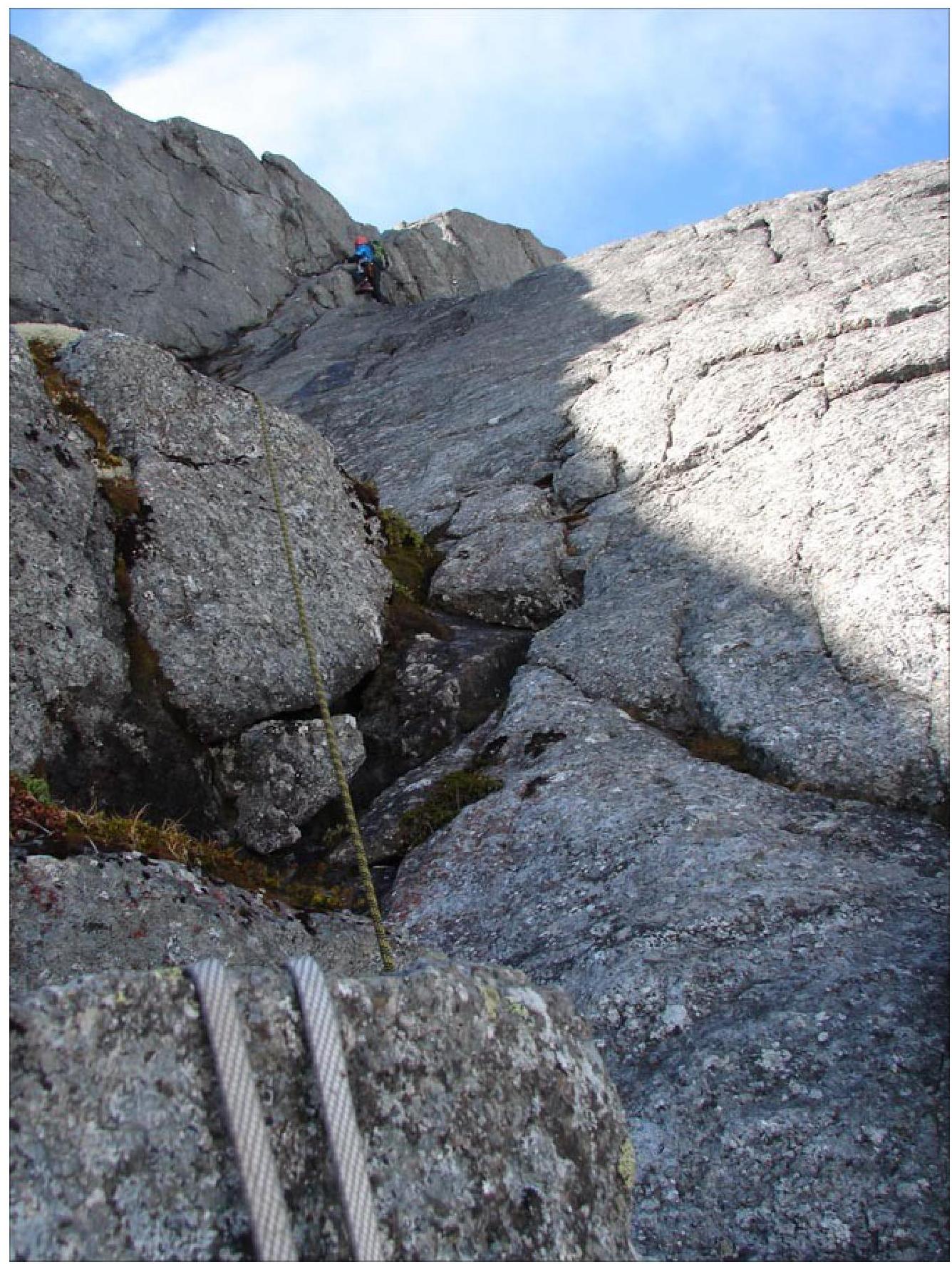
Photo 9. Passage of the oblique internal corner on section R3–R4, an alternative route to the right along cracks is
possible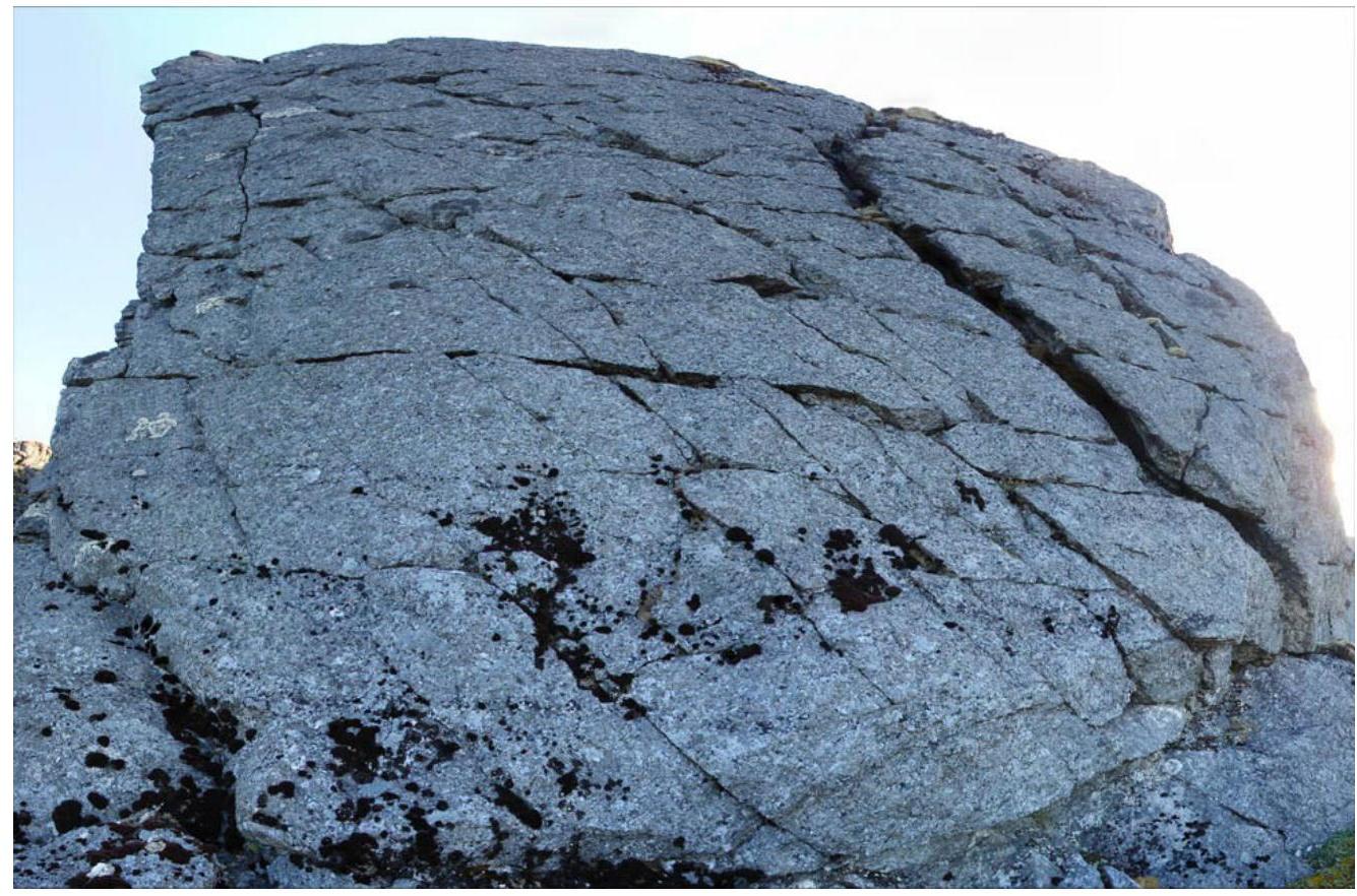
Photo 10. Last wall on section R5–R6 — thanks to a characteristic wide crack to the right, it is clearly visible from below from the approach
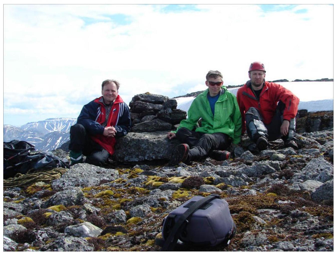
Photo 11. Team on the plateau after the ascent at the summit control point
Additional technical photos of the route from the first ascent
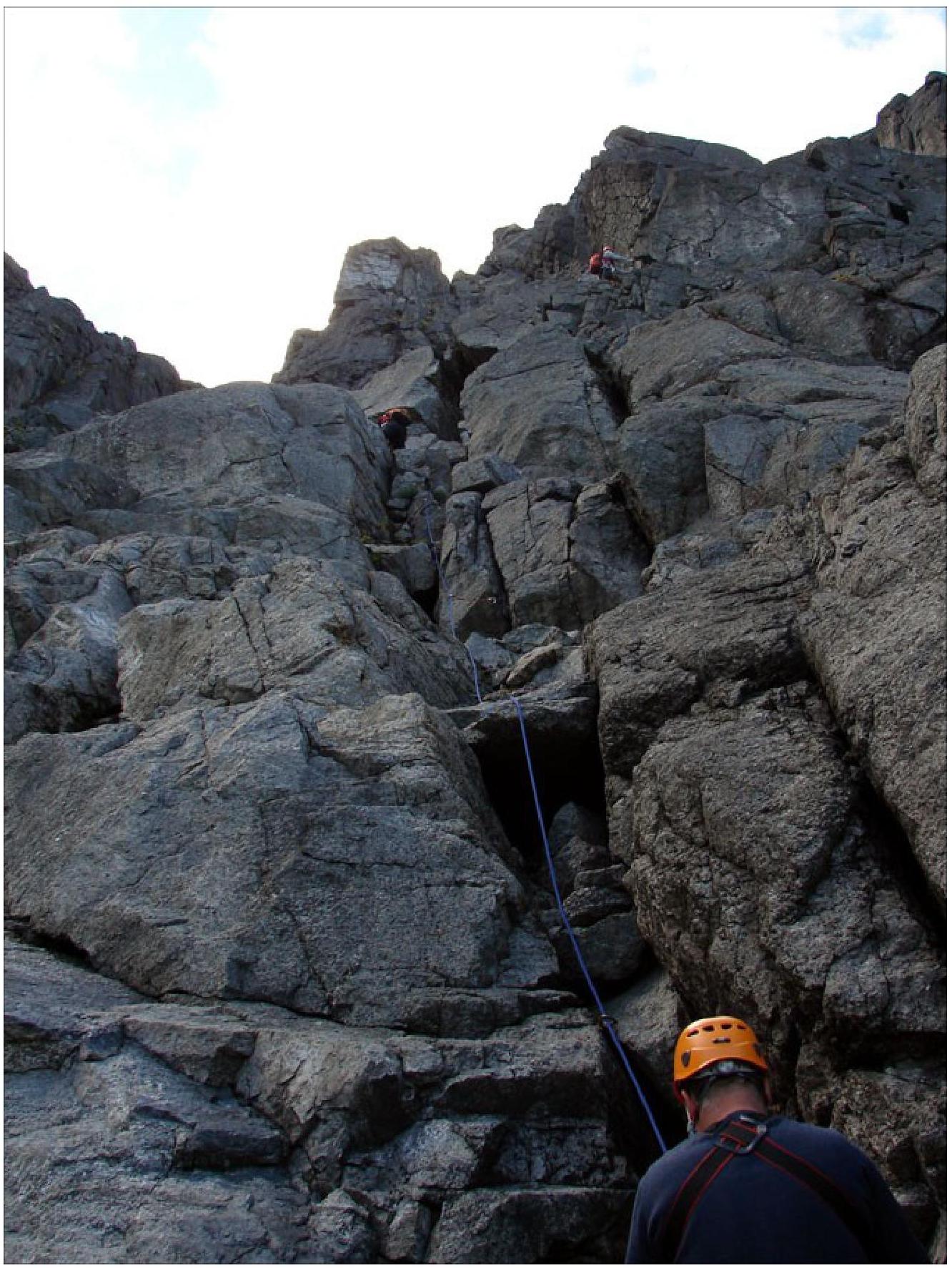
Photo 12. Passage of section
R0–R1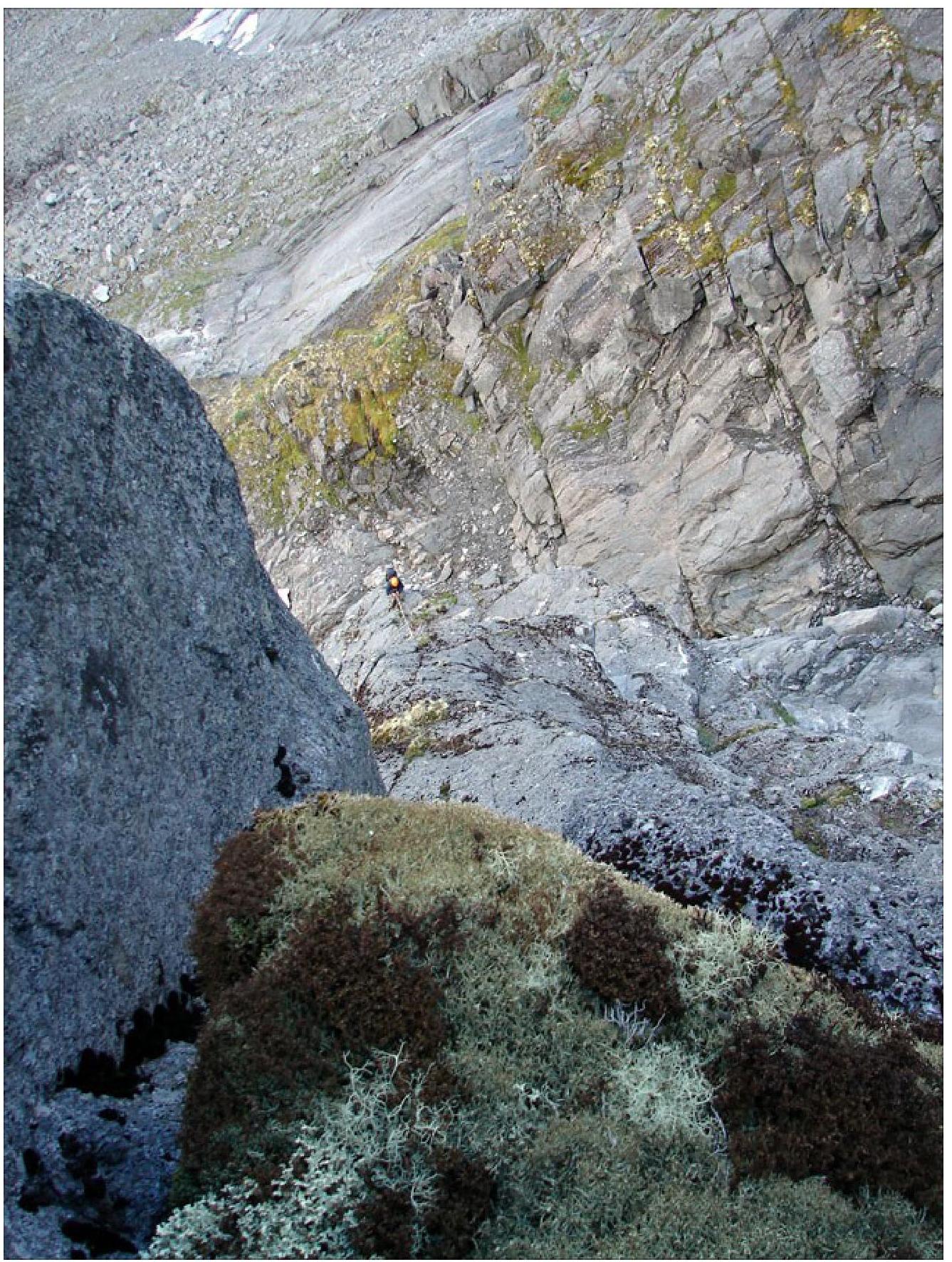
Photo 13. View from station R2 down to section
R1–R2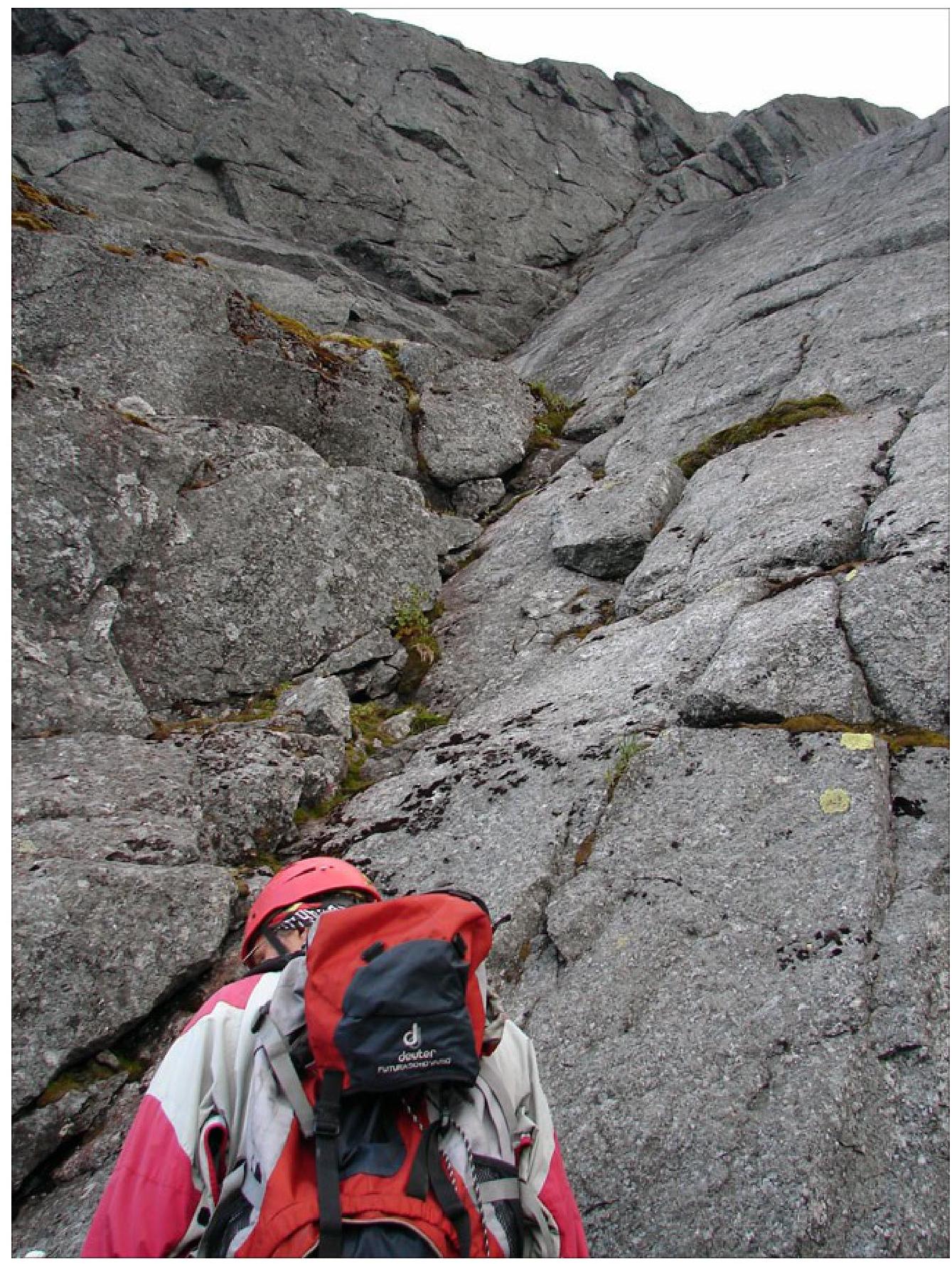
Photo 14. Oblique internal corner on section
R3–R4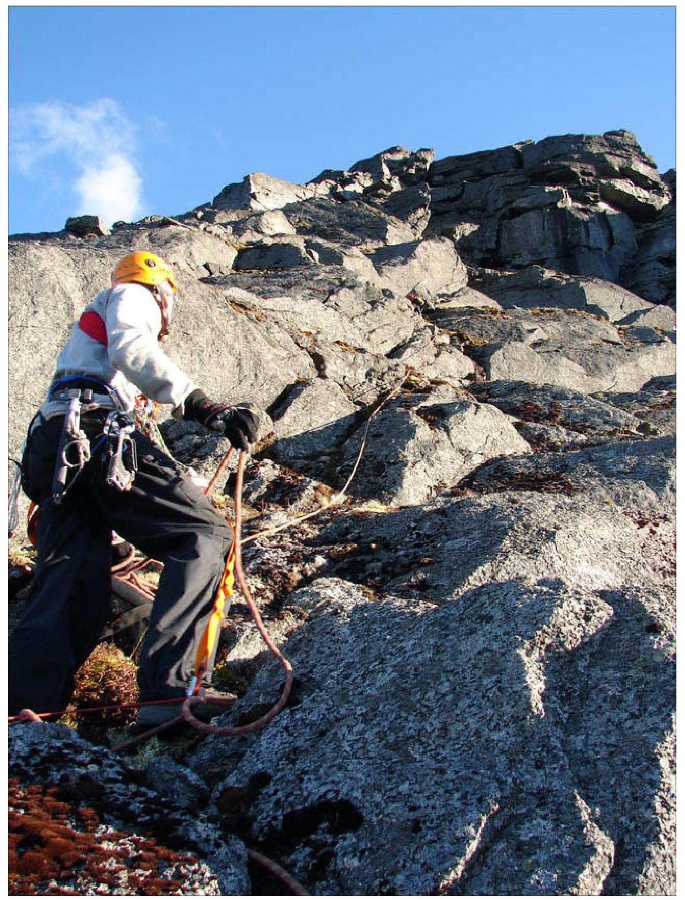
Photo 15. Section R4–R5


