Report
On the Ascent
via the center of the counterforce to the right of the central counterforce of the "Otkol" cirque, v. Takhtarvumchorr (S) (1058 m)
"Bantik" route (first ascent by Ivanov D., 2010), cat. 2B diff., Takhtarvumchorr ridge, Khibiny (June 12, 2011, second ascent)
Apatity
2016
Ascent Passport
-
Kola Peninsula. Khibiny mountain range. Classification table section number: 8.6.1.
-
Route name — "Bantik", Takhtarvumchorr South, 1058 m, via the center of the counterforce to the right of the central counterforce of the "Otkol" cirque.
-
Proposed difficulty category: 2B (first ascent: July 31, 2010, Ivanov D.E.)
-
Route type: rock (summer).
-
Elevation gain — 310 m.
Technical part length — 390 m.; section lengths: II cat. diff. — 340 m., III cat. diff. — 50 m.; average steepness of the key part — 40°; overall route steepness — 30°.
- Pitons used on the route:
- friends and nuts — 15 pcs.;
- left behind — 0 pcs.
- Team's total climbing hours: 4 (excluding approach and descent).
- Leader: Ivanov D. — 2nd sports category
team members: Pochivalov S. — 3rd cat. instructor; Govdan V. — 2nd sports category; Goloborodko A. — 2nd sports category; Goloshchapov I. — 3rd sports category.
- Coach: Ivanov D.
- Time on the route:
start of ascent — 9:00; summit reached — 13:00. Descent from the summit: via the plateau to the south and then along the NE ridge of Takhtarvumchorr (S) "by lifts" to the Ganechina cirque, then to the valley of Lake Maly Vudyavr.
-
Organization: Apatity-Kirov Alpinism Federation.
-
Report responsible: Goloborodko A., goloborodkoalex@gmail.com.
Area Map
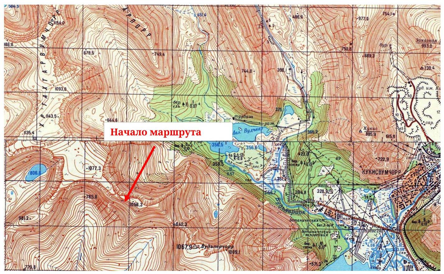
Fig. 1. Area map (fragment, scale — 1:50 000)
Area Panorama
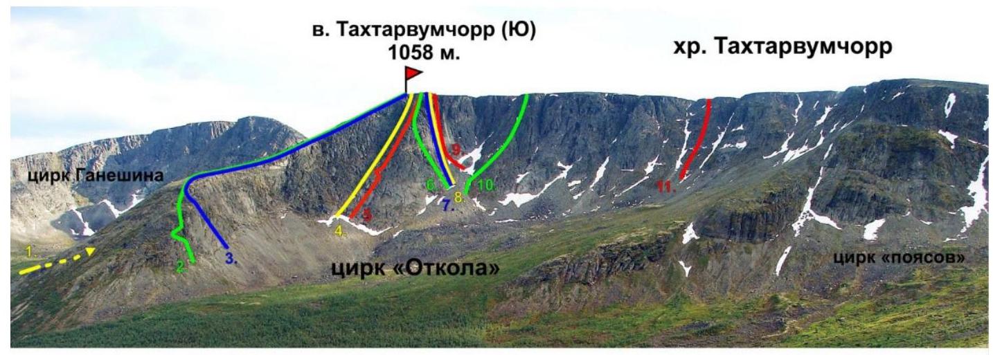
-
1B, to "Otkol" via Geografov Pass, Shumilov O., 1992
-
2B, "Roga", Shumilov O., 1992
-
2A, center of the E wall of the ridge, Shumilov O., 1992
-
3A, 2Bz, "Otkol" couloir, Shumilov O., 1992
-
3A, to "Otkol" via E wall, Shumilov O., 1992
-
3B, "Olenеводы", Proklov V., 2011
-
5A, "Otkol" via center of NE wall, Timoshenko D., 1993
-
5A, "Otkol" via center of N wall, Afanasiev V., 2004
-
2Bz, "Otkol" couloir from the north, Balagurin S., 2014
-
2B, "Pravee 'Otkol'", Shumilov O., 1992
-
2B orig., "Bantik", Ivanov D., 2010 Fig. 2. Ganechina cirque, photo from the southern slope of Takhtarporr
Orographic Scheme of the Area
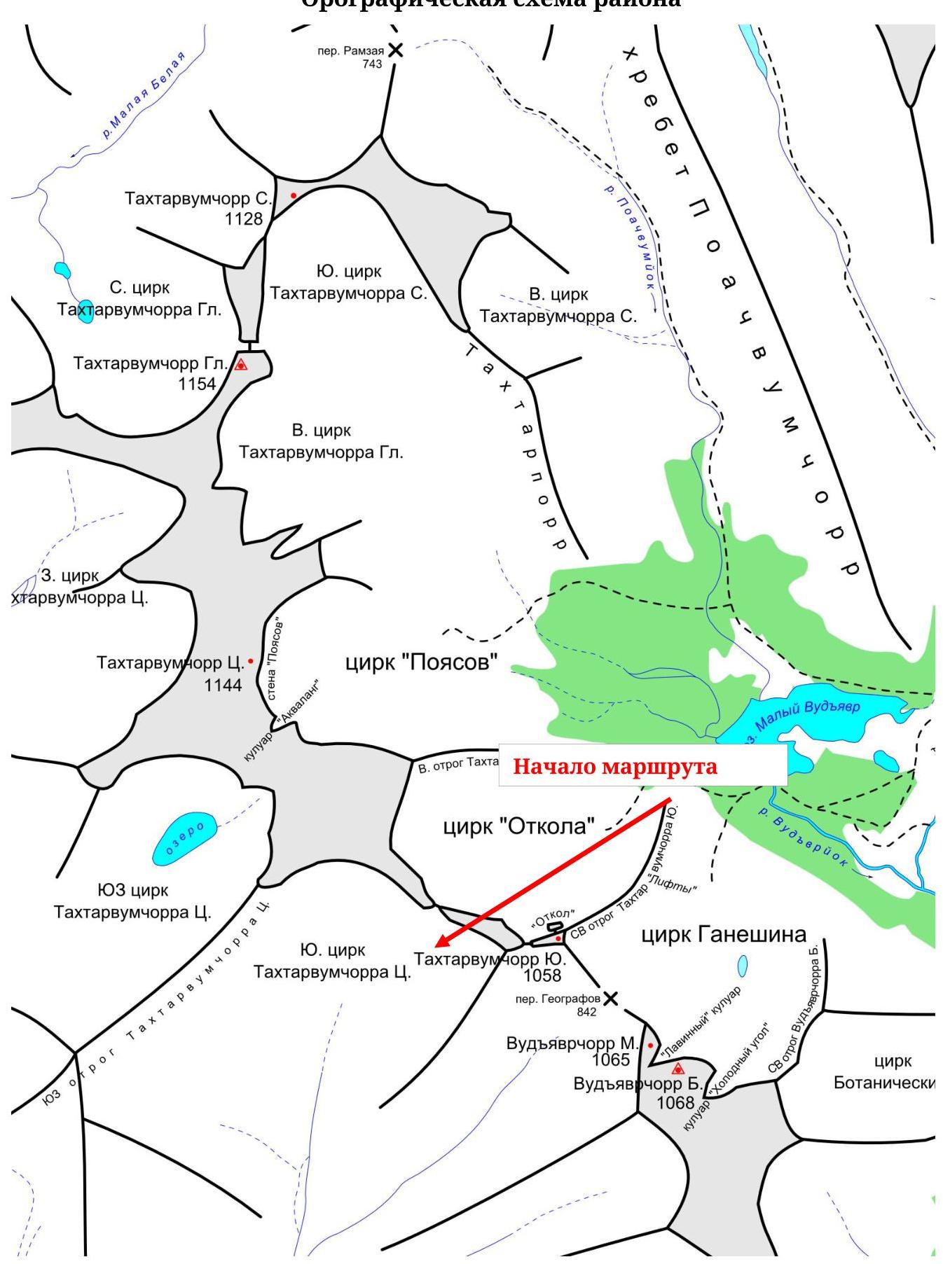 Fig. 3.
Orographic scheme of the central part of Khibiny
Fig. 3.
Orographic scheme of the central part of Khibiny
General photo of the
route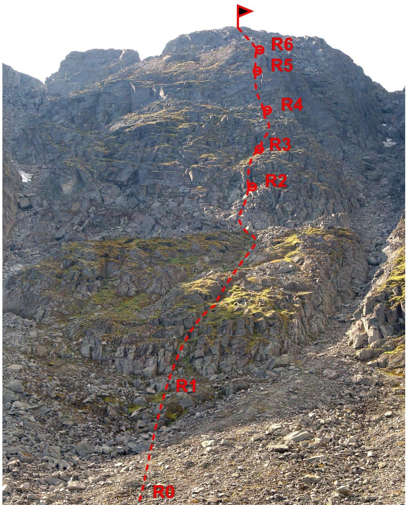 Fig. 4.
Photo of the route — front E
Fig. 4.
Photo of the route — front E
Due to the terrain features — the counterforce has an indistinct, heavily destroyed ridge and is located in the central part of the cirque; it is not possible to take a profile photo.
Route scheme in UIAA
symbols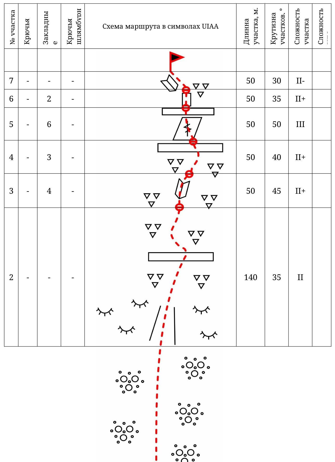
| :-- | :-- | :-- | :-- | :-- |
| 1 | - | - | - | |
| 160 | 25 | I |
Route Description
R0–R1: Ascent along the scree to the rocks, 160 m, 25°, I cat. diff. R1–R2: Through a shallow couloir, passage through the belt of moss-covered "ram's foreheads", then along the destroyed rocks to the inclined internal angle, simultaneous movement is possible with organization of protection through the terrain; anchor station on a rock, 140 m, 35°, II cat. diff.
R2–R3: Through the internal angle along the destroyed rocks and smoothed "ram's foreheads" along the indistinct ridge — exit under the next rock belt, 50 m, 45°, II+ cat. diff.
R3–R4: Along the moss-covered destroyed rocks — exit to a wide ledge, under a large wall — the key section of the route, 50 m, 40°, II+ cat. diff.
R4–R5: Along the wall along the crack — exit to a long narrow ledge; then slightly left — under the internal angle, 50 m, 50°, III cat. diff.
R5–R6: Through a small wall — exit to the destroyed rocks, along the destroyed rocks — to the gentle inclined slabs, 50 m, 35°, II+ cat. diff.
R6–R7: Along the inclined rock slabs, exit to the flattening, then left along the rocks to the plateau, 50 m, 25°, II cat. diff.
Descent: along the NE ridge of Takhtarvumchorr South to the Ganechina cirque;
Emergency descent: via the ascent route.
Photo
illustrations
Fig. 5.
Approach
Fig. 6. Moss-covered rocks on the R1–R2 section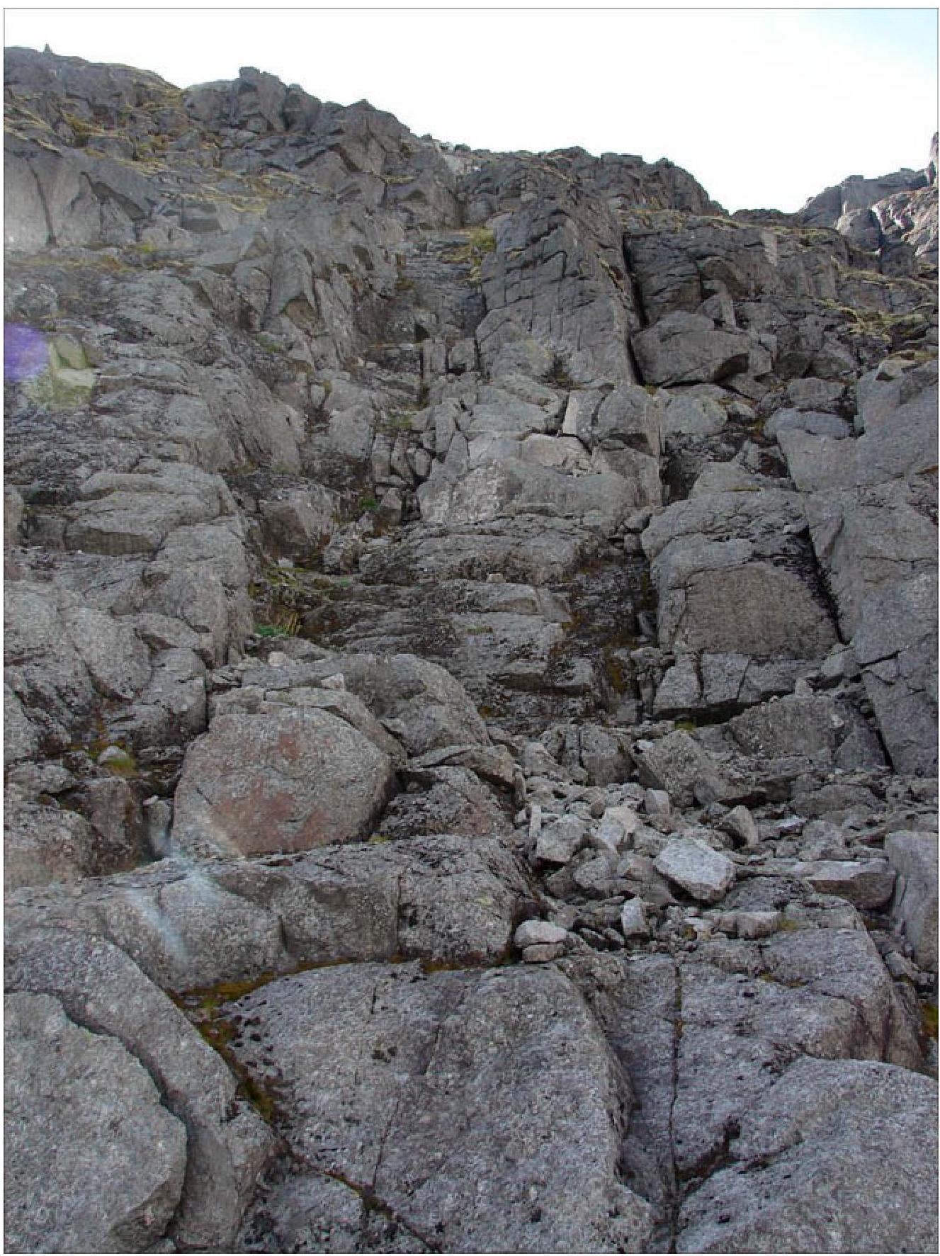
Fig. 7. Upper part of the R1–R2 section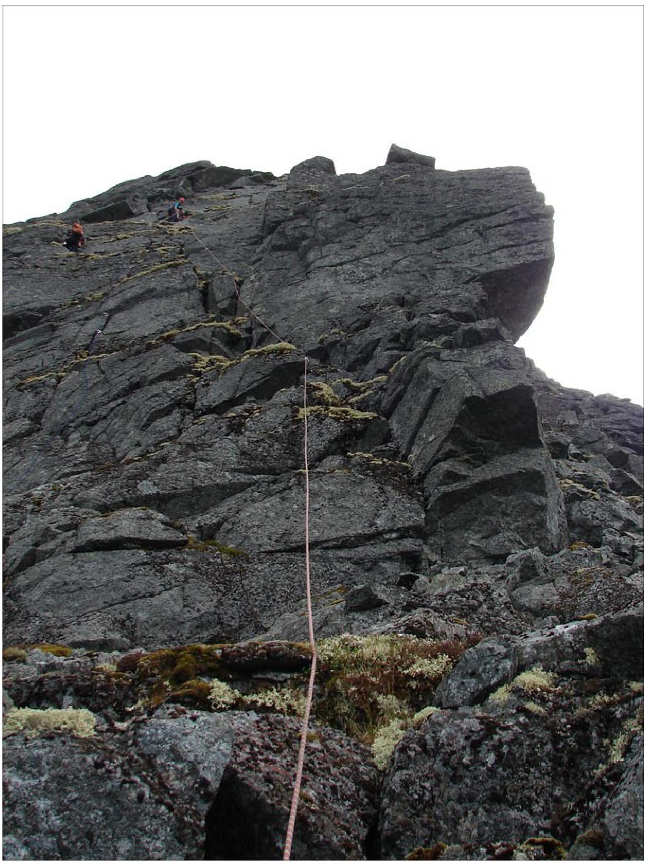
Fig. 8. Passage of the R4–R5 section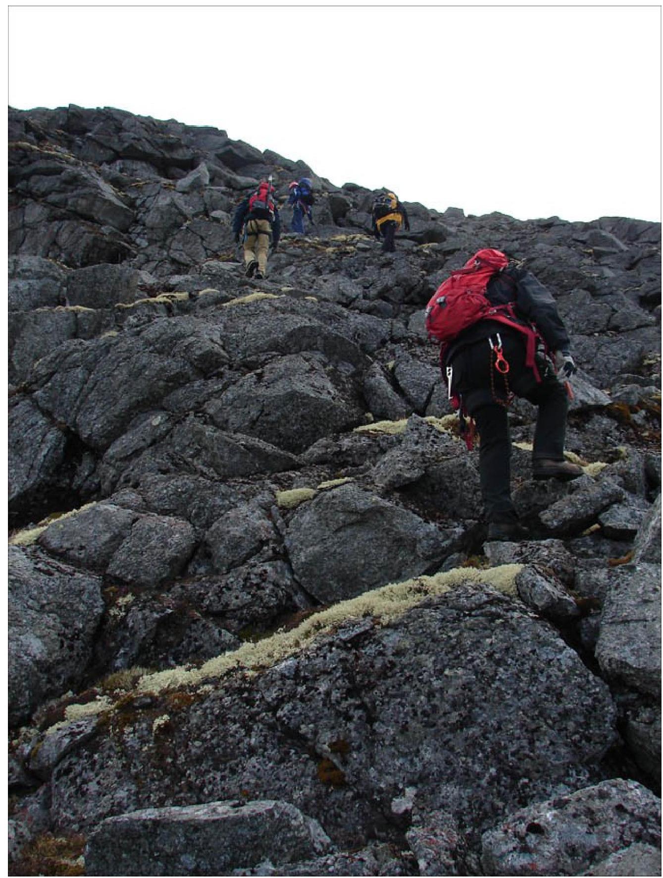
Fig. 9. Exit to the plateau, R6–R7 section
Fig. 10. Team on the plateau


