Report
On the Ascent
via the 3rd category of difficulty route on the southern part of the wall
of the "Poyasov" cirque on Mt. Takhtarvumchorr (Ts) (1144 m)
route "Zubastik", (first ascent by Pochivalov S., 2004) cat. 3B diff. Takhtarvumchorr ridge, Khibiny Mountains (August 26, 2012, 2nd ascent)
Apatity
2016
Ascent Passport
-
Kola Peninsula. Khibiny mountain massif. "Poyasov" cirque. Classification table section number: 8.6.1
-
Route name — "Zubastik", via the 3rd category of difficulty route on the southern part of the wall of the "Poyasov" cirque on Mt. Takhtarvumchorr (Ts).
-
Proposed category of difficulty: 3B (first ascent: Pochivalov S., July 25, 2004).
-
Route type: rock (winter — combined);
-
Height difference — 350 m.
technical part length — 480 m.; section lengths: II cat. diff. — 245 m., III cat. diff. — 100 m., IV cat. diff. — 95 m.;
Average steepness — 50° (key sections up to 80°).
- "Quick releases" used on the route:
- friends and stoppers — 41 pcs.;
- left behind — 0 pcs.
- Team's walking hours: 7 hours (excluding approach and descent), approach from Lake Maly Vudyavr 1.5 hours.
- Leader: Pochivalov S. — 3rd category instructor;
Participants: Goloborodko A. — 2nd sports category; Govdan V. — 2nd sports category.
- Coach: Ivanov D.
- Time on the route: start — 9:10. Summit — 16:10. Descent from the summit: across the Takhtarvumchorr plateau to the south and then along the NE ridge of Takhtarvumchorr (S) "via the lifts" to the Ganesha cirque or along the E ridge of Takhtarvumchorr (Ts) to the "Otkola" cirque, then to the valley of Lake Maly Vudyavr.
- Organization: Apatity-Kirov Alpinism Federation.
- Report responsible: Goloborodko A., goloborodkoalex@gmail.com. Map
(fragment)
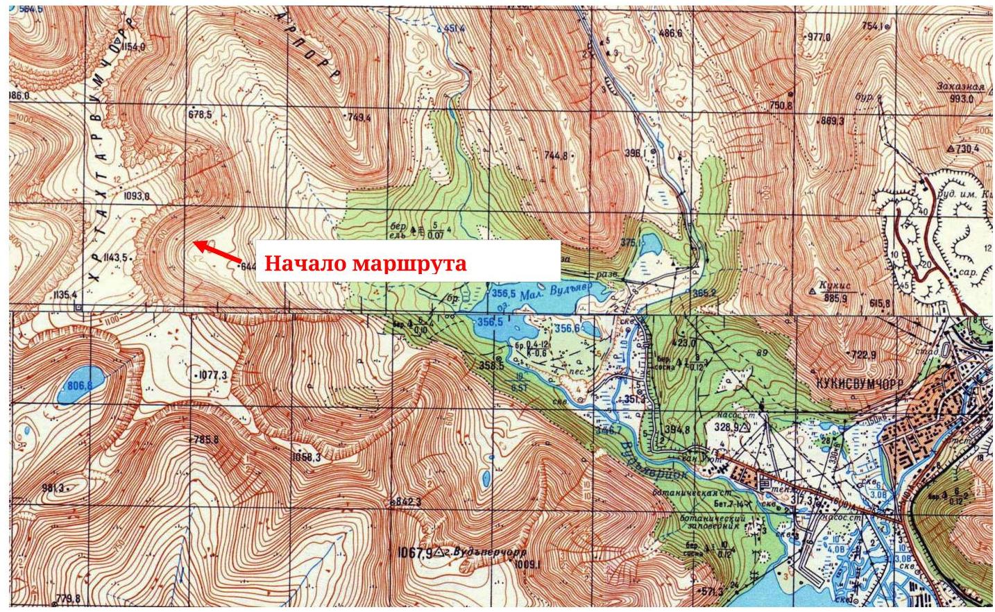
Fig. 1. Map (fragment, scale — 1:50 000)
Panorama
of the area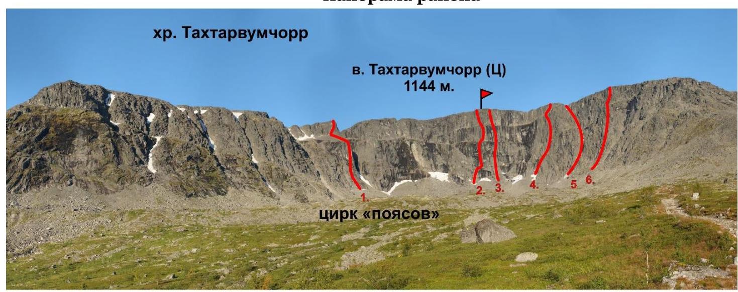
- 4B, "Golfstrim", Yurkin A., 2013
- 5A, via the center of the "Poyasov" wall, Andreev A., 2004
- 5A, via the inner corners of the "Poyasov" wall, Murin E., 2015
- 2B, via the couloir right of the "Poyasov" wall, Ageev N., 2004
- 2A, "Zig-Zag" couloir, Shumilov O., 1992
- 3B cat., "Zubastik", Pochivalov S., 2004. Fig. 2. Ganesha cirque, photo from Lake Maly Vudyavr. Fig. 2. "Poyasov" cirque, photo from the approach. Orographic scheme
of the area
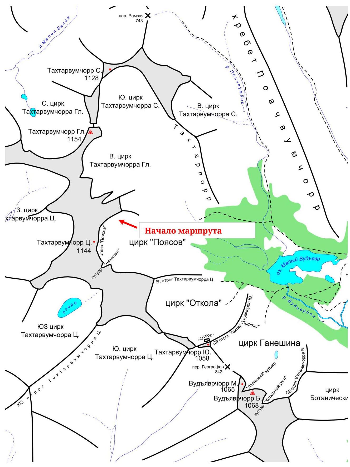 Fig. 3.
Orographic scheme of the central part of the Khibiny Mountains. General photo of the route with
the line
Fig. 3.
Orographic scheme of the central part of the Khibiny Mountains. General photo of the route with
the line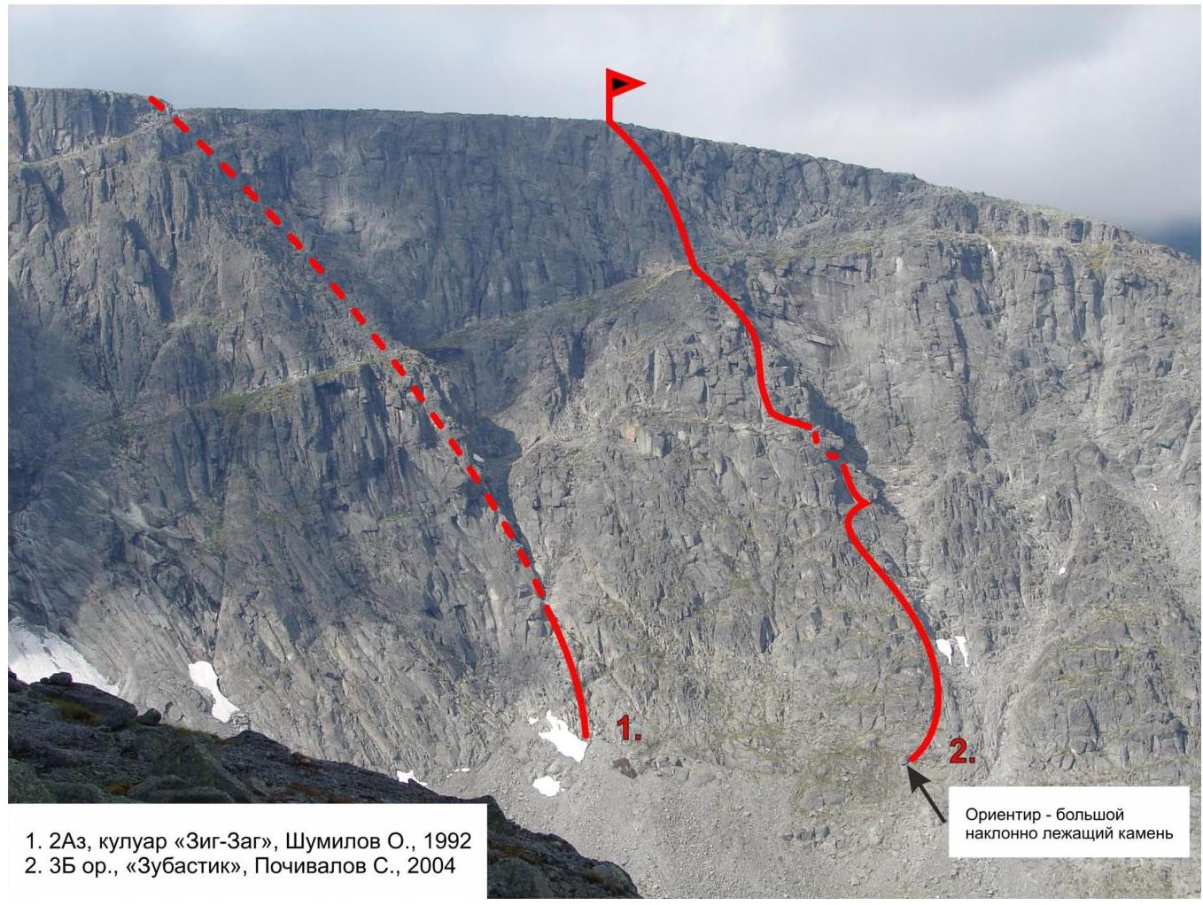
Fig. 4. Routes "Zig-Zag couloir" and
"Zubastik"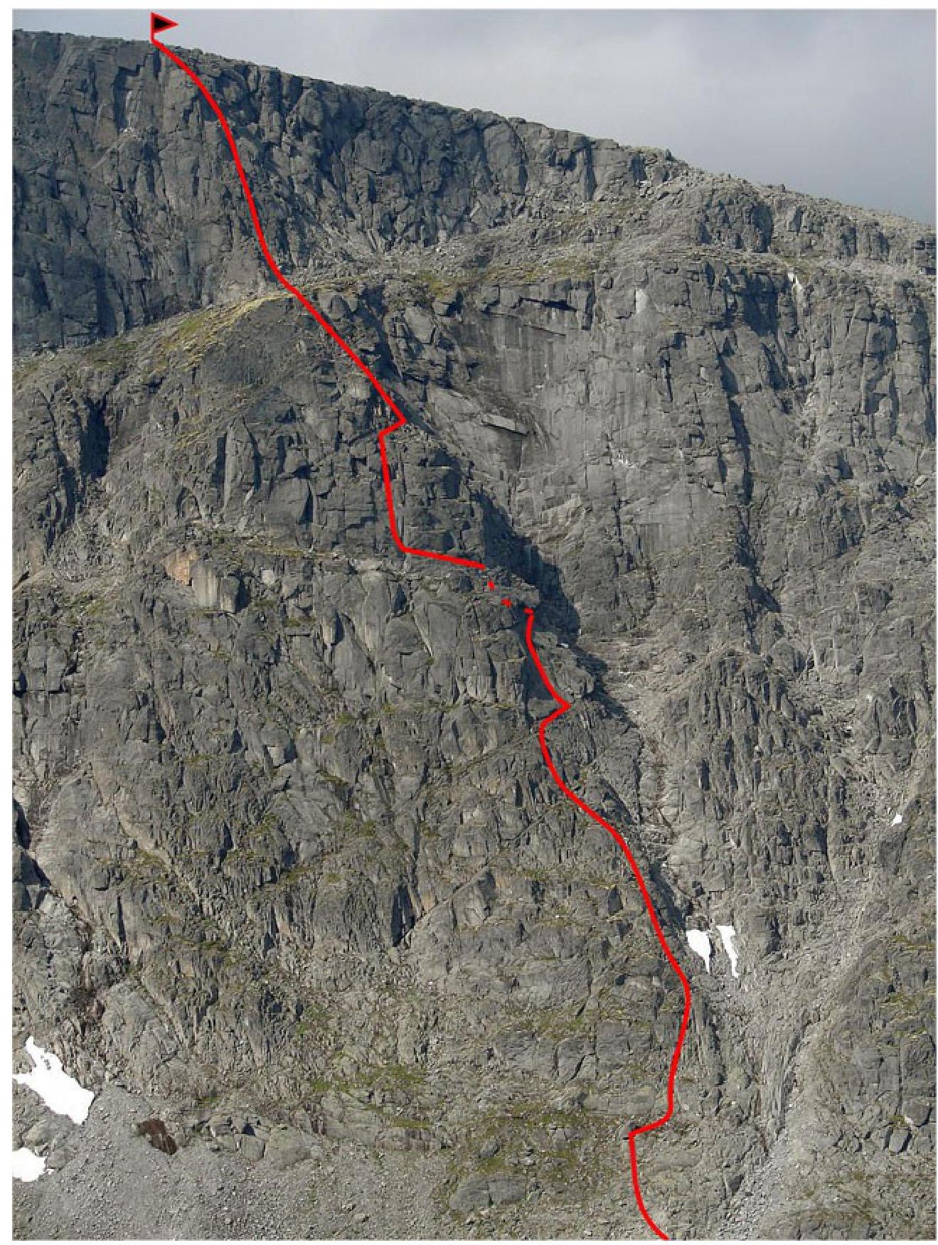
Fig. 5. Route line —
front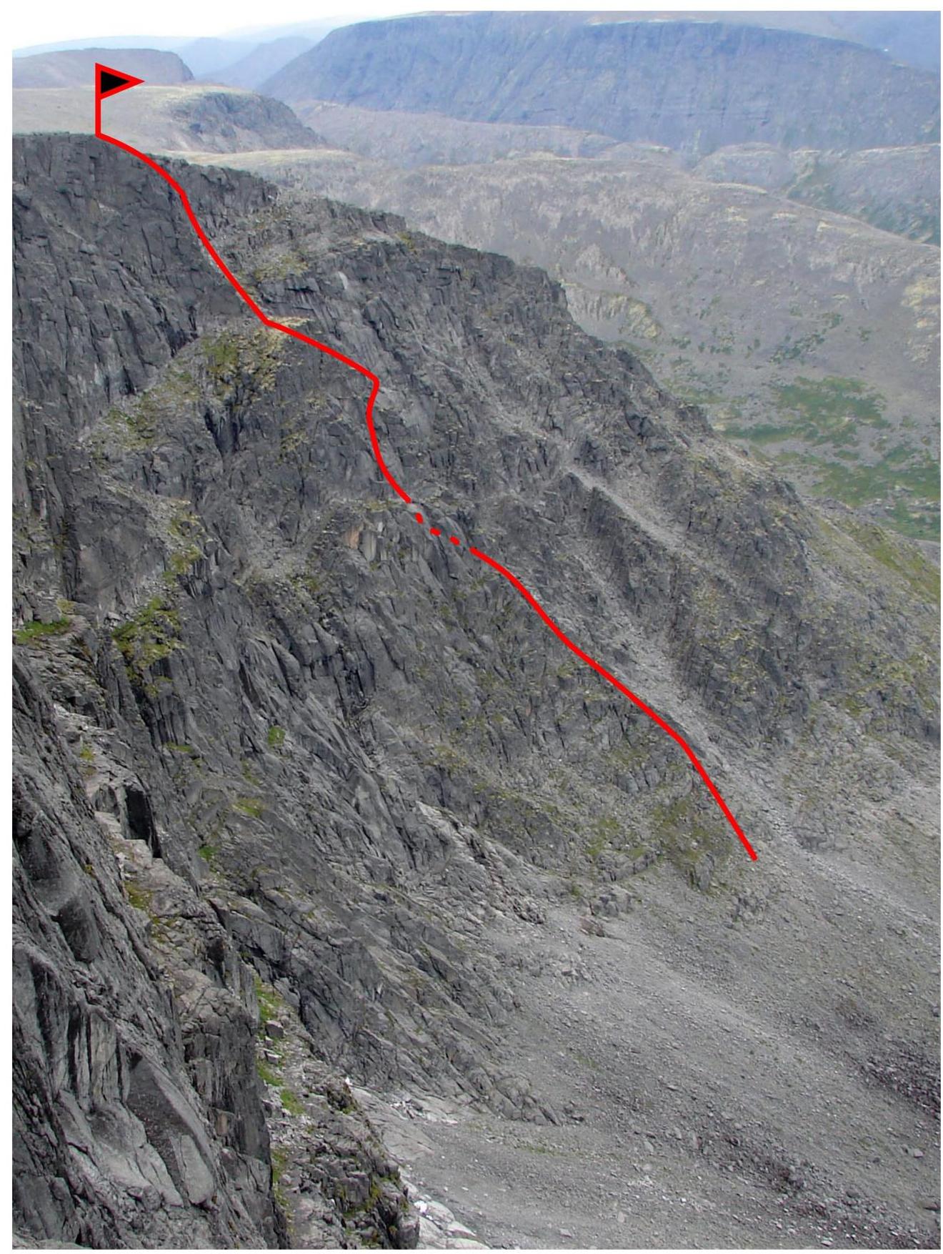
Fig. 6. Route line —
profile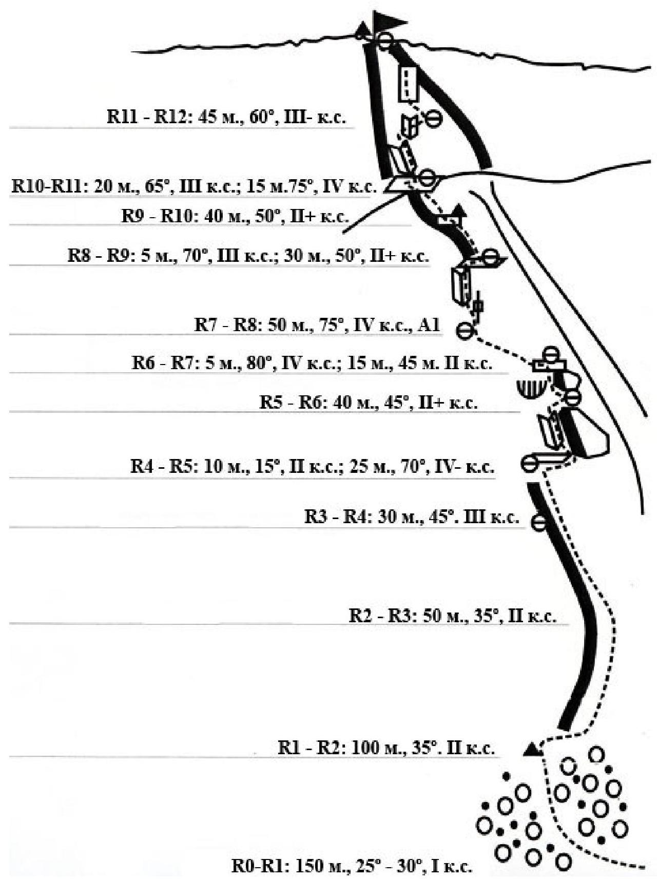
Fig. 7. Route scheme in UIAA symbols.
Route Description
Approach: from Lake M. Vudyavr to the "Poyasov" cirque (direct visibility) 1.5 hours.
R0–R1: across medium and small scree 150 m, 25°–30°, I cat. diff., approach to the counterfort left of the couloir's end; control cairn №1.
R1–R2: along the boundary between the counterfort and the couloir (or along the counterfort) 100 m, 35°, II cat. diff., exit to the ridge.
R2–R3: along the ridge 50 m, 35°, II cat. diff., exit to a large ledge. R3–R4: further along the simple rocks of the ridge 30 m, 45°, III cat. diff., ledge. R4–R5: traverse right 10 m, 15°, II cat. diff., along a small ledge to a large "tooth", left of the "tooth" via cracks and inner corners 25 m, 70°, IV cat. diff., exit to an inclined ledge under the cornice; to the right is another "tooth".
R5–R6: along the inclined slab traverse right, 1.5-meter descent into the couloir, further passage through the couloir under the "tooth" ("speleo"), then via fractures and ledges exit to a large ledge: 40 m, 45°, II+ cat. diff.; belay on a rock.
R6–R7: via a crack 15 m, 80°, IV cat. diff., then left along the rocks 15 m, 45°, II cat. diff., exit to a small ledge under a small wall.
R7–R8: via the small wall, then via cracks and inner corners left of the ridge 50 m, 75°, IV cat. diff., possible A1; exit to the ridge.
R8–R9: via a gap 5 m, 70°, III cat. diff., then along the ridge 30 m, 50°, II+ cat. diff., exit to a small ledge, control cairn №2 on a hook.
R9–R10: along the ridge 40 m, 50°, II+ cat. diff., exit to a large ledge (from the ledge there is an emergency exit to the summit right along a large oblique ledge 150 m).
R10–R11: from the ledge right of the not clearly defined ridge of the pre-summit counterfort first via an inner corner 20 m, 65°, III cat. diff., then right, crossing the inner corner 15 m, 75°, IV cat. diff., exit to a small ledge (in wet weather, passage of the second inner corner is problematic and dangerous!).
R11–R12: along the right side of the ridge 45 m, 60°, III cat. diff., exit to the summit. Descent from the summit: across the Takhtarvumchorr plateau to the south and then along the NE ridge of Takhtarvumchorr (S) "via the lifts" to the Ganesha cirque or along the E ridge of Takhtarvumchorr (Ts) to the "Otkola" cirque, then to the valley of Lake M. Vudyavr. Emergency descent: at the start of the route via the ascent path; in the middle section along a wide ledge left into the "Zig-Zag" couloir; in the upper section along a wide oblique ledge right with an exit to the plateau.
Summit control cairn on the edge of the plateau 150 m to the west, opposite the "Zig-Zag" couloir.
Recommended equipment:
- large size stoppers in abundance.
Recommended walking time (summer) — 7 hours; Photo illustrations
of the ascent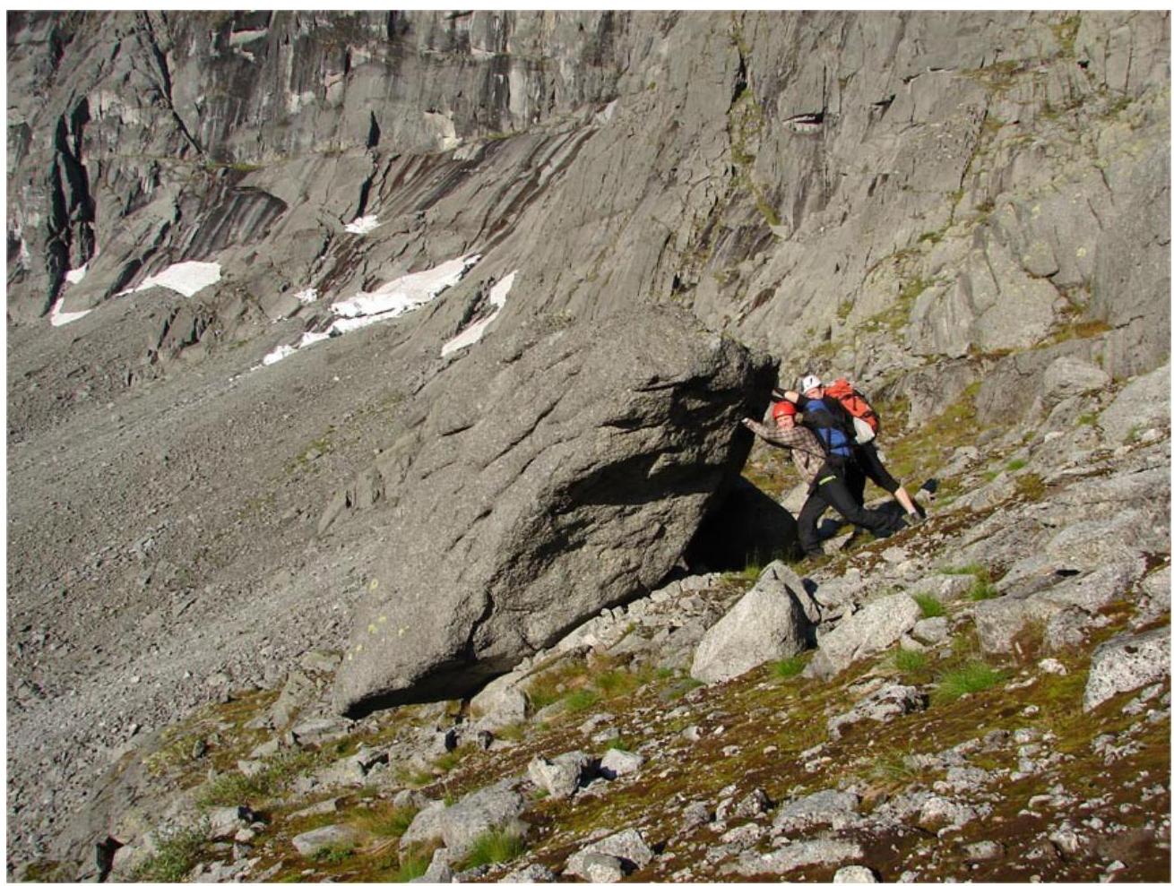
Photo 8. Landmark for the start of the route — a large inclined lying rock

Digited by Google
Photo 9. R2–R3 — start of the ridge
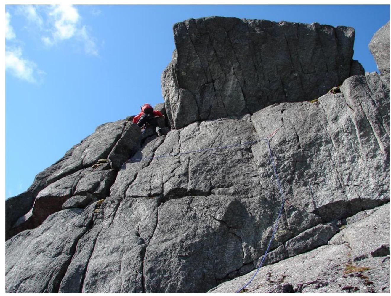
Photo 10. Section R4–R5, bypassing one of the cornices — "tooth"
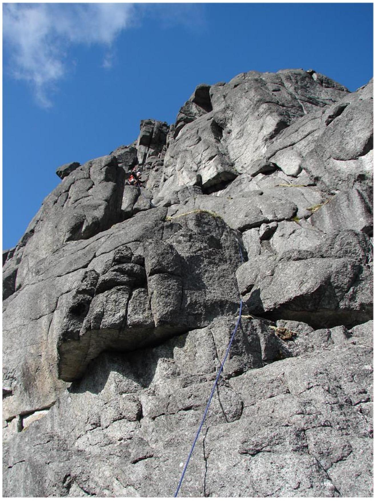
Photo 11. Section R6–R7, passage between several cornices — "teeth"
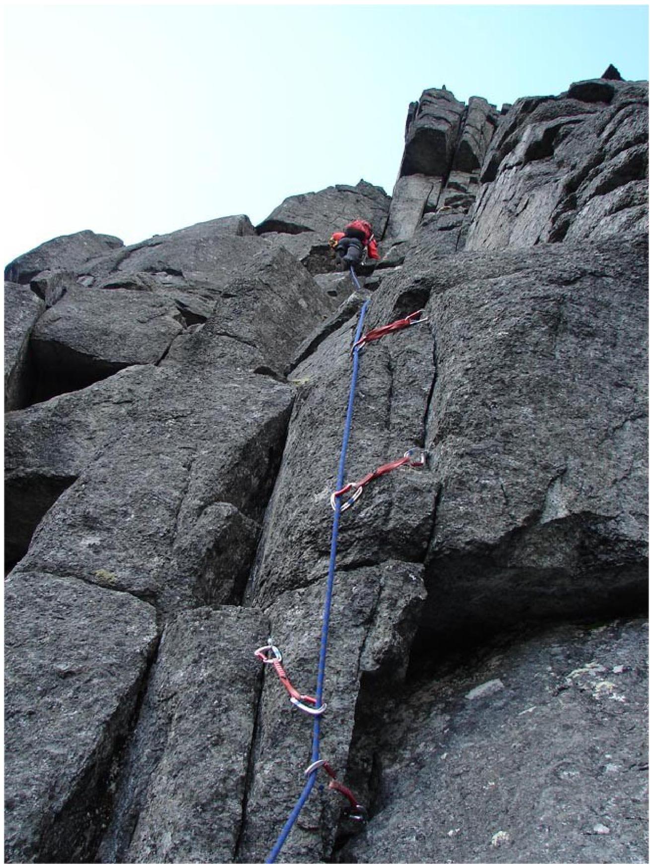
Photo 12. Section R7–R8, another "tooth" visible
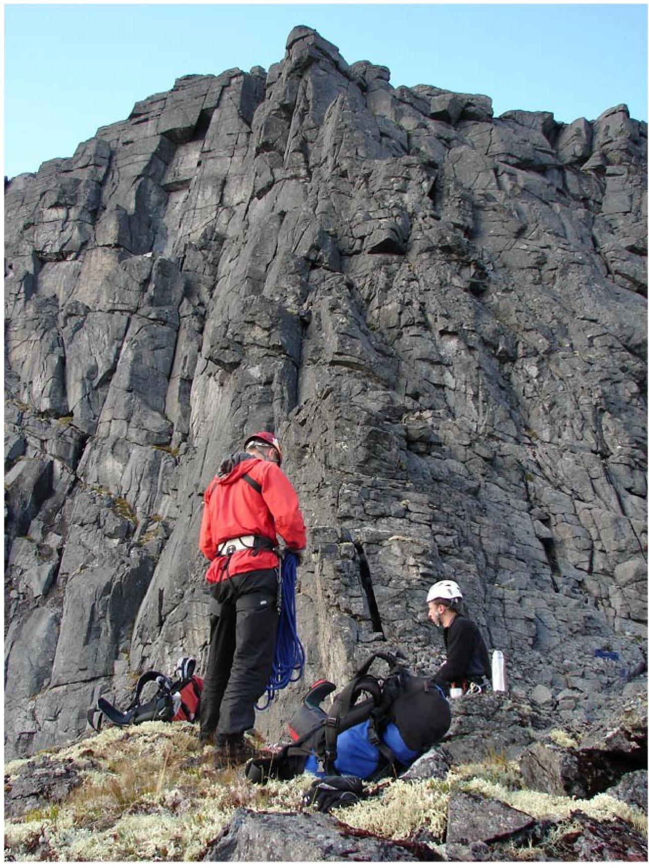
Photo 13. R10 — wide ledge, center view of section R10–R12
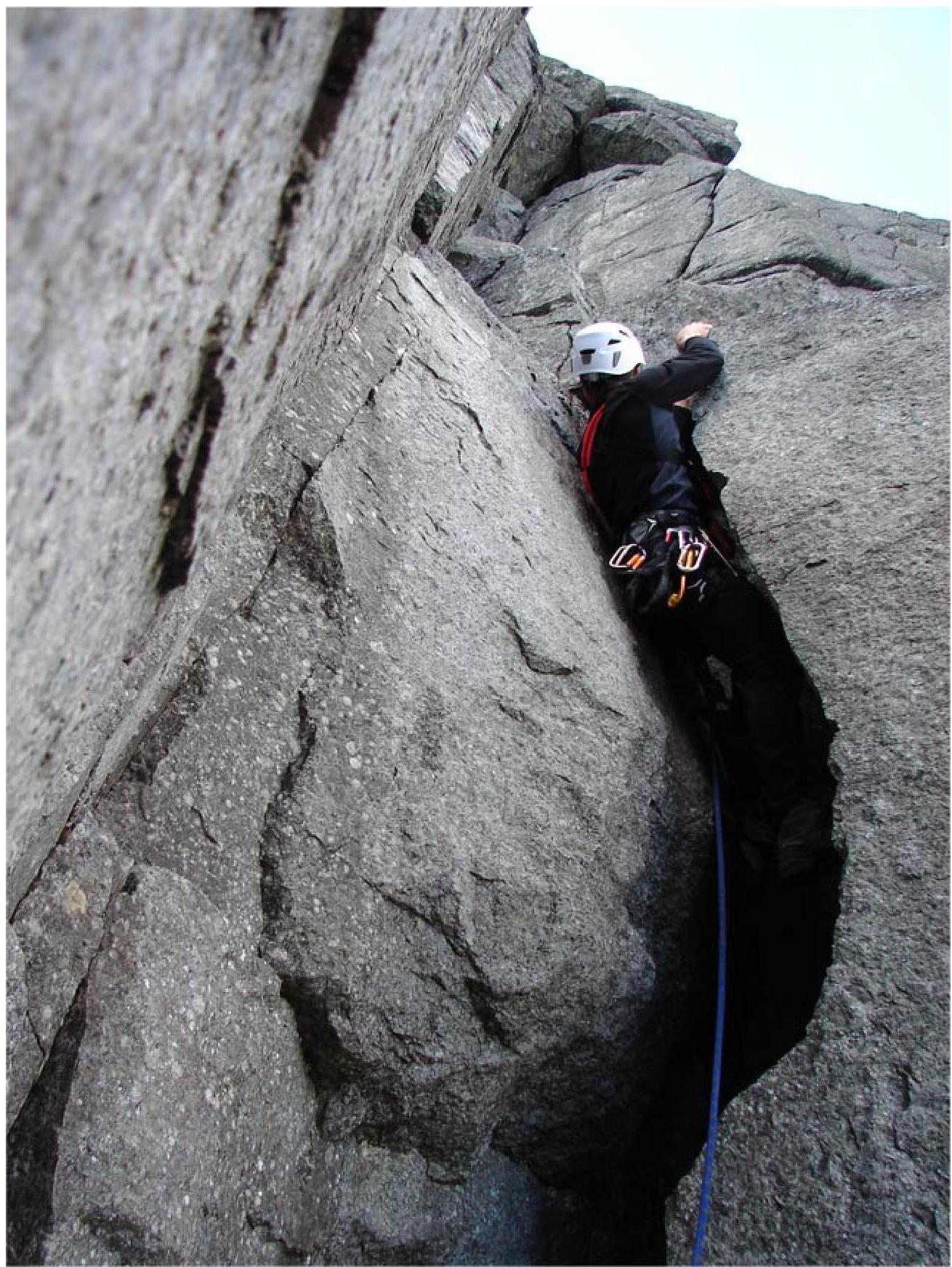
Photo 14. Section R10–R11, passage of a wide S-shaped crack in the inner corner
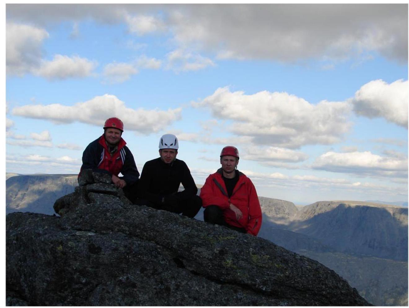
Photo 15. Team on the plateau


