Ascent Passport
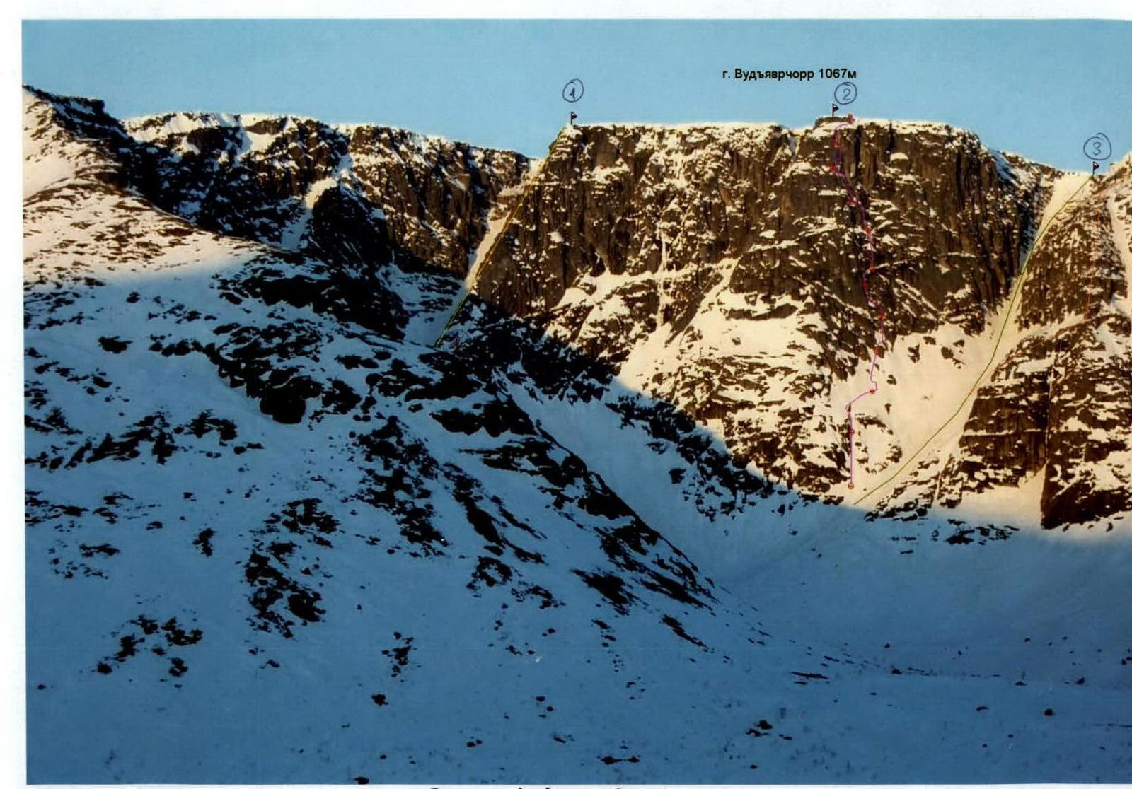
- Khibiny mountain range. Ganesheva Cirque. Classification table section number: #8.6
- Peak name: Vudyavrchorr 1067 m, route name — "Lestenka".
- Proposed — 5B category difficulty, first ascent.
- Route type: rock.
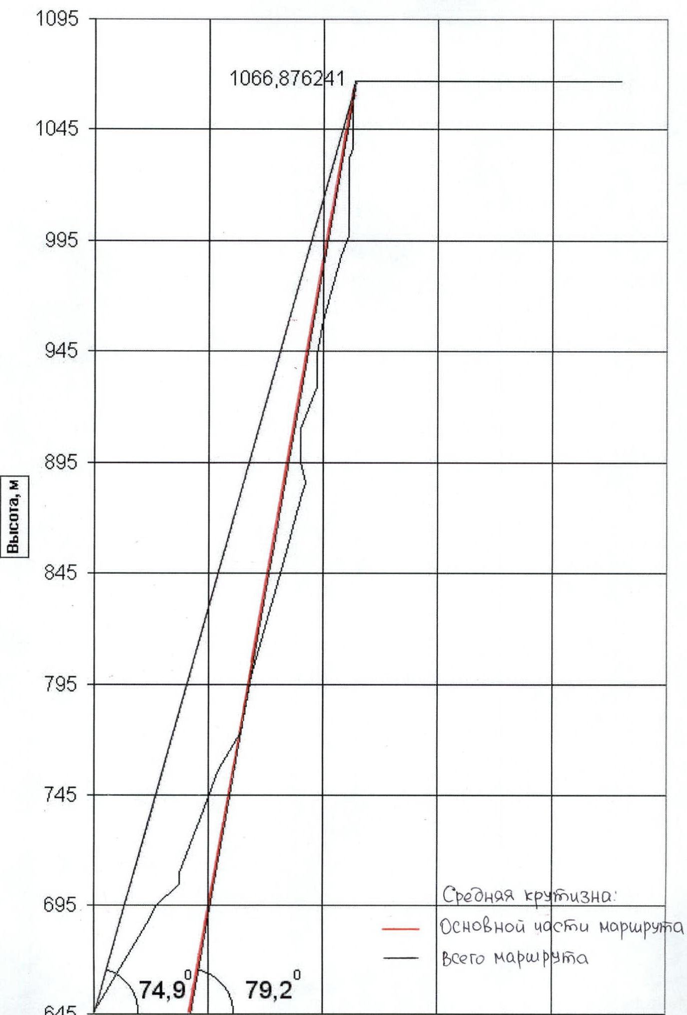
- Route elevation gain: 470 (by altimeter)
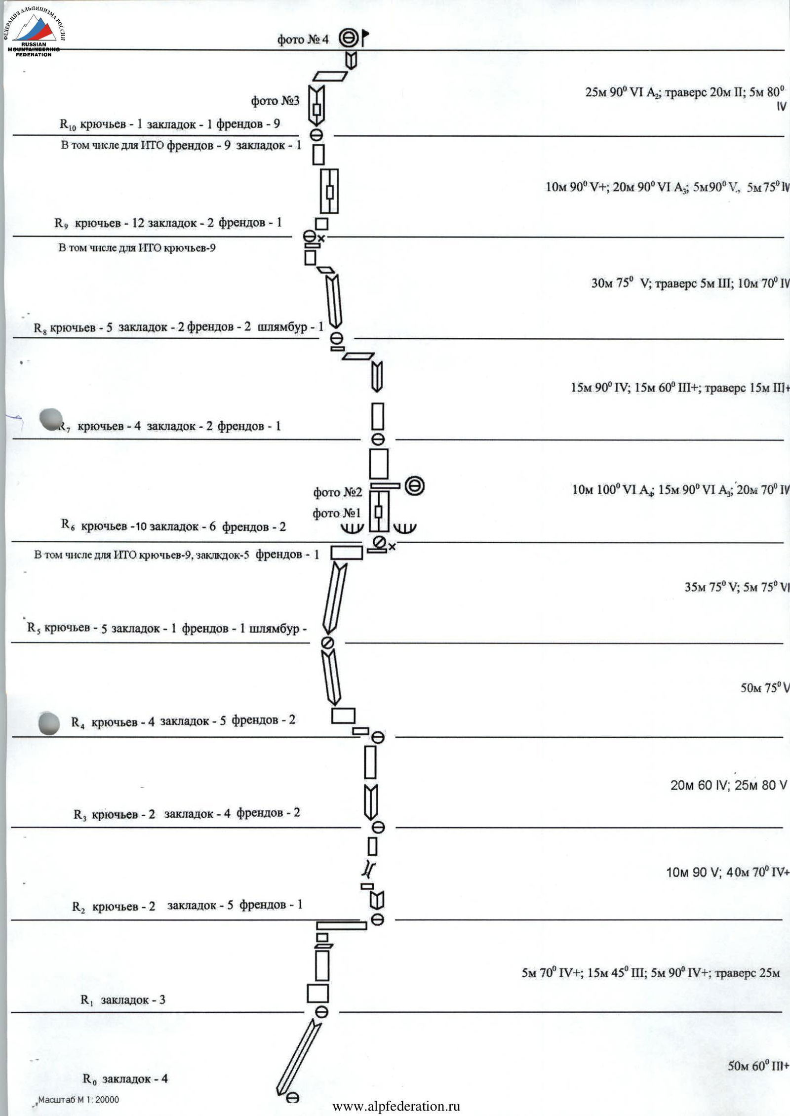
Route length: 510 m. Section lengths:
- V category difficulty — 120 m,
- VI category difficulty — 70 m. Average steepness:
- main part of the route — 79°
- entire route — 75°
- Pitons left on the route: total — 7; including bolted pitons — 2. Pitons used on the route:
- stationary bolted pitons: 2 (including artificial aids 0)
- removable bolted pitons: 0 (including artificial aids 0). Total artificial climbing aids (artificial aids) used: 35 points.
- Team's total climbing hours: 34 hours, 3 days
- Leader: Pankov Maxim Anatolyevich, Candidate Master of Sports.
Participants:
- Andreyev Arkadiy Borisovich, 1st sports rank
- Sidorenko Sergey Vasilyevich, 1st sports rank
- Orlov Vladimir Alexandrovich, 2nd sports rank
-
Coach: Shumilov O.I., Master of Sports Tinin Yu.P., Master of Sports
-
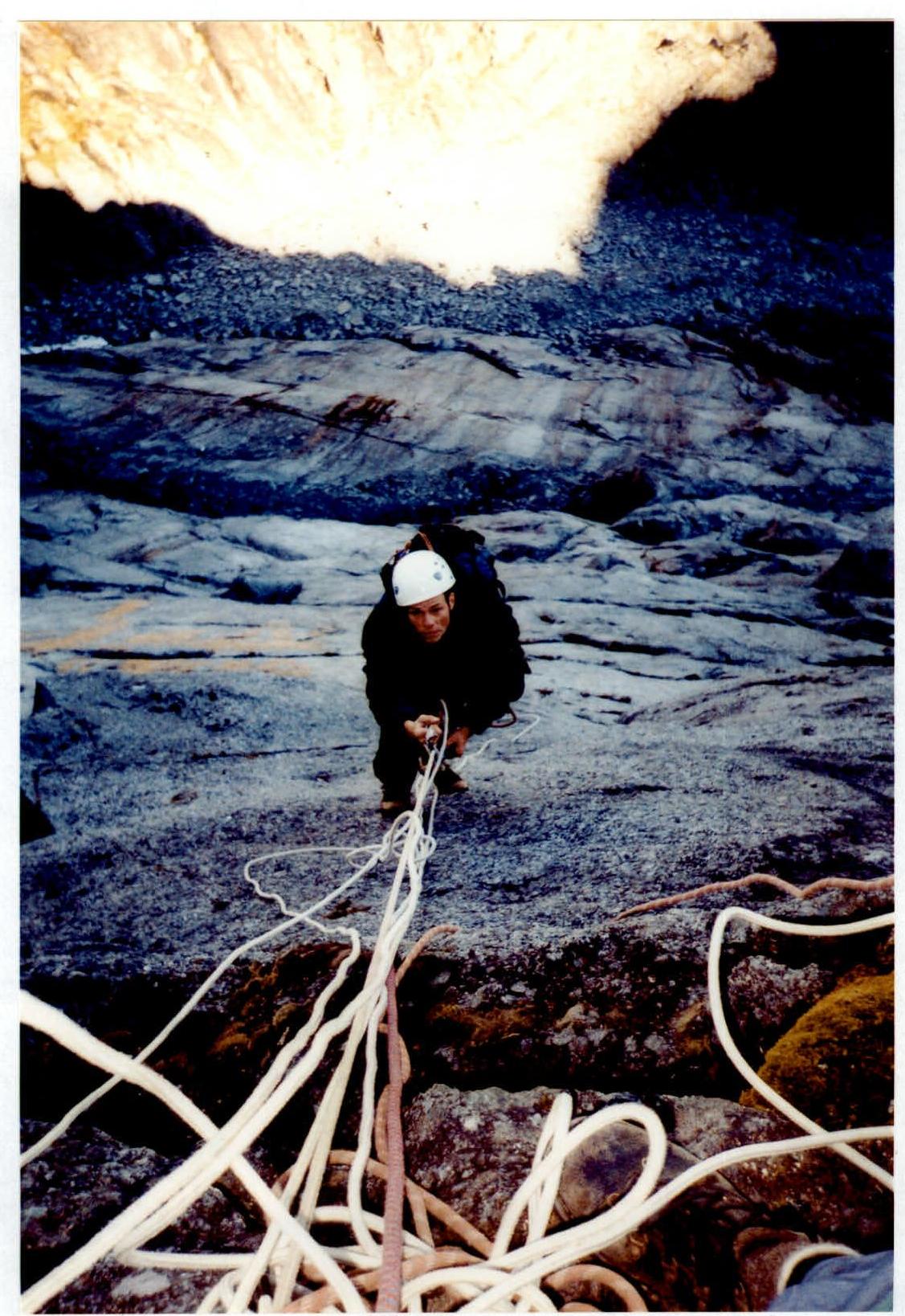
Approach to the route: August 20, 2002 Summit reached: August 22, 2002 Return to base camp: August 22, 2002
Route profile (left) Hand-drawn route profile
Area photopanorama.
Scale 1:20000
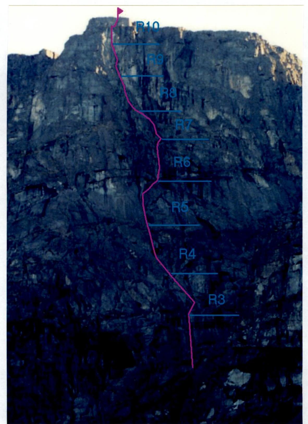
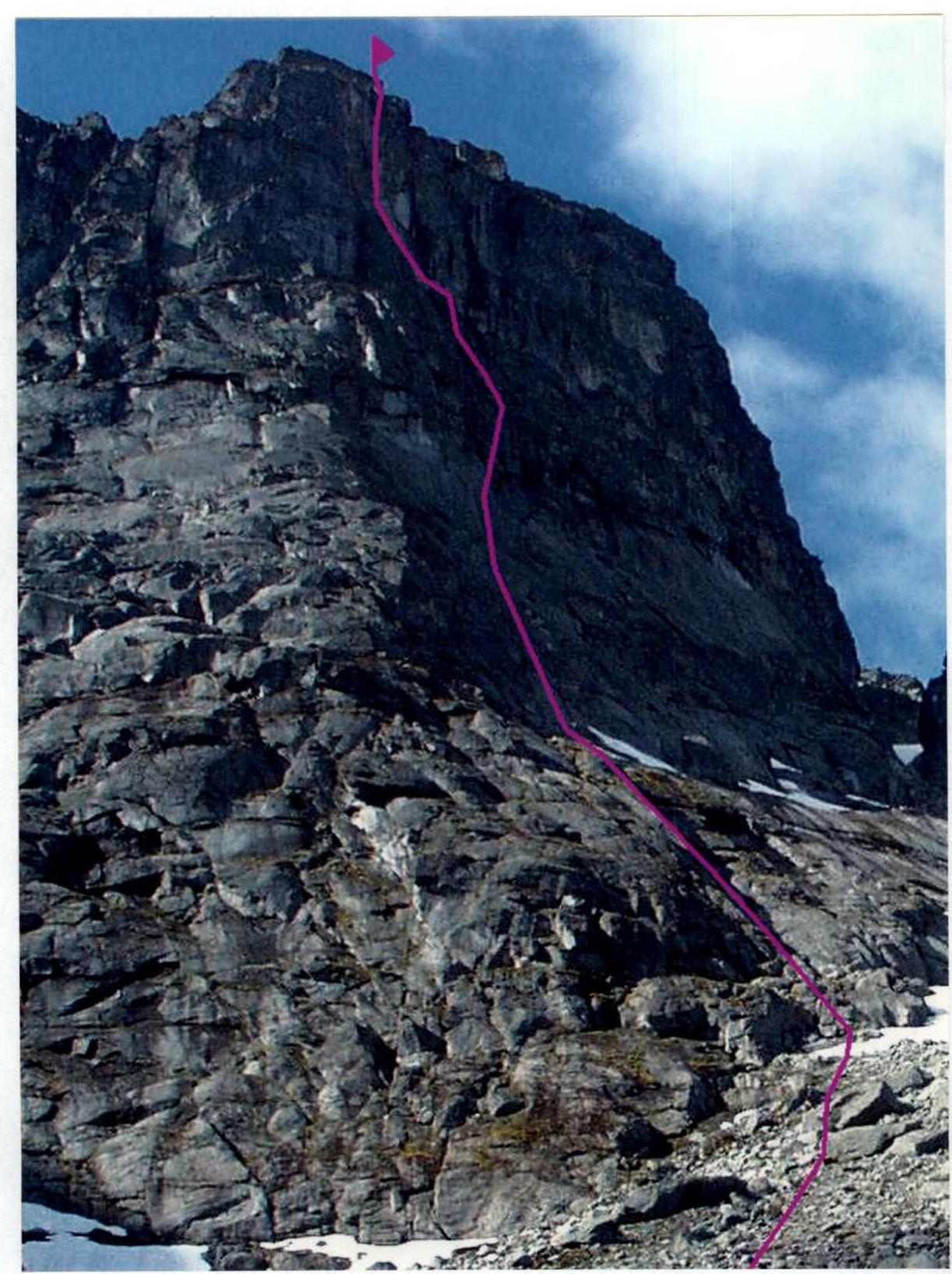
Technical photo of the route
Route Description:
Approach to Ganesheva Cirque, into the avalanche couloir. R0–R1: From the avalanche couloir of Mt. Vudyavrchorr, at the start of the granite slabs — left into the inside corner 50 m, 60° III+.
R1–R2: Then exit the corner via the left wall 5 m, 70° IV+. Further up, under a huge ledge 15 m, 45° III. Exit onto the ledge — wall 5 m, 90°, IV+. Then traverse along the easy ledge 25 m to the stationary belay station — a loop around a larger rock.
R2–R3: Up, via the inside corner 10 m, 90° V, then via a series of chimneys — 40 m, 70° IV+. Good spot for a belay station.
R3–R4: Further via the inside corner 20 m, 60° IV, and then via the wall — 25 m, 80°, V. Good spot for a belay station, with a ladder attached at the station.
R4–R5: From the ladder, towards the huge inside corner and then via the corner — 50 m, 75°, V. Semi-hanging belay station.
R5–R6: Further — via the corner, under the eaves — 35 m, 75°, V. Traverse with a slight height gain 5 m, 75° VI. At the station, there's a ledge for two, a control cairn, and a bolt.
R6–R7: From under the eave, vertically up via a tight crack 10 m 100° VI A4; 15 m 90° VI A3, past a good ledge for a possible overnight stay — up 20 m 70° IV. Good spot for a belay station.
R7–R8: Further via the wall and inside corner, to a narrow ledge leading left 15 m 90° IV; 15 m 60° III+, traverse 15 m III+. Good spot for a belay station.
R8–R9: Up, via the inside corner (30 m 75° V); then traverse left 5 m III and wall 10 m 70° IV. Good spot for a belay station, with a bolt.
R9–R10: From the station, right and up 10 m 90° V+; then a tight crack — 20 m 90° VI A3, further via the rocks 5 m 90° V, 5 m 75° V. Good spot for a belay station.
R10–R11: From the station, a vertical inside corner (25 m 90° VI A2), exit onto a large ledge and traverse right — 20 m II; then via the inside corner (5 m 80° IV) — exit onto the summit.
The control cairn is built from rocks on the plateau. The rocks on the route are partially smoothened, the R4–R6 section is traversed on wet rocks; many cracks are suitable for very thin pitons. Pitons of all types and artificial aids — friends, stoppers — work well. The free climbing level required for the route is 6A. In polar day conditions (summer), it's possible to climb the route in a team of two in alpine style.
Descent from the summit:
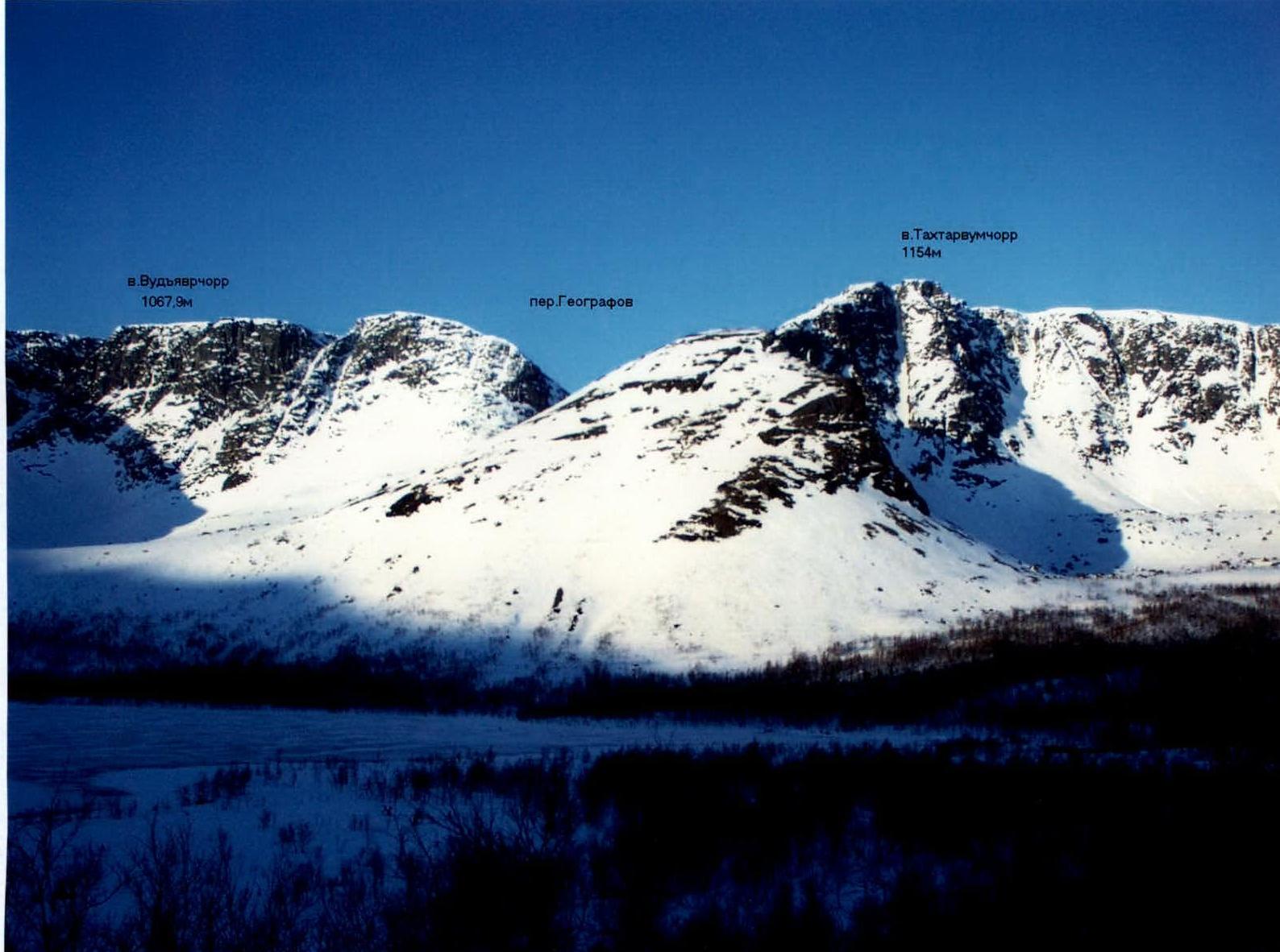
- Via the western slope to Geografov Pass, then through the pass to Maly Vudyavr Lake
- Through the Avalanche Couloir
Emergency exit from the route: via the ascent path, into the couloir.
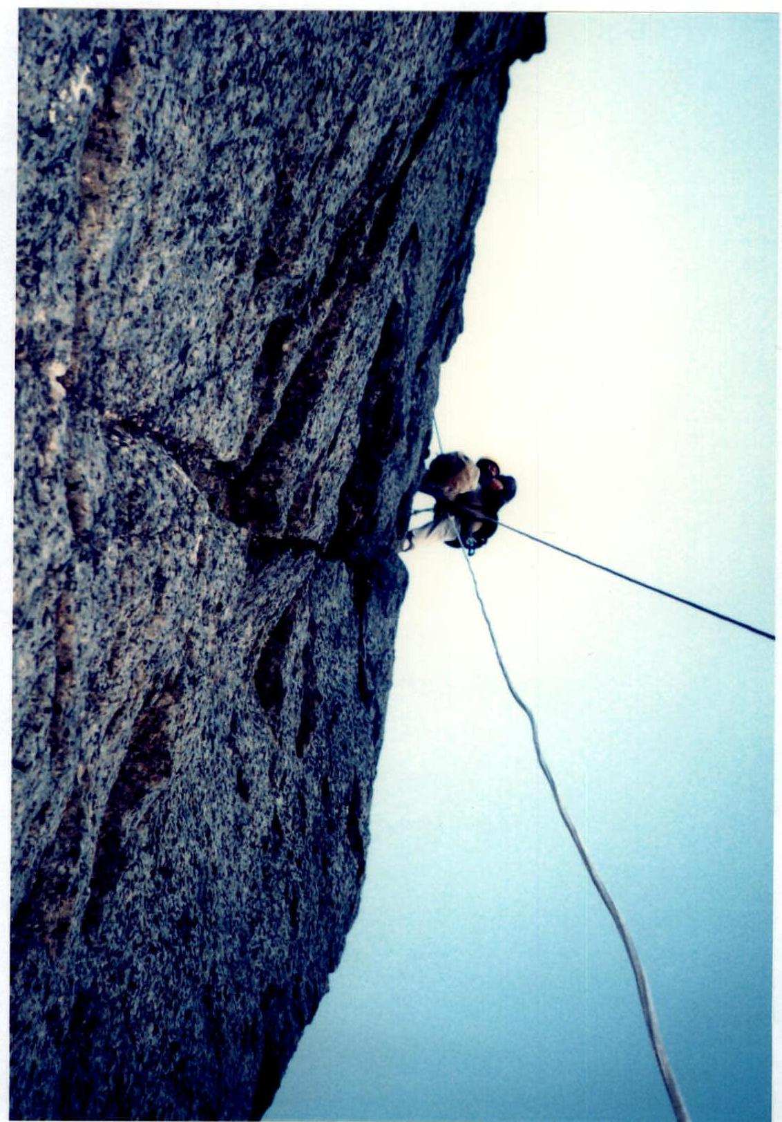
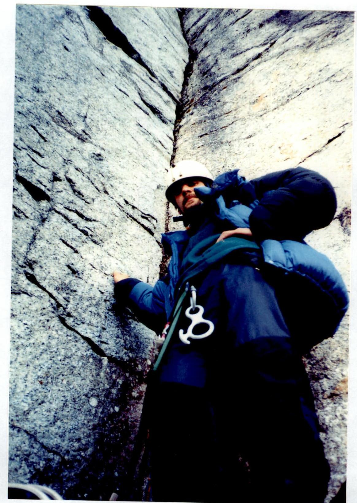
Roping on the R6–R7 section.
Roping on the R6–R7 section.
R10–R11 section. Terrain demonstration.


