3A
Ascent Passport
-
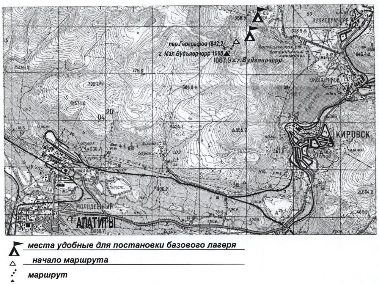
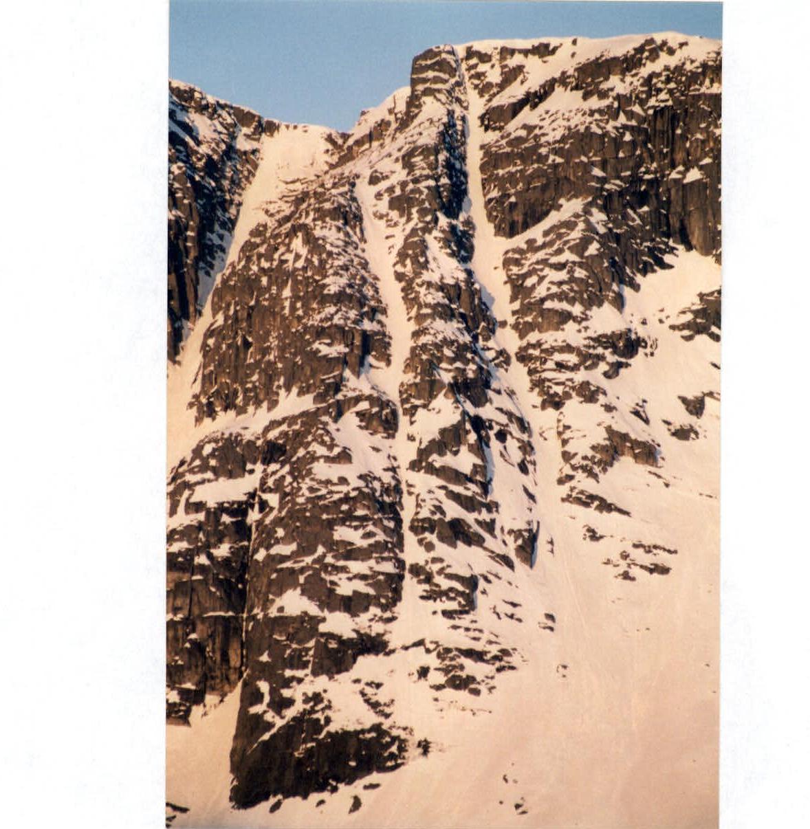
Region: Khibiny Mountains. Cirque: valley of Maly Vudyavr lake, Ganesha cirque (Geographers pass). Section number according to KMGV-2001: 8.6.
-
Peak name: Maly Vudyavrchorr, height: 1065 m. Route name: via the third counterfort of the eastern wall "Korablik".
-
Proposed: 3A cat. difficulty, first ascent.
-
Nature of the route in winter: combined. Nature of the route in summer: rock.
-
Height difference of the route: 550 m (by altimeter).
Route length: 750 m. Length of sections:
- 5 cat. difficulty — m;
- 6 cat. difficulty — 65 m. Average steepness:
- main part of the route — 55°;
- entire route — 50°.
-
Pitons left on the route: total: — ; including bolted: — Total used on the route: rock pitons: 9; nuts, etc.: 26. Used stationary bolted pitons: — , including for ITO; used removable bolted pitons: — , including for ITO.
-
Team's climbing hours: 6 hours, one day.
-
Leader: Pochivalov Sergey Sergeevich, sports rank, title: 1st sports rank. Participants:
- Gorshkov Igor Yuryevich, 1st sports rank;
- Sukhov Alexander Gennadyevich, 2nd sports rank;
- Shestikhin Sergey Mikhailovich, 2nd sports rank.
-
Coach: Shumilov Oleg Ivanovich, sports rank, title: Master of Sports.
-
Departure for the route: 9:00, July 28, 2001. Reaching the summit: 15:00, July 28, 2001. Return to base camp: 17:00, July 28, 2001.
-
Organization: Murmansk Region Alpine Federation.
2. Maly Vudyavrchorr (1065 m)
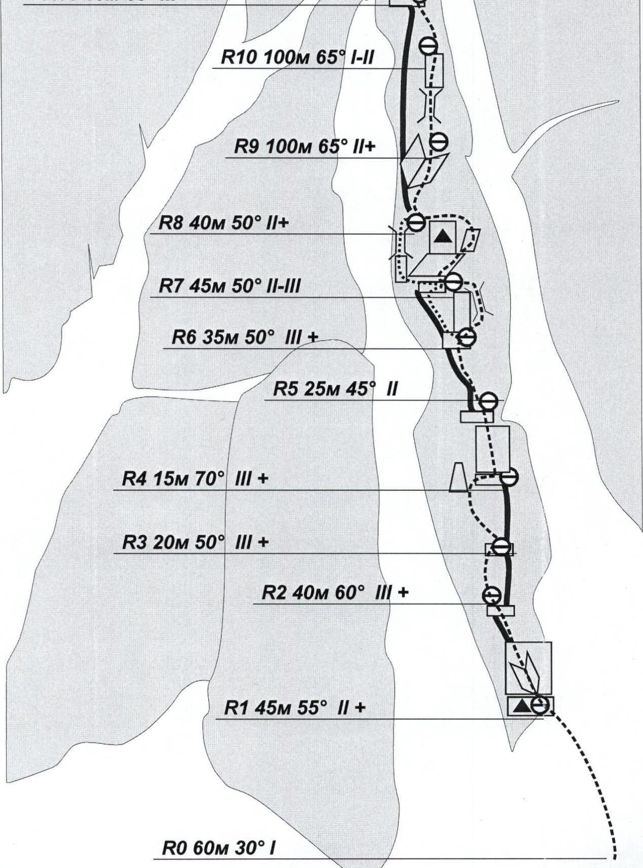
R12 25 m 80° 4
R11 40 m 65° 3
Route Description
R0–R1: Along inclined slabs 60 m, 30° 1 cat. difficulty. Exit to a ledge. Control cairn # 1, made of stones.
R1–R2: Up an inside corner 8 m, then via "ram's foreheads" and a ridge 35 m, 55° 2+ cat. difficulty. Exit to a ledge.
R2–R3: Along a wide ridge and rocks 40 m, 60° 3+ cat. difficulty.
R3–R4: Leftwards across rocks 20 m, 50° 2+ cat. difficulty, then rightwards to a ledge; a large stone is on the left of the ledge.
R4–R5: Up a wall to the right of a narrow cleft 15 m, 70° 3+ cat. difficulty.
R5–R6: Along a ridge 25 m, 45° 2 cat. difficulty. Exit to a ledge. Control cairn # 2 on the wall.
R6–R7: From the ledge leftwards along a ridge 35 m, 50° 2+ cat. difficulty. Exit to a ledge.
R7–R8: From the ledge along an inclined slab, a small ledge, and mossy rocks 45 m, 50° 2–3 cat. difficulty. Exit to a ridge.
R8–R9: Along a ridge and an inside corner 40 m, 50° 2+ cat. difficulty. Exit to a ridge.
R9–R10: Along a ridge, a wide chimney to the right of the ridge and an inclined ledge 100 m, 45° 2+ cat. difficulty. Exit to a ridge.
R10–R11: Along a ridge 100 m, 35° 1–2 cat. difficulty. Exit to a large ledge below the pre-summit tower.
R11–R12: Across rocks 40 m, 65° 3+ cat. difficulty. Exit to a ledge, control cairn # 3, made of stones.
R12–R13: Up a wall 25 m, 80° 4+ cat. difficulty, initially along an inside corner 5 m using ITO and ladders, then leftwards across rocks and up an inside corner 10 m. Exit to a ridge and to the summit.
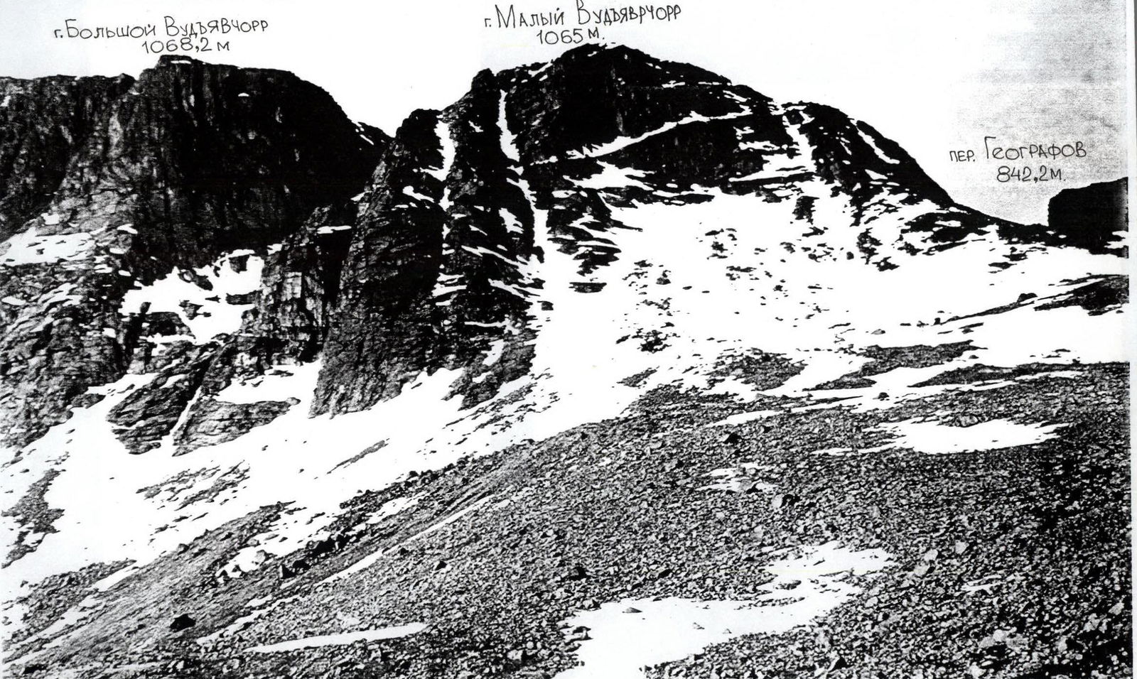
Descent from the summit: via Geografov pass or Lavinny couloir (in winter).
Emergency exit from the route: via Lavinny couloir; via the couloir on the right or via the ascent route.
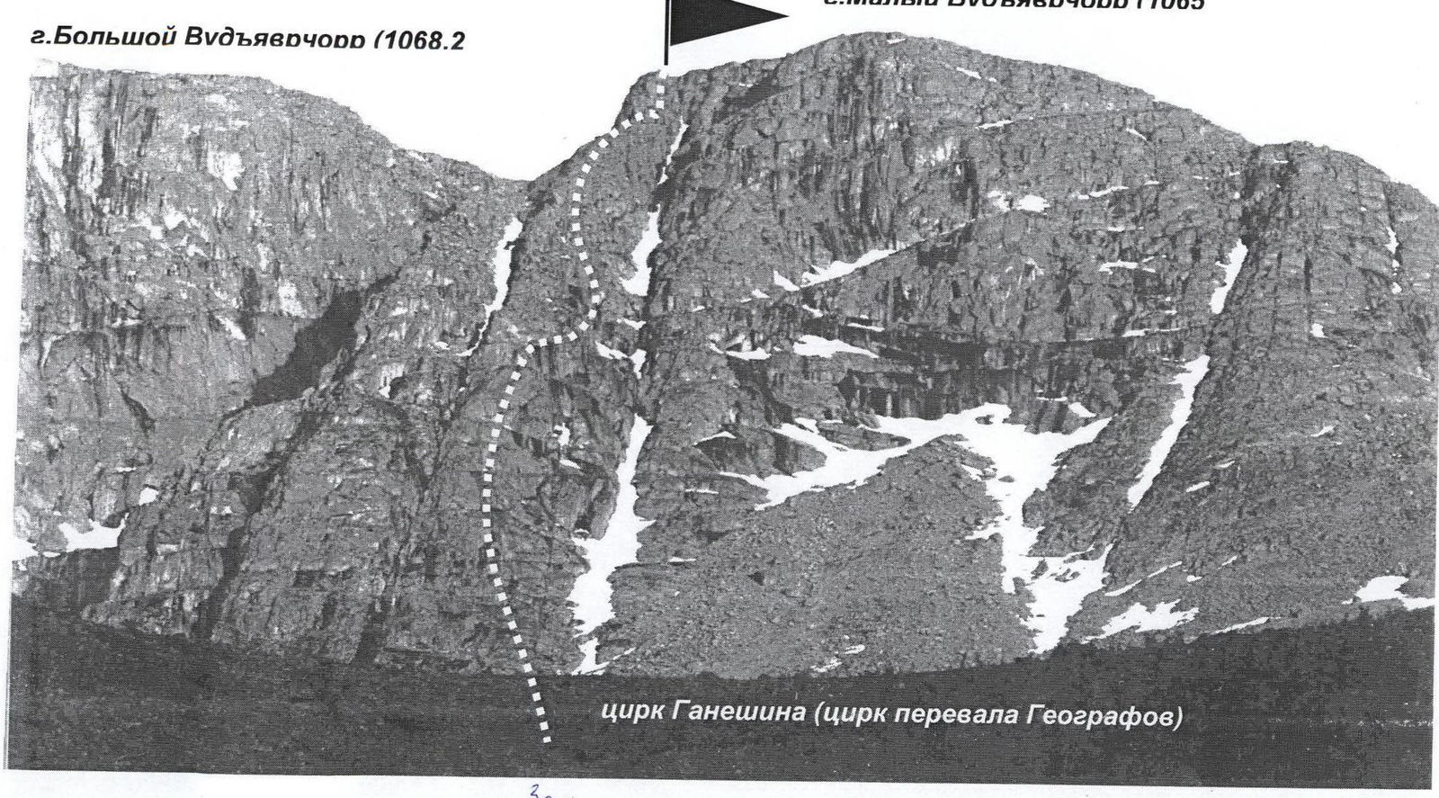
Ganesha Cirque
Mt. Maly Vudyavrchorr
 Mt. Bolshoy Vudyavrchorr 1068.2 m

 2. Bolshoy Vudyavrchorr (1068.2 m)