
Report
On the ascent to Telpos-Iz Eastern peak via the North-West slope and North-East ridge, category 1B, by the team from F.k.i.p.GP (Ukhta) from March 25, 2023, to March 25, 2023.
I. Ascent Report
| №№ | 1. General Information | |
|---|---|---|
| 1.1 | Full name, sports rank of the team leader | Yakimenko Oksana Anatolyevna, MS |
| 1.2 | Full name, sports rank of the team members | Goloviznin Roman Vladimirovich, z/n; Likhomanov Aleksey Nikolaevich, z/n; Manin Aleksey Dmitrievich, b/r; Osetrov Alexander Alexandrovich, b/r |
| 1.3 | Full name of the coach | Badich Nikolay Evgenievich |
| 1.4 | Organization | Federation of Clubs for Research and Travel of the Trade Union Movement of Gazprom Corporation |
| 2. Characteristics of the Ascent Object | ||
| 2.1 | Region | Northern Urals |
| 2.2 | Valley | Shchugor River valley, from the dry stream gorge |
| 2.3 | Section number according to the 2013 classification table | 8.2. |
| 2.4 | Name and height of the peak | Telpos-Iz Eastern, 1617 m |
| 2.5 | Geographical coordinates of the peak (latitude/longitude), GPS coordinates | 63.918586, 59.181804 |
| 3. Characteristics of the Route | ||
| 3.1 | Name of the route | Via the North-West slope and North-East ridge |
| 3.2 | Proposed category of difficulty | 1B |
| 3.3 | Degree of route development | – |
| 3.4 | Relief characteristics of the route | Combined |
| 3.5 | Height difference of the route (altimeter or GPS data) | 1033 m |
| 3.6 | Length of the route (in meters) | 5260 m |
| 3.7 | Technical elements of the route (total length of sections of various difficulty categories with relief characteristics) | no technical difficulties snow-ice – 4100 m I category snow-ice – 730 m II category combined – 430 m III category ice/rock/combination M IV category ice/rock/combination M Movement on closed glacier M Rappel descent (on descent) – |
| 3.8 | Descent from the peak | Via the ascent route |
| 3.9 | Additional characteristics of the route | – |
| 4. Characteristics of the Team's Actions | ||
| 4.1 | Time of movement | 6.5 hours |
| 4.2 | Overnight stays | – |
| 4.3 | Departure on the route | 7:00 March 25, 2023 |
| 4.4 | Arrival at the peak | 13:30 March 25, 2023 |
| 4.5 | Return to base camp | 21:30 March 25, 2023 |
| 5. Person responsible for the report | ||
| 5.1 | Full name, e-mail | Yakimenko Oksana Anatolyevna, locust@inbox.ru |
II. Description of the Ascent
1. Characteristics of the Ascent Object

Fig. 1. Panorama of the massif. Taken on March 20, 2023, from the Shchugor River near the Glubnik shelter.

Fig. 2. General photo of the peak. Taken on March 20, 2023, from the Shchugor River a kilometer from the dry stream bed.
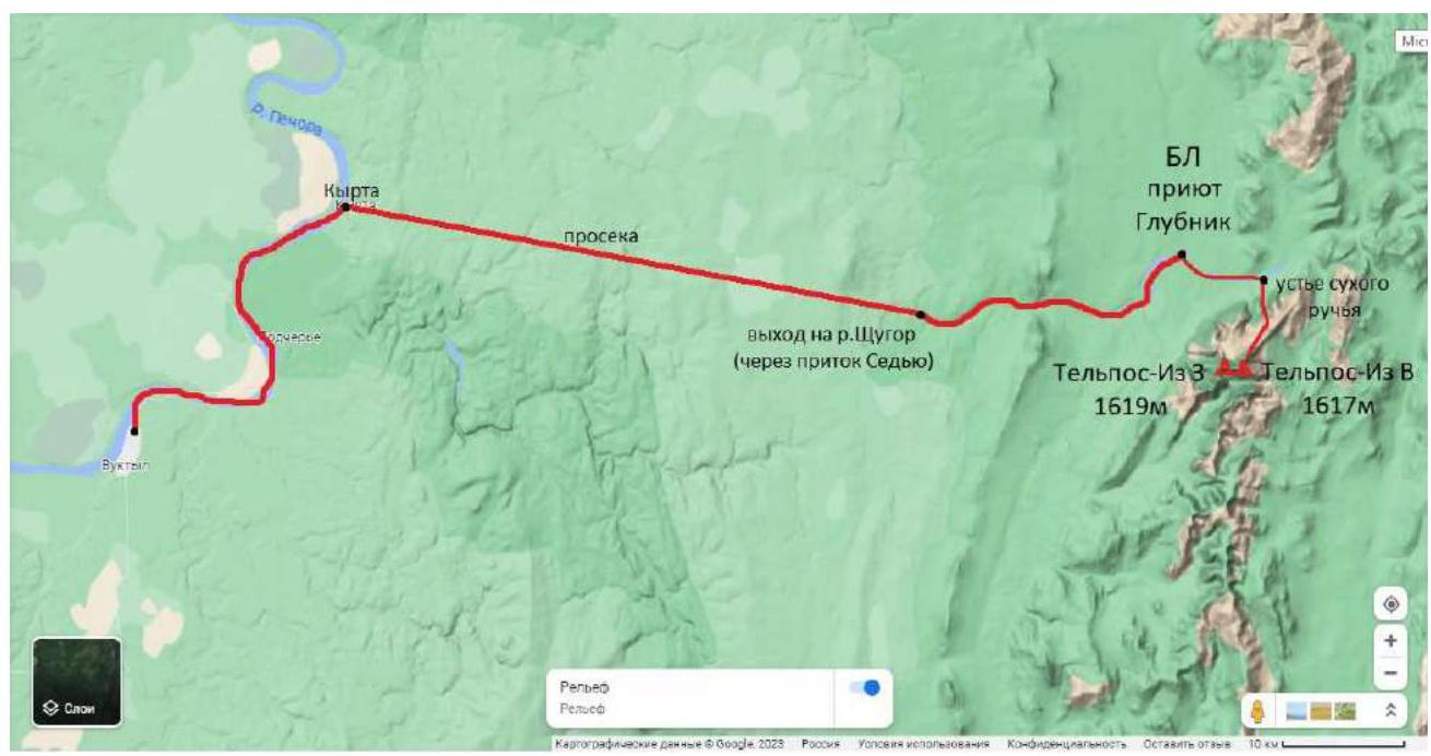
Fig. 3. Map-scheme of the location of the ascent object and nearby settlements.
The Telpos-Iz mountain (Komi Тӧлпос-Из — "mountain of the nest of winds") is the main peak of the Northern Urals, located near the conventional boundary between the Northern Urals and the Subpolar Urals on the left bank of the Shchugor River in the Komi Republic, within the "Yugyd va" National Park, Vuktyl urban district. It is a two-peaked mountain massif with peak heights:
- 1617 m Eastern
- 1619 m Western.
In winter, when rivers are frozen, the ascent area can be reached by snowmobiles via the following route:
- From Vuktyl to the settlement of Kyrta — 38 km along the Pechora River
- Then 48 km along a forest clearing to the confluence of the Sedyu tributary and the Shchugor River
- Further 33 km along the Shchugor River to the Glubnik tributary — here is the eponymous tourist shelter of the "Yugyd va" national park.
It is best to set up a base camp in the national park shelter, which consists of wooden houses with stoves. The surrounding forests are inhabited by wild animals: during our stay in the area, six wolves were spotted, making tent accommodation unsafe.
The mountain is composed of crystalline schists, quartzitic sandstones, and conglomerates. The slopes are covered with taiga forests, above 500 m — mountain tundra. The Telpos-Iz area is known for its bad weather — strong winds often blow from the peak, bringing clouds, rain, or snow. For this reason, several days should be allocated for the ascent to wait for a weather window.
In winter, there is a lot of deep snow in the gorges leading to the mountain, and it is advisable to travel either on ski-tours or snowshoes. The approach via the dry stream bed is convenient as it has the shortest taiga section and allows the use of a snowmobile, making it possible to complete the route from base camp to base camp in one day.
The north-western slopes of the NE ridge do not pose a high avalanche risk in winter due to their gentle slope, the presence of rocky outcrops, and strong winds that blow the snow into a "thick plywood board" from which snow is easily blown off.
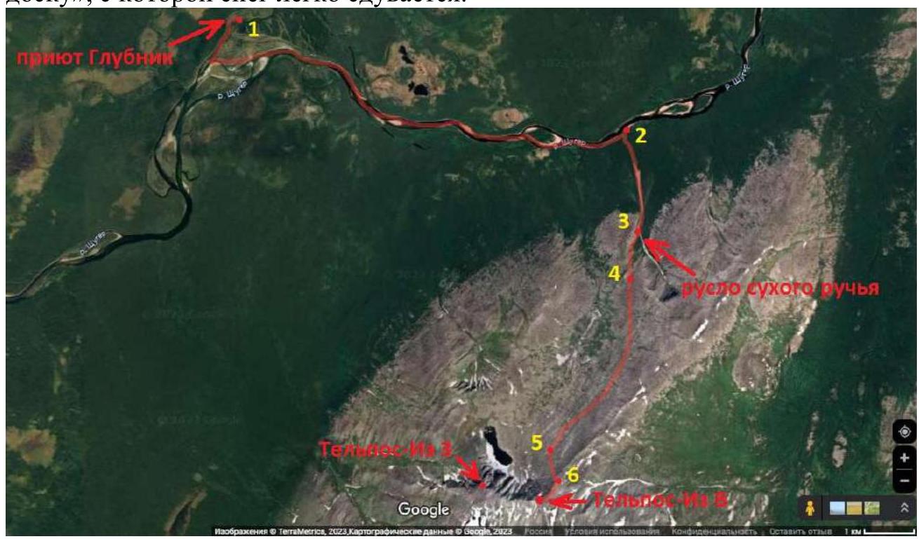
Fig. 4. Map of the ascent area.
Description of points marked on the map:
- Base camp, Glubnik shelter (wooden house with stove heating).
- Mouth of the dry stream, height 182 m.
- Narrowing of the gorge, rocky walls. In summer, there is a waterfall here; in winter, it is a good place for snow activities. Height 340 m.
- Exit to the north-western slope via the ridge shoulder, start of the route, place for putting on crampons. Height 584 m.
- Exit to the indistinctly expressed ridge of the NE ridge. Height 1255 m.
- Exit to the NE ridge. Height 1480 m.
Description of distances and height differences:
1–2 — movement from base camp to the mouth of the dry stream along the river 10 km. 2–3 — movement along the stream bed to the narrowing of the gorge 2 km (height gain 158 m). 3–4 — ascent to the ridge shoulder and exit via it to the north-western slope of the ridge 1.5 km (height gain 244 m). 4–5 — traverse along the snow-ice north-western slope with a gradual gain in height to the indistinctly expressed ridge of the NE ridge 4.1 km (height gain 671 m). 5–6 — ascent along the snowy ridge to the exit onto the NE ridge 500 m (height gain 225 m). 6–peak — movement along the rocky snow-covered ridge, bypassing and via gendarmes to the eastern peak of Telpos-Iz 660 m (height gain 137 m).
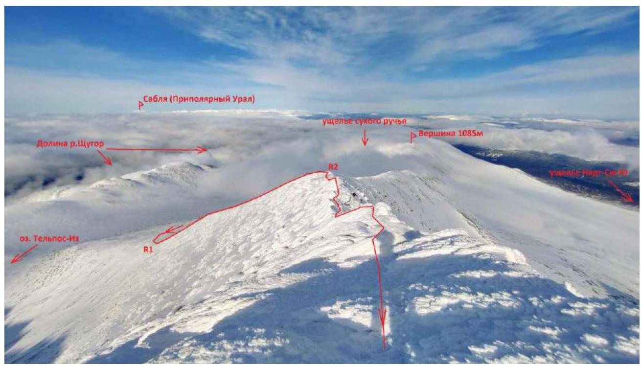
Fig. 5. Profile and thread of the route. March 25, 2023. Taken from under the peak.
2. Characteristics of the Route
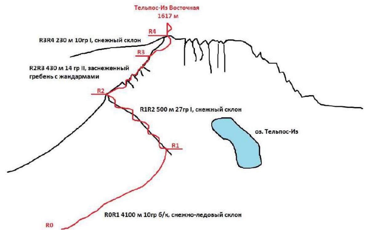
Fig. 6. Scheme of the route.
3. Characteristics of the Team's Actions
March 18:
- General gathering of participants in Vuktyl,
- Preparation and adjustment of equipment,
- Packing of things and products for transportation to the base camp.
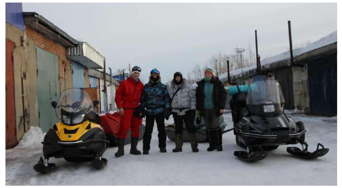
Fig. 7. Gathering of the ascent team. March 19 — transportation to the base camp. Departure at 7:00 accompanied by a ranger from the "Yugyd va" National Park. The path went first along the ice of the Pechora River to the village of Kyrta, then along a forest clearing to the Sedyu tributary (there is a shelter with the same name) and then along the ice of the tributary and the Shchugor River to the Glubnik tributary, where the "Glubnik" shelter is located — the base camp. Arrival at 17:00. The weather in the area was snowy.
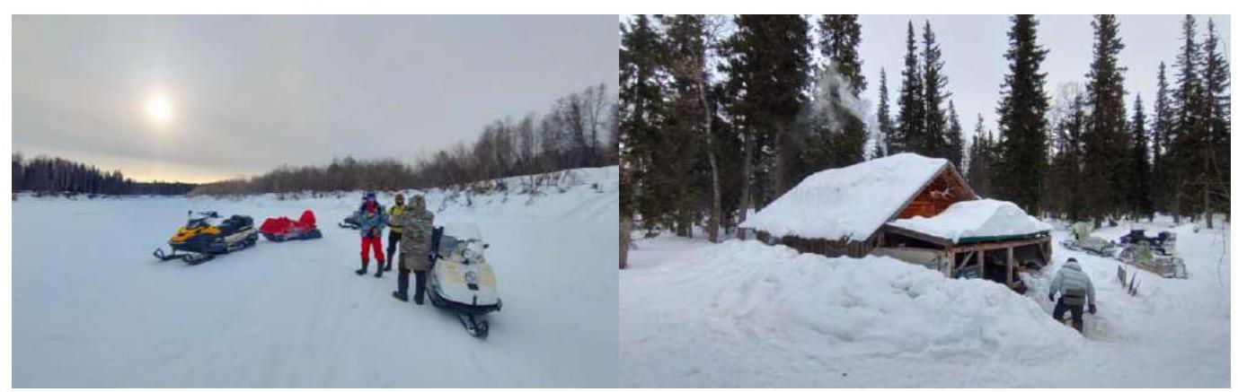
Fig. 8. Road along the river. "Glubnik" shelter. March 20:
- Reconnaissance of places for rock climbing,
- Reconnaissance on skis of the approach to the route (found a snowmobile track, which was later used),
- Conducting snow activities in the narrow part of the dry stream gorge.
The cloudy morning weather turned into clear and windless conditions by evening, allowing the entire Telpos-Iz massif to be seen and photographed.
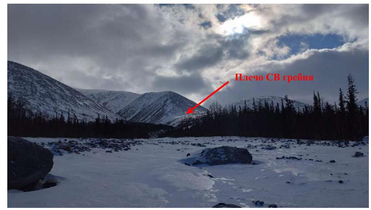
Fig. 9. Exit from the forest into the open part of the dry stream gorge.
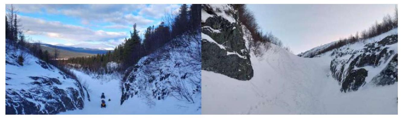
Fig. 10. Narrowing of the gorge (in summer, there is a waterfall here). Place for snow activities. March 21:
- Until noon — avalanche training on a snowy slope near the base camp;
- After lunch — rock climbing training on the rocky bank of the Shchugor River (coordinates 63.993771, 59.099184).
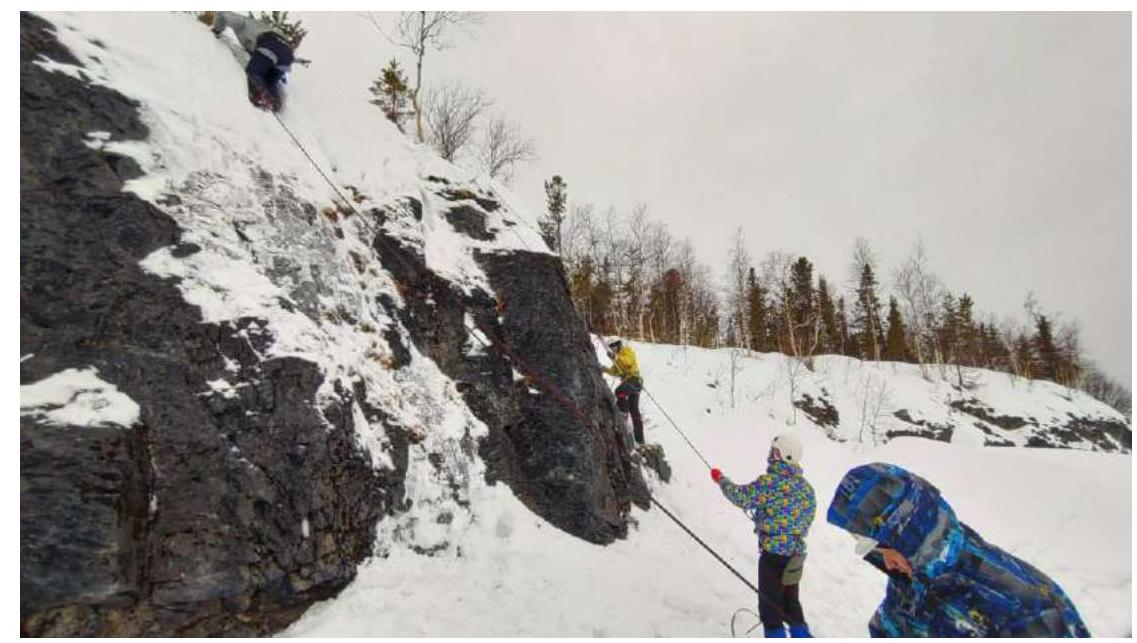
Fig. 11. Rock climbing training. March 22 — a day of lectures, rest, and preparation for the ascent. March 23 at 6:00 — departure for the ascent. In conditions of reduced visibility (snowstorm, fog) and gusty winds, we ascended to a height of 1430 m using a navigator and decided to descend. By 15:00, we returned to the base camp.
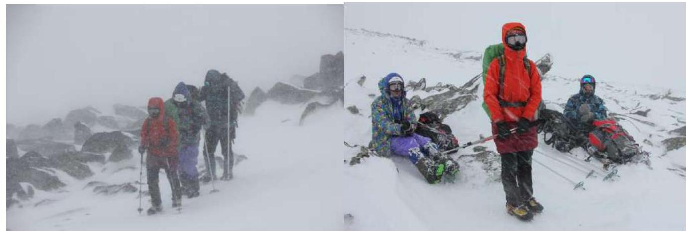
Fig. 12. Attempted ascent on March 23 in difficult weather conditions. March 24 — a day of lectures, fishing, and rest due to bad weather in the area. March 25 at 5:00 — departure for the ascent from the base camp. By 6:00, we reached the narrowing of the gorge (point 3 Fig. 4), by 7:00 we approached the start of the route (point R0), where we put on harnesses and crampons. We reached the NE ridge at 12:00. Then we took out ropes, tied into teams, and continued moving along the ridge to the Eastern peak. We reached the peak as a team at 13:30, and then part of the team made a traverse to the Western peak. The descent was via the ascent route.
In the morning, clouds hung over the massif, but by noon, clear and windless weather had set in, which lasted until evening, allowing not only the route to the Eastern peak to be completed but also a traverse to the Western peak and back.

Fig. 13. Start of section R0–R1 and movement along it.
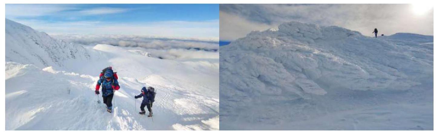
Fig. 14. Movement along section R1–R2.
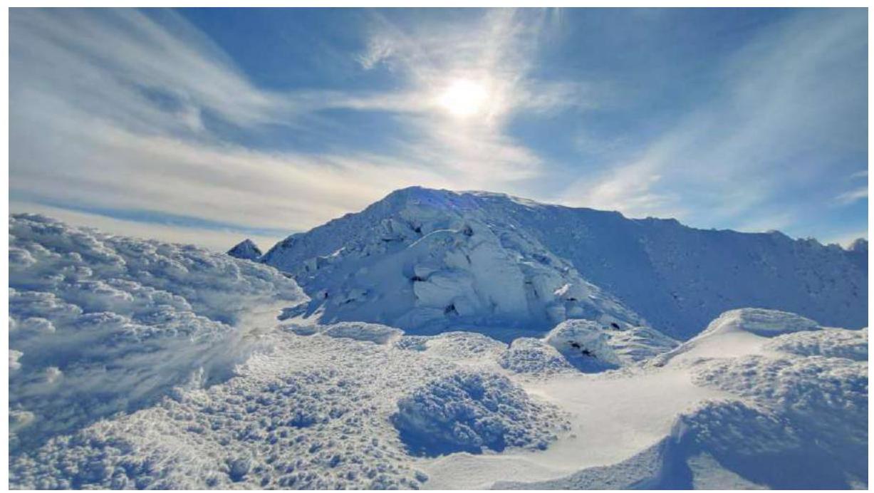
Fig. 15. Exit onto the ridge, ahead is section R2–R3.

Fig. 16. View from the ridge to the south, time 12:00.
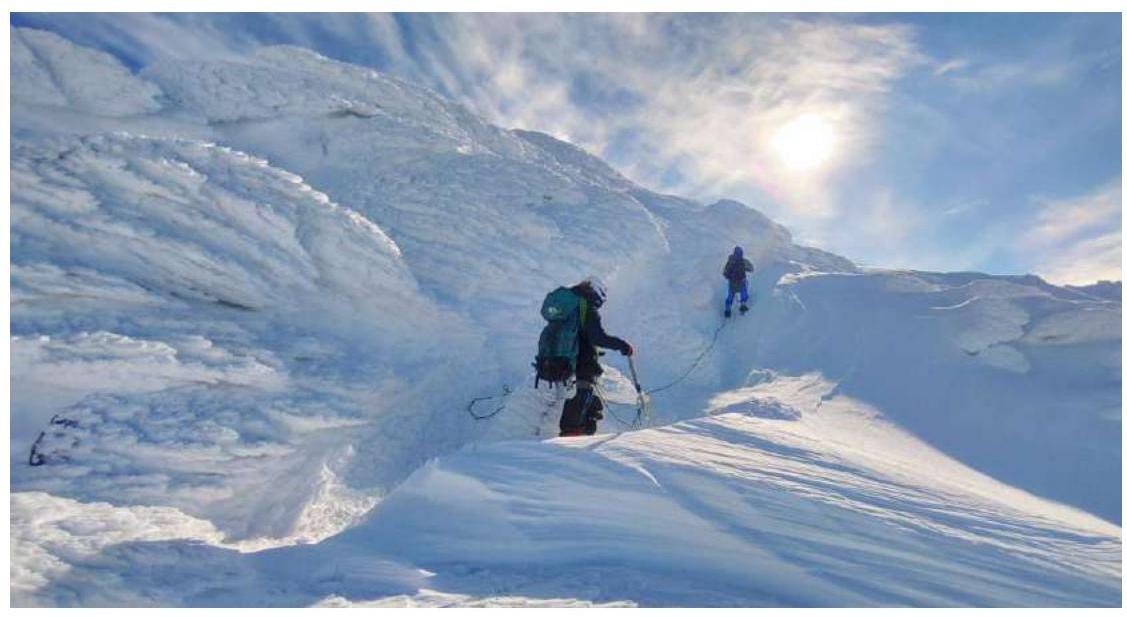
Fig. 17. Start of movement along section R2–R3.
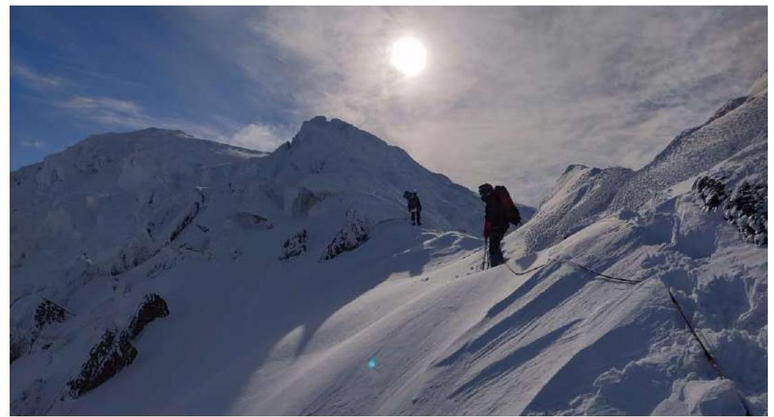
Fig. 18. Middle of section R2–R3.
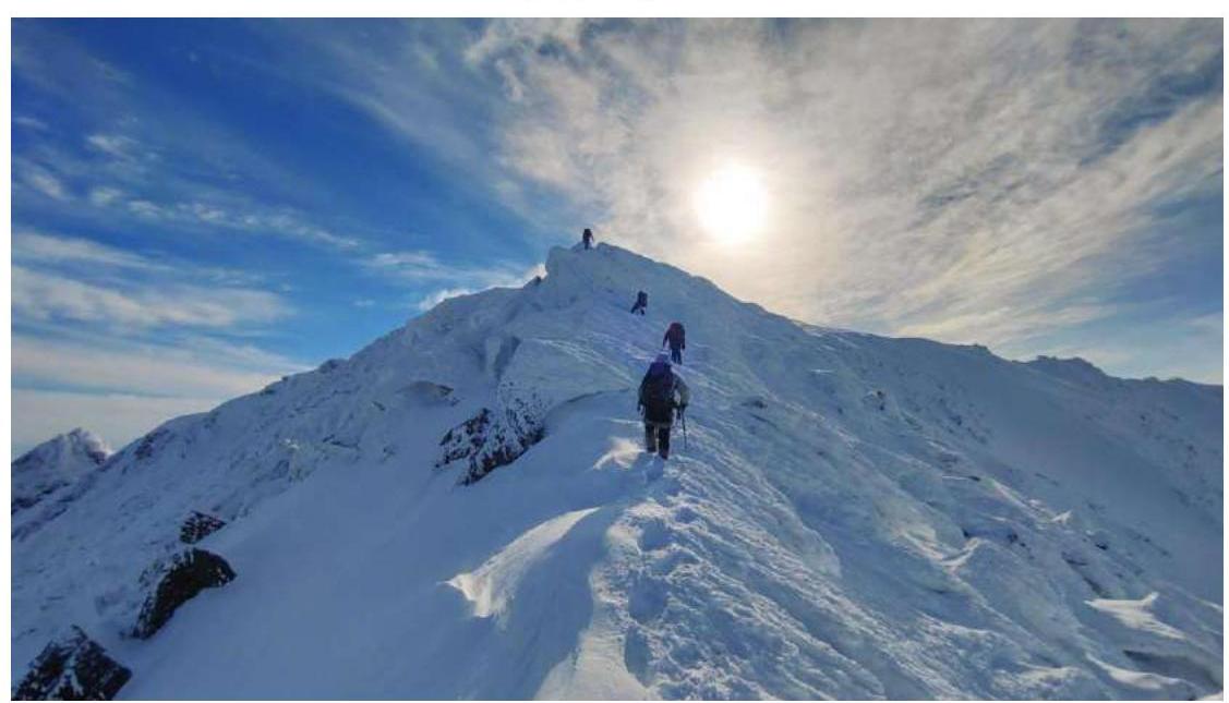
Fig. 19. Passage of a gendarme "en face".
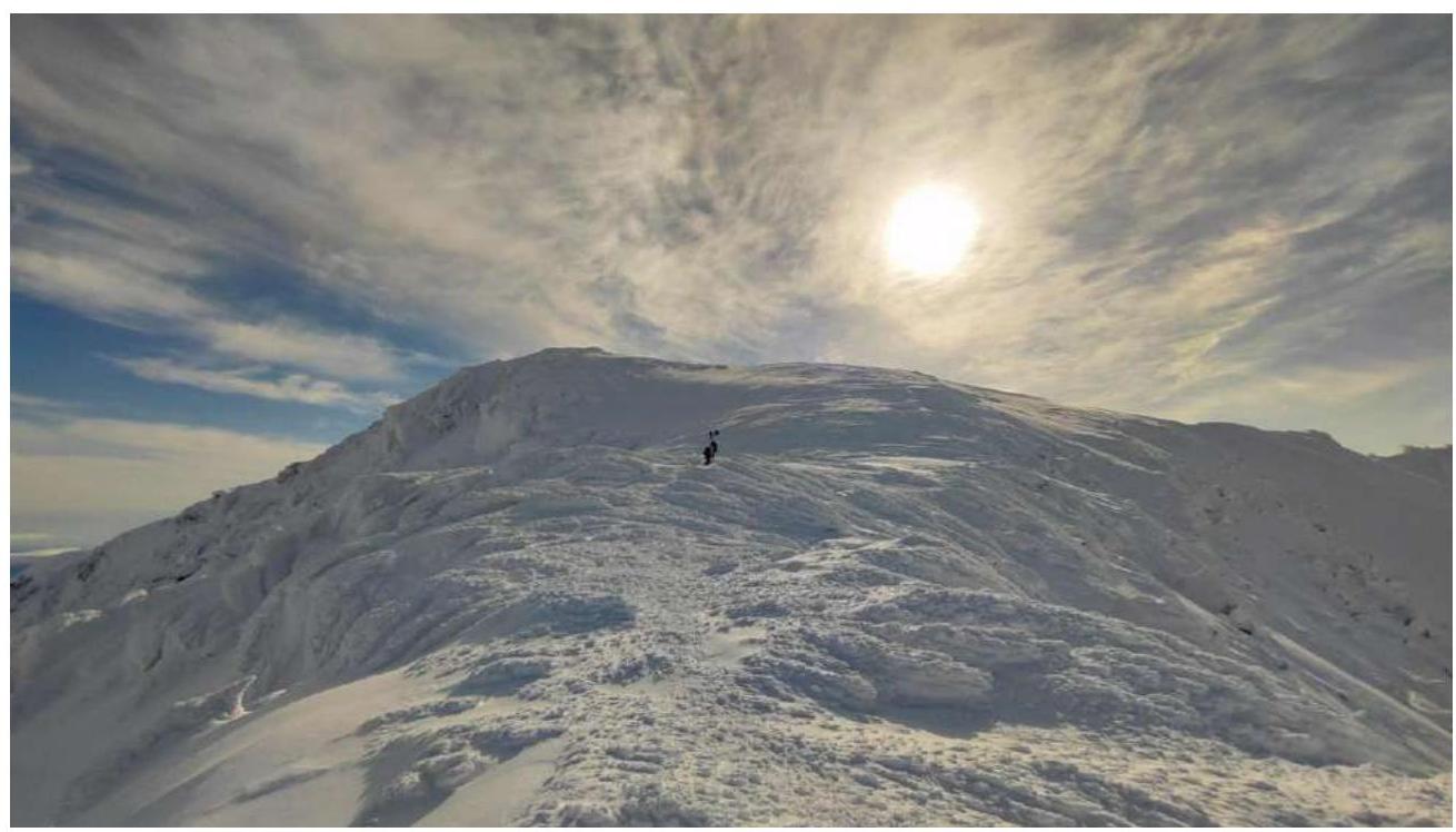
Fig. 20. Section R3–R4.
4. Photo of the Team on the Peak
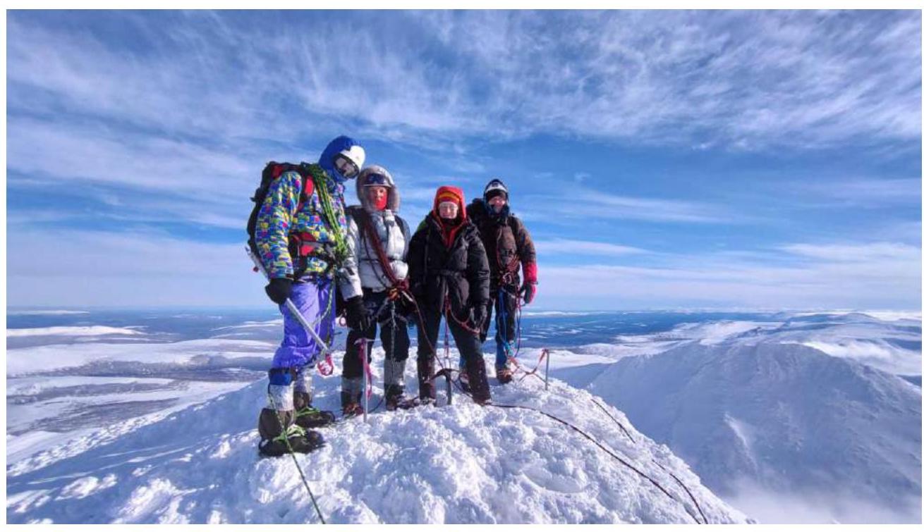
Fig. 21. In the photo from left to right:
- Manin A.
- Osetrov A.
- Yakimenko O.
- Likhomanov A.
Behind the camera — Goloviznin R. The peak is snowy, there is no control tour.
5. Evaluation of the Route.
Based on the information gathered, the main hazards in the area (in winter) are:
- strong winds and bad weather (precipitation, fogs),
- after heavy snowfalls — avalanches.
From our observations, the weather here is indeed harsh, but there are suitable windows for ascents. Regarding avalanche risk, it is minimal because the north-eastern slopes have a gentle slope and many "anchors" that hold the snow. There is no mobile connection in the area; we used a satellite phone in case of emergencies and radios for communication with the base; since the distance to the base camp is large, either the emergency officer or the radio operator needs to travel to the beginning of the gorge or to a zone with direct visibility.
For a successful passage of the route, it is recommended to plan the approach to its start (snowmobiles, skis, or overnight stay by the lake under the mountain). It is also necessary to have windproof ski goggles, crampons, ice axes, and ropes for traversing the ridge in teams, as well as a navigator.
Descent from the peak:
- via the ascent route;
- from the NE ridge into the Nyart-Syu-Yu gorge;
- from the peak to the south towards the southern pass.
The route to the peak corresponds to category 1B routes in winter conditions, similar in complexity to category 1B routes in the Khibiny. This will be the first mountaineering route in the given area, although there is information on the internet about previous passages by hiking tourists, both in winter and summer.
Comments
Sign in to leave a comment