Ascent Passport
- Region — Subpolar Urals
- Ridge — Issledovatel'skiy Kryazh
- Gorge — Balbanyu River Valley
- Section number according to KMGV-2001 — #8. "Other mountain systems, massifs"
- Summit name — Starik
- Height: 1232
- Route name — via South-West ridge
- First ascent — Proposed 1B category difficulty (rocky)
Note: The Alpinism Federation of the Komi Republic requests the Classification Commission of the FAR to certify the group's first ascent as 2A category difficulty.
Elevation gain — 591 m (according to the "General Staff" map). Route length — 2000 m. Average steepness of the main (technical part) of the route — 55–65°. Average steepness of the entire route — 61°. No pitons were left on the route. Time spent by the team on the ascent:
- Approach to the bivouac "Reindeer herders' camp by Balbanty Lake" from the geologists' base Zhelannaya — 3 hours.
- Ascent from the bivouac "Reindeer herders' camp by Balbanty Lake" — 6 hours. Team leader: S. Zhuravlev, CMS, 2nd cat. instructor. Participants:
- I. Vilekzhaninov — 3rd rank (Syktyvkar)
- D. Severinova — 3rd rank (Syktyvkar)
- P. Gayner — 3rd rank (Syktyvkar)
- A. Panyukov — 3rd rank (Syktyvkar)
- A. Shershov — 3rd rank (Yoshkar-Ola). Coach — Zhuravlev Sergey Vasilyevich, CMS, 2nd cat. instructor. Departure on the route — 9:00, July 23, 2004. Summit reached — 12:30, July 23, 2004. Return to the base camp — 15:30, July 23, 2004.
Monitoring expedition of the Alpinism Federation of the Komi Republic and the Directorate of the Yugyd Va National Park "Polar Vertical-2004".
Contact: Zhuravlev Sergey Vasilyevich, Gayner Polina Sergeevna, Syktyvkar, 167000,
Internatsionalnaya st., 97, apt. 12, phone 24-24-91, E-mail: Zhur58@rambler.ru

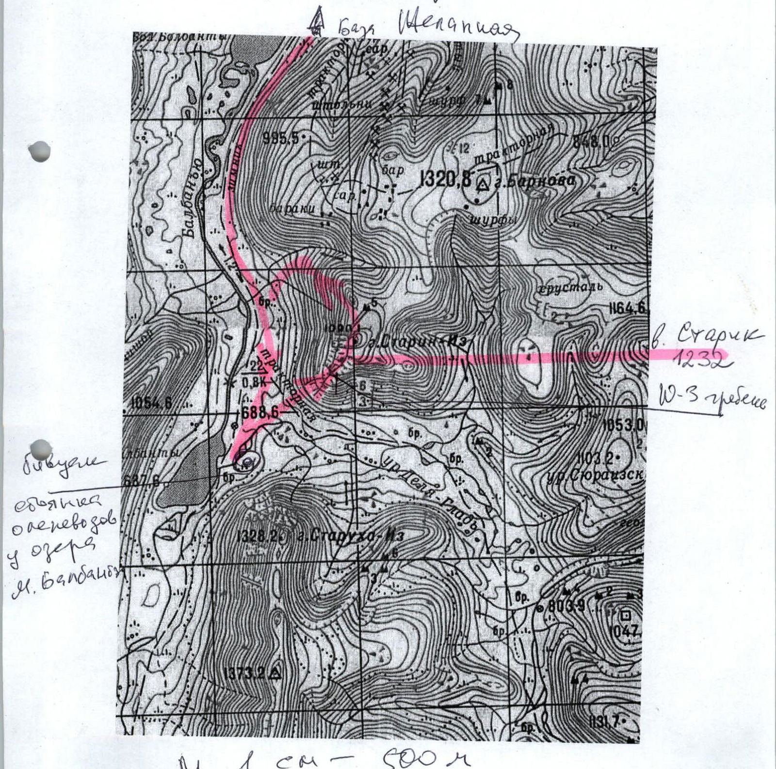
Map-scheme of the approach and ascent to Starik peak 1B category difficulty via SW ridge
 View
of Starik peak (1232) from the base camp, i.e., from the reindeer herders' camp by Maly
Balbanty Lake
View
of Starik peak (1232) from the base camp, i.e., from the reindeer herders' camp by Maly
Balbanty Lake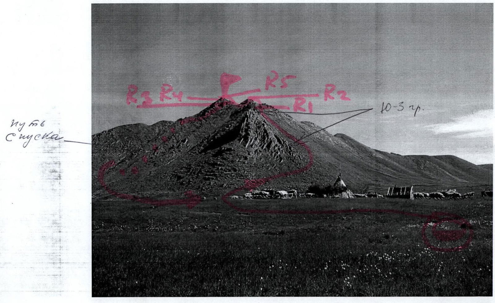
Overview photo from the summit of Barkova peak (from the north) of the peaks in the upper reaches of the Balbanyu River valley:
1 — Starik (1232), 2 — Starukha (1328), 3 — Karpinsky peak
(1803)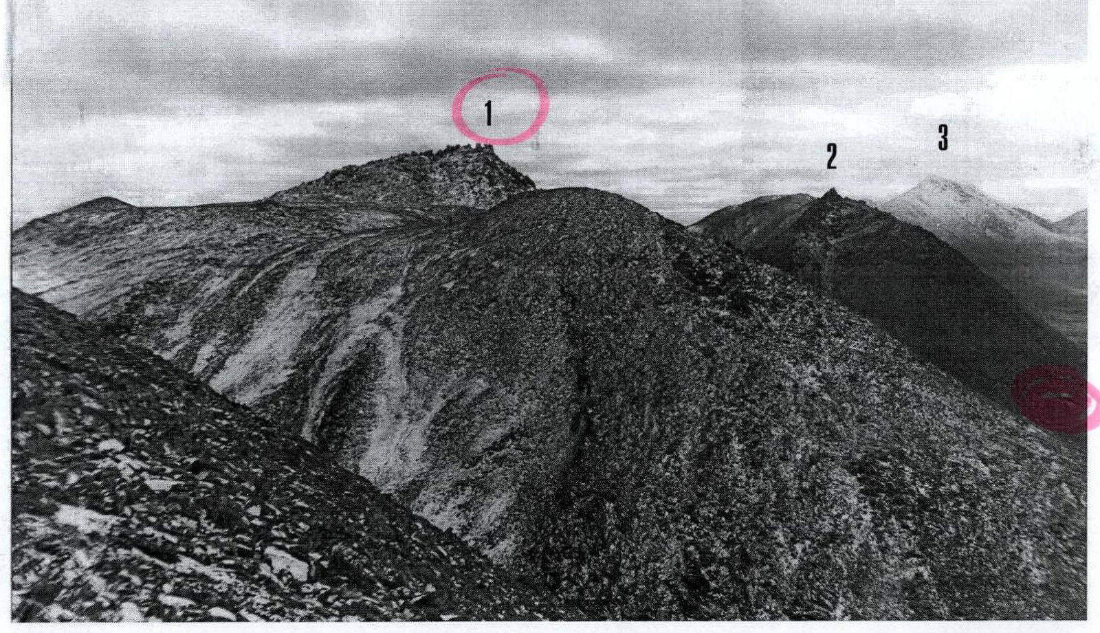
Route description (OSP)
Approach: From the base camp near the reindeer herders' cabin on the right bank of Maly Balbanty Lake, the approach to the foot of the ridge is about two kilometers, 1.5 hours of walking on talus slopes, mountain tundra, and kurumniks. It is also necessary to navigate through marshy areas.
The beginning of the ridge is marked by:
- talus slopes,
- transitioning into large-block talus,
- then into a rocky ridge.
The beginning of the traverse should be considered the start of the ascent on talus slopes from the all-terrain vehicle road leading to the Syuresh gorge.
Technical part of the route: The ascent begins with crossing the geologists' all-terrain vehicle road leading to the Syuresh gorge. The start of the route is the ascent on talus slopes to the large-block talus to the right of the rocky ridge. Upon reaching the large-block talus, organize rope teams.
Further movement in rope teams:
- on large-block talus,
- on the rocky, heavily destroyed ridge.
Simultaneous movement. Then — approach to the key section.
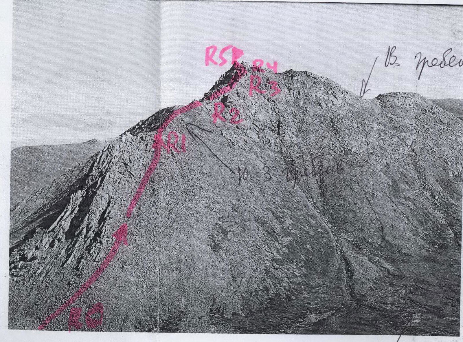
The crux of the route — three rope lengths on the rocky ridge, passed with alternating belay. The difficulty level of this section is 2–2+. In winter, movement is complicated by ice formation.
After passing the key section, movement to the summit is again simultaneous on the rocky ridge of 1st category difficulty.
The summit is plateau-like, with a jumble of large останцев. Continuation of the traverse — movement from the summit to the north: a well-defined rocky ridge, gradually losing height.
Descent along the ridge to the saddle, separating Starik peak from Barkova peak, then:
- down the talus couloir;
- further along the Balbanyu River — return to the base camp near the reindeer herders' camp.
Required special mountaineering equipment for a training group NP-1 of 10 people:
- Main rope — 4 pcs. x 40 m
- Rock pitons — 3 pcs.
- Expendable slings — 4 pcs.
- Carabiners — 5 pcs.
Profile of the southwestern ridge of Starik peak (1232) (Photo taken from the north, from the summit of Starukha
(1328))
Elevation gain: 591 m. Initial mark: R0 — 689 m above sea level. Summit height: R5 — 1232 m above sea level. Average steepness of the route — 61°. Average steepness of technical sections — 55–65°. Route length — 2000 m.