Report on the First Ascent to the Summit 1154.0 (Skalny) via the Route: "Through the Inner Corner of the Western Rocky Massif (Vorkutinsky Ugolok Route)" 2A Category of Complexity (Skalny) by the Team of the Sauk-Pai Club (Vorkuta) in September 2017
Report compiled in 2018
I. Ascent Passport
| № | 1. General Information | |
|---|---|---|
| 1.1 | Full Name, Sports Rank of the Leader | Seriakov Sergei Valentinovich (2nd sports rank, Vorkuta) |
| 1.2 | Full Name, Sports Rank of the Participants | 1. Salnikov Sergei Sergeevich (3rd sports rank, Vorkuta); 2. Nifontov Sergei Vasilievich (3rd sports rank, Vorkuta); 3. Matyukha Pavel Viktorovich (3rd sports rank, Vorkuta) |
| 1.3 | Full Name of the Coach | Zhuravlev Sergei Vasilievich: Candidate Master of Sports, 1st category instructor-methodologist, Syktyvkar |
| 1.4 | Organization | NP "Club of Northern Travels 'Sauk-Pai'" (Syktyvkar) |
| 2. Characteristics of the Ascent Object | ||
| 2.1 | Region | Polar Urals, Raiiz mountain massif |
| 2.2 | Valley | Nyrdvomenshor River valley |
| 2.3 | Number according to the 2013 Classification Table | 8.3 |
| 2.4 | Name and Height of the Summit | Skalny 1154.0 m |
| 2.5 | Geographical Coordinates of the Summit (latitude/longitude), GPS Coordinates | Geographical coordinates: 66°05′5″ — 65°03′0″ |
| 3. Characteristics of the Route | ||
| 3.1 | Name of the Route | Through the Inner Corner |
| 3.2 | Proposed Category of Complexity | 2A (rocky) |
| 3.3 | Degree of Route Exploration | First ascent |
| 3.4 | Relief Characteristics of the Route | Rocky |
| 3.5 | Height Difference of the Route (altimeter or GPS data) | From the base camp — "Priyut" stand (height — 500.0 m) to the summit (1154.0 m) — 654 m. Height difference of the technical part (R0–R7, 600 m) to the summit (1154.0 m) — 554 m. |
| 3.6 | Length of the Route (in meters) | 2120 m |
| 3.7 | Technical Elements of the Route | I category combination — 900 m. II category rocks — 220 m. III category combination — 0 m. IV category rocks — 0 m. Movement on a closed glacier — none. Rappelling — none. |
| 3.8 | Descent from the Summit | To the west, via the 1B category route |
| 3.9 | Additional Characteristics of the Route | 1. Convenient stand with running water, abandoned geophysicists' stand "Priyut". 2. In summer, due to the polar night, there is a significant amount of daylight for the route passage. |
| 4. Characteristics of the Team's Actions | ||
| 4.1 | Time of Movement | 8 hours |
| 4.2 | Overnight Stays | None |
| 4.3 | Start of the Route | 8:00, September 12, 2017 |
| 4.4 | Reaching the Summit | 11:30, September 12, 2017 |
| 4.5 | Return to the Base Camp | 16:00, September 12, 2017 |
| 5. Responsible for the Report | ||
| 5.1 | Full Name, e-mail | Zhuravlev Sergei Vasilievich, mr.Zhur1958@mail.ru |
II. Description of the Ascent
1. Characteristics of the Ascent Object
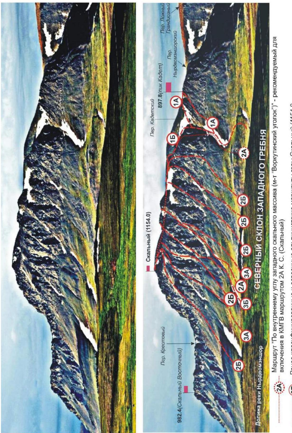
1.1. General Photo of the Summit
1.2. Photo of the Route Profile
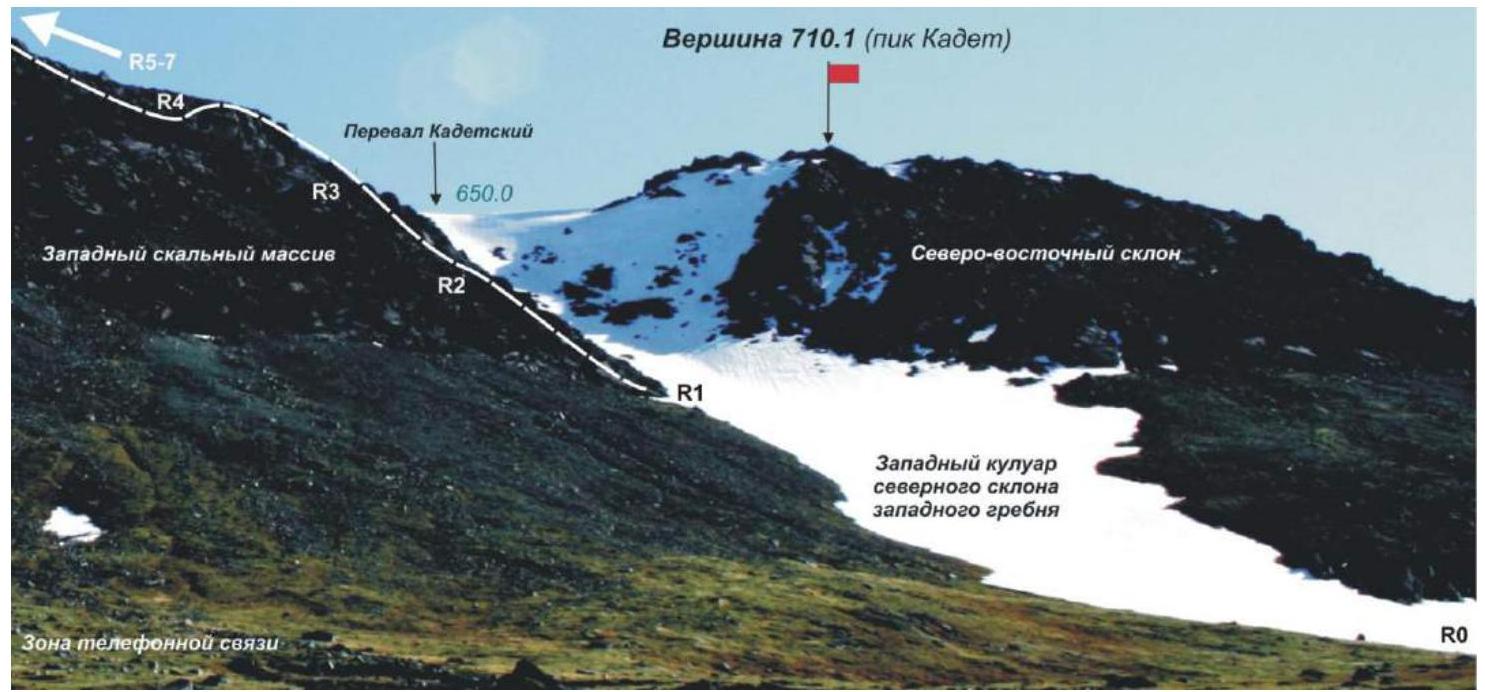
Photo of the western slope profile of the western rocky massif — the technical part of the route. Reference points of the technical sections of the route are marked.
1.3. Panoramic Photo of the Region
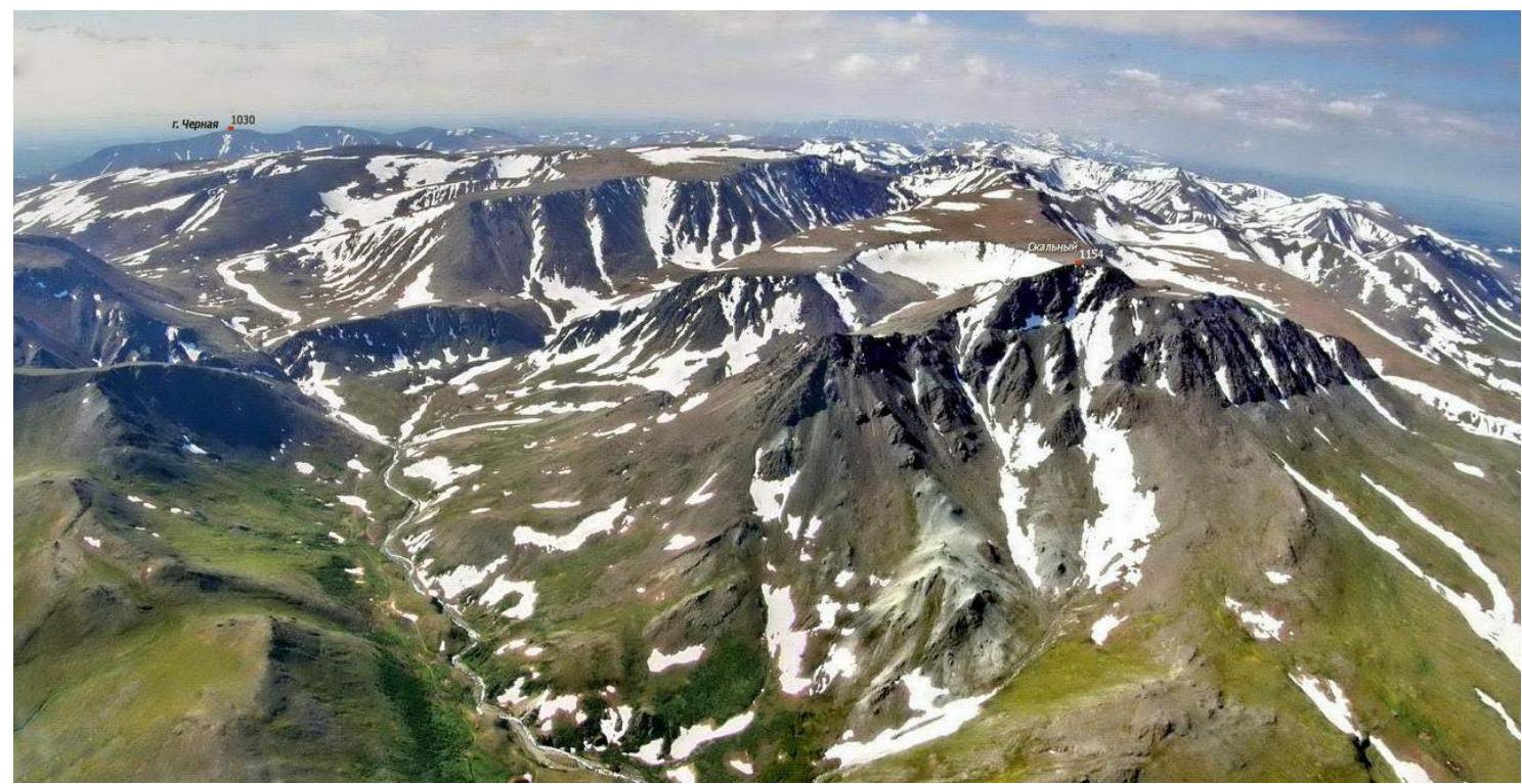
Aerial photo from the northeast, from a helicopter. The northwest part of the Raiiz massif is shown. On the right is the Skalny mountain massif (1154.0 m).
Note: In the KMGV, the mountain is listed under the unofficial name Dinosaur Main with a height of 1159.0 m.
1.4. Map of the Region
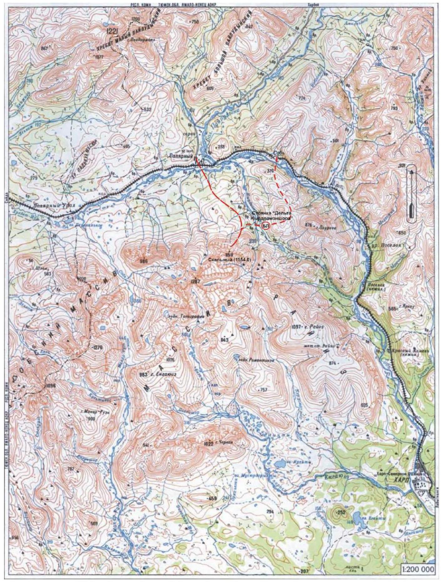
Skalny (1154.0 m)
Paths to the route from:
- Sob railway station
- 110 km halt
- abandoned settlement Polyarný
Brief geographical overview of the ascent region.
The Skalny summit (1154.0 m) is located in the Yamalo-Nenets Autonomous Okrug, Ural Federal District of the Russian Federation, 25 km southeast of the 110 km halt (formerly Polyarný settlement), in the Nyrdvomenshor River valley (right-bank tributary of the Sob River), on the eastern slopes of the Polar Urals. It is the most explored mountain peak by mountaineers in the Raiiz mountain massif. The summit is a dome-shaped rise in the rocky ridge, on the west of the central part of the mountain, with a height of 1154 m (on old maps, the height mark of the northern summit of the mountain is 1159.0 m). The name of the mountain is official and appears on maps of the Polar Urals with a scale of 1 cm — 500 m. The lack of an official name on kilometer maps led to the emergence of unofficial names, including in the KMGV (in the KMGV, the mountain is listed under the name Dinosaur Main). The mountain has three distinct peaks: Skalny Eastern (in KMGV — Dinosaur Eastern) with a height of 9825.0 m (on old maps — 1010 m above sea level), Skalny (in KMGV — Dinosaur Main) with a height of 1154.0 m (on old maps — 1159 m above sea level), and Skalny Western (710 m) — a peak with non-category routes. Currently, routes of category 1B to 4A complexity have been developed to the Skalny summit (1154.0 m), mostly rocky but also some combined routes.
Description of the western ridge and the second counterfort of the northern slope of the western ridge.
The western ridge is a pronounced ridge leading from the summit to the west. To the north and northeast, towards the Sob River valley and the Nyrdvomenshor River valley (a tributary of the Sob River), the slope features rocky outcrops divided by couloirs into rocky massifs and counterforts. Due to geological features, each counterfort or rocky massif on the northern slope of the western ridge is of interest for mountaineering ascents.
Description of the route: "Through the inner corner of the western rocky massif (Vorkutinsky Ugolok route)" approximately 2A category of complexity (rocky).
The route "Through the inner corner of the western rocky massif (Vorkutinsky Ugolok route)" is a rocky training route of 2A category complexity, having the necessary set of natural obstacles for routes of this level of complexity. The passage of this route has not only aesthetic but also significant sports-practical value, as it allows, within the framework of the ascent, to practice techniques of belaying and self-belaying on rocky terrain. The route is logical in orientation, laid through a pronounced inner corner of the massif. The objective safety of the route allows for training and competitive ascents in the summer. In winter, the inner corner is avalanche-prone due to snow accumulation. The name "Vorkutinsky Ugolok" was given by the first ascent group for easier identification and memorization of the route.
2. Characteristics of the Route
2.1. Technical Photograph
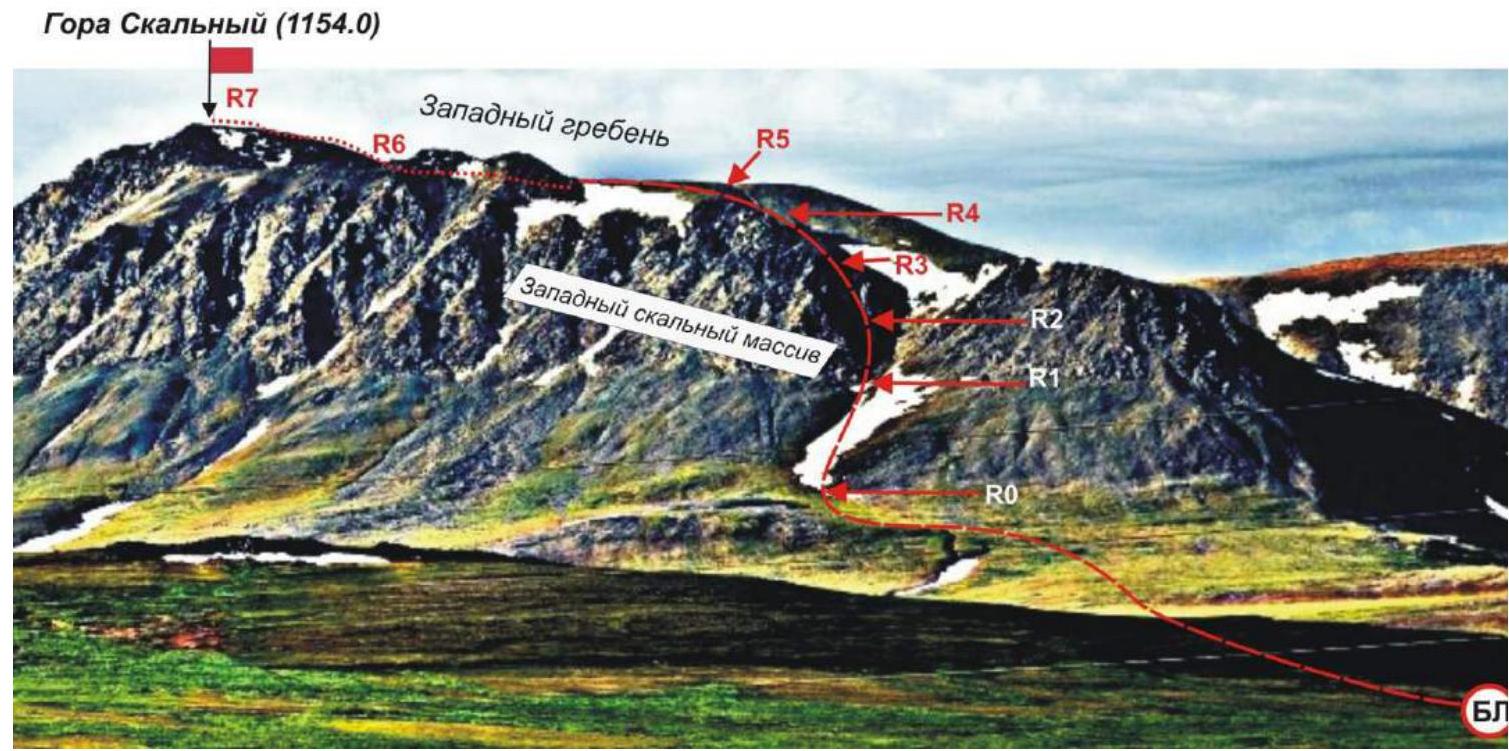
Photo from the northwest, from the Sob River valley. Reference points of the technical sections of the route are marked.
Profile photo of the route from the northwest. Reference points of the technical sections of the route are marked.
2.2. Technical Characteristics of the Route Sections
Scheme in UIAA symbols. Table of technical sections.
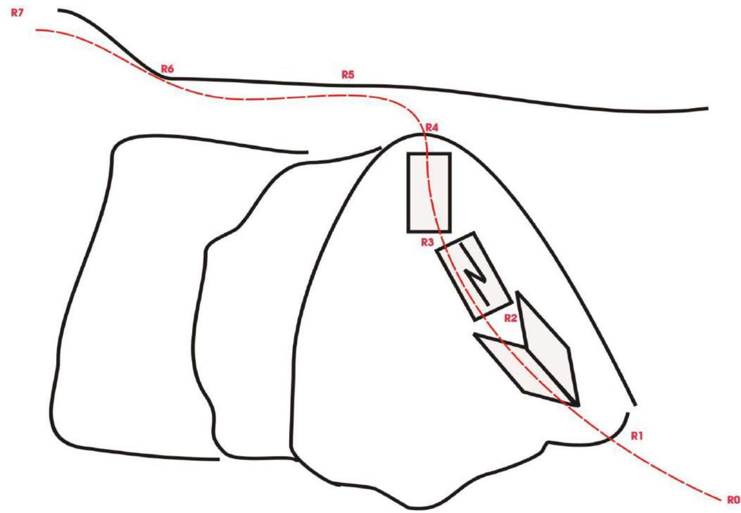
| Section № | Relief Characteristics | Category of Complexity | Length, m | Type and Number of Hooks |
|---|---|---|---|---|
| APPROACH | From "Deltа Nyrdvomenshora" stand — 1–1.5 hours through mountain tundra. From "Priyut" stand — 30 minutes. | |||
| R0 | Place of organizing rope teams — a hollow in the western couloir of the northern slope, the beginning of the technical part of the route. Height mark — 500 m above sea level. | |||
| R0–R1 | Scree, snow, firn | n/c, 1 | 500 m | 0 |
| R1–R2 | Inner corner | 2 | 100 m | 10 hooks (4 channel, 6 horizontal) |
| R2–R3 | Wall with a crack | 3 | 60 m | 0 |
| R3–R4 KEY! | Inclined wall | 3 | 60 m | 6 hooks (horizontal) |
| R4–R5 | Plateau of the western ridge, kurumnik | Non-category | 500 m | 0 |
| R5–R6 | Plateau of the western slope, kurumnik | Non-category | 500 m | 0 |
| R6–R7 | Coarse-blocky slope | 1 | 400 m | 0 |
| R7 | Skalny summit (1154.0 m). Scree dome of coarse-blocky material. | |||
| DESCENT | Down the scree slopes to the northwest, to the "Kadetsky" pass. Then down the western couloir to the north, into the Nyrdvomenshor River valley. |
3. Characteristics of the Team's Actions
3.1. Brief Description of the Route Passage.
| Section № | Description | Photo Number |
|---|---|---|
| APPROACH | From the base camp — "Delta Nyrdvomenshora" stand. Cross the Nyrdvomenshor River by wading. Then, through scree ridges and kurumniks, ascend to the foot of the mountain to the hollow of the western couloir of the northern ridge. (1.5–2 hours from the stand). From the "Priyut" base camp — move along the foot of the mountain through mountain tundra to the hollow of the western couloir of the northern slope. (From the stand — 30–40 minutes). | |
| R0 | Hollow of the western couloir of the northern slope. Place of organizing rope teams. | |
| R0–R1 | Approach through a snowy slope to the base of the inner corner of the western rocky massif of the western ridge — the beginning of the technical part of the route. Slope steepness — 15–25°. Simultaneous movement with a shortened rope. Length — 500 m. Complexity level — non-category. | |
| R1–R2 | Ascend through the left (by direction) side of the inner corner of the western rocky massif. Dense rocks, oblique shelves covered with stone crumbs. Many cracks of various sizes for intermediate belay points, making it easy to find a place for a protection element. Ridge steepness — up to 45°. Length — 100 m. Complexity level — 1 category. Many large holds and footholds. | Photo №1 |
| R2–R3 KEY! | Passage of an inclined wall with a chimney and a crack. Dense monolithic rocks. Chimney at the beginning — 6 m. Movement with alternating belay using ledges, loops thrown over ledges, and hooks for intermediate support points. Section steepness — 50°. Section length — 60 m. Complexity level — 2+ category. Lower, upper, and intermediate stations — convenient, on wide rocky shelves. Blocked from 3 rock hooks. | Photo №2, Photo №3, Photo №4, Photo №5 |
| R3–R4 KEY! | Passage of a wall and exit to the top of the western rocky massif. Movement with alternating belay. Steepness — 60°. Total section length — 65 m. Complexity level — 2+ category. Lower and upper stations — convenient, on wide rocky shelves. Blocked from 3 rock hooks. | Photo №6 |
| R4–R5 | Ascend to the plateau of the western ridge. Medium-blocky scree. Simultaneous movement with mutual belay. Section steepness — 20°. Length — 500 m. Complexity level — non-category. | |
| R5–R6 | Movement under the summit dome along the plateau of the western ridge. Simultaneous movement. Medium-blocky scree. 800 m, non-category. | |
| R6–R7 | Ascend to the summit dome through destroyed coarse-blocky rocks. Simultaneous movement with mutual belay. Steepness — 30–45°. Section length — 400 m. Complexity level — 1 category. | |
| R7 | Skalny summit (1154.0 m). Dome of coarse-blocky material. A geodetic network sign of the Russian Federation is installed on the site. | |
| DESCENT | Descent from the summit is technically not complicated. Down scree and snowy fields first to the northwest towards the Sob River valley to the "Kadetsky" pass, then down the western couloir. |
3.2. Photo of the Team on the Summit with a Control Tour.
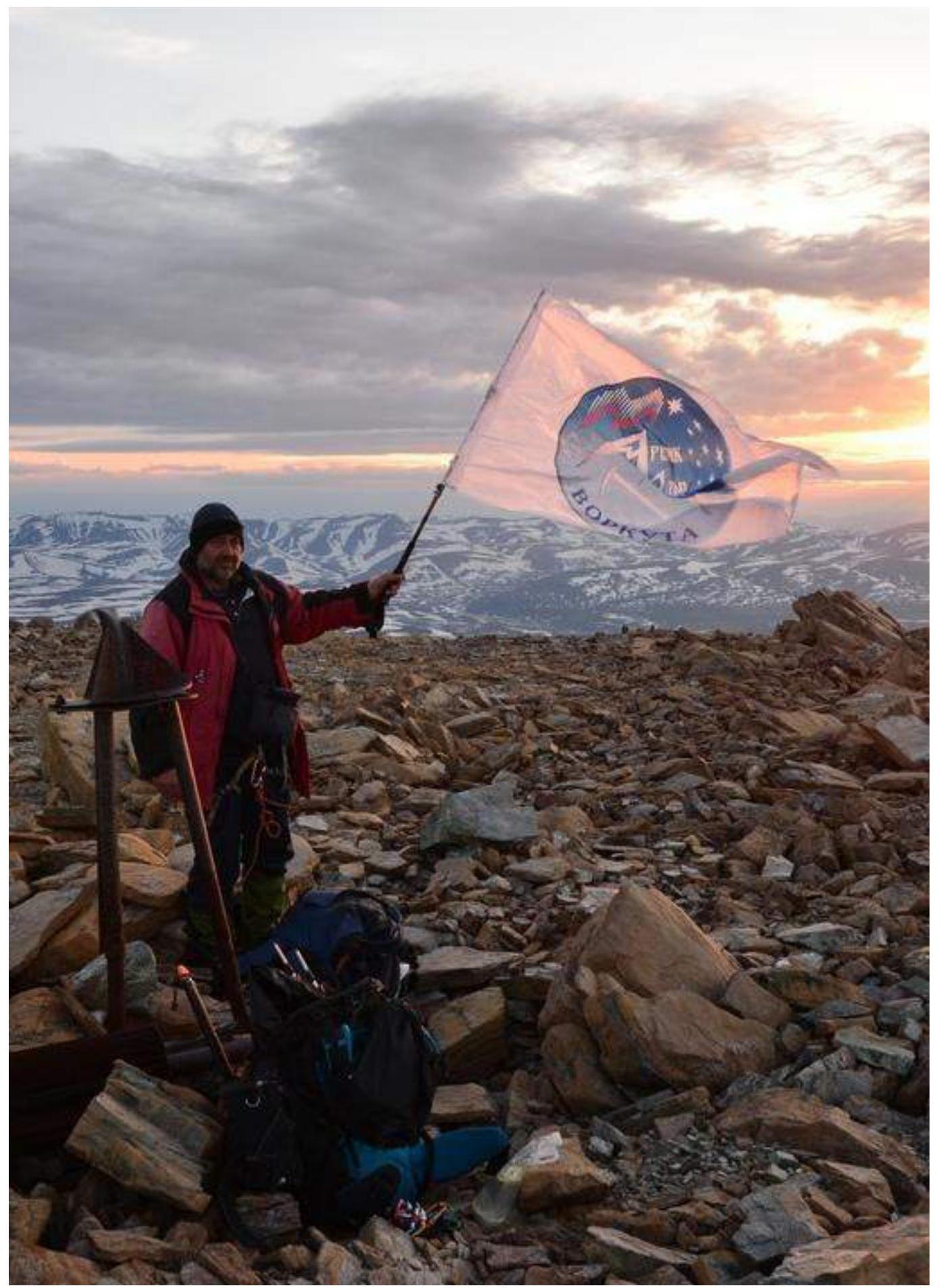
Team leader from Vorkuta — S. V. Seriakov on the summit. (In the background — the Maly Paipudinsky ridge.)
3.3. Safety Assessment of the Route.
The route to the Skalny summit (1154.0 m) is a characteristic rocky training route of 2A category complexity, allowing the training of beginner mountaineers of the second year of training, as well as testing the skills of mountaineers of the 3rd sports rank.
Accessible approaches and ease of orientation when searching for the route are among the safety qualities.
Communication on the route was carried out using VHF radios, in direct visibility from the Nyrdvomenshor valley, from the base camp. Telephone connection is available only in one place — under the western rocky massif, to the left (upwards) of the snowy hollow of the western couloir.
The route is rocky. Throughout the route, there are convenient shelves and platforms for organizing stations. The relief allows the use of loops, and on the key section — rock hooks. Channel rock hooks of medium size are most applicable, and long horizontal hooks were actively used for intermediate points. The key section of the route is at the beginning. In case of unfavorable weather or force majeure circumstances, there is a safe descent from the key section of the route. The route meets the safety requirements of mountaineering training routes.
Analogues of the route: Chet-Chat — 2A category (Caucasus, Adyrsu valley), VIA-Tau — 2A category (Caucasus, Adyrsu valley).
Photo Illustrations
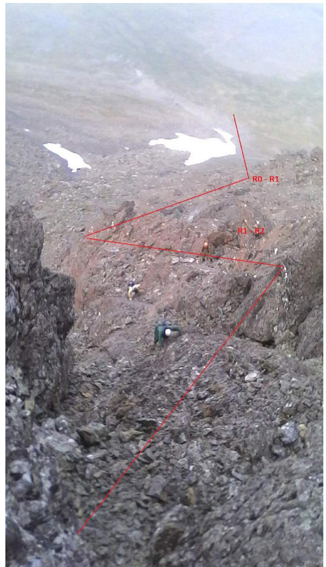
PHOTO №1. Sections: R0–R1, R1–R2. Ascent from the western couloir through the inner corner to the key section of the route. The recommended path is indicated by vectors.
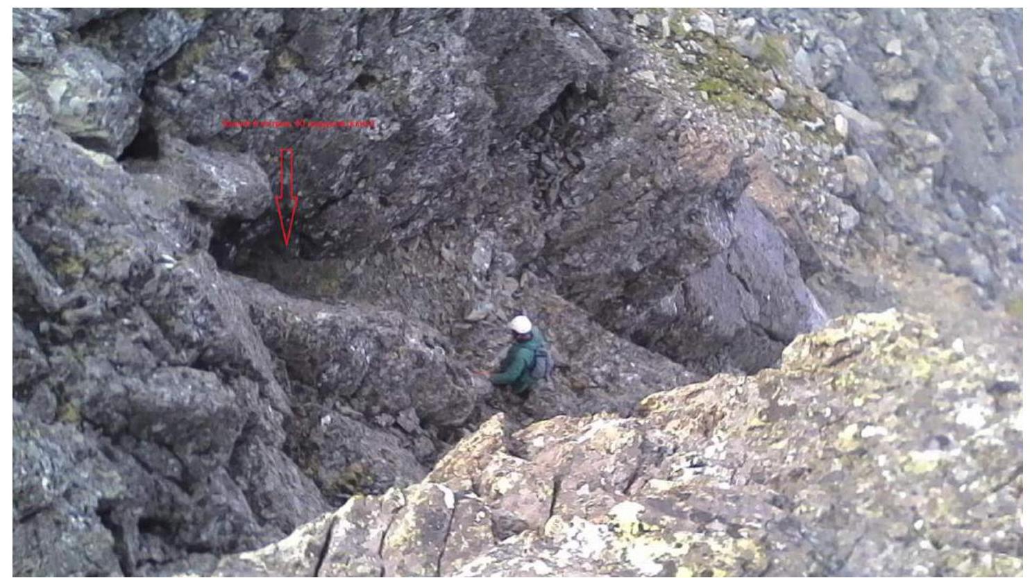
PHOTO №2. Photo of section R2–R3 — passage of the lower part of the key section of the route. At the beginning of the wall with a crack, there is a chimney (6 m, 60°).
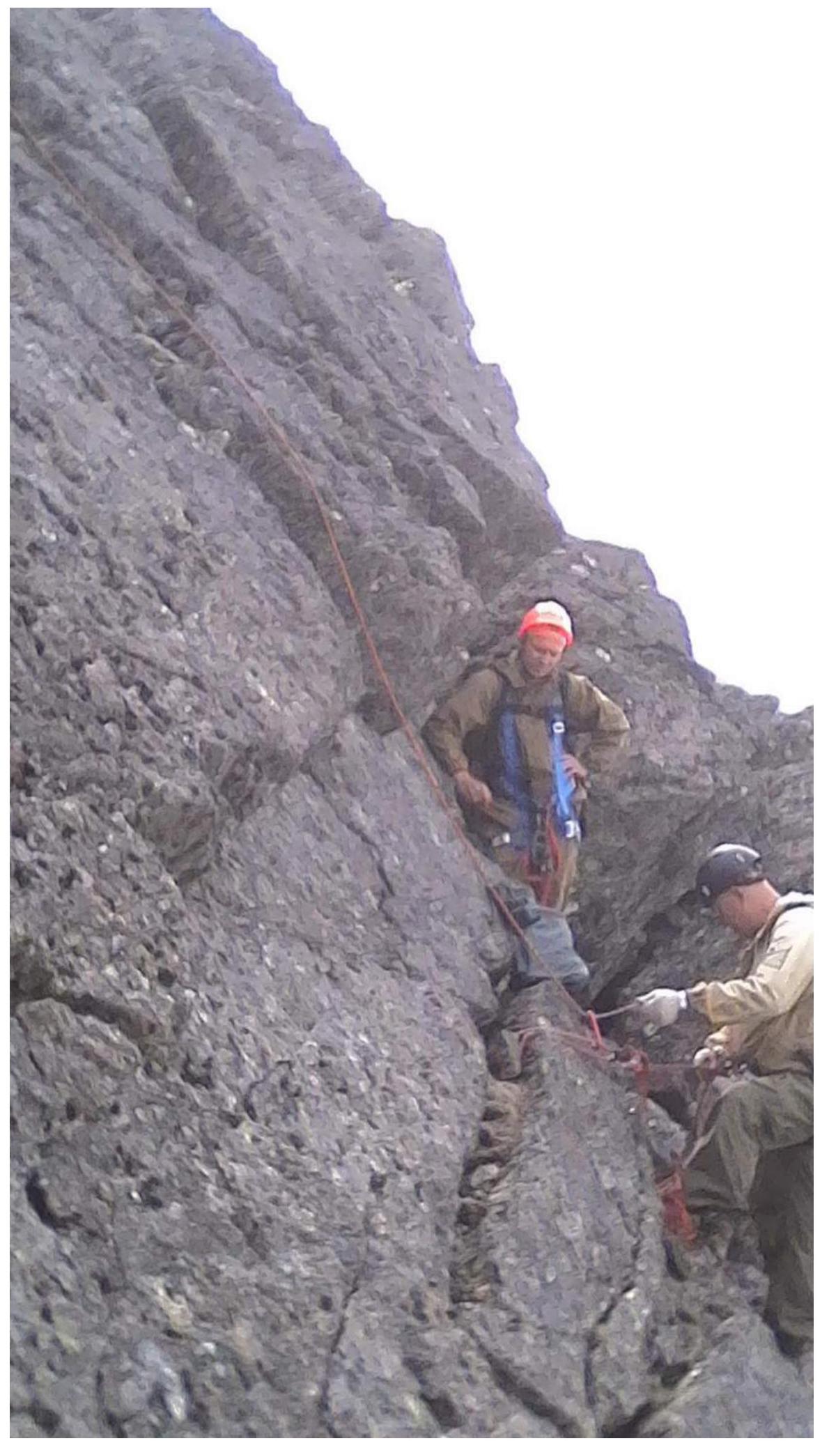
PHOTO №3. Photo of section R2–R3 — passage of the wall with a crack. Station above the chimney.
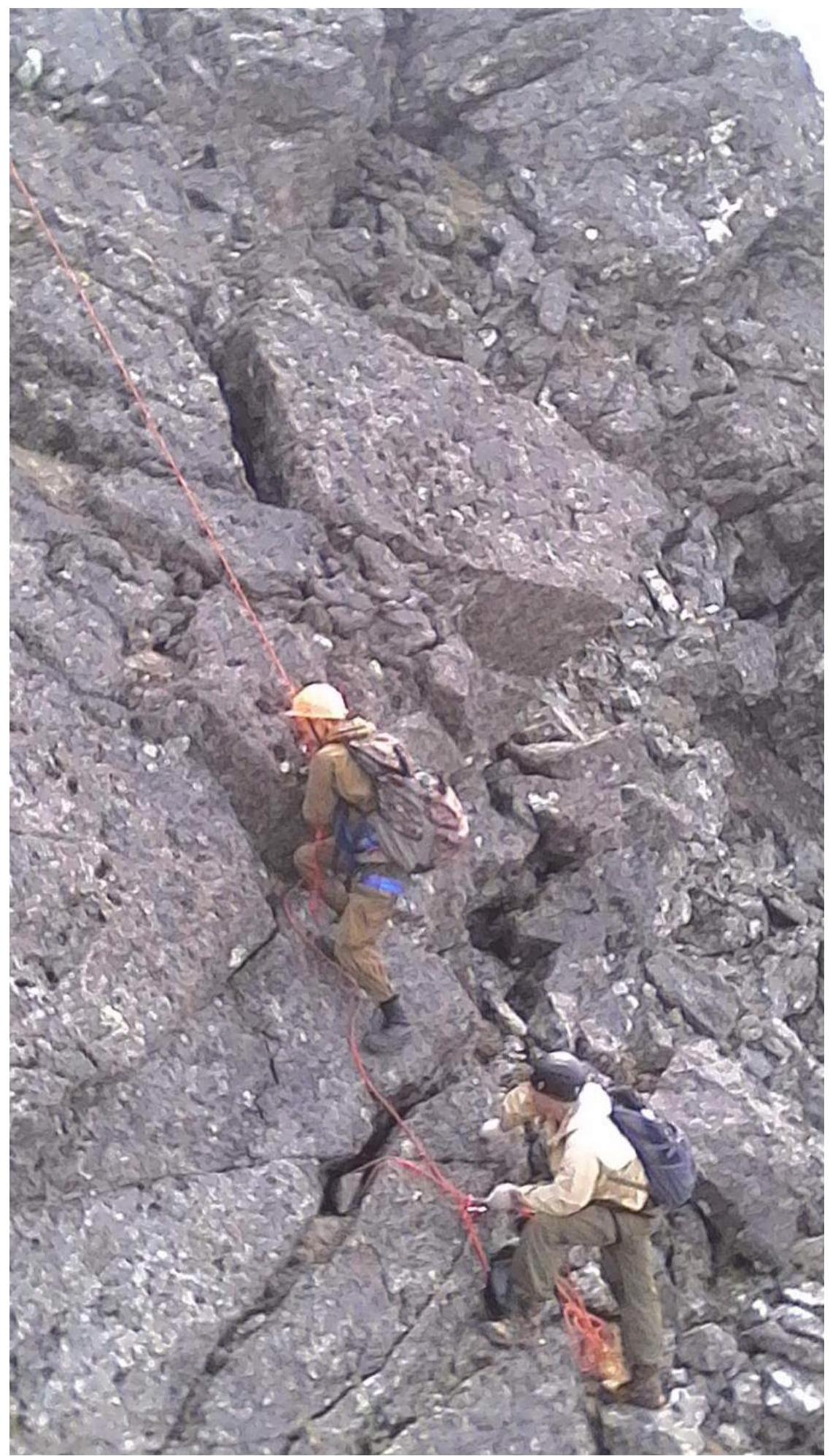
PHOTO №4. Photo of section R2–R3 — passage of the wall with a crack. Lower part of the wall.
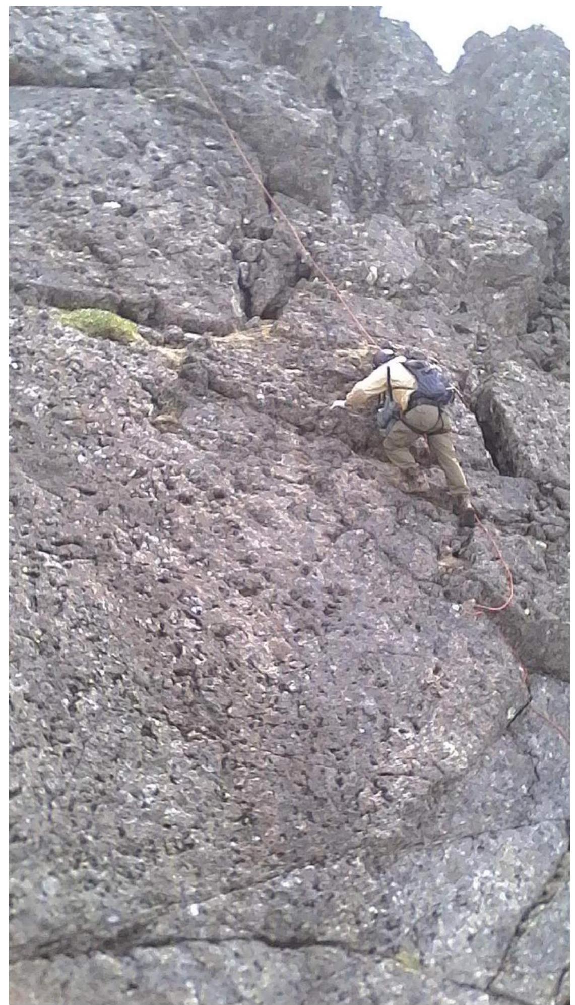
PHOTO №5: Photo of section R3–R4 — key section of the route. Upper part of the wall with a crack.
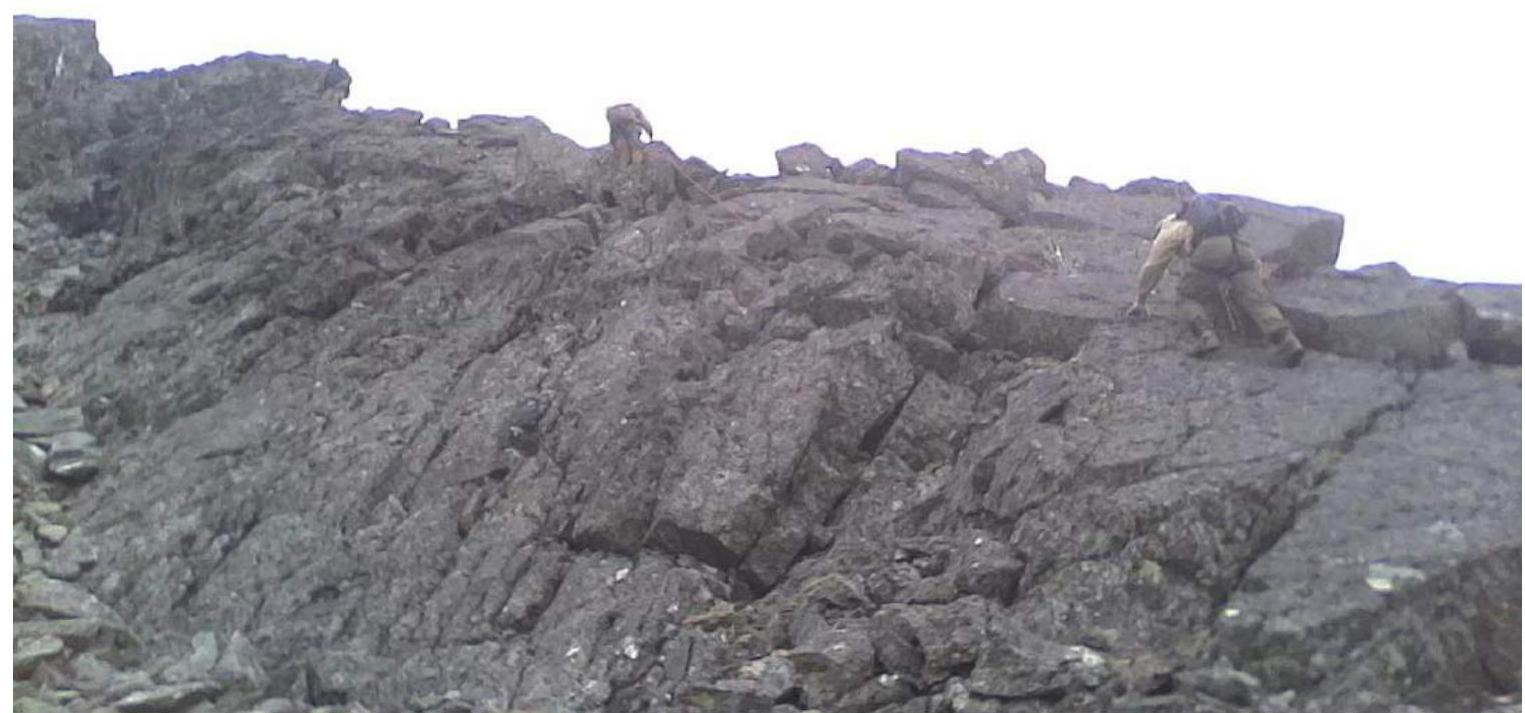
PHOTO №6: Photo of section R3–R4 — exit to the top of the western rocky massif.
Conclusion
Excerpt from the decision of the coaching council dated November 25, 2017.
on the results of the analysis of the first ascent of the mountaineering route to the Skalny summit (1154.0 m). Route: "Through the inner corner of the western rocky massif (Vorkutinsky Ugolok route)" made within the framework of the competition for mountaineering: "Fourth stage of the cup of NP 'Club of Northern Travels 'Sauk-Pai' — 'Mountains of the World'" (class "First Ascents")
An analysis was conducted of the first ascent of the mountaineering route to the Skalny summit (1154.0 m) (Polar Urals, Raiiz mountain massif). Route: "Through the inner corner of the western rocky massif (Vorkutinsky Ugolok route)" 2A category of complexity (rocky).
The analysis and subsequent coaching council were attended by:
- Zhuravlev S. V. (Syktyvkar, Candidate Master of Sports, 1st category instructor-methodologist) — senior coach-releaser, chief judge of the competition cup of NP "Club of Northern Travels 'Sauk-Pai'";
- Maltsev S. L. (Ukhta, 1st sports rank, instructor-methodologist of the 2nd category in mountaineering) of NP "Sauk-Pai", deputy chief judge of the competition for safety;
- Surovtsov V. A. (Syktyvkar, 2nd sports rank, instructor-methodologist in mountaineering of the 3rd category), senior expert judge for the sports discipline of the competition "Class of First Ascents";
- Ascent leader S. V. Seriakov (Vorkuta, 2nd sports rank).
The route sheet stated an ascent to the Skalny summit (1154.0 m) (Polar Urals, Raiiz mountain massif). Route: "Through the inner corner of the western rocky massif (Vorkutinsky Ugolok route)" 2A category of complexity (rocky).
The route was completed within the stated timeframe, without TB violations. All participants of the ascent reached the summit. A note was retrieved from the training department under the guidance of V. Toropov (2017).
As a result of the analysis of the ascent — the first ascent of the mountaineering route, it was determined that:
- The decision of the group leader to choose the inner corner of the western rocky massif for the first ascent does not contradict safety requirements; the route has a logical passage.
- According to the photographs of the technical sections provided, the scheme compiled by the participants in UIAA symbols with a table of obstacles on the route, the route corresponds to the technical level of 2A category of complexity (rocky).
Decisions made by the coaching council:
- To credit the leadership to the ascent leader of 2A category of complexity, and to the participants — participation in the ascent of 2A category of complexity;
- For the sports group to prepare and submit a report on the first ascent of the mountaineering route to the classification commission of the FAR;
- To recommend the route to the Skalny summit "Through the inner corner of the western rocky massif (Vorkutinsky Ugolok route)" for inclusion in the KMGV as a rocky route — 2A category of complexity.
The decision was signed by members of the coaching council.
The presence of signatures of S. V. Zhuravlev, S. L. Maltsev, V. V. Toropov is confirmed by the acting director of NP "Club of Northern Travels 'Sauk-Pai'" — S. V. Zhuravlev.