Ascent Passport
- Region: Subpolar Urals, Sablinsky Ridge.
- Summit: Sablya (1497 m)
Route "LADOGA" via the left part of the NNE wall from Gofman's Glacier.
- Assumed 6B category of difficulty, first ascent.
- Route character: rock.
- Height difference of the route: 820 m, including the wall part: 570 m.
Route length: 915 m, including wall part — 602 m. Length of sections: 5th category of difficulty – 165 m, 6th category of difficulty – 217 m. Average steepness: wall part of the route — 81° entire route — 67°
- Pitons left on the route:
total: 30, including bolted — 1
Pitons used on the route (including placements): 385
bolted stationary: 0
removable bolted — 15, including artificial aid — 14.
Total artificial points of support (AID) used: 247.
- Team's travel hours: 120, travel days — 10 (total 12).
- Team: Federation of Alpinism, Rock Climbing, and Ice Climbing of St. Petersburg.
Leader: Kirill Vladimirovich Korabelnikov, Candidate Master of Sports (St. Petersburg). Members:
- Gennadiy Vladimirovich Blinov, Master of Sports (Yekaterinburg)
- Sergey Anatolyevich Kofanov, Master of Sports (Yekaterinburg)
- Vladimir Yuryevich Baranov, Candidate Master of Sports (St. Petersburg)
- Alexey Vladimirovich Gorbatenkov (St. Petersburg) (1st sports category)
- Coach: Sergey Sergeyevich Tyulpanov, Master of Sports (St. Petersburg)
- Departure to the route: 11:00, April 8, 2002.
Reached the summit: 13:00, April 19, 2002. Returned to Base Camp: 17:00, April 20, 2002.
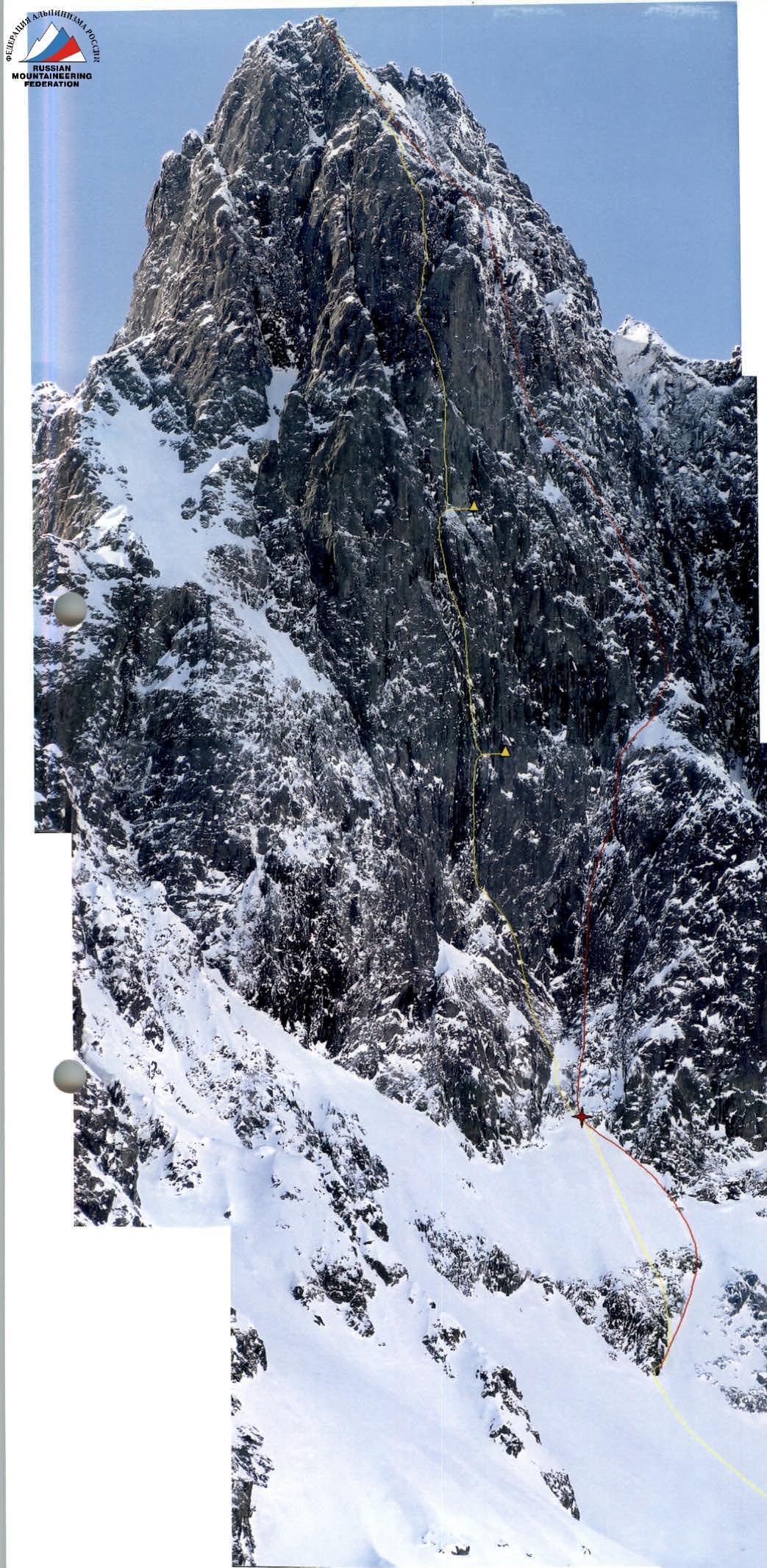
Photo 1. Yellow thread — "LADOGA" route by the team from FACL St. Petersburg. Yellow triangles — locations of platforms. Red thread — route by the team from Perm OSC. Red dotted line shows the approximate route, including its invisible part.
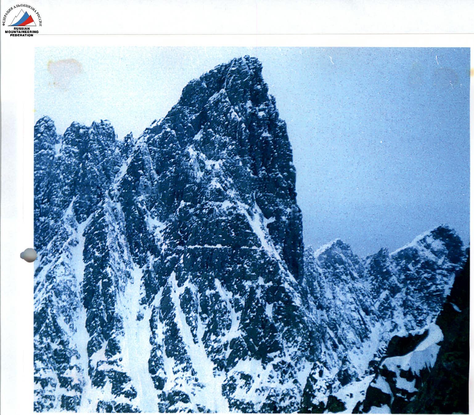
Photo 2. Profile of the wall.

Route profile
summit, 1495 m end of wall part location of the second platform start of wall part, 860 m location of the first platform start of the route, 675 m. 81° 67°
Brief Overview of the Region
The Subpolar Urals is the most elevated and wide part of the Urals. Some peaks rise above 1800 m above sea level, and the width of the mountain belt reaches 150 km (at 65° N). Here, the meridional direction of the Ural ridges changes to northeast, and the Subpolar Urals form a wide arc descending in several tiers to the Lyapinskaya depression (lowland) of the West Siberian Plain. Along the inner side of the arc are the highlands of the mid-mountain zone (500–1000 m) and the eastern undulating strip (150–350 m), cut by deep river valleys flowing into the Lyapin.
Along the outer side of the arc stretch heavily dissected ridges of the high-mountain zone (over 1000 m) — Sablinsky, Western and Eastern Saledy, Maldynyrd, Research, and Narod-Ityinsky, between which flow rivers of the Pechora basin. The watershed of the Subpolar Urals, separating Europe from Asia, is the Narod-Ityinsky and Research ridges.
The Sablinsky Ridge is the westernmost in the Subpolar Urals. Its western slopes, more gentle, descend to the Pechora Plain. The eastern slopes are steep and cliffy, with cirque glaciers in deep cirques, including Gofman's Glacier. The summit of Sablya is composed of fine- and microcrystalline effusive rocks, particularly the NNE wall is entirely made of leucite phonolite.
The beginning of comprehensive scientific geographical research in the Subpolar Urals was laid by the North Ural Expedition of the Russian Geographical Society, led by E. Gofman, in 1847 and 1850. A first large-scale map of the territory was compiled (at a scale of 3 versts per inch), geological, astronomical, zoological, botanical, and hydrological studies were conducted (the latter on the rivers of the Pechora- Shchugor, Bolshoy Patok, Manaraga, Vangyr, Balbanyu basins, and some rivers of the Ob basin).
In the second half of the 19th century, research was mainly conducted to find possible connecting paths between Pechora and Ob through the passes of the Subpolar Urals. Thus, the expedition of P. Kruzenstern (1874–1876) searched for a water route between Shchugor and Severnaya Sosva. In the 1880s, on behalf of the Irkutsk industrialist A. M. Sibiryakov, the expedition of K. D. Nosilov explored the basins of Severnaya Sosva, Lyapin, and Shchugor and the passes through the Northern and Subpolar Urals. In 1885, the Sibiryakov winter route was built, connecting the landing on the Lyapin River with the settlement of Ust-Shchugor on Pechora (see p. 103). Among the most significant at the beginning of the 20th century, the expeditions of A. V. Zhuravsky (1908), who ascended the Bolshaya Synya to the Sablya Ridge, and B. N. Gorodkov (1915), who gave a brief description of the soils and vegetation of the eastern slope of the Subpolar Urals, should be mentioned.
Climbers began to be attracted to the Subpolar Urals only recently, while tourists have been actively visiting this region for about 30 years, and ascents to Sablya via the simple path from the west were often made. The eastern slopes of the ridge are most interesting for mountaineering. The first known ascent to Sablya from the east was made by a group from Perm, which included the current captain of the Perm team, V. Puchnin. The route via the SE wall from the cirque south of Gofman's Glacier was estimated by the climbers as approximately 5B category of difficulty.
In June 2000, V. Shamalo and K. Beketov from St. Petersburg:
- attempted to ascend the NNE wall but were forced to return due to the high objective difficulty of the route and bad weather;
- ascended to the summit via the simpler SE ridge, estimating its difficulty as 4B.
Several weeks later, presumably the same route was repeated by a group from Syktyvkar, although their difficulty assessment was 5A–5B.
The low level of exploration by climbers in the region is due to the difficulty of approaching the object. The Pechora lowland to the west of the ridge is heavily swampy. This region is most accessible in the cold season when the swamps freeze. The nearest settlement and highway are Priuralskoye village and the Araneets road.
The most common paths to the base camp:
- From Aranets through Araneetsky Pass along the winter road — about 80 km to the Base Camp under Gofman's Glacier.
- From the north along the valleys of Synya and Levaya Vozh, then through the watershed and down to the Base Camp along the Sedyu valley — about 120 km.
The simplest way to reach the Base Camp is to use the services of helicopter pilots from the Pechora aviation unit.
The Sablinsky Ridge is a national park territory. A permit from the national park administration is required for a visit.
| 1497 | cloudy, −8–10 °C | cloudy, −10–12 °C | cloudy, −12–15 °C | cloudy, snow, −12–15 °C | snow, blizzard, −5–10 °C | snow, blizzard, −2–5 °C | clear, −5–10 °C | cloudy, snow, −2–4 °C | cloudy, −3–7 °C | clear, −5–12 °C | clear, −5–12 °C | clear, −5–12 °C |
|---|---|---|---|---|---|---|---|---|---|---|---|---|
| 1450 | ||||||||||||
| 1400 | ||||||||||||
| 1350 | ||||||||||||
| 1300 | ||||||||||||
| 1250 | ||||||||||||
| 1200 | ||||||||||||
| 1150 | ||||||||||||
| 1100 | ||||||||||||
| 1050 | ||||||||||||
| 1000 | ||||||||||||
| 950 | ||||||||||||
| 900 | PROCESSING | |||||||||||
| 850 | ||||||||||||
| 800 | ||||||||||||
| 750 | ||||||||||||
| 700 | 1 8.04 | 2 9.04 | 3 10.04 | 4 11.04 | 5 12.04 | 6 13.04 | 7 14.04 | 8 15.04 | 9 16.04 | 10 17.04 | 11 18.04 | 12 19.04 |
| height | days of ascent |
Brief Description of the Route Ascent
The approach to the route from the Base Camp to the ancient moraine of Gofman's Glacier is not difficult and takes about an hour. Near the route, there is a local flattening of the glacier where a tent with equipment and supplies was set up.
April 8, 2002. Started processing. Passed sections R0–R4, gaining about 250 m from the tent through snow and rocks. Section R3 is quite steep and can be avalanche-prone, especially after snowfalls.
April 9. Continued processing, passing sections R4–R6.
April 10. Continued processing. Passed sections R7–R10. The most difficult section is R8, representing a chimney with snow drifts between the wall and a 20–30-meter outcrop. Various friends and holes for sky-hooks were used.
April 11. Continued processing. Passed sections R11 and most of R12, including a small cornice at the top of the section. Section R11 is a smooth slab with very small cracks. The smallest pitons and sky-hooks for relief were used.
April 12. Blizzard, staying in Base Camp.
April 13. The first half of the day — blizzard, after 14:00 — some improvement in weather, decided to head to the route. Managed to pass only 12 m due to strong wind and snowfall. Reached a ledge (section R13), where we decided to set up the first platform and the first control tower.
April 14. Continued processing. Passed sections R14–R15. Steep rocks, almost no snow. The general direction of movement was along the right part of a huge couloir — an internal angle. In the center, all cracks and holds are smoothed out and can be rockfall-prone from the first climber, while the right side is protected by a cornice. Various placements and pitons were used. Both platforms and some provisions were lifted onto the wall. The first platform and the first control tower were set up.
April 15. Passed sections R16–R18. Movement was also along the right part of the couloir, after its narrowing — straight up through the cornice. The cornice is composed of blocks, with loose rocks. When passing the cornice, medium-sized friends and channel pitons were used.
April 16. "Took off." Passed sections R19–R20 and the lower 10 m of section R21. On section R19, the route already exited the couloir and continues along an internal angle upwards and slightly left. The second platform and the second control tower were set up, and all equipment was lifted.
April 17. Passed sections R21–R26. Since the wall cleared of snow after the blizzard, the first climber went in rock shoes, which increased the ascent speed. The most difficult section was R21. A smooth slab with a small cornice at the top. Small pitons and placements were used, as well as holes for sky-hooks and sky-hooks for relief.
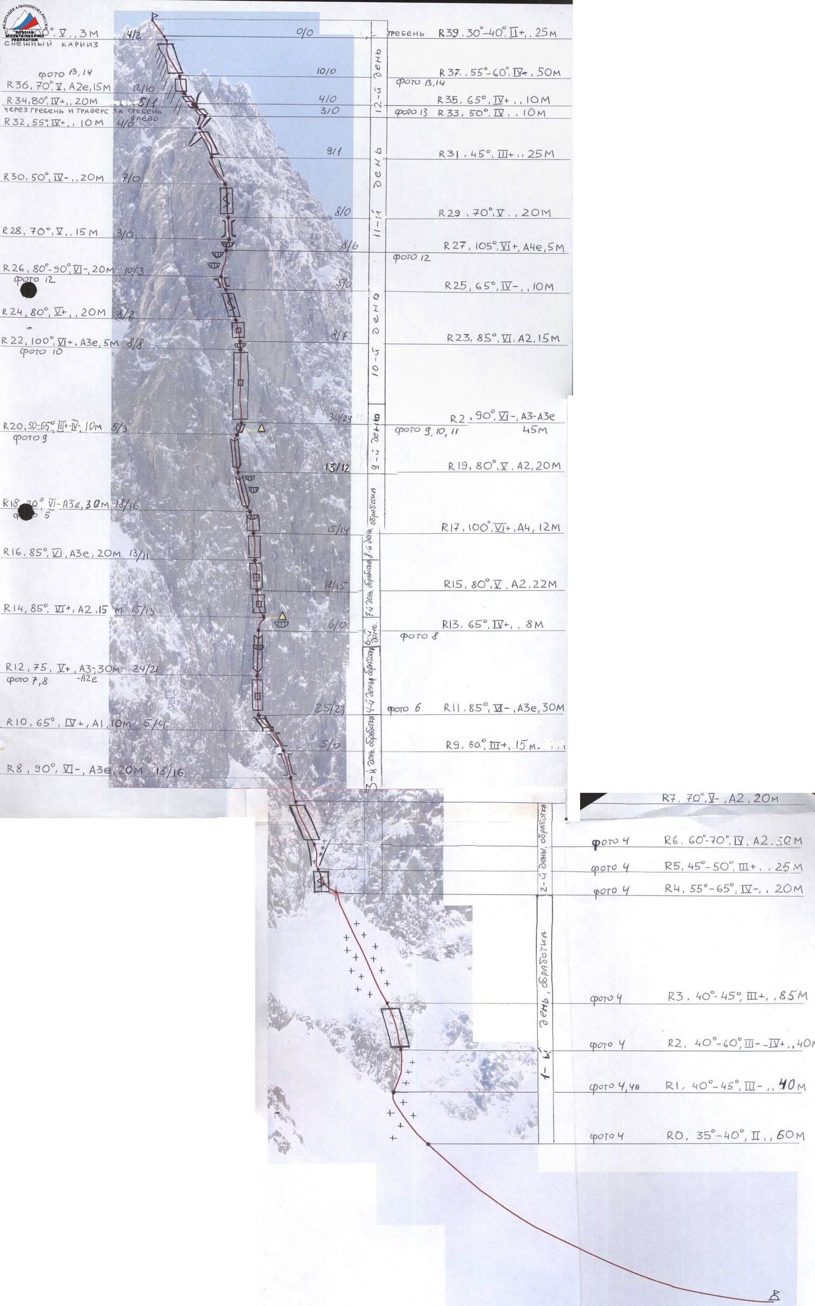
Details of the passage of route sections:
- R0: 35–40°, 2, 50 m
- R1: 40–45°, 3, 40 m
- R2: 40–60°, 3–4, 40 m
- R3: 40–45°, 3, 85 m
- R4: 55–65°, 4, 20 m
- R5: 45–50°, 3, 25 m
- R6: 60–70°, 4, A2, 30 m
- R7: 70°, 4, A2, 20 m
- R8: 90°, 6, A3e, 20 m
- R9: 60°, 3, 15 m
- R10: 65°, 4, A1, 10 m
- R11: 85°, 5, A3e, 30 m
- R12: 75°, 5, A3, 30 m
- R13: 65°, 4, 8 m
- R14: 85°, 6, A2, 15 m
- R15: 80°, 6, A2, 22 m
- R16: 85°, 6, A3e, 20 m
- R17: 100°, 6, A4, 12 m
- R18: 90°, 6, A3b, 30 m
- R19: 80°, 5, A2, 20 m
- R20: 50–65°, 5, 10 m
- R21: 90°, 6, A3–A3e, 45 m
- R22: 100°, 6, A3e, 5 m
- R23: 85°, 6, A2, 15 m
- R24: 80°, 5, 20 m
- R25: 65°, 4, 10 m
- R26: 80–90°, 5, 20 m
- R27: 105°, 6, A4e, 5 m
- R28: 70°, 5, 15 m
- R29: 70°, 5, 20 m
- R30: 50°, 4, 20 m
- R31: 45°, 3, 25 m
- R32: 55°, 4, 10 m
- R33: 50°, 4, 10 m
- R34: 80°, 4, 20 m
- R35: 65°, 4, 10 m
- R36: 70°, 4, A2e, 15 m (snow cornice)
- R37: 55–60°, 5, 50 m
- R39: 30–40°, 2, 25 m
April 18. Passed sections R27–R33. Throughout these sections, internal angles and couloirs diverge to the right, initially simple but gradually becoming more complicated and leading to snow-covered rocks. Therefore, we tried to stick to the left walls of the internal angles.
April 19. Reached the summit.
- Section R33 leads to a sharp ridge descending from a gendarme to the NW.
- Followed by a traverse to the saddle between the gendarme and the wall.
- When reaching the main ridge, had to cut a snow cornice.
Reached the summit around 13:30, meeting the team from Perm OSC on the summit.
- They started descending to the west, while we descended via the ascent route around 16:00.
- Descended to the first platform.
April 20, 2002. Continued descending via the ascent route.
- Around 15:00 were at the start of the route.
- Around 17:00 — back at Base Camp.
Safety Measures
- The expedition was equipped with "Berkut" radios for communication with Base Camp. Communication sessions occurred every 2 hours. There was also communication with the Perm group through Base Camp.
- The equipment included a KV station "Angara." Communication was maintained with the Pechora aviation unit, through which information was passed to the media. According to a prior agreement with the aviation unit commander, in case of an emergency on the wall, a plane from Pechora with rescuers from the Ministry of Emergency Situations would have taken off immediately.
Features and Hazards of the Route
- Avalanche hazard. In good, stable weather, the route is not avalanche-prone. However, after snowfalls, the approaches and the entire lower part, especially section R3, are avalanche-prone. One should also be cautious of falling snow drifts, dangerous for the first climber. Thus, during the ascent via the ropes near section R6, a snow drift of several cubic meters knocked out a tooth of Korabelnikov K.
- Rockfall hazard. In winter, the route is not rockfall-prone, except for sections R17–R20 and R26–R28, where the wall is partially destroyed and there is a possibility of getting hit by a rock from the first climber. In summer, however, almost the entire route is rockfall-prone, except for the upper part and areas under cornices.
Conclusion: the route is recommended to be climbed in the cold season. In summer:
- High rockfall hazard.
- Abundance of blood-sucking insects.
- Possibility of causing harm to the tundra vegetation and wildlife of this area.
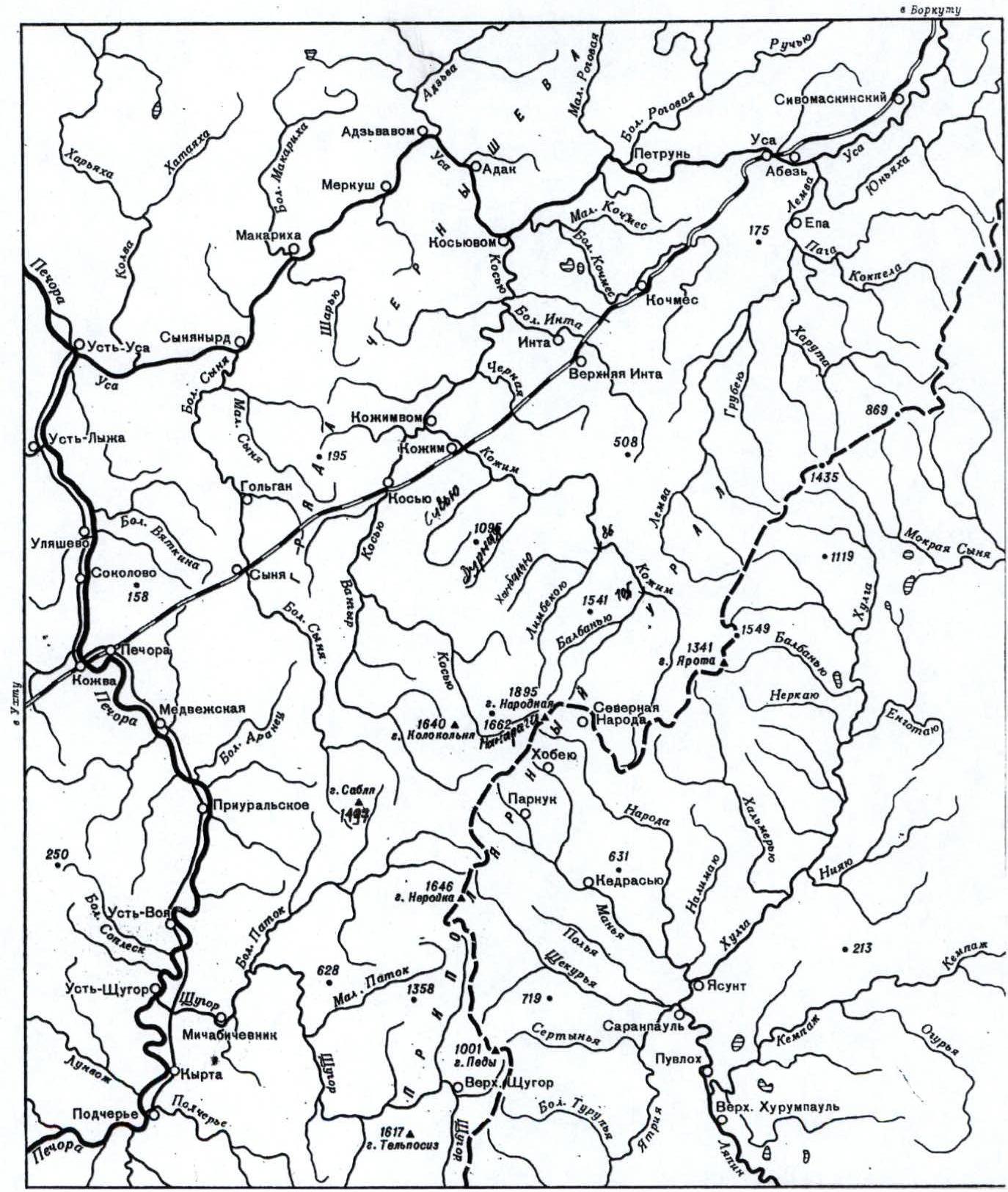
Overview map-scheme of the region.
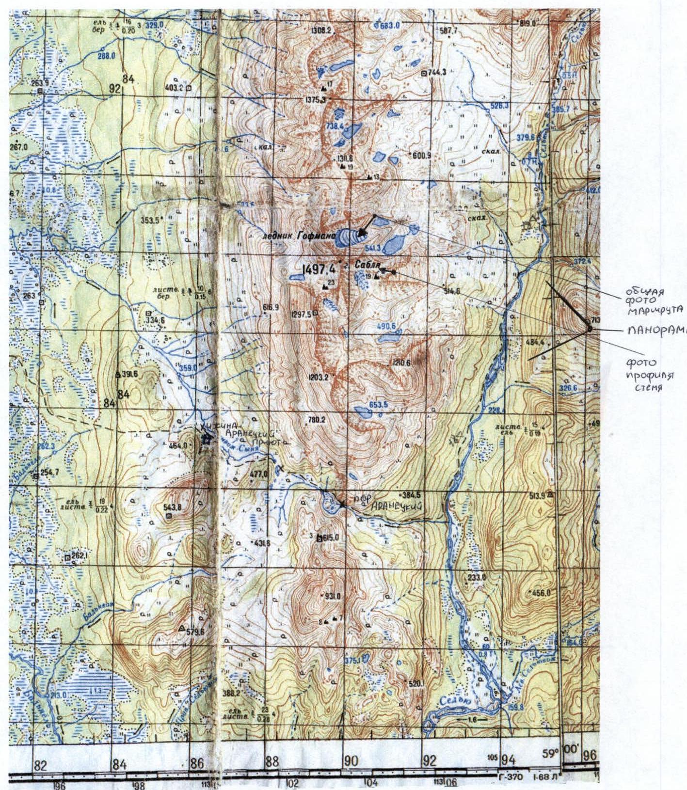
Topographic map of the ascent region
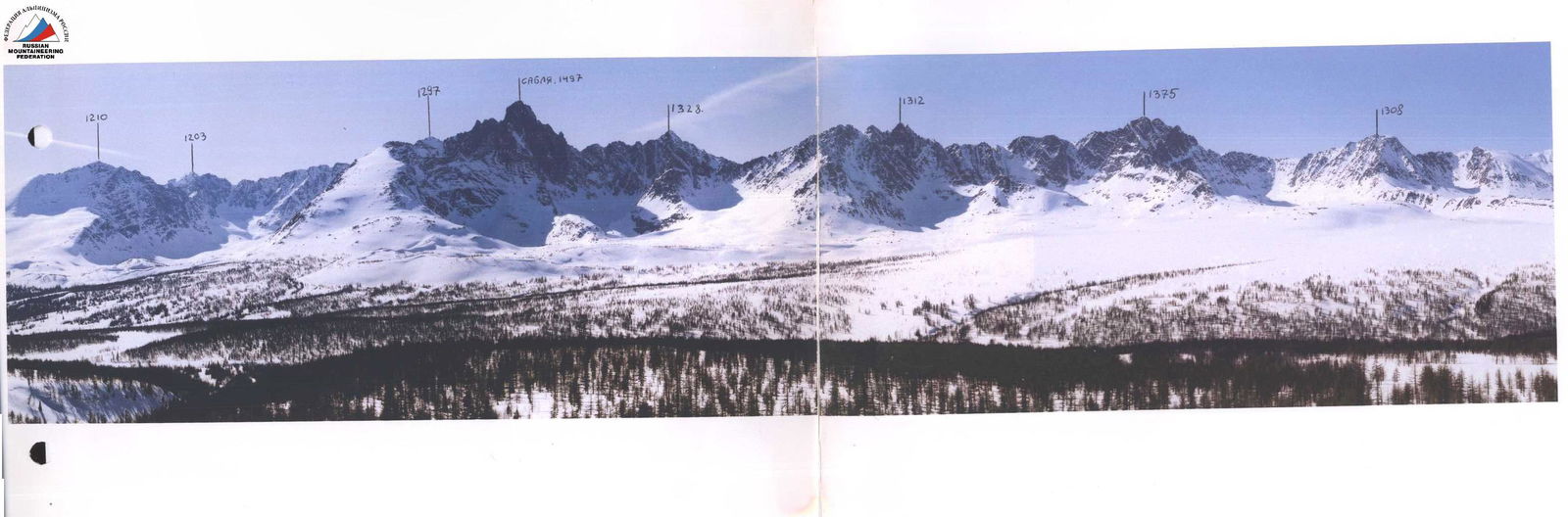
Photo 3. Panorama of the Sablinsky Ridge.
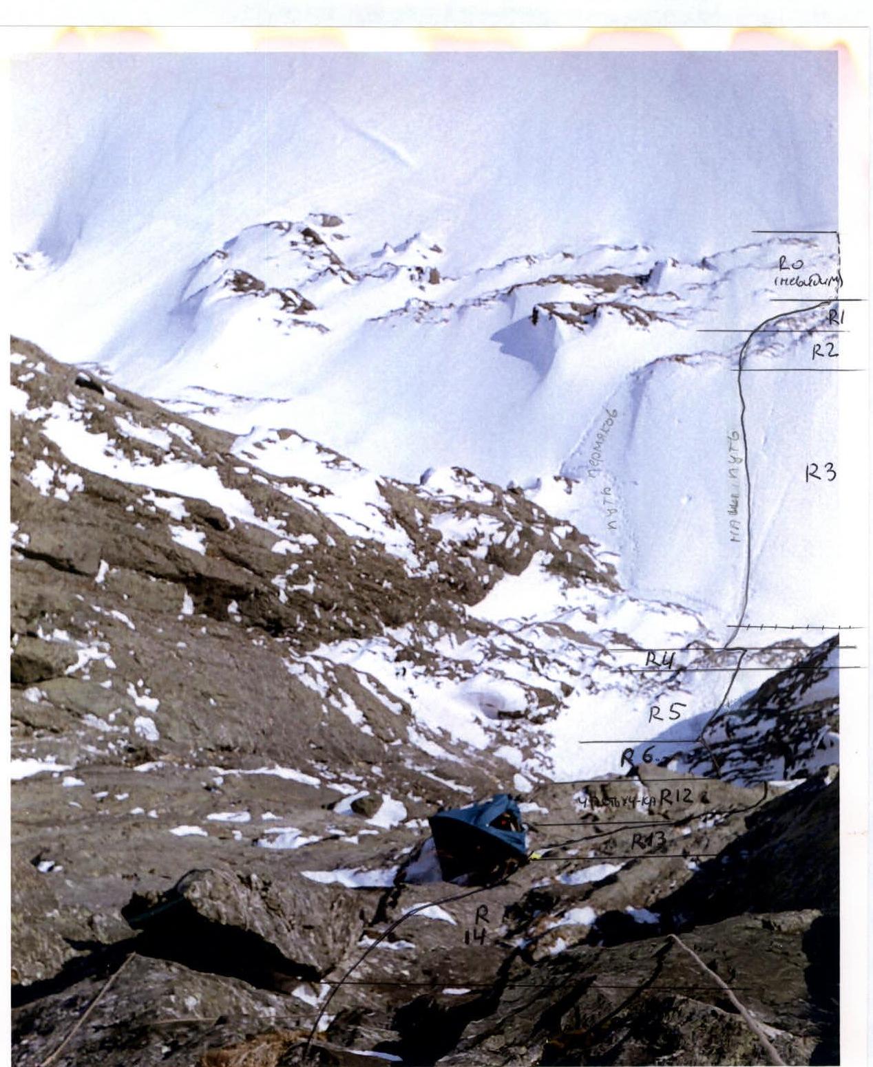
Photo 4. Sections R0–R6 and R12–R14 from section R15.
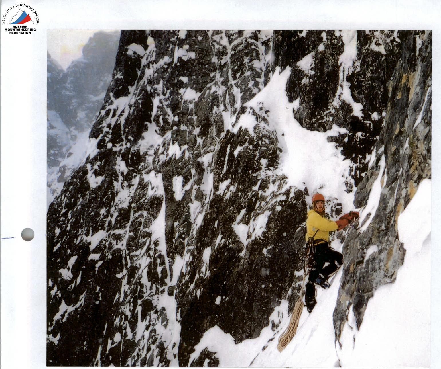
Photo 4a. Start of the wall part. Section R4.
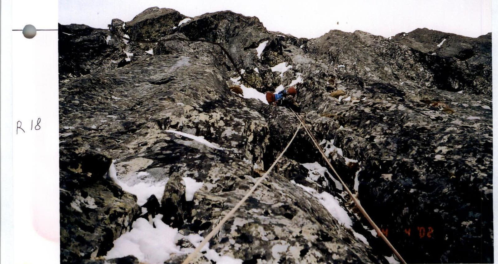
Photo 5. Section R18.
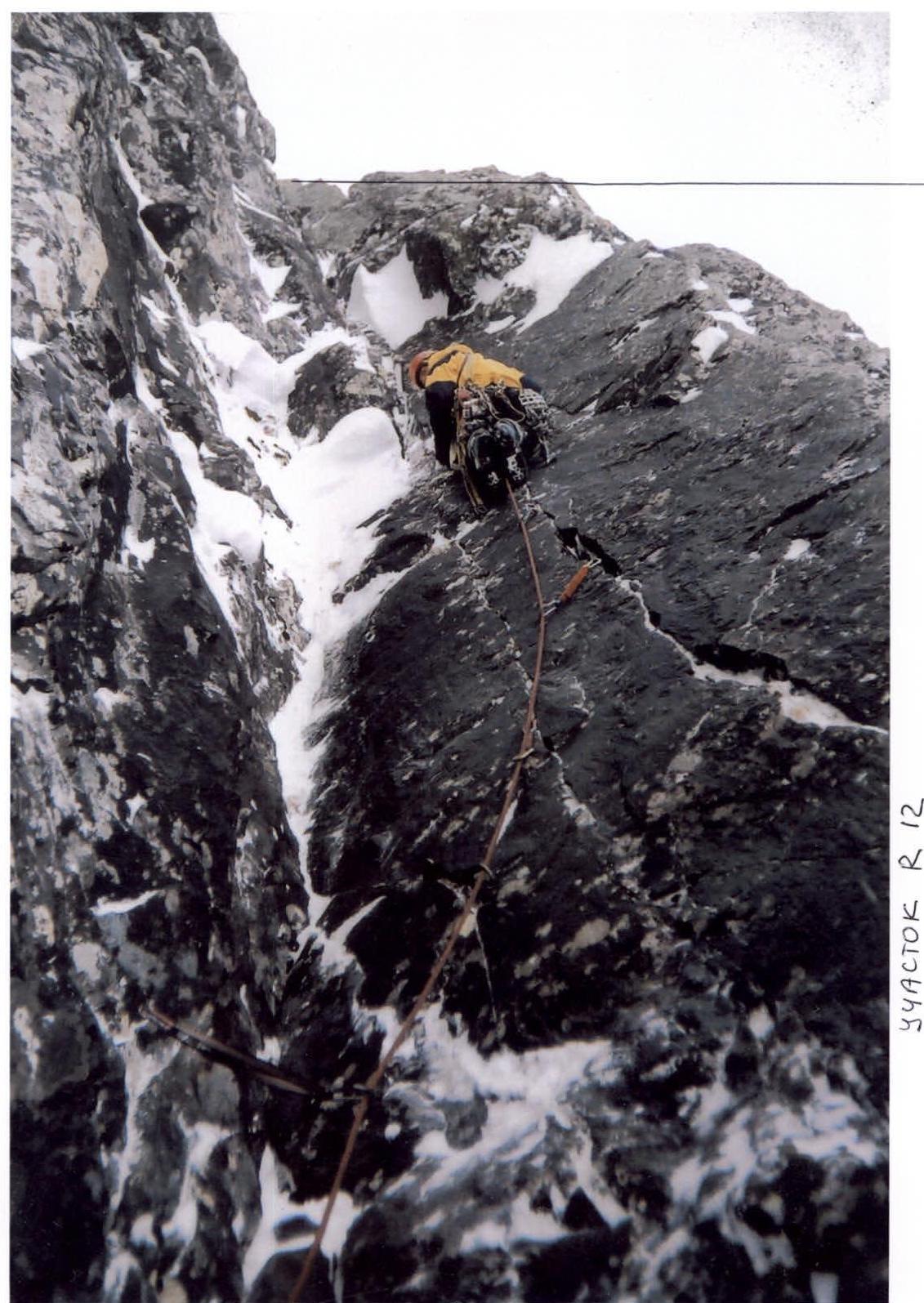
Photo 7. Section R12.

Photo 6. Start of section R11 from section R10.
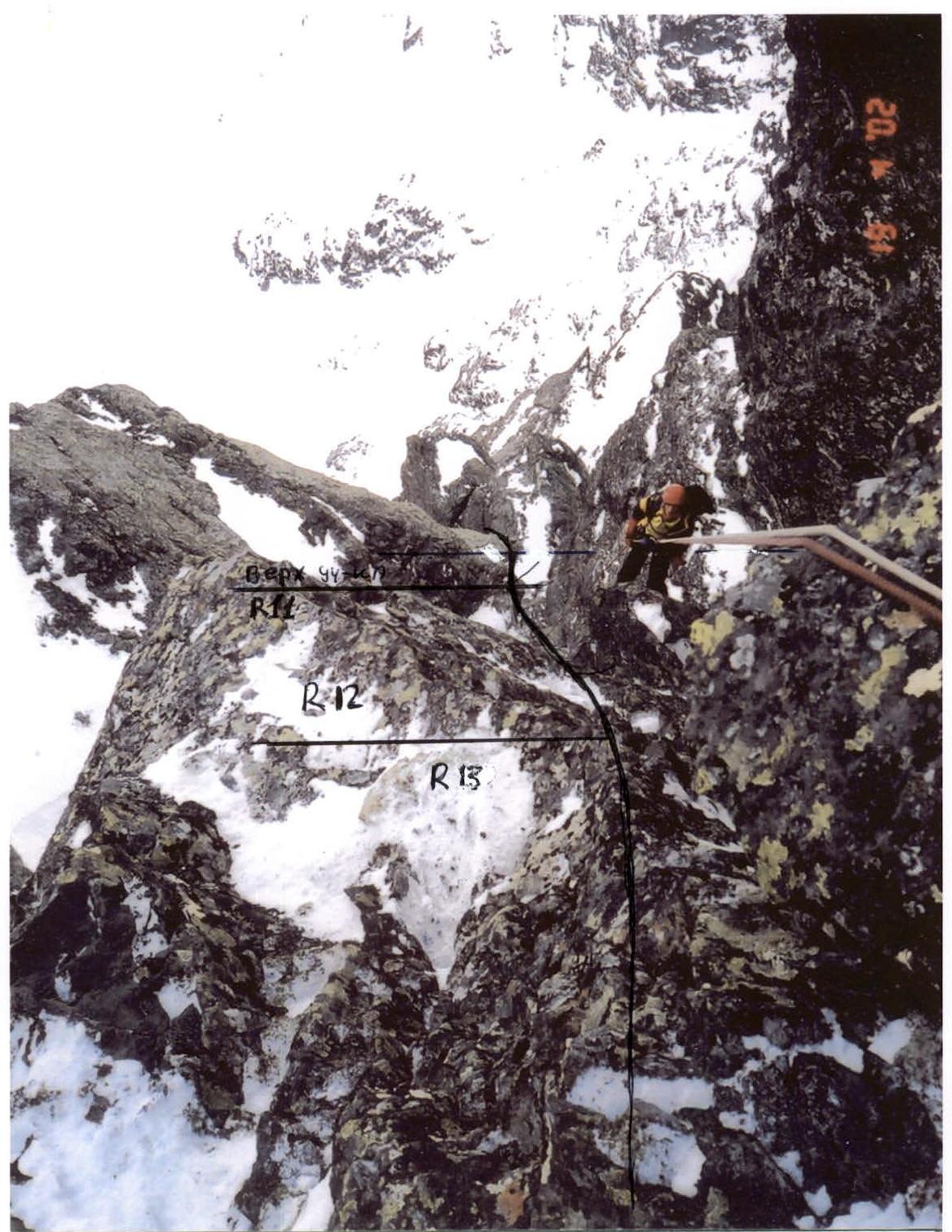
Photo 8. Sections R12–R13 from the location of the first platform.
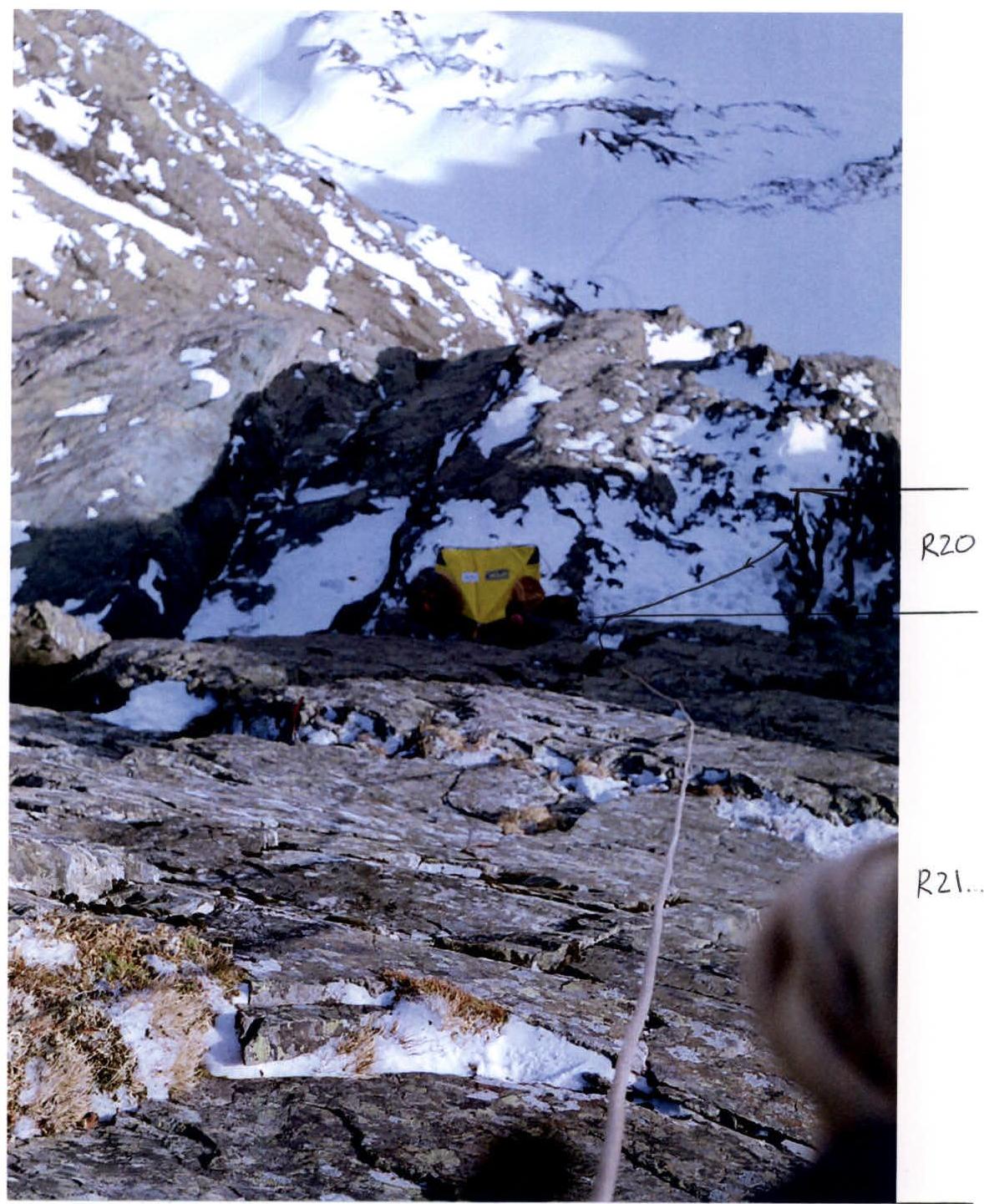
Photo 9. Sections R20–R21 and the location of the second platform.
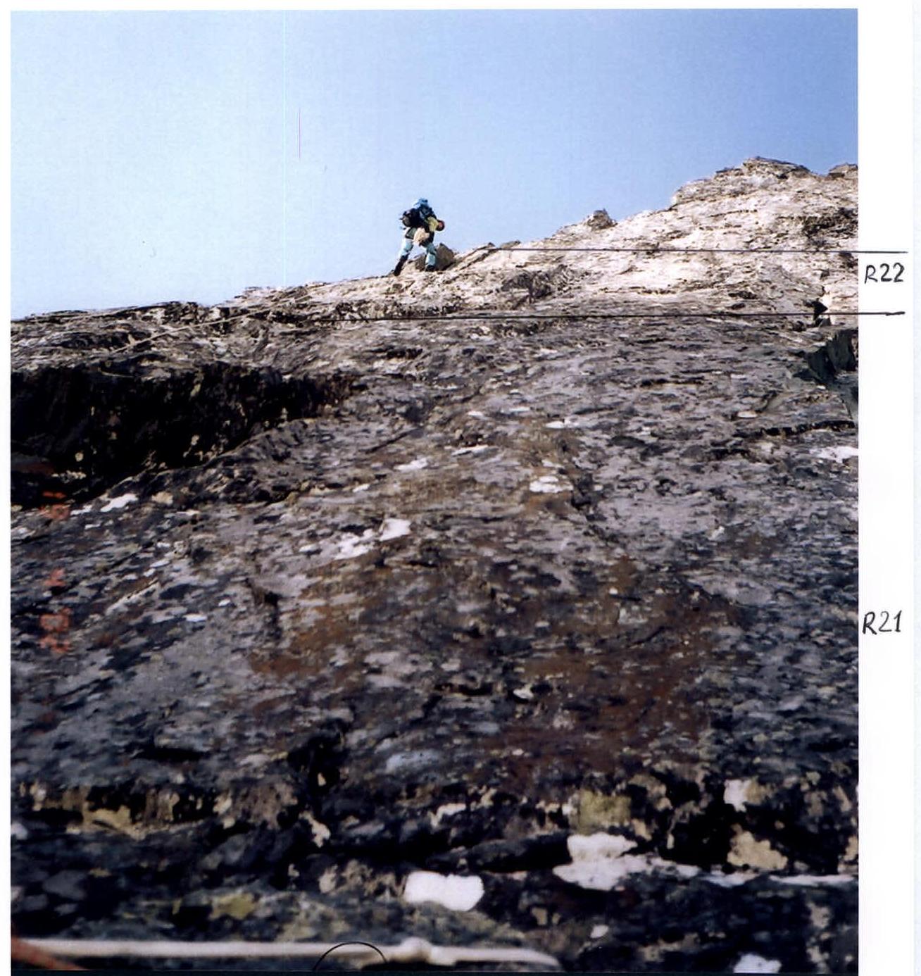
Photo 10. Sections R21–R22.
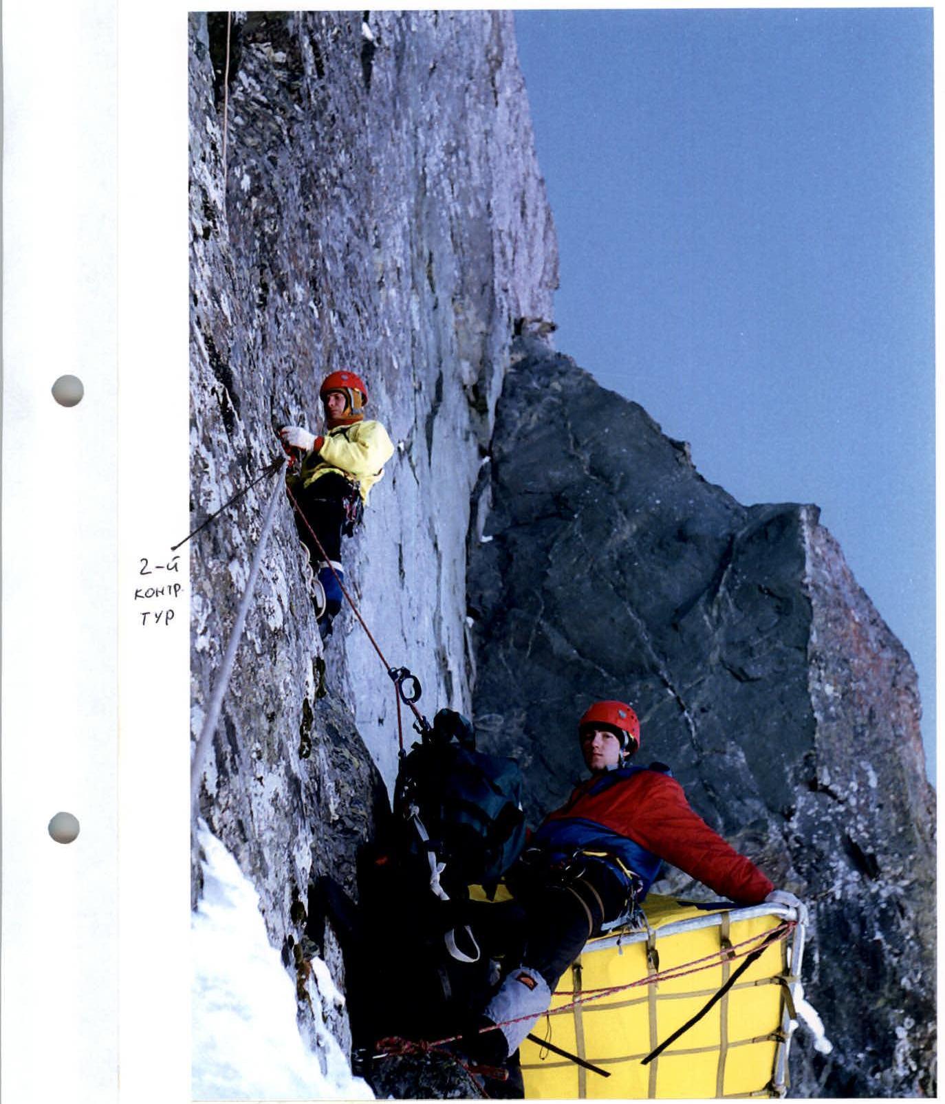
Photo 11. Second platform and the location of the second control tower.
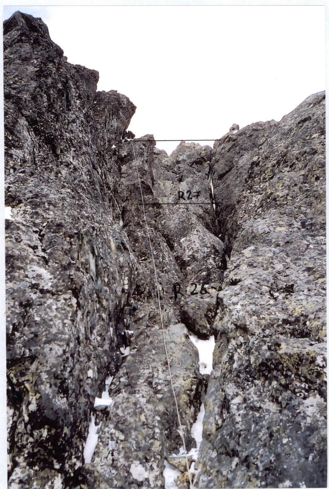
Photo 12. Sections R26–R27.

Photo 13. Sections R34–R36.
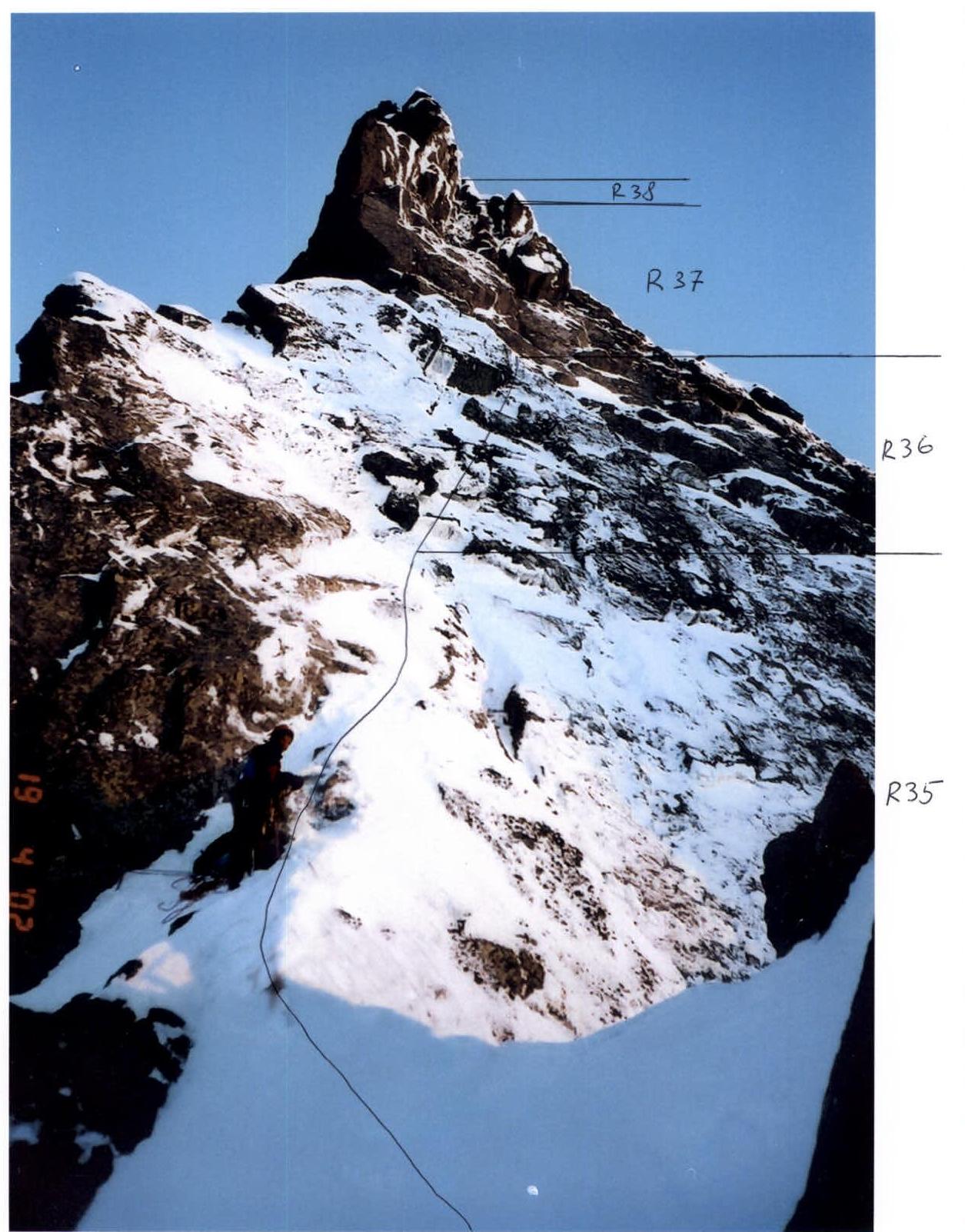
Photo 14. Sections R35–R38.
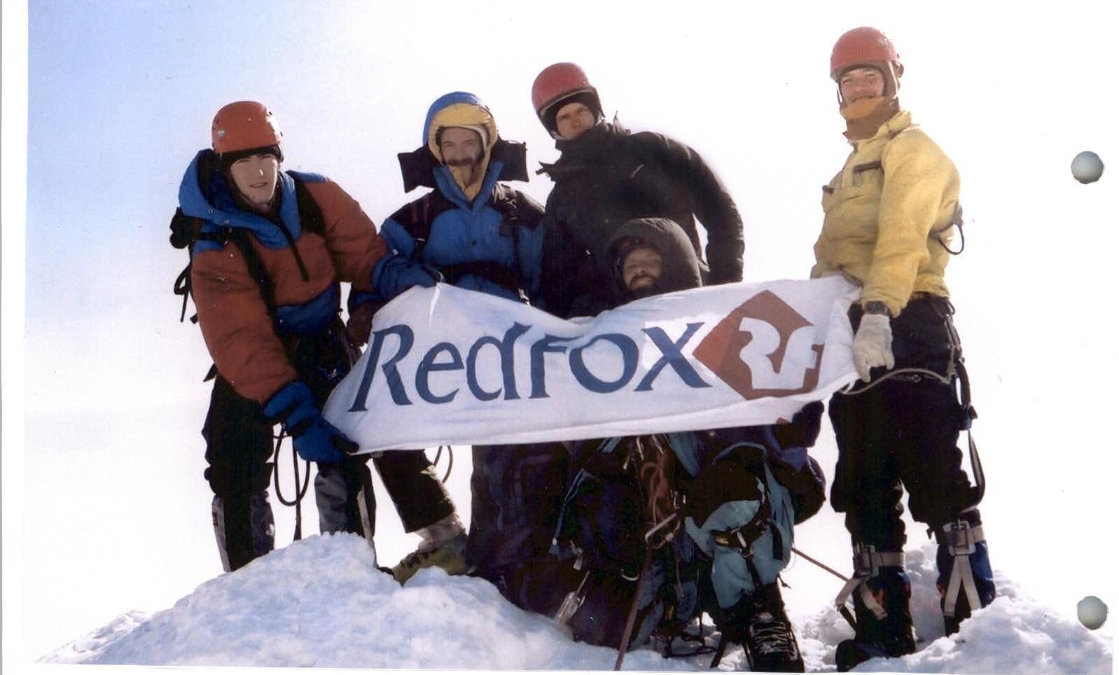
Photo 15. The group in full on the summit.