
Report on the First Ascent to Peak 1082.4 (Raiiz Severny) via the Route: "Along the First Northern Spur of the Western Ridge" Category 2B (Rocky) by the "Sauk-Pai" Club Team (Syktyvkar) in July 2018
The report was compiled in 2018.
I. Ascent Passport
| № п.п. | 1. General Information | |
|---|---|---|
| 1.1 | Full Name, Sports Rank of the Leader | Andrei Aleksandrovich Goletarov (2nd sports rank, Inta) |
| 1.2 | Full Name, Sports Rank of the Participants | 1. Mikhail Aleksandrovich Napalkov (3rd sports rank, Syktyvkar); 2. Anastasia Vasilievna Vityazeva (3rd sports rank, Salekhard); |
| 1.3 | Full Name of the Coach | Sergei Vasilievich Zhuravlev: CMS, 1st category instructor-methodologist, Syktyvkar. |
| 1.4 | Organization | NP "Northern Travels Club 'Sauk-Pai'" (Syktyvkar). |
| 2. Characteristics of the Ascent Object | ||
| 2.1 | Region | Polar Urals, Raiiz mountain massif |
| 2.2 | Valley | Nyrdvomen-Shor river valley |
| 2.3 | Section Number according to the 2013 Classification Table | 8.3 |
| 2.4 | Name and Height of the Peak | Raiiz Severny 1082.4 |
| 2.5 | Geographical Coordinates of the Peak (latitude/longitude), GPS Coordinates | |
| 3. Characteristics of the Route | ||
| 3.1 | Route Name | Along the first northern spur of the western ridge |
| 3.2 | Proposed Category of Difficulty | 2A (rocky) |
| 3.3 | Degree of Route Exploration | First ascent |
| 3.4 | Route Terrain Character | rocky |
| 3.5 | Route Elevation Gain (altimeter or GPS data) | From the base camp — "Geologists' Camp 'Nefritovy Stream'" (height — 320.0 m) to the summit (1084.2 m) — 764 m. Technical part elevation gain (R0 — 450 m) to the summit (R12 — 1084.2 m) — 634.2 m. |
| 3.6 | Route Length (in meters) | 1465 |
| 3.7 | Technical Elements of the Route | Category I — 100 m. Category II — 470 m. Category III — 135 m. Category IV — 0 m. Glacier travel — none. Rappelling — none. |
| 3.8 | Descent from the Summit | North, non-categorical. |
| 3.9 | Additional Route Characteristics | 1. Convenient, wind-protected, abandoned geologists' camp "Nefritovy Stream" with running water. 2. In summer, due to the polar night, there is a significant amount of daylight for the ascent. |
| 4. Characteristics of the Team's Actions |
| 4.1 | Travel Time | 12 ч |
| 4.2 | Overnight Stays | нет | | 4.3 | Start of the Route | 3 July 2018, 7:00 | | 4.4 | Reaching the Summit | 3 July 2018, 14:30 | | 4.5 | Return to Base Camp | 3 July 2018, 19:00 | | | 5. Responsible for the Report | | | 5.1 | Full Name, e-mail | Sergei Vasilievich Zhuravlev, mr.Zhur1958@mail.ru |
II. Ascent Description
1. Characteristics of the Ascent Object
1.1. General Photo of the Summit
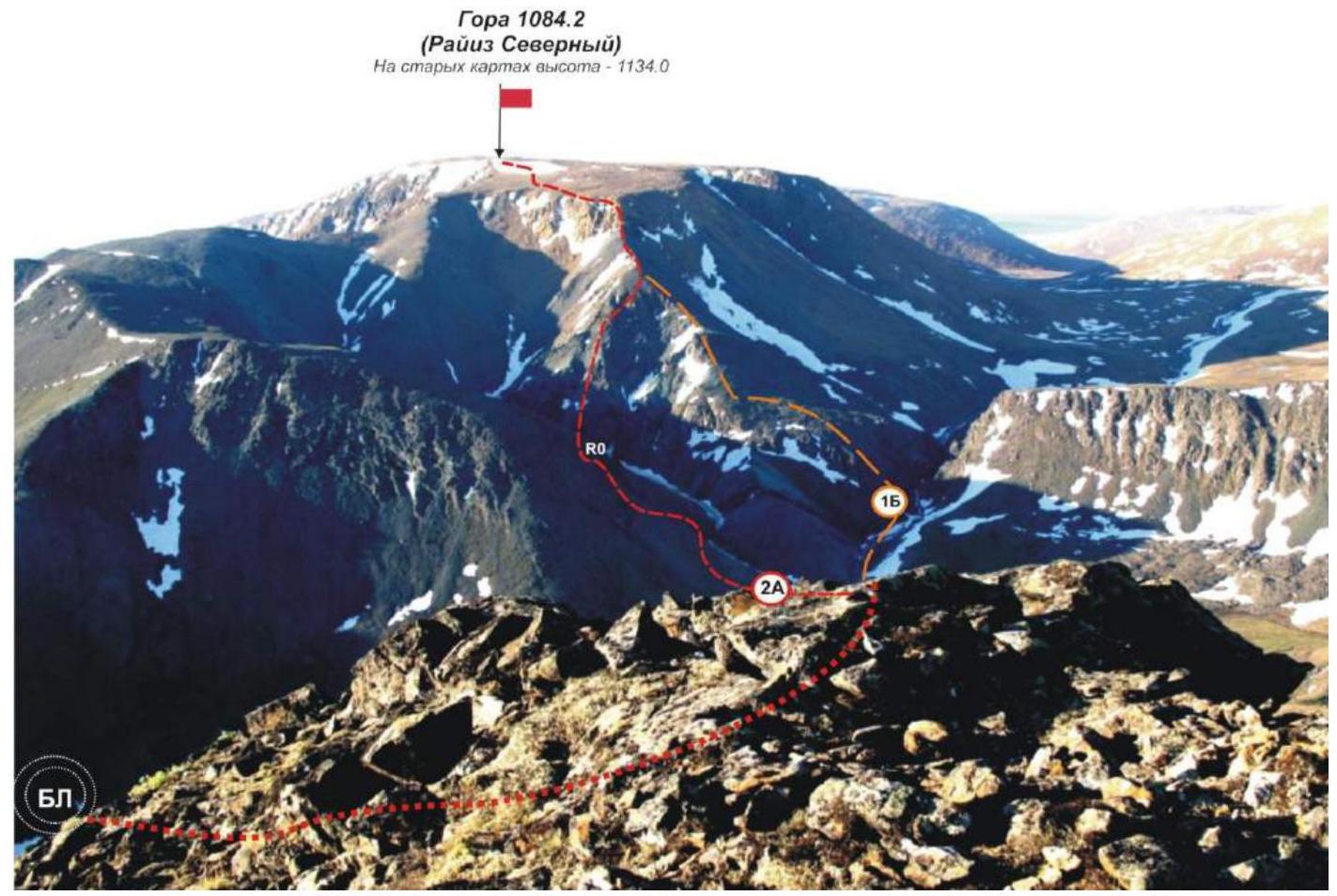
Photo of peak 1084.2 (Raiiz Severny) from peak 982.4 (Skalny Vostochny). Routes are marked:
- Category 1B — along the western ridge (classified and included in the KMGV)
- Category 2A — the route proposed for inclusion in the KMGV.
1.2. Route Profile Photo
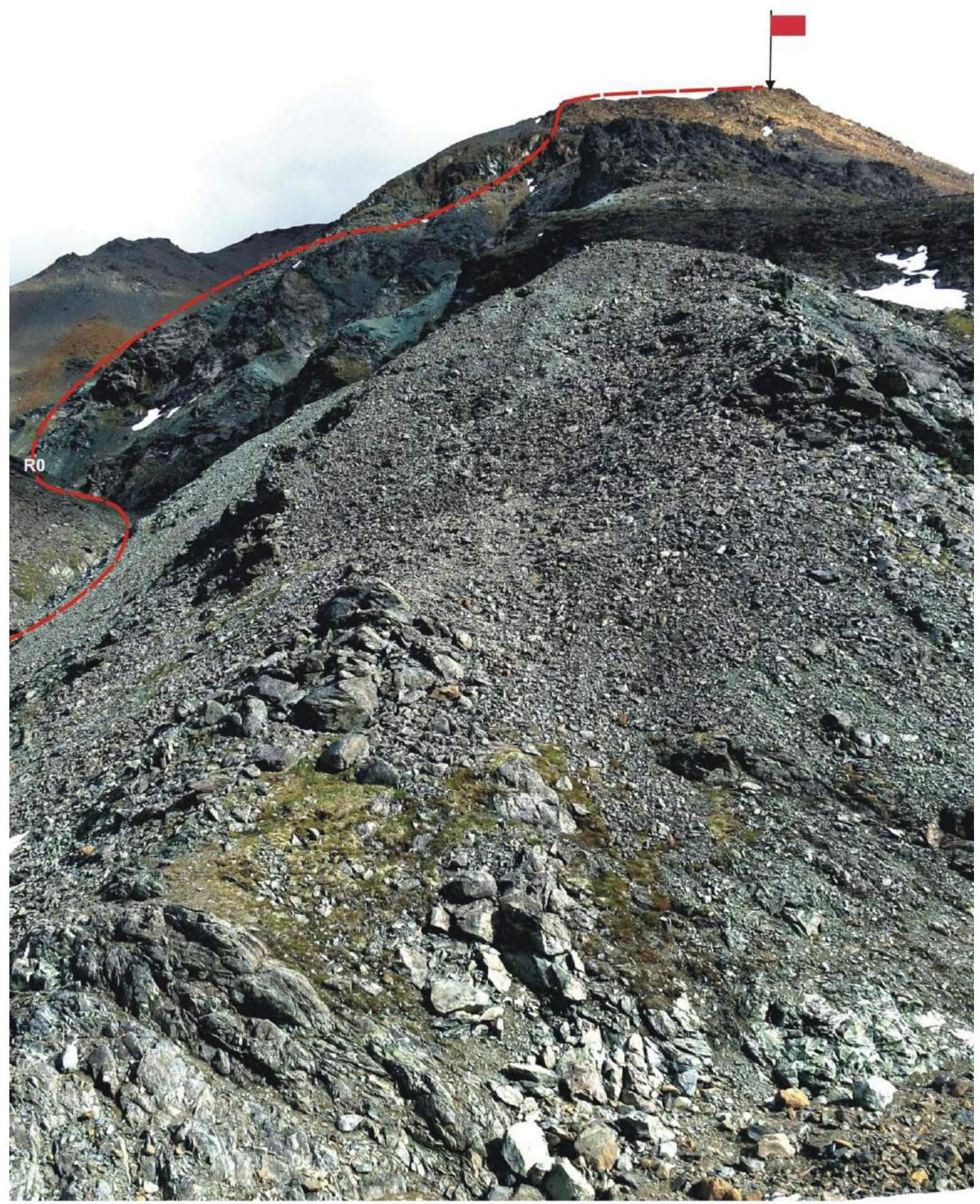
Profile of the route "Along the first northern spur of the western ridge". Photo from the western ridge, from the Category 1B route. July 2018.
1.3. Panoramic Photo of the Area
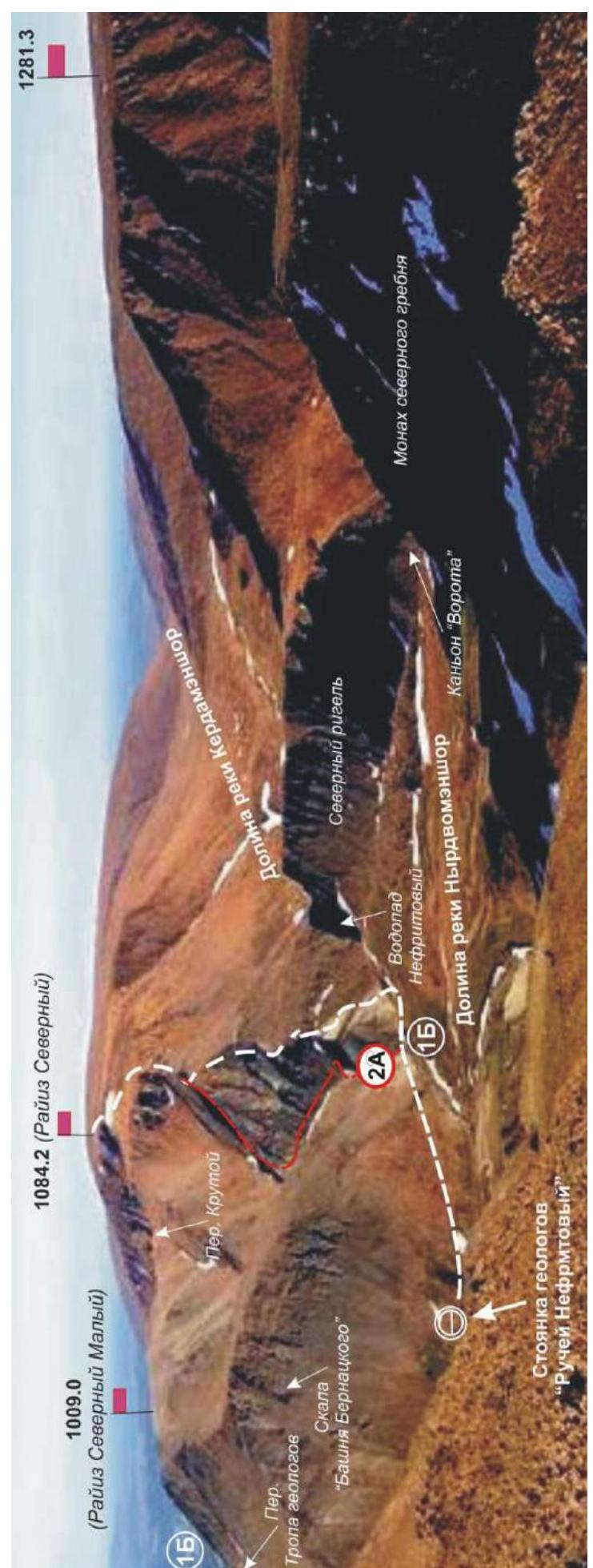
1.4. Area Map
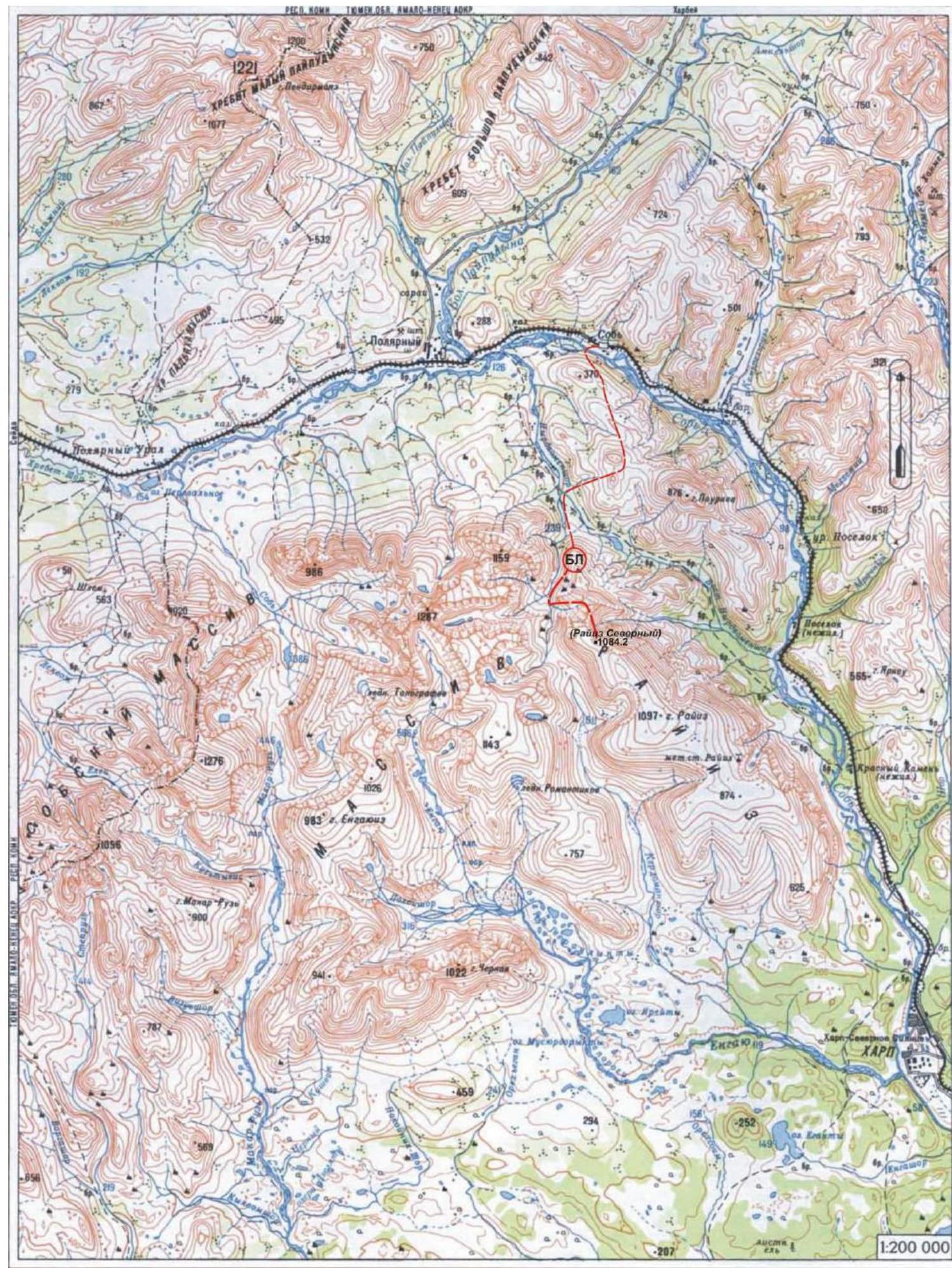
The path to the summit 1084.2 (Raiiz Severny) is marked on the map.
A brief geographical overview of the ascent area. Logistics in the ascent area.
Peak 1084.2 (Raiiz Severny) is located in the Yamalo-Nenets Autonomous Okrug, Ural Federal District, Russian Federation, 30 km southeast of the 110 km halt (formerly the Polarny settlement), in the Nyrdvomen-Shor river valley (right-bank tributary of the Sob' river), on the eastern slopes of the Polar Urals. It is the highest point of the Raiiz plateau. The summit is dome-shaped, with a height of 1084.2 m (on old maps, the height of the northern summit of Raiiz is 1134.0 m). The name of the mountain is official and appears on maps of the Polar Urals. Raiiz is a plateau-like mountain, characteristic of the Polar Urals, and is the titular mountain that gave its name to the entire mountain massif. It has several peaks: from 800 m in the southeast (Kudryavaya mountain) to 1084.2 m (Raiiz Severny) in the north of the summit plateau. The orographic clarification of the summit — Raiiz Severny — is given for the convenience of orienting climbers, as the main summit of Raiiz, which has an official geographical name and is marked on Russian maps, is lower than Raiiz Severny. Peak 1084.2 (Raiiz Severny) can be an object for educational and sports ascents, as it has several pronounced rocky ridges, cirque ridges on the northern slope, and a western ridge.
Description of the Western Ridge and the First Northern Spur of the Western Ridge
The western ridge is a pronounced ridge leading from the summit to the west. In its lower part, it is scree, and in its upper part, it is rocky, descending into the Nyrdvomen-Shor river valley and serving as a watershed for the upper reaches of the Nyrdvomen-Shor river and the Nefritovy stream. In the central part of the western ridge, the northern slope is divided by three rocky spurs descending into the valley of a nameless stream. The spurs are located at the junction of rock formations:
- the first spur is composed of dense yellow-green rocks;
- the second and third spurs are heavily destroyed and composed of black-green schistose rocks.
In July 2018, a group of climbers from the Republic of Komi, led by A. A. Goletarov, laid a logical rocky route of approximately Category 2A complexity along the first spur. The second and third spurs were deemed potentially rockfall-prone after inspection and are not currently considered as potential educational and sports climbing routes.
Description of the Route: "Along the First Northern Spur of the Western Ridge" — approximately Category 2A
The route: "Along the first northern spur of the western ridge" is a rocky educational and training route of Category 2A, having the maximum natural obstacles for routes of this level of complexity (Category 2A). The passage of this route has not only aesthetic but also significant sports and practical value, as it allows, within the framework of the ascent, to practice:
- belaying techniques
- self-belaying techniques on rocky terrain of increased complexity.
The route is logical in orientation. It is laid along a pronounced ridge spur, and is therefore objectively safe, although technically challenging, which allows for educational and sports ascents both in summer and winter.
At the same time, the route requires good rock climbing preparation for participants, as the key passage is a 30 m Category 3+ rock wall with some sections of Category 4.
2. Route Characteristics
2.1. Technical Photographs
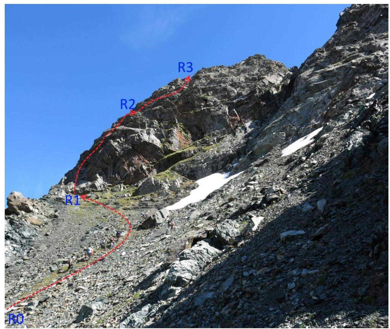
Photo from the west: the beginning of the technical part of the route — the lower part of the first northern spur of the western ridge. KEY ROUTE SECTION! Reference points of technical sections are marked.
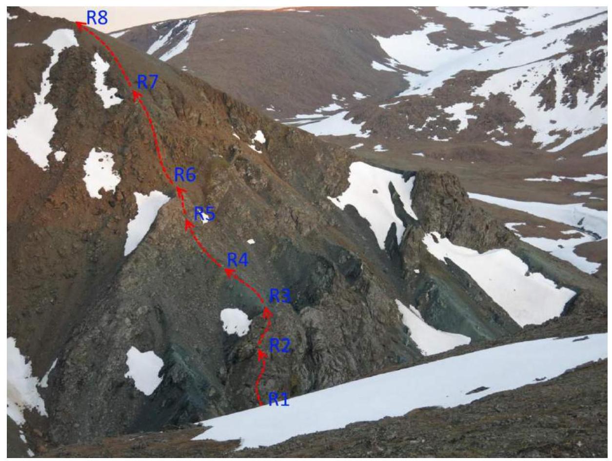
Photo of the middle part of the route. Taken from the western spur of peak 1009.0 (Raiiz Severny Maly). The image shows:
- the upper part of the key section,
- the wall after the scree terrace,
- the rocky ridge leading to the junction of the spur with the western ridge. Reference points of technical sections are marked.

Photo of the upper part of the route. Taken from the scree terrace in the central part of the scree terrace. The image shows:
- the scree terrace
- the rocky wall at the junction of the spur with the western ridge
- reference points of technical sections are marked.
2.2. Technical Characteristics of Route Sections
Diagram in UIAA symbols.
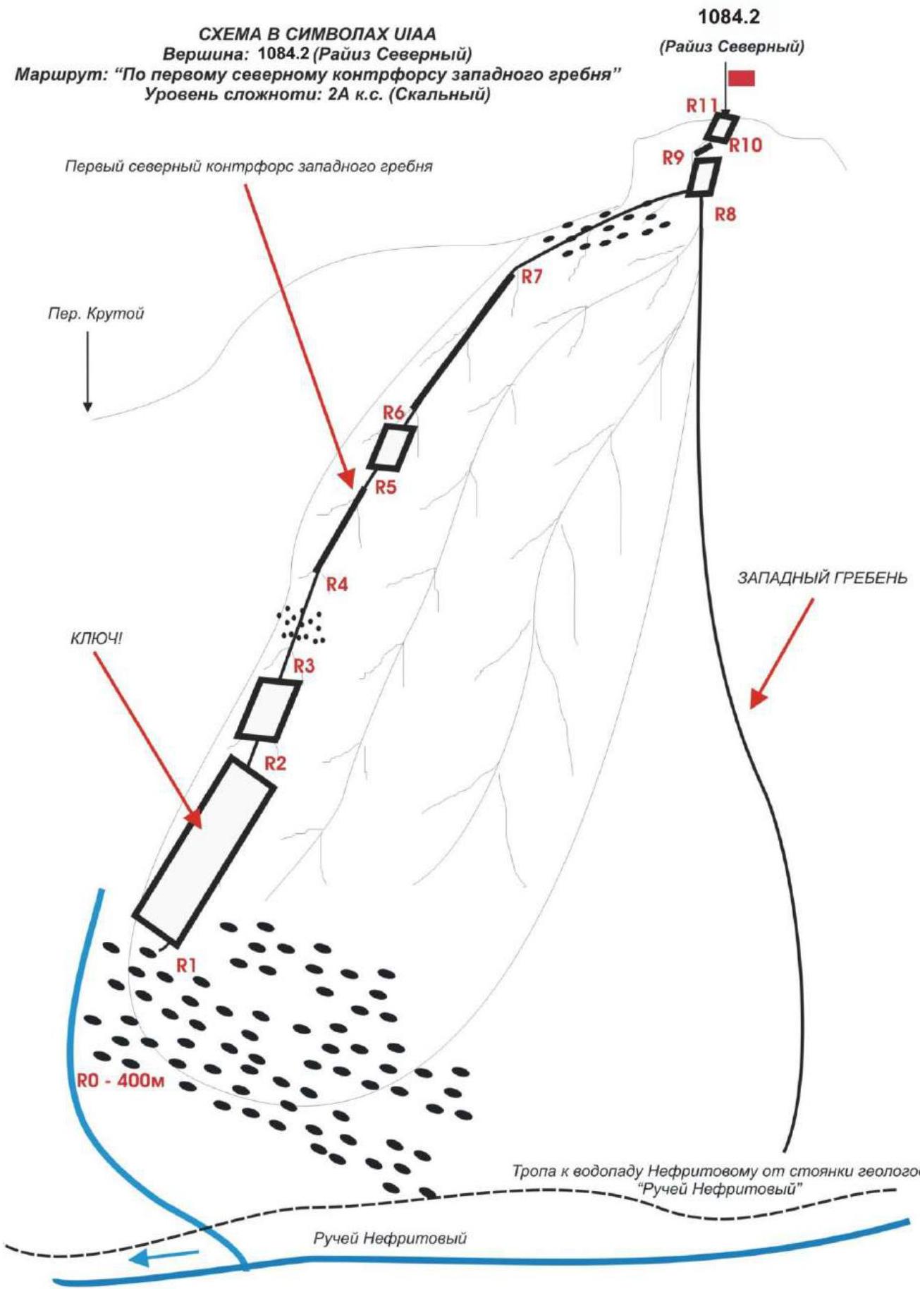
Approach: from the camp — geologists' base "Nefritovy Stream" to the start of the route — 1 hour.
Table of Technical Sections
| Section № | Terrain Character | Category of Difficulty | Length, m | Type and Number of Hooks |
|---|---|---|---|---|
| R0 | Location of rope teams — Nefritovy Stream source, start of the technical part of the route. Elevation — 400 m above sea level. | |||
| R0–R1 | Scree | n/c, 1 | 400 | 0 |
| R1–R2 | Inclined wall. KEY ROUTE SECTION! | 3+ convenient station | 55 | 10 incl. |
| R2–R3 | Inclined wall | 3- convenient stations | 30 | 6 incl. |
| R3–R4 | Scree terrace | n/c | 100 | 6 incl. |
| R4–R5 | Large-block ridge | 2-, 2+ Convenient station | 100 | 0 |
| R5–R6 | Inclined wall | 3- Convenient station | 20 | 3 incl. |
| R6–R7 | Rocky large-block ridge | 2- | 200 | 0 |
| R7–R8 | Scree slope | n/c | 300 | 4 incl. |
| R8–R9 | Rocky wall | 3- Convenient station | 30 | 6 incl. |
| R9–R10 | Large-block ridge | 2 | 150 | 0 |
| R10–R11 | Rocky wall of the pre-summit tower | 2- Convenient station | 20 | 3 incl. |
| R11–R12 | Medium-block scree. Exit to the summit. | n/c, convenient station | 60 | 0 |
| R12 | Summit 1084.2 (Raiiz Severny). |
3.1. Brief Description of the Route Passage.
Approach
Nefritovy Stream Source. Location of Rope Teams.
| Section № | Description |
|---|---|
| APPROACH | From the base camp near the abandoned geologists' camp "Nefritovy Stream". Ascend along the trail to the stream, then along the stream valley to the base of the first northern spur of the western ridge (1–1.5 hours). |
| R0 | Nefritovy Stream source. Location of rope teams. |
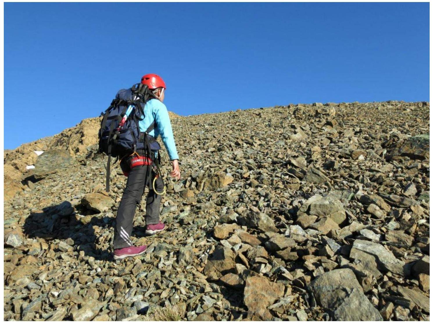
| R0–R1 | Approach along the scree slope to the base of the first (left-hand) northern spur of the western ridge. Start of the technical part and key section of the route. Slope steepness — 15–25°. Simultaneous movement with a shortened rope. Length — 400 m. Difficulty level — non-categorical, at the top — Category I. |
| R1–R2 KEY! | Passage of the key section. Dense monolithic rocks. Many cracks of various sizes for intermediate belay points, making it easy to find a placement for a protection device. Steepness 80, 65°. Step height — 55 m. Length — 70 m. Difficulty level — Category 3+. Short sections of 1.5–2 m — Category IV. |
| R2–R3 | Passage of the second inclined rocky wall. Dense monolithic rocks. Movement with alternating belay using ledges and loops thrown over ledges. Section steepness — 55°. Length — 30 m. Difficulty level — Category III. |
| R3–R4 | Passage along the scree terrace. Simultaneous movement. Steepness — 15°. Total section length — 100 m. Difficulty level — non-categorical. |
| R4–R5 | Large-block ridge. Simultaneous movement with mutual belay using terrain features. Section steepness — 30°. Length — 100 m. Difficulty level — Category 2+, II. |
| R5–R6 | Passage of the rocky wall. Polished monolithic rocks. Finding placements for hooks and protection devices is not difficult. Convenient ledges and large stone blocks for station organization at the start and end of the section. Section length — 20 m with a steepness of 50°. Difficulty level — Category III. |
| R6–R7 | Passage along the large-block rocky ridge. Movement with alternating belay. Finding terrain for rope placement is not problematic. Section steepness — 45°. Length — 200 m. Difficulty level — Category II. |
| R7–R8 | Ascent along the scree slope to the western ridge. Simultaneous movement on a shortened rope. Section steepness — 15°. Length — 300 m. Difficulty level — non-categorical. |
| R8–R9 | Passage of the rocky wall (key section of the Category 1B route along the Western Ridge). Movement with alternating belay, with a rope. Section length — 30 m. Steepness — 50°. |
| R9–R10 | Passage along the large-block ridge on destroyed rocks (left-hand). Movement on a shortened rope. Simultaneous, using terrain features for belay. Section steepness — 20°. Length — 150 m. Difficulty level — Category 2, 1+. |
| R10–R11 | Ascent to the pre-summit tower along the inclined wall. Destroyed rocks, subjective rockfall hazard. Movement with alternating belay. Section steepness — 55°. Length — 20 m. Difficulty level — Category 2+. |
| R11–R12 | Ascent to the summit dome along medium-block scree. |
| R12 | Summit 1084.2 (Raiiz Severny). |
| DESCENT | Descent from the summit is technically simple. Along scree and snow fields, first northwest towards the Nyrdvomen-Shor river valley to the "Geologists' Trail" pass, then along a snow-scree couloir to the base camp "Geologists' Camp 'Nefritovy Stream'". |
2.2. Photo of the Team on the Summit with the Control Tour.
Ascent participant — A. Vityazeva reaches the summit.
2.3. Safety Assessment of the Route.
The route to peak 1084.2 (Raiiz Severny) is a characteristic rocky ridge route of Category 2A, allowing to test not only the technical knowledge, skills, and abilities of Category 3 climbers.
Accessible approaches and orientation when searching for the route: the route starts from the Nefritovy Stream, which is one of the safety aspects.
Communication on the route was carried out using VHF radios, but with interruptions — there is no direct visibility of the route from the Nyrdvomen-Shor valley, from the base camp. Mobile phone connection is absent.
The route is ridge-like, which increases the level of safety when used for educational purposes. Throughout the route, there are convenient ledges and platforms for organizing stations. The terrain allows the use of various protection devices for intermediate belay points and self-belay. The key section is at the bottom. In case of unfavorable weather or force majeure, it is not difficult to safely descend from the route. The route meets the safety requirements for alpine educational and sports routes.
Route analogues:
- Mount GMI (North Ossetia, Koi Dzhan gorge) — Category 2A.
- Peak Polarny along the NE ridge (Polar Urals, Raiiz massif).
Photo Illustrations
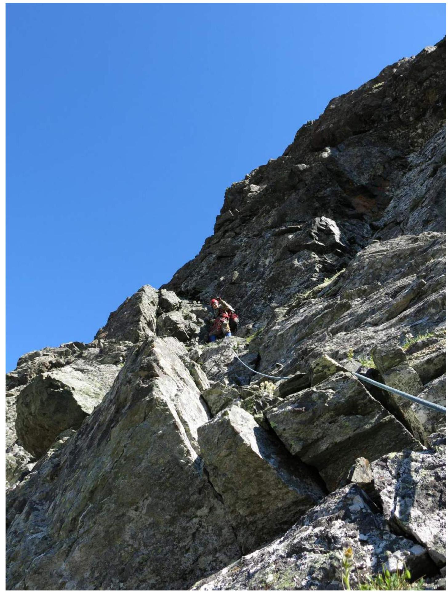
PHOTO №1. Photo of section R1–R2 — passage of the lower part of the key section. July 2018, photo by A. Vityazeva. A. Goletarov — team leader on the route.
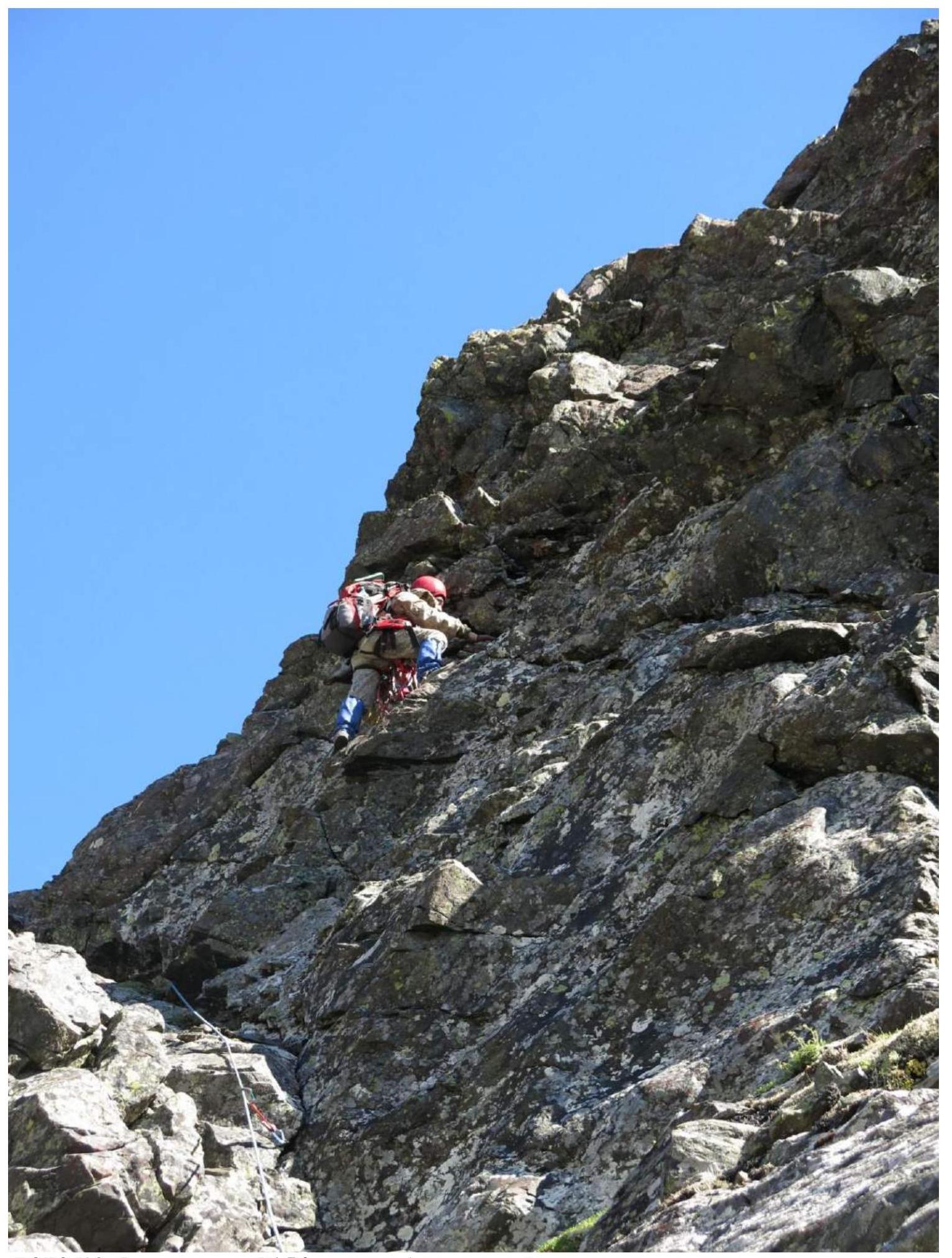
PHOTO №2. Photo of section R1–R2 — passage of the upper part of the key section.
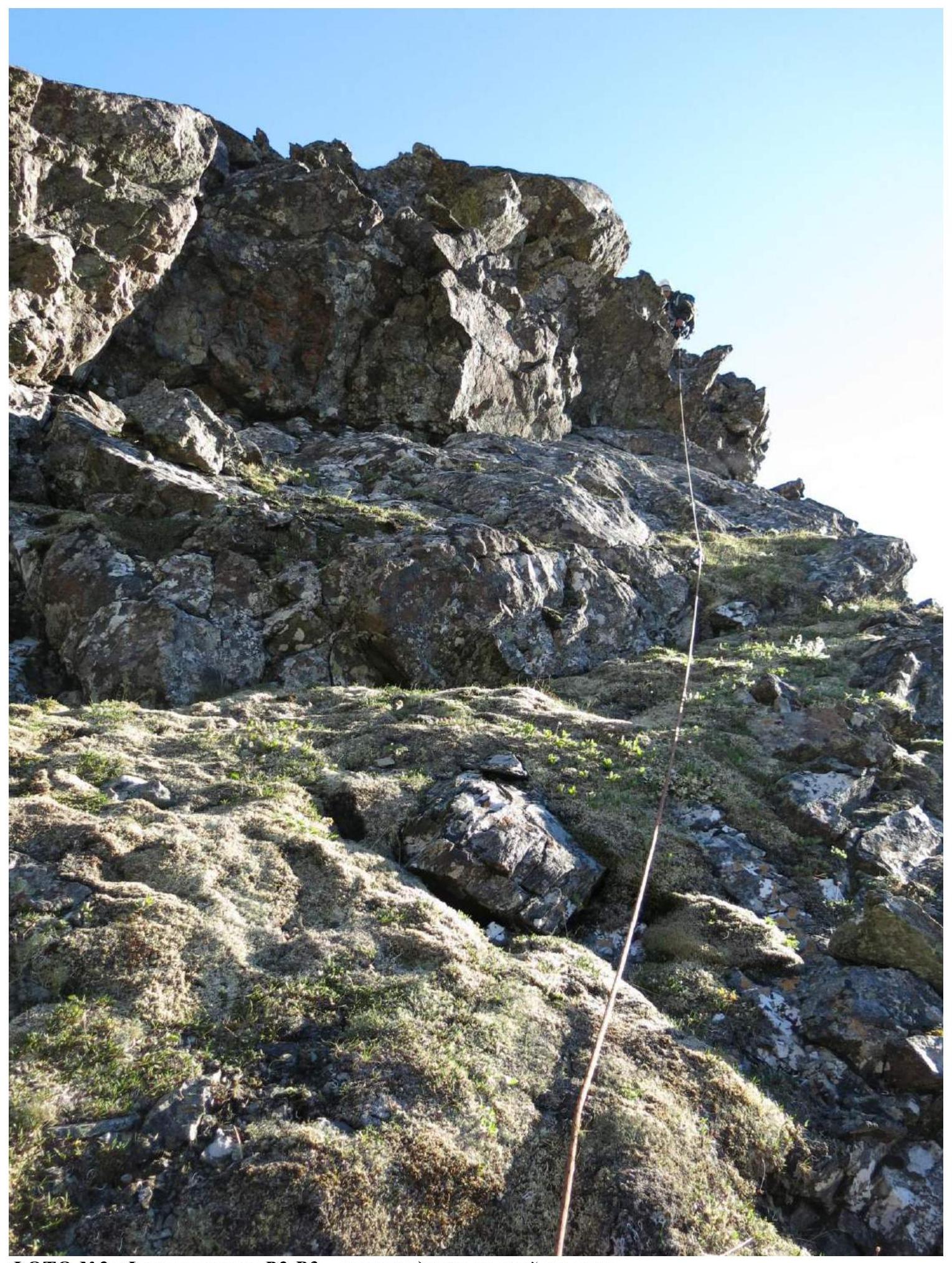
PHOTO №3: Photo of section R2–R3 — passage of the second wall.
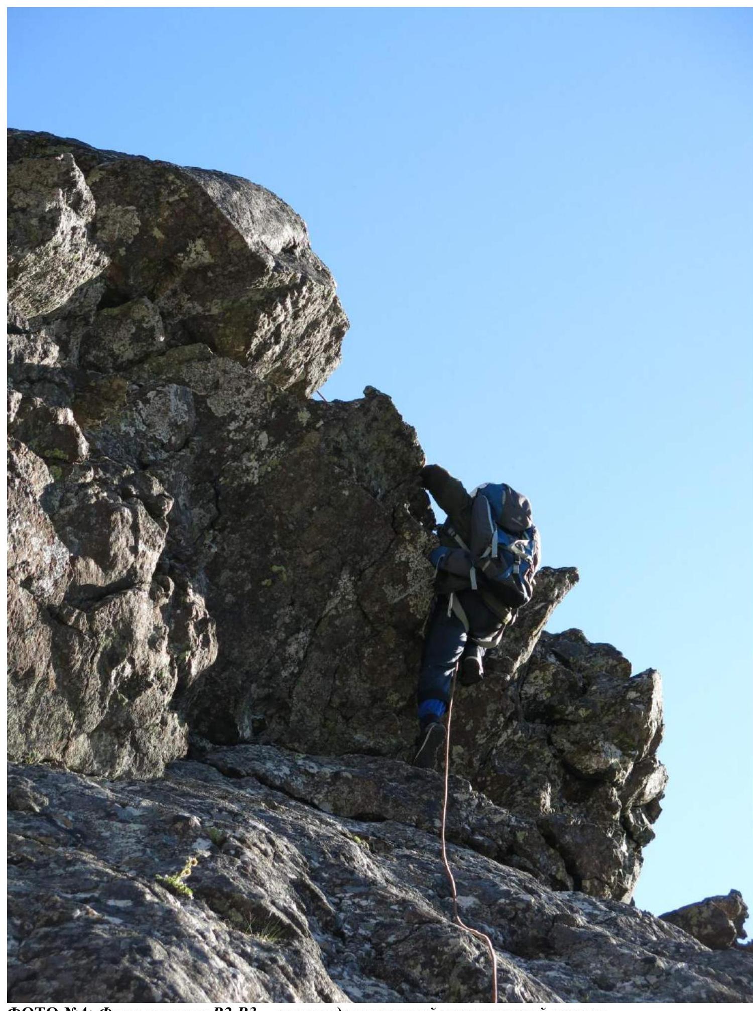
PHOTO №4: Photo of section R2–R3 — passage of the upper part of the second wall.
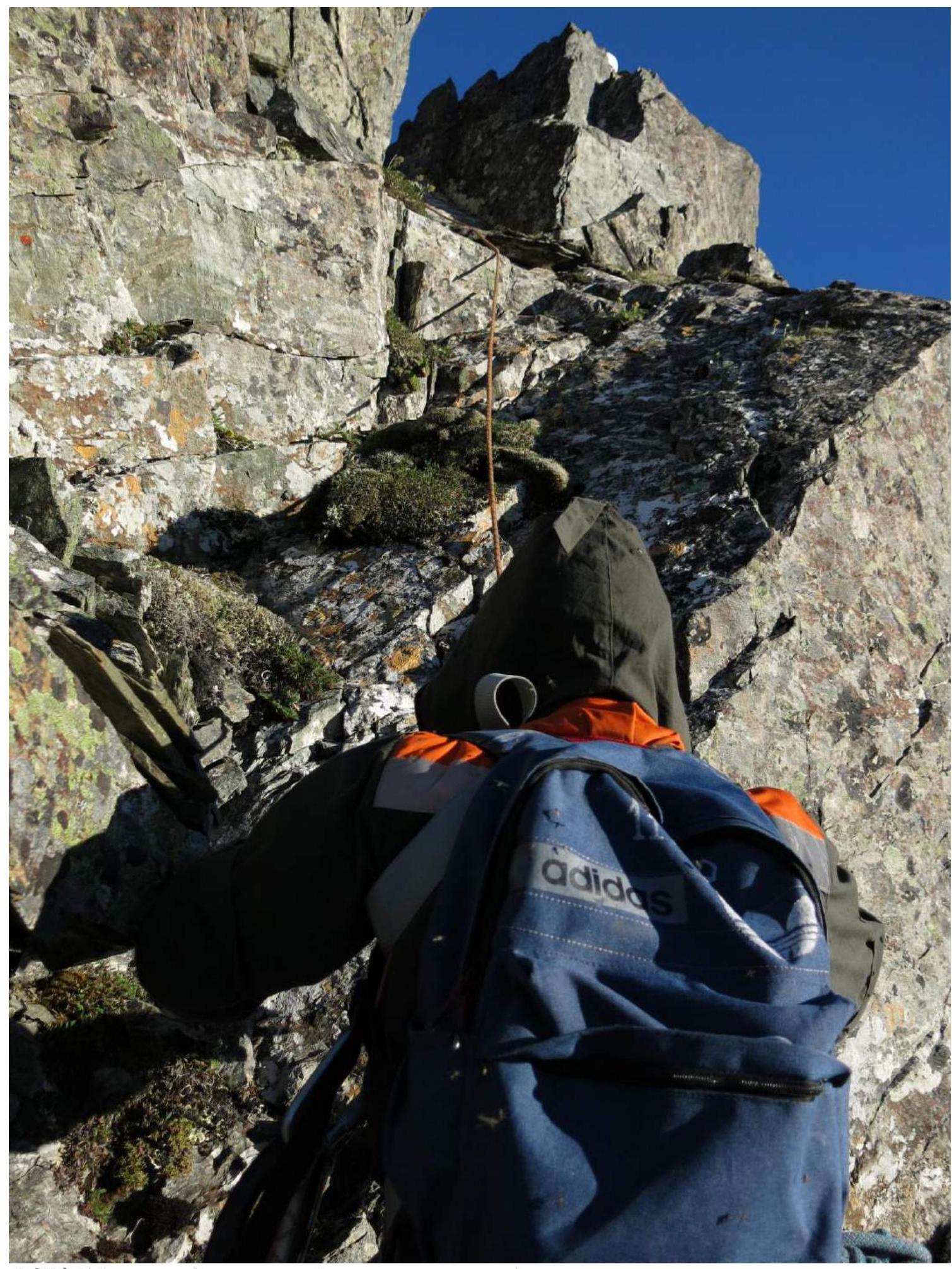
PHOTO №5: Passage of the lower part of the wall between terraces.
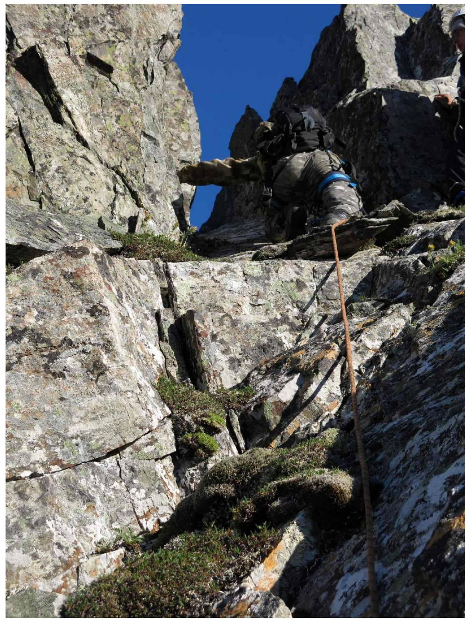
PHOTO №6: Photo of section R5–R6 — passage of the upper part of the wall between terraces.
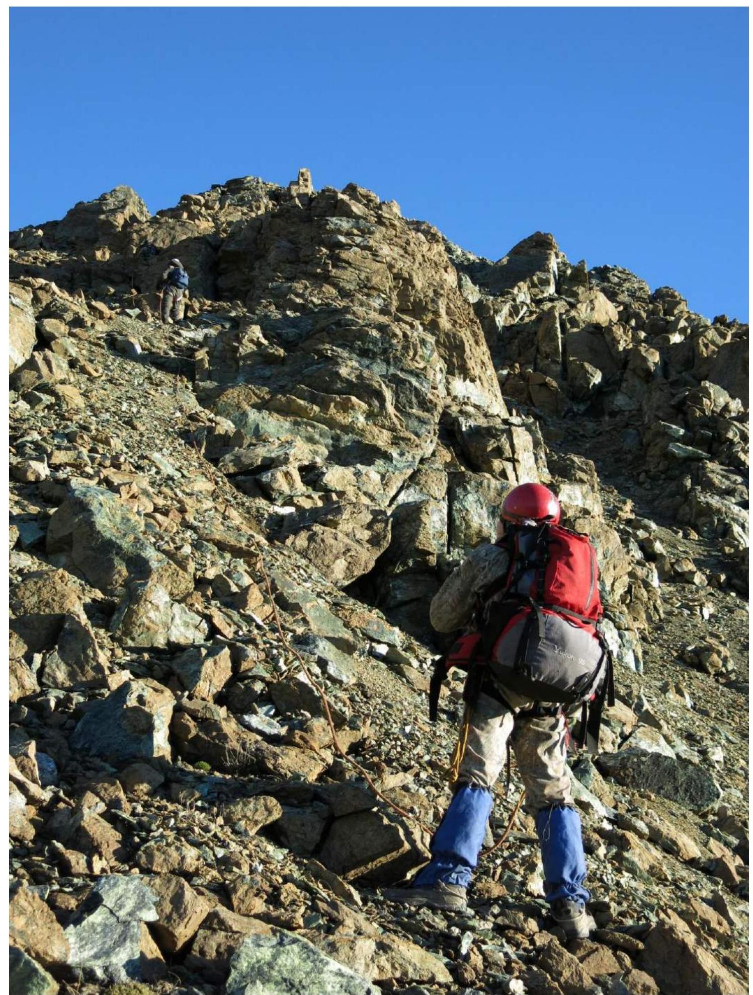
PHOTO №7: Passage of the destroyed large-block ridge of the spur and exit to its junction with the western ridge.

PHOTO №8: Sections R10–R11–R12. Rocky ridge before exiting to the pre-summit. Ascent from the pre-summit to the summit. In the background — peak 1084.2 m (Severny Raiiz).
Conclusion
Excerpt from the Coaching Council Decision of May 9, 2018
on the results of the review of the first ascent of the alpine route to peak 1084.2 (Raiiz Severny). Route: "Along the first northern spur of the western ridge" Category 2B (rocky) (approximately), made within the framework of the alpine competitions: "Third stage of the NP 'Sauk-Pai' Club Cup — 'Raiiz-2018'" (class "First Ascents")
A review was conducted of the first ascent of the alpine route to peak 1084.2 (Raiiz Severny). Route: "Along the first northern spur of the western ridge" Category 2B.
The review of the ascent and the subsequent coaching council were attended by:
- S. V. Zhuravlev (Syktyvkar, CMS, 1st category instructor-methodologist) — senior coach-leader, chief judge of the NP 'Sauk-Pai' Club Cup competitions;
- S. L. Maltsev (Ukhta, 1st sports rank, 2nd category instructor-methodologist in alpine climbing) — deputy chief judge for safety;
- V. A. Toropov (Syktyvkar, 1st sports rank, 3rd category instructor-methodologist in alpine climbing), senior judge-expert in the sports discipline of the "Class of First Ascents" competition;
The route sheet stated an ascent to peak 1084.2 (Raiiz Severny) Category 2B (rocky).
The route was completed within the stated timeframe, without TB violations. As a result of the review, it was determined:
- The team leader's decision to choose the first spur of the northern slope of the western ridge for the first ascent was deemed correct and safest by the coaching council.
- According to the photographs of the technical sections, the diagram compiled by the participants in UIAA symbols with a table of route obstacles, the route corresponds to the technical level of Category 2B (rocky).
Decisions made by the coaching council:
- To credit the team leader with Category 2B, and the participants with participation in Category 2B;
- For the sports team to prepare and submit a report on the first ascent to the FSR classification commission;
- To recommend the route to peak 1084.2 (Raiiz Severny). Route: "Along the first northern spur of the western ridge" Category 2B for inclusion in the KMGV as a rocky route — Category 2A.
The decision was signed by the members of the coaching council. The presence of signatures by S. V. Zhuravlev, S. L. Maltsev, V. A. Toropov is confirmed by the acting director of NP "Sauk-Pai" Club — S. V. Zhuravlev.
Reviews of Independent Experts
I familiarized myself with the "Report on the first ascent of the alpine route to peak 1084.2 (Raiiz Severny). Route: 'Along the first northern spur of the western ridge' Category 2B in the framework of the alpine competitions: 'Third stage of the NP 'Sauk-Pai' Club Cup — 'Raiiz-2018'' (class 'First Ascents') in June — July 2018"
The report is compiled in accordance with the new requirements of the FSR classification commission. The photos and diagrams are clear and of good quality. The quality of the report allows alpine teams to obtain comprehensive information and repeat the route.
An excellent training route in a well-developed area, the technical part at the bottom is convenient for demonstrating the basics of alpine climbing to beginners and signpost climbers, the logical approach, technical work, and exit to the summit from the ridge make this route effective and necessary in the area.
The development of alpine resources in the Ural Federal District, primarily educational and sports routes of 1–3 categories of complexity, allows the development of alpine climbing in the regions.
I recommend including this route in the KMGV in section 8.3 as a standalone rocky route to peak 1084.2 (Raiiz Severny) — Category 2A.
For the classification of the route as Category 2B, the factor of height (presence of hypoxia) is lacking.
Vyacheslav Viktorovich Babkin, CMS, 2nd category instructor-methodologist, Yekaterinburg.
I familiarized myself with the "Report on the first ascent of the alpine route to peak 1084.2 (Raiiz Severny). Route: 'Along the first northern spur of the western ridge' Category 2B in the framework of the alpine competitions: 'Third stage of the NP 'Sauk-Pai' Club Cup — 'Raiiz-2018'' (class 'First Ascents') in June — July 2018"
This route was viewed by me in March 2014 as a potential winter educational and sports route. Due to weather conditions (temperature down to –40°C), the attempt to ascend was abandoned and replaced with a more accessible one.
The report is compiled in accordance with the new requirements of the FSR classification commission. The photos and diagrams are clear and of good quality. The quality of the report allows alpine teams to obtain comprehensive information and repeat the route.
A logical and technically saturated route, allowing for ascents with educational and sports groups NP-2 (Initial Training 2nd year of study ("signpost climbers")) in the mode of a test ascent.
To increase the safety of the route when used for educational purposes, I would recommend drilling the key section with bolt hooks at the most complex sections, as the key is technically more complex than the standard for Category 2 routes.
I recommend including this route in the KMGV in section 8.3 as a standalone rocky route to peak Raiiz Severny — Category 2A.
For the route to be Category 2B, the factor of height is lacking.
Sergei Igorevich Bernatsky, Master of Sports of the USSR, 2nd category instructor-methodologist, Yekaterinburg.