The summit of Erkusei (1098.9 m). Route: via the southwestern wall. Category of difficulty: approximately 2A. Leader: Surovcev V. A. Subpolar Urals, Rosomakha mountain range. Section in KMGV - 8.3. E-mail - mr.zhur1958@mail.ru
Report
On the first ascent of the climbing route to the summit of Erkusei (1098.9 m) via the route: "Along the southwestern wall". Level of difficulty - approximately 2A category of difficulty (Rocky) at the alpine event "Northern Vertical" (a joint project of JSC "Severgaztrans" and NP "Club of Northern Travels 'Sauk-Pai'") 2016, in the class "First ascents".
Region: Northwestern Federal District of the Russian Federation (NWFD), Komi Republic. Mountain country: Subpolar Urals. Valley: Bolbanyu River valley. Ridge: Rosomakha. Summit: Erkusei (1098.9 m). Route: via the southwestern wall. Category of difficulty: approximately 2A. Character of the route: rocky. Prepared by: V.V. Surovcev, Zhuravlev S.V. Date: March 2016.
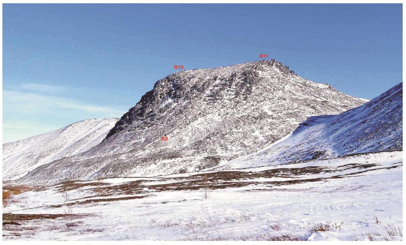
Subpolar Urals. Bolbanyu River valley. Rosomakha ridge. Erkusei mountain (1098.9). Photo of the southwestern wall and southwestern slope from Lake Bolshoe Bolbanty.
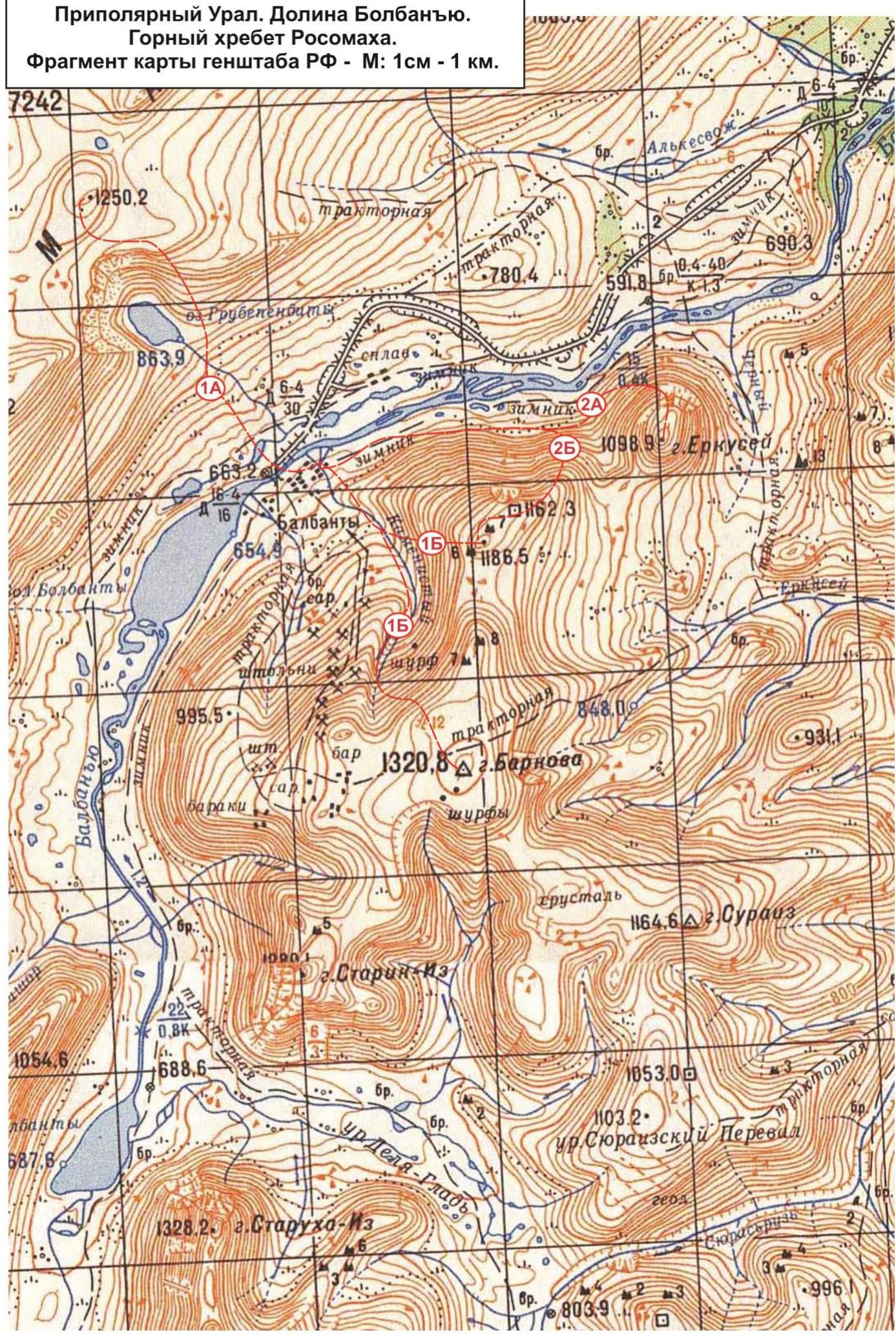
Subpolar Urals. Bolbanyu River valley. Rosomakha mountain range.
Fragment of the General Staff map of the Russian Federation - Scale: 1 cm - 1 km.
Passport
- Section number according to KMGV - 2010 - 8.3. Subpolar Urals, Rosomakha mountain range, Bolbanyu River valley.
- Name of the summit: Erkusei Height: 1098.9 m.
- Route: via the southwestern wall.
- Category of difficulty: proposed 2A category of difficulty.
- Character of the route - rocky.
- Height difference of the route: 435 m.
- Route length: 830 m.
- Length and level of difficulty of technical sections: 1 category of difficulty - 3 sections - 310 m, 2 category of difficulty - 8 sections - 248 m, 3 category of difficulty - 3 sections - 51 m, 4 category of difficulty - 0 sections - 0 m, 5 category of difficulty - 0 sections - 0 m, 6 category of difficulty - 0 sections - 0 m.
- Average steepness: main part of the route - 45°, key section - 65°.
- Pitons used: Total used on the route: rock pitons - 7 pcs, chocks - 23 pcs, stationary pitons - 0, ITC - 0, removable pitons - 0. Left on the route: total - 0; including stationary pitons - 0.
- Departure to the route - 7:00 April 2, 2016. Arrival at the summit - 15:30 April 2, 2016. Return to the base camp - 17:00 April 2, 2016.
- Team's working hours: - 10 hours.
- Leader: Valery Vadimovich Surovcev (Syktyvkar, 2nd sports category, instructor-methodologist of the 3rd category).
Participants
Sergey Tiranov (Syktyvkar, 2nd sports category). Mikhail Kanev (Syktyvkar, 3rd sports category). Mikhail Osipov (Syktyvkar, 3rd sports category).
- Coach: Zhuravlev Sergey Vasilievich (Syktyvkar, CMS, instructor-methodologist of the 1st category).
Description of the summit
The summit of Erkusei is one of the most interesting summits for climbers in the Rosomakha mountain range, located on the territory of the Municipal formation "City District - Inta", in the Komi Republic, in the Northwestern Federal District of the Russian Federation. Geographically - in the central part of the Rosomakha ridge of the Subpolar Urals, in the Bolbanyu River valley. The summit is a pronounced rocky dome with a flat top, steep rocky walls, breaking off to the north, west and northwest. Height - 1098.9 m, plotted on the maps of the General Staff of the Russian Federation. The name is official. The unofficial Russian name is Shaman-gora, due to the fact that Erkusei is part of a group of sacred summits of the Subpolar Urals among the indigenous reindeer herders. At the summit - a cult place of shamanic rituals. Ascending women to the summit is taboo. It is not recommended to take pictures or videos in the background of Erkusei mountain when reindeer herders are present, as such filming is also taboo. One route has been laid and classified to the summit of Erkusei:
- Along the northern wall - 2B category of difficulty (winter). As part of the alpine event "Northern Vertical", a route was passed and classified along the southwestern wall - 2A category of difficulty (rocky).
Description of the route: "Along the southwestern wall" (rocky) 2A category of difficulty.
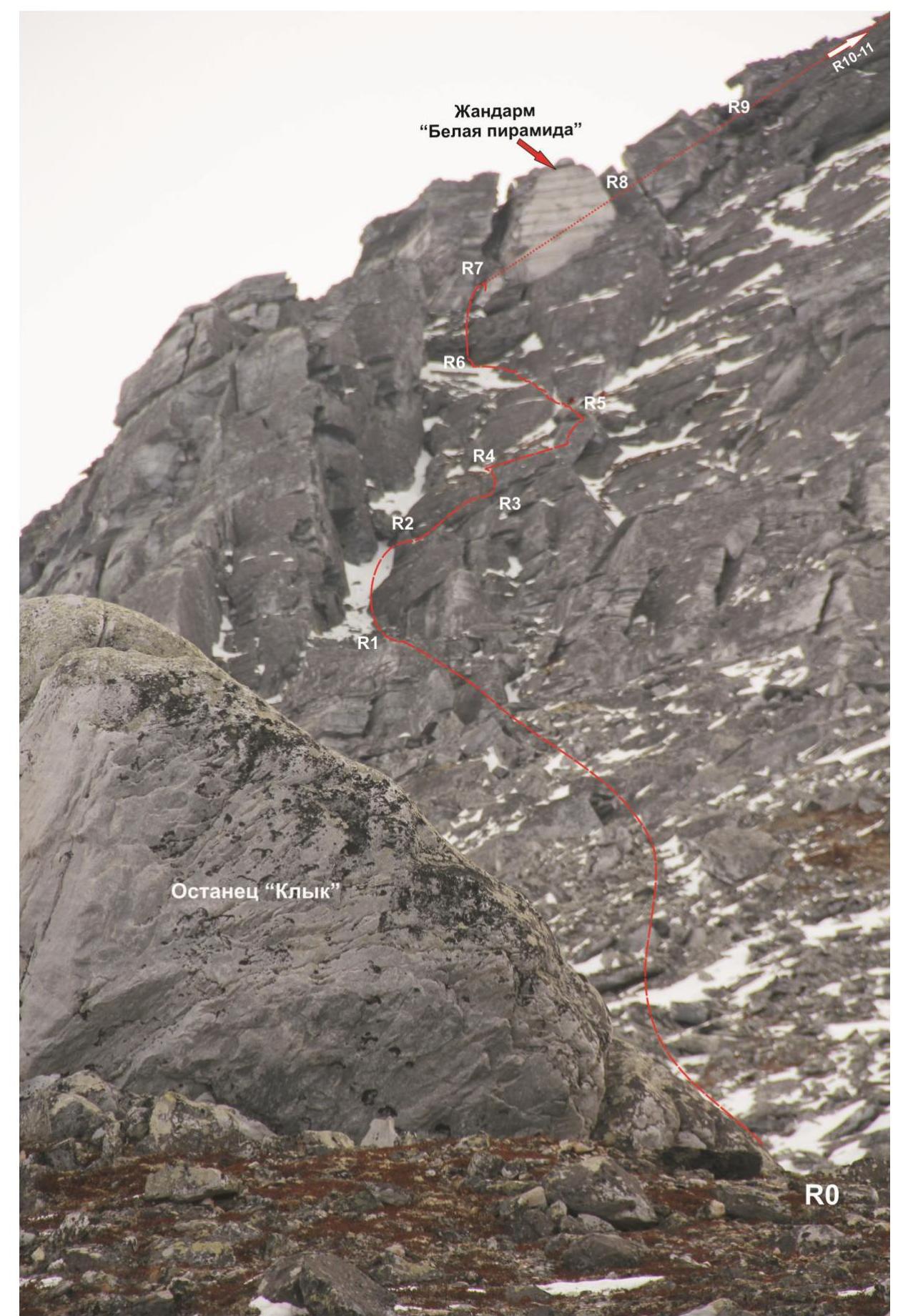
The route: "Along the southwestern wall (rocky)" - a technically complex rocky route, focused on sports groups of climbers (due to the key section with local obstacles of the 3rd category of difficulty), or educational and sports departments, where participants already have experience of ascents of 2A category of difficulty. The route is logical in orientation, the line goes along a pronounced rocky slope from "beacon" to "beacon". Subjectively rockfall-prone.
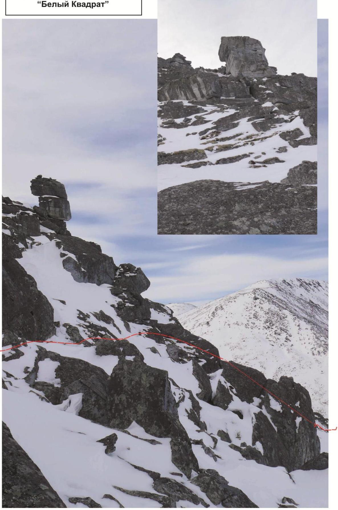
Note: "Beacon - a pronounced natural landmark. There are three such landmarks on the route: Klyk - a rocky remnant on the talus terrace at the beginning of the route, a stone block - "White Square" in the middle part of the route, gendarme "White Pyramid" - in the upper part of the route".
Equipment
For making an ascent as part of a sports group of 4 people on the route, the following special equipment is required:
- personal - standard, crampons and ice axe are mandatory only in winter or in the off-season;
- public: main rope 10 mm - 2 pcs. × 50 m. Chocks - 12 pcs., anchor pitons - 6 pcs., friends - 4 pcs. Quickdraws - 12 pcs. Loops - 6 pcs. Rock hammer - 2 pcs.
Approach
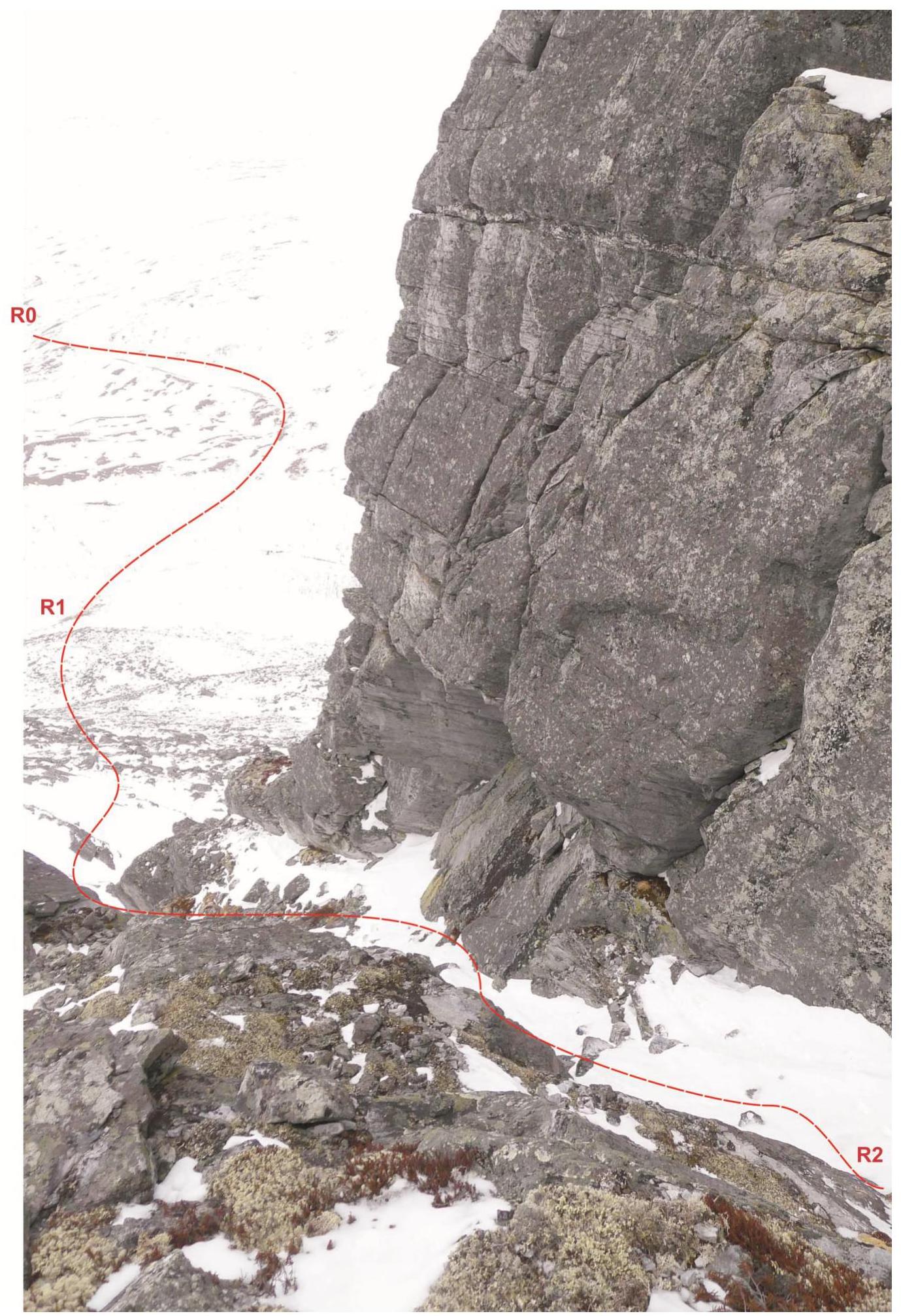
From the Zhelannaya base, go down along the right bank of the Bolbanyu River. On the all-terrain road, approach the talus terrace of the western part of the northern wall (1-1.5 hours). The first landmark - the rocky remnant "Klyk" (R0) is clearly visible against the sky. Climb to it along the talus slope. At the stone remnant, it is convenient to put on harnesses and helmets. Then, along the coarse-block talus, climb under the southwestern wall, to the rocky couloir on the left. Go along the counterforce, then enter the rocky couloir (on the right along the way), turning into an internal angle with stone plugs. It should be bypassed along a series of shelves and internal corners on the right along the way, keeping the stone block "White Square" in sight. Without climbing to the base of the "White Square", exit to a wide talus shelf. On the shelf, it is necessary to rope up - here begins the technical part of the route.
Technical part
Along the shelf, approach the rocky massif to the left and move along a series of small shelves on the left side of the internal angle. On the rocky shoulder - the first control cairn. Then, along the internal angle, approach the talus shelf under the prospect of the stone block "White Square". Here begins the key section of the route.
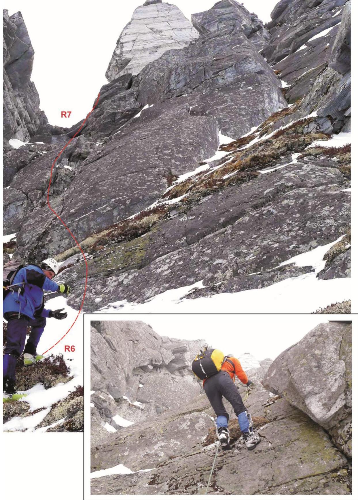
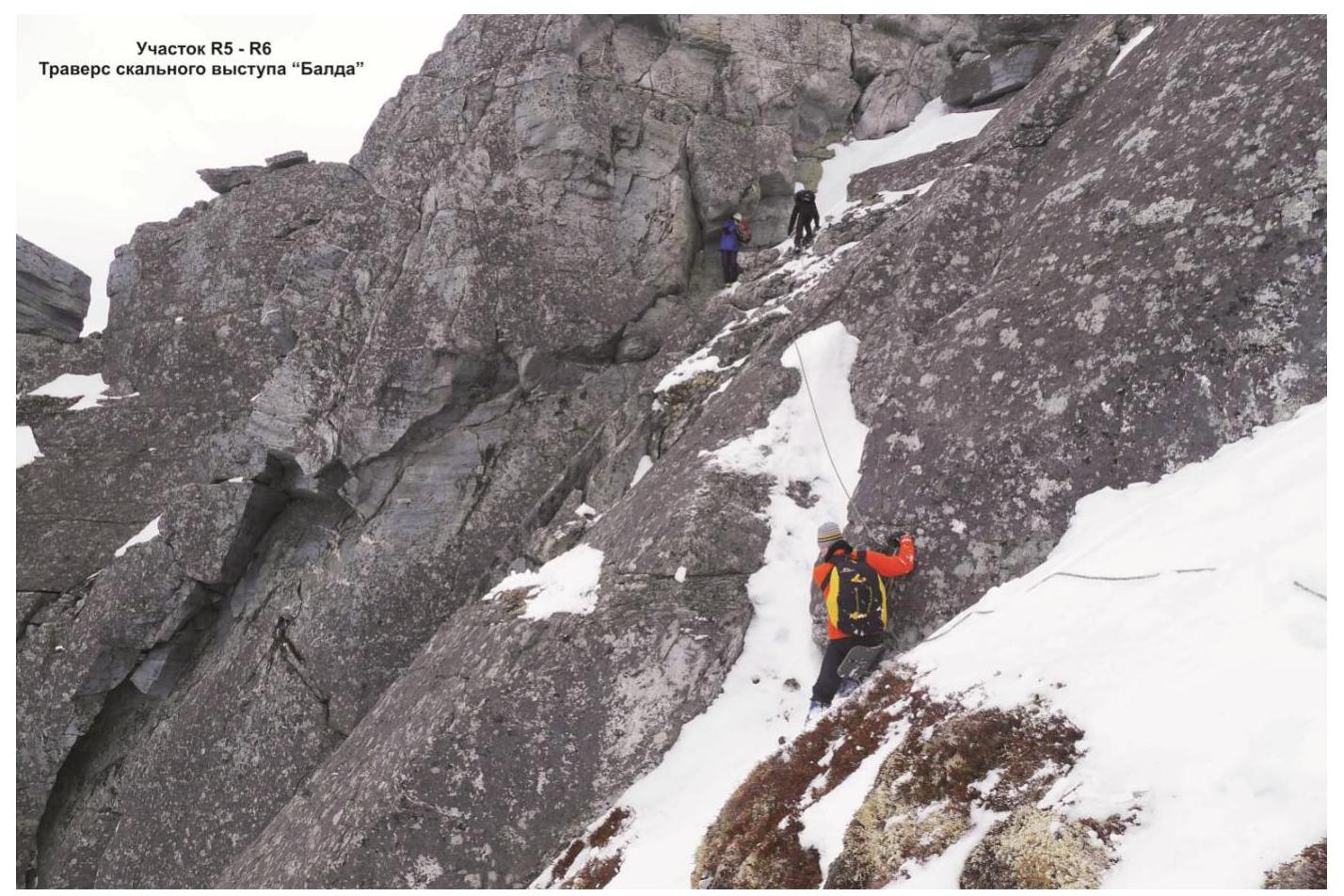
Key sections: Represents a psychologically and technically complex traverse of the rocky massif "Balda". The main psychological difficulty is the lack of microrelief on the smoothed rocks, the technical one - the non-visible bypass of the overhang with the exit to the rocky shelf, the bypass requires a deviation from the wall. Further transition along the slabs under the smoothed inclined rocky slab under the gendarme "White Pyramid". Passing the slab, and then the internal angle, leading to the western counterforce - the second key place of the route. After passing the key sections on the shelf on the ridge of the counterforce - the second control cairn.
- Approach to the key section.
- Passing the key.
Gendarme "White Pyramid"
Further along the monolithic smoothed rocks - a series of inclined smoothed slabs with shelves separating them - exit under the talus dome of Erkusei summit. The coarse-block talus becomes more gentle and turns into a medium-block talus.
Summit
The summit is a rocky remnant on the summit talus plateau, aside from a similar rocky remnant with the remains of pagan shamanic cult rituals.
Descent from the summit
Along the talus plateau of the dome to the east, towards the Barkova mountain. Rocky outcrops are bypassed on the left along the way along the eastern slope of the mountain. Further exit to the pass between Erkusei mountain and Barkova mountain (Northwestern). The descent from the pass along the western slope into the Bolbanyu valley does not present any technical or orientation difficulties.
P.S. The route was passed by three groups:
- Sports group "Spaskomi" led by V. Surovcev (Syktyvkar, 2nd sports category, instructor-methodologist for mountaineering of the 3rd category);
- Expert sports double led by E. Pashuk (Makhachkala, CMS, instructor-methodologist of the 3rd category, head of the alpine event);
- Educational and sports department NP-2 led by A. Goletarov (Inta, 2nd sports category, instructor-methodologist).
The general opinion of the ascent leaders - the route corresponds to the level of 2A category of difficulty (rocky) for sports groups. According to the leader of the expert ascent - for use in educational and sports purposes on a complex traverse, it is necessary to create a permanent point of intermediate belay (anchor), until the installation of a stationary belay point - to refrain from releasing educational and sports departments NP-2, which do not have experience of ascents on rocky routes of 2A category of difficulty.
Route analogues: Trapezia along the NW edge - 2A category of difficulty (Kabardino-Balkaria, Adyl-Su gorge); Kaydzhan (N) along the N ridge 2A category of difficulty (North Ossetia, Kaydzhan gorge).
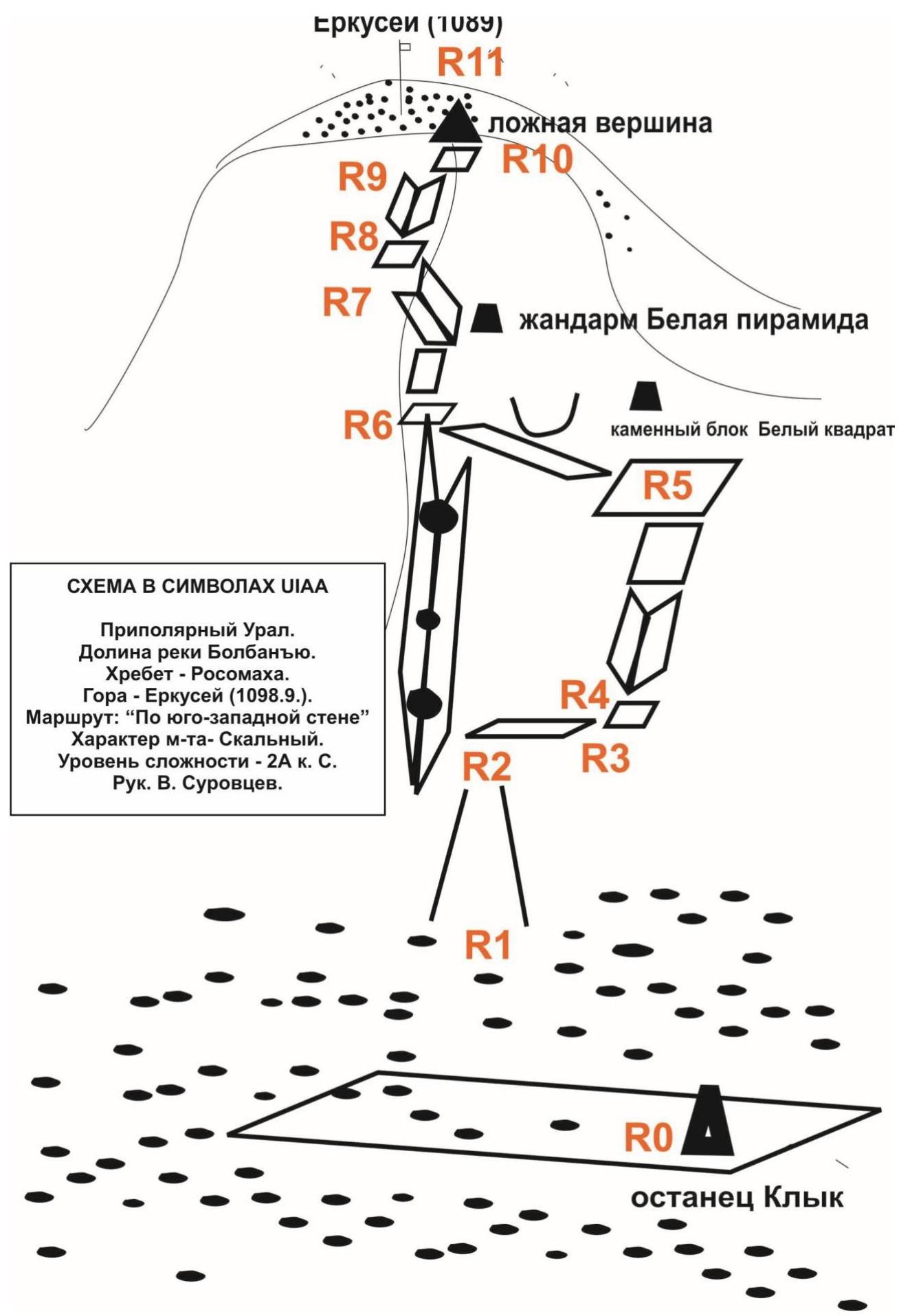
Subpolar Urals. Bolbanyu River valley. Erkusei summit (1098.9 m). Route: "Along the southwestern wall". Level of difficulty: 2A category of difficulty (winter) approximately. Table of natural obstacles.
| № участка | Протяженность | Крутизна | Характер рельефа | Кат. сл. | Кол-во Кр./закл. (шт.) |
|---|---|---|---|---|---|
| ПОДХОД | От базы «Желанная» по правому берегу р. Болбанъю до каменного останца «Клык» занимает 1–1,5 ч. | ||||
| R0 | Скальный останец «Клык» расположен на осыпной террасе у подножия горы Еркусей под юго-западной стеной скального массива. | ||||
| R0–R1 Подъём под юго-западную стену г. Еркусей | 200 м | 25°–30° | Осыпной крупноблочный склон | н/к | 0 / 0 |
| R1–R2 Вход в кулуар, переходящий во внутренний угол. Траверс к выраженному ориентиру — каменный блок — «Белый квадрат» | 60 м | 45° | Заснеженный скальный кулуар, внутренний угол с пробкой | 1 | 0 / 0 |
| R2–R3 Выход на полку с контрольным туром на плече западного контрфорса | 60 м | 60° | Скалы — монолит, наклонные плиты | 2 | 2 / 2 |
| R3–R4 Прохождение внутреннего угла | 30 м | 50° | Скалы — монолит, внутренний угол | 2 | 0 / 4 |
| R4–R5 Прохождение ключа маршрута (удобные отщепы справа) | |||||
| І участок | 8 м | 15° | Наклонная полка | 2 | 0 / 2 |
| ІІ участок | 4 м | 70° | Внутренний угол (1-й участок ключа маршрута) | 3 | 0 / 2 |
| ІІІ участок | 44 м | 50° | Скалы — монолит, плиты | 3 | 2 / 6 |
| R5–R6 Траверс влево к началу внутреннего угла под жандармом «Белая пирамида» | |||||
| І участок | 10 м | Осыпные полки | 2 | 0 / 0 | |
| ІІ участок | 5 м | 70° | Нависающая скала — монолит (2-й участок ключа маршрута) | 3 | 0 / 0 |
| ІІІ участок | 30 м | 60° | Разрушенные осыпные полки | 2 | 0 / 0 |
| R6–R7 Подъём по внутреннему углу к жандарму «Белая пирамида» (слева по ходу) | |||||
| І участок | 40 м | 70° | Разрушенные скалы | 2 | 0 / 0 |
| ІІ участок | 20 м | 60° | Наклонные плиты (камнеопасность!) | 2 | 0 / 2 |
| R7–R8 Выход на слабовыраженный гребень контрфорса | 50 м | 50° | Скалы — монолит, наклонная плита | 2 | 3 / 2 |
| R8–R9 Подъём по гребню контрфорса | 20 м | 60° | Внутренний угол (на полке — 2-й контрольный тур) | 3 | 0 / 3 |
| R9–R10 Выход на ложную вершину | 100 м | 45° | Осыпные плиты | 1 | 0 / 0 |
| R10–R11 Подъём по осыпному склону | 150 м | 10° | Крупная, среднеблочная осыпь | 1 | 0 / 0 |
| R11 Вершина г. Еркусей (1098,9 м) | Вершина хорошо выражена навалом крупных камней. Размещение группы восходителей проблем не вызывает | ||||
| СПУСК | Спуск по некатегорийному южному гребню в сторону горы Баркова до перевала (Обход скальных выходов слева по ходу (по восточному склону)). С перевала — по западному кулуару в долину Болбанъю. |
Total
Route length - 830 m. Height difference - 435 m. Average steepness: total route - 45°, technically complex sections - 65°.
Character of the relief - rocky. Technical sections:
- 1 category of difficulty - 3 sections - 310 m
- 2 category of difficulty - 8 sections - 248 m
- 3 category of difficulty - 3 sections - 51 m
- 4 category of difficulty - 0 sections - 0 m
- 5 category of difficulty - 0 sections - 0 m
- 6 category of difficulty - 0 sections - 0 m
Pitons and chocks used: 7/23 pcs. Pitons and chocks left: 0/0 pcs.
Photopoint "Klyk"
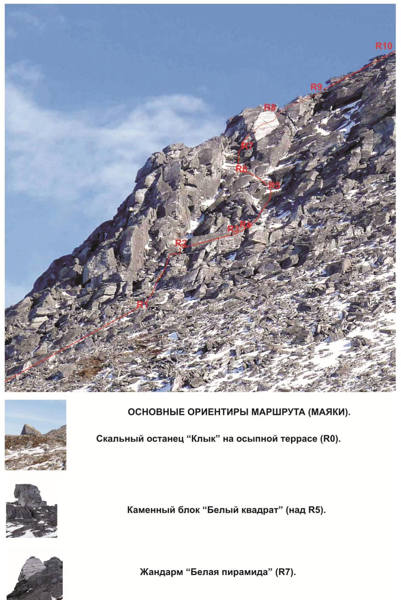
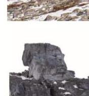
MAIN ORIENTATION POINTS OF THE ROUTE (BEACONS). Rocky remnant "Klyk" on the talus terrace (R0).
Stone block "White Square" (above R5).
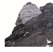
Gendarme "White Pyramid" (R7).
 Landmark - stone block "White Square"
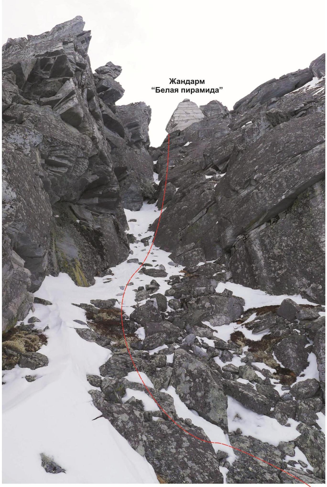 "White Pyramid". Subpolar Urals. Bolbanyu River valley. Rosomakha ridge. Erkusei summit (1098.9 m). April 2016.
Group of first ascenders of the route: "Along the western counterforce of the northern wall" - 2A category of difficulty (rocky)
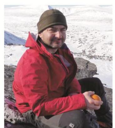
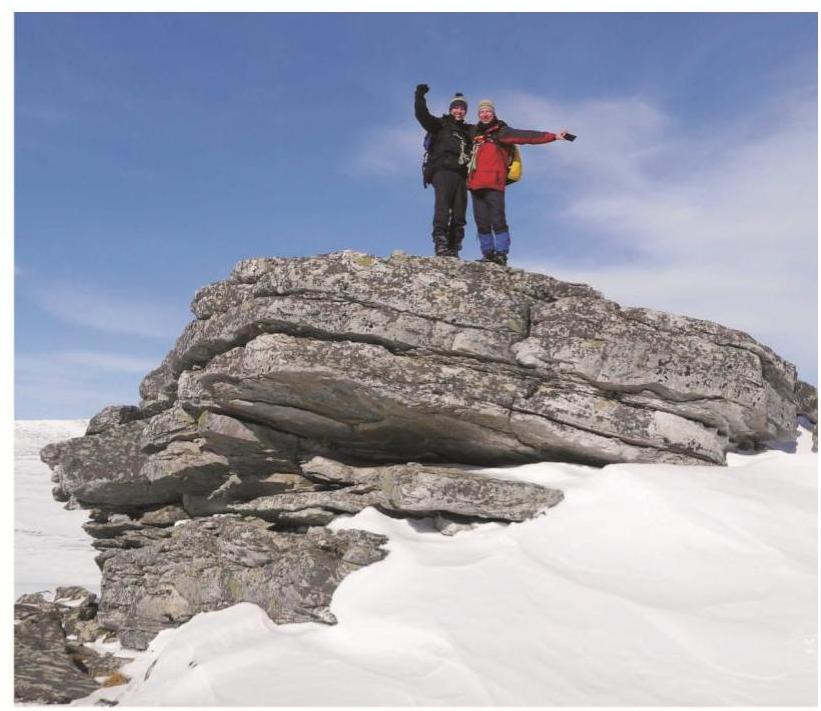
Surovcev Valery Aleksandrovich: Syktyvkar, 2nd sports category, instructor-methodologist of the 3rd category. Climbing experience - 4A category of difficulty. First ascent experience - 2A category of difficulty.
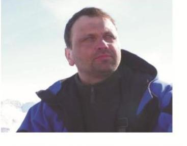
Tiranov Sergey Yurievich: Syktyvkar, 2nd sports category, rescuer of the 1st category. Climbing experience - 3B category of difficulty. First ascent experience - 2A category of difficulty.
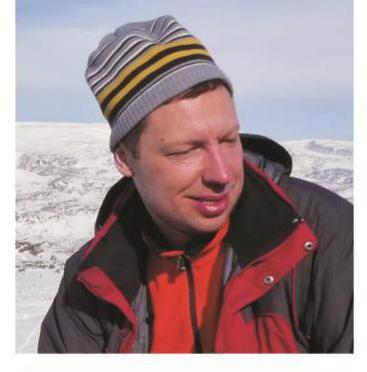
Osipov Mikhail Valerievich: Syktyvkar, 3rd sports category. Climbing experience - 2B category of difficulty. First ascent experience - none.
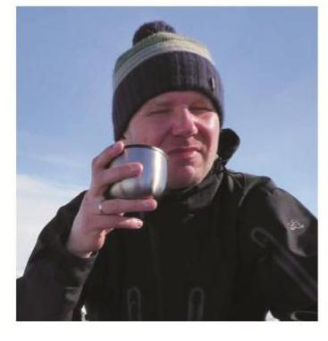
Kanev Mikhail Vladimirovich: Syktyvkar, 3rd sports category. Climbing experience - 2B category of difficulty. First ascent experience - none.