Barkova Northwest peak (1186.5)
Route: via the 2nd buttress of the northern slope
Difficulty: approx. 2B
Leader: Sergey L. Maltsev
Subpolar Urals, Rosomakha mountain range
Section in KMGV — 8.3.
E-mail — mr.zhur1958@mail.ru
Report
On the first ascent of the mountaineering route to the summit Gora Barkova Northwest (1186.5) via "the 2nd buttress of the northern slope". The level of complexity is approximately 2B category (rocky) at the alpine event "Severnaya Vertikal" (a joint project of JSC "Severgaztrans" and NP "Club of Northern Travels 'Sauk-Pai'") in 2016 (Class "First Ascent").
Region: Northwestern Federal District of the Russian Federation, Komi Republic Mountain country: Subpolar Urals Gorge: Bolbanyu River valley Range: Rosomakha Peak: Barkova Northwest (1186.5 m) Route: via the 2nd buttress of the northern slope Category of difficulty: approximately 2B Route type: rocky
Prepared by: S.L. Maltsev, S.V. Zhuravlev March 2016
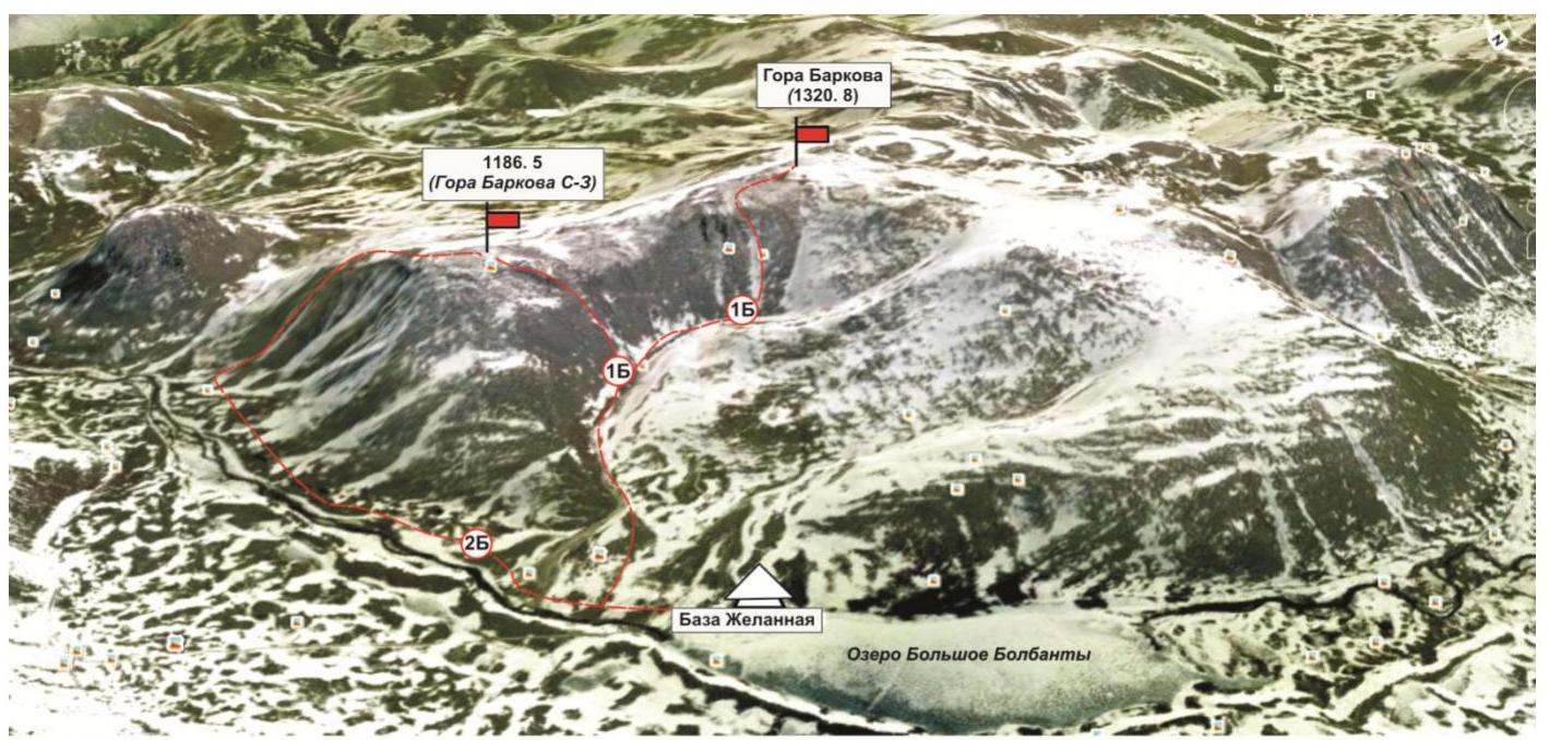
Overview photo from a satellite with the peaks of Gora Barkova and the lines of mountaineering routes mastered in March-April 2016:
- Gora Barkova (NW) — "via the 2nd buttress of the northern slope" — 2B category (rocky).
- Gora Barkova (NW) — "via the southwestern edge" — 1B category (rocky).
- Gora Barkova — "via the central couloir of the western slope" — 1Bz (snow-ice).
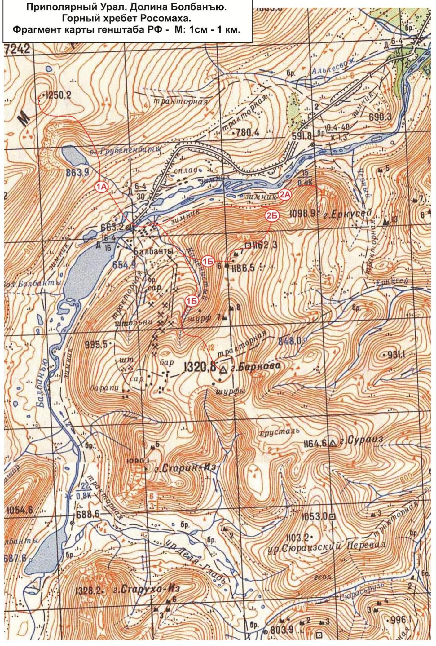
Subpolar Urals. Bolbanyu valley. Rosomakha mountain range. Fragment of the map of the General Staff of the Russian Federation — M: 1 cm – 1 km.
Passport
- Section number according to KMGV — 2010 — 8.3.
Subpolar Urals, Rosomakha mountain range, Bolbanyu River valley.
- Name of the peak: Barkova Gora (Northwest)
height: 1186.5 m
- Route: via the 2nd buttress of the northern slope.
- Category of difficulty: proposed 2B category.
- Route type: rocky.
- Height difference of the route: 530 m
- Route length: 1020 m
- Length and level of complexity of technical sections:
Technical sections:
- 1 category — 2 sections — 450 m
- 2 category — 3 sections — 400 m
- 3 category — 1 section — 120 m
- 4 category — 0 sections — 0 m
- 5 category — 0 sections — 0 m
- 6 category — 0 sections — 0 m
- Average steepness: main part of the route — 30°. Crux — 65°.
- Number of pitons used:
Total used on the route: rock pitons — 4 pcs., chocks — 28 pcs., stationary bolt hanger — 0, ITO — 0, removable bolts — 0. Left "pitons" on the route: total — 0; including bolt hangers — 0.
- Exit to the route — 08:00, April 3, 2016.
Reached the summit — 15:30, April 3, 2016. Returned to the base camp — 19:00, April 3, 2016.
- Team's walking hours: — 11 hours.
- Leader: Sergey Leonidovich Maltsev (Ukhta, 1st sports category, instructor-methodologist of the 2nd category).
Participants: V. Schastlivtsev (Babaevo, Vologda region, 3rd sports category)
- Coach: Sergey Vasilyevich Zhuravlev (Syktyvkar, Candidate for Master of Sports, instructor-methodologist of the 1st category).
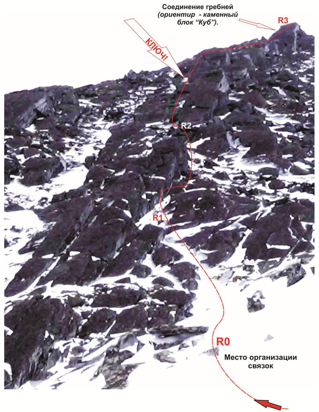
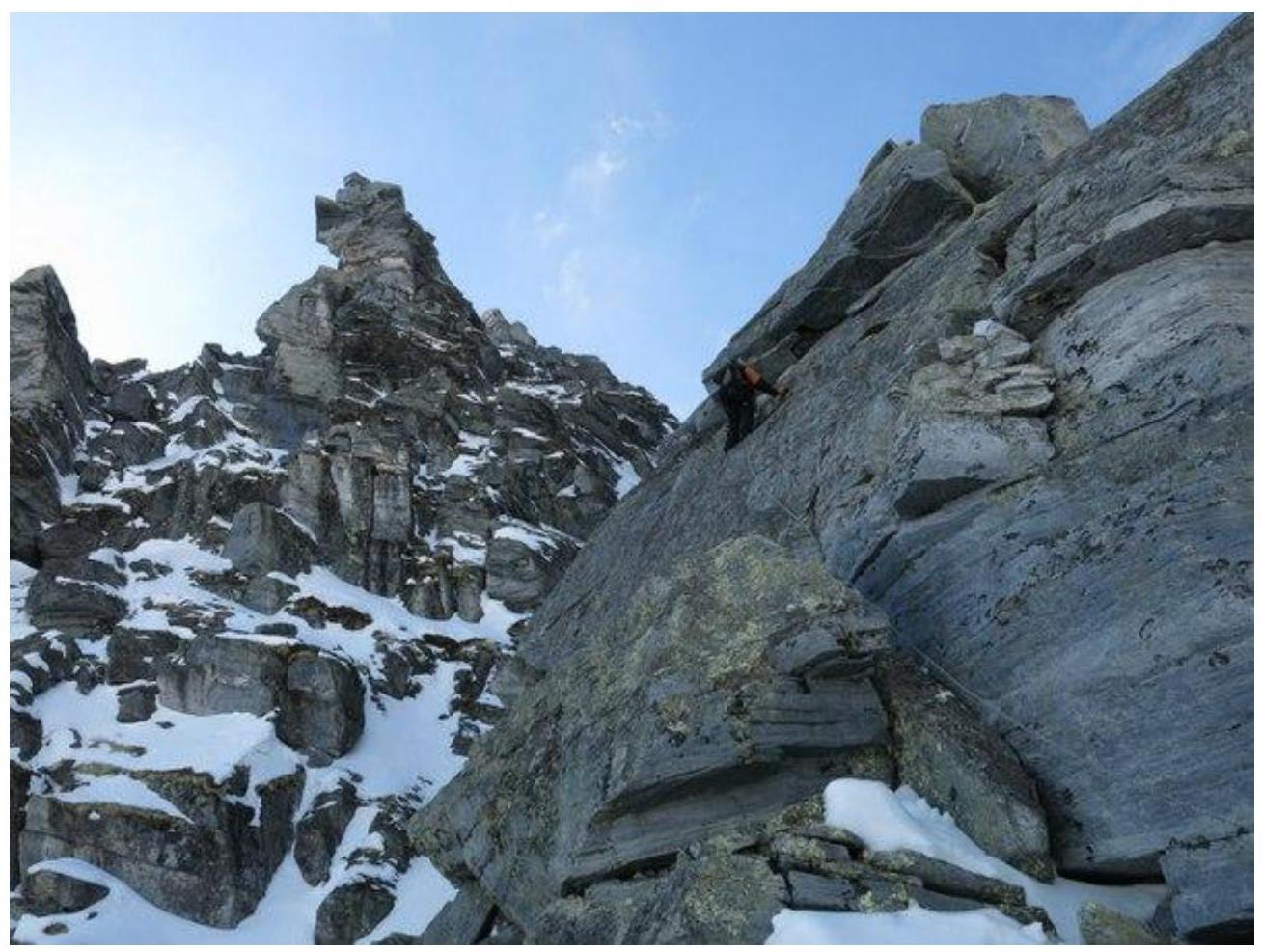
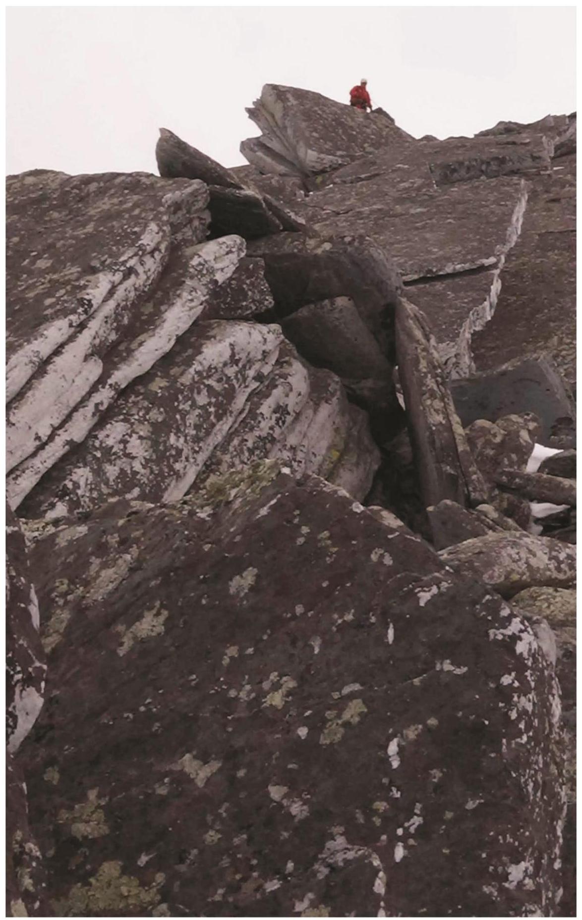
Subpolar Urals. Bolbanyu River valley. Rosomakha range. Gora Barkova (Northwest). Route "via the 2nd buttress of the northern slope" — approximately 2B category. Technical photo of the most difficult part of the route.
Description of the peak
Gora Barkova is one of the peaks of the Rosomakha mountain range, located in the Northwestern Federal District of the Russian Federation, in the Komi Republic, on the territory of the Municipal Formation "City District — Inta". Geographically — in the central part of the Rosomakha range of the Subpolar Urals, in the Bolbanyu River valley. Gora Barkova is a table mountain with two peaks marked on the General Staff map. The main peak of Gora Barkova is a dome-shaped elevation on a vast plateau of the table mountain.
The northwest peak (without an official name) is a destroyed, scree-covered dome, to which rocky buttresses lead from the north, northwest, and west, and on the east — a gentle slope, after a small depression (–100 m), turning into the plateau of the main peak.
The height of the main peak of Gora Barkova is 1320.8 m, the northwest peak — 1186.5 m.
The name of the mountain is official, given in honor of the famous Russian geographer A.S. Barkov.
The mountaineering interest on the main peak of Gora Barkova is represented by routes from the valley of the Kamenskiy stream along the rocky slope of the western cirque, as well as rocky buttresses leading to the northwest peak of Gora Barkova from the south and north.
As part of the "Severnaya Vertikal" alpine event, the following routes were traversed and classified:
- Barkova Main — "via the central couloir of the western slope" — approximately 1Bz (snow-ice).
- Barkova (NW) — "via the southwestern edge" — approximately 1B category (rocky).
- Barkova (NW) — "via the 2nd buttress of the northern slope" — approximately 2B category (rocky)
Description of the route: Barkova (NW) — "via the 2nd buttress of the northern slope" — approximately 2B category (rocky)
The route "via the 2nd buttress of the northern slope" is a logical, rocky route, oriented towards the training and sports divisions of climbers undergoing training under the programs of Initial Training of the second year of study — NP-2. The route allows to fully work out:
- the technique of movement on rocky terrain,
- methods of belaying and self-belaying.
The route is logical in orientation, the line goes along the rocky ridge of the pronounced buttress. The route is objectively safe.
Equipment
To accomplish the ascent as part of a sports group of 6 people on the route, the following special equipment is necessary:
personal — standard (crampons and ice axe are mandatory in winter). communal: main rope 10 mm — 2 pcs. × 50 m. Chocks — 12 pcs., Quickdraws — 8 pcs., Loops — 6 pcs., Rock pitons — 4 pcs., Rock hammer — 1 pc., Ice axe — 1 pc.
Approach
From the Zhelannaya base, go downstream along the Bolbanyu River along the right bank to the gully leading to the pass between the peaks of Erkusei and Gora Barkova. Then up the gully to the base of the second rocky buttress. At the base of the buttress, organize rope teams.
Technical part
Then, to the right, along the pronounced rocky couloir in the lower part of the buttress, ascend to the ridge of the buttress and move along the ridge. The ridge is composed of inclined slabs of varying steepness. Movement is mostly alternate. The slabs alternate with inclined ledges.
For intermediate points and organization of belay stations, the following are actively used:
- large ledges on the ridge;
- massive rock outcrops of feather-like shape.
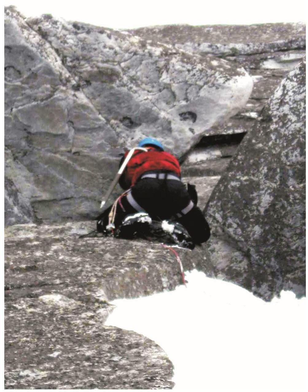
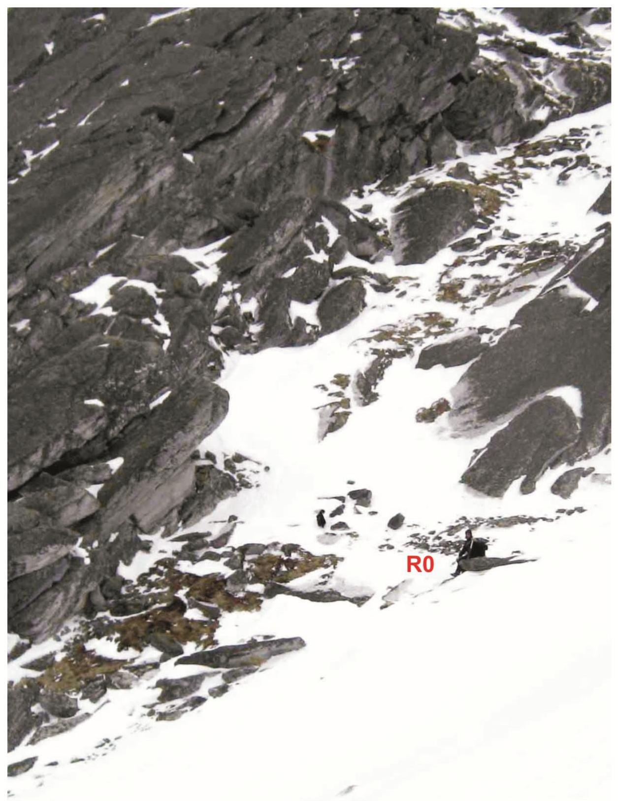
Crux: The section of smoothed slabs ("Two slabs") in the middle part of the ridge is the crux of the route. With an average steepness, the passage of this section requires stable skills when moving on complex rocks.
The entire section is traversed in balance, with handholds from below.
Subpolar Urals. Bolbanyu River valley. Rosomakha range. Gora Barkova (Northwest). Route "via the 2nd buttress of the northern slope" — approximately 2B category. Section R2–R3. Passage of the crux — the "Two slabs" section.
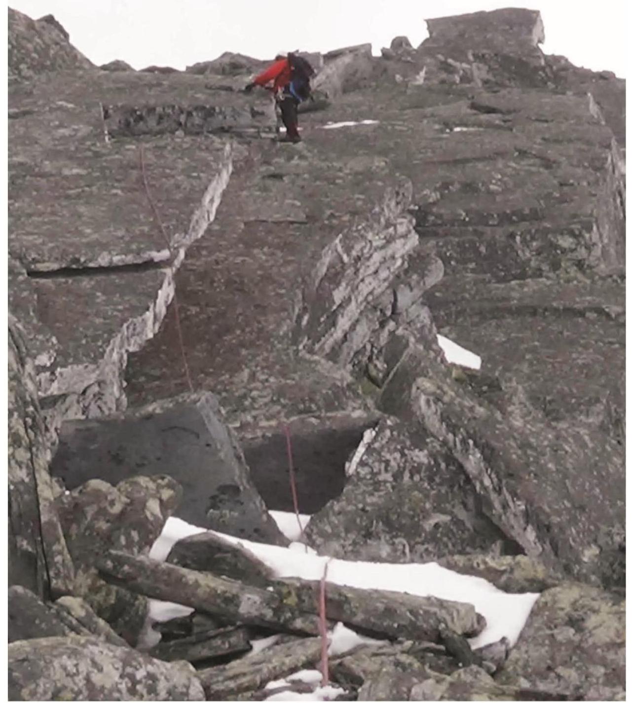
In the photo: passage of the upper part of the crux — the second slab. After passing the crux — movement along a long ridge of medium difficulty with alternate belaying to the junction of two rocky buttresses at a large stone block "Kub". Then along the ridge — movement on a shortened rope along a simple rocky ridge to the "Acula" pinnacle. Under the "Acula" pinnacle — a control cairn. Further, the route is not technically difficult. The ridge becomes more gentle and leads to the pre-summit scree plateau. The ascent to the scree-covered summit dome is carried out along a non-categorized scree slope in the direction of a rocky remnant of large fragmentary material.
Summit
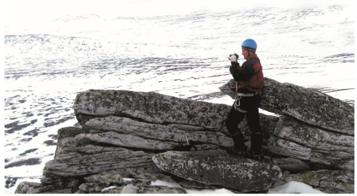
The summit is a dome with a pileup of large stone blocks. A benchmark sign of the geodetic network of the Russian Federation is installed on the summit.
Descent from the summit
Along the non-categorized western slope into the Bolbanyu River valley, then, after descending into the valley, return to the Zhelannaya base upstream along the river.
Classified analogues of the route
- VMF via the W buttress — 2B category (Kabardino-Balkar Republic, Caucasus, Adyrsu gorge).
- Tsiti (3) from the Midagrabin glacier — 2B category (North Ossetia, Caucasus, Midagrabin glacier horseshoe).
- Gora Karpinsky via the NW buttress — 2B category winter (Komi Republic, Subpolar Urals, Bolbanyu River valley).
Subpolar Urals. Bolbanyu valley. Barkova Northwest peak (1186.5). Route: "via the 2nd buttress of the northern slope". Level of complexity: 2B category (rocky) approximately. Table of natural obstacles.
| № section | Length (m) | Steepness | Character of relief | Category | Number of Pitons/Chocks (pcs.) |
|---|---|---|---|---|---|
| APPROACH | From the "Zhelannaya" base along the Bolbanyu River valley to the gully leading to the pass between the peaks Erkusei and Gora Barkova (NW). Then up the gully to the base of the second rocky buttress of the northern slope, to the start of the route — 1.5 hours | ||||
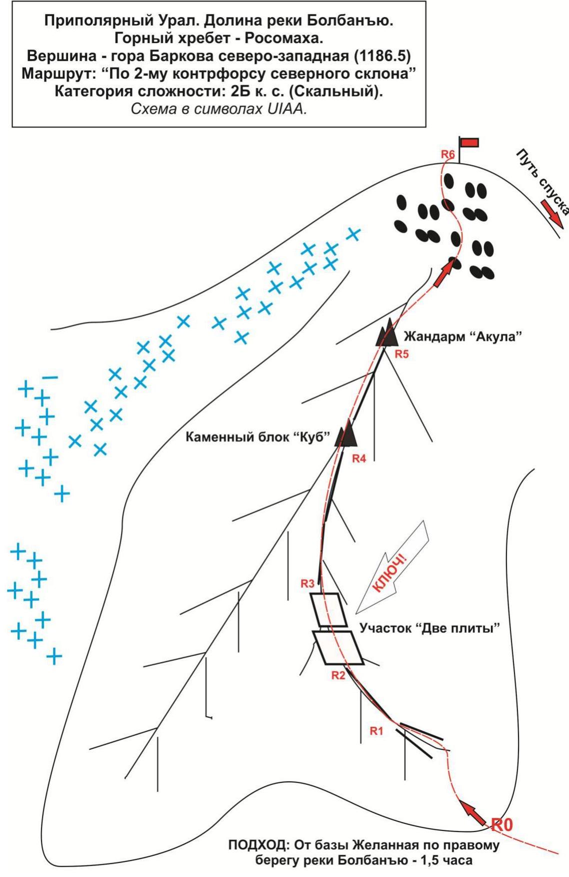
| R0 | Base of the buttress. To the right along the path — entrance to the rocky couloir. | ||||
| R0–R1 Ascent along the rocky couloir to the rocky ridge of the buttress | 150 | 20–25° | Rocky couloir | 1 | 0 / 0 |
| R1–R2 Approach along the ridge to the crux "Two slabs" | 50 | 45° | Rocky ridge | 2 | 0 / 4 |
| R2–R3 Passage of the crux "Two slabs" | 120 | 65° | Rocks-monolith, smoothed slabs. In the center — a ledge, convenient for belaying | 3 | 2 / 10 |
| R3–R4. Passage along the ridge to the junction of two buttresses (landmark — stone | 200 | 35° | Rocks-monolith, slabs | 2 | 0 / 8 |
| R4–R5. Exit to the pre-summit to the "Acula" pinnacle (Control cairn!) | 150 | 35° | Rocks-monolith, slabs | 2 | 0 / 6 |
| R5–R6. Exit to the summit along the scree-covered slope | 300 | 20–25° | Scree slope | 1, n/k | 0 / 0 |
| R6. Summit Gora Barkova (NW) (1186.5) | The summit is expressed by a pileup of large stones. Accommodation for the group of climbers presents no problems. | ||||
| DESCENT | Descent along the non-categorized western slope to the Zhelannaya base. |
Route length — 1020 m. Height difference — 530 m. Average steepness:
- total route — 30°,
- crux — 65°.
Relief type — rocky
Technical sections:
- 1 category — 2 sections — 450 m
- 2 category — 3 sections — 400 m
- 3 category — 1 section — 120 m
- 4 category — 0 sections — 0 m
- 5 category — 0 sections — 0 m
- 6 category — 0 sections — 0 m
Pitons and chocks used: 4 / 28 pcs.
Pitons and chocks left: 0 / 0 pcs.
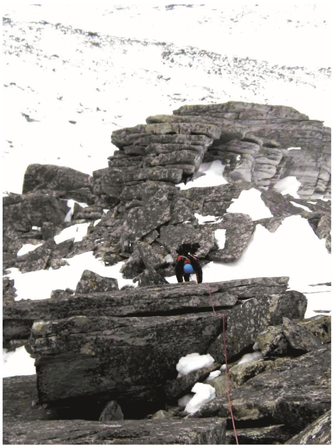
Subpolar Urals. Bolbanyu River valley. Rosomakha range. Gora Barkova (Northwest). Route "via the 2nd buttress of the northern slope" — approximately 2B category. Start of the route. Place of organizing rope teams at the beginning of the rocky couloir, leading to the ridge, in the right part of the buttress.
Subpolar Urals. Bolbanyu River valley. Rosomakha range. Gora Barkova (Northwest). Route "via the 2nd buttress of the northern slope" — approximately 2B category.
Section R0–R1: Ascent along the ridge of the buttress under the crux.
Subpolar Urals. Bolbanyu River valley. Rosomakha range. Gora Barkova (Northwest). Route "via the 2nd buttress of the northern slope" — approximately 2B category. Section R3–R4. Passage along the ridge to the stone block "Kub".
Subpolar Urals. Bolbanyu River valley. Rosomakha range. Gora Barkova (Northwest). Route "via the 2nd buttress of the northern slope" — approximately 2B category. Section R3–R4. Passage along the ridge to the stone block "Kub".
Summit 1186.5 — Gora Barkova Northwest.
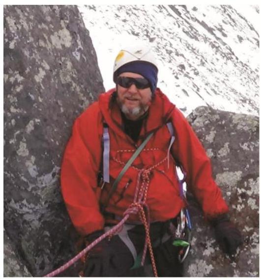
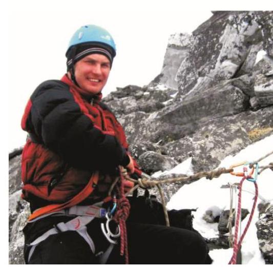
S.L. Maltsev (Ukhta, 1st sports category, instructor-methodologist of the 2nd category). Climbing experience — 5A category. First ascent experience — 3A category.
V.S. Schastlivtsev (Babaevo, Vologda region, 3rd sports category). Climbing experience — 2B category. First ascent experience — 1B category.