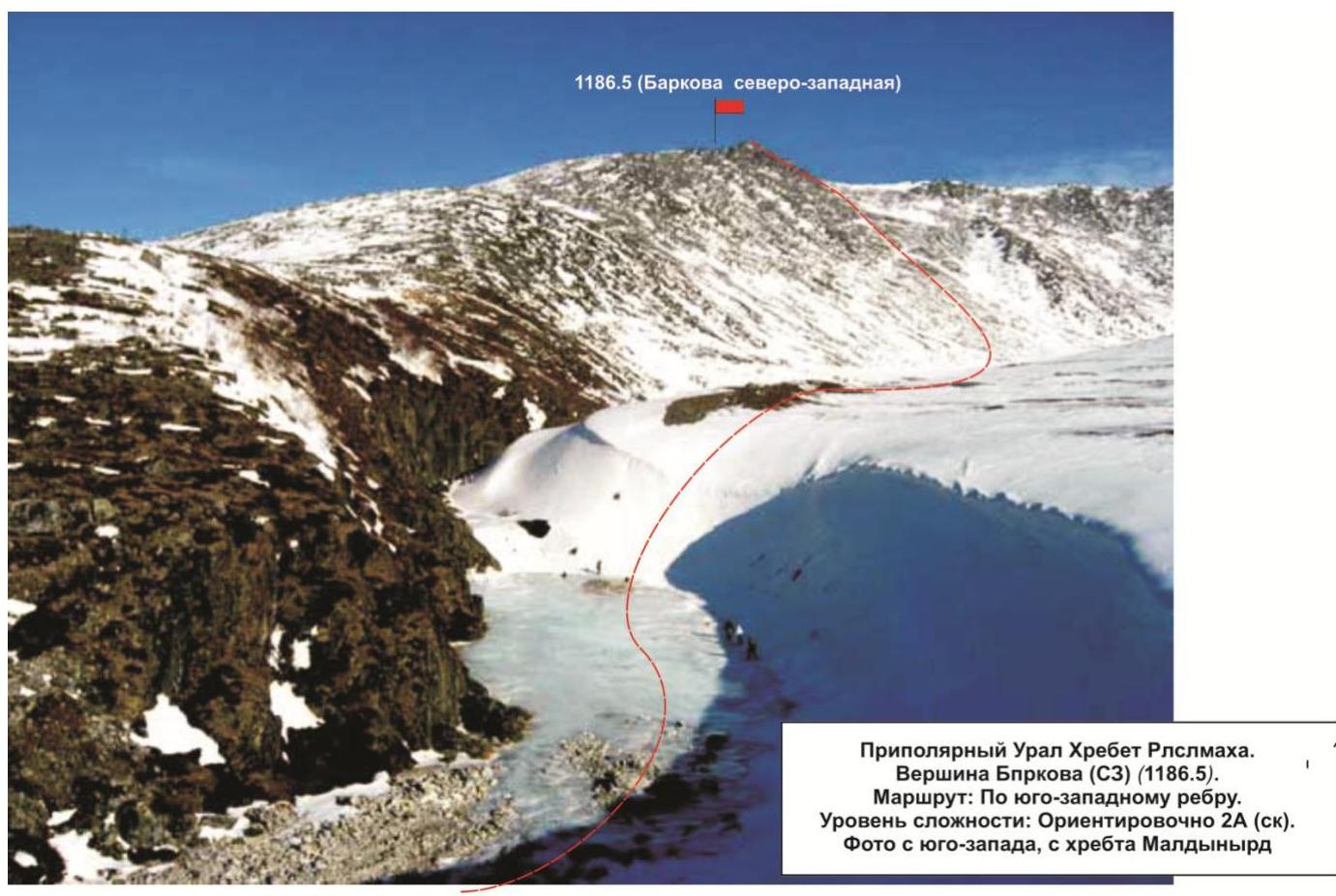
Barkova North-Western peak (1186.5) Route: via the south-western edge Appr. cat. of difficulty: 1B Leader: Maltsev S. L. Subpolar Urals, Rosomakha mountain range Section in CMGA — 8.3 E-mail — mr.zhur1958@mail.ru
Report
On the first ascent of the mountaineering route to the summit Gora Barkova North-Western (1186.5) via "Southwestern edge"
- Difficulty level - approximately 1B category of difficulty (rocky)
- Event - mountaineering event "Severnaya Vertikal"
- Project - a joint project of JSC "Severgaztrans" and NP "Club of Northern Travels "Sauk-Pai"" 2016
- Class - "First ascents"
Region: Northwestern Federal District of the Russian Federation, Komi Republic Mountain country: Subpolar Urals Gorge: Bolbanyu river valley Mountain range: Rosomakha Summit: Gora Barkova North-Western (1186.5) Route: via the south-western edge Category of difficulty: approximately 1B category of difficulty Route type: rocky Prepared by: Maltsev S. L., Zhuravlev S. V. March 2016
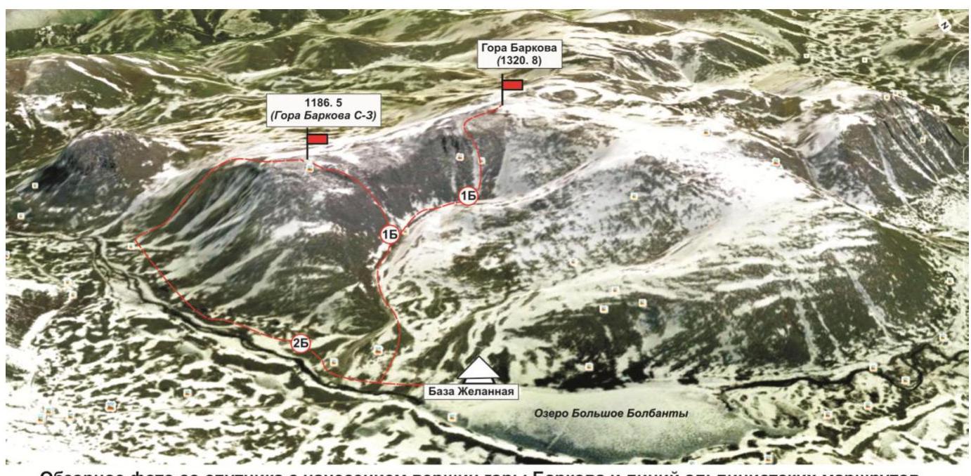
Overview photo from a satellite with the peaks of Gora Barkova and the lines of mountaineering routes mastered in March-April 2016:
- Gora Barkova (NW) — "Along the 2nd buttress of the northern slope" — 2B category of difficulty (rocky).
- Gora Barkova (NW) — "Along the south-western edge" — 1B category of difficulty (rocky).
- Gora Barkova — "Along the central couloir of the western slope" — 1Bz (snow-ice).
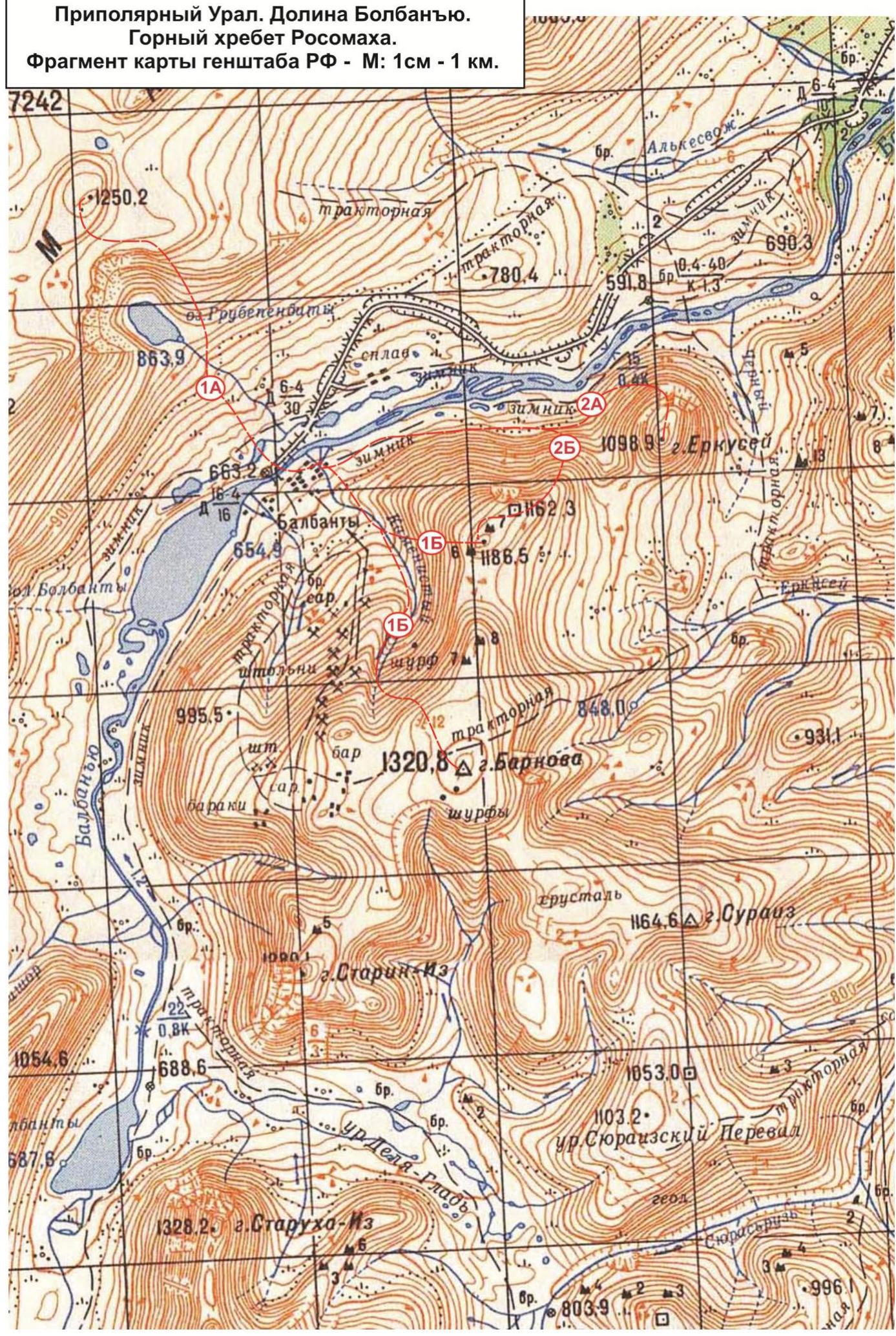
Subpolar Urals. Bolbanyu valley. Rosomakha mountain range. Fragment of the General Staff map of the Russian Federation — Scale: 1 cm — 1 km.
Passport
- Section number according to CMGA - 2010 - 8.3.
Subpolar Urals, Rosomakha mountain range, Bolbanyu river valley.
-
Name of the summit: Barkova Gora (North-Western)
height: 1186.5
-
Route: via the south-western edge.
-
Category of difficulty: proposed 1B category of difficulty
-
Route type - rocky.
-
Route height difference: 400 m
-
Route length: 1003 m
-
Length and level of difficulty of technical sections:
Technical sections:
- 1 - 2 sections - 160 m
- 2 - 6 sections - 310 m
- 3 - 1 section - 3 m
- 4 - 0 sections - 0 m
- 5 - 0 sections - 0 m
- 6 - 0 sections - 0 m
- Average steepness: main part of the route - 30°. Crux - 65°.
- Number of pitons used:
Total used on the route:
- rock pitons - 0 pcs
- chocks - 14 pcs
- stationary bolt pitons - 0
- ITO - 0
- removable bolt pitons - 0
Left "pitons" on the route: total - 0; including bolt pitons - 0.
- Exit to the route - 8:00, August 4, 2016.
Reached the summit - 15:30, August 4, 2016.
Return to the base camp — 17:00, August 4, 2016.
- Team's travel time: 9 hours.
- Leader:
Maltsev Sergey Leonidovich (Ukhta, 1st sports category, instructor-methodologist of 2nd category).
Participants:
V. A. Schastlivtsev (Babanovo, Vologda region, 3rd sports category), S. N. Chikanchi (Ukhta, 3rd sports category), Yu. D. Kozlov (Syktyvkar, 3rd sports category).
- Coach: Zhuravlev Sergey Vasilyevich (Syktyvkar, Candidate for Master of Sports, instructor-methodologist of 1st category).
Left pitons and chocks: 0/0 pcs.
Description of the summit
Gora Barkova is one of the peaks of the Rosomakha mountain range, located in the Northwestern Federal District of the Russian Federation, in the Komi Republic, on the territory of the Municipal formation "City district - Inta". Geographically - in the central part of the Rosomakha ridge of the Subpolar Urals, in the Bolbanyu river valley. Gora Barkova is a mesa with two peaks marked on the General Staff map of the Russian Federation.
The main peak of Gora Barkova is a dome-shaped elevation on the vast plateau of the mesa.
The north-western peak (which has no official name) is a destroyed, scree-covered dome, to which lead rocky buttresses from the north, north-west and west, and to the east - a gentle slope, after a small depression (-100 m), turning into the plateau of the main peak.
The height of the main peak of Gora Barkova is 1320.8 m, the north-western peak is 1186.5 m.
The name of the mountain is official, given in honor of the famous Russian geographer A. S. Barkov.
The mountaineering interest on the main peak of Gora Barkova is represented by:
- routes from the Kamienisty stream valley along the rocky slope of the western cirque;
- rocky buttresses leading to the north-western peak of Gora Barkova from the south and north.
Within the framework of the mountaineering event "Severnaya Vertikal", the following routes were passed and classified:
- Barkova Main - "Along the central couloir of the western slope" - approximately 1Bz (snow-ice).
- Barkova (NW) - "Along the south-western edge" - approximately 1B category of difficulty (rocky).
- Barkova (NW) - "Along the first buttress of the northern slope" - approximately 2A category of difficulty (rocky).
- Barkova (NW) - "Along the second buttress of the northern slope" - approximately 2B category of difficulty (rocky).
Description of the route: Barkova (NW) - "Along the south-western edge" - approximately 1B category of difficulty (rocky).
Route: "Along the south-western edge" - a logical, rocky route, oriented towards educational and sports groups of mountaineers undergoing training under the programs of Initial Training of the first and second year of study - NP-1 and NP-2. The route allows to fully work out:
- the technique of movement on rocky terrain,
- methods of belaying and self-belaying.
The route is logical in orientation, the line follows the rocky ridge of the pronounced rocky edge. The route is objectively safe.
Equipment
To complete the ascent as part of an educational and sports group of 6 people, the following special equipment is required on the route:
personal - standard (crampons and ice axe in winter are mandatory). Public:
- main rope 10 mm - 2 pcs × 50 m
- chock elements - 12 pcs
- quickdraws - 8 pcs
- slings - 6 pcs
- rock pitons - 4 pcs
- rock hammer - 1 pc
- ice axe - 1 pc
- extractor - 1 pc
Approach
From the base "Zhelannaya" go along the Kamienisty stream valley. After the waterfall, climb the slope to the base of the south-western rocky edge.
The edge:
- is clearly expressed,
- is clearly visible from the base "Zhelannaya",
- is clearly visible during the approach.
At the base of the edge on flat rocky slabs - a convenient place for organizing rope teams. This is the beginning of the technical part of the route.
Technical part
Further ascent to the rocky ridge of the edge, identical in complexity and structure of the rocks, both on the left and on the right along the way. The slopes of the ridge are composed of inclined slabs of varying steepness. Movement is mostly alternating. The slabs alternate with inclined shelves.
For intermediate points and organization of belay stations are actively used:
- large ledges on the ridge,
- massive rocky spalls of feather-like shape.
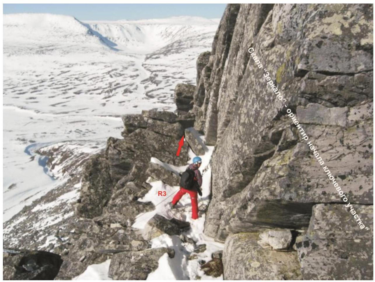
Move along the ridge to the "Grib" gendarme. From the "Grib" gendarme begins the key section of the route.
Key section: The key to the route is the ascent to the oblique shelf under the "Zerkalo" rock and bypassing the "Zerkalo" rock on the left along the course along a series of inclined slabs of medium complexity.
The most difficult place:
- A small section (3 m) of a smoothed rock 3.
After passing the key section, movement along the long ridge of medium climbing difficulty to a pronounced internal angle. After passing the internal angle - ascent to the rocky shoulder with a characteristic landmark - the opening in the rock "Okno".
After the "Okno" opening:
- the ridge becomes less pronounced;
- movement along the slabs to the pre-summit - the end of the rocky edge;
- further exit to the scree-covered dome to the rocky remnant at the summit, which does not cause problems.
Summit
The summit is a dome with a rocky remnant. At the summit is installed a reference sign of the geodetic network of the Russian Federation.
Descent from the summit
Along the non-categorized western slope into the Bolbanyu river valley, then, after descending into the valley, go upstream to return to the base "Zhelannaya".
Classified analogues of the route
- Pik Zimniy - 1B (Kabardino-Balkar Republic, Caucasus, Adyrsu gorge).
- Kaydzhany (Malaya) - 1B (North Ossetia, Caucasus, Kaydzhany gorge).
- Starik-Iz along the southern ridge (Komi Republic - 1B category of difficulty winter, Subpolar Urals, Bolbanyu river valley).
Route diagram in UIAA symbols
Gora Barkova North-Western (1186.5)
 Subpolar Urals. Bolbanyu valley. Barkova North-Western peak (1186.5). Route: "Along the south-western edge". Difficulty level: 1B category of difficulty (rocky) approximately. Table of natural obstacles.
| № section | Length (m) | Steepness | Nature of terrain | Cat. diff. | Number of pitons/chocks (pcs.) |
|---|---|---|---|---|---|
| APPROACH | From the base "Zhelannaya" along the Kamienisty stream valley to the south-western slope. 40 min | ||||
| R0 | Right bank of the Kamienisty stream under the south-western slope. | ||||
| R0–R1 | 500 | 20–25° | Scree slope | n/c | 0 / 0 |
| R1–R2 | 60 | 45° | Rocky ridge | 1 | 0 / 0 |
| R2–R3 | 100 | 45° | Monolithic rocks, slabs | 2 | 0 / 4 |
| R3–R4 | 100 | 45° | Monolithic rocks, slabs | 2 | 0 / 3 |
| R4–R5 | 30, 3 | 35°, 70° | Monolithic rocks, slabs. Rocky wall | 2, 3 | 0 / 7 |
| R5–R6 | 30 | 50° | Large-block ridge. Dense rocks. | 2 | 0 / 0 |
| R6–R7 | 30 | 50° | Internal angle, dense rocks with convenient microrelief | 2 | 0 / 0 |
| R7–R8 | 30 | 50° | Slabs, inclined shelves. | 2 | 0 / 0 |
| R8–R9 | 100 | 20–25° | Scree slope | 1, n/c | 0 / 0 |
| R9 | The summit is marked by a jumble of large stones. Accommodation of the climbing group does not cause problems. | ||||
| DESCENT | Descent along the non-categorized western slope to the base "Zhelannaya". |
Summary
Route length - 1003 m. Height difference - 400 m. Average steepness:
- total route - 30°,
- key section - 70°.
Terrain type - rocky. Technical sections:
- 1 - 2 sections - 160 m
- 2 - 6 sections - 310 m
- 3 - 1 section - 3 m
- 4 - 0 sections - 0 m
- 5 - 0 sections - 0 m
- 6 - 0 sections - 0 m.
Used pitons and chocks: 0/14 pcs. Left pitons and chocks: 0/0 pcs.
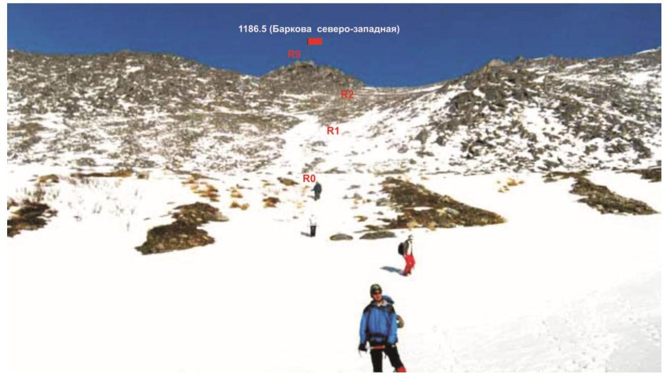
Photo №1 - technical photo with a drawing of the route from the Kamienisty stream valley.
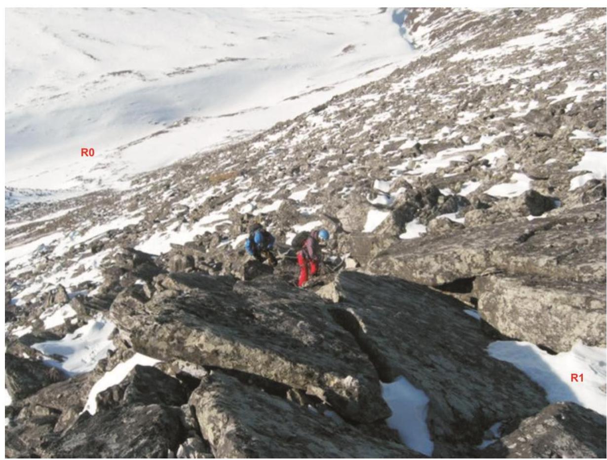
Photo №2 - the beginning of the buttress.
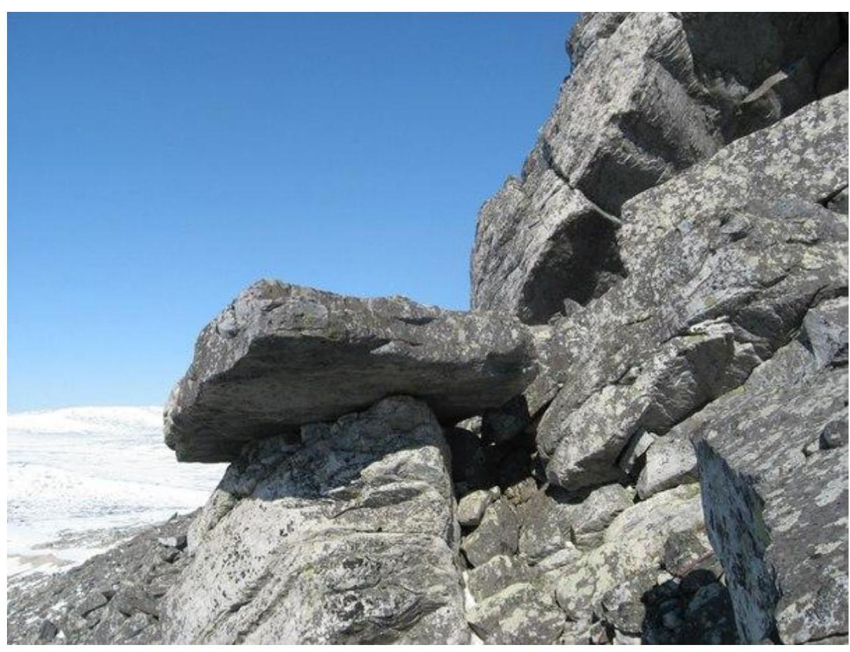
Photo №3 - a characteristic landmark of the beginning of the technical part - the "Grib" gendarme.
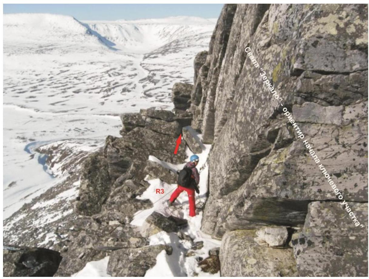
Photo №4 - "Zerkalo" rock. The key place is the bypass of the wall on the left along the course along the inclined slabs.
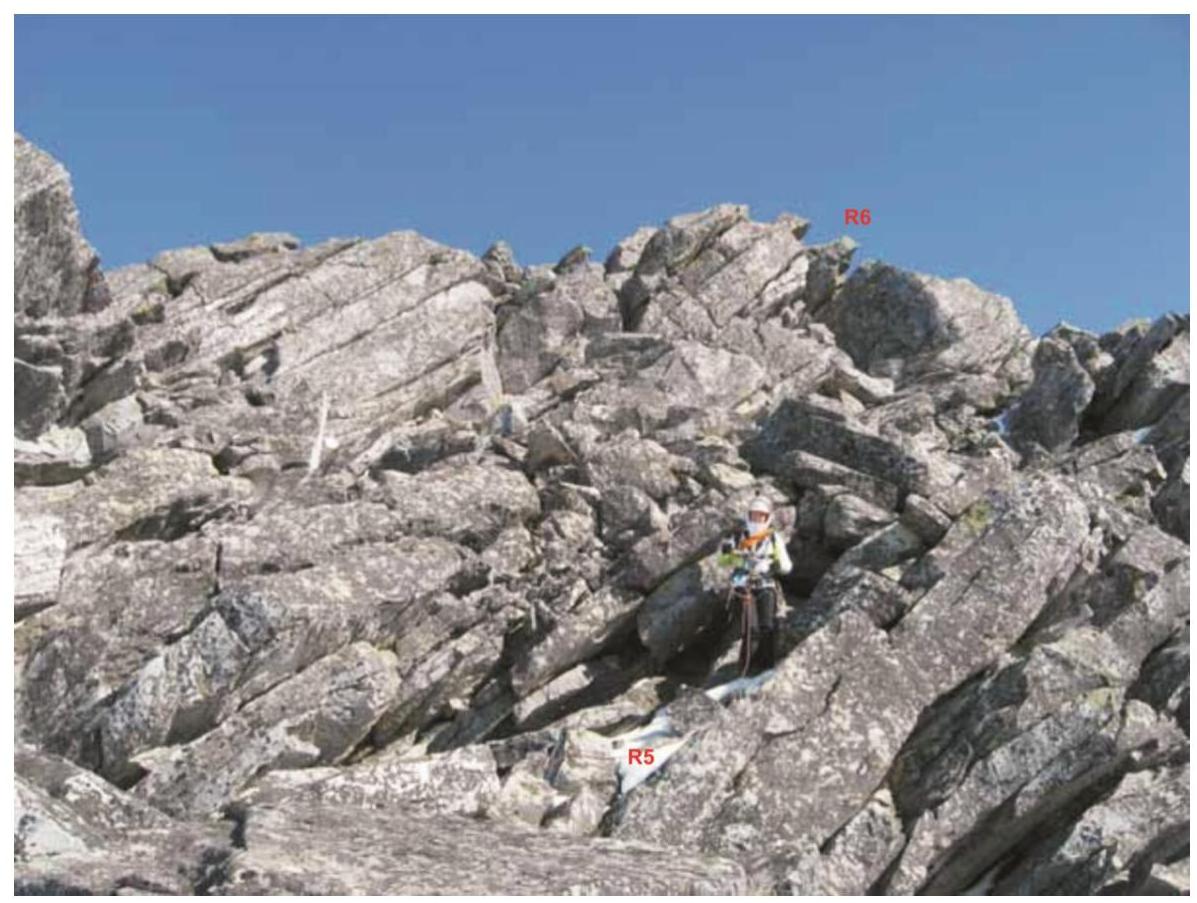
Photo №5 - characteristic rocks of the ridge when reaching the pre-summit.
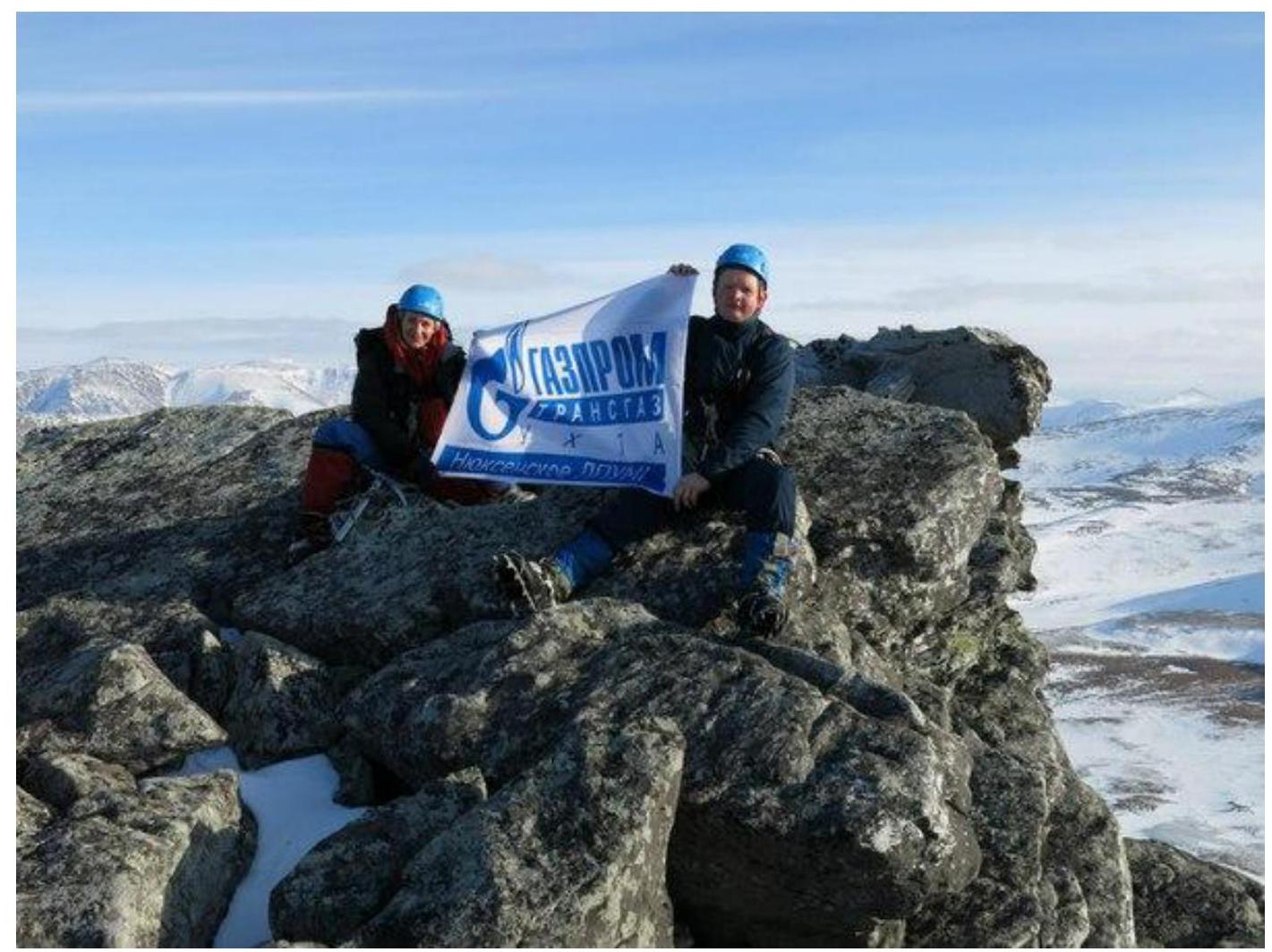
Photo №6 - summit - Gora Barkova (north-western).