Report
On the first ascent to the summit of "Aleksandrovskaya" mountain 2847 m by GPS. Via N ridge, 2B cat. diff. by the team of Ural High-Mountain Club "Gorec" from November 16, 2021 to November 16, 2021.
I. Climbing Report
| № | 1. General Information | |
|---|---|---|
| 1.1 | Full name, sports rank of the team leader | Nazarov Andrey Evgenievich, 2nd sports rank |
| 1.2 | Full name, sports rank of the participants | Kolunin Ruslan Nikolaevich, 1st sports rank, Lazo Vitaly Ivanovich, 1st sports rank |
| 1.3 | Full name of the coach | Ermachek Yuri Vladimirovich, Master of Sports |
| 1.4 | Organization | Ural High-Mountain Club "Gorec" |
| 2. Characteristics of the Climbing Object | ||
| 2.1 | Region | Eastern Antarctica, Wohlthat massif |
| 2.2 | Valley | Mikheev Mountains |
| 2.3 | Section number according to the 2013 classification table | 11.7 |
| 2.4 | Name and height of the summit | "Aleksandrovskaya" 2847 m by GPS |
| 2.5 | Geographical coordinates of the summit | S 72.08° 351″, E 11.31° 109″ |
| 3. Characteristics of the Route | ||
| 3.1 | Name of the route | N ridge |
| 3.2 | Proposed category of difficulty | 2B |
| 3.3 | Degree of route development | First ascent |
| 3.4 | Nature of the route terrain | Rock |
| 3.5 | Height difference of the route | 584 m |
| 3.6 | Length of the route | 2005 m |
| 3.7 | Technical elements of the route | I cat. diff. rocks — 30 m. II cat. diff. rocks — 220 m. III cat. diff. rocks — 140 m. IV cat. diff. rocks — 15 m. |
| 3.8 | Descent from the summit | Non-categorized to the start of the route |
| 3.9 | Additional characteristics of the route | Lack of water, low temperatures |
| 4. Characteristics of the Team's Actions | ||
| 4.1 | Time of movement | 12 h 10 min |
| 4.2 | Overnights | Absent |
| 4.3 | Start of the route | 11:30, November 16, 2021 |
| 4.4 | Reaching the summit | 20:20, November 16, 2021 |
| 4.5 | Return to the base camp | 23:40, November 16, 2021 |
| 5. Responsible for the Report | ||
| 5.1 | Full name, e-mail | Kolunin R.N., rassel2007@mail.ru |
II. Description of the Ascent
1. Characteristics of the Climbing Object
The Mikheev Mountains are one of the southernmost mountains in the Wohlthat massif, Queen Maud Land. This massif has been heavily impacted by glacier movement, as evidenced by its gentle peaks. The nature of the mountains is similar to the Khibiny Mountains: the terrain is "weakly developed" (few crevices, cracks), and smoothed. Many scree slopes.
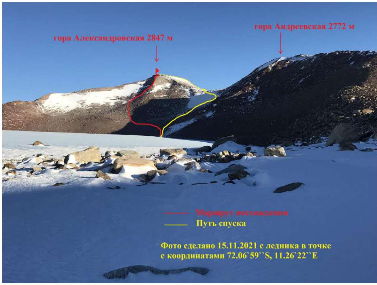
Photo 1. General photo of "Aleksandrovskaya" mountain in the massif with the ascent route (red) and descent route (yellow) marked. Photograph of the northern slopes of the Mikheev Mountains.
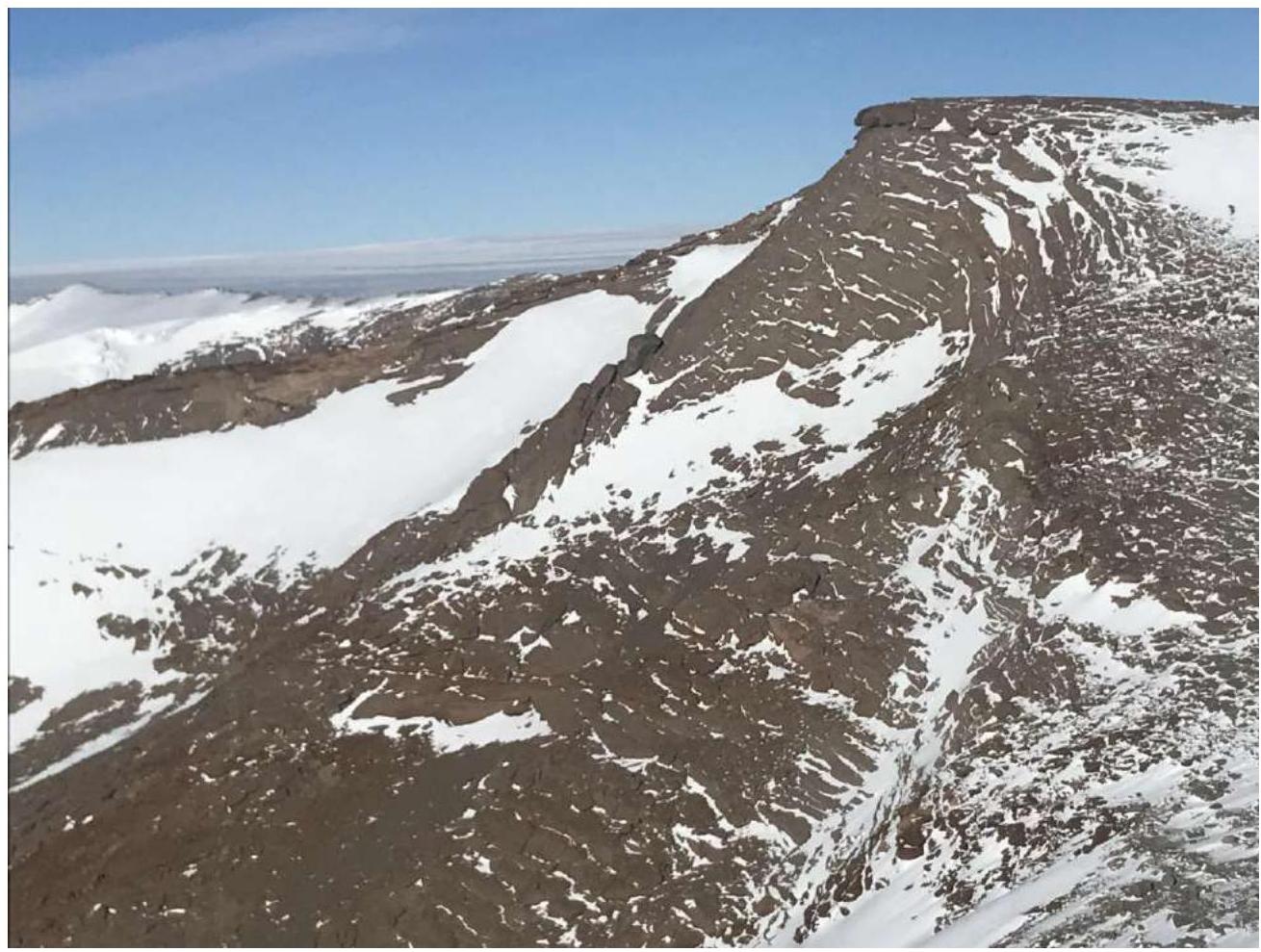
Photo 2. Profile of the ascent route. Taken from the summit of Andreevskaya mountain 2772 m.
Panorama of the area
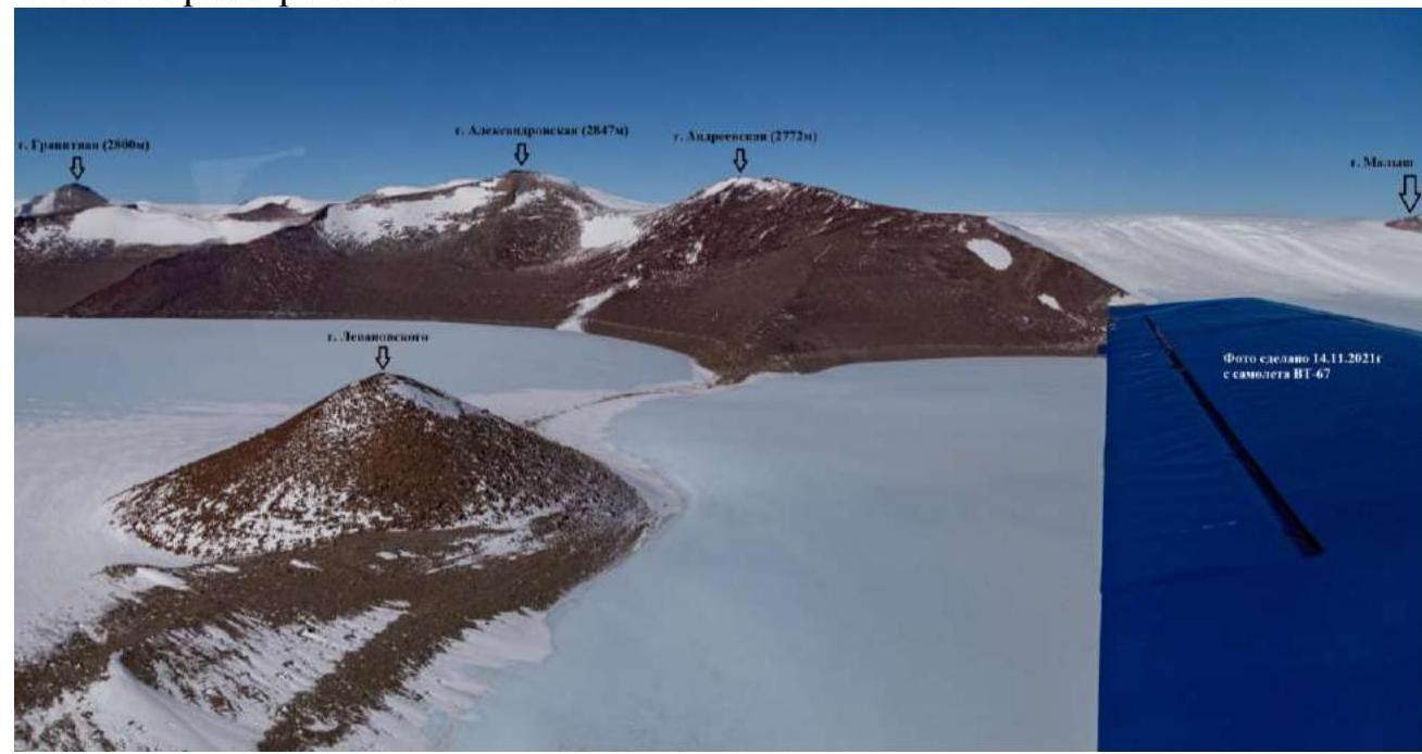
Photo 3. Photo of the Mikheev Mountains taken on November 14, 2021 from a VT-67 aircraft.
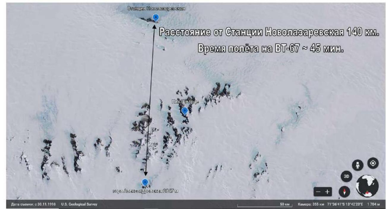
Photo 4. Satellite image of the Wohlthat massif and Novolazarevskaya station.
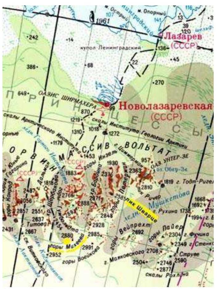
Photo 5. Schematic map of the Wohlthat massif peaks.
2. Characteristics of the Route
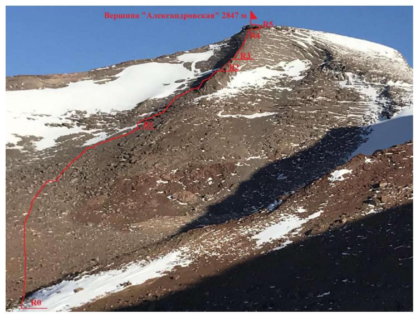
Photo 6. Technical part of the ascent route.
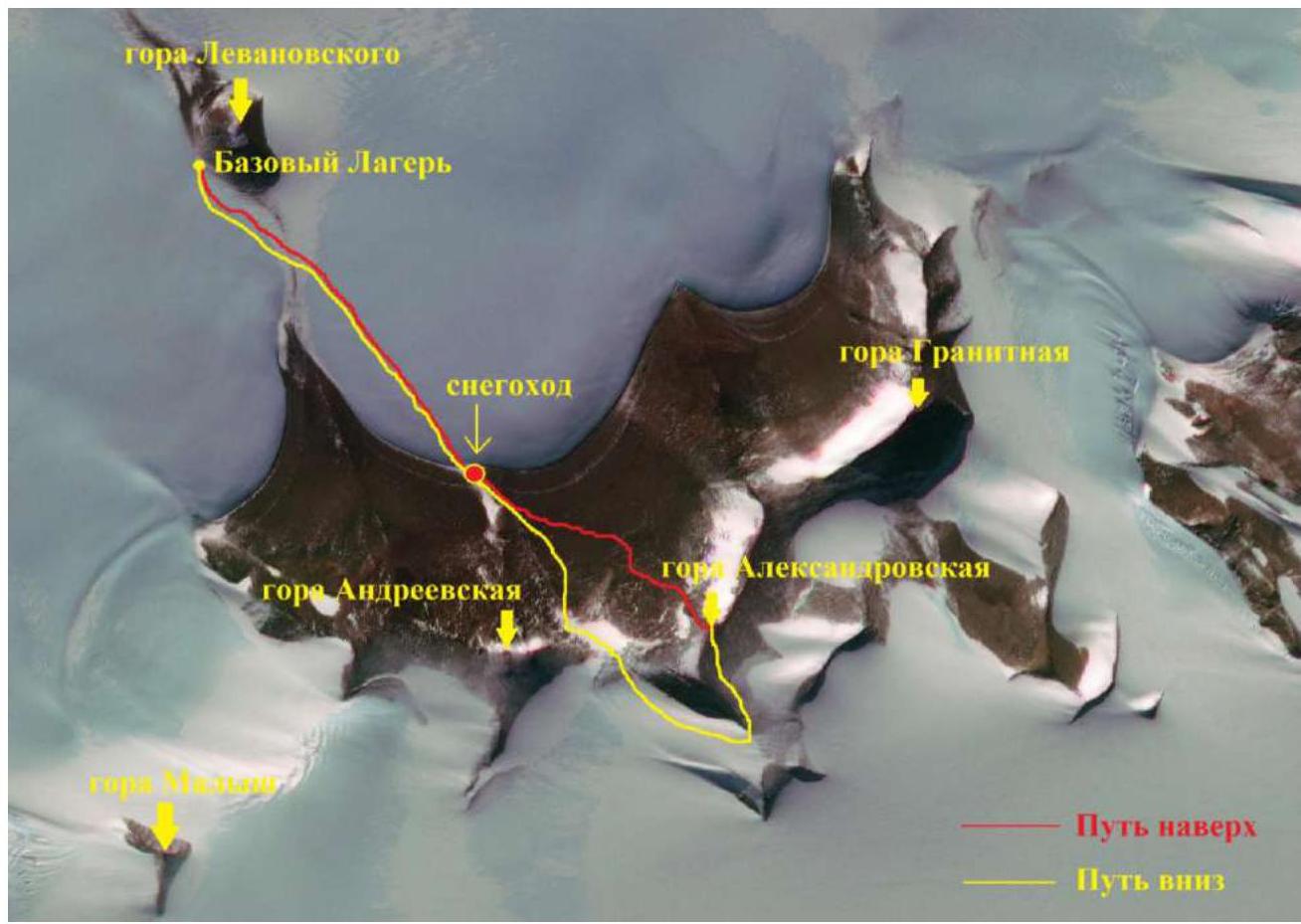
Photo 7. Ascent route from the Base Camp.
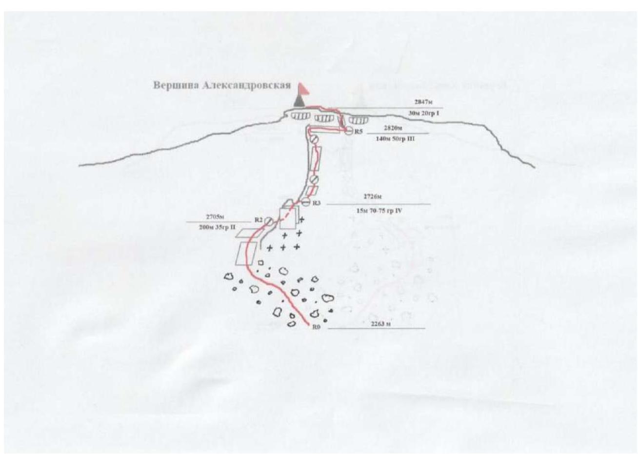
Photo 8. Schematic diagram of the route in UIAA symbols.
Technical characteristics of the route sections
| Section | Nature of the terrain | Category of difficulty | Length, m | Type and number of anchors |
|---|---|---|---|---|
| R0–R1 | Scree slope | - | 1600 | 0 |
| R1–R2 | Inclined slabs | II | 200 | 2 stoppers |
| R2–R3 | Rock wall | IV | 15 | 4 stoppers, 1 loop |
| R3–R4 | Rocky ridge | III | 140 | 7 stoppers, 2 friends, 2 loops |
| R4–R5 | Rock wall, traverse | II | 20 | 2 stoppers, 1 loop |
| R5–summit | Inner corner, inclined slabs | I | 30 | 0 |
3. Characteristics of the Team's Actions
The distance from the base camp to the foot of the mountain is 3200 m. We covered this part of the route by snowmobile on the open glacier.
| Section | Description | Photo number |
|---|---|---|
| R0–R1 | Scree slope with an angle of about 10° at the beginning and 30° at the end, has no technical difficulty, but requires careful attention to footing: many loose rocks, some as tall as a person! The section is quite long in time, distance, and height. It took us 2 hours 10 minutes to overcome it. The ascent from the snowmobile (edge of the glacier) was 400 m vertically. From the edge of the glacier, we moved towards the rocky ridge, which is clearly visible against the background of the summit. The ridge should be bypassed on the left, as there is a lot of compacted snow on the right, making it impassable without crampons. We were initially set on a rocky route, so we chose sections of the slope free from snow. | 9 |
| R1–R2 | Inclined slabs, fitted together like a mosaic. In some places, snow lies between the slabs, compacted to ice. Movement is simultaneous in a rope team. In a couple of places, we used protection anchors for insurance. Once level with the rocky ridge, we began to move right towards it. | 10 |
| R2–R3 | Before reaching the rocky ridge, we had to climb a 15 m high wall — the key section of the route. Climbing is on friction and small ledges, complicated by wind, frost, and high-altitude footwear. Intermediate anchors are on stoppers. At the end of the section, when exiting onto the ridge, there are a couple of large rocks on which a large loop can be thrown and a belay station set up. The rest of the participants ascend via fixed ropes. | 11 |
| R3–R4–R5 | Long rocky ridge, 2–5 m wide, with a slope of 50°. (see photo 2). Moving along it in a rope team is unreasonable due to many sections on friction and strong wind. There are few insurance points, but the rocks hold well, the terrain is not crumbly, and climbing is pleasant at a temperature of –30°! There are few places to set up belay stations, so we first climbed 40 m (station on a rocky outcrop), then the entire rope length — 60 m, also on a rocky outcrop. The final 40 m of the ridge are slightly easier — we climbed directly under the cornice, from where we began a traverse along inclined smooth slabs to the right at 90° (section R4–R5). In this place, small stoppers work well. The 60 m rope barely reached a huge boulder at the end of the traverse, where we set up a station. | 12 |
| R5–summit | From the boulder, we began moving in a rope team into a wide crevice in the cornice, which led to the summit plateau and the summit itself. We reached the summit at 20:20. The summit is a plateau. Due to hurricane-force winds, it was impossible to stay there, so we immediately began descending south. | 13 |
| descent | The descent went through the summit plateau, strictly south to the glacier, and then along its edge towards the pass between Aleksandrovskaya (2847 m) and Andreevskaya (2772 m) peaks. Crampons were necessary for the descent from the pass. The descent from the pass was in rope teams down a steep snowslope to the scree slope. Then down the slope to the start of section R0–R1. | 14 |
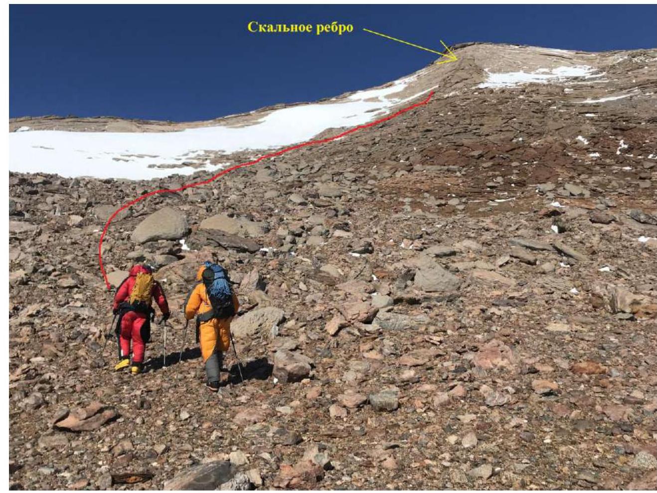
Photo 9. Section R0–R1. Lazo V. and Nazarov A. ascend the scree slope to the start of the technical part of the route. Despite the sun and good weather, the air temperature is –28°C.
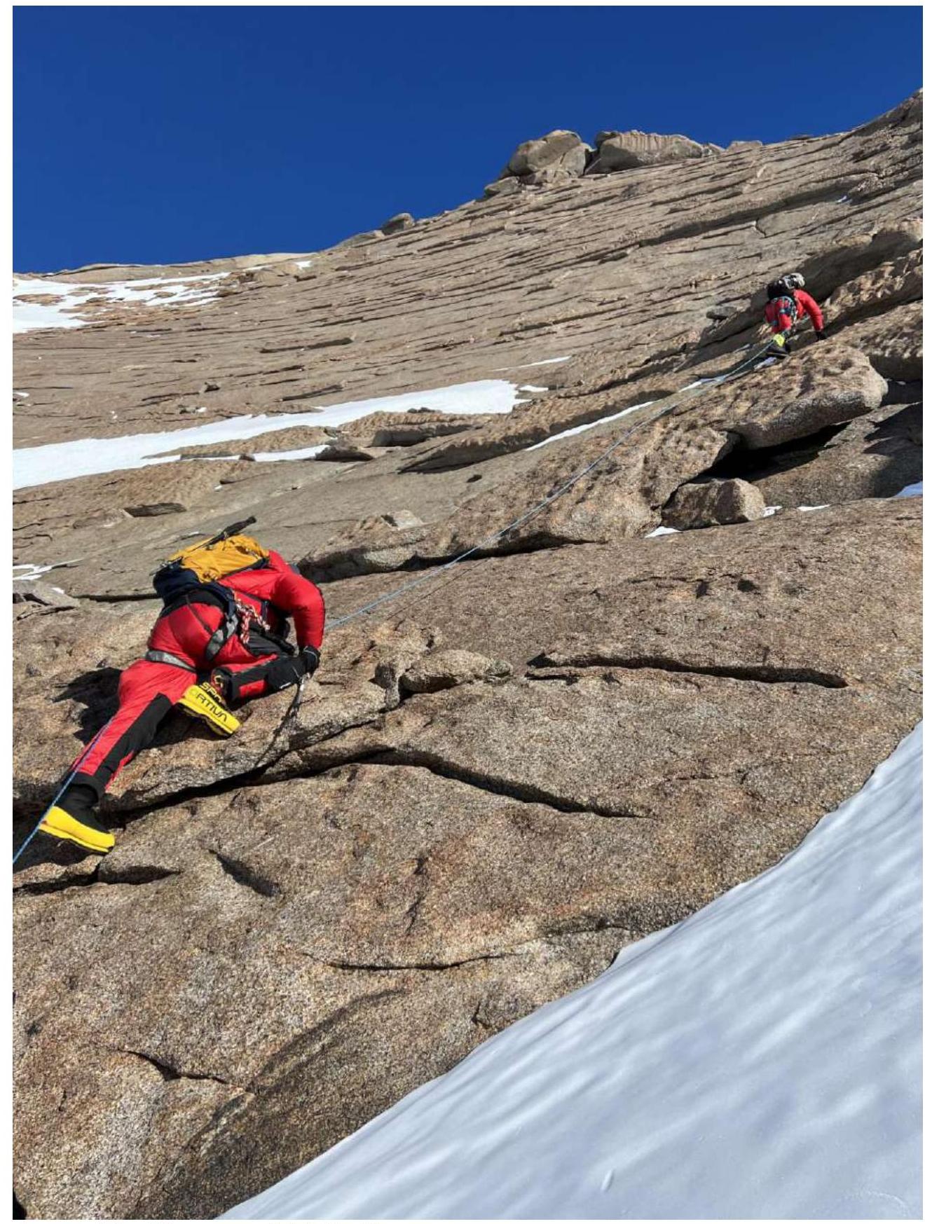
Photo 10. Section R1–R2. Moving in a rope team along inclined slabs towards the rocky ridge. Kolunin R. leads, photo by Nazarov A.
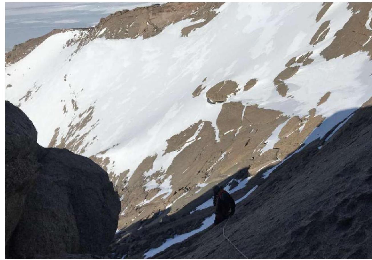
Photo 11. Section R2–R3. Rock wall, view from above. Nazarov A. ascends via ropes.
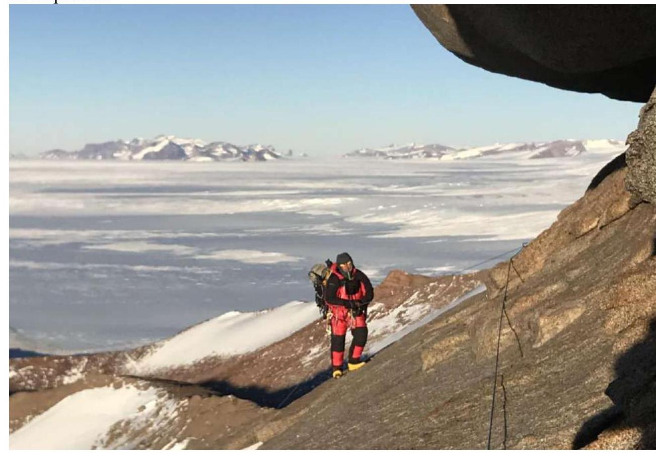
Photo 12. Lazo V. at the end of section R3–R4, with the start of the traverse under the cornice R4–R5 visible.
Team photo at the summit
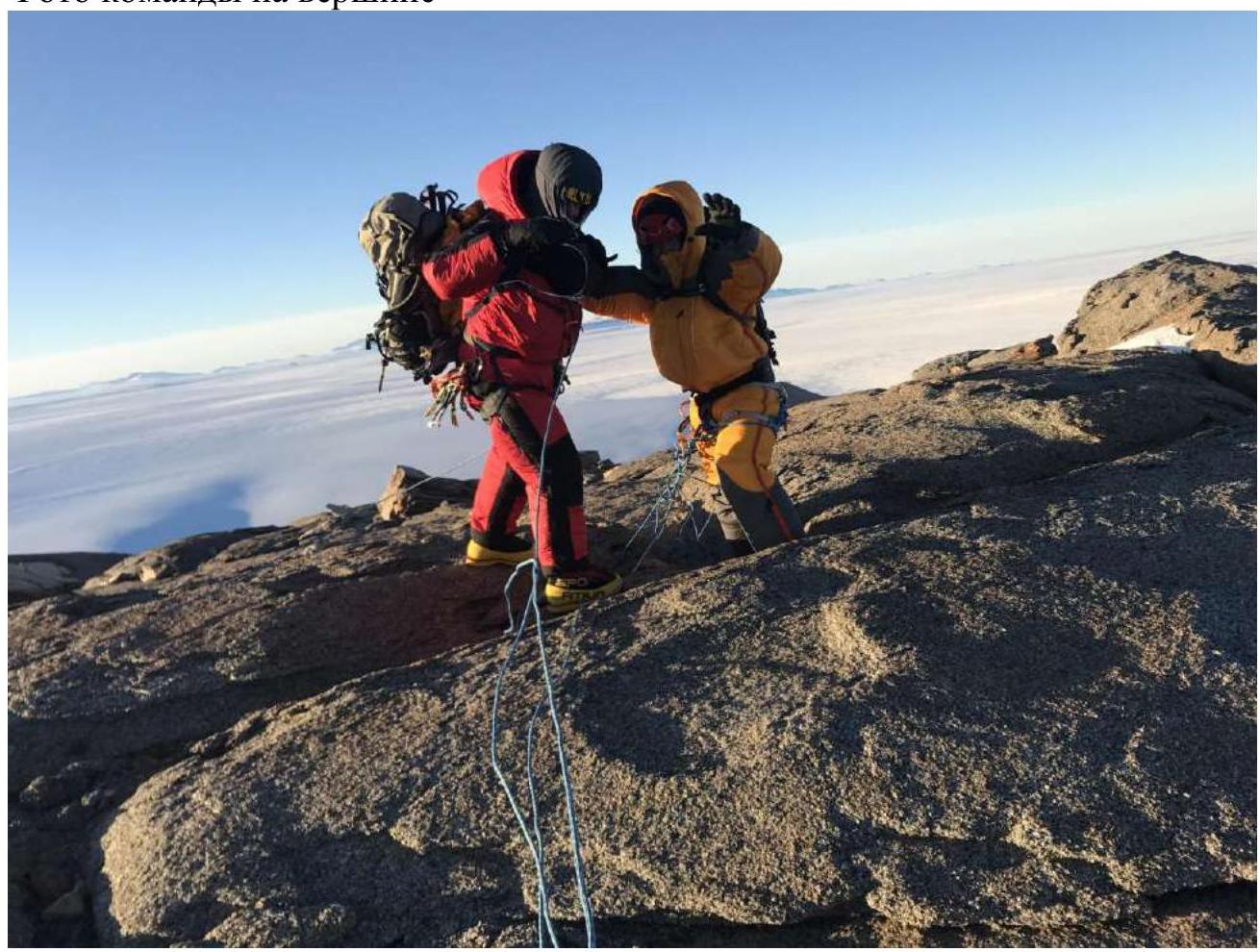
Photo 13. At the summit of Aleksandrovskaya mountain 2847 m in hurricane-force winds, Lazo V. and Nazarov A., photo by Kolunin R.

Photo 14. Descending from the glacier towards the pass. In the foreground is Andreevskaya mountain 2772 m, and in the distance to the left is Malysh mountain. Climbing routes in Antarctica remain exclusive first ascents. However, in recent years, the logistics of delivering climbers here have become simpler and cheaper. In the area where our expedition took place, not a single person had ever set foot on the ice, let alone the mountains.
The mountains of Antarctica are harsh primarily due to their climate, and when planning ascents, it is essential to have an up-to-date weather forecast. During our ascent, in addition to radio communication between each participant and the base camp, we also had a satellite phone, a GPS tracker, and a GPS navigator for each participant.
Delivery to the climbing area is only possible by air due to the complex mountainous terrain and large glacier crevices.
The descent from the summit is logical and straightforward but requires good weather and visibility. Orientation in poor weather conditions is not possible. In Antarctica, the weather does not deteriorate suddenly, and before it worsens, there are always primary signs (cloudiness, increasing wind, etc.).
From November to March, the mountains experience "polar day," and ascents can be made at any time of day. However, it is worth noting that temperature fluctuations between "day" and "night" are significant. In our case, the ascent began in the middle of the day at a temperature of –28°C and ended "at night" when the temperature was –42°C!
Low temperatures, complex terrain, and strong winds place high demands on climbers, so we can recommend such ascents to experienced climbers as training for higher mountains (7000+ m and above).
The peaks named "Aleksandrovskaya" 2847 m and "Andreevskaya" 2772 m have working names that are being registered at the time of writing this report.


