
Russian Mountaineering Championship 2021
Altitude Class
Report on the first ascent to Peak Voennykh Topografov (6873 m) via the South Face route "Impromptu," approximately 5B category of difficulty, by the team from the Federation of Alpinism and Sports Climbing of Moscow, August 20-27, 2021.
Head Coach: Kuznetsova E. V. Team Leader: Nilov S. A. Moscow 2021
Peak Voennykh Topografov (6873 m) South Face "Impromptu"
Ascent Passport
| 1. General Information | ||
|---|---|---|
| 1.1 | Full Name, Sports Rank of the Team Leader | Nilov S. A. (MS) |
| 1.2 | Full Name, Sports Rank of Participants | Golovchenko D. N. (CMS) Grigoryev D. R. (CMS) |
| 1.3 | Full Name of the Coach | Kuznetsova E. V. |
| 1.4 | Organization | Federation of Alpinism and Sports Climbing of Moscow |
| 2. Characteristics of the Ascent Object | ||
| 2.1 | Region | Tian Shan |
| 2.2 | Ridge | Meridional Ridge |
| 2.3 | Number of the Section According to the 2013 Classification Table | 11.3 |
| 2.4 | Name and Height of the Peak | Voennykh Topografov Main (6873 m) |
| 2.5 | Geographical Coordinates of the Peak (Latitude/Longitude), GPS Coordinates | 42.076948N 80.323826E |
| 3. Characteristics of the Route | ||
| 3.1 | Route Name | Impromptu |
| 3.2 | Proposed Category of Difficulty | 5B |
| 3.3 | Degree of Route Exploration | First Ascent |
| 3.4 | Relief Characteristics of the Route | Combined |
| 3.5 | Height Difference of the Route | 2174 m |
| 3.6 | Route Length | 2950 m |
| 3.7 | Technical Elements of the Route | II category ice-snow - 200 m, III category ice-snow - 600 m, IV category ice-snow - 1500 m, V category combined - 650 m |
| 3.8 | Average Steepness of the Route | 54° |
| 3.9 | Average Steepness of the Main Part of the Route | 56° |
| 3.10 | Descent from the Summit | Via the Western Ridge to Chonteren Pass |
| 3.11 | Additional Characteristics of the Route | – |
|---|
Characteristics of the Team's Actions
| 4.1 | Time of Movement | 40 hours, 7.5 days |
|---|---|---|
| 4.2 | Overnight Stays | Shelves, Bergschrunds |
| 4.3 | Time of Route Processing | – |
| 4.4 | Exit to the Route | 15:00 August 20, 2021 |
| 4.5 | Summit Ascent | 14:00 August 27, 2021 |
| 4.6 | Return to ABC | 15:00 August 29, 2021 |
Weather Conditions
| 5.1 | Temperature, °C | Down to –20 °C during the day, down to –35 °C at night on August 25 |
|---|---|---|
| 5.2 | Wind Speed, m/s | Up to 30 m/s on August 25 |
| 5.3 | Precipitation | Snow: August 22, 24, and 26 |
| 5.4 | Visibility, m | 100 m on August 26 |
| 6. Responsible for the Report | ||
| 6.1 | Full Name, e-mail | Golovchenko D. N. |
| Mighty83@yandex.ru |
Technical Photo with the Route Line
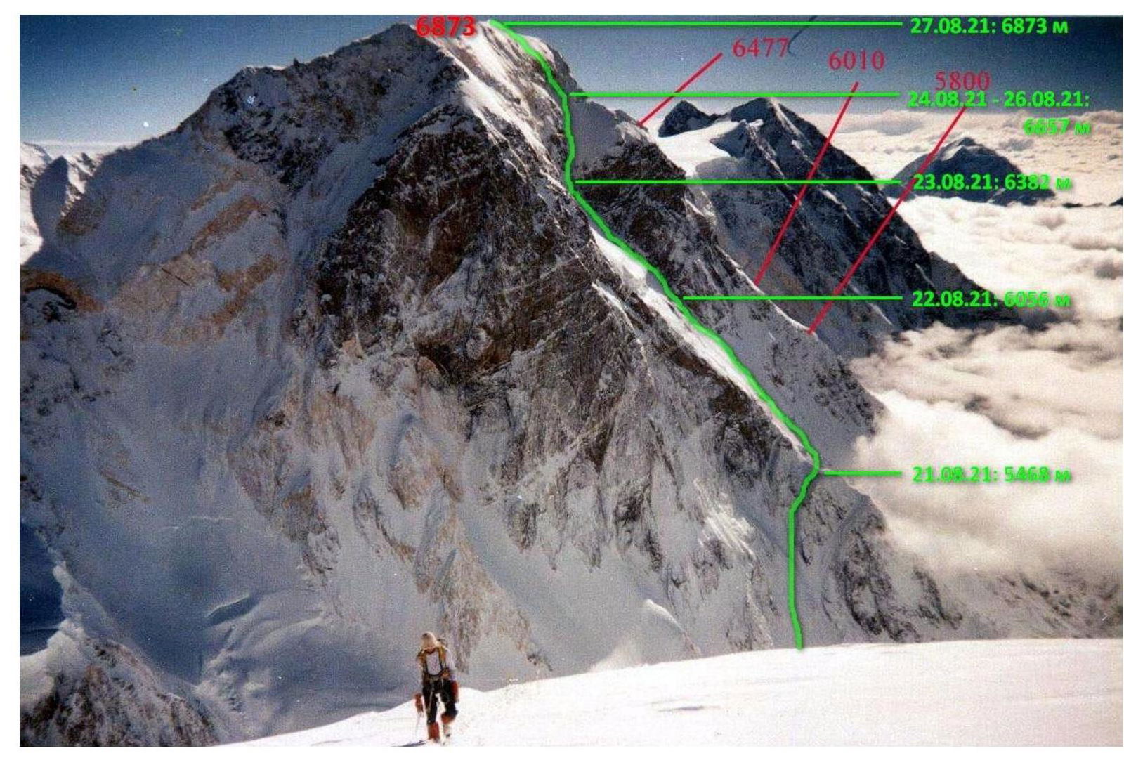
Peak Voennykh Topografov from Pobeda Peak with the route line (Photo: Gleb Sokolov) Dates and overnight stay locations are marked. Red marks indicate A. Juliya's route along the South Ridge.
General Photo of the Mountain and Existing Routes
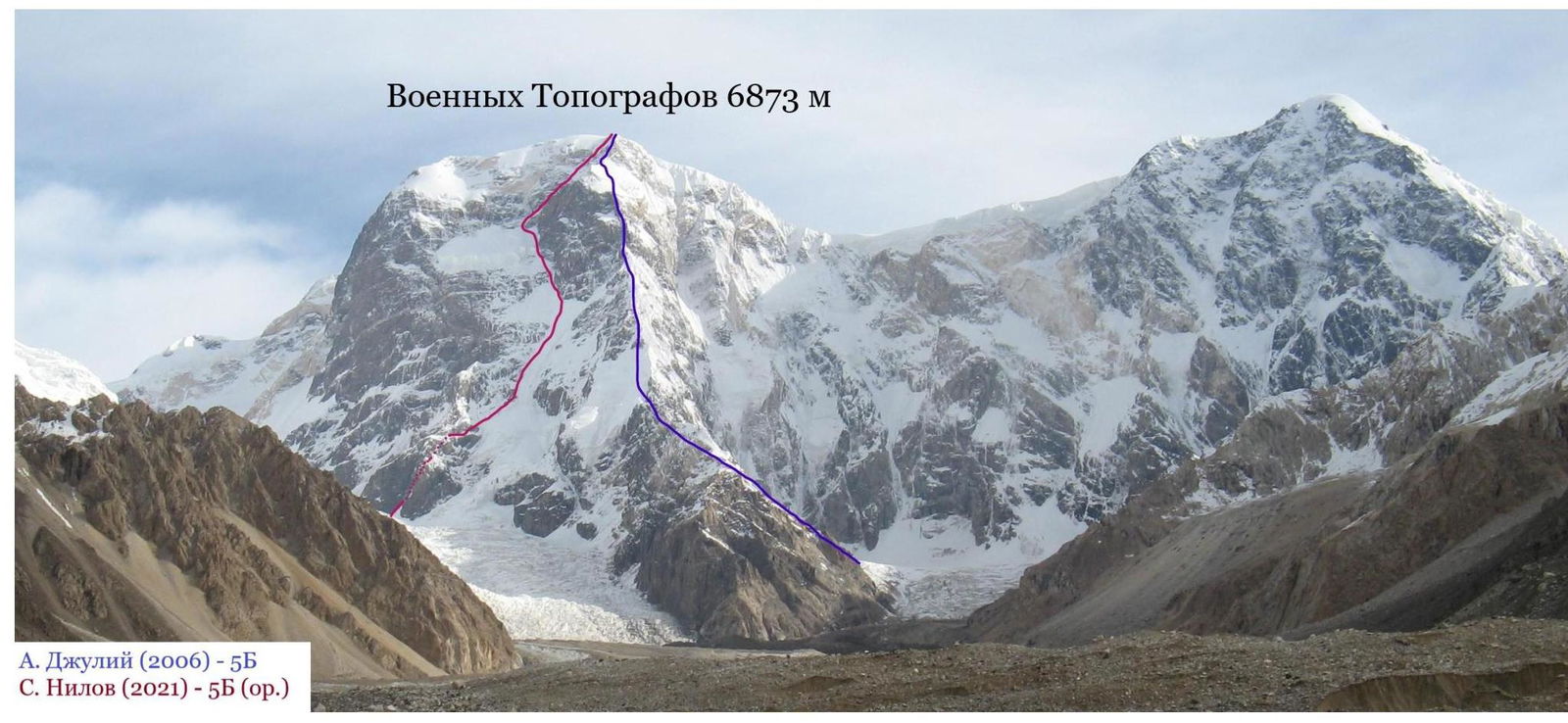
Peak Voennykh Topografov from the South (Photo: A. Juliya)
Photo of the Upper Part of the Route
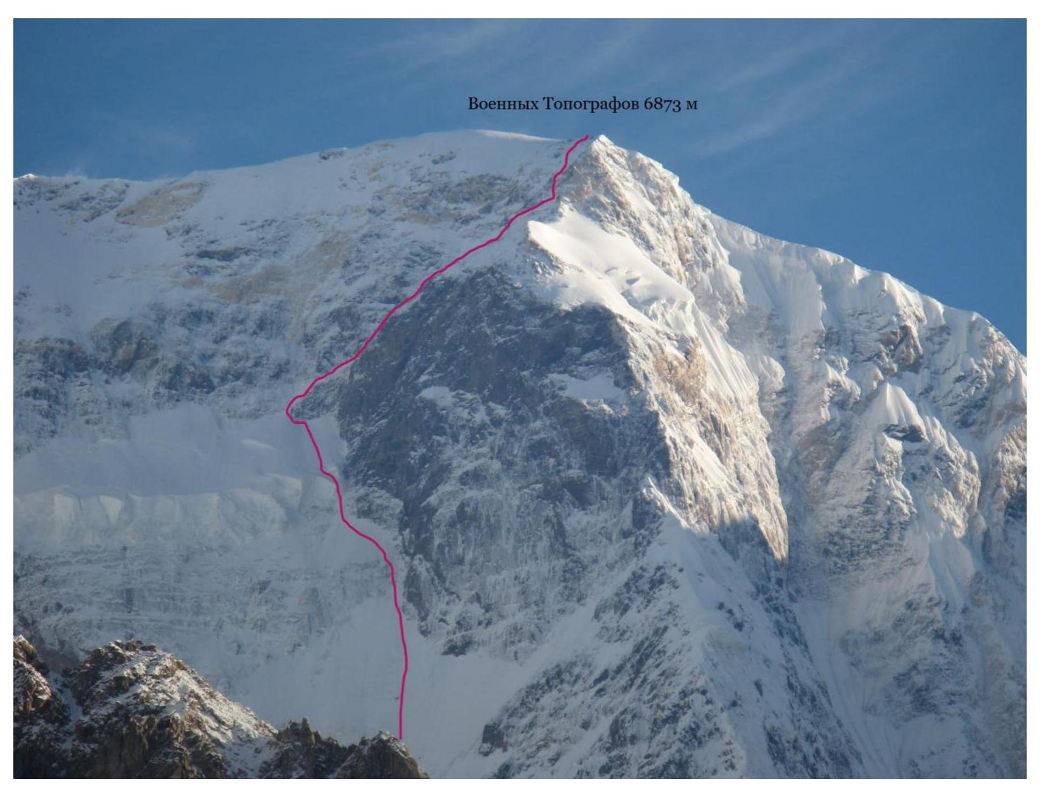
The team's route line in the upper part of the ascent (Photo: A. Juliya)
Panoramic Photo of the Area
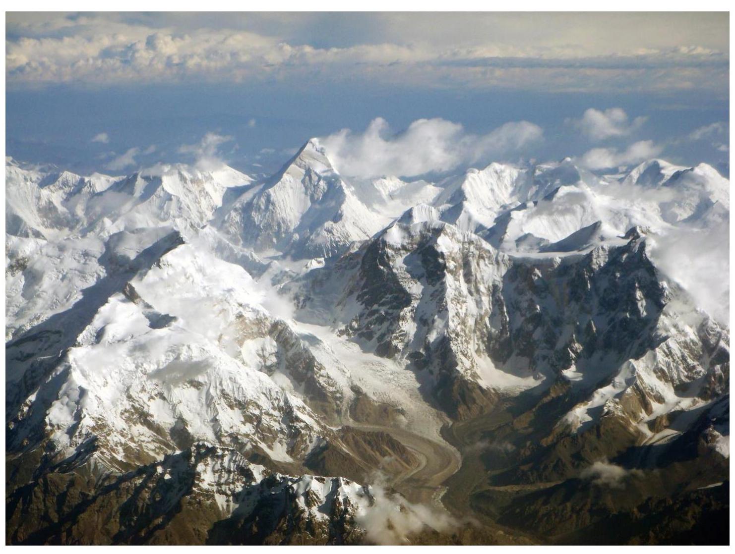
Panoramic photo from the south. Peak Voennykh Topografov is on the right side of the image.
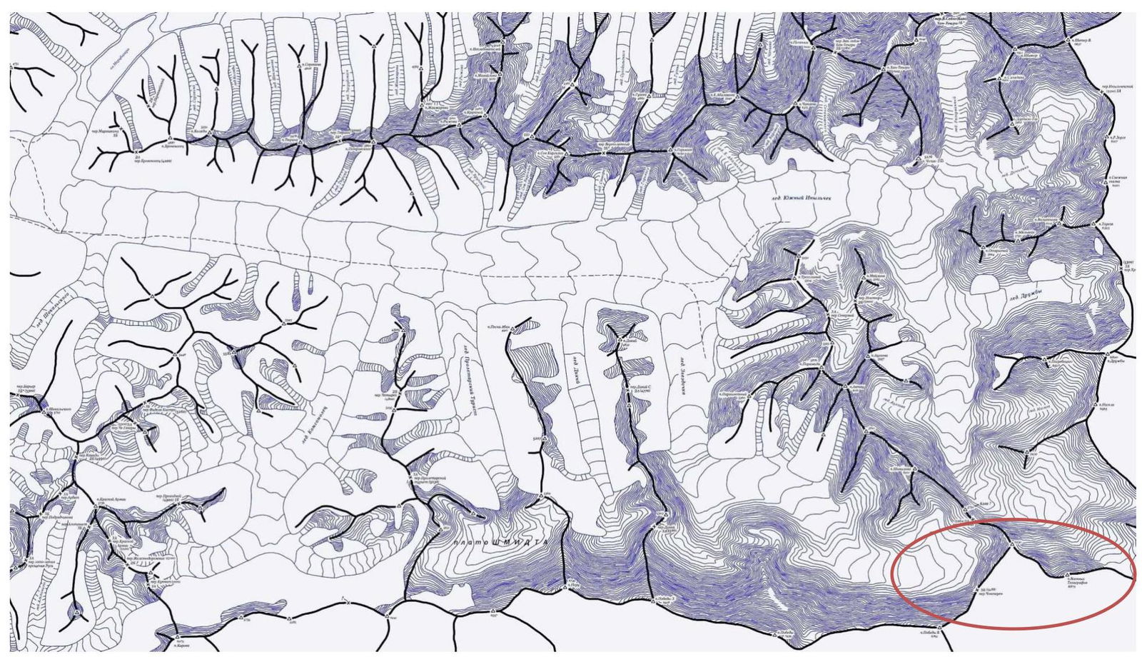
Map of the Area
Description of the Area
Central Tian Shan is the highest and most majestic part of the Tian Shan mountain system. It is a vast "knot" of mountain ranges stretching about 500 km from west to east and 300 km from north to south. This is the most picturesque region of Tian Shan, representing a complex system of intertwining mountain ridges (Terkey Ala-Too, Sary-Djaz, Kuy-Ly, Tengri Tag, Enilchek, Kakshaal Too, Meridional Ridge, etc.), crowned with majestic peaks of the northernmost highest mountains on the planet - Peak Pobeda (7439 m) and the fantastic pyramid of Khan Tengri (7010 m). To the north, the Borohoro Ridge connects Tian Shan with the Dzungarian Alatau system. Almost the entire territory of this region is located above 1500 m above sea level, and the mountain peaks are covered with centuries-old snow caps, giving rise to many dozens of glaciers, rivers, and streams. There are over 8000 glacial fields and glaciers here, the most representative of which are South Inylchek (about 60 km long) and North Inylchek (35 km long) (Enilchek, "Little Prince"), Djetyoguz-Karakol (22 km), Kaindy (26 km), Semenov (21 km), and others, with a total area exceeding 8100 km².
The relief of most Tian Shan ridges is high-altitude, heavily dissected by numerous valleys (northern slopes are much more rugged than southern ones), with well-developed glacial forms. The slopes have many scree fields, glaciers, and moraines on the glaciers, and numerous alluvial cones at the foot. The valleys of mountain rivers have a large height difference and a noticeable stepped profile with flat, swampy terraces - "saz." Many large valleys are surrounded by high-altitude plateaus - "syrt," sometimes reaching 4700 m. The plateaus and highlands are home to high-altitude pastures "dжайloo," covered with diverse vegetation and alpine meadows. At altitudes from 1000 to 2000 m, the foothills are fringed with adyrs. There are about 500 lakes in the area, the largest being Song-Kul ("disappearing lake," 270 km²) and Chatyr-Kul (153 km²).
The highest point is Peak Pobeda (7439 m), located on the border between Kyrgyzstan and the Xinjiang Uyghur Autonomous Region of China. The second highest peak is Khan Tengri (7010 m), and the third is Peak Voennykh Topografov (6873 m).
From Central Tian Shan, three mountain ranges diverge to the west, separated by intermontane basins (Issyk-Kul with Lake Issyk-Kul, Naryn, At-Bashi, etc.) and connected on the west by the Fergana Ridge.
History of Ascents
- 1958 - A team led by I. Erokhin ascends the Western subpeak (6818 m) from Chonteren Pass during acclimatization before traversing Peak Pobeda.
- 1965 - A team from the Kazakh Alpinist Club ascends the NW ridge of Peak Voennykh Topografov from Vysokiy Pass and reaches the Main Summit for the first time - recorded in the classifier.
- 1988 - A USSR team traverses Pobeda - Voennykh Topografov during preparation for an expedition to Kangchenjunga.
- 1990 - V. Khrshchaty team's fantastic traverse Pobeda - Khan Tengri through 15 peaks, including Peak Voennykh Topografov from Chonteren Pass.
- 1999 - A group led by S. Lavrov ascends at least to the Western subpeak
- 2003 - A team led by A. Korenev makes the first ascent via the NE ridge - recorded in the classifier.
- 2005 - The trio Kirikov-Oleinik-Parshin ascends the Main and Western summits.
- 2006 - A team led by A. Juliya ascends via the South Ridge, establishing the first route from the Chinese side - recorded in the classifier.
- 2017 - A team led by S. Romanenkov ascends from Chonteren to the Western subpeak.
Tactical Actions of the Team
Before departing to the area, we gathered all available information about the peak and the history of ascents. We also determined that the best time for ascents is from mid-July to mid-August. The team:
- Engaged in general physical preparation (GFP);
- Visited various climbing gyms in Moscow.
The area is high-altitude; the base camp is at 4200 m. Nearby peaks are 6000-7000 m, and Peak Voennykh Topografov is 6873 m. We flew to the camp at South Inylchek by Mi-8 helicopter on August 10. Without a support group or technical capabilities for cargo delivery under the route, the team began active acclimatization on the first day and simultaneously transported gear to Chonteren Pass, considered the starting point. The distance from the base camp to the pass is about 20 km. On the first day, we carried a couple of ropes and some gas and food to the beginning of Zvezdochka Glacier. On the first day, this distance took 4 hours, and a week later, we could run it in an hour and a half. We reached Chonteren Pass on August 18 and carried about 120 kg of cargo there. The next day, we observed the mountain and searched for a descent route to the south under the beginning of the route.
In Moscow, when planning the ascent, we intended to climb the wall to the Western subpeak and brought a lot of rock climbing gear, with ice gear as a backup. We did not bring a platform. On August 20, we rappelled down from the pass with 3 ropes and descended to Chonteren Glacier. After some time, the wall revealed a good, logical line leading directly to the summit. Unlike our initial plan, the line was snow and ice, but the temptation to reach the Main Summit immediately and the relative simplicity of the line prevailed - we decided to climb it.
For high-altitude food, we took:
- Carbohydrates: instant noodles and dry mashed potatoes;
- Proteins/Fats: cured sausage and cheese.
Snacks and quick carbohydrates: chocolate bars, chocolate tablets, nuts, dried fruits.
We cooked on gas.
The descent from the route was initially planned via the Western Ridge to Chonteren Pass. For this, we left a cache on the pass.
On the route, the team used 50-meter ropes, 1 dynamic and 3 static. Necessary equipment for the route includes:
- Crampons;
- Ice axes;
- Ice screws.
Sometimes useful:
- Anchor hooks;
- Placement elements: friends, camilots.
We found a cairn on the summit but no note. We left our own note and a Snickers bar. Further down on the Western Ridge, we found two more cairns:
- One was empty again;
- The second contained a note from Kirikov dated August 5, 2005.
Romanenkov's team also found this note but, lacking their own, took a photo and left it on the Western subpeak. We left a note at every cairn.
Brief Description of the Route by Sections
R0 - Along a correctly shaped snow cone to a large bergschrund, where we spent the night. 200 m, 45°, 2.
R1 - Along an ice-snow couloir and then along a rocky ridge to a large shelf with snow. The shelf provided a comfortable overnight stay. 600 m, 50°, 3.
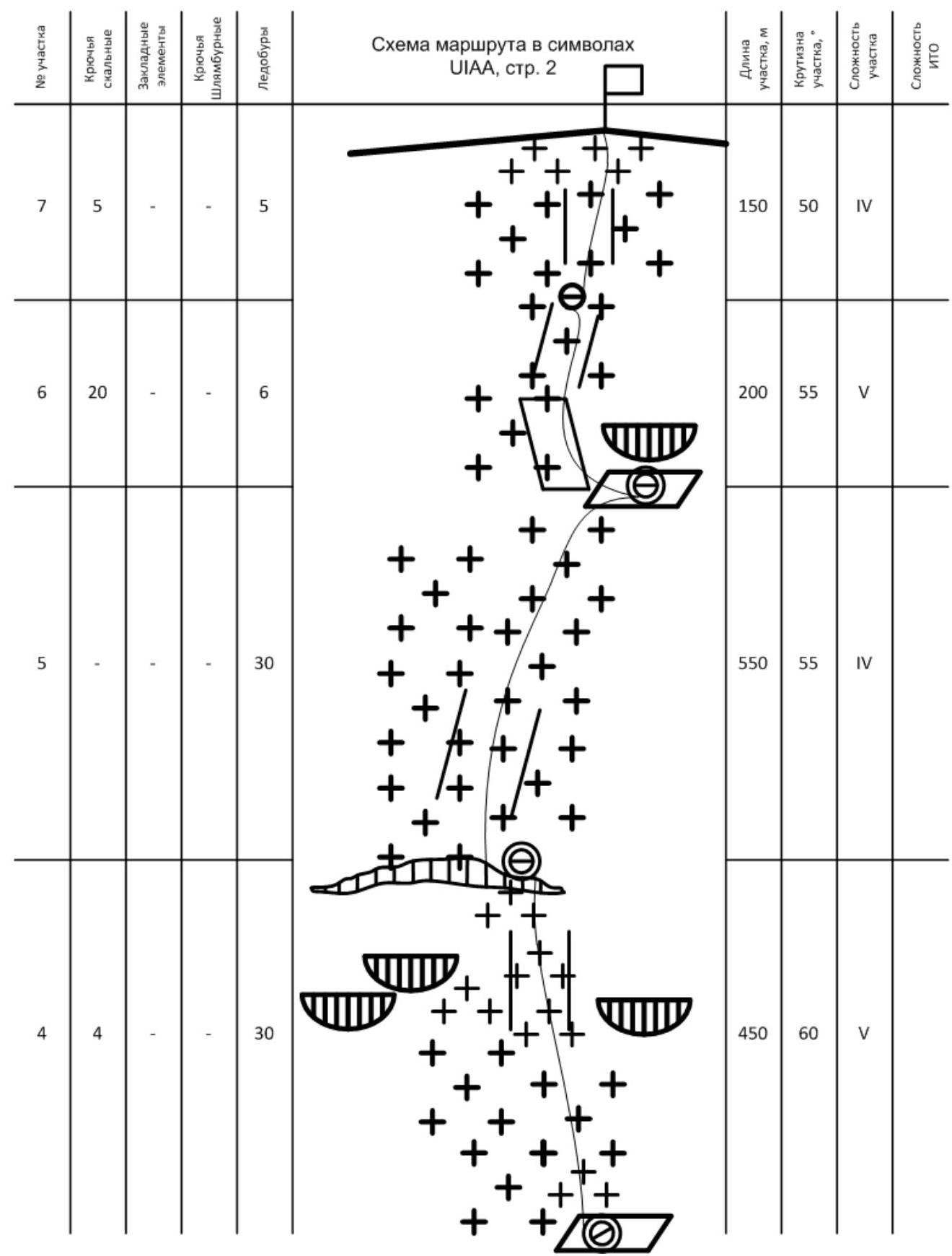
R2 - From the shelf, we traversed right and then ascended along an ice-snow slope under rock outcrops. We spent the night on one of the ledges in a semi-reclined position. 800 m, 55°, 4.
R3 - Continued upward along a snow-ice slope to a bergschrund. Inside, we found a comfortable overnight stay. 450 m, 60°, 5.
R4 - Traversed along the bergschrund to the left, then ascended a vague couloir to a large snow field. We traversed the field upward to the right under a large overhanging rock. Under the rock, we found a shelf with a comfortable overnight stay. 550 m, 55°, 4.
R5 - From the overnight stay, we moved right and then left upward along destroyed rocks on the ridge. Further, we encountered several slippery wall sections. 200 m, 55°, 5.
R6 - Ascended destroyed rocks on the ridge straight up to the exit onto a large snow dome - the summit. 150 m, 50°, 4.
Route Diagram in UIAA Symbols

Drawn Profile of the Route
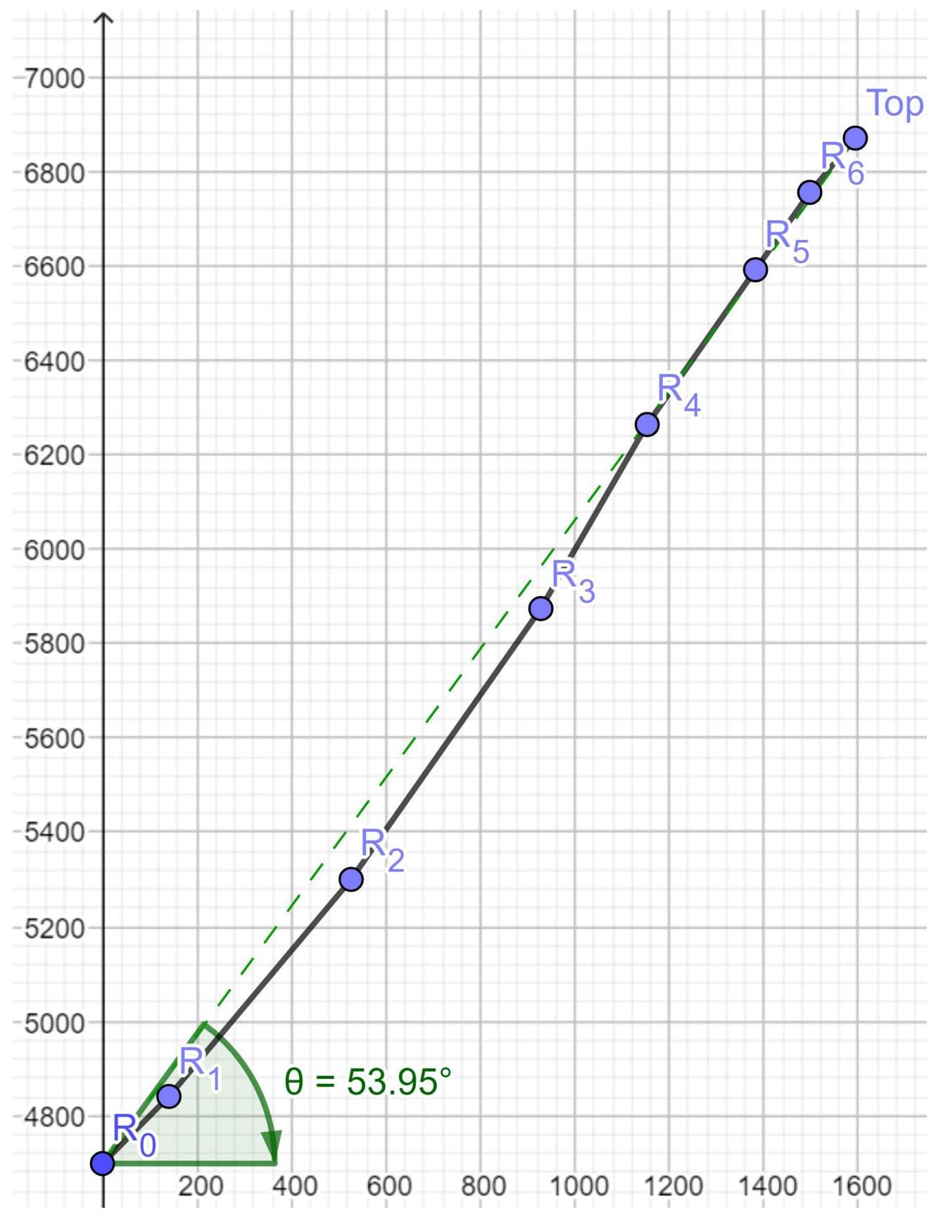
Graph of Altitude Gain and Weather
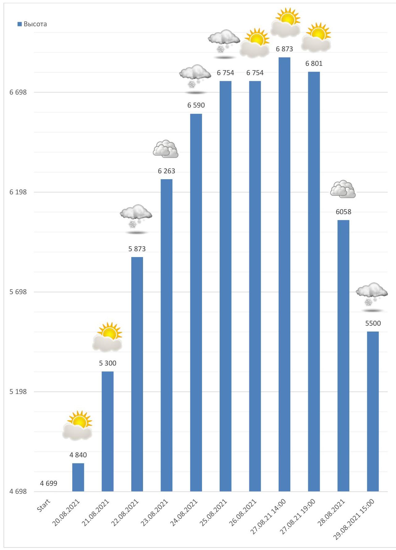
Photo Illustrations
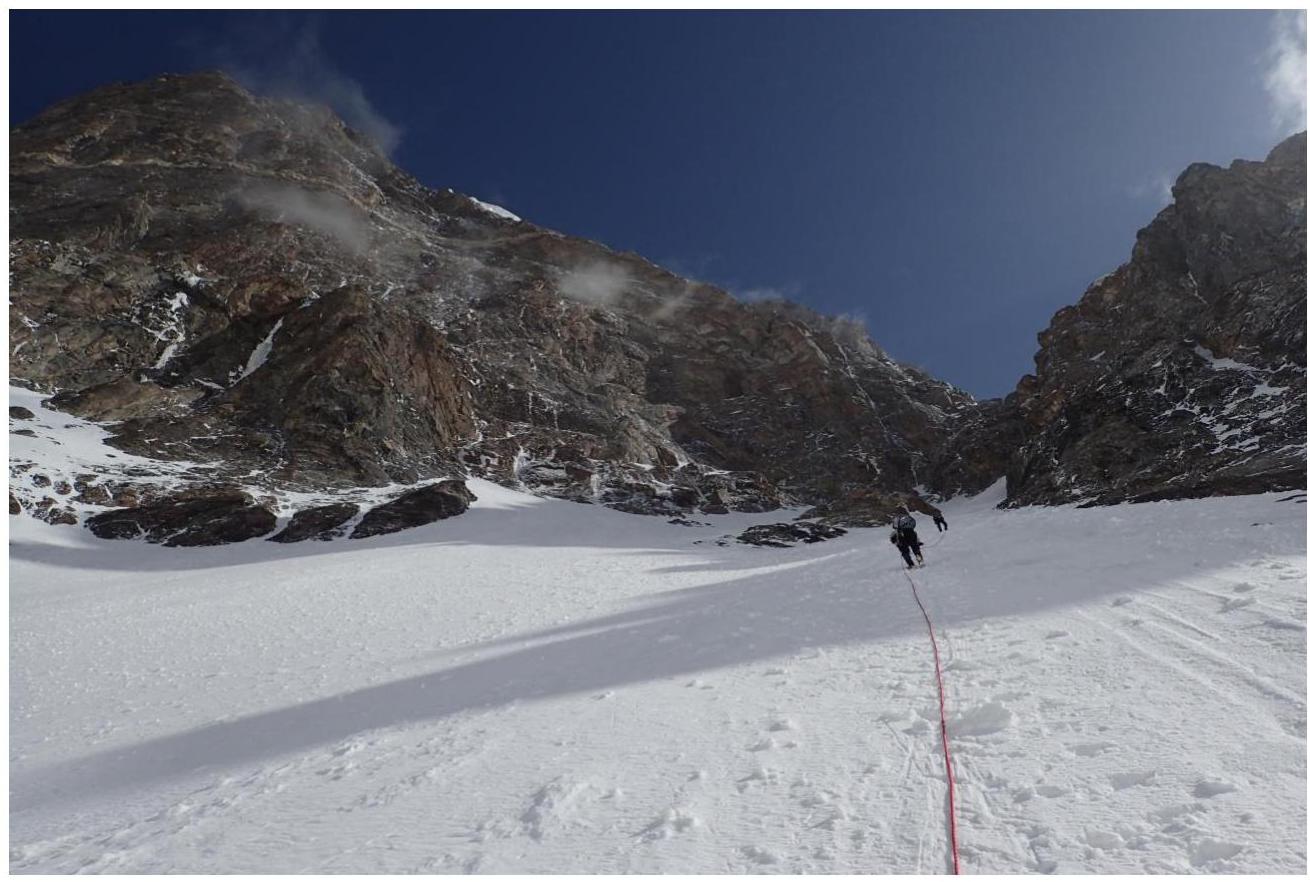
Photo 1. Section R1

Photo 2. Section R1
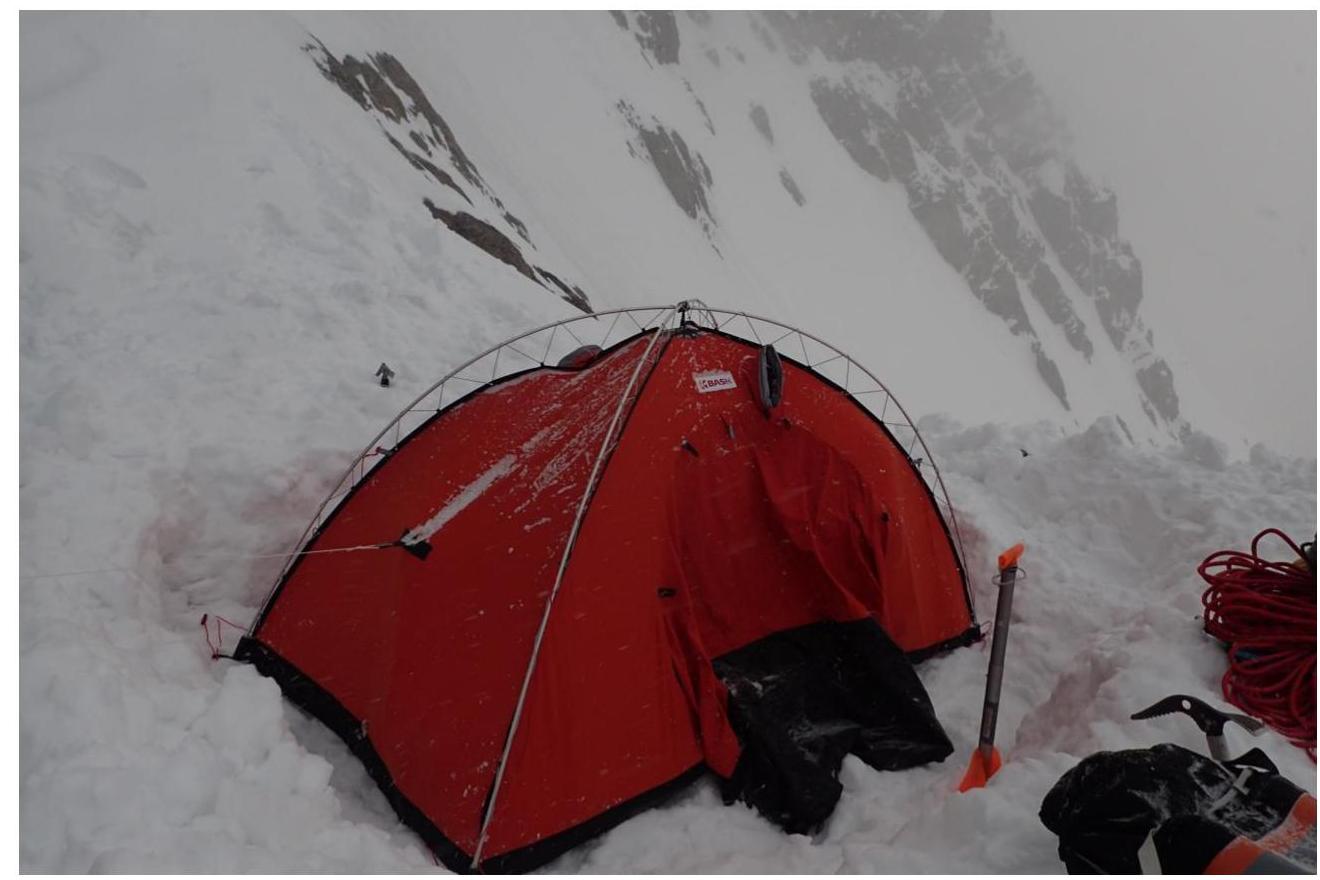
Photo 3. Second overnight stay at 5300 m
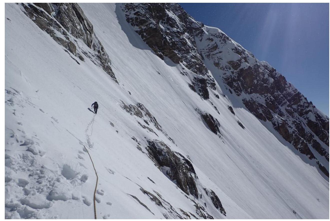
Photo 4. Beginning of section R2
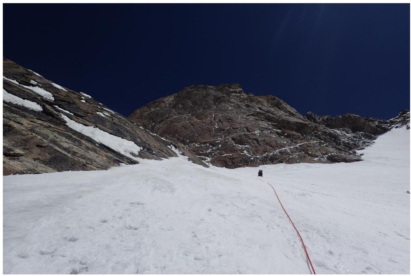
Photo 5. Section R2
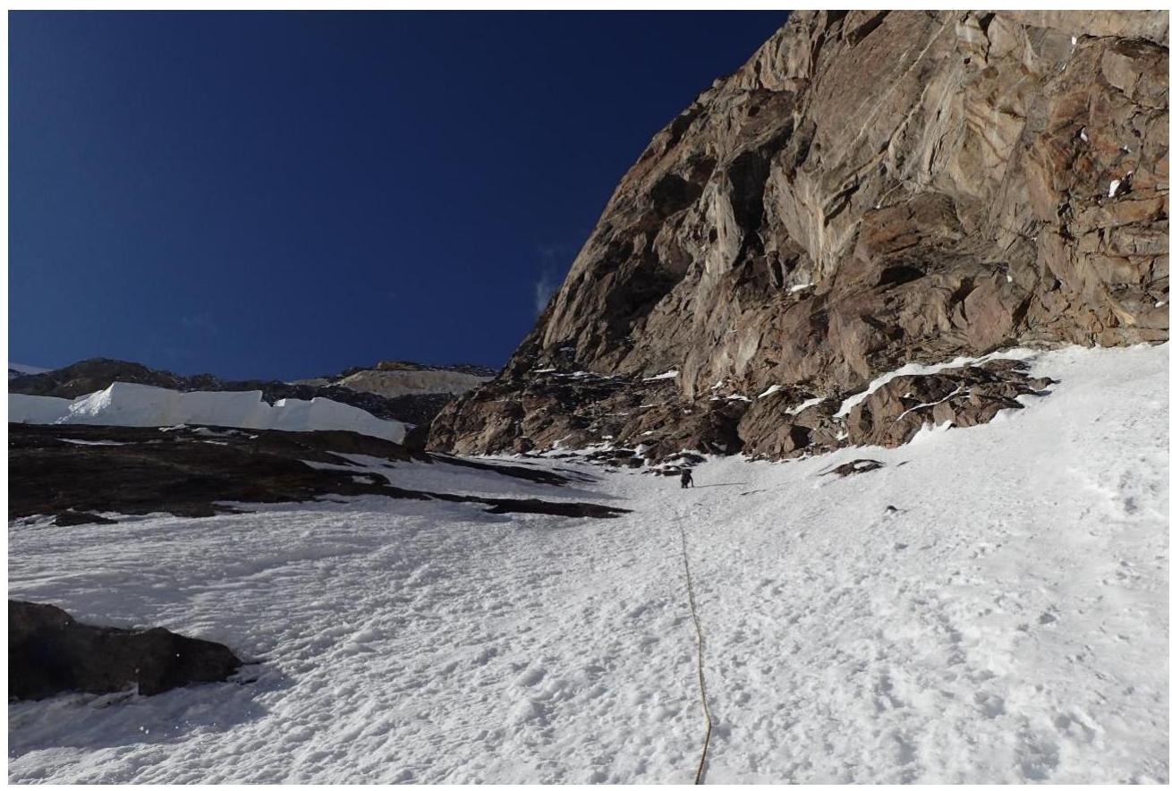
Photo 6. Section R2
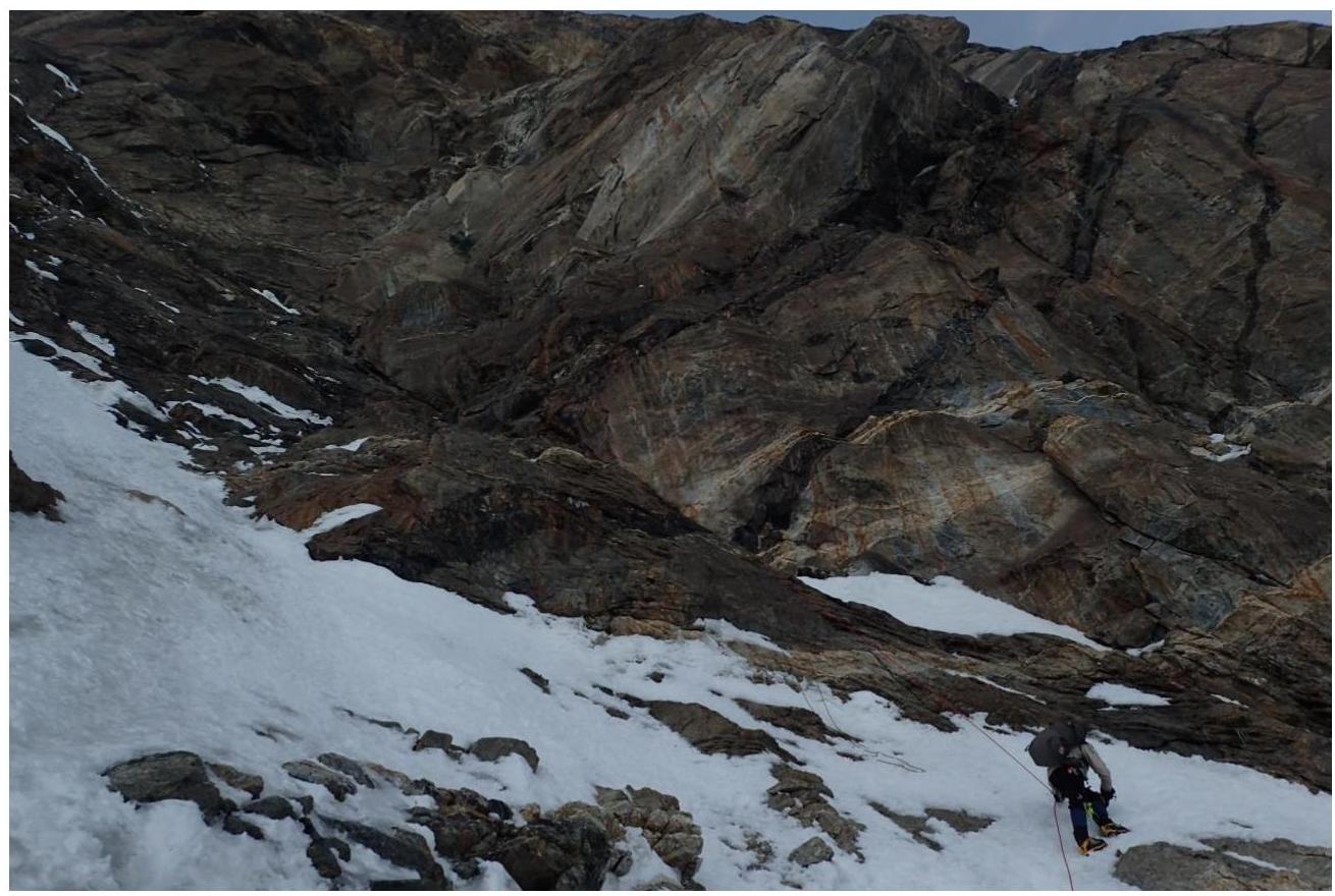
Photo 7. Approach to the third overnight stay at 5873 m
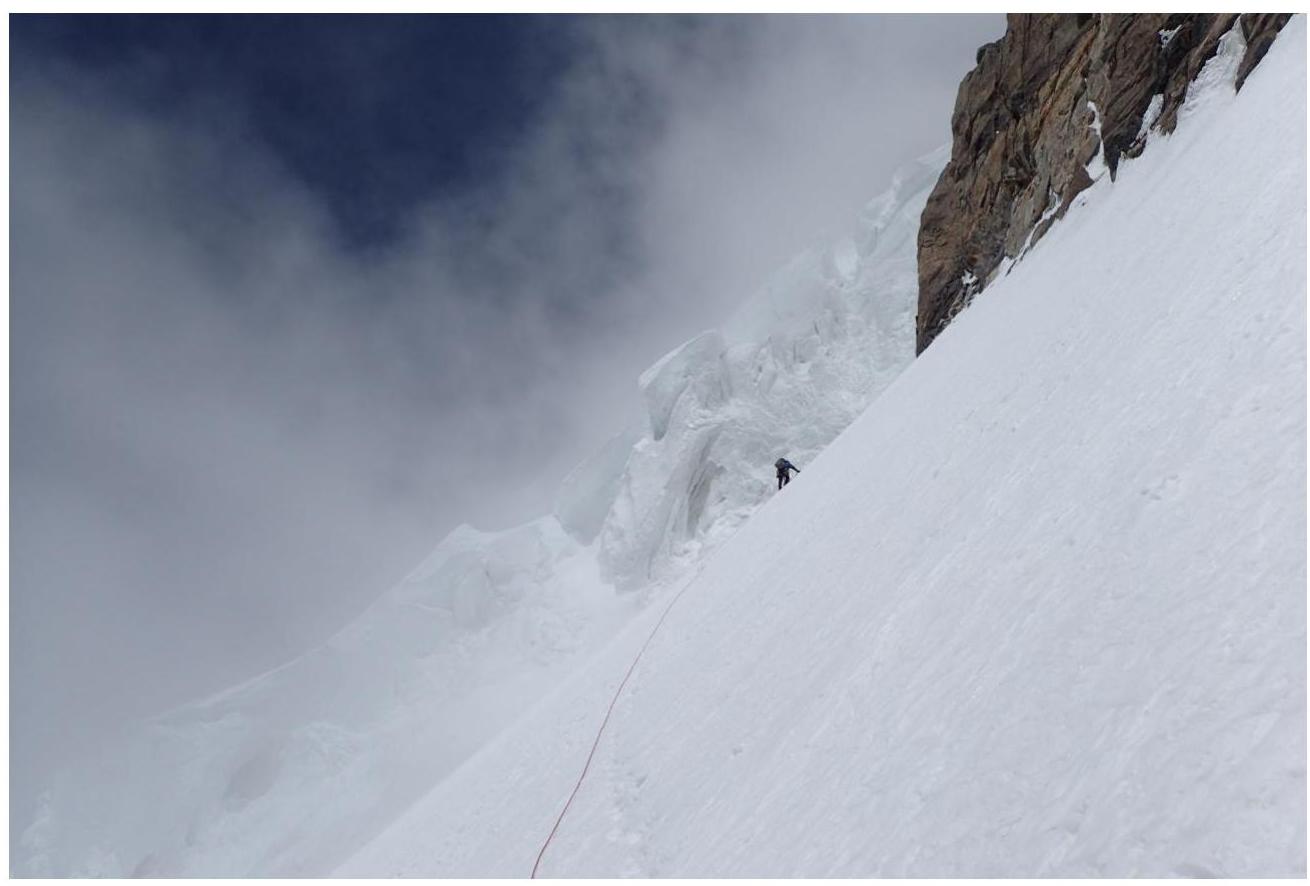
Photo 8. Section R3
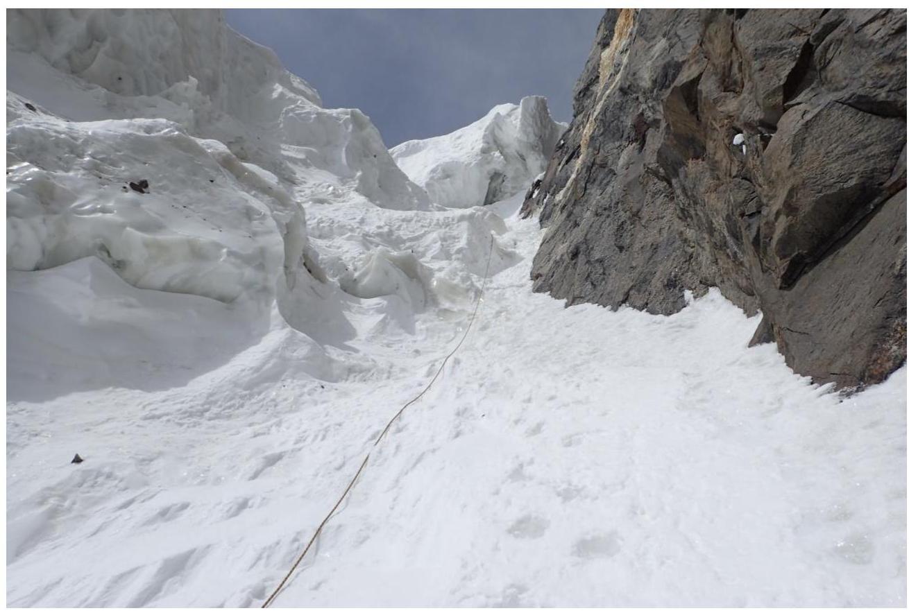
Photo 9. Section R3
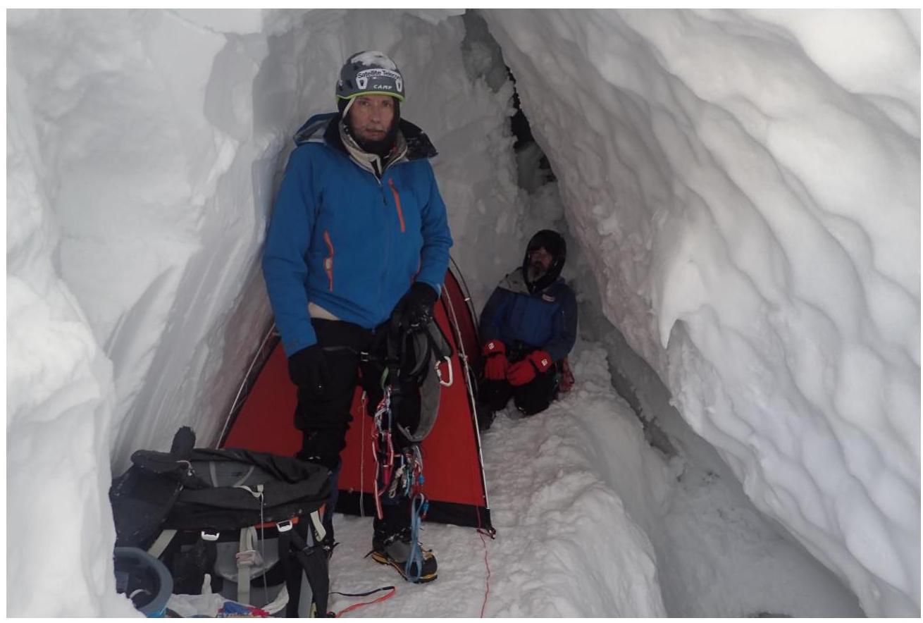
Photo 10. Fourth overnight stay at 6263 m
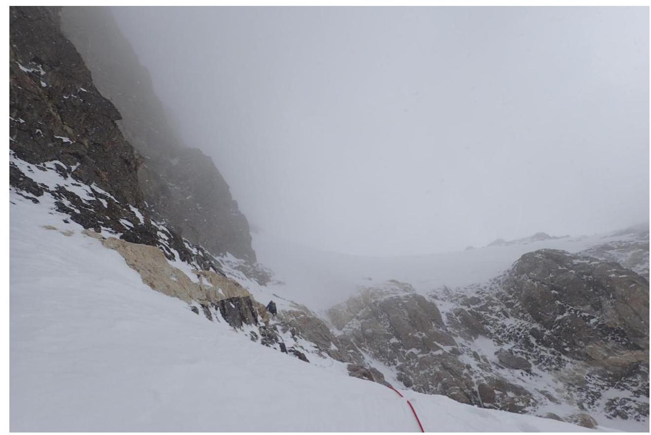
Photo 11. Section R4
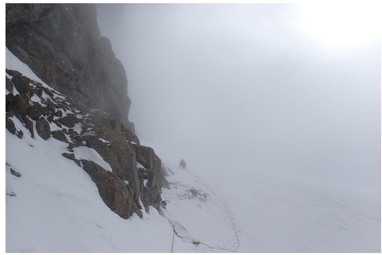
Photo 12. Section R4
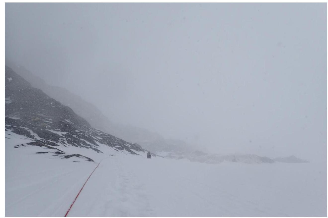
Photo 13. Section R4
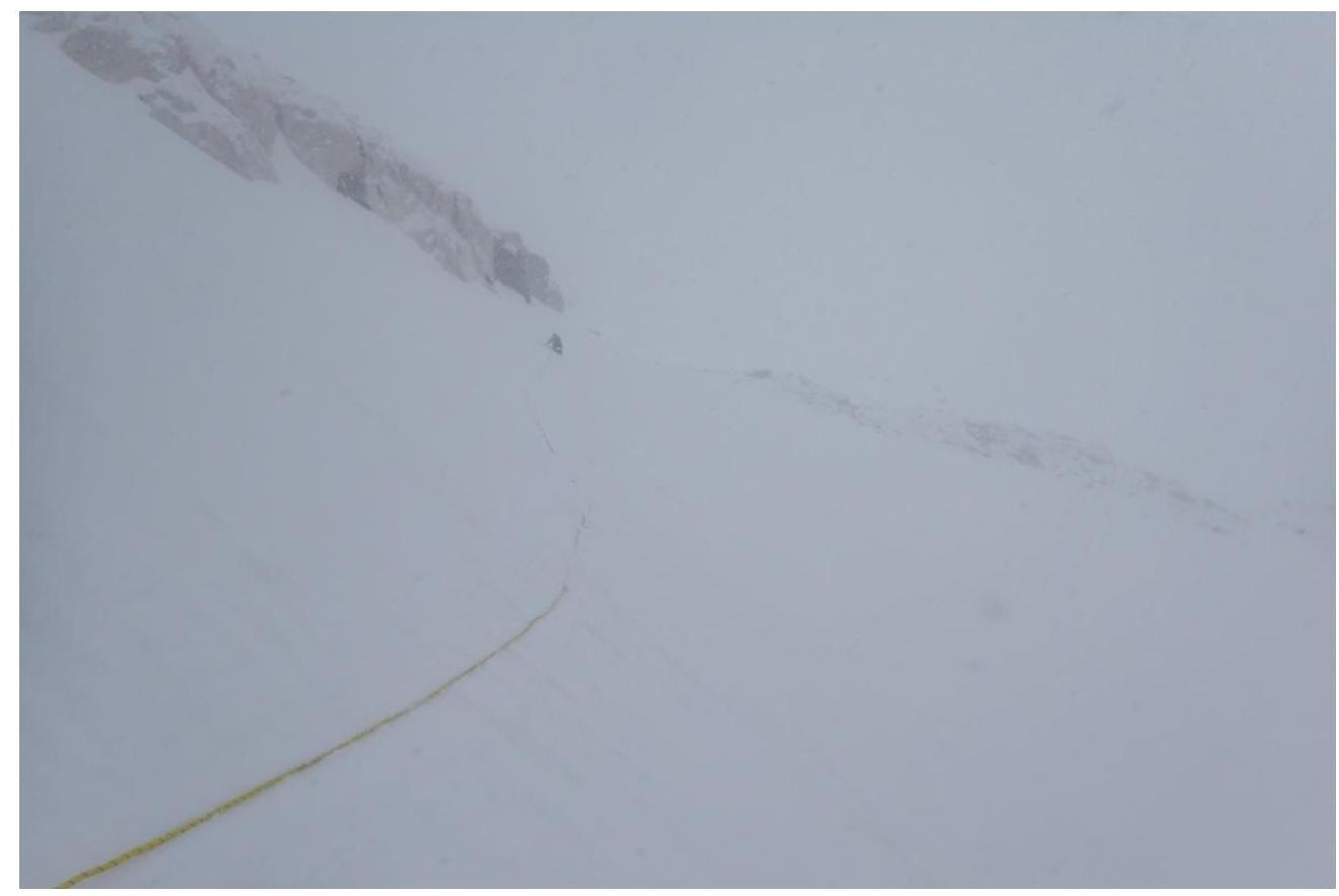
Photo 14. Section R4
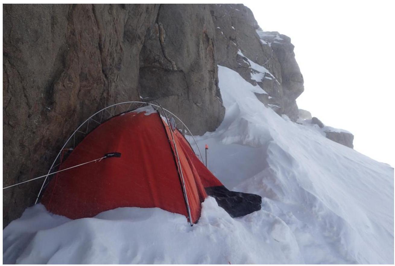
Photo 15. Fifth overnight stay at 6754 m

Photo 16. Section R5
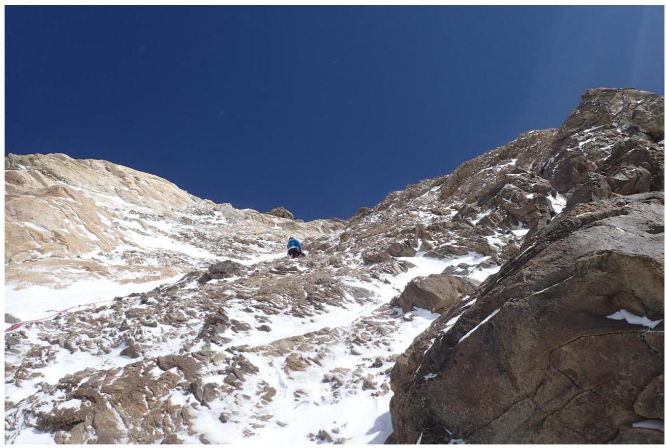
Photo 18. Section R5
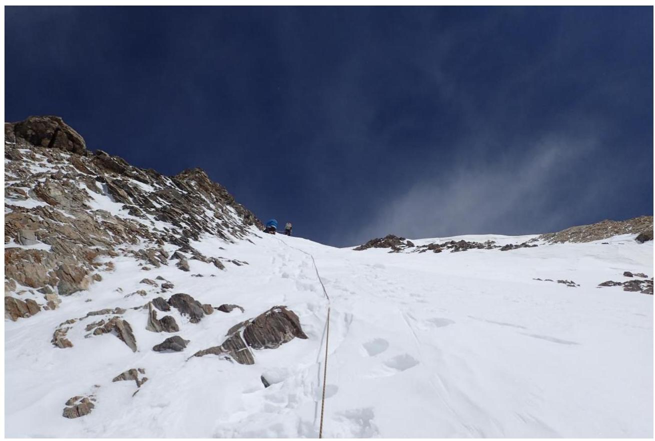
Photo 19. Section R6
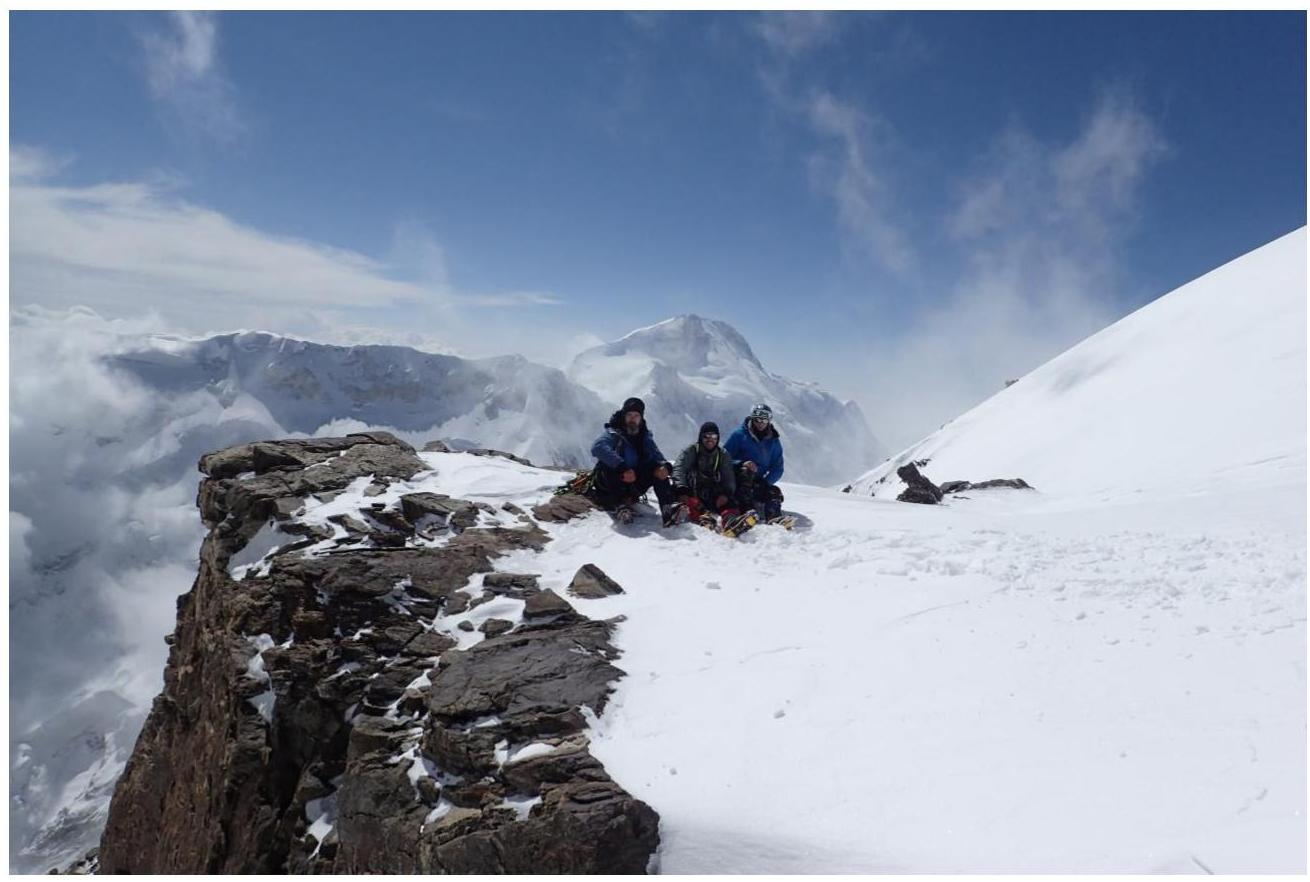
Photo 20. Team at the summit cairn
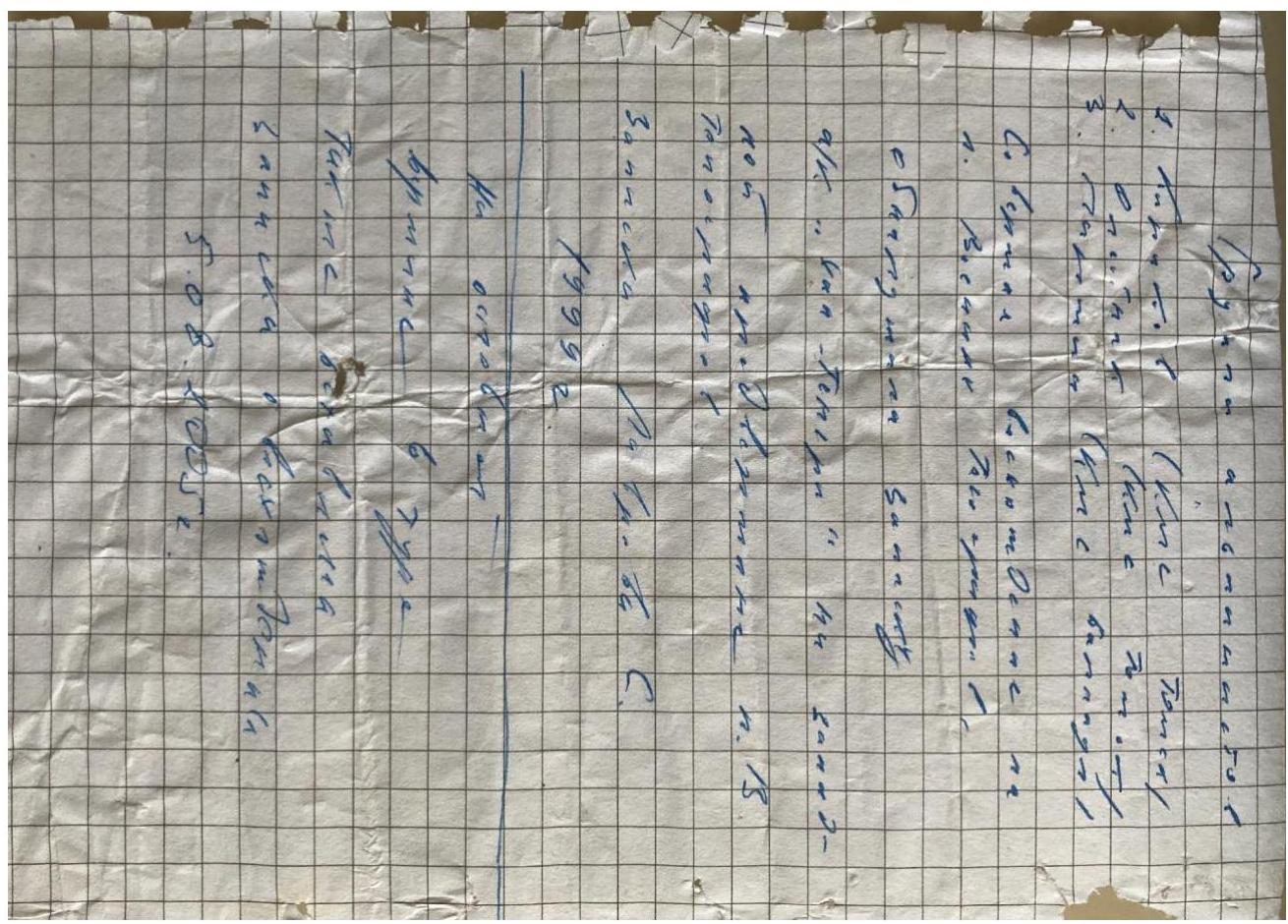
Photo 21. Note from the Western subpeak of Peak Voennykh Topografov
Comments
Sign in to leave a comment