
Ascent Passport
-
Region: Eastern Pamir, China, section 11.3 of the classification table.
-
Peak name: Muztag Ata, 7546 m, route: via the South Ridge.
-
Proposed category: 5B category of difficulty, first ascent.
-
Route type: ice and snow.
-
Route elevation gain: approximately 1450 m.
Route length: approximately 3200 m. Length of sections with 5th category of difficulty: 20 m. Average slope:
- main part of the route – approximately 45°,
- entire route – approximately 35°.
-
Pitons left on the route:
Total – 0, including screw pitons – 0. Pitons used on the route:
- screw pitons – 0 pcs.
- Total artificial technical means (ITM) used – 2.
-
Team's travel time: approximately 18 hours, 3 days.
-
Team leader:
- Valery Shanalo, Master of Sports of Russia.
- Participant: Alexey Gorbatenkov, 1st sports category.
-
Coach:
- Valery Shamalо, Master of Sports of Russia.
-
Departure from Base Camp (BC): 9:00 AM, August 21, 2005.
Departure onto the route: 10:00 AM, August 22, 2005. Reaching the summit: 3:00 PM, August 24, 2005. Return to BC: 11:00 PM, August 24, 2005.
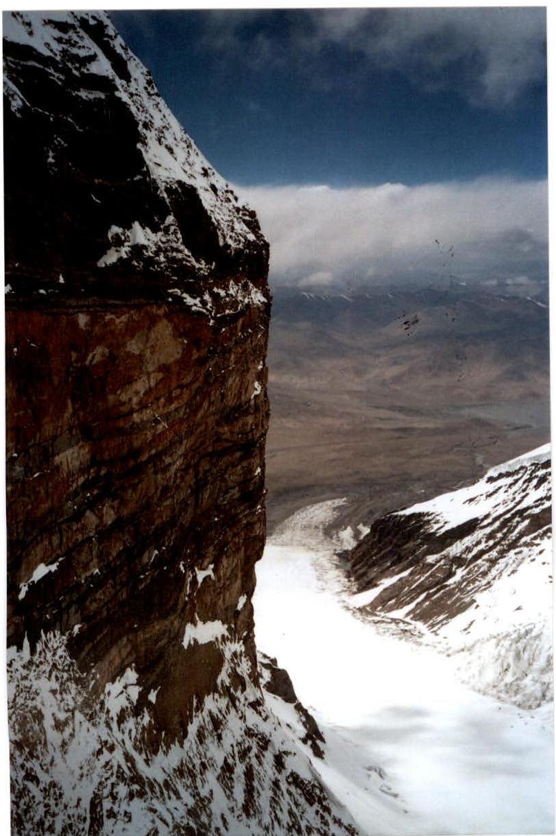
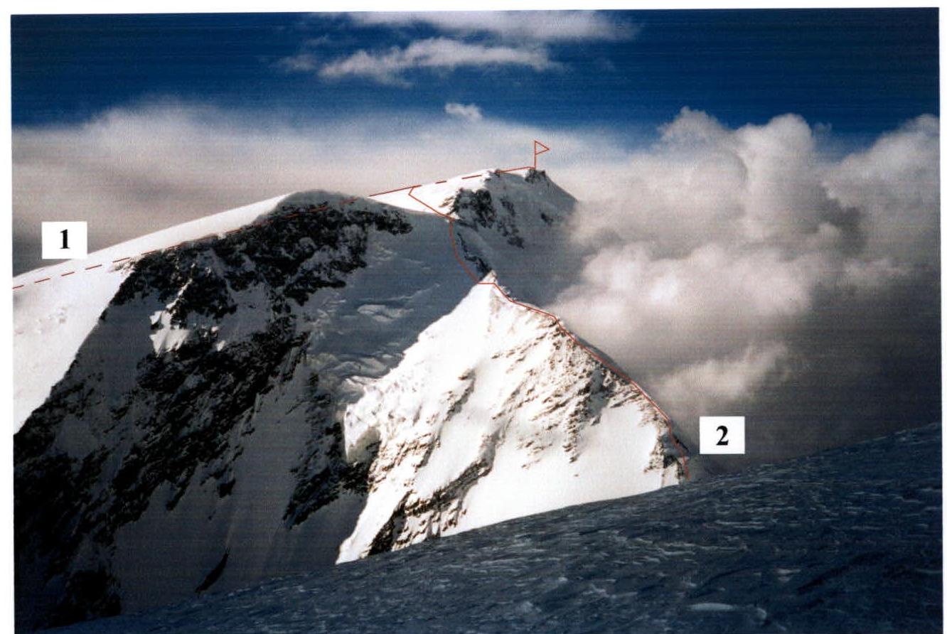
Fig. 1. General photo of the peak with approximate routes
- Route via the West slope, 5A category of difficulty, led by Kuzmin, 1956 (The part of the route not visible in the photo is marked with a dotted line)
- Route by the team of V. Shamalо – A. Gorbatenkov, St. Petersburg, August 22–24, 2005. Approximately 5B category of difficulty. (The part of the route not visible in the photo is marked with a dotted line)
Photo taken from the summit of Koskulak, August 17, 2005.
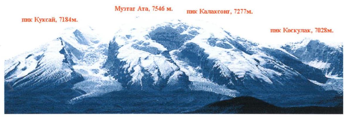
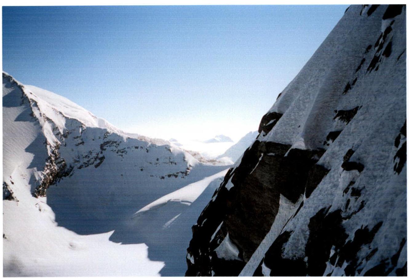
Fig. 2. Profile of the South Ridge. Photo taken from the North wall of Koskulak. Elevation approximately 6250 m. Date of photo: August 14, 2005.
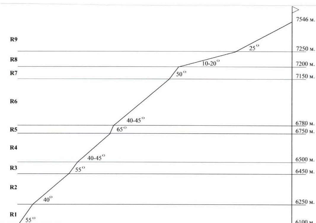
Fig. 3. Profile of the route via the South Ridge.
Brief Description of the Climbing Region
Muztag Ata is located near the boundary between the Pamir and Kunlun mountain ranges, in China.
The first ascent was made in 1956 by a Soviet-Chinese expedition led by Kuzmin via the western slope. Since then, many ascents have been made to the summit, mostly via the gentle western slopes. Ascents from the north and northeast are also known. To the southwest of the summit, peak Kalaksonng rises 70 m above the snow plateau, and the glacier to the south of the massif is also named after it, separating Muztag Ata and peak Kalaksonng from peak Koskulak. From the snow plateau near the saddle between Muztag Ata and Kalaksonng, a distinct ridge stretches southwards to the 6100 pass, along which no ascents were made until 2005. In 2005, after an unsuccessful attempt by a team from Moscow (up to 6800 m), two successful ascents were made via the South Ridge – by our team (Gorbatenkov–Shamalо) on August 22–24, and by a team of tourists from MAI led by A. Lebedev (with an ascent to Kalaksonng) in late August.
For our ascent, we used a base camp (4450 m) located to the west of Muztag Ata. It can be reached from Kashgar by car in one day. It is possible to drive a 4x4 vehicle directly to the BC, but to ensure local employment, groups are typically dropped off a few kilometers away and their gear is transported to the BC on camels.
The approach from BC to our route on the north wall takes 1–2 days. The path bypasses the icefall on the Kalaksonng glacier, then follows the moraine on the left orographic (right-hand) edge of the glacier, before descending slightly (by 50 m) onto the glacier.
Small crevasses are encountered, which are usually easy to jump over.
Suitable campsites are available almost everywhere.
The 6100 pass is logically considered the starting point of the route, after which it is necessary to proceed with protection.
Route diagram in UIAA symbols. Scale 1:6000
 |  |  |  |  |  | 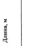 |
|---|---|---|---|---|---|---|
| R9 | - | Photo 6, 7 | 1–2 | 1000 m | 25° | |
| R8 | - | Photo 5 | 1–2 | 1000 m | 10–20° | |
| R7 | - | 4 | 70 m | 55° | ||
| R6 | - | 3 | 500 m | 40–45° | ||
| R5 | 4/5 | 40 m | 65° | |||
| R4 | - | Photo 4 | 3- | 450 m | 40–45° | |
| R3 | - | Photo 3 | 4- | 60 m | 55° | |
| R2 | - | Photo 2 | 2–3 | 500 m | 40° | |
| R1 | - | Photo 1 | 4- | 300 m | 55° |
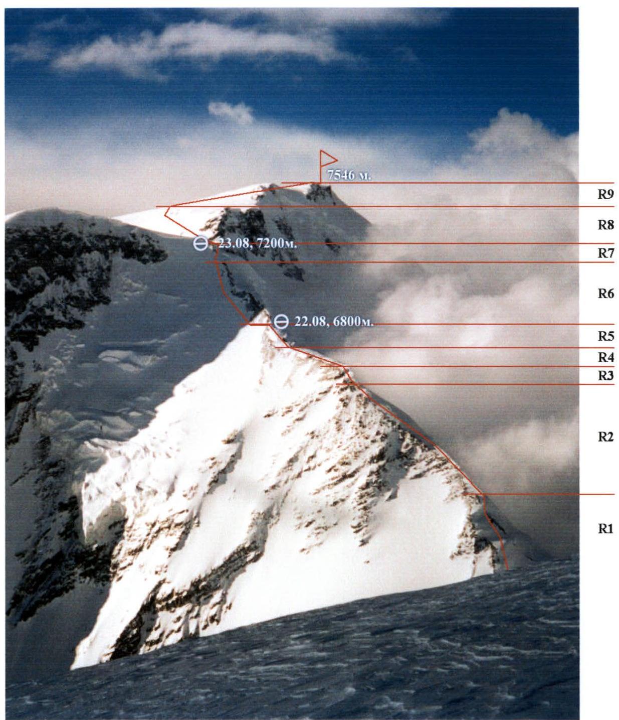
Fig. 7. Technical photo of the route.
On the summit of Muztag Ata, the team did not find a summit note, but found a large number of wands marking the summit, as well as an old, partially destroyed cairn. As confirmation of reaching the summit, photos were taken of the participants against the backdrop of the summit mound (3–4 m high). Unfortunately, the weather did not allow for panoramic photos with views of the surrounding peaks. Approximately 50 m north of the indicated location, there is another summit mound with wands marking the summit. Determining which of the two summit mounds is higher is only possible with precise instruments.
Photo Illustration of the Report
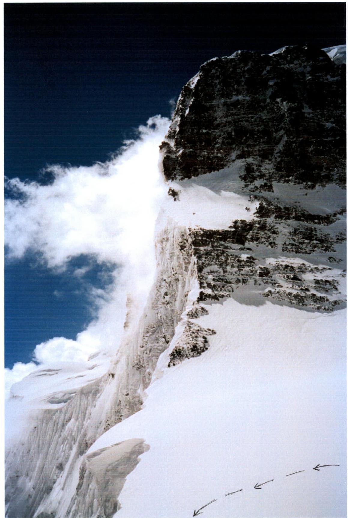
Photo 1. Section R1. Photo taken above the pass between peaks Kalaksonng and Koskulak.
Photo 2. Section R2.
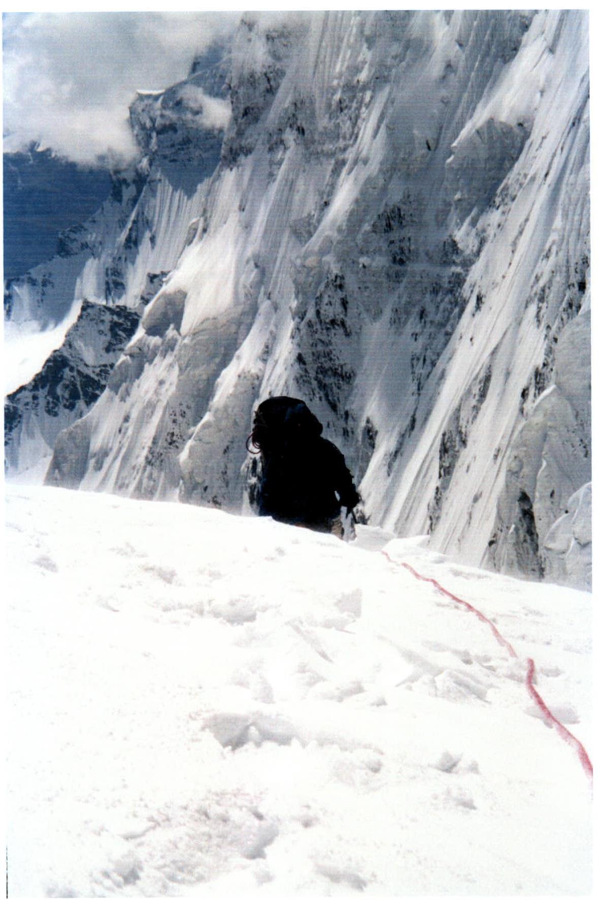
Photo 3. End of section R3.
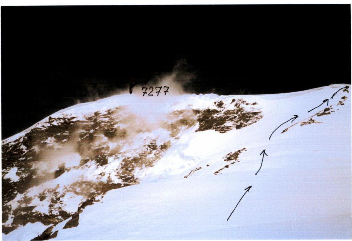
Photo 4. Photo from section R4 towards peak Kalaksonng.
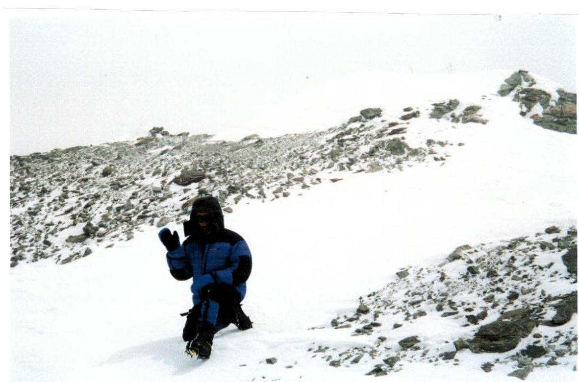
Photo 7. Alexey Gorbatenkov on the summit of Muztag Ata.

Comments
Sign in to leave a comment