
Ascent Passport
-
Region: China — Kunlun, Kongur Muztagh range. Section number according to the classification table 11.3.
-
Peak name: Muztag Ata. Route name: via the Northwest Ridge
-
Route classified by FASIЛ KР: 5A category of difficulty, first ascent
-
Route character: snow-ice
-
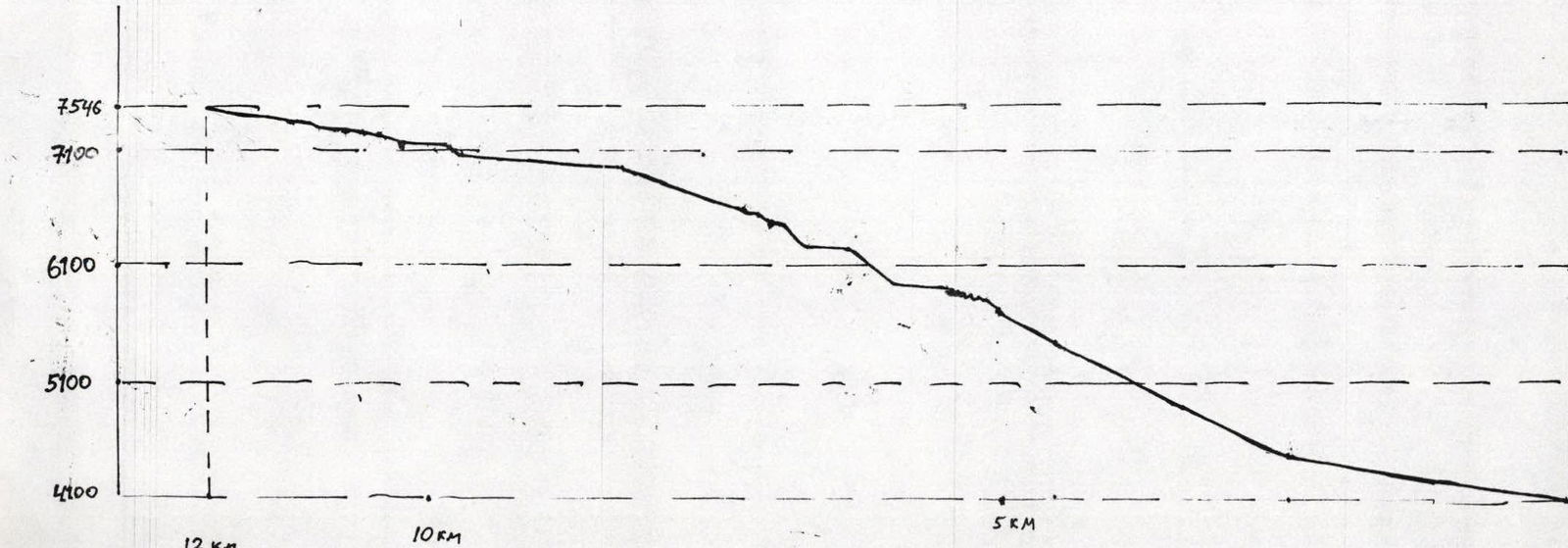
Height difference of the route: 3450 m. Route length: 14000 m. Length of section V category of difficulty ___________ m, VI category of difficulty ___________ m. Average steepness 30°
-
Pitons left on the route: total ___________ including piton hangers ___________. Use of pitons on the route: Stationary piton hangers ___________ including ITO ___________ Removable piton hangers ___________ including ITO ___________
-
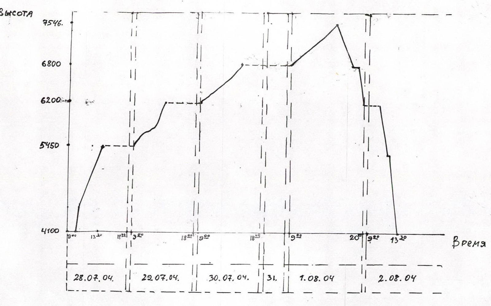
Team's climbing hours: 40 hours, days: 5
-
Ascent participants: Nikishin S.V., Nikishi
-
Departure to the route July 28, 2004, summit August 1, 2004, return to base camp August 2, 2004.
-
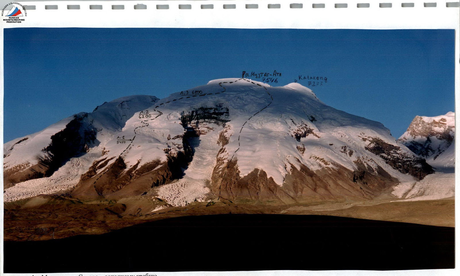
Route via the Northwest ridge.
-
USSR route 1956. Schematic diagram of the route.
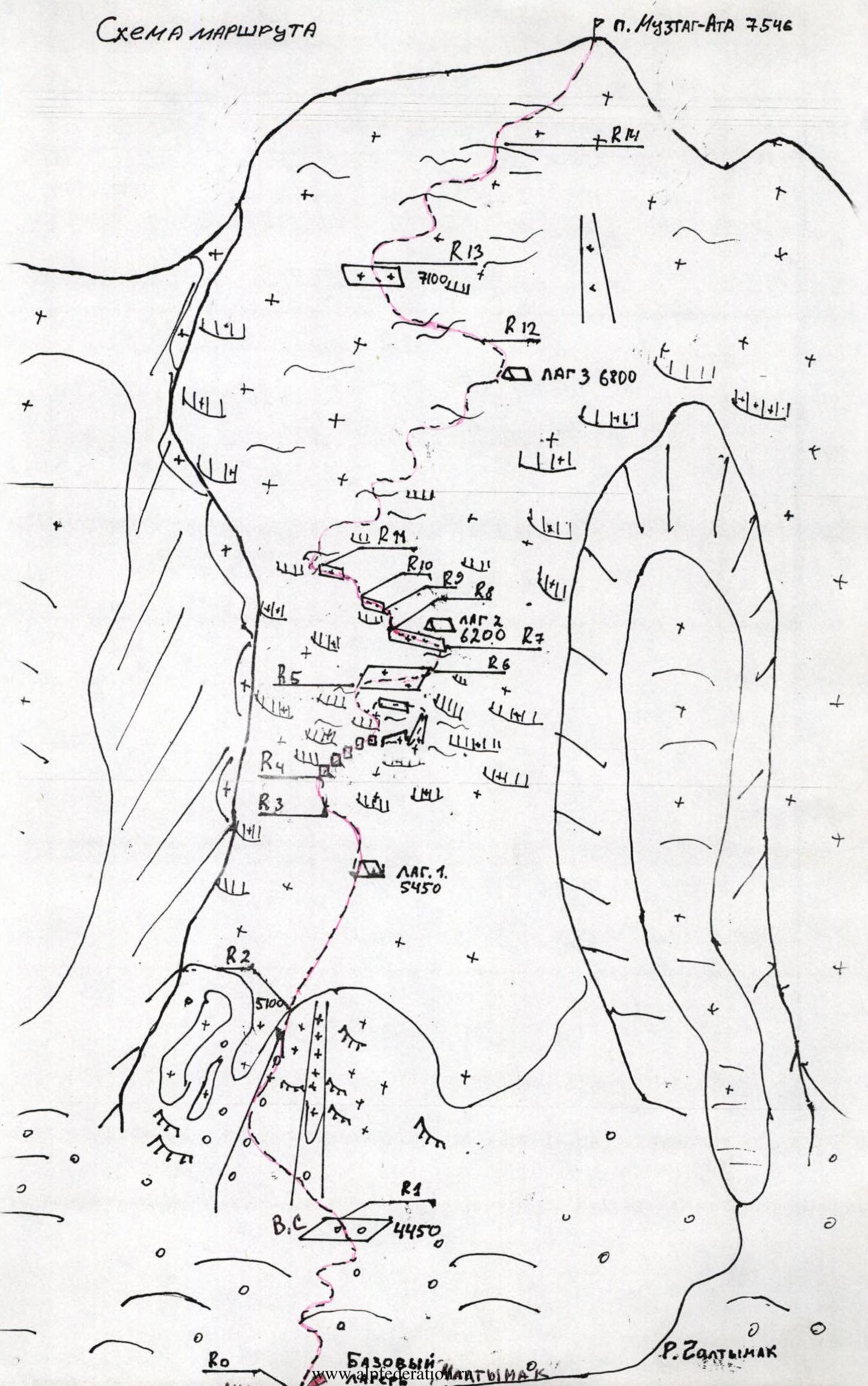
| Section | Length (meters) | Steepness (degrees) | Category of difficulty |
|---|---|---|---|
| R0 | 2500 | 10–20 | 1 |
| R1 | 1800 | 20–30 | 1 |
| R2 | 1100 | 30 | 2 |
| R3 | 150 | 40 | 2+ |
| R4 | 800 | 30–55 | 2–3 |
| R5 | 500 | 10 | 1 |
| R6 | 500 | 35 | 2 |
| R7 | 500 | 10 | 1 |
| R8 | 200 | 40 | 2 |
| R9 | 100 | 15 | 2 |
| R10 | 350 | 30 | 2 |
| R11 | 1000 | 20–30 | 2 |
| R12 | 1500 | 10–20 | 2 |
| R13 | 1200 | 20 | 2 |
| R14 | 1800 | 10–20 | 2 |
Route Description
- R0: Ascent via moraine hills.
- R1: Wide rocky ridge.
- R2: Snow-ice slope. The first camp was established at an altitude of 5450 m.
- R3: Snow-ice slope.
- R4: Icefall — 5 snow-ice walls about 10 meters high each, with wide crevasses in between, traversed via snow bridges. Further, via a narrow ice "knife" we exit into a steep 45–50° couloir, after the couloir to the left via a broken snow shelf. Through a powerful ice fault, an unreliable snow bridge, exit onto the plateau.
- R5: Wide plateau, 5900 m.
- R6: Snow-ice slope.
- R7: Wide area 6200 m. The second camp was established here.
- R8–R11: Snow-ice slopes. Passages between crevasses. 3rd camp at an altitude of 6800 m.
- R12–R14: Snow-ice slopes, ridges to the summit, moving to the left of large faults. Rocky outcrop at the summit.
Descent via the ascent route.
Ascent
- 28.07.04: Departed from base camp (4100 m), ascended to the first camp.
- 29.07.04: Ascended to the second camp.
- 30.07.04: Relocated the camp from 6200 m to 6800 m, established the 3rd camp. Weather — snow, wind.
- 31.07.04: Severe storm, stayed in the third camp.
- August 1, 2004: at 9:00 departed from the camp, at 15:30 reached the summit. The summit push was made in stormy weather and poor visibility (strong wind, snow). For orientation, a satellite navigator was used. At 20:00 descended to 6200 m.
- August 2, 2004: descended to base camp.
Route Profile
Movement Schedule
-
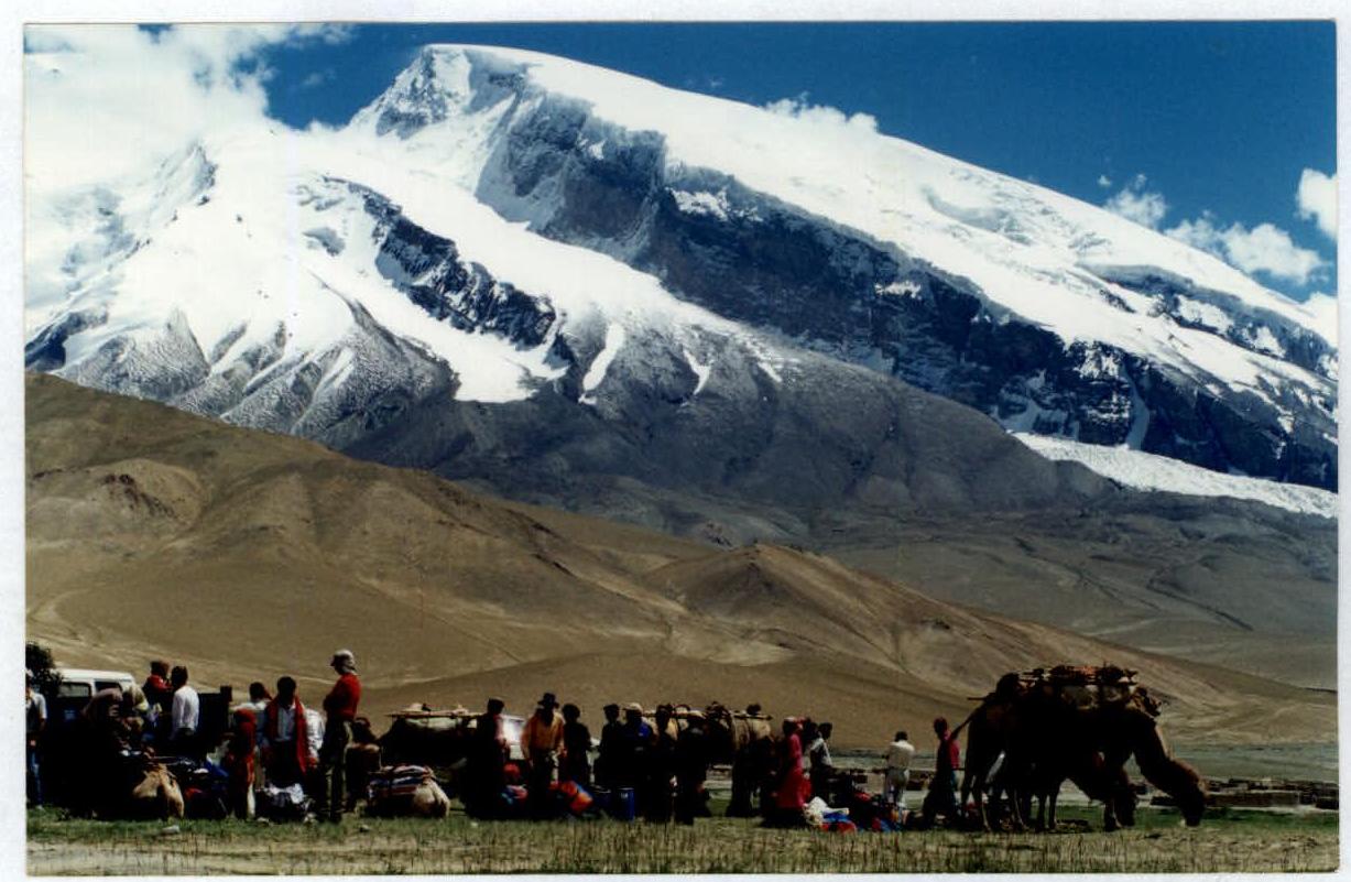
Mustag Ata. View from the northeast.
-
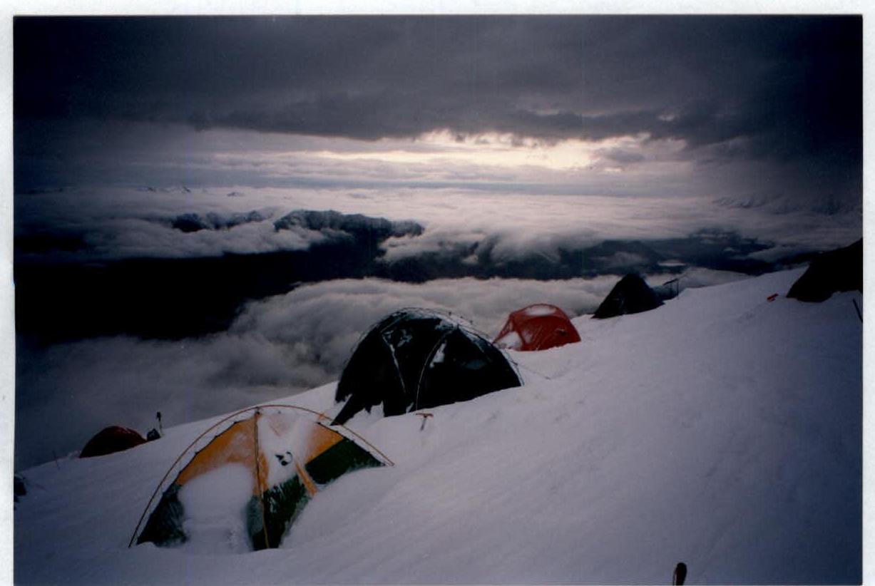
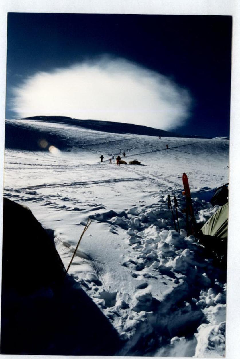
First camp.
-
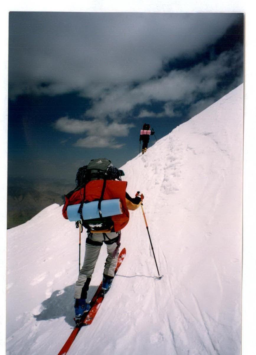
Ascent above the first camp.
-
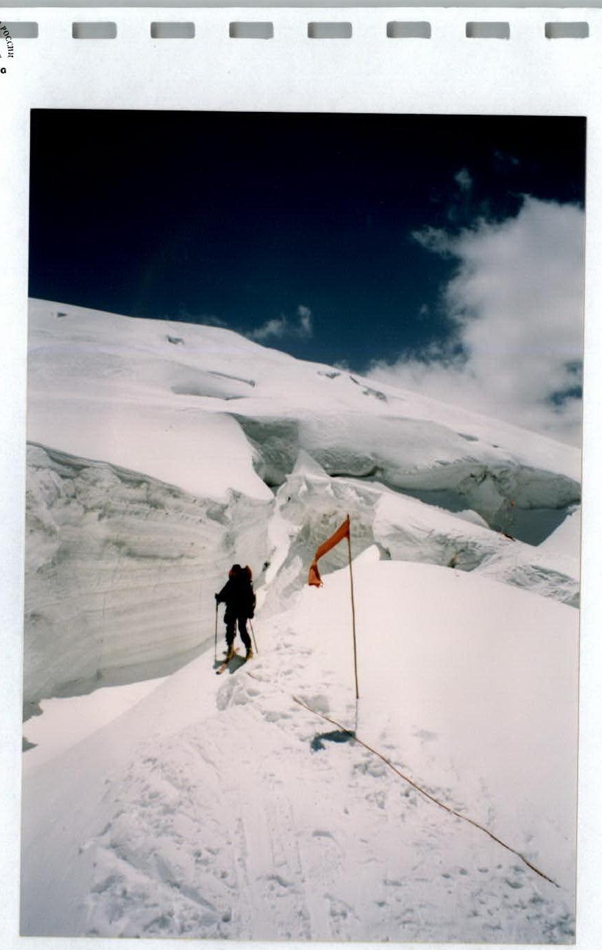
In the icefall.
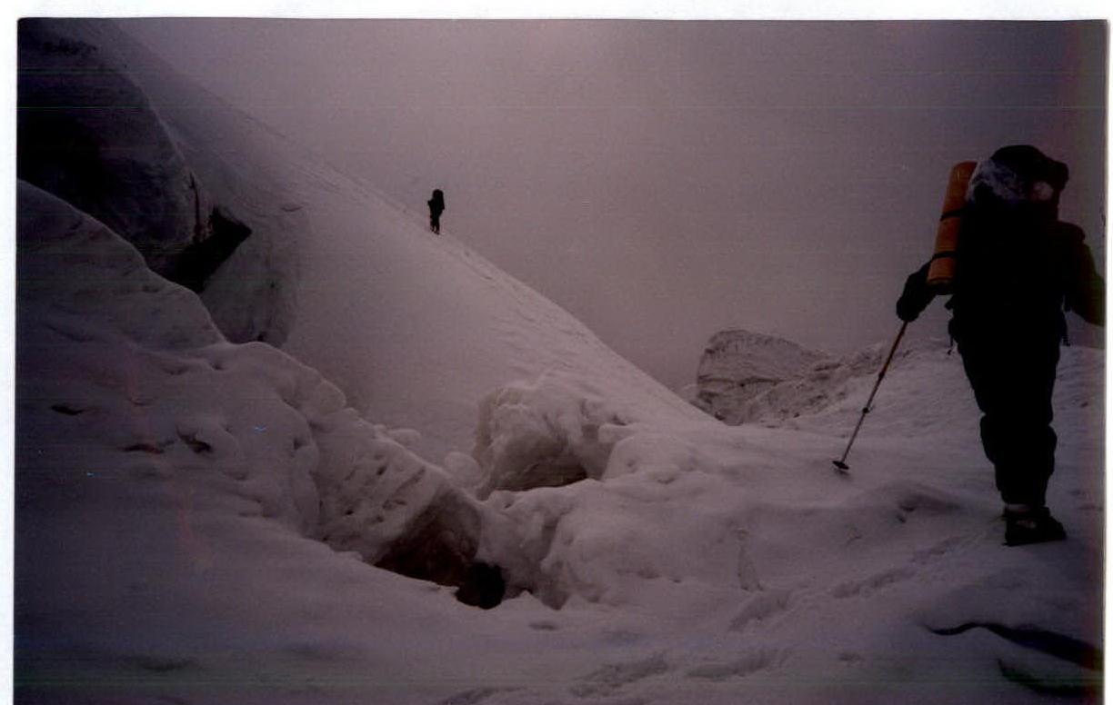
In the icefall.
Second camp.
Comments
Sign in to leave a comment