10
ASCENT DOCUMENT
-
Region: Eastern Pamir, China, section 11.3 of the classification table.
-
Name of the peak: Koskulak, 7028 m, route: via the North face.
-
Proposed - 6A category of difficulty, first ascent.
-
Character of the route: combined.
-
Height difference of the route: about 1300 m.
Total length of the route: about 2300 m.
Length of sections:
- V category of difficulty - 160 m
- VI category of difficulty - 15 m
Average steepness:
- main part of the route - about 55°,
- entire route - about 52°.
-
Pitons left on the route:
total - 2, including bolted pitons - 0. Pitons used on the route:
- bolted - 0 pcs.
- ITO - 22
-
Team's climbing hours: about 56 hours, 7 days.
-
Team leader:
Shanalo Valery Pavlovich, Master of Sports of Russia.
Participant:
- Gorbatenkov Alexey, 1st sports category
-
Coach:
Shanalo Valery Pavlovich, Master of Sports of Russia.
-
Departure from Base Camp:
- 10:00 August 10, 2005.
Start of the route:
- 9:00 August 11, 2005.
Reaching the summit:
- 16:00 August 17, 2005.
Return to Base Camp:
- 9:00 August 19, 2005.

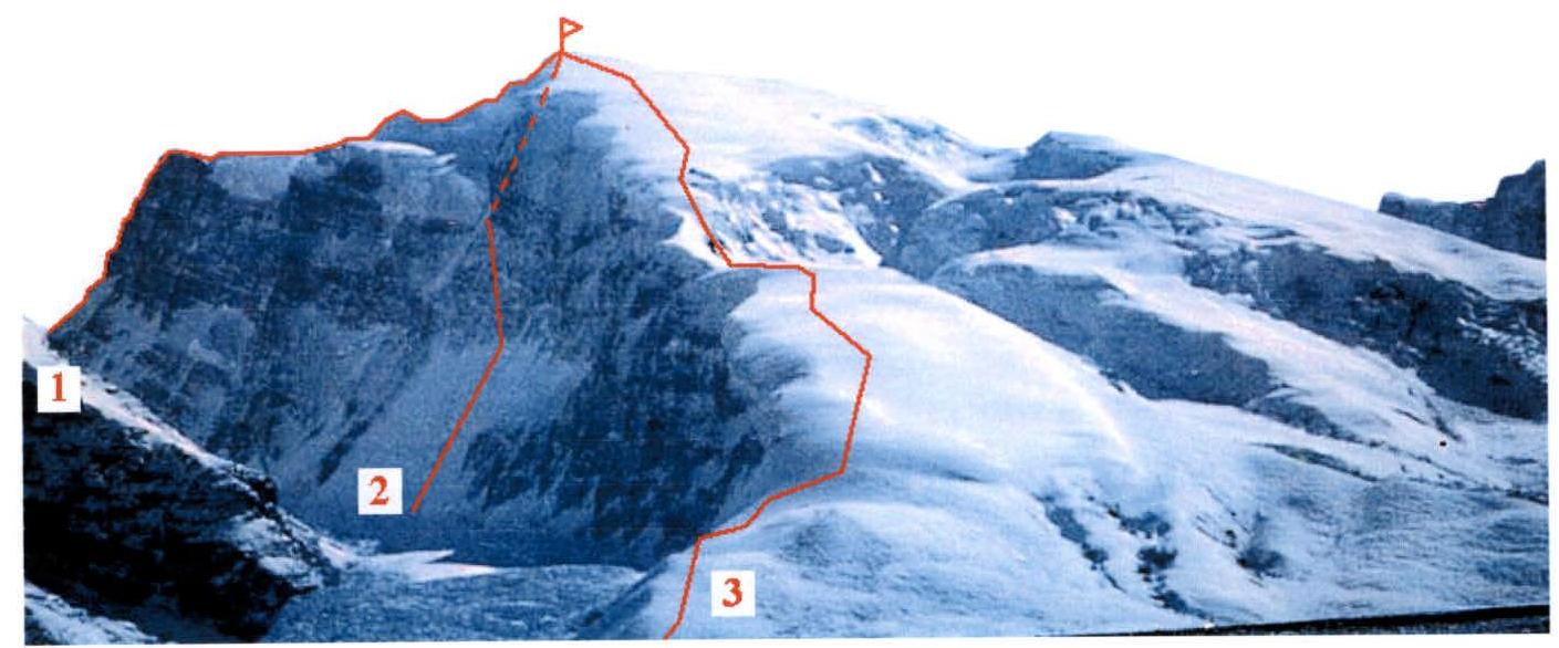
Fig. 1. General photo of the peak with approximate routes
- Route of the team from MAI alpine club, Moscow. August 20-27, 2005. Approximately 6A category of difficulty.
- Route of the duo V. Shamalо - A. Gorbatenkov, St. Petersburg, August 11-17, 2005. Approximately 6A category of difficulty. (The part of the route not visible in the photo is marked with a dotted line)
- Approximate route of A. Novikov's team, Moscow and the expedition led by A. Petrov, Moscow, August 10, 2005, August 12, 2005. Approximately 5A category of difficulty.
Photo taken from the Karasu valley. The photograph from the MAI tourist club website was used. (http://www.turclubmai.ru↗)
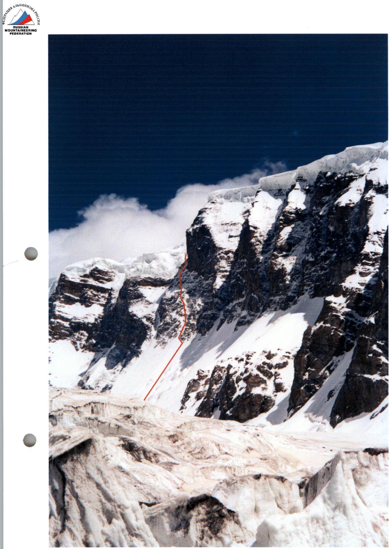
Fig. 2. Photo of the peak with the lower part of the route marked. Photo taken from the Kalakson glacier, at an altitude of about 5400 m. Date taken: August 6, 2005.
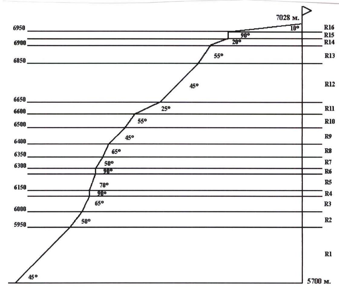
Fig. 3. Profile of the route along the North face.
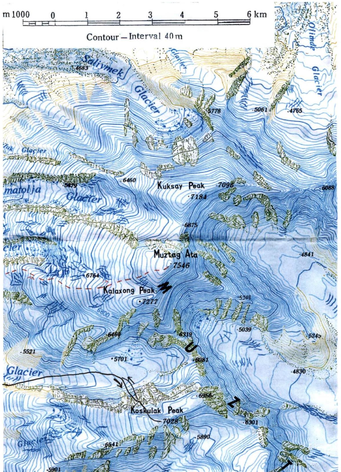
Fig. 5. Map of the ascent area 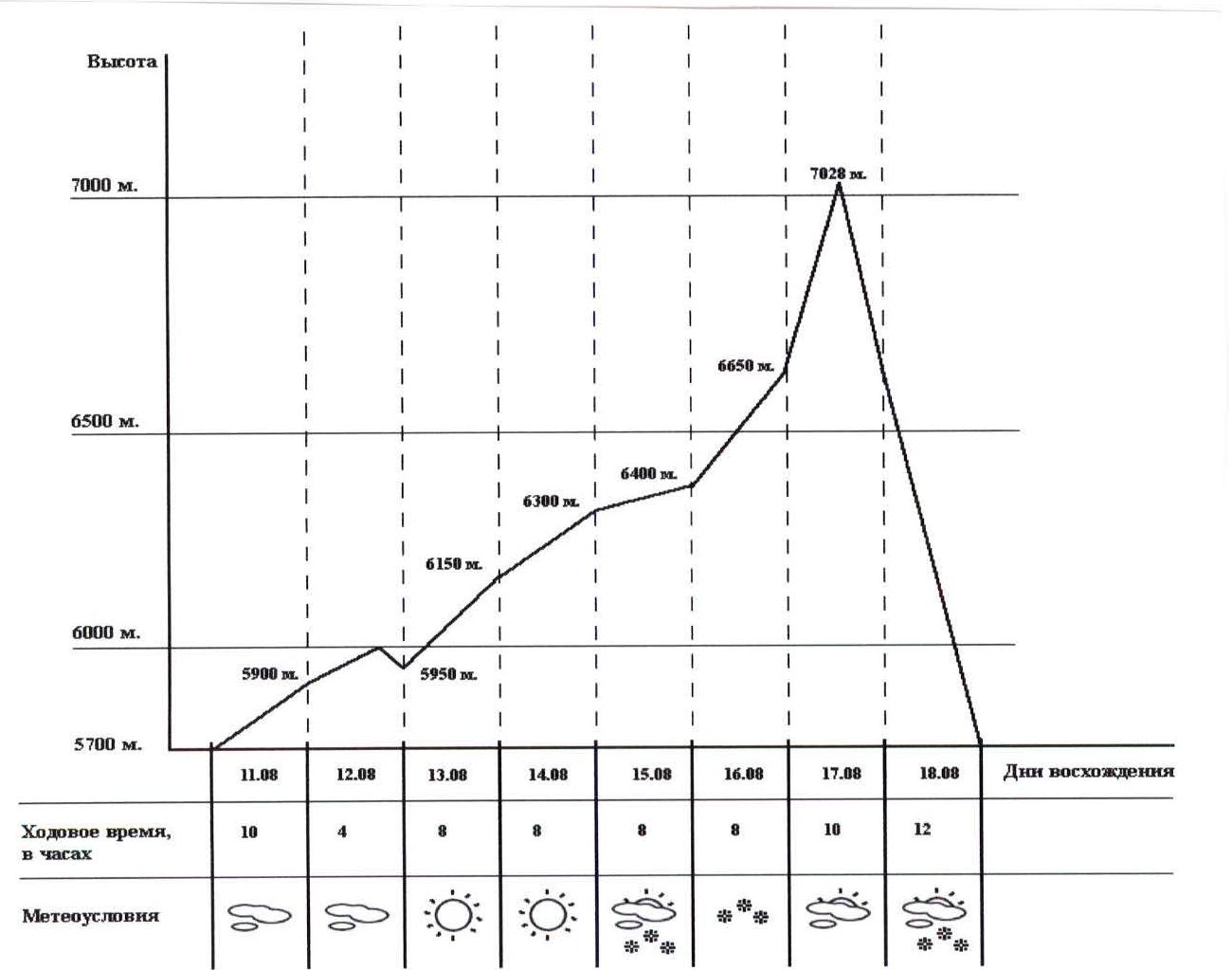
Route diagram in UIAA symbols. Scale ~ 1:5000
| Section number | Ice and snow pitons | Rock pitons | Chocks | UIAA notation | Photo | Difficulty | Length, m | Steepness, degrees |
|---|---|---|---|---|---|---|---|---|
| R16 | - | - | - | Photo 10–14 | I | 300 | 20 | |
| R15 | 12/12 | - | - | Photo 9 | VI | 12 | 80–90 | |
| R14 | - | - | - | II | 50 | 20 | ||
| R13 | 4 | - | - | V– | 80 | 55–70 | ||
| R12 | - | - | - | III | 500 | 45 | ||
| R11 | - | - | - | II | 200 | 25 | ||
| R10 | - | - | - | Photo 8 | IV– | 200 | 55 | |
| R9 | 1 | - | - | Photo 6, 7 | III | 250 | 45 | |
| R8 | - | 4 | - | IV– | 70 | 65 | ||
| R7 | - | 4 | 8 | Photo 4, 5 | IV+ | 100 | 45 | |
| R6 | - | 8/2 | 12/3 | Photo 3 | VI– | 25 | 85–90 | |
| R5 | 15 | 2 | 4 | Photo 2 | V– | 170 | 70 | |
| R4 | - | 7/3 | 9/2 | VI– | 20 | 90 | ||
| R3 | 6 | 2 | - | Photo 1 | IV+ | 180 | 65 | |
| R2 | 6 | - | - | III+ | 70 | 50 | ||
| R1 | - | - | - | I–II | 400 | 45 |
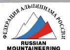
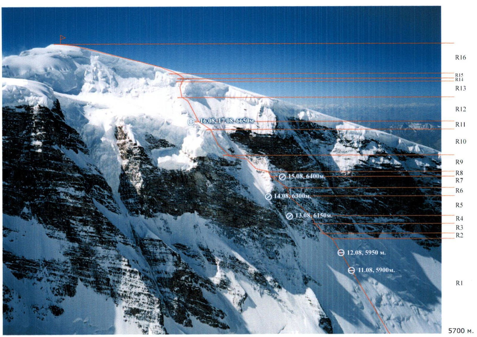
Fig. 7. Technical photo of the route
The summit of Koskulak is a large snow dome, making it very difficult to leave a control cairn or a note. The nearest rocks or stones to the summit are located at a significant distance. Moreover, we were able to determine the exact location of the summit with an accuracy of tens of meters only with the help of special technical means. As confirmation of our presence on or near the summit, in addition to photo No. 14, where the summit is barely identifiable (due to its unimpressive appearance), we provide photos taken from the summit (No. 11, 12, 13) in the direction of north - northwest - southwest. They show:
- the neighboring peaks of Muztag-Ata and Kalakson to the north,
- our trail from the point of exit onto the plateau.
The distance from the exit point to the summit is about 300 m, which can be easily determined from the map on page 6.
PHOTO ILLUSTRATIONS OF THE REPORT
Photo 1. Section R3. Beginning of the rock belt.
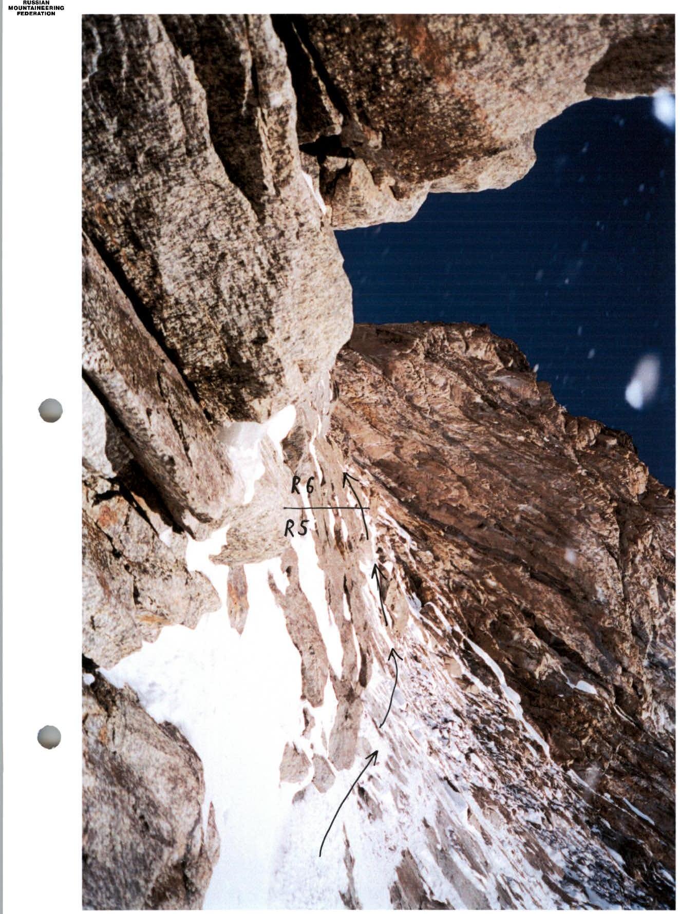
Photo 2. Overhang above the first bivouac. Section R5.
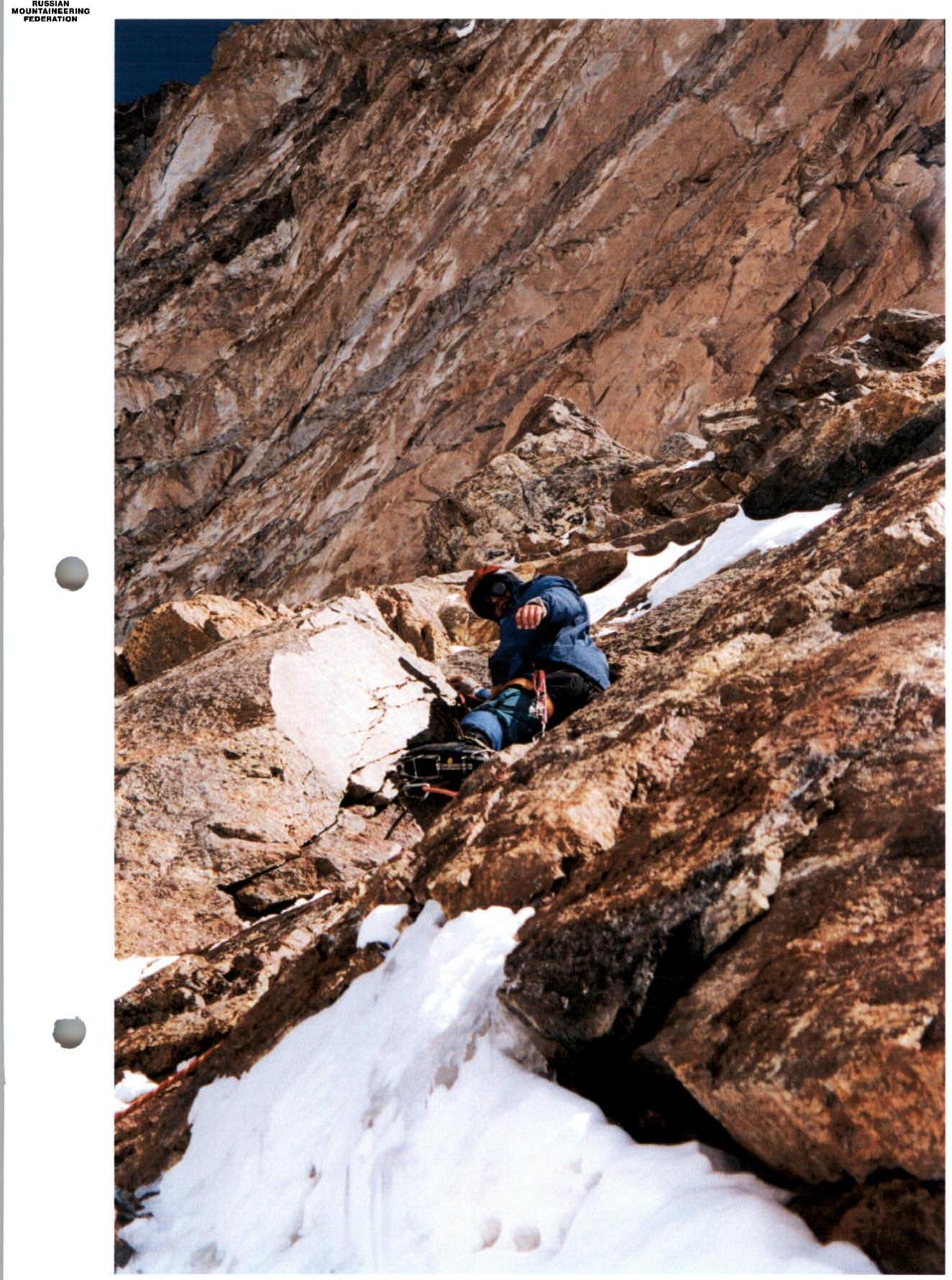
Photo 3. Work on the rocks. Section R6.
Where is M-t going?

Photo 4. Exit from the second bivouac. Section R7.
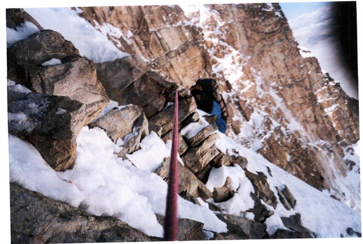
Photo 5. Section R7.
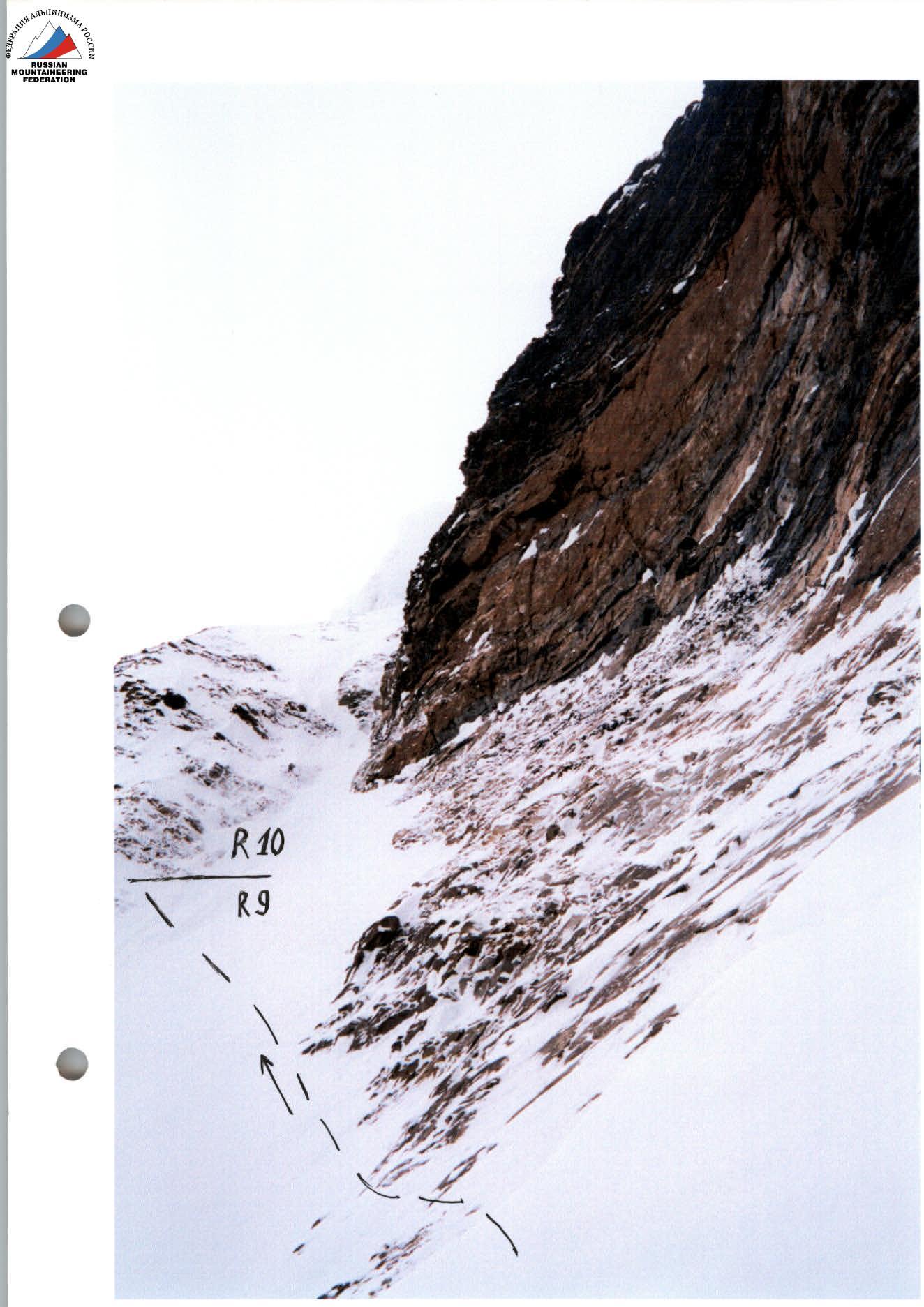
Photo 6. Exit into the snow couloir. Section R9.
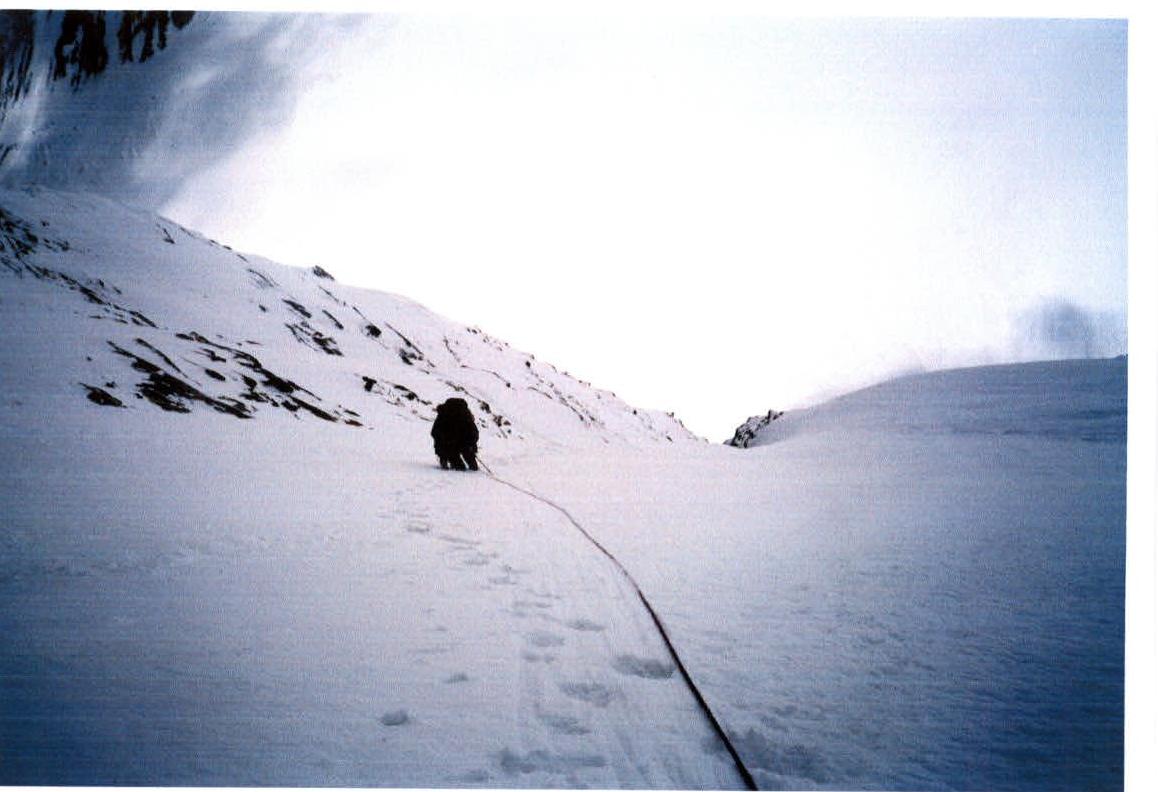
Photo 7. In the couloir.
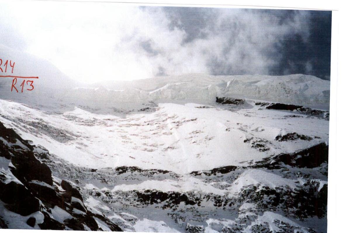
Photo 8. Exit from the icefall. Section R10.
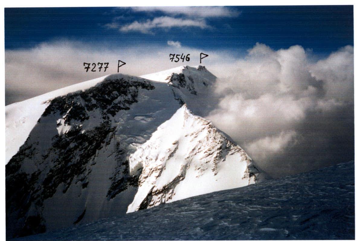
Photo 11. Photo from the summit plateau towards the peak of Kalakson and the peak of Muztag-Ata. Section R16.
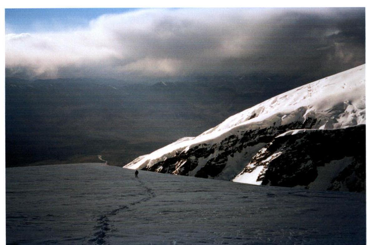
Photo 12. Photo from the summit plateau to the northwest. Section R16.