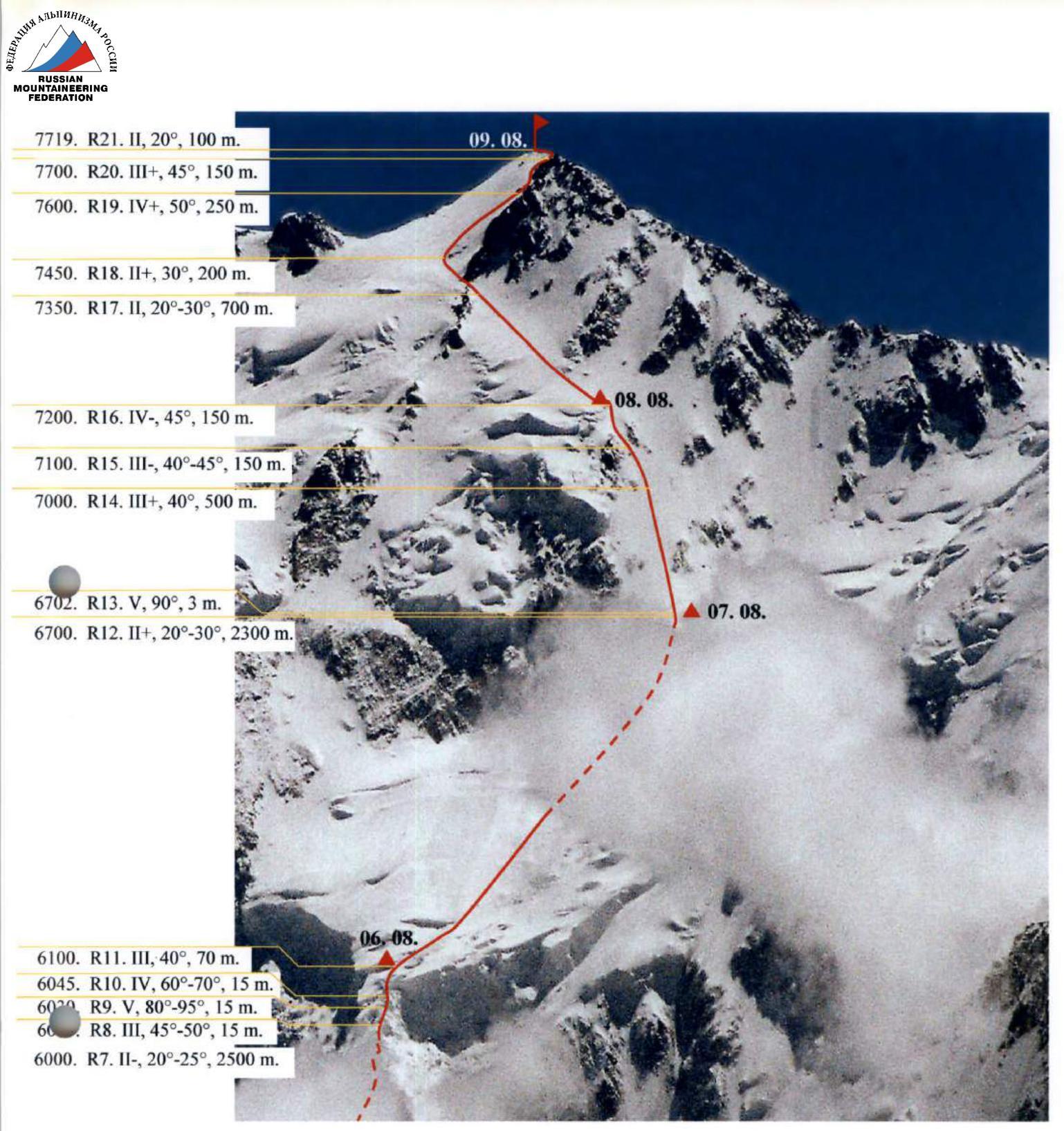
11.3.6
Ascent Certificate
-
Region: Eastern Pamir, China, Karayalak gorge, section 11.3 of the classification table.
-
Peak name: Kongur, 7719 m, route: via NW slope and N ridge.
-
Proposed - 6A category of complexity, first ascent, 2nd overall ascent.
-
Route type: ice-snow.
-
Route elevation gain: approx. 4000 m.
Route length: approx. 11500 m.
Length of sections with 5th category of complexity: 17 m.
Average steepness:
- main part of the route - approx. 33°,
- entire route - approx. 33°.
-
Pitons left on the route:
total - 10, including screw pitons - 0.
Pitons used on the route:
screw removable - 0 pcs.
Total number of used ITC - 5.
-
Team's climbing hours: approx. 200 hours, 21 days.
-
Team leader:
Shamaло Valery Pavlovich, Master of Sports of Russia.
Team members:
- Korabelnikov Kirill Vladimirovich, Master of Sports of Russia
- Silin Oleg, 1st sports category
- Purins Valdiss, 1st sports category
- Gorbatenkov Alexey, 1st sports category, up to a height of approx. 7350 m.
-
Coach:
Shamaло Valery Pavlovich, Master of Sports of Russia.
-
Departure for the route: 9:00, July 10, 2004.
Start of ascent: 6:00, August 5, 2004.
Reaching the summit: 16:00, August 9, 2004.
Return to Base Camp: 22:00, August 10, 2004.
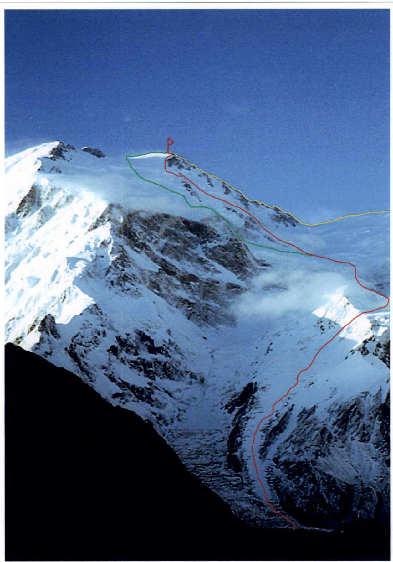
General photo of the peak. Taken from a height of 3000 m on August 12, 2004.
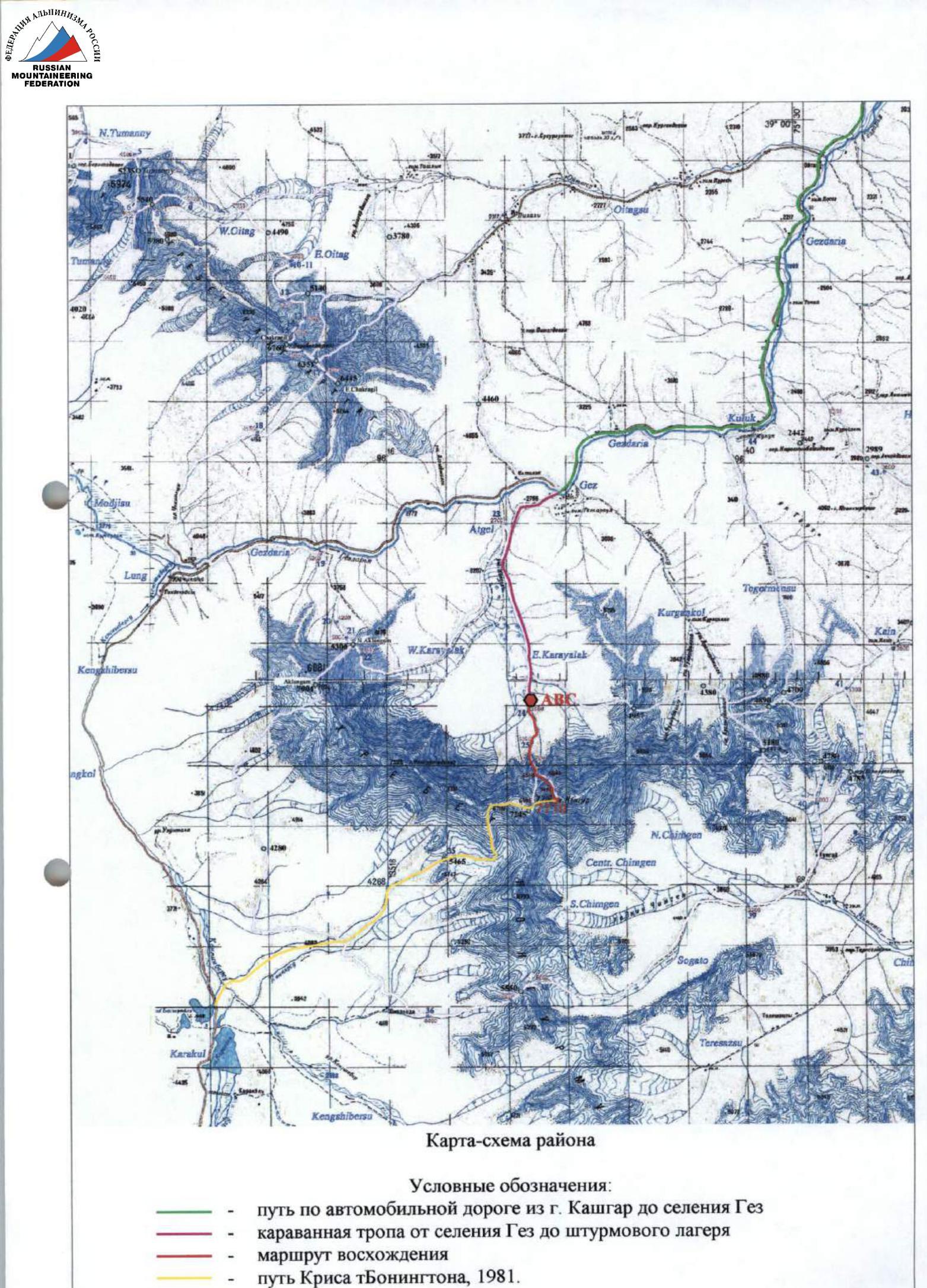
Legend:
- route of the FASIL team from St. Petersburg
- route of the FASIL team from Moscow
- route of Chris Bonington's team, 1981.
During the expedition, the St. Petersburg team was unable to take a suitable photo of the route profile from the right or left.
On the right, a significant part of the route is obscured by the northern ridge of peak 7126; on the left, it is obscured by the northern ridge of Kongur.
It is possible to take a photo of the route at an angle or a profile photo that would have some part of the route obscured. However, this would require a significant traverse through Karayalak glacier or nearby glaciers, possibly ascending neighboring slopes or ridges. This would take 1-2 days. Due to time constraints and challenging weather conditions, our team had to abandon such a plan.
We hope that the necessary photograph can be found in the archives or reports of the Moscow or Krasnoyarsk expeditions, as well as in the reports or publications of the MAi tourist club team led by A. Lebedev.
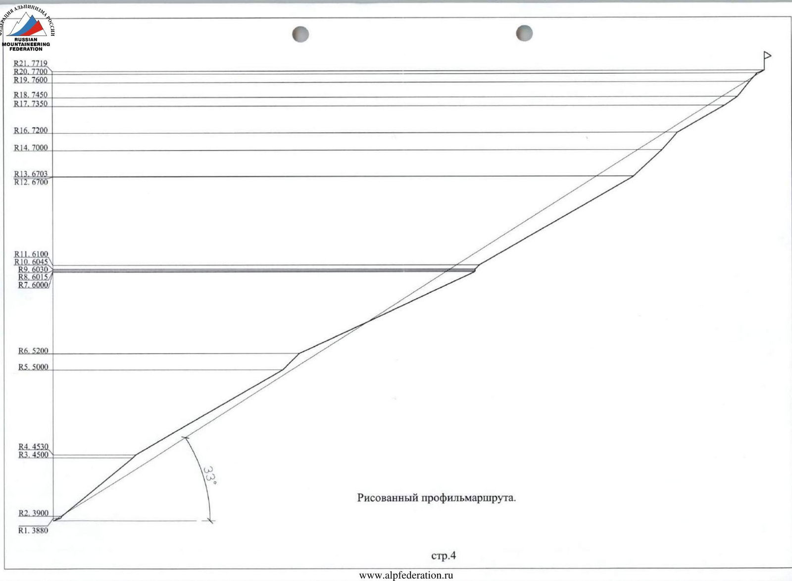
Drawn profile of the route.

Photopanorama of the ascent area
Brief Description of the Ascent Area
Kongur peak is located near the border of the Pamir and Kunlun mountain systems, in China, and is the highest point of the Pamir. Kongur is the northernmost peak with a height over 7700 m.
Until 2004, only one successful ascent to the peak was known - in 1981, Chris Bonington's team reached the summit from the southwest, via the western ridge.
Approaching the foot of the northern slopes from the north is remarkably straightforward. From Kashgar, one can drive to Ghez settlement on the road leading to Pakistan. From the settlement, it takes about 6 hours of leisurely walking, approximately 15 km, with a height gain from 2200 m to 3500 m, to reach Base Camp via the right-bank moraine of Karayalak glacier.
The northern slopes of the mountain are not too steep but are highly avalanche-prone. The peak is almost entirely surrounded by several belts of hanging glaciers, making it very inaccessible and leading to the failure of several dozen expeditions.
The peak is situated in a long ridge with a height of approximately 7000 m over several dozen kilometers, stretching from east to west. The ridge includes several seven-thousanders - Kongur East, peaks 7246, 7126, 7200, and Kongur-Tyube.
The area is characterized by very challenging weather conditions. There are very few clear days. The most stable weather occurs in mid-August.
Annually, the area is visited by 2-3 expeditions, typically aiming to ascend the peak. In 2004, there were unsuccessful attempts by French and Italian expeditions, and three successful attempts from the north by expeditions from St. Petersburg - Riga, Moscow, and Krasnoyarsk.
From Base Camp (3500 m), the approach to the route takes about 30 minutes and follows a grassy moraine. The beginning of the route is logically marked by passing the lower icefall, where the first minor technical difficulties arise. The height of this section is approximately 3700 m.
Page 6a
Technical photograph of the route. Layout of photographs.
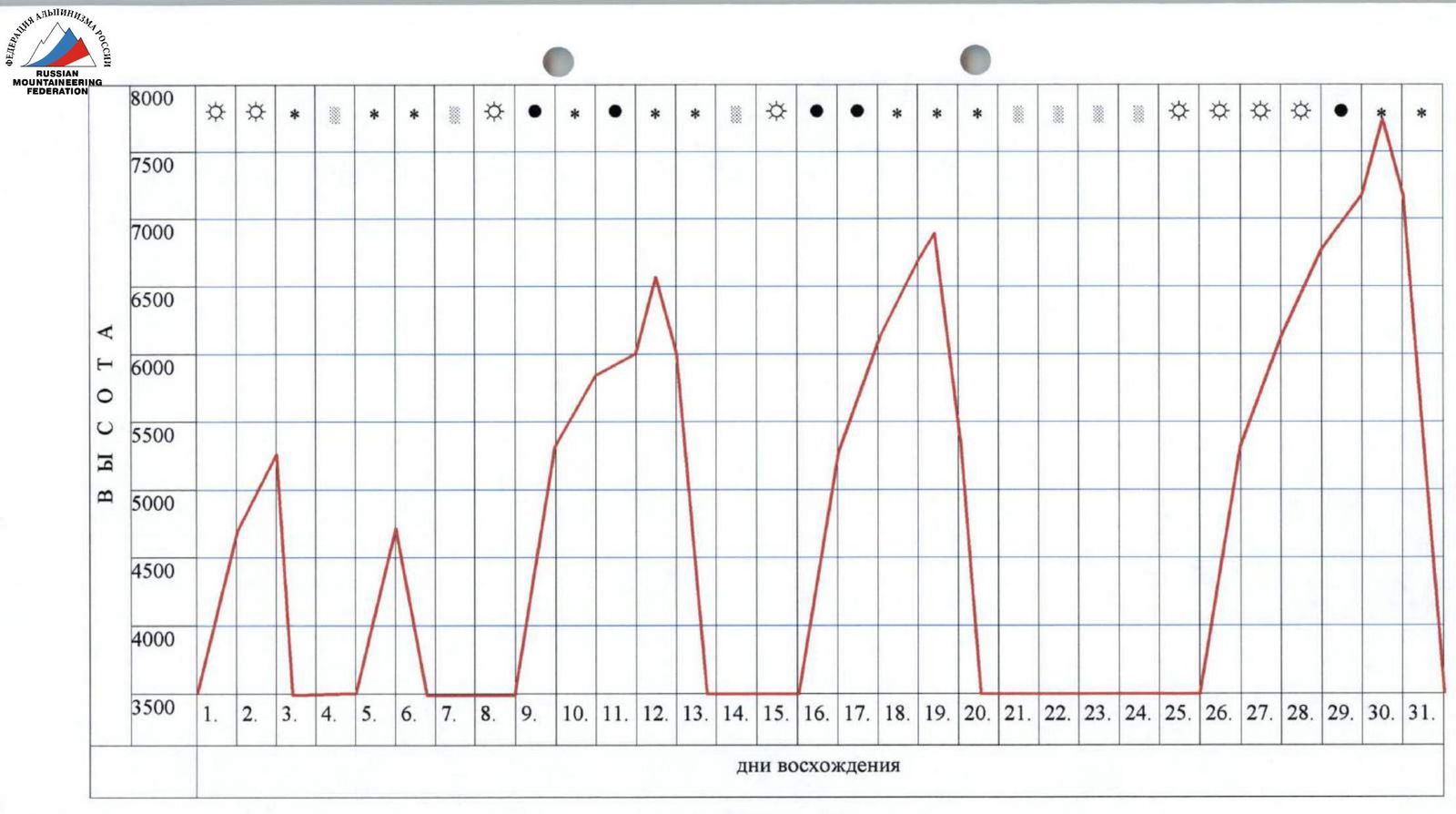
Ascent graph
Legend:
- ∵ - clear
- □ - rain
-
-
- snow
-
- ● - overcast
Page 7
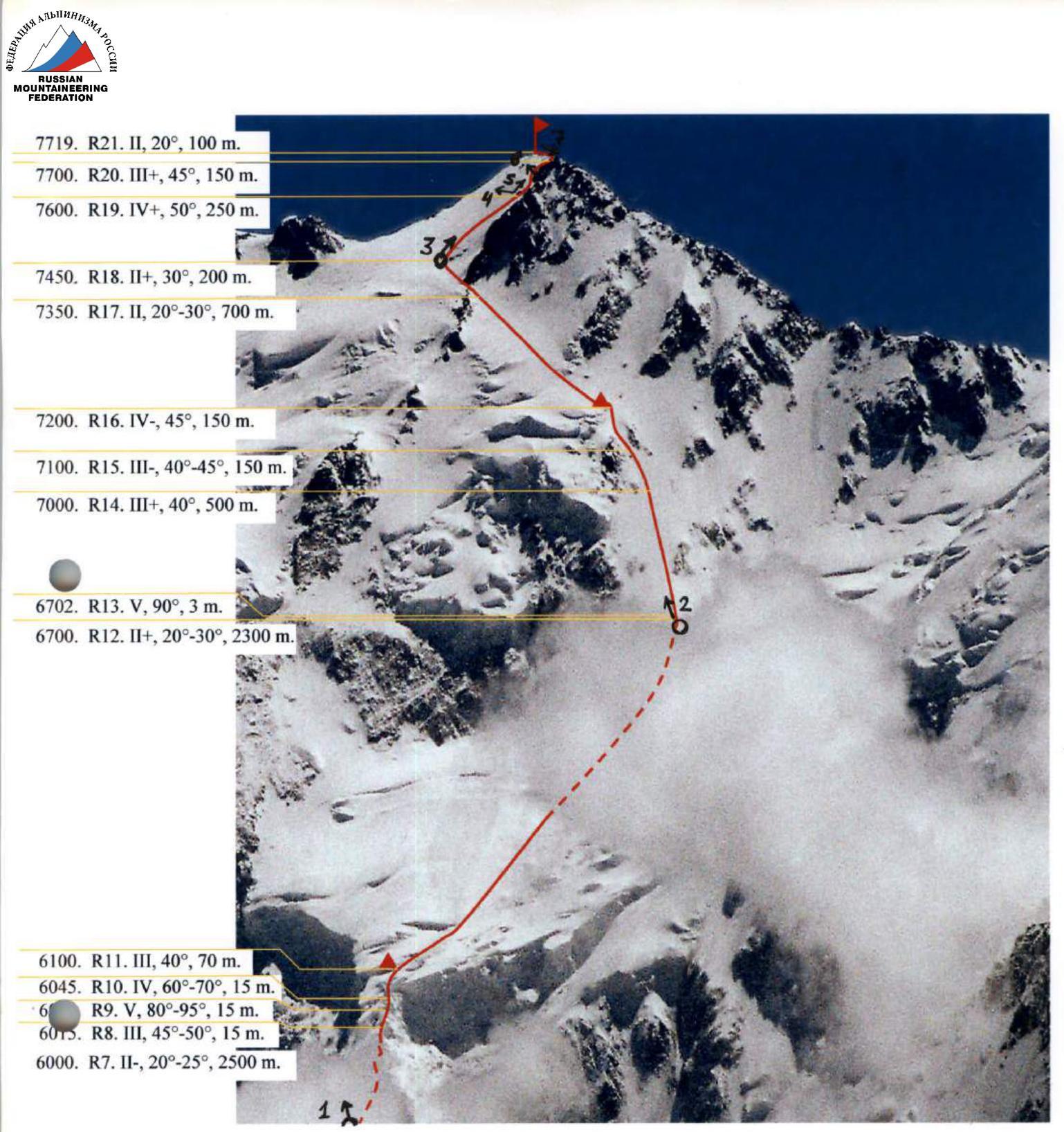
| Section | Pitons used, including ITC | UIAA Scheme | Complexity | Length, m | Steepness |
|---|---|---|---|---|---|
| R10. 6045 | 2 |  | 4 | 15 | 60–70° |
| R9. 6030 | 3/2 |  | 5 | 15 | 80–95° |
| R8. 6015 | 1 | 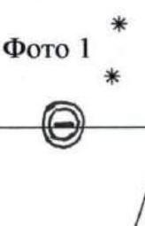 | 3 | 15 | 45–50° |
| R7. 6000 | - | Photo 1 | 2– | 2500 | 20–25° |
| R6. 5200 | 1*5 |  | 4– | 300 | 40–45° |
| R5. 5000 | - | * | 2 | 2200 | 20–30° |
| R4. 4530 | 2 |  | 3+ | 50 | 45° |
| R3. 4500 | - |  | 3 | 1200 | 30–40° |
| R2. 3900 | 6/1 |  | 4 | 30 | 60° |
| R1. 3880 | - |  | 2 | 100 | 20° |
| R0. 3850 | - |  | 1 | ||
| R21. 7719 | - | Photo 7, 8 | 2 | 100 | 20° |
| R20. 7700 | - | Photo 4, 5, 6 | 3+ | 150 | 45° |
| R19. 7600 | - | Photo 3 | 4+ | 250 | 50° |
| R18. 7450 | - | 2+ | 200 | 30° | |
| R17. 7350 | - | 2 | 700 | 20–30° | |
| R16. 7200 | 5 | 4– | 150 | 45° | |
| R15. 7100 | 2 | 3– | 150 | 40–45° | |
| R14. 7000 | - | 3+ | 500 | 40° | |
| R13. 6703 | 2/2 | Photo 2 (bergschrund) | 5 | 3 | 90° |
| R12. 6700 | - | 2+ | 2300 | 20–30° | |
| R11. 6100 | - | 3 | 70 | 40° |
Technical photograph of the route. 6015. R8. 3, 45–50°, 15 m. 6016. R7. 2–, 20–30°, 2500 m. 6017. R6. 4–, 40–45°, 300 m. 6018. R5. 2, 20–30°, 2200 m. 6019. R4. 3+, 45°, 50 m. 6020. R3. 3, 30–45°, 1200 m. 6021. R2. 4, 60°, 30 m.
Technical photograph of the route. No control cairn was found on the summit. The summit is a snowy ridge with three slight elevations of several meters. Between the eastern and middle elevations lies a large boulder on which a control cairn could be built. However, constructing it from stones is challenging; it could only be hung on a screw piton. Our team did not bring screw pitons to the summit, so we were also unable to leave a note. As confirmation of our presence on the summit, we provide, in addition to the photo of the team on the summit (which is poorly identifiable due to extremely poor weather conditions), a photopanorama from the summit to the west, showing the junction of the western (climbed by Bonington's team in 1981) and northern ridges. In the photo report, it is listed as No. 7, page 113.
Photo Illustration of the Report
Photographs of the upper part of the route are of low quality due to very poor weather conditions on the day of the ascent. All images were taken with a Samsung camera with autofocus. Unfortunately, photographs from the lower part of the route are not included. Initially, when compiling the report in St. Petersburg, we believed that the film had been lost during the ascent. Later, it was discovered that this film had accidentally been taken to Riga and was with Oleg Silin. The unillustrated sections up to 6100 m coincide with our route and the route of the Moscow and Krasnoyarsk expeditions. The team leader and participant Valdiss Purins have detailed video materials, from the beginning of route processing to the summit.

Photo 1. View towards the peak from section R7. Shooting height 5850 m. Page 11 B.

Photo 2. View of sections R13–R16. Shooting height approx. 6700 m. Page 11 V.
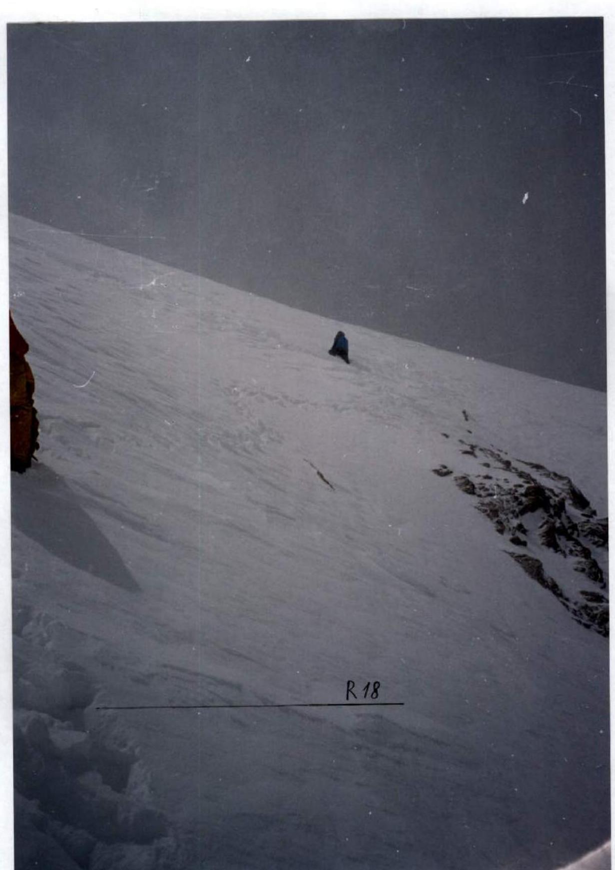
Photo 3. Valery Shamaло laying a trail on a steep, avalanche-prone slope at a height of approximately 7500 m. Slope steepness is about 50°. Page 11 G.
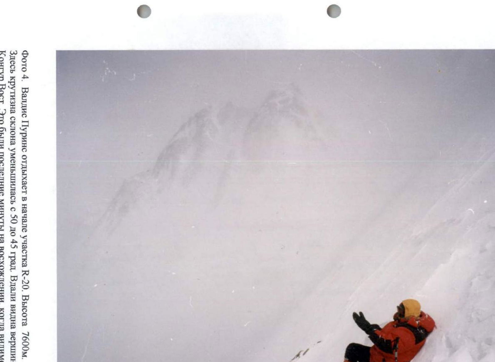
Photo 4. Valdiss Purins resting at the start of section R20. Height 7600 m. Here, the slope steepness decreased from 50 to 45°. In the distance, Kongur East peak is visible. These were the last minutes of the ascent with visibility exceeding hundreds of meters. Page 11 D.
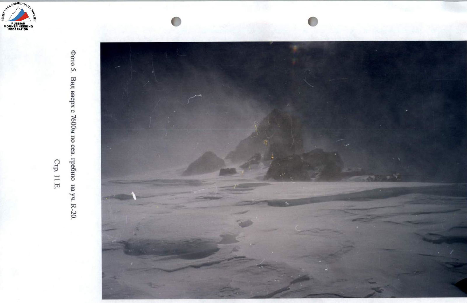
Photo 5. View upwards from 7600 m along the northern ridge to section R20. Page 11 E.
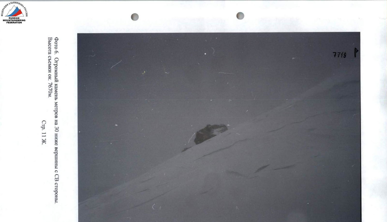
Photo 6. A huge boulder 30 meters below the summit from the NE side. Shooting height approximately 7670 m. Page 11 F.
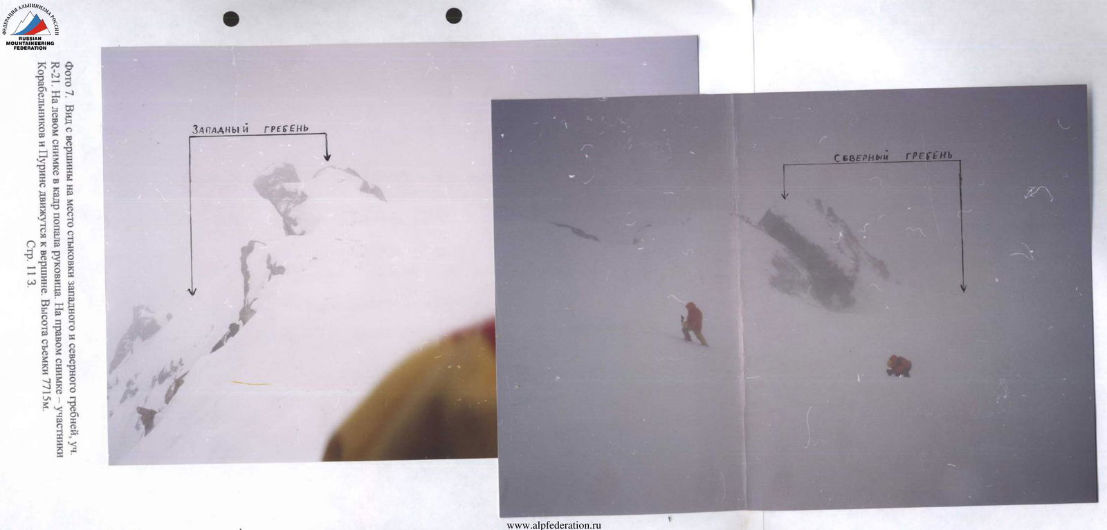
Photo 7. View from the summit to the junction of the western and northern ridges, section R21. In the left image, a mitten is visible in the frame. In the right image, Korabelnikov and Purins are moving towards the summit. Shooting height 7715 m. Page 11 Z.