
Report
On the First Ascent of Kokosel Peak 6858 m (other names: Muztagh Ata Far S., Kokosel Tag or Kokoser Tagh)
1. Climbing Passport
- Region: Kongur Muztagh Range (Kashgar Mountains, Chinese Pamir). Valley: Kokosel. Section number according to the 2008 classification table - 11.3
- Name of the peak: Kokosel or Kokoser, Muztagh Ata South Far. Name of the route: via the southern ridge from the Kokosel Glacier.
- Proposed category: 5A, first ascent.
- Nature of the route: snow and ice.
- Height difference on the route: 1538 m (by GPS).
- Route length: 3590 m.
- Length of sections: category IV - 430 m, category V - 460 m, category VI - 0 m.
- Average slope: main part of the route - 38°, entire route - 25.6°.
- Number of pitons used on the route: 8 ice screws.
- Team's total climbing hours: 19 hours, 3.5 days.
- Team leader: Andrei Alexandrovich Lebedev, 1st sports category, Moscow.
- Participants: Vladislav Evgenievich Kagan, 1st sports category, Minsk, Marina Anatolievna Tarakanovskaya, Candidate Master of Sports (alpinism), Novosibirsk, Dmitry Vladimirovich Chizhik, Candidate Master of Sports (alpinism), Moscow, Petr Vladimirovich Yudin, 1st sports category (alpinism), Novosibirsk, Oleg Zigmontovich Yanchevsky, Candidate Master of Sports (alpinism), Kiev.
- Coach: Andrei Alexandrovich Lebedev.
- Start of the route: 9:00 AM, August 24, 2005.
- Summit reached: 10:15 AM, August 27, 2005.
- Descent to the tongue of the Kalaxong Glacier (4600 m) after traversing the massif: 6:30 PM, August 28, 2005.
Note. The ascent was conducted in alpine style as part of a category 6 sports mountain trip, entered for the Russian Tourism Championship (1st place). Route book No. 1/3-603, approved on June 29, 2005, by the Moscow FST MCC, see also the trip report [1].
2. General Information about the Peak
The peak Kokosel (Kokosel Tag), also known as Kokoser (Kokoser Tagh) or, as in the Himal Index database, Muztagh Ata South Far (Muztagh Ata Far S.), is located in the Kongur Muztagh Range in the Kashgar Mountains on the Chinese Pamir. The peak is a southern neighbor of the peak Koskulak (7028 m) and is situated 7 km south of Muztagh Ata (7546 m).
Kokosel has an extended 2700-meter-long ridge stretching from west to east with several elevations of similar height.
On Soviet maps and a Chinese 1:100,000 scale map, the peak is not labeled.
Coordinates (by GPS measurements): 38°12.54′ N, 75°8.04′ E. On the Chinese 1:100,000 scale map, the following elevations are marked on the ridge: 6849, 6793, and 6841 (listed from west to east). These points have longitudes of 75°6.74′, 75°7.36′, and 75°7.83′, respectively. On Soviet 1:100,000 and 1:200,000 scale maps, a point 6910 is marked with a longitude of 75°8.37′.
During the traverse of the eastern part of the mountain, it was discovered that points 6841 and 6910 are not the highest. The highest point of the eastern part of the mountain has a longitude of 75°8.04′, i.e., it is located between the marks 6841 and 6910, approximately one-third of the way from 6841 to 6910. GPS measurements at this point gave a height of 6858 m.
A comparison of the eastern (6858) and western (6849) main peaks is given in Table 1.
Table 1.
| Peak | Height on map | Height by GPS | Height by SRTM database | N latitude | E longitude |
|---|---|---|---|---|---|
| Main (eastern) | - | 6858 | 6826 | 38°12.54′ | 75°8.04′ |
| Western | 6849 | - | 6808 | 38°12.31′ | 75°6.74′ |
Note. SRTM - Shuttle Radar Topography Mission database.
3. Photos of the Peak
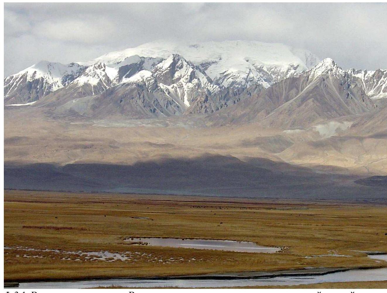 Fig. 3.1. View of the peak from the south. In the center of the massif, a broad southern ridge extends southward, along which the route is laid. Photo by an unknown author [2]
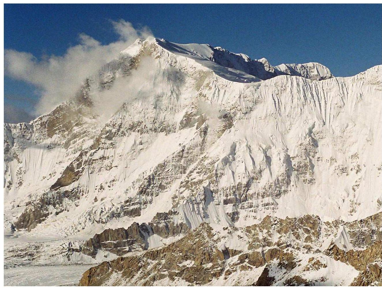 Fig. 3.2. View from the north-northeast, from Tuyuk Pass. Photo by A. Lebedev (2002).
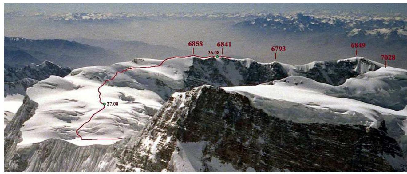 Fig. 3.3. View from the summit of Muztagh Ata (7546 m). In the foreground is peak Koskulak (7028 m). In the background is the ridge of peak Kokosel. The red line depicts the path of the traverse from the point of exit onto the ridge (to the right of 6841) and the beginning of the descent from the summit. Photo by O. Yanchevsky (2005).
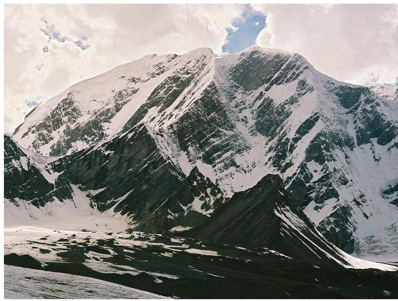 Fig. 3.4. View of the peak from the east from the Koksel Glacier. Photo by A. Lebedev (2005).
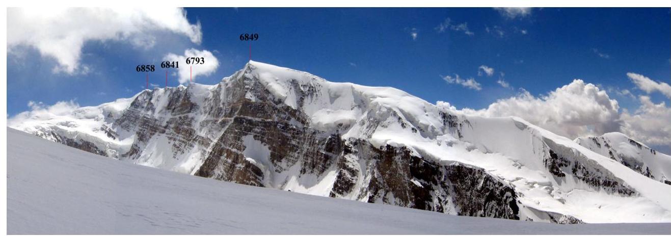 Fig. 3.5. View of the peak from the southwest from the western ridge of peak Koskulak. Photo by V. Odokhovsky (2005).
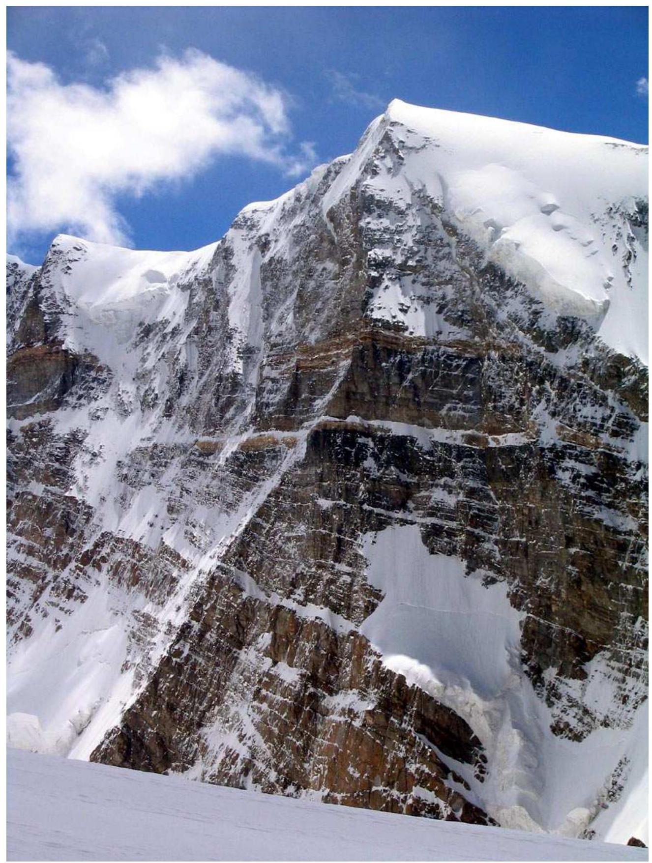 Fig. 3.6. North face of the western peak 6849 m. View from the southwest from the western ridge of peak Koskulak. Photo by V. Odokhovsky (2005).
4. Panoramic Photos of the Area
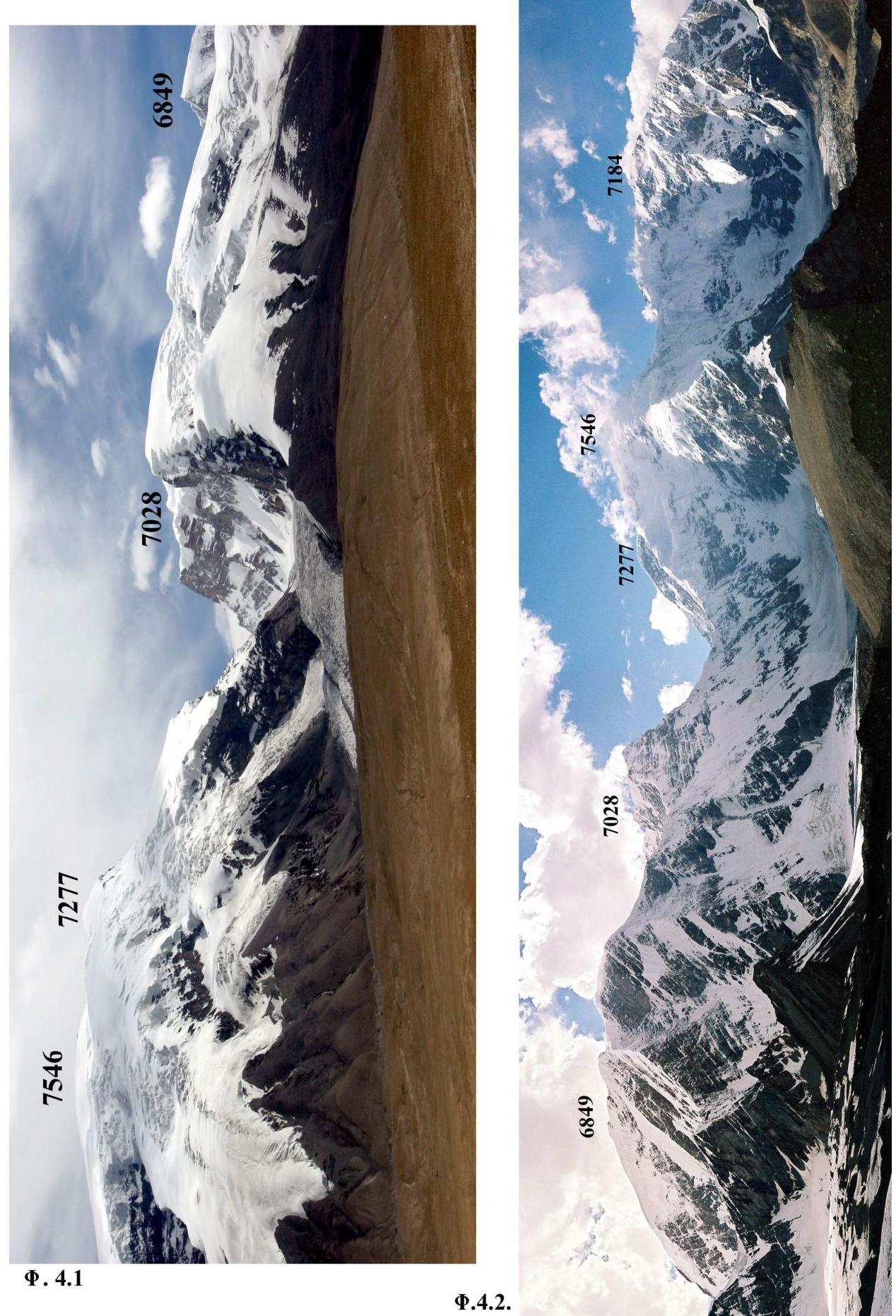
Fig. 4.1. Muztagh Ata (7546 m), Kalaxong (7277 m), Koskulak (7028 m), and 6849 m - the western peak of the Muztagh Ata South Far massif. Photo by A. Mashenin (2005).
Fig. 4.2. View from the Koksel Glacier: 5500 m - pass from the Koksel Glacier to the Kokosel Glacier, 6858 m - Muztagh Ata South Far, 7028 m - peak Koskulak, 7546 m - Muztagh Ata, 7184 m - peak Kuksay (North Muztagh Ata). Photo by A. Lebedev (2005).
5. Photos of the Route Profile
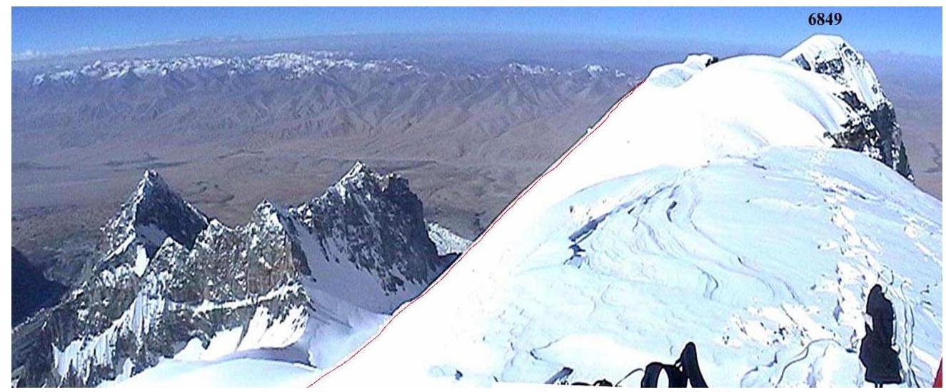 Fig. 5.1. View from the ridge towards the western peak 6849 m. To the left is visible the profile of the final sections (R5 and R6) of the ascent to the summit. Photo by A. Lebedev (2005).
6. Drawn Profile of the Route
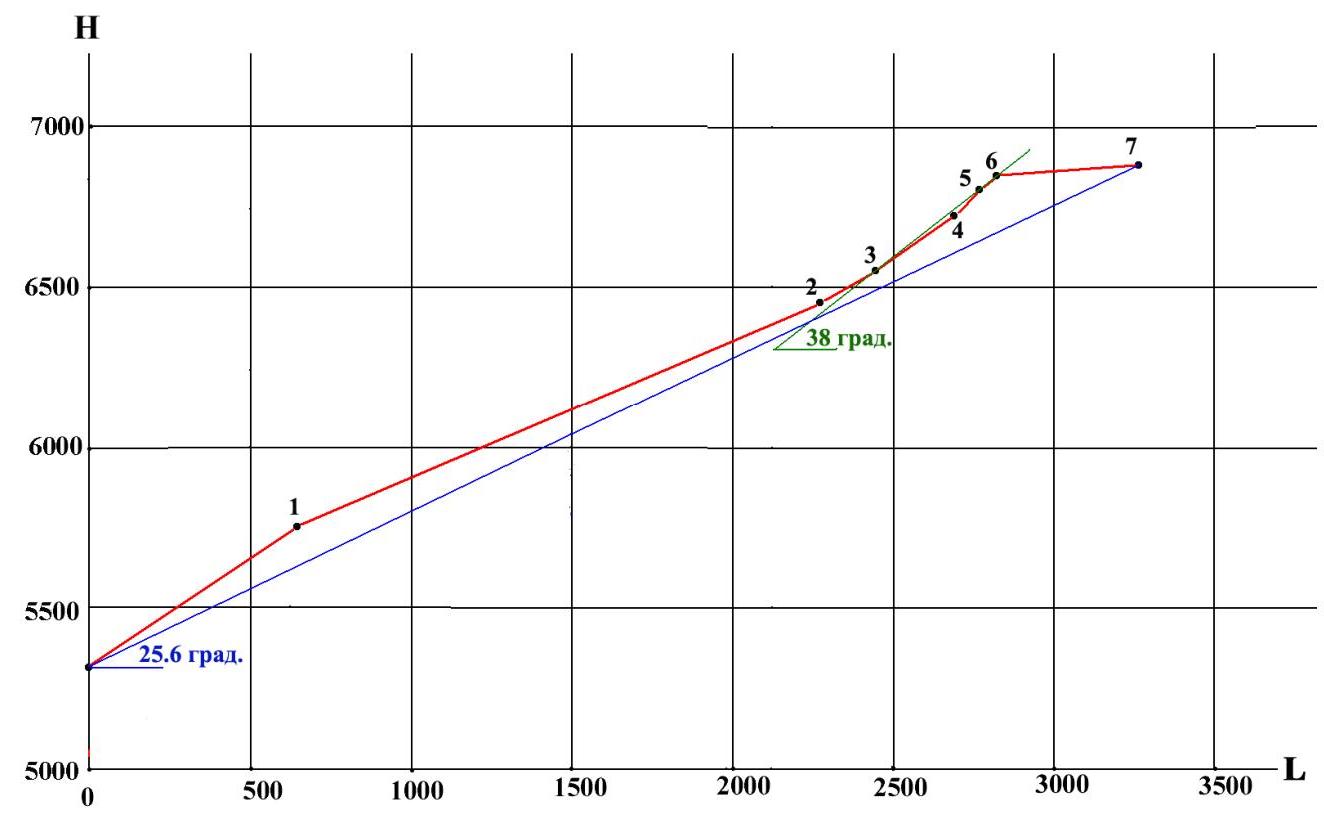
Black numbers mark the ends of the route sections, see Table 3.
7. Map of the Climbing Area

The highest point (6858 m) of the eastern part of the peak lies one-third of the way from the mark 6841 m towards the mark 6910 m.
8. Ascent Schedule
Table 2. Daily Transitions
| Date | Climbing time (h min) | Ascent (m) | Height difference (m) | Transition description |
|---|---|---|---|---|
| August 24 | 8:00 | 837 | 5100–5937 | Kokosel Glacier - southern ridge |
| August 25 | 4:00 | 474 | 5937–6411 | Section R2 |
| August 26 | 6:00 | 430 | 6411–6841–6827 | Sections R3–R7 |
| August 27 | 1:10 up + 5:00 down | 31 | 6827–6858–6441 | Section R7, start of descent |
| August 28 | 8:00 | 0 | 6441–4600 | Descent along the Koskulak Glacier |
9. Characteristics of the Route Sections
Table 3. Route Sections
| № | Section type | Start height | End height | Tech. cat. | Difficulty | Length (m) | Slope (°) | Tactics |
|---|---|---|---|---|---|---|---|---|
| 1 | Snow and ice slope | 5320 | 5756 | 2 | 3 | 760 | 35 | Simultaneously in rope teams |
| 2 | Broad snow ridge | 5756 | 6450 | 1 | 3 | 1750 | 22 | Simultaneously in rope teams |
| 3 | Snow slope | 6450 | 6539 | 1 | 3 | 190 | 28 | Simultaneously in rope teams |
| 4 | Snow and ice slope | 6539 | 6711 | 3 | 5 | 300 | 35 | Simultaneously in rope teams |
| 5 | Ice slope | 6711 | 6782 | 3 | 5 | 100 | 45 | Rappel on ice screws |
| 6 | Snow and ice slope | 6782 | 6820 | 3 | 5 | 60 | 40 | Simultaneously in rope teams |
| 7 | Ridge with cornices | 6820 | 6858 | 2 | 4 | 430 | 10 | Simultaneously in rope teams |
Average slope of the route - 25.6°. Average slope of the main part (sections R4–R6) - 38°. Total route length - 3590 m. Length of the main part (sections R4–R6) - 460 m. Total length of category V sections - 460 m.
10. Technical Photos of the Route
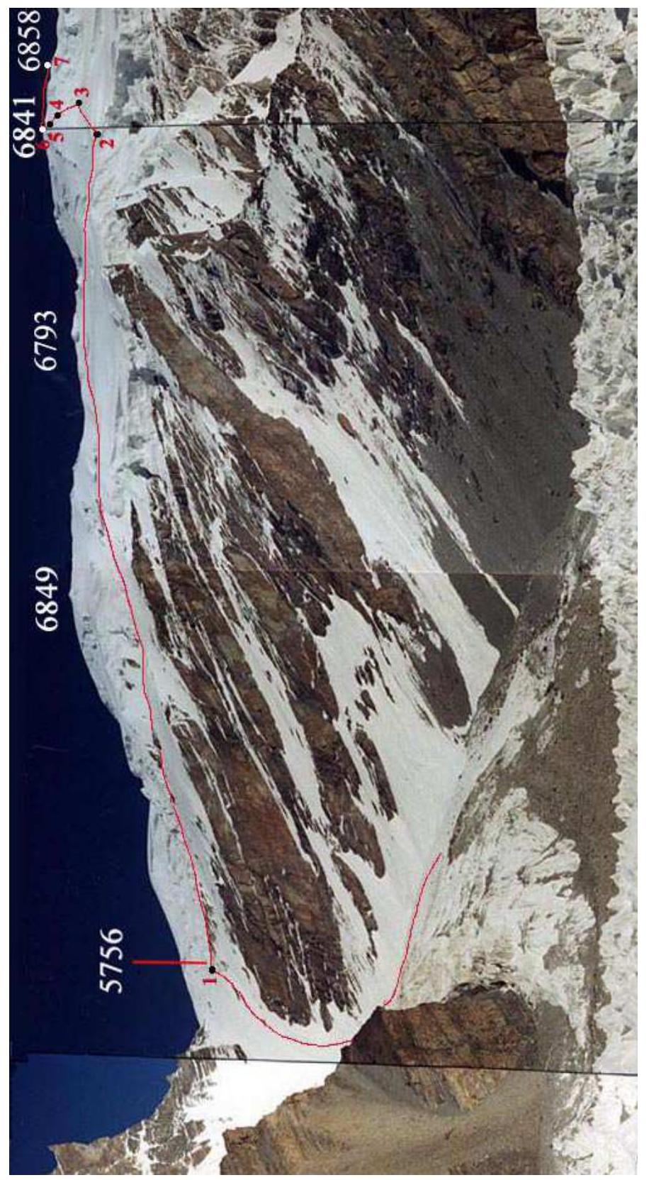 Fig. 10.1. View from the south from the Kokosel Glacier. Lower part of the route. Red numbers mark the ends of the corresponding route sections. Photo by A. Lebedev (2002).
 Fig. 10.2. Upper part of the route: sections R3–R6. Photo by A. Lebedev (2005).
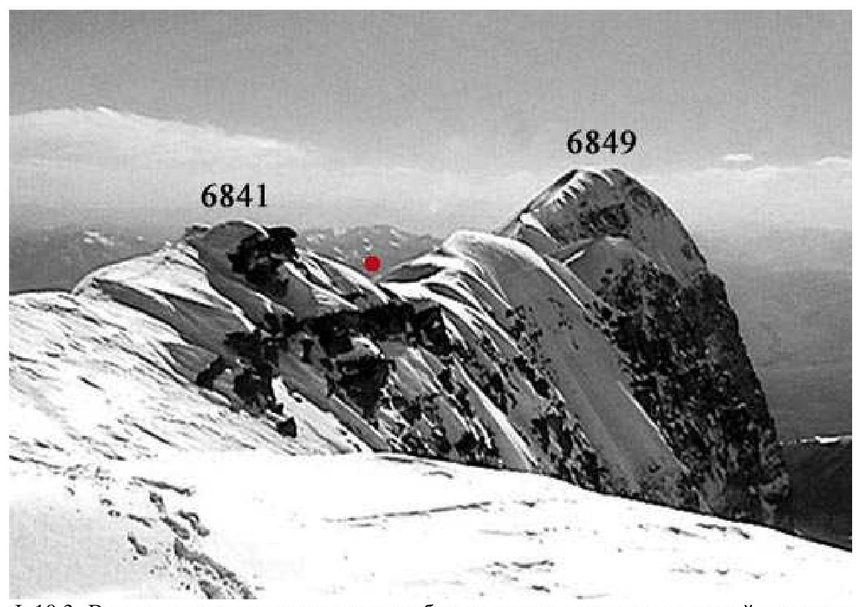 Fig. 10.3. View from the camp on the ridge towards the western peak 6849 m. The red circle marks the point of exit onto the ridge. The character of the ridge (section R7) is visible. Photo by A. Lebedev (2005).
11. Photo Illustrations
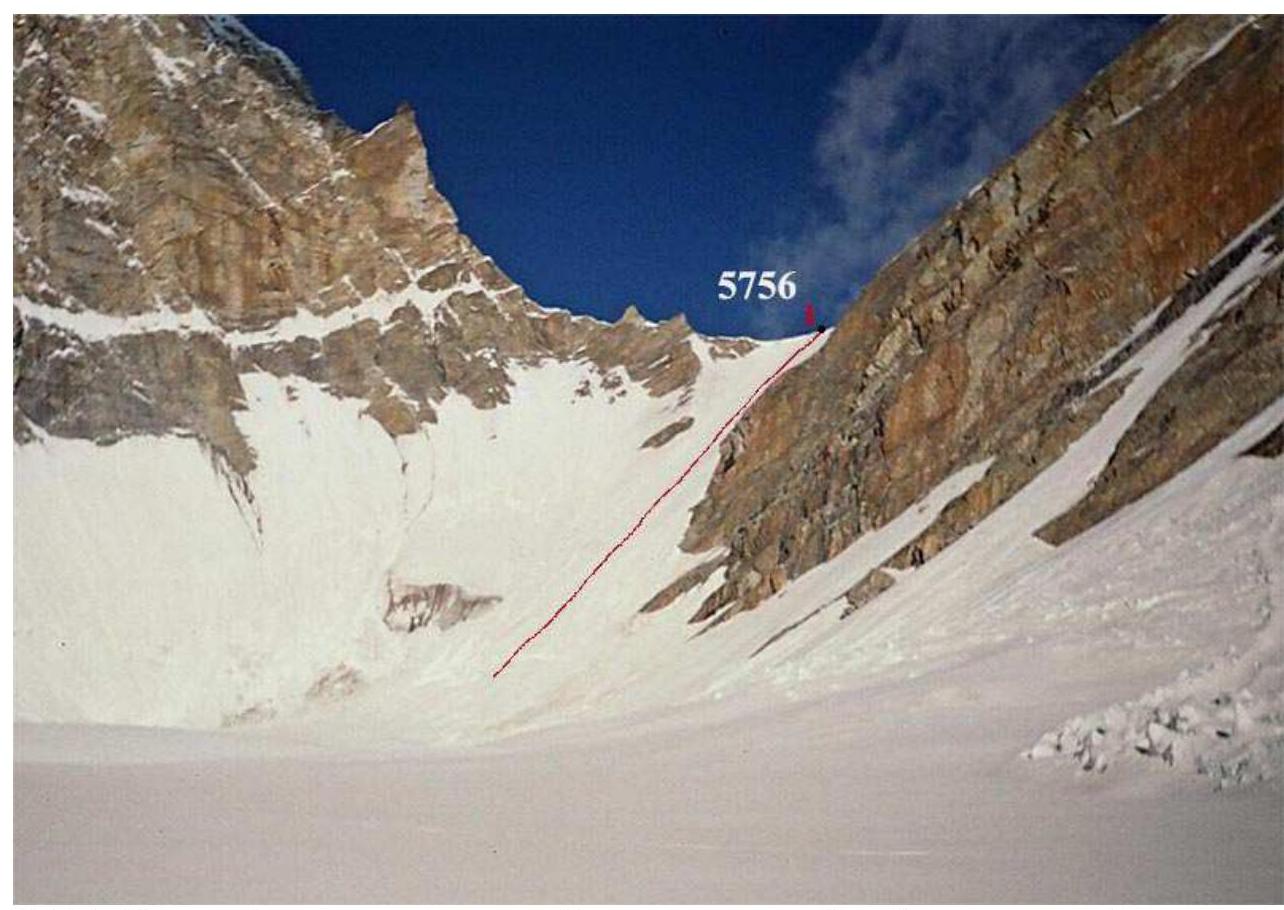 Fig. 11.1. Section R1 - ascent from the Kokosel Glacier to the southern ridge (to the pass 5756 m). Photo by M. Tarakanovskaya (2005).
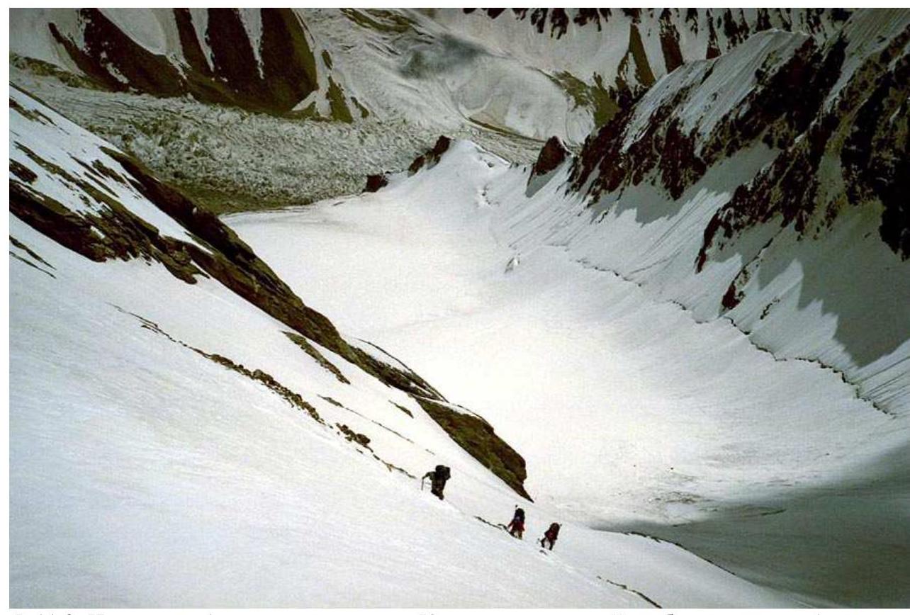 Fig. 11.2. On section R1 - ascent from the Kokosel Glacier to the southern ridge (to the pass 5756 m). Photo by O. Yanchevsky (2005).
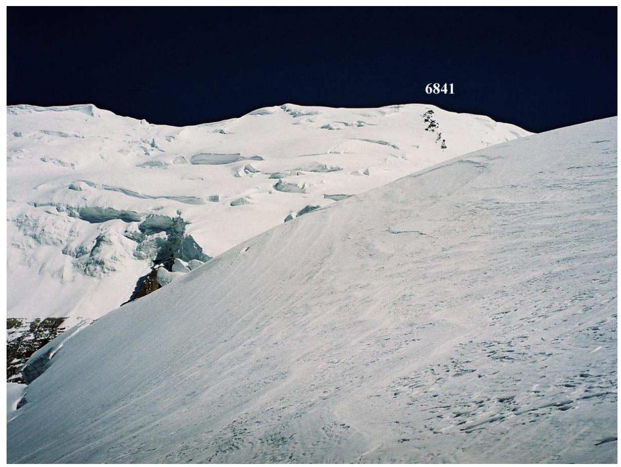 Fig. 11.3. On section R2. Ahead, above the slope of the ridge, is a rising ridge of rocks towards point 6841, to the right of which are sections R4 and R5. Photo by A. Lebedev (2005).
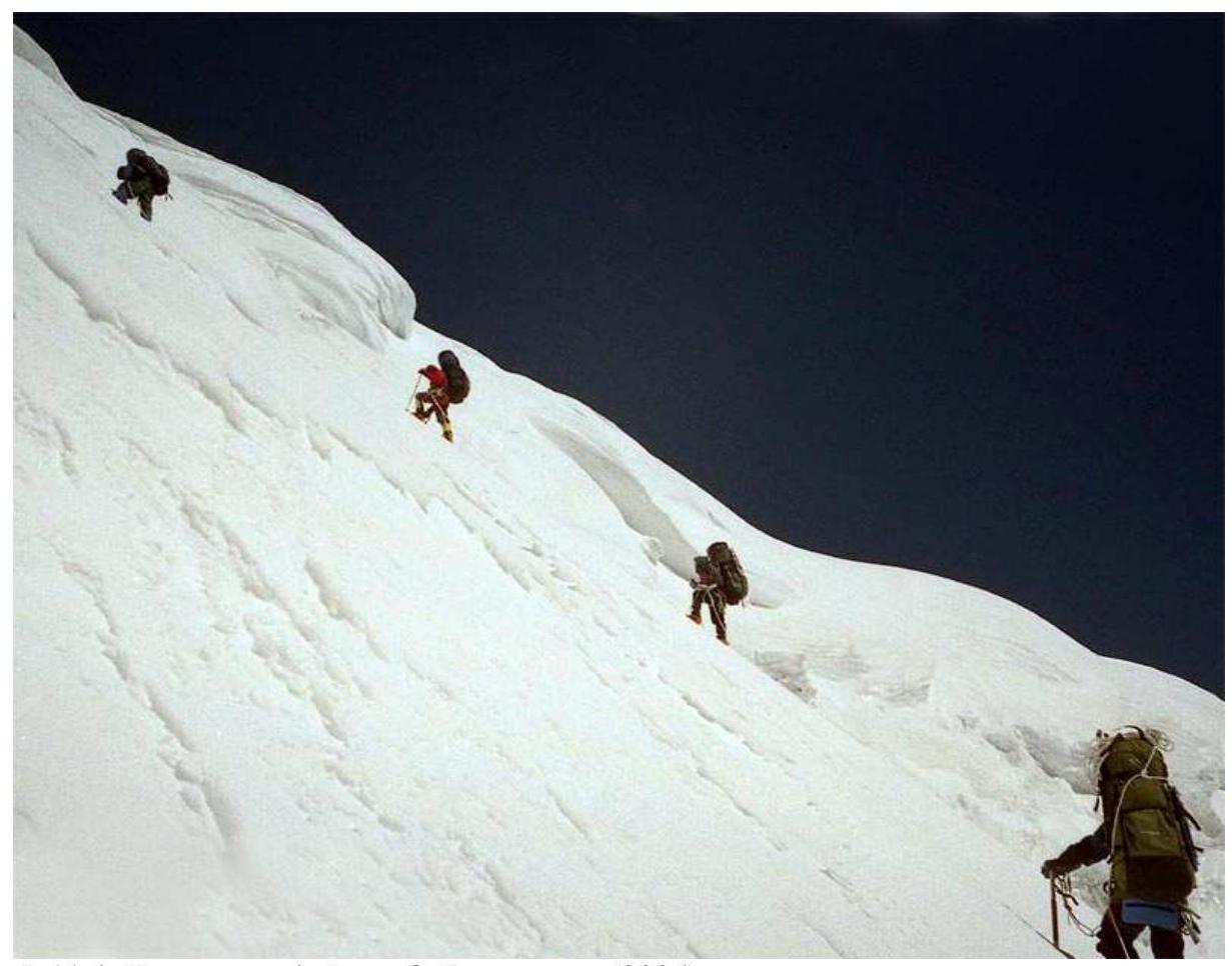 Fig. 11.4. On section R4. Photo by O. Yanchevsky (2005).
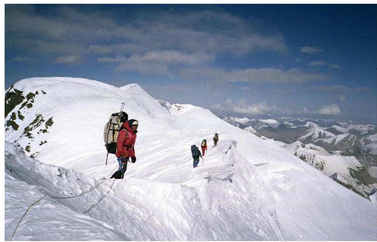 Fig. 11.5. On section R7. Photo by O. Yanchevsky (2005).
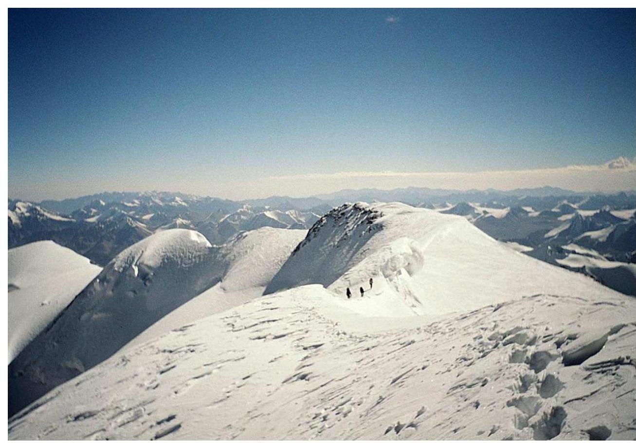 Fig. 11.6. Beginning of the descent from point 6858 m along the eastern ridge. View from the summit to the east. Photo by A. Lebedev (2005).
12. Approach to the Route
The Karakoram Highway (Kashgar-Islambad) passes 8 km southwest of the tongue of the Kokosel Glacier. The journey from Kashgar along the highway takes 3-4 hours.
13. Description of the Ascent (from report [1])
August 24. Almost the entire day was spent overcoming the snow and ice ascent (39–35°) to the pass 5756 m, see fig. 11.1. We moved in rope teams simultaneously on suitable tracks. When ice appeared at the very top (100 m), we switched to simultaneous movement on ice axe belays. On the saddle of the pass, we turned right and ascended along the partly narrow ridge to the first flat spot, where we camped. Height 5937 m.
August 25. On a clear morning, we continued moving towards point 6841 along the southern ridge. On this section, the ridge was broad. By lunchtime, we approached the pre-summit ascent, see fig. 10.2, and set up camp for the night. Height 6411 m. We clearly wouldn't make it to the summit, and a convenient intermediate camping spot was not in sight.
August 26. Clear morning. The pre-summit ascent had a slope of 40–45° and a height difference of about 350 m. We decided that the ascent would be simpler if we bypassed the ascent to the right and exited onto a convexity resembling a ridge with traces of a cornice, see fig. 10.2. This allowed us to shorten the steep section. We ascended along this southeastern ridge in rope teams simultaneously, see fig. 11.4, until we were stopped by the pre-summit ascent from this side. Here, we hung 100 m of rope on a 45° ice slope until we reached rock outcrops with a convenient platform for lunch.
After lunch, we ascended (50–70 m, 35–40°) in rope teams simultaneously onto the summit ridge, turned east, traversed (as it seemed to us) point 6841, and camped for the night, see fig. 10.3. Height 6827 m.
August 27. On a clear morning, we continued the traverse, overcame several bumps on the way with heights from 6830 m to 6840 m, and finally saw a significant rise ahead. Our GPS showed 6858 m on it. Further east, there was only a descent, see fig. 11.6.
Ahead, behind the next bump, a saw-like profile of five cornices was guessed. We didn't feel like continuing the traverse and turned left onto the slope, see fig. 3.3.
Below, in a basin, we were enveloped in fog. Beyond its far edge was a kind of abyss; the bottom was barely visible. A rappel rope, and we were on the edge of a deep pit. Then a long path across the slope along the edge of a bergschrund or slightly below. We crossed the next basin and descended onto a gentle glacier. We camped at a height of 6440 m, see fig. 3.3.
August 28. On a clear morning, we crossed the plateau towards the saddle between Muztagh Ata South Far and Koskulak and descended onto the glacier. It turned out to be uncomplicated. We walked along it closer to the right bank. We jumped over crevasses about 1 m wide and, if they were wider, bypassed them. By lunchtime, we descended to the bend of the glacier's icefall. We bypassed the icefall along the talus of the right bank. Below the icefall, we crossed the glacier towards the center or slightly closer to the left bank, bypassed the zone of falling ice from the rocks, and ascended onto the moraine of the left bank. Along the moraine, we descended to the tongue of the glacier with a ridge of rare seracs and camped. Height 4600 m.
14. Organization of the Ascent
- The ascent was conducted as part of the Comprehensive Mountain Sports Expedition by SK MAI to the Chinese Pamir, which took place from July 25, 2005, to September 13, 2005.
- Photos were taken by expedition members A. Lebedev, M. Tarakanovskaya, and O. Yanchevsky.
- The organization of the expedition was supported by: S7 Airlines ("Siberia"), SITES-Center, GlobalTel.
15. References
- A. Lebedev. Report on a category 6 mountain trip to the Chinese Pamir in 2005.
- http://www.panoramio.com/photo/15737729↗