11.3.8
| 1. ROUTE PASSPORT | |||
|---|---|---|---|
| 1 | Region | Kongur Muztagh Range | |
| 2 | Valley | Karakul Lake | |
| 3 | Number of section according to the classification table | ||
| 1999 year | |||
| 4 | Name of the peak | Aklangam | |
| 5 | Name of the route | via SW edge of SE ridge | |
| 6 | Route difficulty assessment | 4B cat. diff. | First ascent |
| 7 | Route character | Ice-snow | |
| 8 | Height difference on the route | 2185 m | From Ruchyeikovyy Pass (4810) |
| 9 | Route length | 7090 m | |
| 10 | Average steepness of the route | 18.4° | |
| 11 | Duration of the route | In travel hours | 22 h |
| In days | 4 days | ||
| 12 | Leader | Lebedev Andrey Aleksandrovich | MSМК по туризму |
| 13 | Participants | Demeshchik Pavel Aleksandrovich | |
| Ivanenkov Oleg Georgievich | |||
| Maksimovich Yuriy Aleksandrovich | |||
| Rykalov Petr Vladimirovich | MS по туризму | ||
| 14 | Coach | Lebedev Andrey Aleksandrovich | |
| 15 | Departure on the route | August 24, 2002 | 8:20 |
| 16 | Ascent to the summit | August 28, 2002 | 11:20 |
| 17 | Return to the base camp | August 29, 2002 | 18:10 |
The peak Aklangam is located in the Kongurtagh Range (Kunlun) to the northwest of the Kongur Tyube massif (7595) and is separated from its northwest shoulder (Kokodag, 7210) by a saddle 6666. Aklangam is the last peak of the Kongurtagh Range; its northwest ridge gradually descends to the Karakorum Highway towards the confluence of Kengshiber and Mojisu rivers. The peak is a nodal one; a significant spur runs northeast from it, with S.Aklangam Pass (5300) and an unnamed peak 6103. Aklangam is not listed in the English Club's peak database. The height of Aklangam according to a Chinese map is 6978 m, according to a Russian map — 7004 m; the GPS reading of the first ascenders showed 6995 m, which is close to the average between 6978 and 7004 m.
2. GRAPHICAL DOCUMENTATION
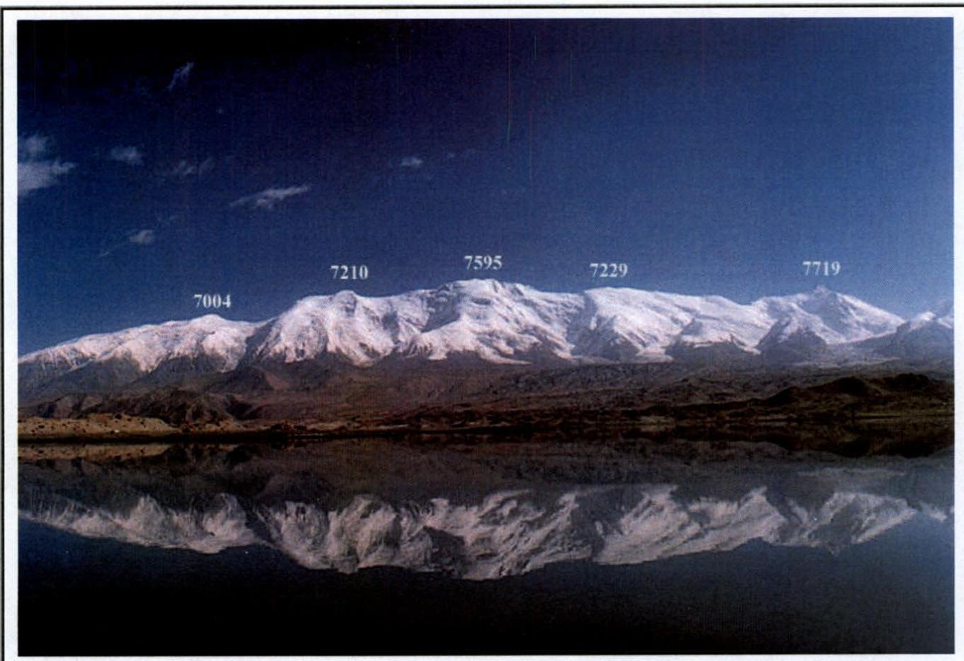 Fig. 1. General photo of the peak, taken on August 31, 2002, from the shore of Karakul Lake.
From left to right: 7004 — Aklangam, 7210 — Kokodag, 7595 — Kongurtyube, 7229 — Yamandjar,
7719 — Kongur.
Fig. 1. General photo of the peak, taken on August 31, 2002, from the shore of Karakul Lake.
From left to right: 7004 — Aklangam, 7210 — Kokodag, 7595 — Kongurtyube, 7229 — Yamandjar,
7719 — Kongur.
 Fig. 2. Aklangam, north face, taken on August 4, 2000, from the Karakorum Highway north
of Aklangam.
Fig. 2. Aklangam, north face, taken on August 4, 2000, from the Karakorum Highway north
of Aklangam.
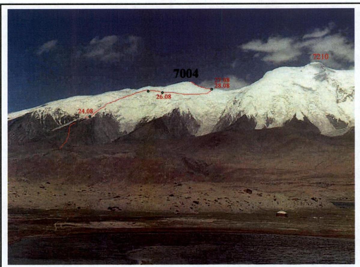 Fig. 3. Route to the summit with overnight locations.
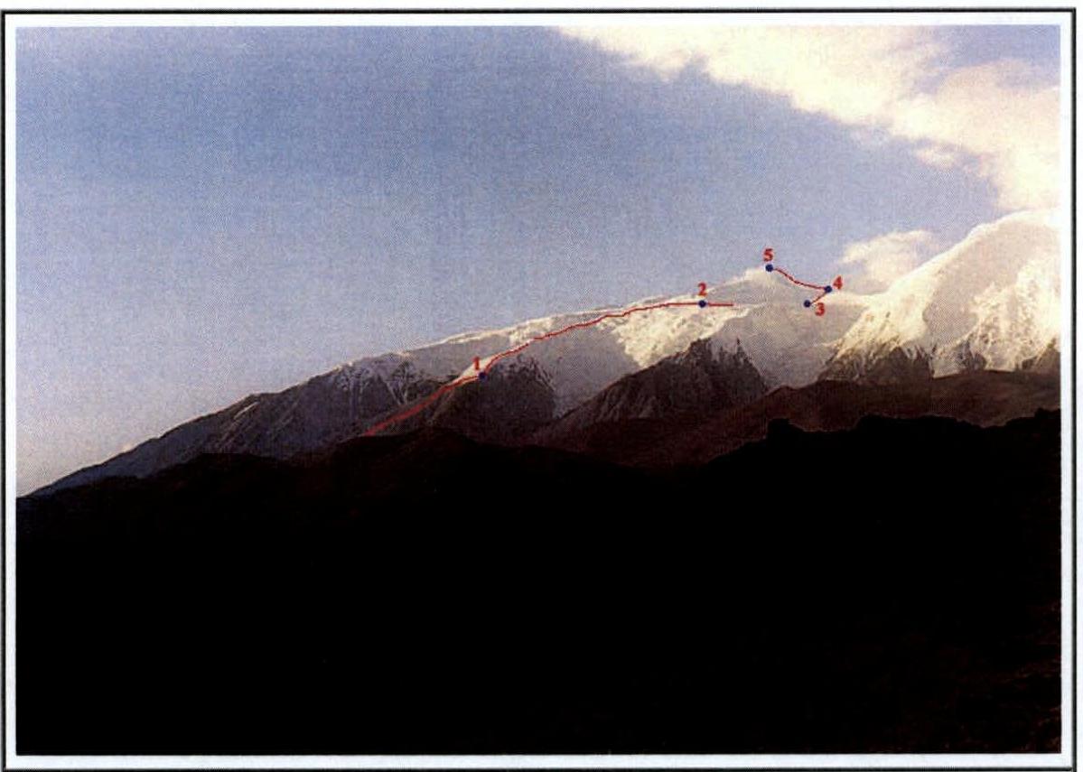 Fig. 4. Route to the summit broken down into sections.
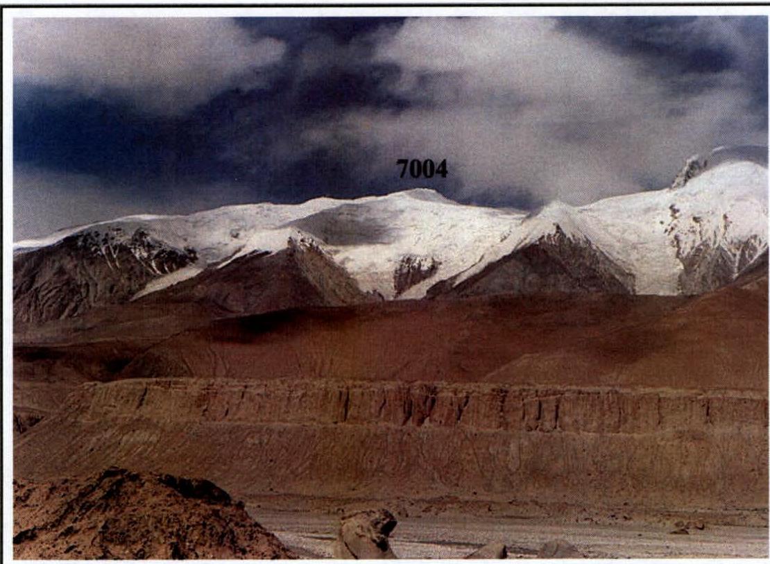 Fig. 5. Lower part of the route, ascent to the plateau.
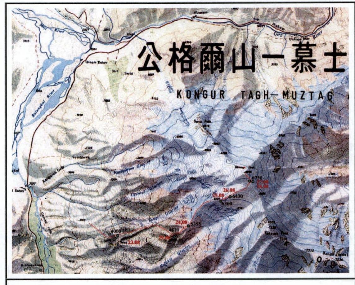
 Map of the peak area.
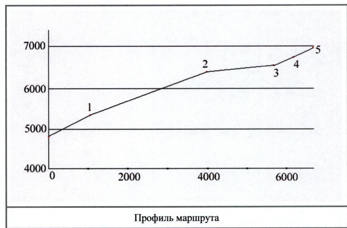
 Route profile.
 Chinese map of the peak area.
3. TABLE OF ROUTE SECTIONS
(above Ruchyeikovyy Pass 4810, 1A)
| N | Section Name | Start Height | End Height | Difficulty | Difficulty + height | Length (m) | Steepness (deg.) |
|---|---|---|---|---|---|---|---|
| 1 | Scree slope | 4810 | 5355 | 1 | 2 | 1180 | 25–30 |
| 2 | Wide ice-snow ridge with ascents | 5355 | 6400 | 2 | 3 | 3120 | 20, ascents up to 35 |
| (10–20 m) | |||||||
| 3 | Snow plateau | 6400 | 6550 | 1 | 3 | 1700 | 5 |
| 4 | Snow-ice slope | 6550 | 6750 | 2 | 4 | 540 | 22 |
| 5 | Wide snow-ice ridge with | 6750 | 7004 | 2 | 4 | 550 | 25–30 |
| scree outcrops |
4. DESCRIPTION OF APPROACHES AND ASCENT
(excerpts from a tourist report)
Located in the Kongurtagh Range, it is the westernmost peak of this range. It looks grandiose from the north from the road in the Gez River gorge, towering 4000 m above it. It is no less majestic when viewed from the west from the Mojisu River valley. From the south, from Lake Karakol, Aklangam is unremarkable due to its more eastern and higher neighbors — peaks Kokodag (7210 m) and Kongurtyube (7595 m). We chose the left (western) edge of the two edges descending to the southwest from the plateau between peaks Aklangam and Kokodag. The approach to the base of the edge (4000 m) from the bridge over Kengshiber (near the village of Bulungkol) took half a day. To the west of the edge, in the pocket of the orographically left moraine of the neighboring glacier Tangy, a clear stream flows. A base camp can be set up on its bank.
The ascent to the edge begins along the orographically left tributary of the stream, which leads to the saddle of Ruchyeikovyy Pass (4810, 1A) in the southwest spur of the edge. From the pass, left and up along the scree gully. The gully ends at a height of 5050 m, exiting to the edge. From here, up along the edge to its shoulder. A one-hour ascent along the scree ends at the snow in the area of the shoulder. We spent the night here from August 24 to 25. Height 5355 m.
From the shoulder 5355 m, up along the ice-snow edge. Periodically occurring fractures are circumvented on the right. Each such detour involves short ascents with a steepness of up to 40° and a length of up to 30 m. In the upper part, the edge becomes wide and gradually turns into a plateau. On August 25, we ascended to a height of 6360 m. On August 26, we managed to go for 45 minutes. Then we were caught in fog, and it started snowing. Height 6430 m. The team had to wait out the bad weather.
August 27 — excellent weather. In the morning, we finished trodding the edge. Then we crossed the plateau and by the second half of the day, we ascended along a long 30-degree slope to the ridge of the Kongurtagh Range east of peak Aklangam. Height — 6750 m. By evening, the weather deteriorated.
On August 28, in the morning, we ascended to the summit of Aklangam along a wide snow-covered scree slope. Short rock walls no higher than 1 m were encountered along the way. To the north, monstrous cornices overhung. A strong wind was blowing. Periodically, we were enveloped in clouds.
The summit of Aklangam is broad and flat. Two piles of stones stand out on the summit plateau. We climbed the higher one. The GPS reading showed 6995 m. All 12 channels were engaged, and the accuracy guaranteed by the device was 4 m.
Almost immediately after descending to the camp at 6750 m, the weather deteriorated again. Descending in poor visibility was very dangerous. It was difficult not to get lost when exiting the plateau onto the edge. Therefore, after the ascent, we did not leave.
On August 29, at 3:00 AM, it was decided to begin the descent by the light of the Moon. As it turned out later, this was unnecessary, in the sense that the day turned out clear afterwards. However, it was impossible to foresee this. By evening, we managed to descend to Ruchyeikovyy Pass (4810 m). This is a very pleasant place for a camp. Two crystal-clear streams run along the flat scree area. The site is separated from the pass and protected from the wind by a low scree rampart.
5. PHOTO ILLUSTRATIONS
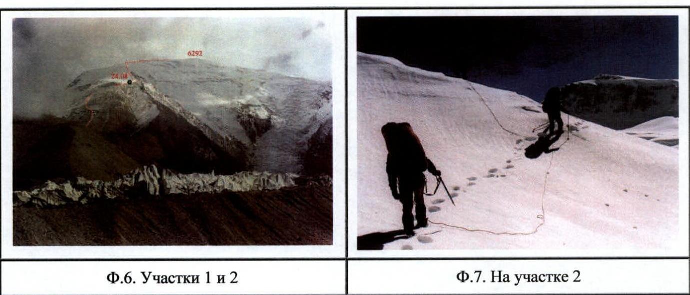 Fig. 6. Sections 1 and 2.
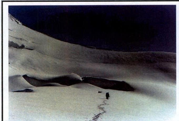 Fig. 7. On section 2.
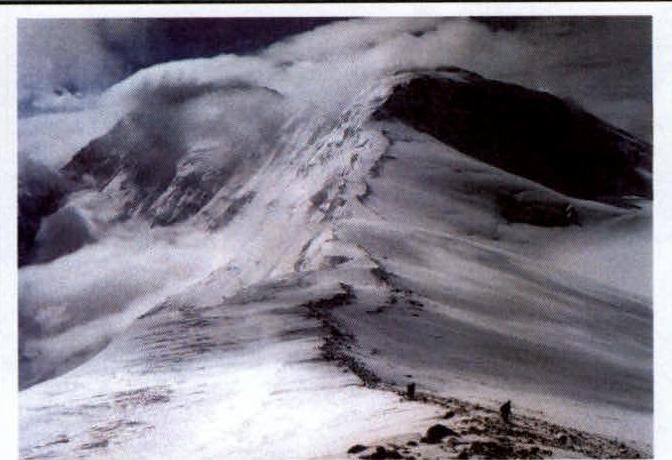 Fig. 9. On section 5, Kongurtyube (left) and Kokodag in the background.
 Fig. 8. On section 3, section 4 ahead.
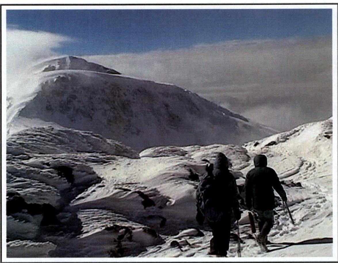 Fig. 15. Approaching the inflection from the summit plateau to the ridge; we are about to descend.