Eiger
Climbing the classic route via the South ridge on Eiger (3970 m), category 3B. Jungfrau region. Bernese Alps, Switzerland.
Moscow 2013
Climbing Report
- Alps. Bernese Alps. Switzerland. Section according to KMGV 2013 — 10.3.
- Peak Eiger (Eiger). Height 3970 m. Via South ridge. Route name: classic route via South ridge.
- Category: 3B. First ascent: G. Edward Foster, H. Baumann, U. Rubi, 1876.
- Route type: combined.
- Height difference: 320 m (by altimeter)
Route length: 3100 m, Average slope: 30°
- Pitons left on the route: 0, Used: friends, nuts — 5 pieces Ice screw — 1
- Team's climbing hours: 7 hours, Descent 7 hours (to Mittellegi hut)
- Team leader: A.E. Volkov — International Master of Sports
Members: A.V. Yurkin — Master of Sports
- Coach: A.E. Volkov (International Master of Sports).
- Exit to the route from Mönchsjochhütte (3651 m)
Route started: 4:00, August 25, 2013. Summit reached: 10:55, August 25, 2013 Overnight on descent to Mittellegi hut (3355 m) Return to base camp (Wengen village): 14:00, August 26, 2013. Descent from summit: via West ridge through Mittellegi hut (3355 m) and "Eismeer" train station on the south side.
-
Organization:
-
Report responsible: Yurkin A.V. Email: s2_aleks@mail.ru
General summit photo.
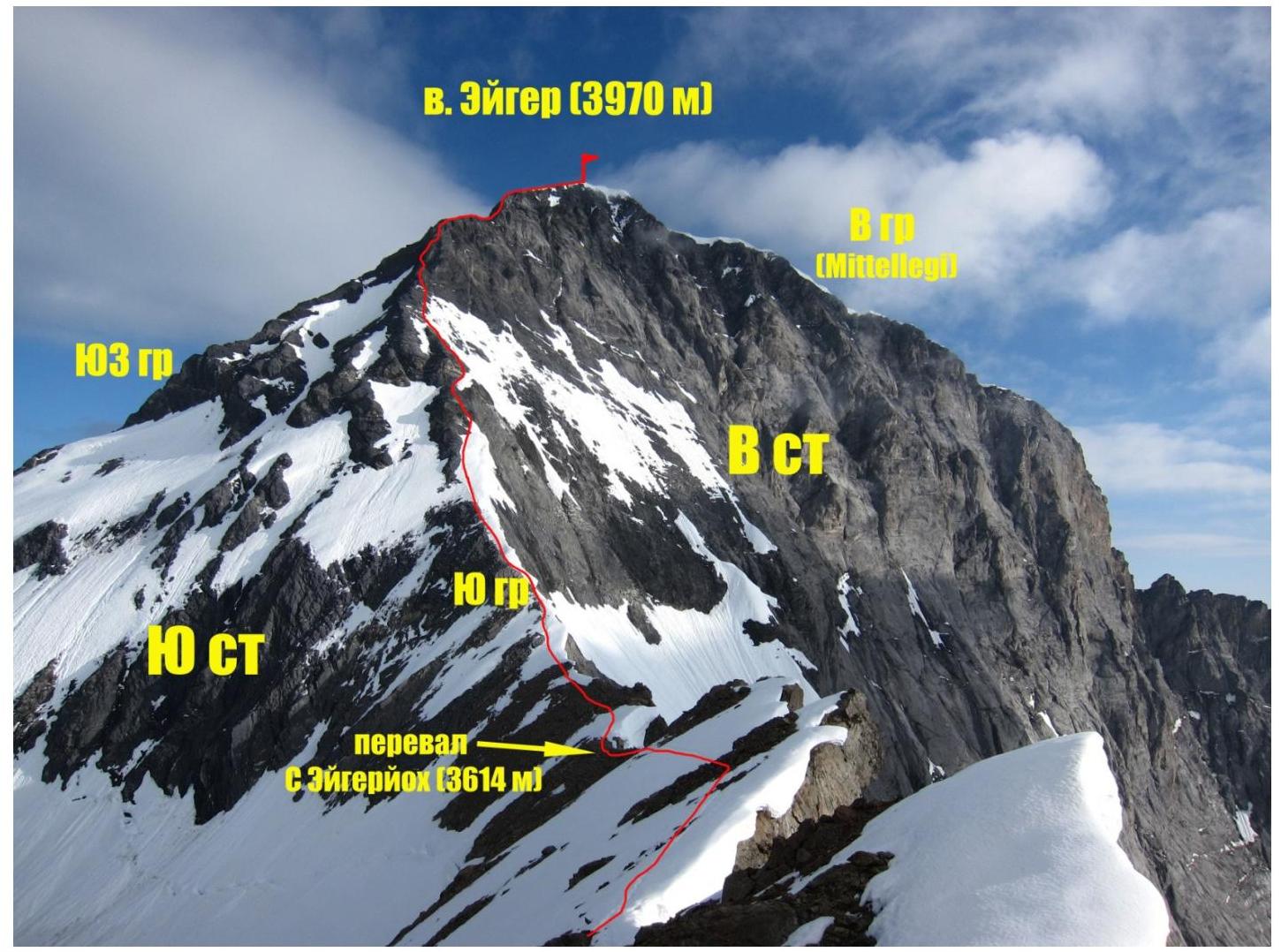
Route scheme. Photo from the ridge between Eigerjoch passes. Taken on July 25, 2013.
Route profile photo
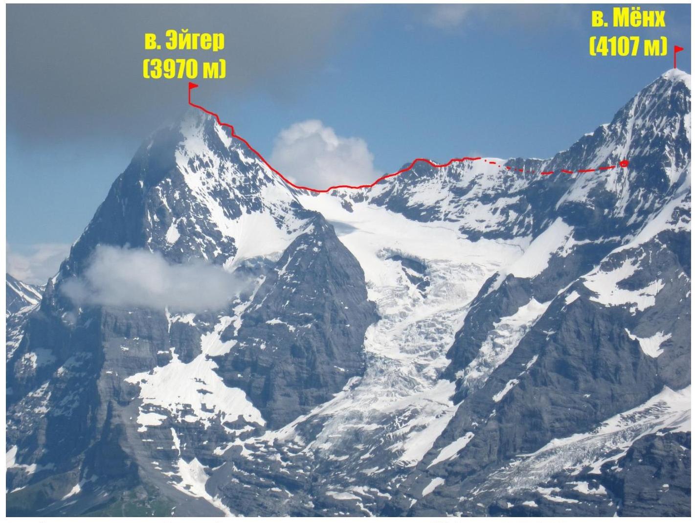
Route profile. Photo taken from Schilthorn slopes. July 19, 2013.
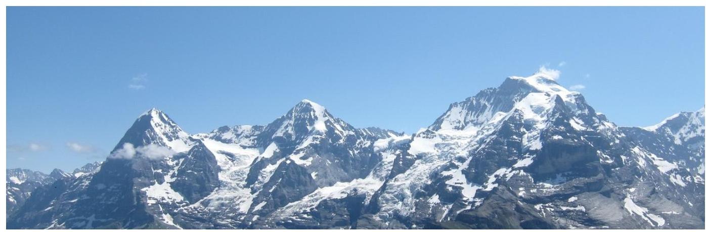
Overview of Jungfrau region. Bernese
Alps.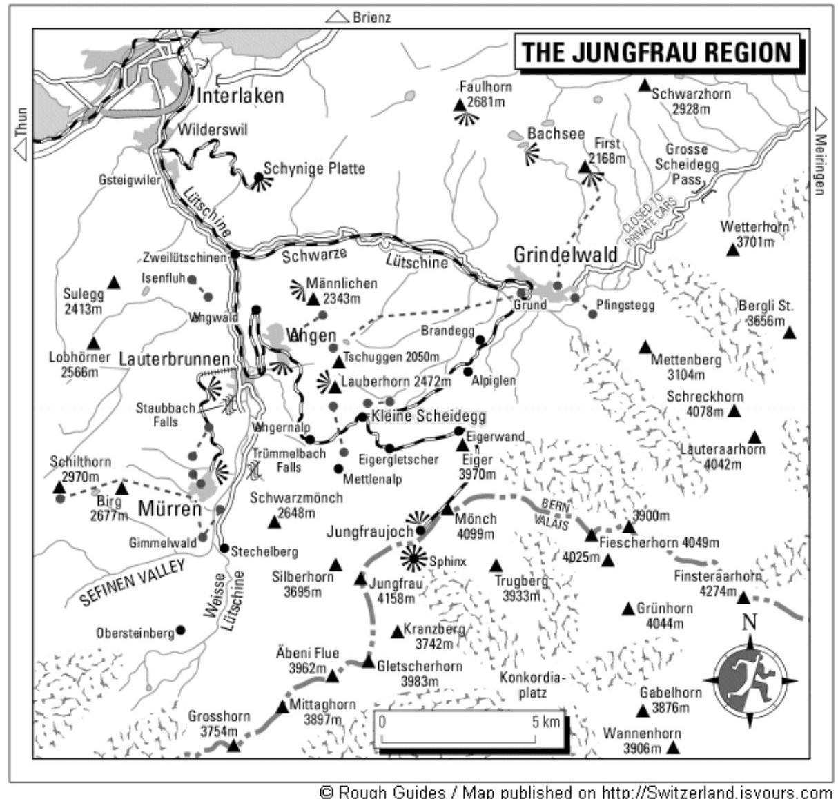
Map scheme of Jungfrau region. Scheme taken from Switzerland.isyours.com
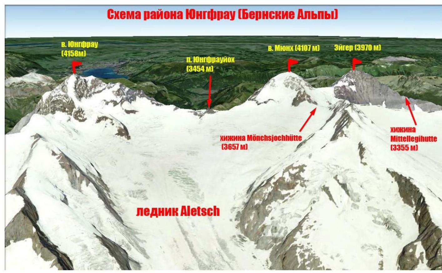
Scheme of the area from Aletsch glacier side

Photo of Jungfrau mountain region from Schilthorn. July 19, 2013.
Eiger (German: Eiger) — the most famous peak in Bernese Alps (Switzerland). Height — 3970 m. Eiger is the easternmost peak in the ridge that goes to Mönch (4107 m) and further to Jungfrau (4158 m).
First mentions of Eiger date back to the 13th century, but the origin of its name is still unknown. Eiger lies in a northeast-southwest direction and from these sides it appears as a characteristic horn. The peak rises above Grindelwald Grund valley by 3000 m and is very susceptible to bad weather coming from the northwest.
Eiger is entirely composed of limestone. The Jungfraujoch railway passes through Eiger via a tunnel. There are stations with panoramic windows:
- In the center of the North face (Eigerwand station, 2865 m)
- In the lower part of the South face (Eismeer station, 3160 m)
The first ascent of Eiger was made on August 11, 1858 by Swiss guides Christian Almer and Peter Bohren, and Irishman Charles Barrington. The route went via the West slope.
Classic routes on Eiger include ascents via East, South, and West ridges, and West slope. Eiger's North face is considered one of the most challenging in the Alps. The large height difference and diverse relief make this face attractive. There are 32 routes on it. Geographic coordinates of the summit: 46°34′39.04″ N 8°0′18.46″ E. Our team climbed one of the classic routes to the summit — via the South ridge. According to the European classification, the route has a category: ZS, III (French scale AD, III, UIAA).
Technical route photos
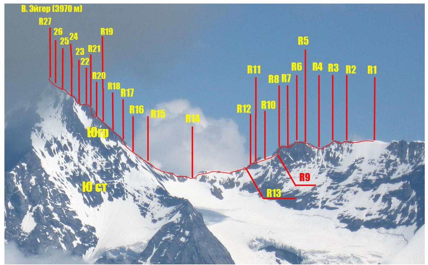
Difficulty table by route sections
| Section No | Length, m | Slope, ° | Relief type | Category | Pitons used |
|---|---|---|---|---|---|
| R0–R1 | 1500 | 25 | snow | I | |
| R1–R2 | 150 | 25 | snow | II | |
| R2–R3 | 50 | 30 | rocks | II | |
| R3–R4 | 30 | 60 | rocks | IV | |
| R4–R5 | 50 | 30 | rocks | III | |
| R5–R6 | 50 | 30 | rocks | III | |
| R6–R7 | 25 | 70 | rocks | IV | |
| R7–R8 | 7 | 45 | rocks | III | |
| R8–R9 | 45 | 60 | rocks | IV | |
| R9–R10 | 50 | 45 | snow-ice | III | 1 |
| R10–R11 | 40 | 35 | snow | II | |
| R11–R12 | 50 | 30 | rocks | II | |
| R12–R13 | 40 | 60 | rocks | III | |
| R13–R14 | 200 | 25 | rocks-snow | II | |
| R14–R15 | 200 | 30 | rocks | II | |
| R15–R16 | 50 | 35 | snow | II | |
| R16–R17 | 30 | 50 | rocks | III | |
| R17–R18 | 50 | 35 | rocks | II | |
| R18–R19 | 50 | 40 | rocks | II | |
| R19–R20 | 30 | 45 | rocks | III | |
| R20–R21 | 35 | 70 | rocks | IV+ | 3 |
| R21–R22 | 25 | 65 | rocks | IV | 2 |
| R22–R23 | 45 | 50 | rocks | III | |
| R23–R24 | 50 | 35 | rocks | II | |
| R24–R25 | 50 | 60 | rocks | III | |
| R25–R26 | 50 | 50 | rocks | III | |
| R26–R27 | 50 | 20 | snow | II |
Brief description of route passage by sections.
Approach
From Mönchsjoch hut, descend down to Mönchsjoch pass (10 min). Immediately after the pass, there is a bergschrund (crossing via a snow bridge in the center) — a snow-ice plateau begins. In season, numerous groups heading to Fiescherhorn peak and nearby peaks pass through; the trail goes straight through the center of the glacier. At the beginning, there is a turnoff to the left towards Eiger South pass. Move in that direction.
R0–R1 Cross the glacier, moving along the eastern slopes of Mönch. Ascend to a small shoulder on the East ridge and further towards Eiger South pass (3747 m). Without ascending to the pass, proceed to the beginning of a long ridge between:
- South Eigerjoch pass
- North Eigerjoch pass.
Attention — hidden crevasses! 1500 m, 25°, I
R1–R2 Snow ridge 200 m, 25°, II
R2–R3 Exit to rocks. Snow-ice sections are encountered. 50 m, 30°, II
R3–R4 Descent down rocks of medium difficulty. Requires station setup for belaying. 30 m, 60°, IV
R4–R5 Ascent along a rocky ridge 50 m, 30°, III
R5–R6 Rocky ridge. Belay via flex points. 50 m, 30°, III
R6–R7 Dülfer descent to a small saddle with a station and a piton. 25 m, 70°, IV
R7–R8 Movement along the ridge, belay via flex points. Piton on the station. 7 m, 45°, III
R8–R9 Descent via an inner corner dülfer style to a snowy ridge. 45 m, 60°, IV
R9–R10 Down along the ridge via a snowy ridge. Ice screws were used for belay. 50 m, 45°, III
R10–R11 Continue moving along the ridge, bypassing a rocky outcrop on the left. 40 m, 35°, II
R11–R12 Down a rocky ridge. 50 m, 30°, II
R12–R13 Down rocks of medium difficulty, belay via a metal pin. 40 m, 60°, III
R13–R14 Simple rocky ridge, occasional snow patches. Exit to North Eiger pass (3614 m): 200 m, 25°, II
R14–R15 Along a rocky ridge with characteristic black inclined slabs. Occasional snow: 200 m, 30°, II
R15–R16 Cross a snowfield before a small ascent: 50 m, 35°, II
R16–R17 Ascend a rocky outcrop from the right via an inner corner. Attention: loose rocks! 30 m, 50°, III
R17–R18 Rocky ridge 50 m, 35, II
R18–R19 Rocky ridge 50 m, 40, II
R19–R20 Climb to the first ascent from the right and continue along the ridge to a small platform under a bastion. Station on a piton. 30 m, 45, III
R20–R21 Initially, ascend a flat slab 3 m and move around the corner, then along the wall towards an inner corner. Belay with camalots and nuts. Station on a good ledge (piton). 35 m, 70°, IV+
R21–R22 Continue up the inner corner to a large platform before the next ridge ascent. 25 m, 65°, IV
R22–R23 Ascend simple rocks to the ascent, exit to the flattening ridge via the center. Belay via flex points. 50 m, 50, III
R23–R24 Ascend the ridge. 50 m, 35, II
R24–R25 From a small saddle, ascend and move right to a cross, then along the ridge to the next good platform. 50 m, 60, III
R25–R26 Ascend the ridge to the beginning of a snowy ridge. "Live" stones! 50 m, 45, III
R26–R27 Exit to the summit via a snowy ridge. Attention — cornices! 50 m, 20, II
Descent: the team descended via the West ridge (not recommended). The best option is to descend via the ascent route.
General route recommendations
The route is a long ridge traverse. Fairly safe and logical. In season, it is often climbed, and many groups descend via this route after ascending via the East ridge. Descent via the South ridge is recommended after ascending via the same ridge.
Key sections of the route are equipped with belay stations and have rappel rings:
- On the ridge between North and South Eigerjoch passes;
- On the South ridge.
When climbing with a training group, it is recommended to bring a set of nuts, friends, and pitons.
Photo illustrations of the report.
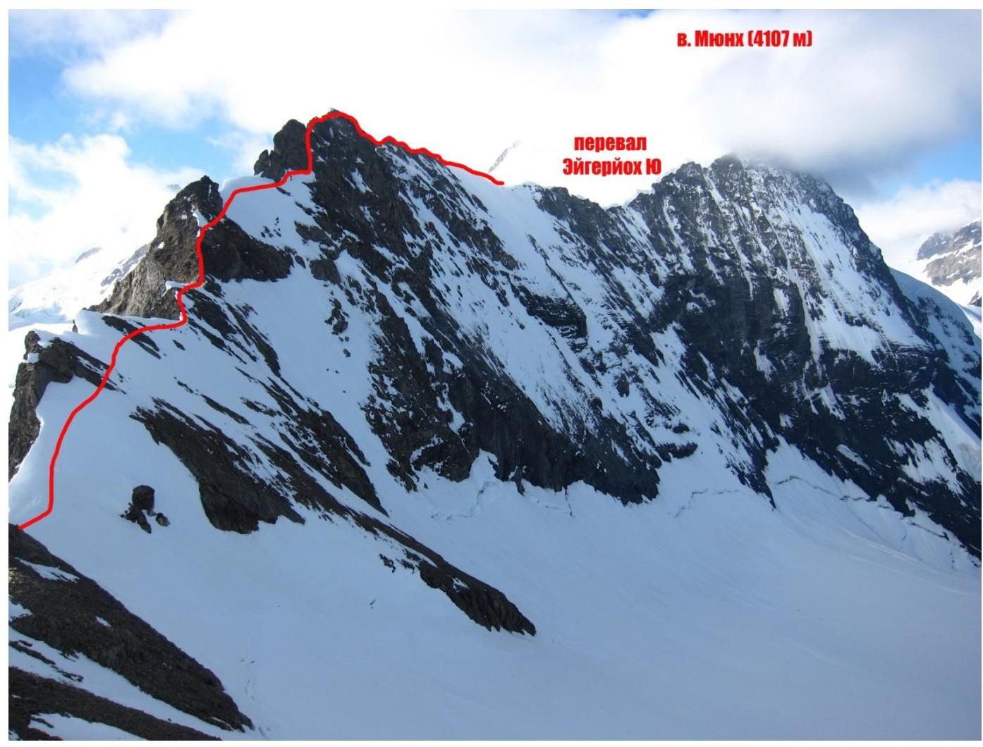
Photo 1. Ridge between North and South Eigerjoch passes. Photo from Eiger South ridge. August 25, 2013.
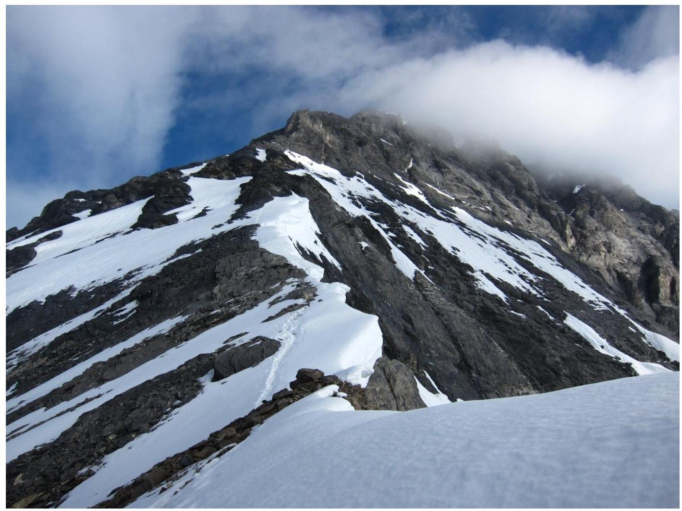
Photo 2. Eiger South ridge. Photo from North Eigerjoch pass. July 25, 2013.
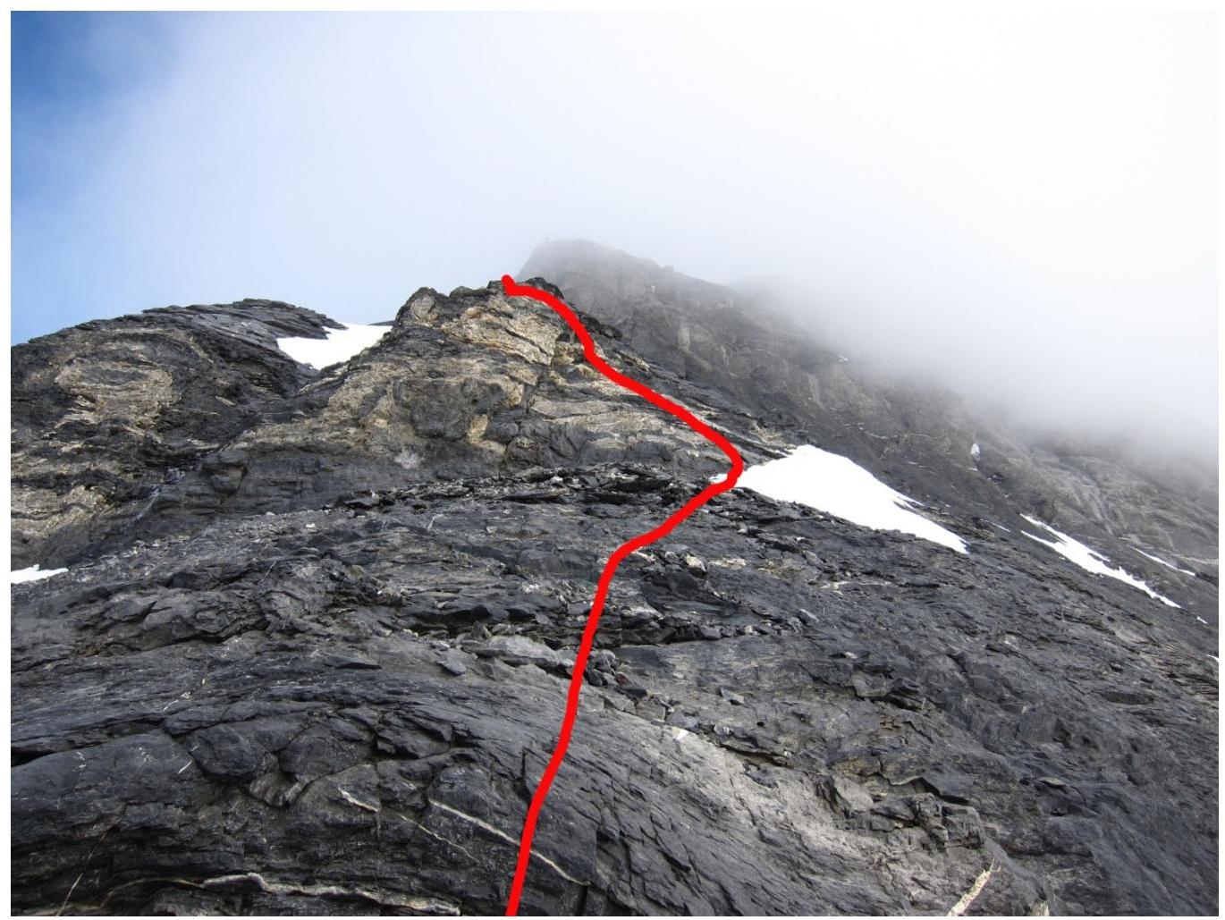
Photo 3. Sections R17–R19.
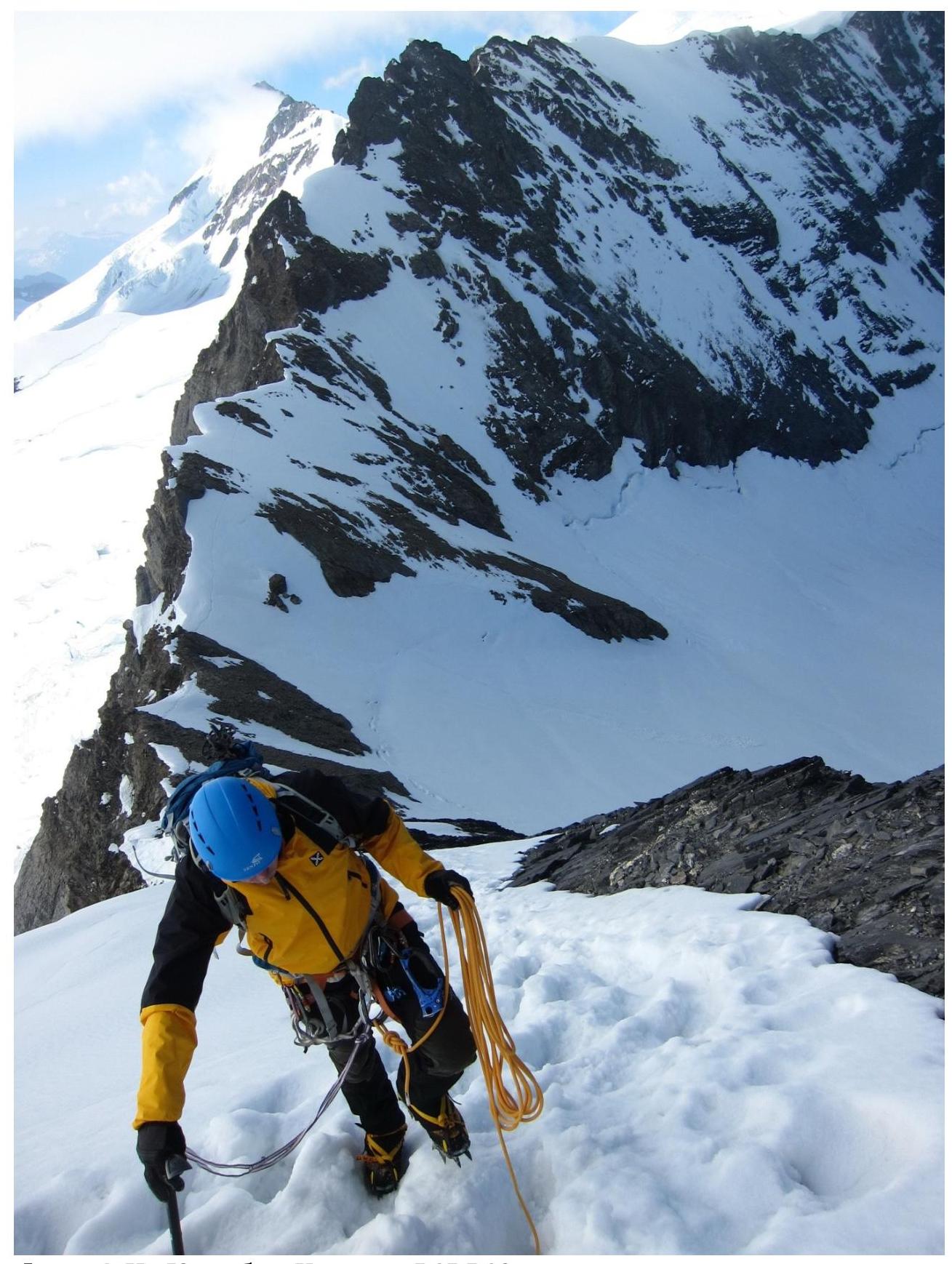
Photo 4. On Eiger South ridge. Section R15–R16
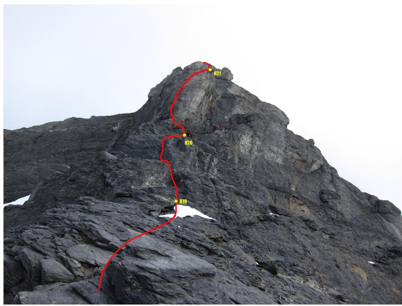
Photo 5. Section R19–R21. Key section of the route. Under the bastion, descending climbers from foreign countries can be seen.

Photo 6. Ridge section R24–R25.

Photo 7. Pre-summit
ridge.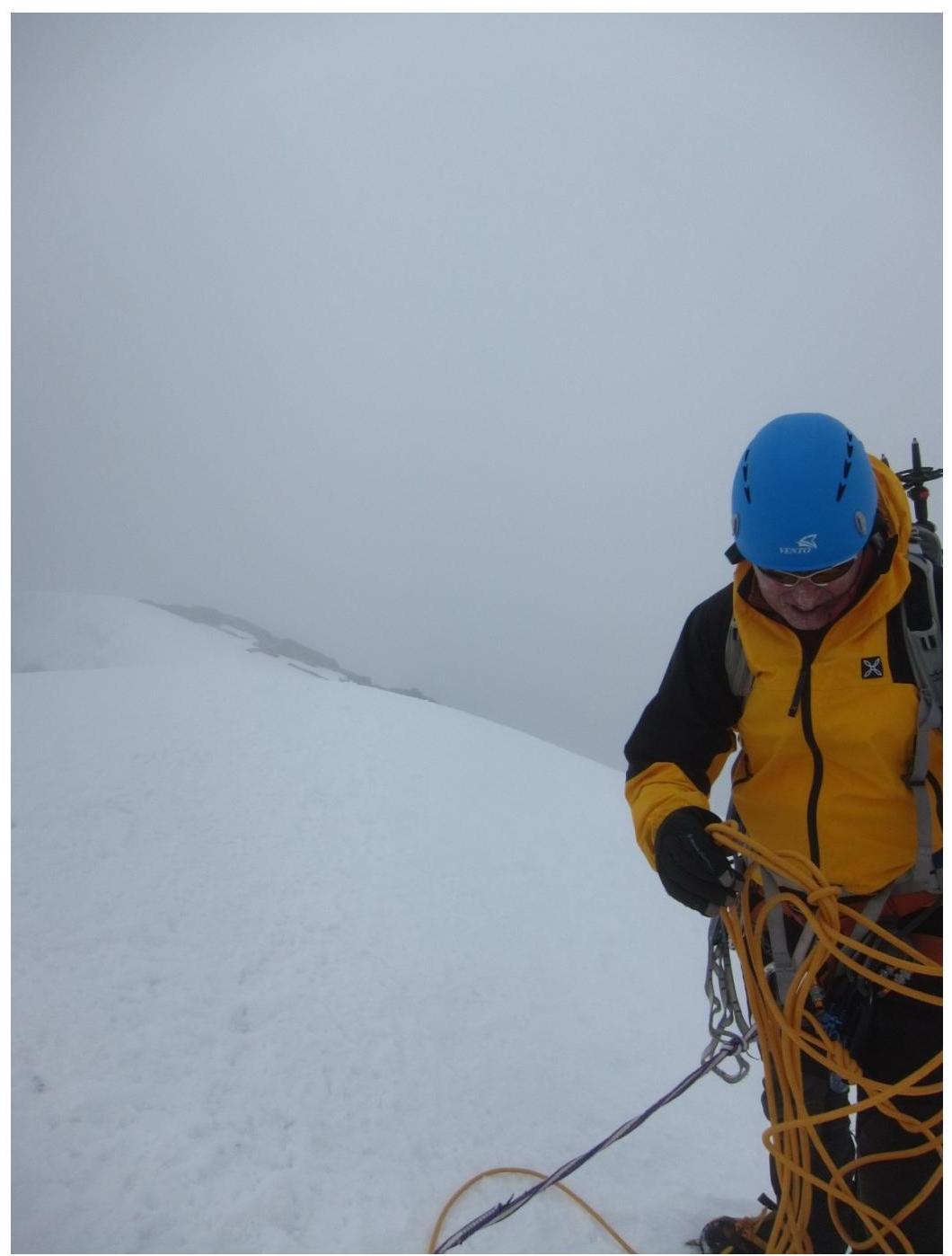
Photo 8. On the summit.


