REPORT ON THE ASCENT OF AIGUILLE DU TOUR VIA THE TRAVERSE OF SOUTHERN AND NORTHERN SUMMITS, CATEGORY 2A, BY THE TRAINING DEPARTMENT OF "POLITEKH" MOUNTAINEERING CLUB UNDER THE LEADERSHIP OF MOLODOZHEN V. A. ON JULY 26, 2018
1. Climbing Report Details
| № | 1. General Information | |
|---|---|---|
| 1.1 | Full Name, Sports Rank of the Leader | Molodozhen V. A. — Master of Sports |
| 1.2 | Full Name, Sports Rank of the Participants | Fineeva A. A. — 3rd sports rank, Sadovskiy S. V. — 3rd sports rank, Duplyak A. K. — 3rd sports rank, Lymanyuk A. Yu. — 3rd sports rank |
| 1.3 | Full Name of the Coach | Molodozhen V. A. |
| 1.4 | Organization | "Politekh" Mountaineering Club |
| 2. Characteristics of the Climbing Object | ||
| 2.1 | Region | France, Upper Savoy, Chamonix valley, Le Tour, Glacier du Tour |
| 2.2 | Valley | Le Tour |
| 2.3 | Section Number according to the 2013 Classification Table | 10.3 |
| 2.4 | Name and Height of the Summit | Aiguille du Tour (southern summit) — 3542 m, Aiguille du Tour (northern summit) — 3544 m |
| 2.5 | Geographical Coordinates of the Summit (latitude/longitude), GPS Coordinates | Aiguille du Tour (southern summit) — 45°59′39.8″N, 7°00′37.3″E; Aiguille du Tour (northern summit) — 45°59′42.0″N, 7°00′39.6″E |
| 3. Route Characteristics | ||
| 3.1 | Route Name | Traverse of southern and northern summits of Aiguille du Tour |
| 3.2 | Proposed Category of Difficulty | 2A |
| 3.3 | Degree of Route Exploration | Well-trodden |
| 3.4 | Terrain Type of the Route | Rocky |
| 3.5 | Height Difference of the Route (data from altimeter or GPS) | Height of campsite — 2702 m; Height at the base of the rocky ascent — 3460 m; Summit height — 3544 m; Height difference from campsite to summit — 842 m; Height difference from the base of the rocky ascent to summit — 84 m. |
| 3.6 | Route Length (in meters) | Distance from campsite to the base of the rocky ascent (approach length) — 3550 m; Distance from the base of the rocky ascent to the southern summit — 140 m; Distance from the southern to the northern summit — 200 m; Descent from the northern summit to the base of the rocky ascent — 130 m; Total length of the rocky section of the route — 470 m; Total route length including approach and return to campsite — 7570 m |
| 3.7 | Technical Elements of the Route (total length of sections of varying difficulty with terrain type) | Category II, rocks — 430 m; Category III, rocks — 40 m; Movement on closed glacier — 5600 m. |
| 3.8 | Descent from the Summit | Descent via the ascent route |
| 3.9 | Additional Route Characteristics | — |
| 4. Characteristics of the Team's Actions | ||
| 4.1 | Time of Movement (team's walking hours, in hours and days) | 9 hours |
| 4.2 | Overnight Stays | Campsite |
| 4.3 | Departure from Overnight Stays | 4:00 on July 26, 2018 |
| 4.4 | Start of the Route | 7:20 on July 26, 2018 |
| 4.5 | Arrival at the Southern Summit | 8:10 on July 26, 2018 |
| 4.6 | Arrival at the Northern Summit | 9:30 on July 26, 2018 |
| 4.7 | Descent from the Route | 10:30 on July 26, 2018 |
| 4.8 | Return to Overnight Stays | 13:00 on July 26, 2018 |
| 5. Person Responsible for the Report | ||
| 5.1 | Sadovskiy Sergey Valerievich | sadovsergey@hotmail.com |
2. Climbing Report Description
1. Climbing Object Characteristics
1.1. General Summit Photo

Date of photo — July 26, 2018. Location — Plateau du Trient, Switzerland, view of the eastern slope of Aiguille du Tour.
Routes:
- Route to the southern summit of Aiguille du Tour — Category 1B;
- Traverse of southern and northern summits of Aiguille du Tour — Category 2A;
- Route to the northern summit of Aiguille du Tour — Category 1B.
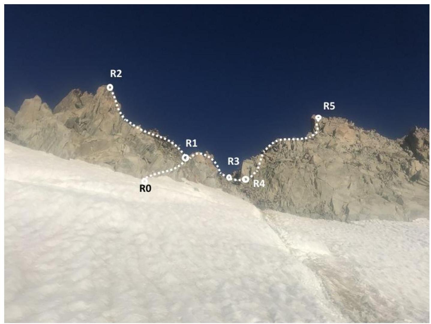
1.2. Route Profile Photo
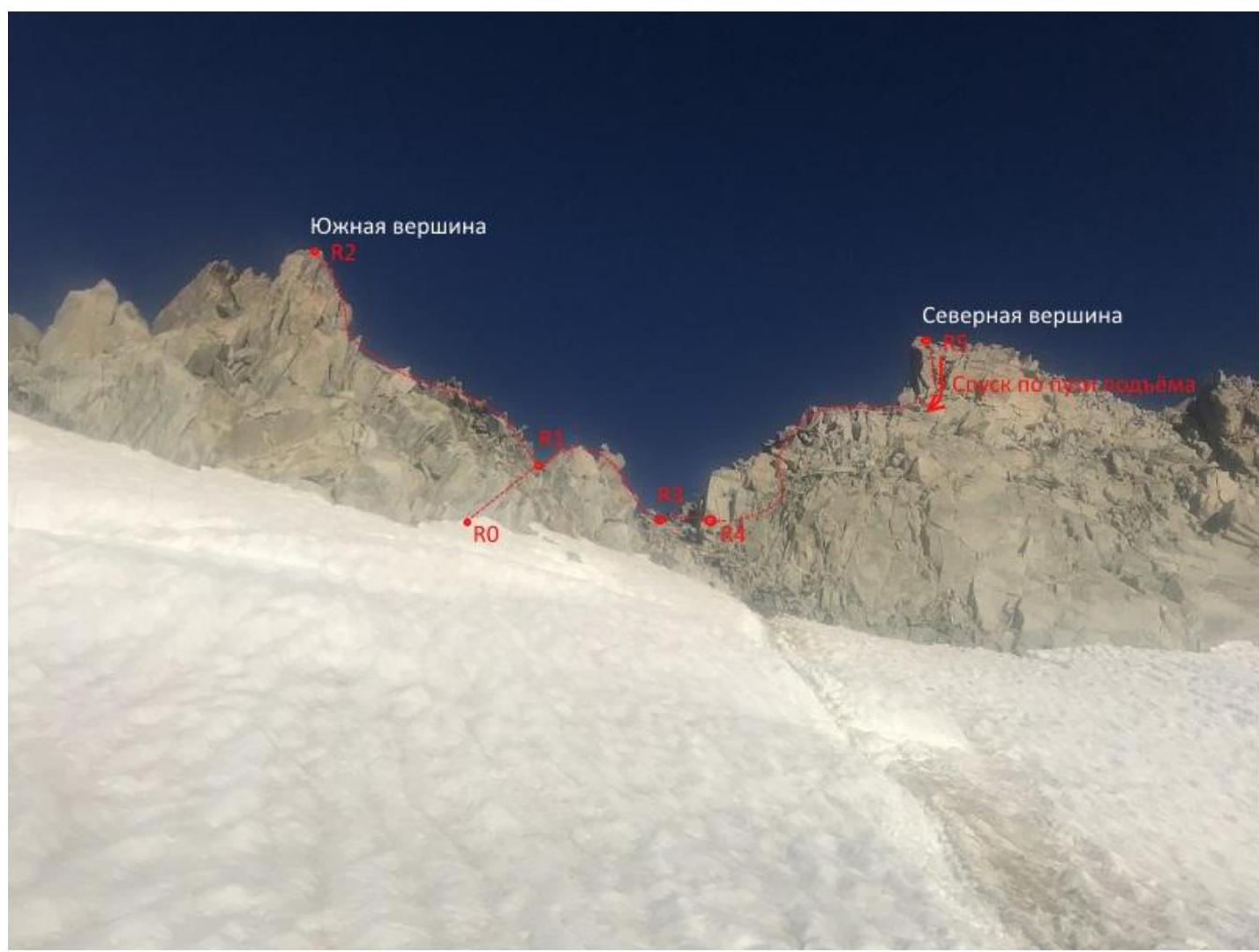
Date of photo — July 26, 2018. Location — Plateau du Trient, Switzerland, view of the eastern slope of Aiguille du Tour.
1.3. Panoramic Photo of the Area
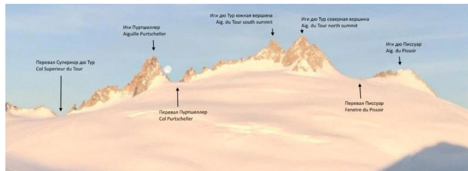
Date of photo — April 2017. Author: Valérie Vischi-Serraz. Location — Plateau du Trient, Cabane du Trient, Switzerland, view of the eastern slope of Aiguille du Tour.
1.4. Area Map
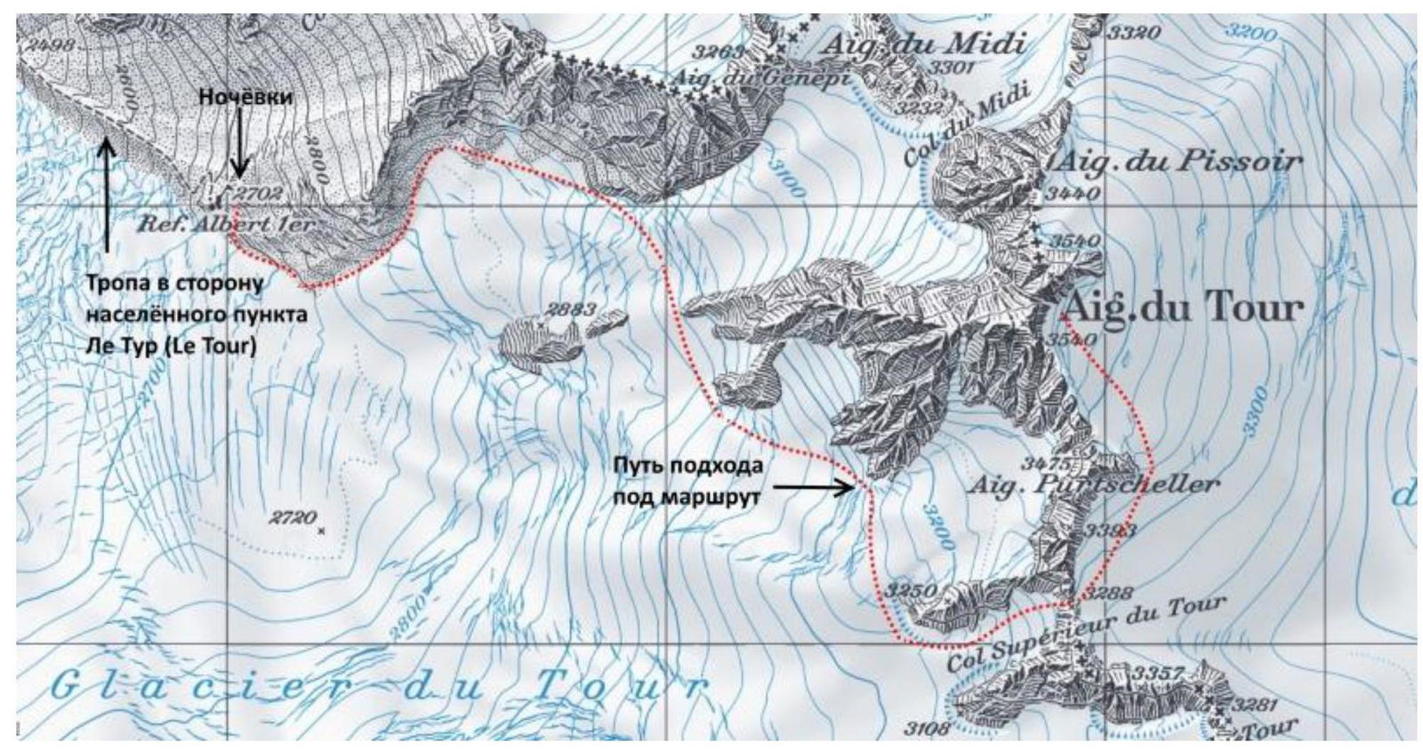
The area where the summit is located is on the border of France and Switzerland. Glacier du Tour is located east of Le Tour, which is in the Chamonix valley, north of Chamonix.
Ascent to the campsite from Le Tour is possible via a trail. The height difference is 1270 m, distance is 6.5 km. The journey takes about 3 hours.
Approach to the campsite is also possible from the upper station of the Les Autannes lift. In this case, the height difference is 550 m, distance is 4 km. The journey takes about 2 hours.
From the campsite, move east along the northern side of the glacier via a trail. The path is marked on the map with a red dotted line. Then, cross to the closed glacier. In summer, this route is quite popular, so a clear path is visible on the glacier. Follow the path southeast to Col Superieur du Tour.
The height of the pass is 3288 m. The height difference from the campsite is 586 m, distance is 2.85 km.
After passing the pass, move north towards the start of the route. The height difference between the campsite and the start of the route is 758 m, distance is 3.55 km. The journey takes about 3 hours.
2. Route Characteristics
| Section | Terrain Type | Category of Difficulty | Length | Type and Number of Pitons |
|---|---|---|---|---|
| R0–R1 | Rocks | 2 | 60 m | |
| R1–R2 | Rocks | 2 | 80 m | |
| R2–R3 | Rocks | 2 | 100 m | |
| R3–R4 | Rocks | 3 | 20 m | 1 cam №3 |
| R4–R5 | Rocks | 2 | 80 m | |
| Descent from the Route | Rocks | 2–3 | 130 m |
3. Characteristics of the Team's Actions
| Section | Description | Photo Number |
|---|---|---|
| R0–R1 | Simple climbing, simultaneous movement in a rope team. Belaying through rock outcrops. | №1 |
| R1–R2 | Simple climbing, simultaneous movement in a rope team. Belaying through rock outcrops. The photo shows the team at the southern summit. | №2 |
| R2–R3 | Simple climbing, simultaneous movement in a rope team. Belaying through rock outcrops. | — |
| R3–R4 | This section is a traverse starting at the top of the couloir separating the two summits and moving horizontally towards the northern summit. It is advisable to set up a belay station before starting this section and move in turns. 1–2 intermediate belay points can be used on this section. Photo №3 shows the view of the northern summit and the traverse below. Photo №4 shows the belay station at the start of the section. | №№3, 4 |
| R4–R5 | Simple climbing, simultaneous movement in a rope team. Belaying through rock outcrops. Photo №5 shows the approach to the northern summit. Photo №6 shows the team at the northern summit. | №№5, 6 |
| Descent from the Route | Descent is organized via the ascent route. On section R3–R4, belaying is necessary for turn-by-turn movement on the traverse. On other sections, belaying is through rock outcrops. |
The route is one of the most popular for climbing and acclimatization. Therefore, the path to the route is clearly visible. The route is not rockfall-prone. The proposed grade of the route is 2A.
Photo №1. Section R0–R1
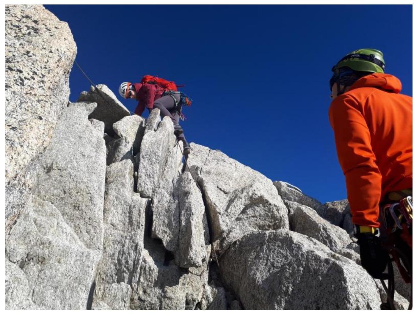
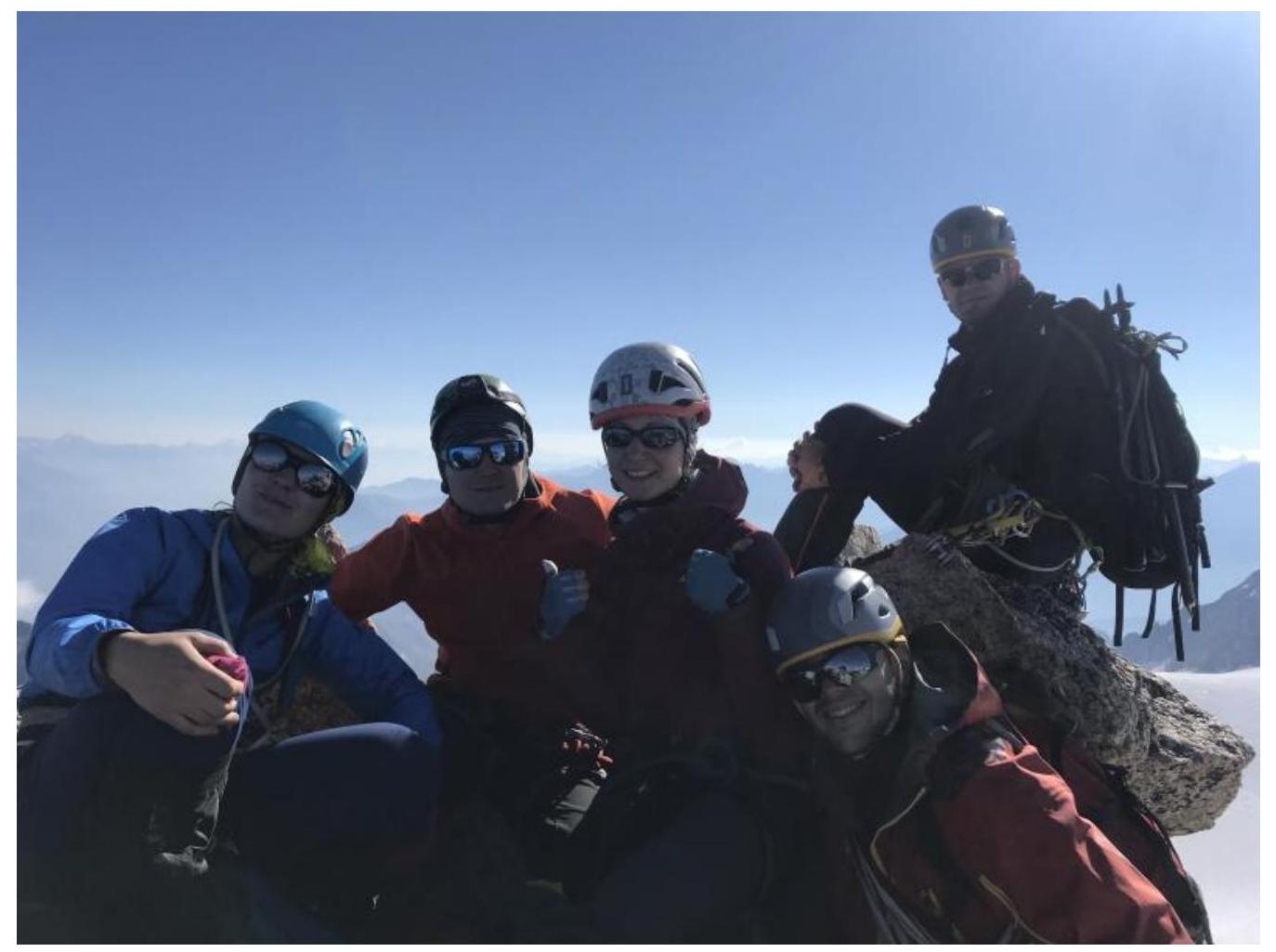
Photo №2. Southern Summit.
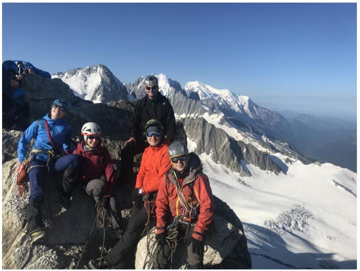
Photo №3. View of Sections R3–R4, R4–R5.

Photo №4. Climber at Point R3.
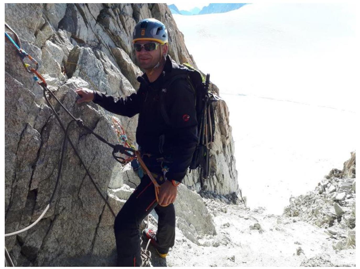
Photo №5. View of Section R4–R5.
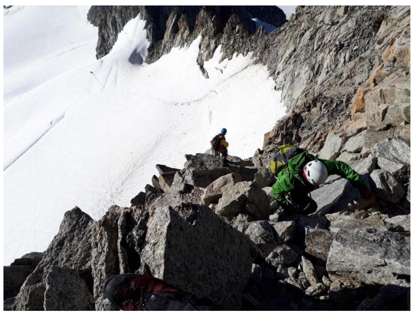
Photo №6. Northern Summit.