
Report
On the ascent via the Arête des Cosmiques to Aiguille Du Midi (3842 m), 3А category of complexity. Glacier du Géant, Mont Blanc massif, Auvergne-Rhône-Alpes, France.
Leader: Kopylov M.B. Coach: Molodozhen V.A.
St. Petersburg 2018
I. Ascent Passport
| Full name, sports rank of the leader | Kopylov M.B. — 1st sports rank | |
|---|---|---|
| 1.1 | Full name, sports rank of the participants | Antipina M.S. — 3rd sports rank. Vtorushin P.Yu. — 3rd sports rank. Gagloev N.A. — 3rd sports rank. Zhdanov I.M. — 2nd sports rank. Stepanyants E.E. — 3rd sports rank. |
| 1.2 | Full name of the coach | Molodozhen V.A. — Master of Sports |
| 1.3 | Organization | a/c Polytechnik, St. Petersburg |
| 1.4 | ||
| 2. Characteristics of the ascent object | ||
| 2.1 | Region | Mont Blanc massif. Glacier du Géant. Auvergne-Rhône-Alpes, France. |
| 2.2 | Valley | — |
| 2.3 | Section number according to the 2013 classification table | 10.3 |
| 2.4 | Name and height of the summit | Aiguille Du Midi. Height 3842 m. |
| 2.5 | Geographical coordinates of the summit (latitude–longitude), GPS coordinates *(1) | |
| 3. Route characteristics | ||
| 3.1 | Route name | Arête des Cosmiques |
| 3.2 | Proposed category of complexity | 3А category of complexity |
| 3.3 | Degree of route development | — |
| 3.4 | Nature of the route terrain | combined |
| 3.5 | Height difference of the route (altimeter or GPS data) | 250 m |
| 3.6 | Route length (in meters) | 300 m |
| 3.7 | Technical elements of the route (total length of sections with varying complexity, indicating the nature of the terrain (ice-snow, rock)) | II category of complexity rocks — 270 m. III category of complexity rocks — 15 m. |
| 3.8 | Descent from the summit | Via the trail through the Aiguille du Midi observation deck |
| 3.9 | Additional route characteristics | No water on the route |
| 4. Team actions characteristics | ||
| 4.1 | Travel time | 3 hours |
| 4.2 | Overnight | Site, shelf — (choose) |
| 4.3 | Departure on the route | 7:30, August 1, 2018 |
| 4.4 | Reaching the summit | 10:30, August 1, 2018 |
| 4.5 | Return to the base camp | 12:00, August 1, 2018 |
| 5. Responsible for the report | ||
| 5.1 | Full name, e-mail | Stepanyants E.E., Gagloev N.A. stepakatya@ya.ru |
General photo of the summit.
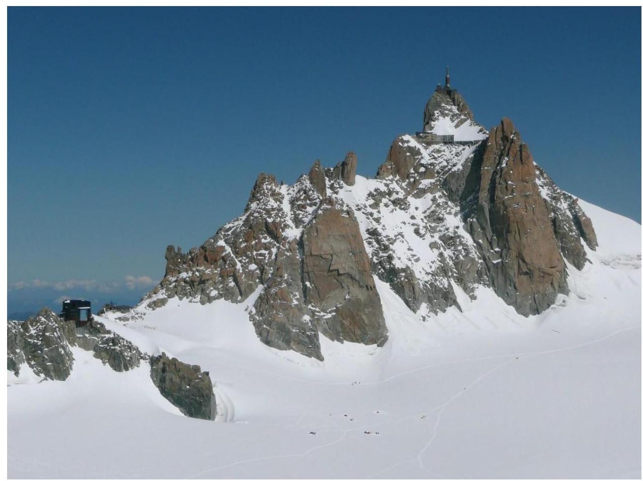
Photo of Aiguille du Midi summit, taken from Vallée Blanche.
Overview of the Glacier du Géant area
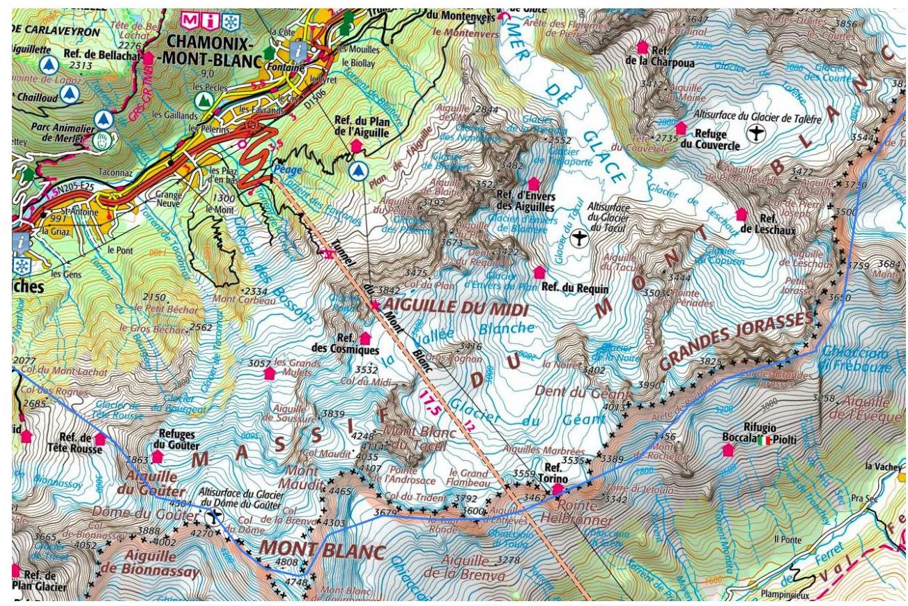
Map of the Glacier du Géant area. Aiguille du Midi (3842 m) is a mountain in the Mont Blanc massif, near the eponymous cable car. The team's ascent to the summit of Aiguille du Midi started from Refuge des Cosmiques (3613 m), which served as a base for the entire cycle of ascents in the area. The hut is located on the Glacier du Géant to the southwest of the Aiguille du Midi cable car (3776 m).
The ascent to the summit of Aiguille du Midi was part of the training camp of the St. Petersburg Alpine Club Polytechnik from July 21 to August 12, 2018.
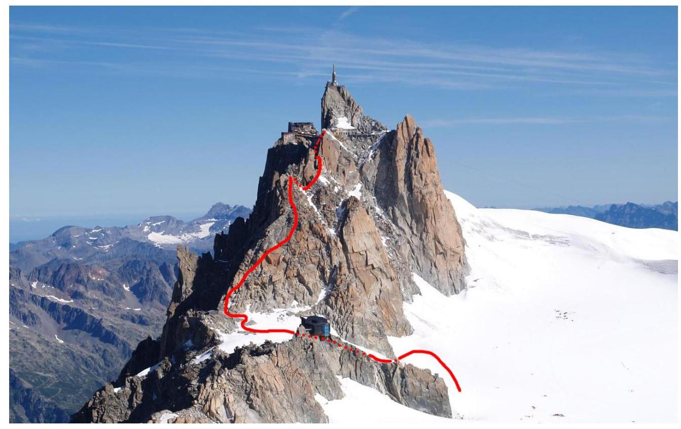
Technical photo of the route
| Section № | Length, m | Steepness, ° | Nature of terrain | Category of complexity | Number of pitons |
|---|---|---|---|---|---|
| R0–R1 | 110 | 45 | rocks | I–II | |
| R1–R2 | 15 | rocks | I | ||
| R2–R3 | 100 | 35 | rocks | II+ | |
| R3–R4 | 15 | 45 | rocks | III | |
| R4–R5 | 60 | 45 | rocks | II |
Brief description of the route passage by sections
Approach
From Refuge des Cosmiques:
- Traverse the snowfield to a rocky outcrop;
- Move towards the summit of Aiguille du Midi;
- Reach the remains of Abri Simond near the summit — the starting point of the route. During the season, a trail is well-trodden here, with numerous groups following the route.
R0–R1 — Ascend the ridge upwards towards the large gendarme, bypassing it on the right, continue moving towards the second gendarme. Rappelling down to the saddle between the second and third gendarmes. 110 m, 45°, I–II.
R1–R2 — Then approach the chimney near the third gendarme. Second rappel down the chimney, which turns into Couloir des Cosmiques at the bottom. 15 m, I.
R2–R3 — Once at the foot of the gendarme, traverse it to the right. Then a small open chimney and back to the ridge. Move along the ridge towards the fourth and last large gendarme (Grand Gendarme), bypass it, and approach a small vertical wall. 100 m, 35°, II+.
R3–R4 — The key section of the route involves pleasant climbing up a diagonal crack with many footholds. Climb up and to the right, then traverse left. The station is belayed. 15 m, 45°, III(4c).
R4–R5 — Then traverse further to the left, finding yourself on the other side of the ridge. Climb up, choosing the easiest path. At the end, there is a ladder to climb up to the Aiguille du Midi observation deck. 60 m, 45°, II.
Descent via the trail through the Aiguille du Midi observation deck.
General recommendations for the route
The route is logical and safe. It is one of the most popular in the area. It is interesting for training ascents as it includes almost all types of terrain, allowing for good practice in belaying using the terrain. For training groups, it is recommended to bring a set of friend devices for organizing intermediate belay points.
Photo illustration of the report.
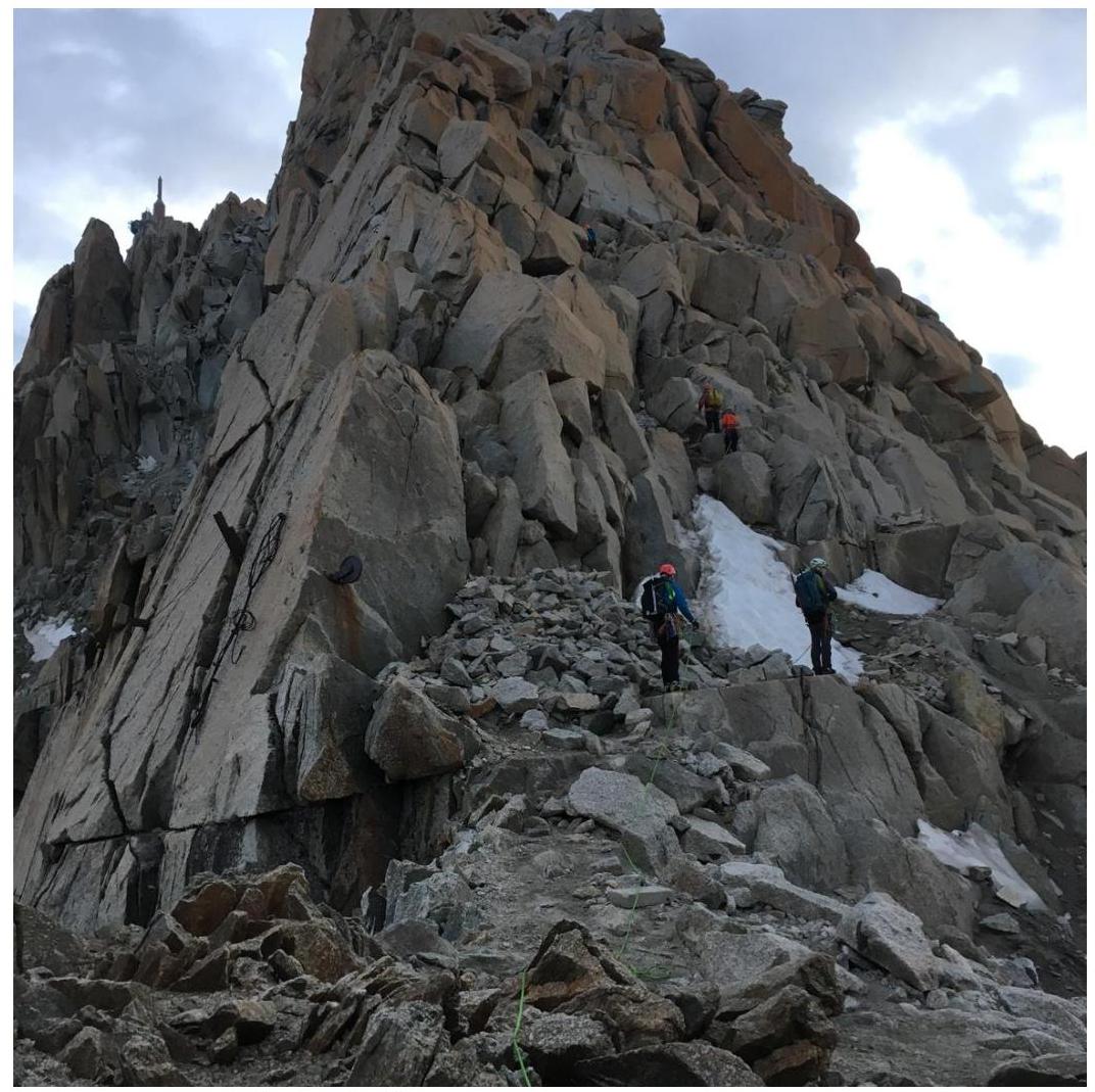
Photo 1. Lower part of the route. Taken near the remains of Abri Simond.
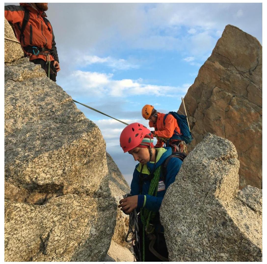
Photo 2. First rappel.
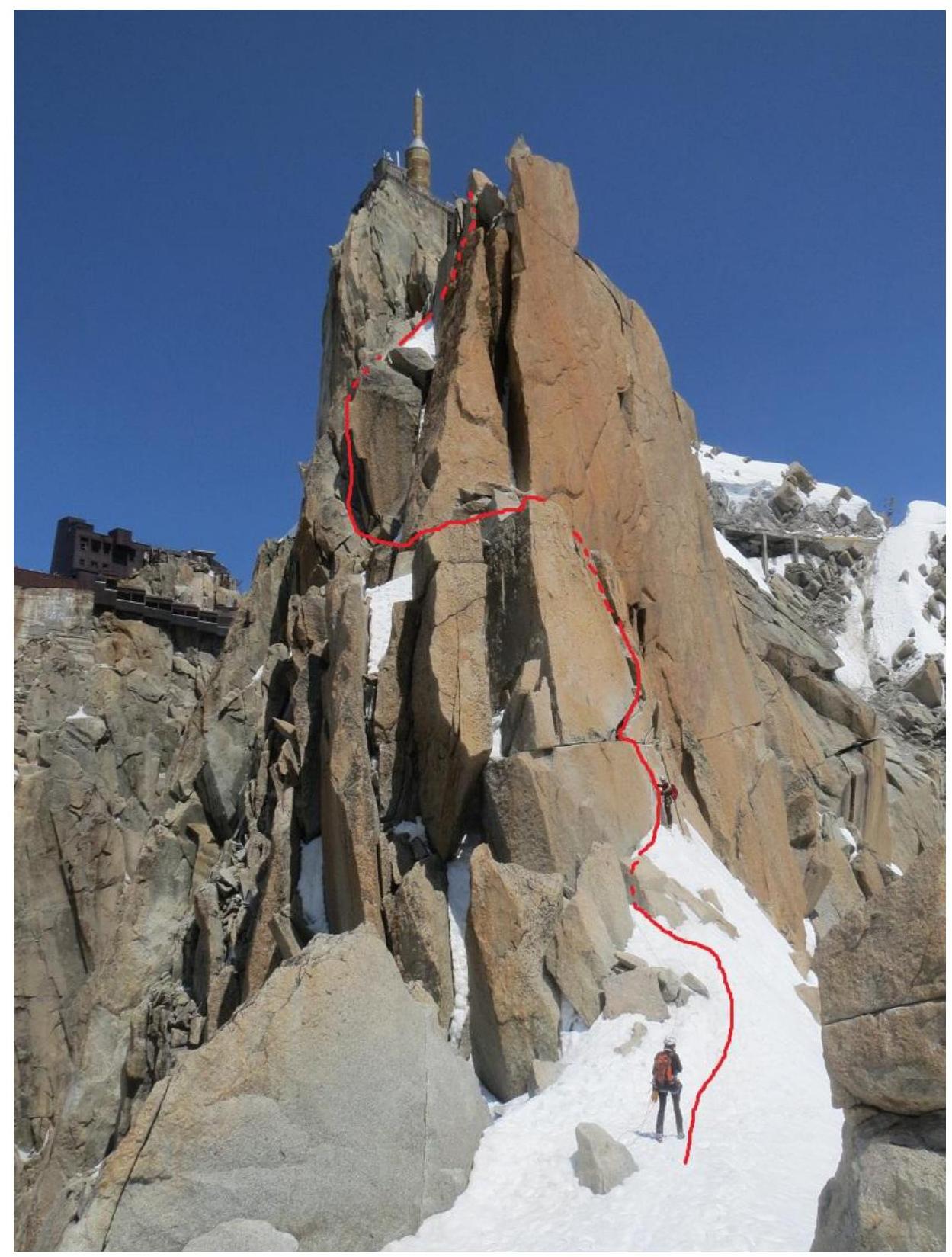
Photo 3. View of the route's "key".
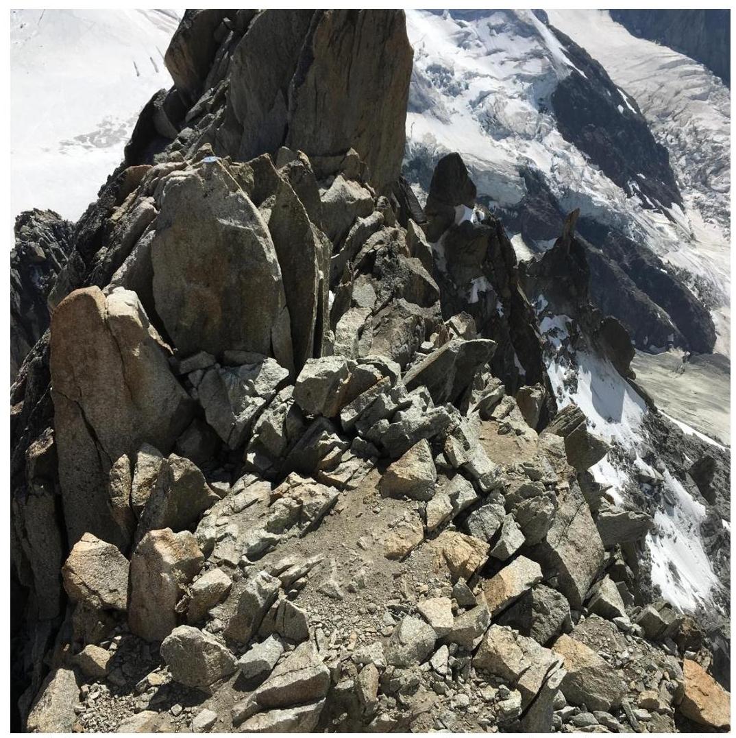
Photo 4. Summit. Taken from the Aiguille du Midi observation deck.
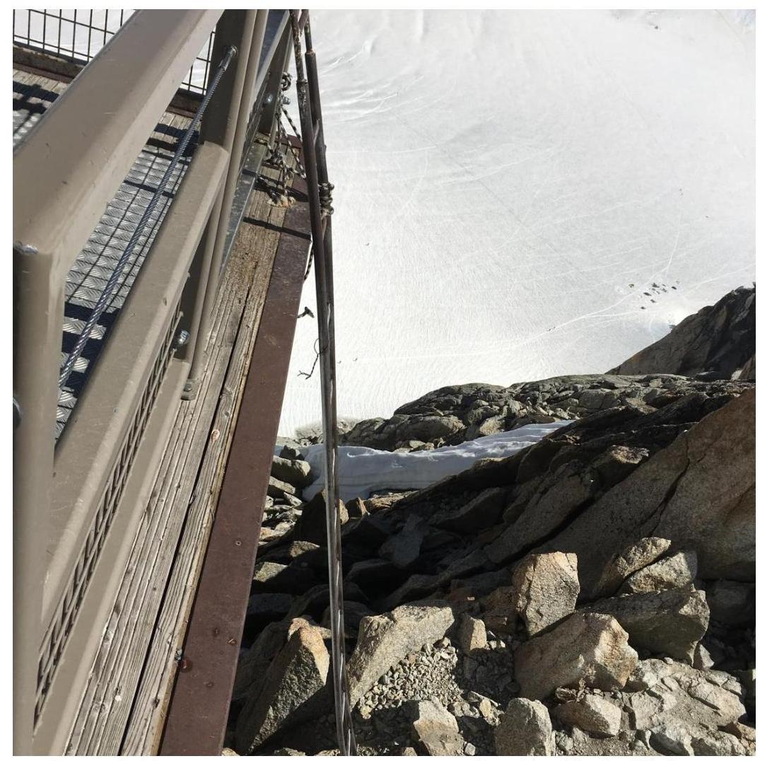
Photo 5. Ladder to the Aiguille du Midi observation deck.
Comments
Sign in to leave a comment