
ASCENT REPORT FOR AIGUILLE VERTE VIA NORTH RIDGE, CATEGORY 4B, BY "POLITECHNIK" CLIMBING TEAM ON AUGUST 2-3, 2018
I. Ascent Passport
- General Information
1.1 Team Leader: Fayzullin Ruslan Rinatovich, 2nd sports category. 1.2 Team Members: * Deripaskina Ekaterina Alexandrovna, 2nd sports category; * Mainbaeva Anastasia Sergeevna, 2nd sports category; * Plaksin Alexander Sergeevich, 2nd sports category. 1.3 Coach: Molodozhen V.A., Master of Sports. 1.4 Organization: "Polytechnic" Climbing Club.
- Characteristics of the Ascent Object
2.1 Region: Alps, France. 2.2 Chamonix Valley. 2.3 Section Number: 10.3. 2.4 Summit: Aiguille Verte, 4121 m. 2.5 Geographical Coordinates (Latitude/Longitude), GPS Coordinates: 45°56′04.5″ N 6°58′12.5″ E; 45.934593, 6.970125.
- Route Characteristics
3.1 Route: via North Ridge. 3.2 Proposed Category: 4B. 3.3 — 3.4 Terrain Type: Mixed. 3.5 Elevation Gain: 900 m. 3.6 Route Length: 1500 m. 3.7 Technical Elements: * 2nd category rock — 530 m; * 2nd category ice/snow — 520 m; * 3rd category rock — 125 m; * 4th category rock — 125 m; * 5th category rock — 80 m. * Glacier travel (approach/descent) — 1800 m. * Rappels on the route: * 1. 2 x 30 m * 2. 2 x 30 m 3.8 Descent from the summit: via South Ridge (Moin Ridge) on the route down the South Face (3B category) to the Talèfre Glacier from the Couvercle Hut. 3.9 Additional Characteristics: Water availability — snow at the campsite.
- Team Actions
4.1 Travel Time: * Day 1: Route — 19 hours. * Day 2: Route — 1 hour 40 minutes, descent — 11 hours. 4.2 Camps: Snow saddle, ledges. 4.3 Start of Ascent: 6:00 AM, August 2, 2018. 4.4 Summit Arrival: 8:00 AM, August 3, 2018. 4.5 Return to Base Camp: 8:00 PM, August 3, 2018.
- Report Author
5.1 Fayzullin R.R.: fruslan@mail.ru
II. Ascent Description
- Ascent Object Characteristics
1.1
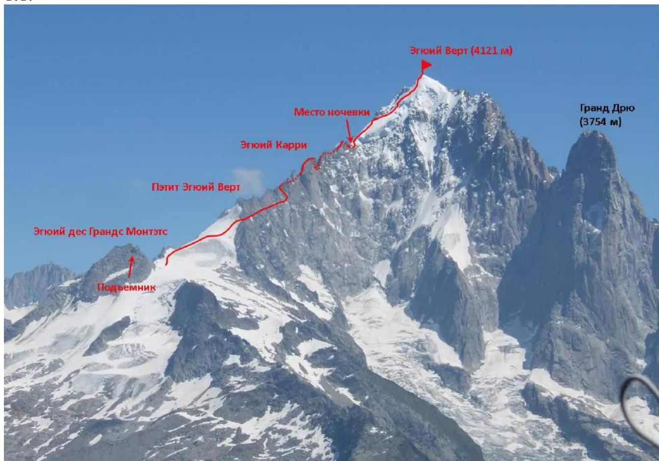
Figure 1 — North Ridge of Aiguille Verte (July 29, 2018). Red line — route via North Ridge to Aiguille Verte.
1.2 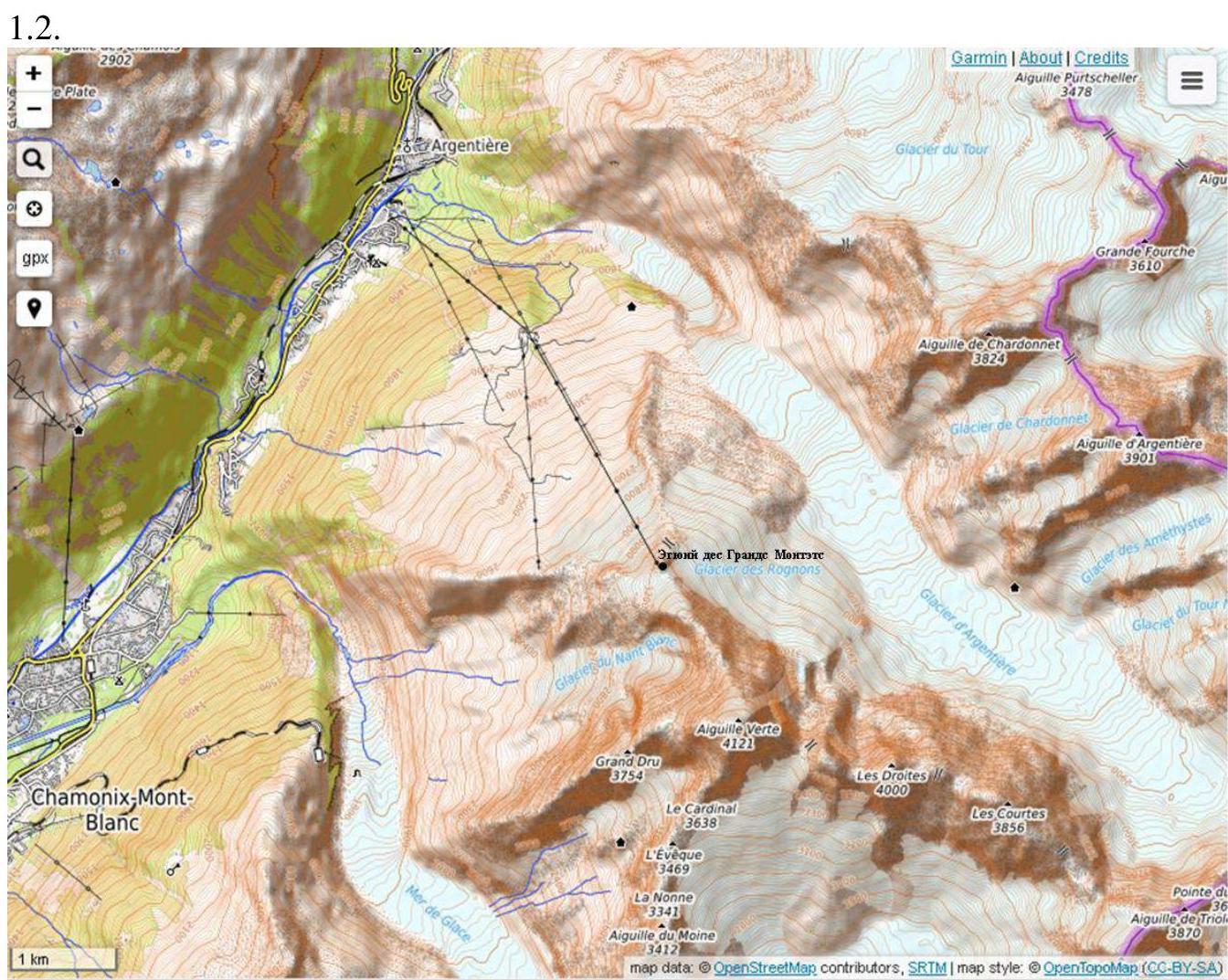
Figure 2 — Overview map of the Aiguille Verte area. Chamonix Valley is located in the French Alps, eastern France, on the border with Switzerland and Italy. Several major glaciers descend into the valley: du Tour, d'Argentière, Mer de Glace, etc. Aiguille Verte is situated between two glaciers: d'Argentière and Mer de Glace (on the map: Glacier d'Argentiere, Mer de Glace).
The approach to the start of the route is made via cable car from the town of Argentière to the summit of Aiguille des Grands Montets. The cable car ride takes 20 minutes, including a change at the intermediate station.
From the upper cable car station, descend to the glacier. Camping options include:
- The boundary between the glacier and rocks;
- The lower part of the glacier, 100 m from the lift station;
- Other convenient locations on the glacier.
There are no designated campsites. No water sources are available; snow (ice) is present.
- Route Characteristics
2.1 Technical photograph of the route — Figure 3. 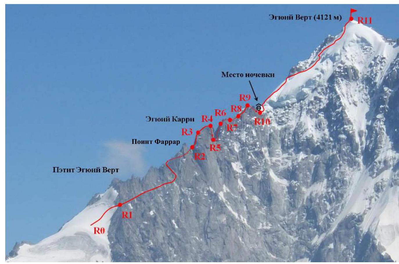
Figure 3 — Route via North Ridge of Aiguille Verte.
2.2 Technical route diagram
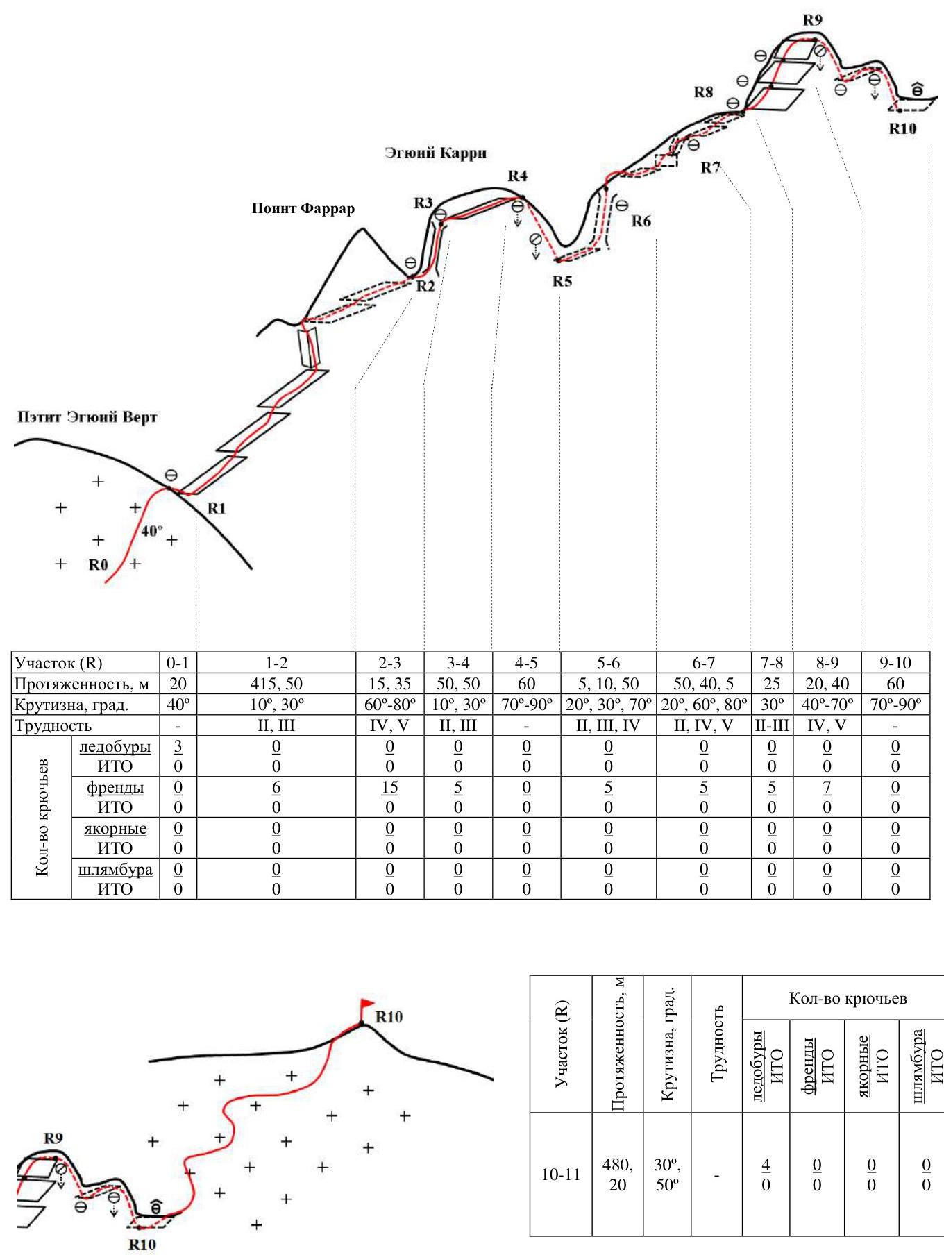
| Section (R) | 0–1 | 1–2 | 2–3 | 3–4 | 4–5 | 5–6 | 6–7 | 7–8 | 8–9 | 9–10 | 10–11 |
|---|---|---|---|---|---|---|---|---|---|---|---|
| Length, m | 20 m | 415–50 m | 15–35 m | 50–50 m | 60 m | 5–10–50 m | 50–40–5 m | 25 m | 20–40 m | 60 m | 480 m, 30°, 20 m, 50° |
| Slope, deg. | 40° | 10°, 30° | 60°–80° | 10°, 30° | 70°–90° | 20°, 30°, 70° | 20°, 60°, 80° | 30° | 40°–70° | 70°–90° | |
| Difficulty | 2–3 | 4–5 | 2–3 | 2–3–4 | 2–4–5 | 2–3 | 4–5 | ||||
| Pitons | |||||||||||
| Ice screws | 3 | 0 | 0 | 0 | 0 | 0 | 0 | 0 | 0 | 0 | 4 |
| Other | 0 | 0 | 0 | 0 | 0 | 0 | 0 | 0 | 0 | 0 | 0 |
| Friends | 0 | 6 | 15 | 5 | 0 | 5 | 5 | 7 | 0 | 0 | 0 |
| Other | 0 | 0 | 0 | 0 | 0 | 0 | 0 | 0 | 0 | 0 | 0 |
| Anchors | 0 | 0 | 0 | 0 | 0 | 0 | 0 | 0 | 0 | 0 | 0 |
| Other | 0 | 0 | 0 | 0 | 0 | 0 | 0 | 0 | 0 | 0 | 0 |
| Bolts | 0 | 0 | 0 | 0 | 0 | 0 | 0 | 0 | 0 | 0 | 0 |
| Other | 0 | 0 | 0 | 0 | 0 | 0 | 0 | 0 | 0 | 0 | 0 |
- Team Actions
3.1 From the lift on Aiguille des Grands Montets, head onto the Glacier des Grands Montets and move along the most gentle path towards the saddle in the middle part of the NW ridge of Petit Aiguille Verte. R0–R1. Ascend the right part of the snow-ice slope to the level of the saddle in the middle part of the NW ridge of Petit Aiguille Verte (Figure 4). A small ice-snow section (20 m) with an angle of 40° is prominent. Before reaching the ridge, move right and exit onto the rocky ridge (saddle on the NW ridge of Petit Aiguille Verte). 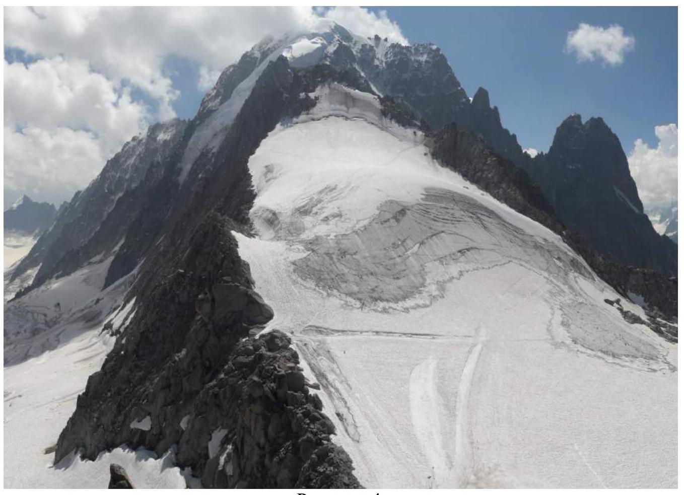
Figure 4 R0–R1. View of Glacier des Grands Montets from the upper cable car station. In the foreground is Petit Aiguille Verte.
R1–R2. From the ridge, descend slightly (30 m) and then move along a system of ledges. The ledges are directed slightly upwards but may require descending in places. Move along the ledges via the easiest terrain. The section includes some deteriorated rocks; be cautious. It is recommended to start the route in a small group. Before reaching Pointe Farrar:
- Ascend to the saddle on the ridge via a wide internal angle (50 m, 3rd category).
- Continue along the ledges on the north side of the ridge (left side of the ridge) to the saddle between Aiguille Carrée and Pointe Farrar.
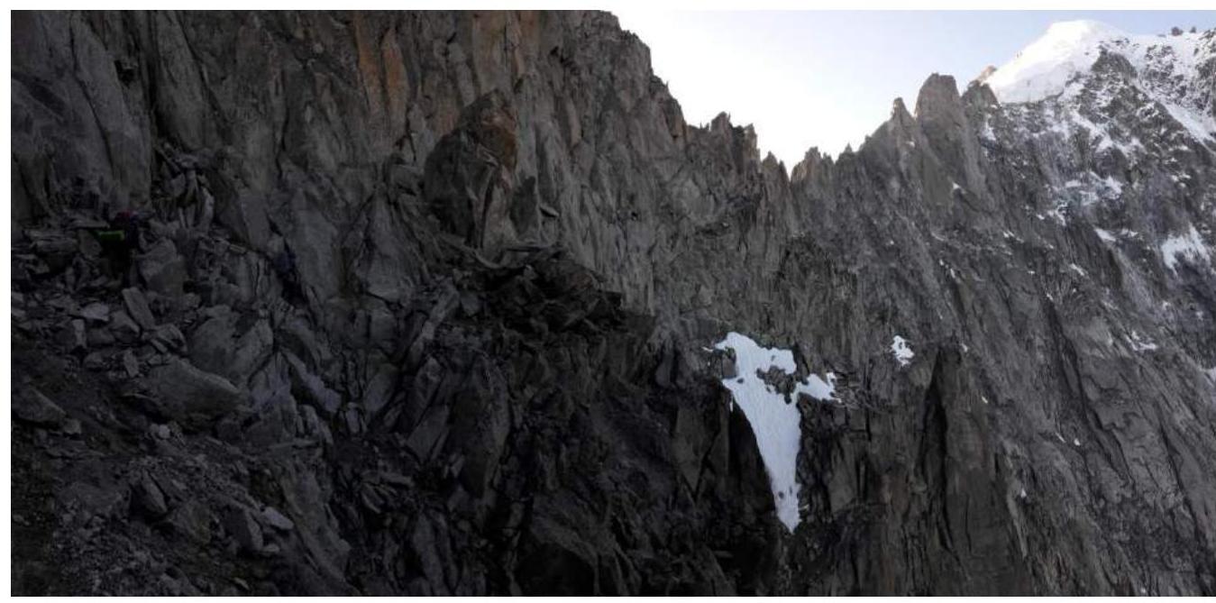
Figure 5 R1–R2. View from the NW ridge of Petit Aiguille Verte onto the system of ledges. 
Figure 6 R1–R2. Middle part of the system of ledges. 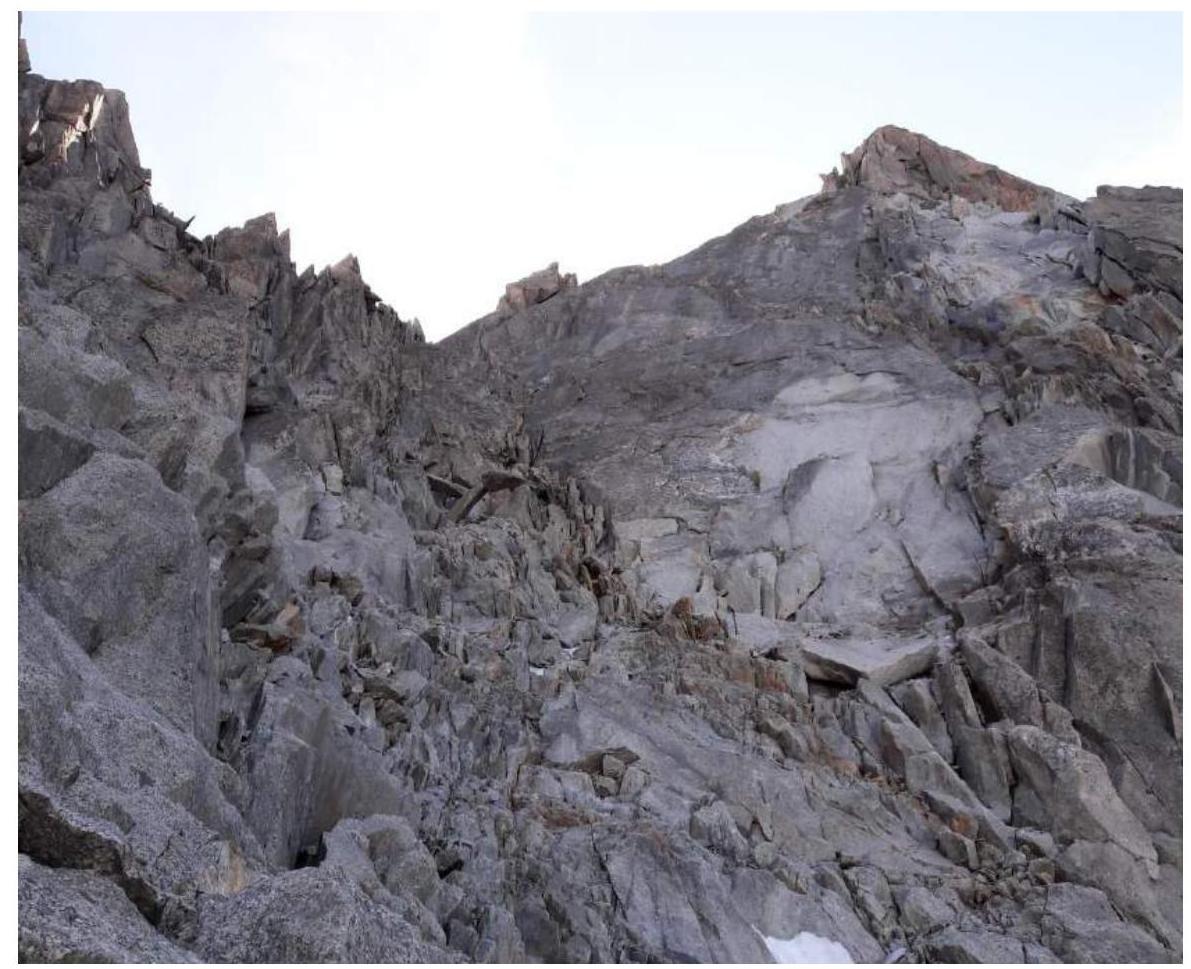
Figure 7 R1–R2. Internal angle onto the saddle before Pointe Farrar. 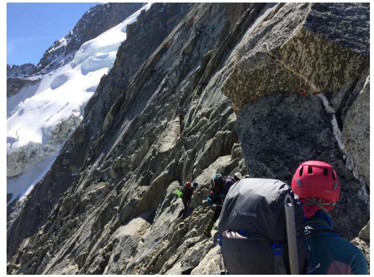
Figure 8 R1–R2. Ledges left of the ridge. R2–R3. From the saddle, ascend to Aiguille Carrée (Figure 9). The section is 50 m via a deep, wide chimney (5th category) with good strength climbing. There are various points for protection on this section.
- Deep, wide chimney
- Category: 5
- Length: 50 m
- Climbing character: strength climbing
- Protection: sufficient
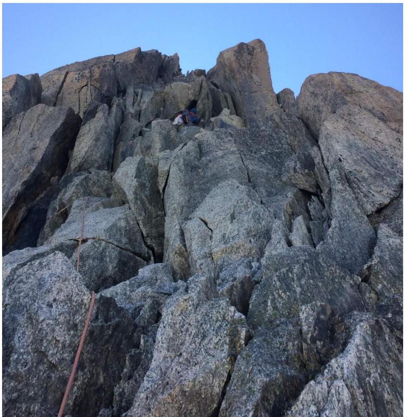
Figure 9 R2–R3. View of the chimney from the saddle before Aiguille Carrée. The route's key section.
R3–R4. Move along the ridge to Aiguille Carrée. The section involves easy climbing (2–3 category).
R4–R5. From the summit, descend slightly to the right to rappel anchors. Two 30 m rappels lead to a saddle.
R5–R6. From the saddle, traverse right along easy ledges (15 m). Bypass a protrusion and ascend a chimney. The chimney is climbed on the right rock part; the inner part is ice-snow. A thawed chimney is very rockfall-prone; alternate movement is recommended. Depending on the month, ice tools may be necessary.
R6–R7. Move along the ridge on easy rocks (2nd category, 50 m). Then, left of the ridge, follow small ledges and walls (4th category, 40 m) leading to the ridge. Before the ridge, 5 m of climbing on an internal angle (5th category).
R7–R8. Move left of the ridge on easy ledges but sometimes awkwardly (Figure 10). Reach a ledge on the ridge at the base of a large slab on the right side. 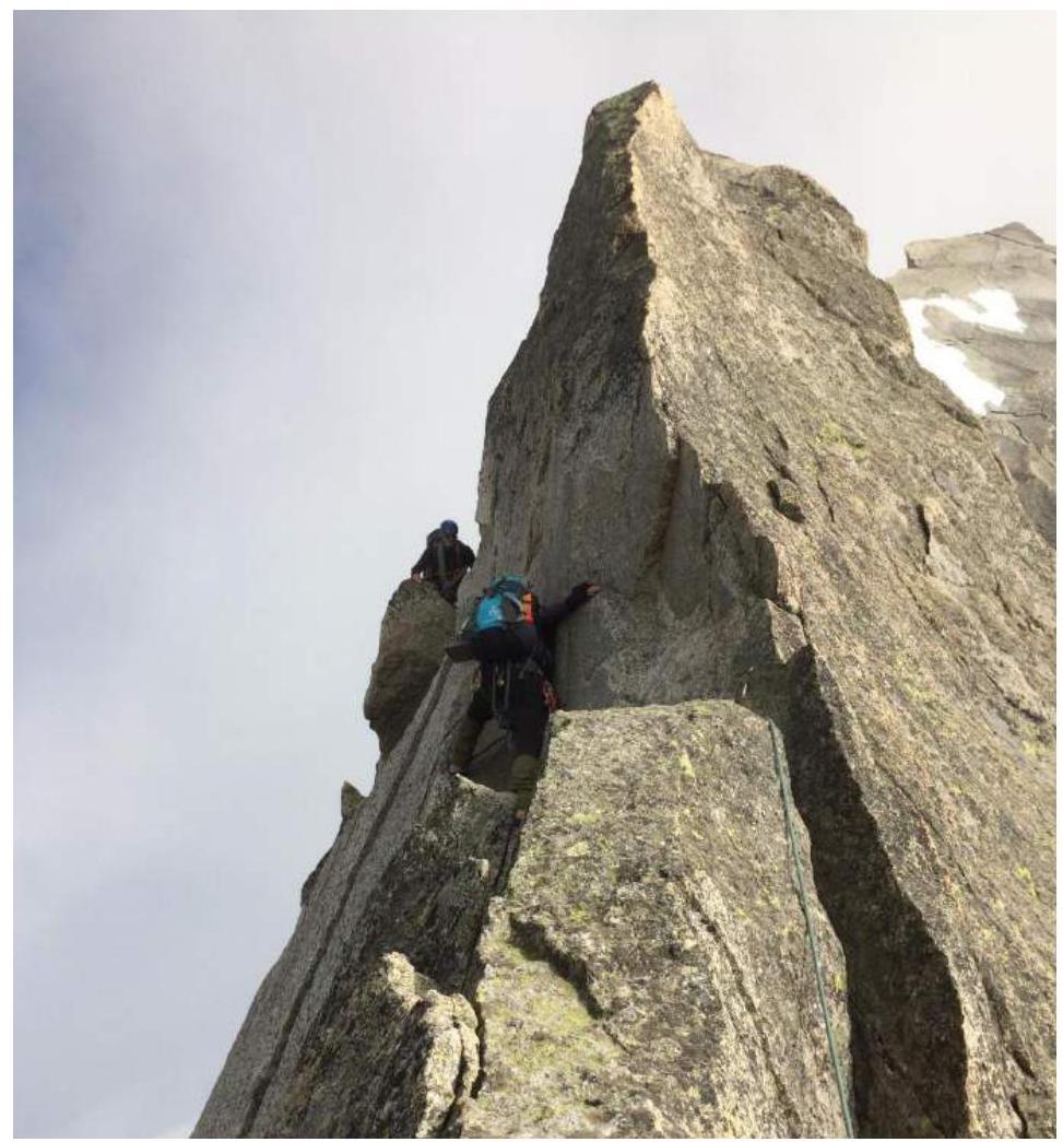
Figure 10 R7–R8. Traverse along ledges left of the ridge. R8–R9. Second key section of the route (Figure 11).
Climb up a crack to the ridge (10 m, 5th category). Old friends are present deep in the crack.
Then, along the ridge and right to the next station (4th category).
From the station, ascend, choosing dry sections on a slab (5th category) (Figure 12). There are difficulties in organizing protection. The next station is on the ridge.
Alternative option:
- Left onto the ridge, then along the ridge without protection points (15 m).
- From the station, right along a horizontal crack, then up a vertical crack (5th category) to an acute ridge.
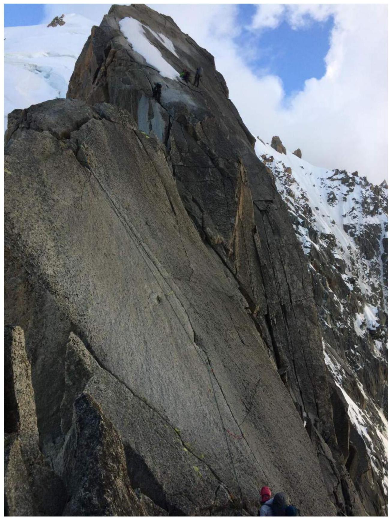
Figure 11 R8–R9. Large slab right of the ridge. Key section.

Figure 11 R8–R9. Second section on the large slab right of the ridge. R9–R10. Rappel from the ridge onto a ledge. Traverse the ledge to the 2nd rappel. Descend onto ledges before a snow slope. Camping is possible here (Figure 12). Alternatively, level a snow ridge slightly above for camping (15 m).

Figure 12. Campsite. R10–R11. Ascend to Aiguille Verte via a snow-ice slope, choosing the easiest route through crevasses (Figure 13).
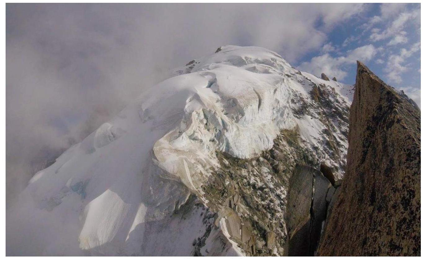
Figure 13. R10–R11. Snow-ice summit dome.
3.2 Team photo on the summit.
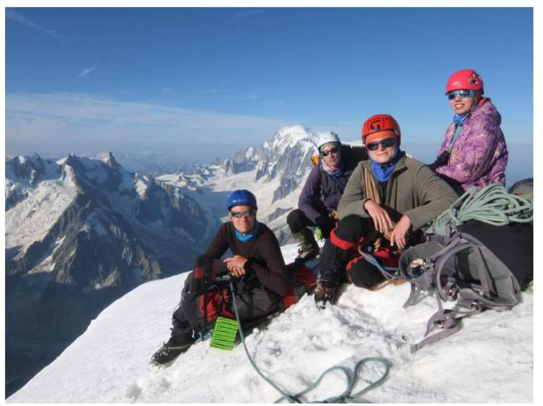
Figure 14 — Summit. 3.3 Descent from the summit via the South Ridge (Moin Ridge) on the route down the South Face (3B category) to the Talèfre Glacier from the Couvercle Hut.
Recommendations:
- Ascent is recommended in a small group due to deteriorated rocks on section R1–R2.
- Ice tools may be necessary for the chimney on section R5–R6, depending on the month.
- A thawed ice chimney becomes very rockfall-prone.
- Rock shoes are recommended for section R8–R9.
- Ascent is recommended in good, stable weather.
- Challenges may arise in finding a suitable tent site.
Comments
Sign in to leave a comment