Report
On the ascent of Chapelle de la Glière peak, category 3B, by the "Polytechnic" mountaineering club team on July 29, 2018.
I. Ascent Report
| № | 1. General Information | |
|---|---|---|
| 1.1 | Full name, sports rank of the leader | Mikhail Vladimirovich Lobanov, 2nd sports rank |
| 1.2 | Full name, sports rank of participants | Alexey Alexeyevich Belyaev, 2nd sports rank, Yulia Alexandrovna Belyaeva, 2nd sports rank |
| 1.3 | Full name of the coach | Vladimir Alexandrovich Molodozhen |
| 1.4 | Organization | "Polytechnic" mountaineering club |
| 2. Characteristics of the ascent object | ||
| 2.1 | Region | Chamonix |
| 2.2 | Valley | Aiguilles Rouges |
| 2.3 | Section number according to the 2013 classification table | 10.3 |
| 2.4 | Name and height of the peak | Chapelle de la Glière, 2663 |
| 2.5 | Geographical coordinates of the peak | 45°57′58.00″ N, 6°51′58.00″ E |
| 3. Route characteristics | ||
| 3.1 | Route name | Via the southern ridge |
| 3.2 | Proposed category of difficulty | 3B |
| 3.3 | Degree of route development | |
| 3.4 | Relief characteristics of the route | Rock |
| 3.5 | Height difference of the route | 300 m |
| 3.6 | Route length | 450 m |
| 3.7 | Technical elements of the route | 2nd cat. diff. rocks 70 m, 3rd cat. diff. rocks 120 m, 4th cat. diff. rocks 200 m, 5th cat. diff. rocks 50 m |
| 3.8 | Descent from the peak | Via the 1B cat. diff. route to the Index cable car station |
| 3.9 | Additional route characteristics | |
| 4. Characteristics of the team's actions | ||
| 4.1 | Time of movement (team's walking hours, indicated in hours and days) | 7 hours |
| 4.2 | Overnights | |
| 4.3 | Start of the route | 10:00 July 29, 2018 |
| 4.4 | Reaching the peak | 15:00 July 29, 2018 |
| 4.5 | Return to the base camp | 19:00 July 29, 2018 |
| 5. Person responsible for the report | ||
| 5.1 | Full name, e-mail | Mikhail Vladimirovich Lobanov, theprevedko@gmail.com |
II. Ascent Description
1. Characteristics of the Ascent Object
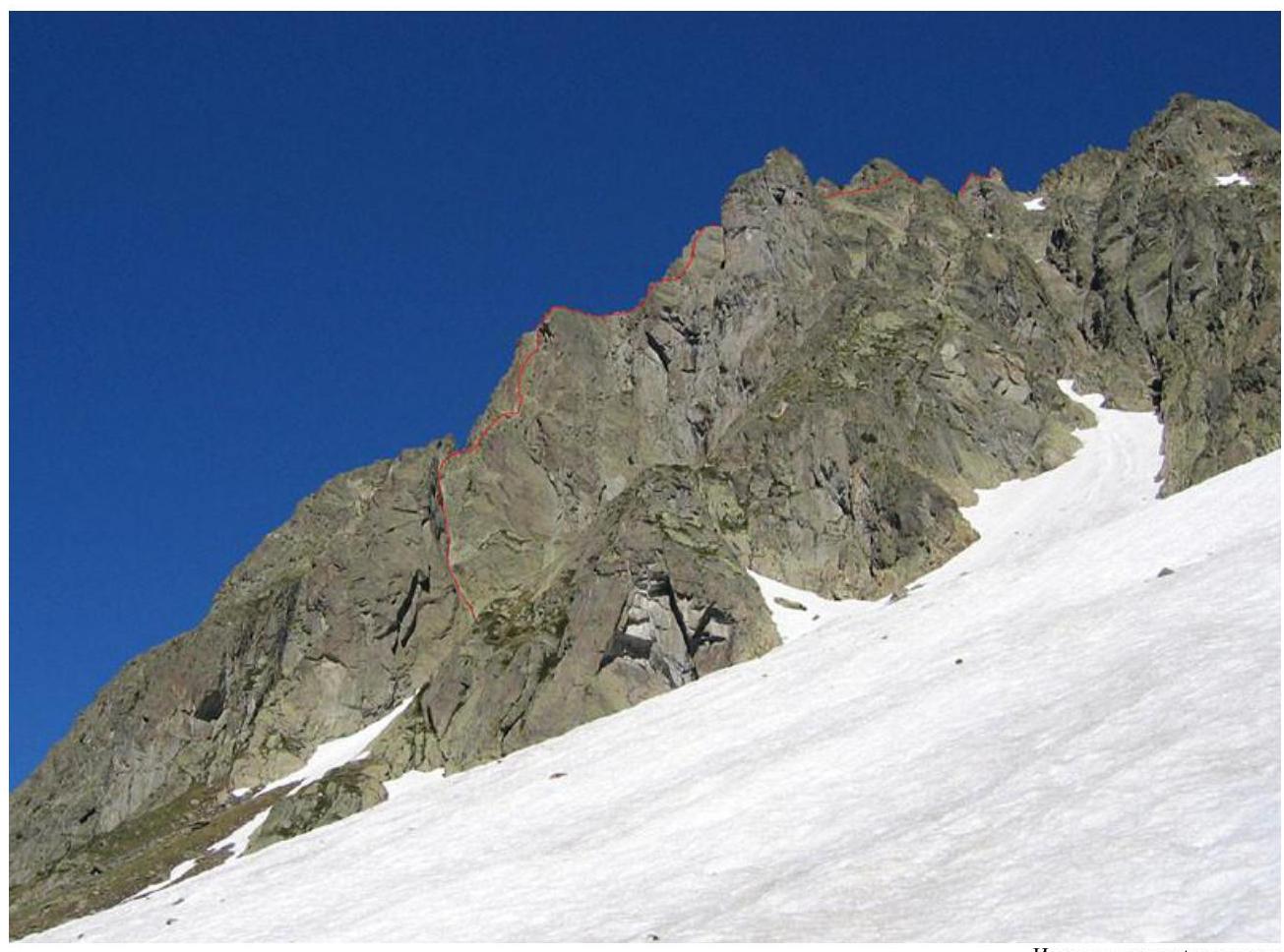
General photo of the peak:
Source: camptocamp.org
Route Profile:
Source: camptocamp.org
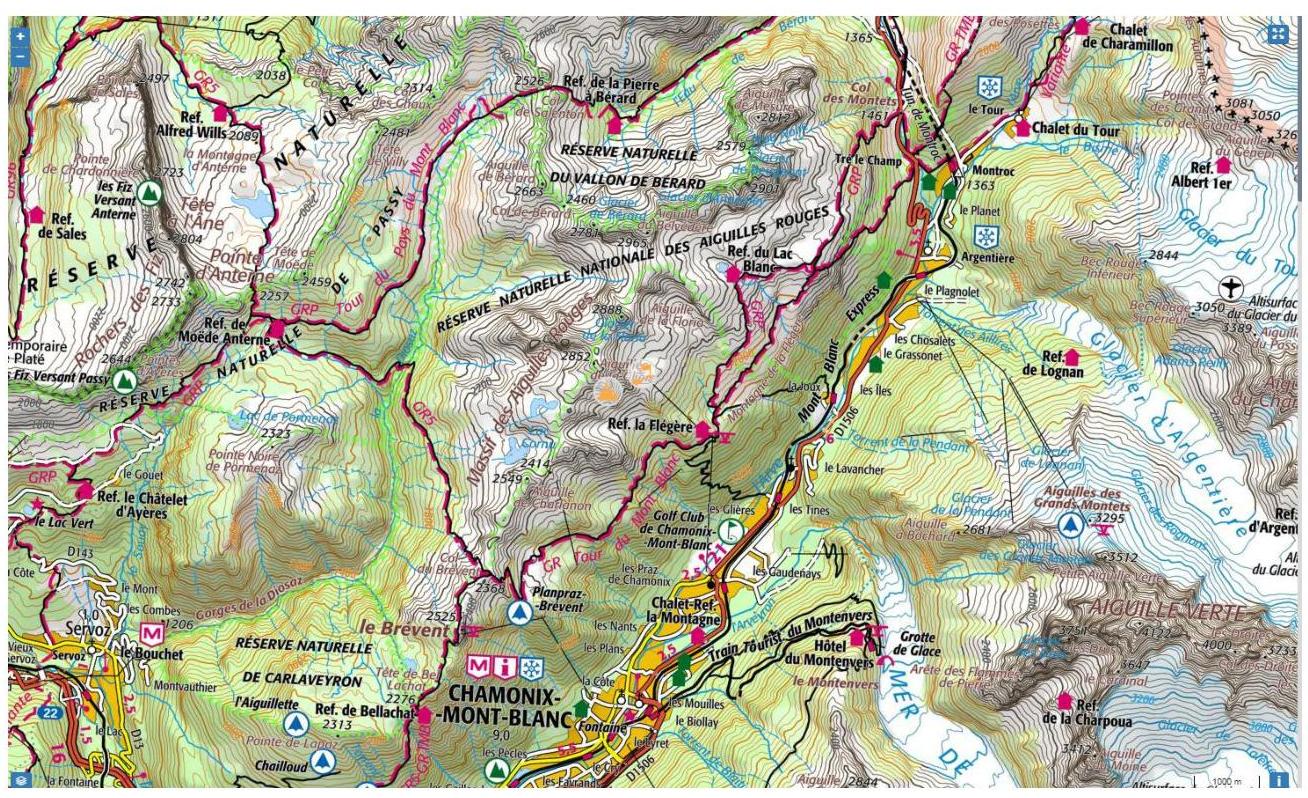
Map of the Ascent Area:
2. Route Characteristics
2.1. Technical photo of the route: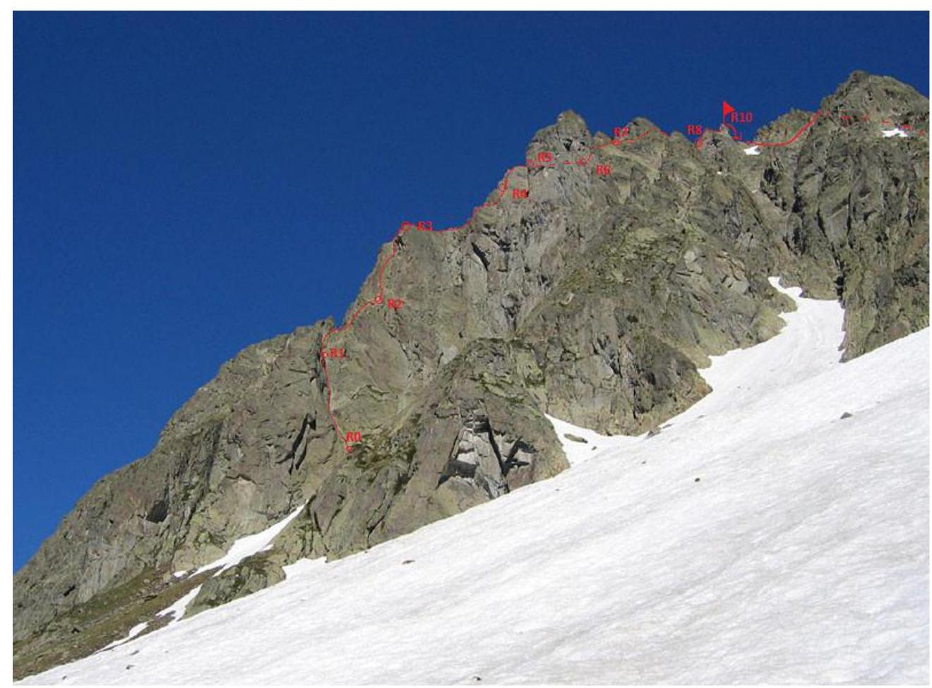
2.3. Technical characteristics of the route sections.
| Section № | Relief Characteristics | Category of Difficulty | Length, m | Type and Number of Pitons |
|---|---|---|---|---|
| R0–R1 | Inner corner | 4 | 50 | Nuts, friends, 10 |
| R1–R2 | Ridge | 3 | 50 | 0 |
| R2–R3 | Inner corner | 5 | 50 | Nuts, friends, 10 |
| R3–R4 | Ridge 50 m, wall 10 m | 3, 5 | 60 | Nuts, friends, 3 |
| R4–R5 | Sharp ridge | 4 | 25 | Nuts, friends, 4 |
| R5–R6 | Broken rocks | 3 | 50 | Nuts, friends, 3 |
| R6–R7 | Inner corner, broken rocks | 4, 3 | 50 | Nuts, friends, 5 |
| R7–R8 | Broken rocks | 2 | 70 | 0 |
| R8–R9 | Wall | 5 | 25 | Nuts, friends, 3 |
3. Characteristics of the Team's Actions
| Section № | Description | Photo Number |
|---|---|---|
| Approach | From the Index cable car station, head west along the rocks, cross a wide couloir (possibly snowy at the beginning of summer), then bypass a rocky spur and ascend a steep narrow couloir to a large boulder at the base of the inner corner. | see general photo |
| R0–R1 | The route begins at the inner corner. A piton is driven at the start of the corner, and there's a bolt to the right. Ascend the inner corner for 50 m, with a belay station on one of the rocky ledges. There's a belay station on bolts below. | 1 |
| R1–R2 | Via the inner corner, exit onto the ridge, move along the ridge to a steep inner corner. Belay station at the base of the corner, with a piton driven in. | |
| R2–R3 | Ascend the steep inner corner (nuts, friends, old pitons) to exit onto the ridge. Belay station on a rocky ledge. | |
| R3–R4 | Move along the easy ridge to a steep smooth wall cut by a vertical crack. Ascend the wall, then continue along the ridge to the start of the "razor's edge." | 2 |
| R4–R5 | The "razor's edge" is a sharp ridge with limited belay options. There's an old loop. Exit onto a large ledge via the ridge. Belay station on the ledge on a large rocky outcropping. | 3 |
| R5–R7 | Via easy rocks, approach the base of a steep inner corner. Ascend the corner, then move up and right to bypass a large jendarme tower. | 4 |
| R7–R8 | After bypassing the jendarme via a col, approach the base of the "chapel." Belay station at the base on personal anchors. | 4 |
| R8–R9 | Ascend the "chapel" via the wall from the south; there are bolts in the upper part. Rappel down from the belay station on bolts; there's a chain at the station. | 4, 5 |
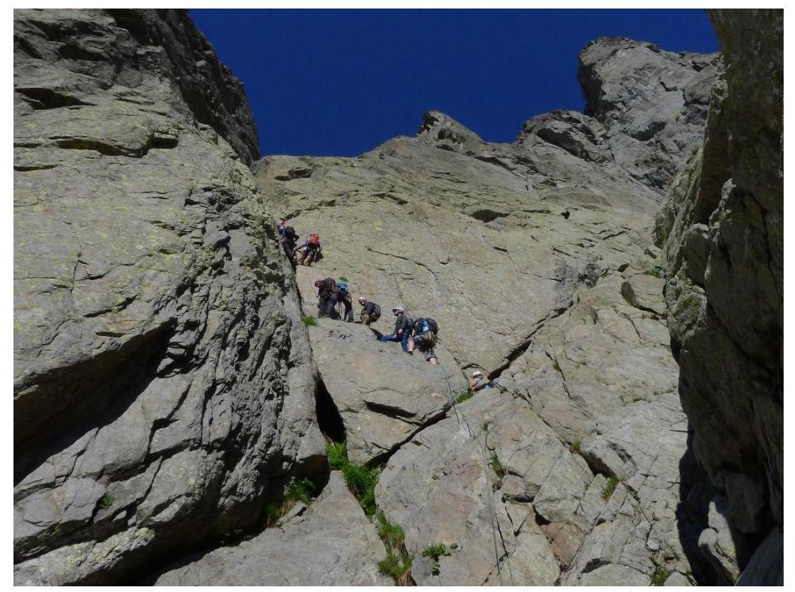
Photo 1. Start of the route, inner corner, 4th cat. diff.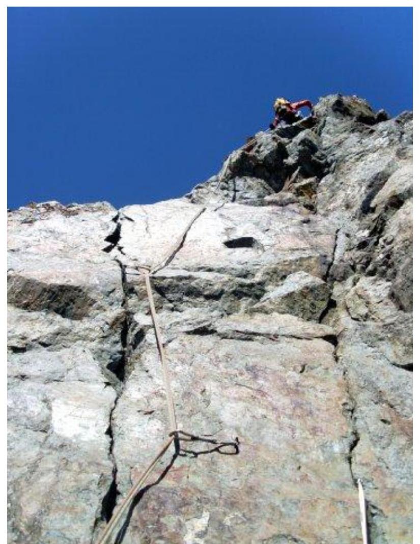
Photo 2. 10 m wall.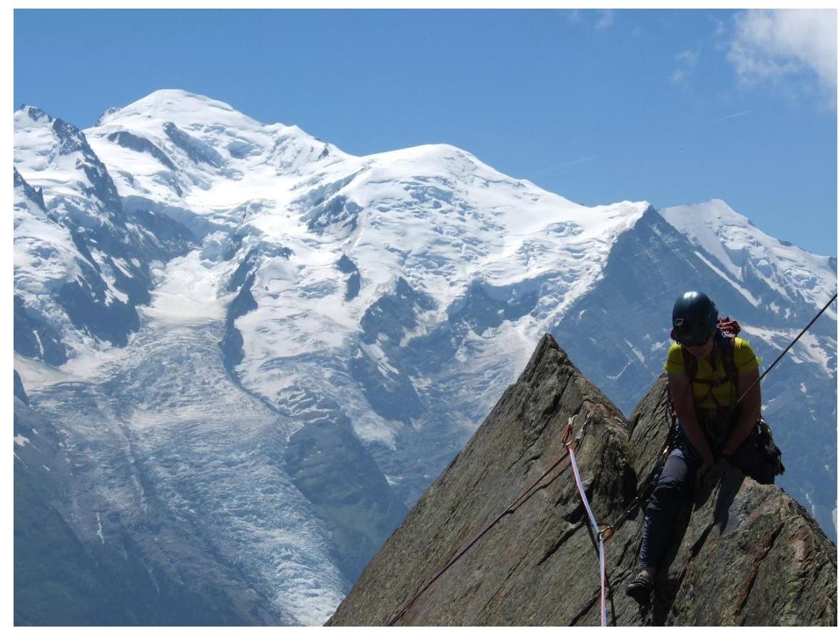
Photo 3. Sharp ridge, known as "Razoir Pitch".
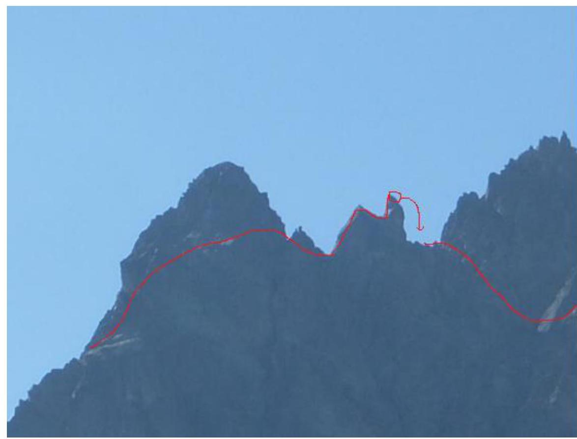
Photo 4. Bypass of the large jendarme and ascent to the "chapel," descent.
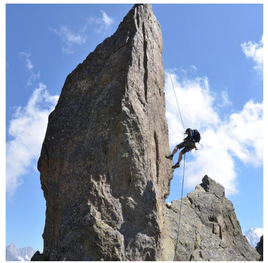
Photo 5. Rappelling down from the peak. The route is very popular; it's better to start before the cable car begins operation. The terrain is monolithic, with good protection almost everywhere. The "razor's edge" is considered one of the most beautiful sections in the area. Recommended for small, 2-3 person, sports groups.
Descent via a trail marked with cairns to the northeast, to the Index cable car station. The trail passes through:
- scree couloir 1
- scree couloir 2
- scree couloir 3
At the end of the descent, there's a section of 3rd cat. diff. rocks that can be rappelled down.
The route has a technical difficulty comparable to that of Crimean routes such as "Ear" and "Filatova Counterfort," but is located in a high-altitude zone. Due to its relatively short length, the category of difficulty is assessed as 3B.
St. Petersburg 2018