Report
On ascending via the north-west ridge to Tête Blanche (3421 m), 1B category of difficulty. Glacier du Tour area. Chamonix, France.
Climbing Report Form
| №№ | 1. General Information | |
|---|---|---|
| 1.1 | Full name, sports rank of the leader | Pivnyak Natalya Nikolaevna, 1st sports rank |
| 1.2 | Full name, sports rank of the participants | Ignatenko Ksenia Viktorovna, Pavlov Andrey Nikolaevich, Sidorenko Alexander Nikolaevich, Sozinov Kuzma |
| 1.3 | Full name of the coach | Molodozhen Vladimir |
| 1.4 | Organization | a/c Polytechnic SPb |
| 2. Characteristics of the Climbing Object | ||
| 2.1 | Region | Alps, Mont Blanc Massif, Chamonix. Upper Savoy, France. |
| 2.2 | Valley | Glacier du Tour, Col du Tour |
| 2.3 | Section number according to the 2013 classification table | Section according to KMGV 2013 – 10.3 |
| 2.4 | Name and height of the summit | Tête Blanche summit. Height 3421 m. |
| 2.5 | Geographic coordinates of the summit (latitude/longitude), GPS coordinates | 45.9837945, 7.0195842 |
| 3. Characteristics of the Route | ||
| 3.1 | Name of the route | Tête Blanche via the North-West Ridge |
| 3.2 | Proposed category of difficulty | 1B |
| 3.3 | Degree of route exploration | - |
| 3.4 | Character of the route terrain | combined (ice-snow + rock) |
| 3.5 | Height difference of the route (data from altimeter or GPS) | 120 m. Average steepness of the entire route — 30° |
| 3.6 | Route length (in meters) | 400 m |
| 3.7 | Technical elements of the route (total length of sections of various difficulty categories with indication of the terrain character (ice-snow, rock)) | Category I difficulty combination — 150 m. Category II difficulty rocks — 250 m. Movement on a closed glacier — 4000 m (approach) |
| 3.8 | Descent from the summit | In a rope team via Category I–II difficulty to Col du Tour |
| 3.9 | Additional characteristics of the route | Presence of water from melting glaciers at the foot of the mountain and near the pass |
| 4. Characteristics of the Team's Actions | ||
| :--: | :-------------------------------------------------------------------------: | :--------------------------------------------------------------------------------------------------------------------------: |
| 4.1 | Time on the route (team's travel hours, in hours and days) | 5 hours (2 hours 30 minutes – approach, 1 hour – ascent, 1 hour 30 minutes – descent) |
| 4.2 | Overnight stays | - |
| 4.3 | Departure to the route | 06:00, 28.07.2018 |
| 4.4 | Reaching the summit | 09:00, 28.07.2018 |
| 4.5 | Return to the base camp | 11:00, 28.07.2018 |
| 5. Responsible for the Report | ||
| 5.1 | Full name, e-mail | Ignatenko Ksenia Viktorovna, kseniya.ign@gmail.com |
General photo of the summit
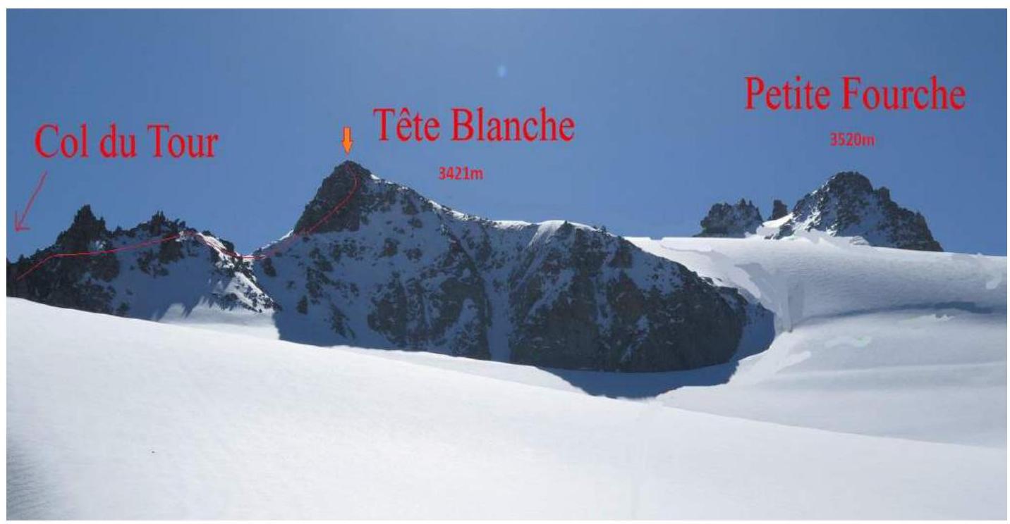
The photo was taken from the side of the Glacier du Tour (North side of the mountain). Date taken – 28.07.2018.
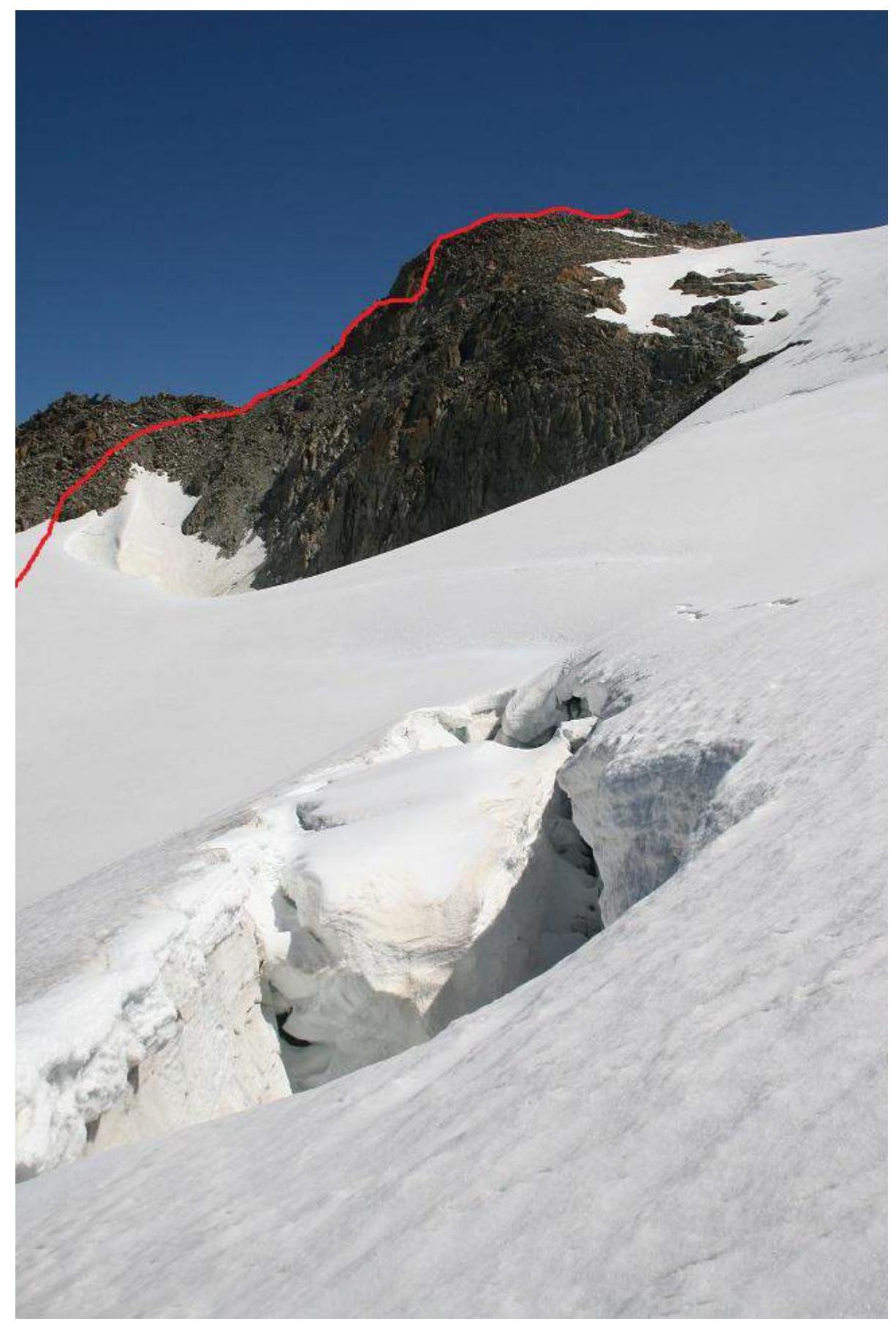
Photo of Tête Blanche summit with Normal route (route in the direction of the SE slope).
Photo of the route profile
The photo was taken from the southern slope of Aiguille de Tour.
Panorama of the area
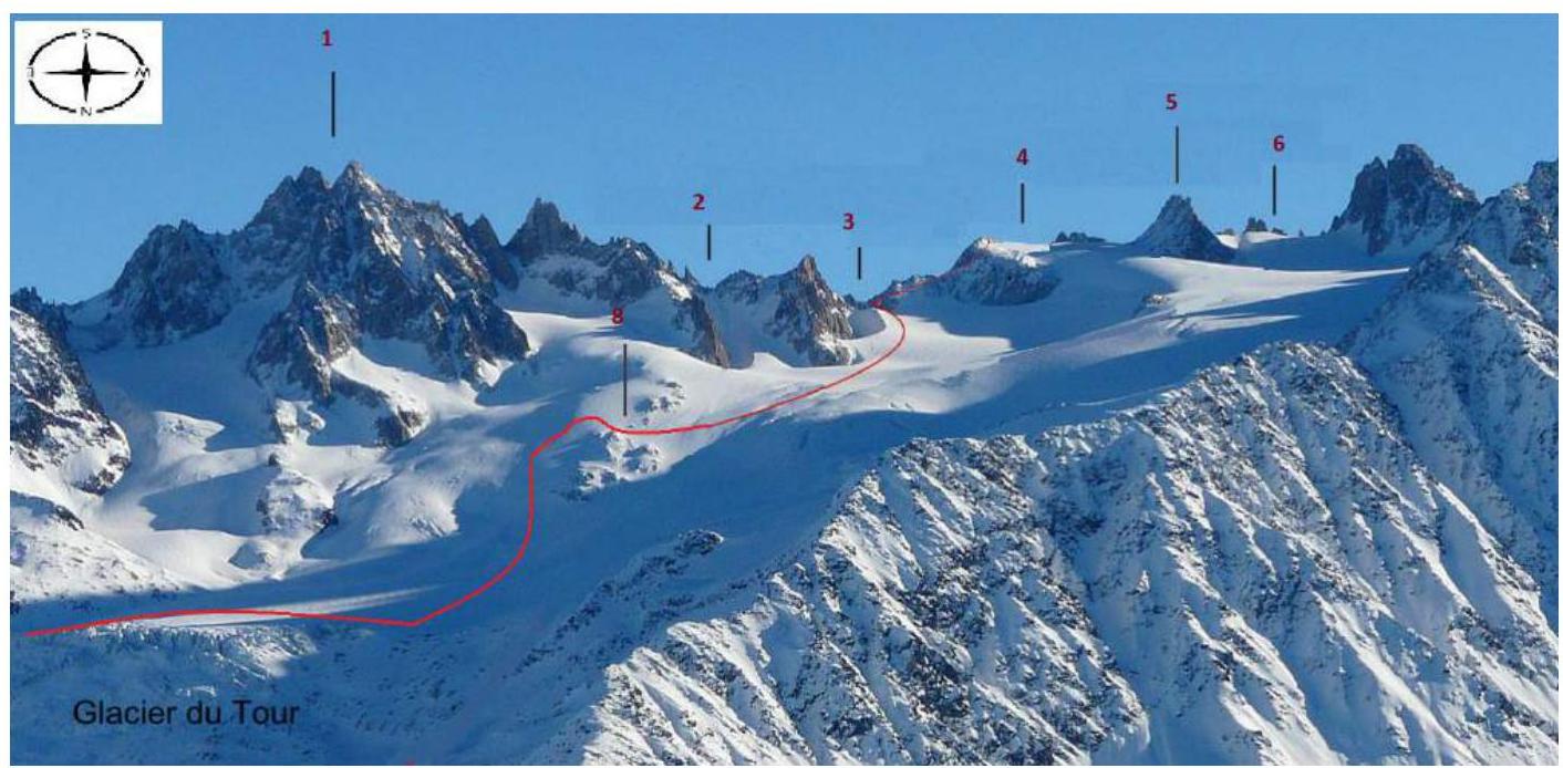
| 1 | Aiguille du Tour | 3540 m |
|---|---|---|
| 2 | Col Supérieur du Tour | - |
| 3 | Col du Tour | - |
| 4 | Tête Blanche | 3421 м |
| 5 | Petite Fourche | 3520 м |
| 6 | Col des Fourches | - |
| 8 | Signal Reilly | 2883 м |
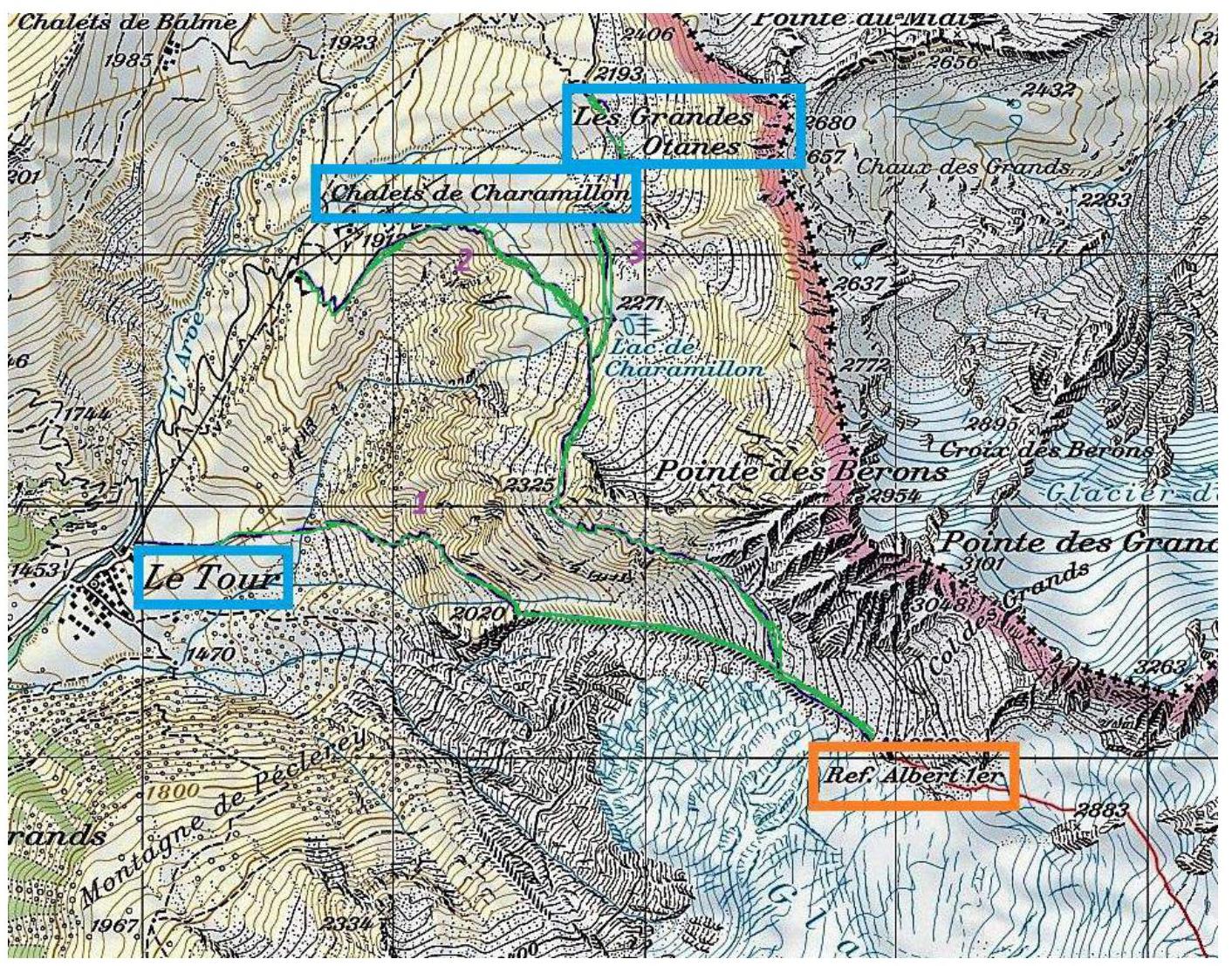
Overview of the Glacier du Tour Area (Mont Blanc Massif)
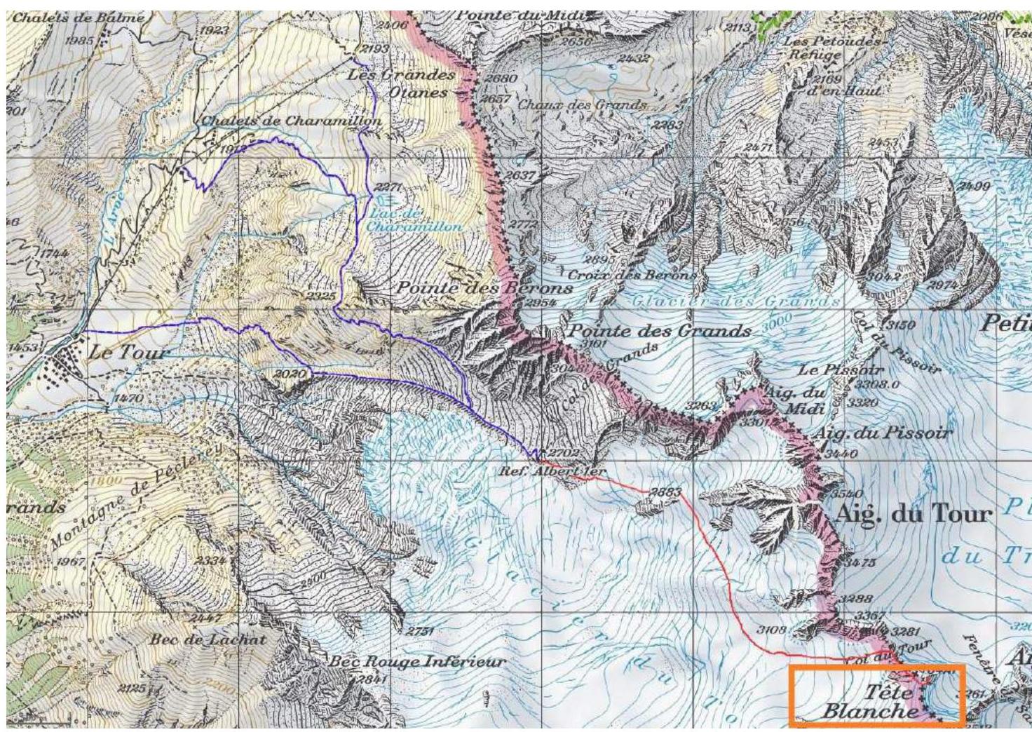
Map of the Glacier du Tour region. The Glacier du Tour region is located in the far eastern part of the Mont Blanc massif. This glacier is one of the largest in the Chamonix valley. The upper plateau of the glacier and the summits can be accessed via the path leading to the Albert Premier hut, the highest accessible mountain refuge in the valley.
The region is home to such well-known peaks as:
- Aiguille du Tour South, 3540 m;
- Aiguille Purtscheller, 3478 m;
- Aiguille du Chardonnet, 3824 m.
Tête Blanche is located on the right side of Col du Tour, the first large couloir visible on the right side, in front of the Trient glacier.
Geographic coordinates of the summit: 45.9837945°, 7.0195842°.
The team's ascent to Tête Blanche started from the overnight stay location near the Albert Premier hut.
According to the European classification, the route has a difficulty category – PD (French).
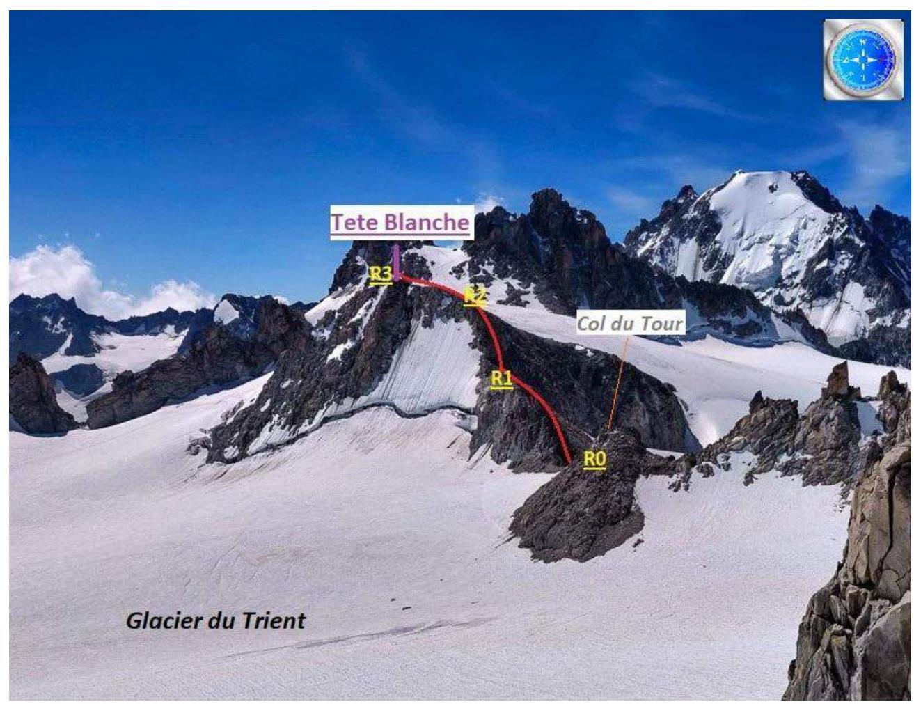
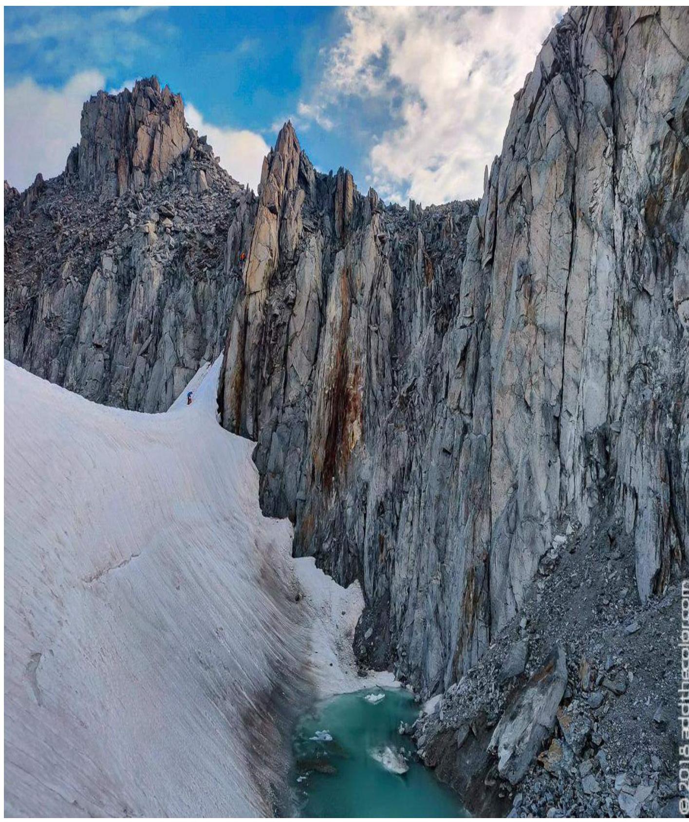
Technical Photo of the Route
| Section № | Length | Steepness | Terrain character | Difficulty category | Number of pitons |
|---|---|---|---|---|---|
| R0–R1 | 150 m | 15–40° | Rocky-scree slope, partially covered with snow, partially with flow ice. Small gendarmes. | 1 | 0 |
| R1–R2 | 150 m | 30–60°, up to 70° on short sections | Rocky-scree slope, partially with flow ice. | 2 | 0 |
| R2–R3 | 100 m | 20–30°, up to 60° on short sections near the summit | Rocky-scree slope, partially with flow ice. | 2 | 0 |
Approach to the Refuge
There are three options for the approach depending on the degree of use of the cable car:
- If not using the cable car, then from the village Le Tour, you need to head to the orographic right lateral moraine of the Glacier du Tour. The path to the moraine can be seen from the cable car station.
- If using the first stage of the cable car, then from the Charamillon station, head right up along a good trail, then traverse around the spur of Pointe des Berons, and exit onto the moraine of the Glacier du Tour in its upper part.
- Or, if starting from the upper station Les Autannes, then traverse to the trail of the second option. In the upper part of the moraine is the Albert Premier refuge (2706 m).
Brief Description of the Route Passage by Sections
Approach
From the campsite near the Albert Premier refuge, follow the trail marked with cairns onto the Glacier du Tour. Bypass the rocky island Signal Reilly (2883 m) from the south. Then move southwest along a gentle slope. Then turn southeast, entering a small cirque under the northern slope of Col du Tour.
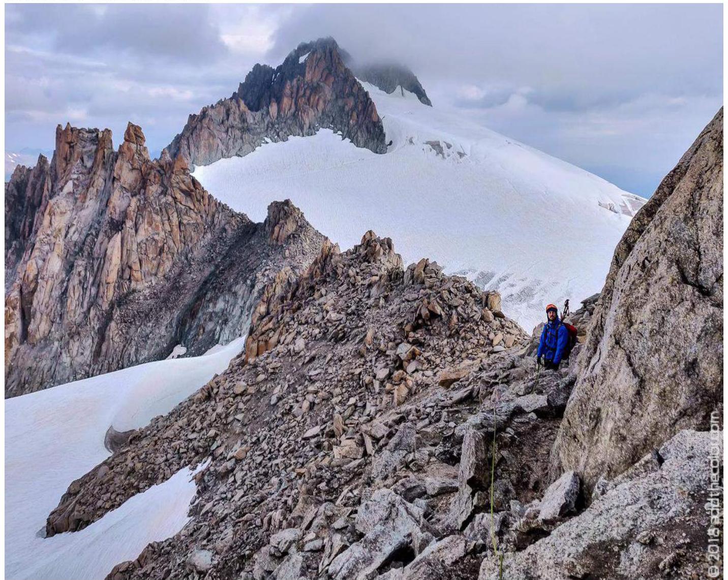
R0–R1. 2, 150 m. Go up, bypassing the rocky massif in the form of gendarmes on the right side. Then traverse along the northwest side of the ridge.
R1–R2. 3, 150 m. Descent into a small couloir followed by a climb along the ledges on the NW ridge, bypassing loose sections. Easy climbing up to a wide ledge.
It is necessary to anchor the rope team to relief features.
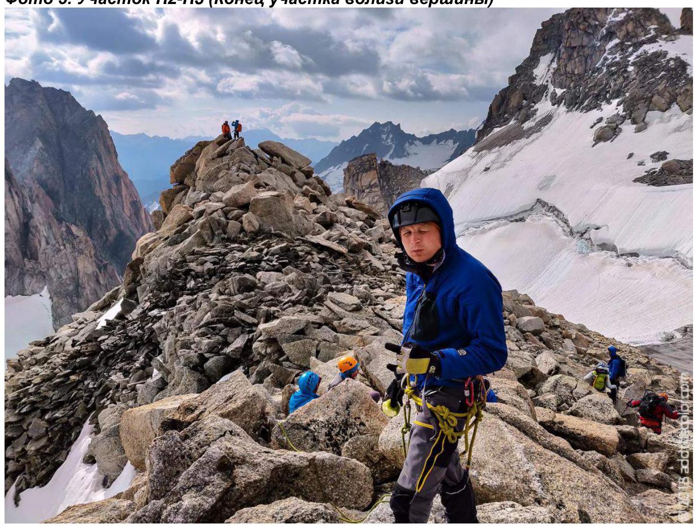
R2–R3. 3, 100 m. Follow the indistinct ledges until reaching the gentle part of the summit ridge.
The ascent trail is quite clearly marked on the route. It is recommended to follow the trail to avoid deviating onto loose rocks and "live" stones. There are no equipped stations on the route, nor are there ready-made artificial anchor points.
Descent
Via the ascent route:
- Through Col du Tour;
- in the direction of the rocky island Signal Reilly;
- exit onto the Glacier du Tour on the ascent trail;
- descend down to the campsite located on the moraine south of the Albert Premier hut.
General Recommendations for the Route
The North-West Ridge of Tête Blanche is straightforward to ascend and is rightfully considered the most popular route to the summit.
Movement in rope teams with simultaneous protection is recommended: participants move simultaneously, connected by a rope and at a safe distance from each other — on average, 15–18 m.
This will help in case of a sudden fall into a crevasse on the closed glacier by one of the team members, as well as on the rock route to the summit, where it is possible to anchor the rope separating the participants to relief features.
The route is logical and safe. It is interesting for training ascents, practicing movement in rope teams, and overall mountaineering efficiency.
The summit can be used as an intermediate point on the way to the summit of Petit Fourche (3520 m), as well as a standalone endpoint.
Photo Illustrations of the Report:
- Photo 1. Approach to the route (Signal Reilly)

- Photo 2. Approach to the route (Col du Tour)
- Photo 3. Section R0–R1
- Photo 5. Section R2–R3 (End of the section near the summit)
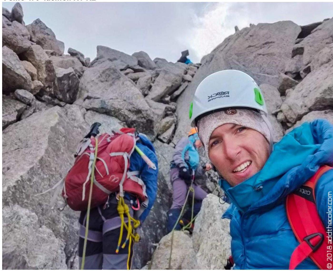
- Photo 4. Section R1–R2
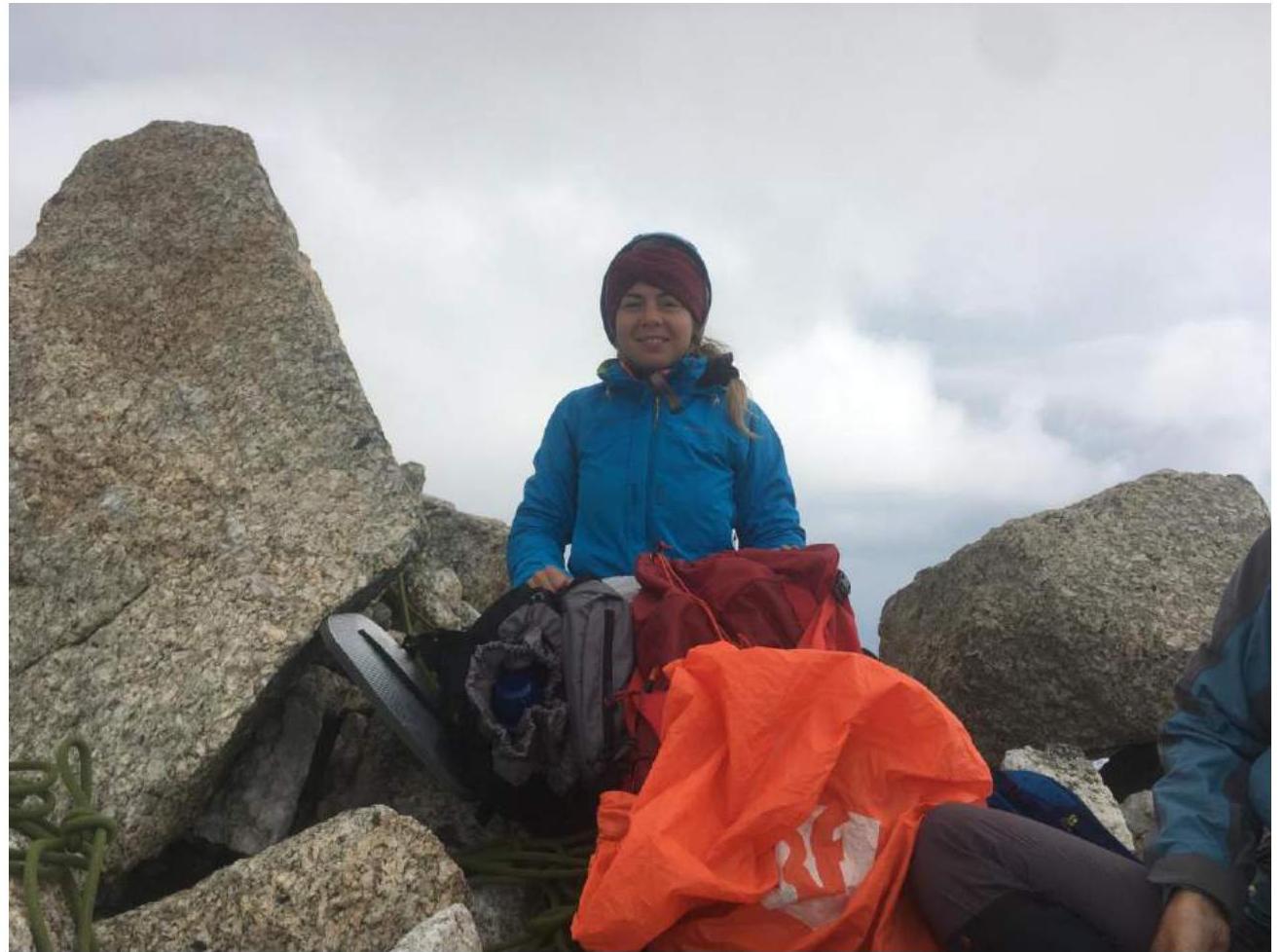
- Photo 6. Summit
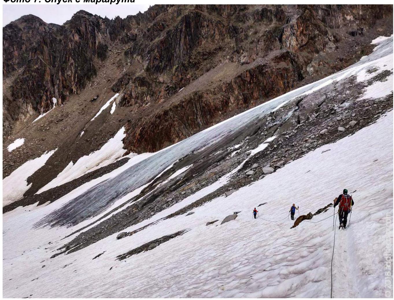
- Photo 7. Descent from the route
St. Petersburg 2018