
ASCENT REPORT ON PETIT CAPUCIN (ROI DE SIAM) VIA SOUTH FACE (LIFTING DU ROI), CATEGORY 4A. BY AK POLITECHNIK TEAM (SAINT-PETERSBURG), JULY 29, 2018
I. Ascent Passport
- General Information
1.1. Team Leader: Turkovskiy K.S., 2nd sports category. 1.2. Participants: Zolotov I.A., 2nd sports category. Muskat V.B., 2nd sports category. 1.3. Coach: Molodozhen V.A., Master of Sports. 1.4. Organization: AK Polytechnik (Saint-Petersburg).
- Ascent Object Characteristics
2.1. Region: Alps, France. 2.2. Chamonix valley. 2.3. KMGV section number: 10.3. 2.4. Summit: Petit Capucin (Roi de Siam), 3600 m. 2.5. Summit coordinates: 45.8532556, 6.8973617.
- Route Characteristics
3.1. Route: via South Face (Lifting du Roi). 3.2. Proposed category: 4A. 3.3. — 3.4. Route terrain: rock. 3.5. Route elevation gain: 200 m. 3.6. Route length: 230 m. 3.7. Technical elements of the route: II category rock — 20 m. III category rock — 79 m. IV category rock — 96 m. V category rock — 35 m. 3.8. — 3.9. — 3.10. Descent from the summit: rappelling via the ascent route. 3.11. Additional characteristics:
- no water on the route;
- belay stations mostly drilled;
- route ascended free climbing without using aid climbing techniques.
- Team Actions Characteristics
4.1. Time: approach — 0.5 h, route — 5.5 h, descent — 2 h. 4.2. Overnight stays: no. 4.3. — 4.4. Route start time: 5:30 July 29, 2018. 4.5. Summit time: 11:00 July 29, 2018. 4.6. Return to overnight stay: 14:00 July 29, 2018.
-
—
-
Report Responsible
6.1. Zolotov I.A. (serhioromeros@gmail.com).
II. Ascent Description
- Ascent Object Characteristics
1.1. General summit photo
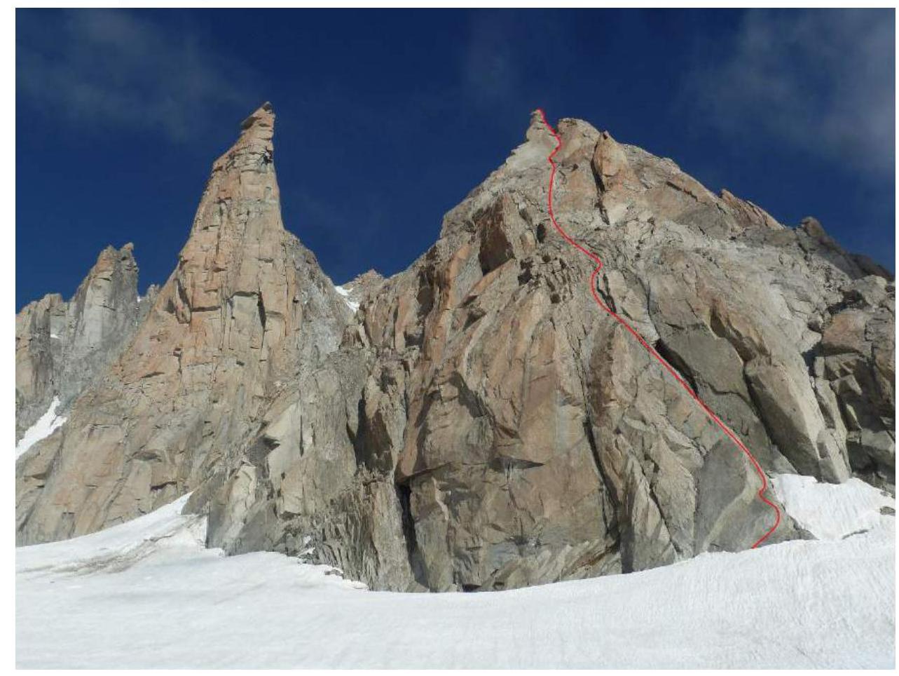 Fig. 1. Petit Capucin (Roi de Siam) summit. View from Glacier du Géant. July 29, 2018.
On Fig. 1: red line — route ascended by the team via South Face.
1.2. Route semi-profile:
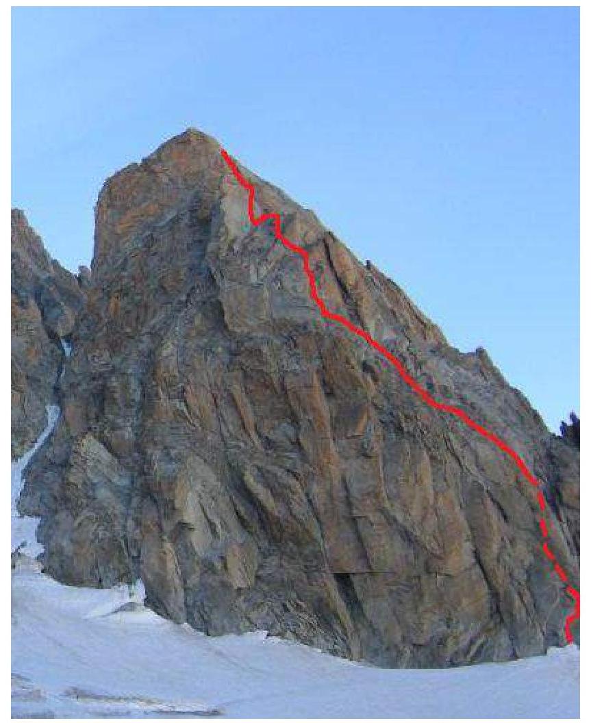 Fig. 2. Roi de Siam summit. View from Glacier du Géant.
1.3. —
1.4. Massif panorama.
Fig. 2. Roi de Siam summit. View from Glacier du Géant.
1.3. —
1.4. Massif panorama.
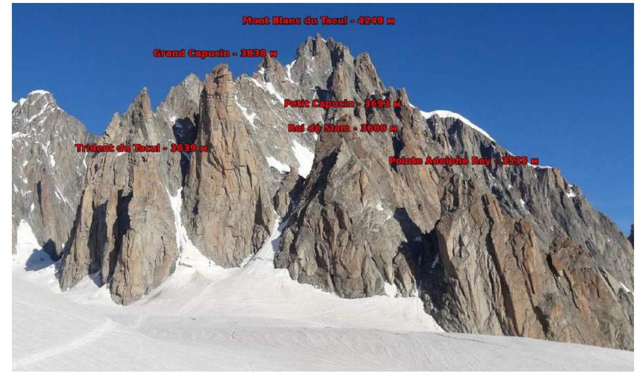 Fig. 3. Panorama. View from Glacier du Géant (Glacier du Géant).
1.5. Area map.
Fig. 3. Panorama. View from Glacier du Géant (Glacier du Géant).
1.5. Area map.
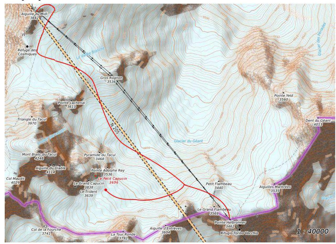 Fig. 4. Area map.
Approach description.
The ascent area is separated from the base camp in Argentière village and from Chamonix by a difficult mountain massif. Bypassing it via Mer de Glace glacier with subsequent ascent to Glacier du Géant is possible but takes two full days. Therefore, it's advisable to use the cable car from Chamonix to Aiguille du Midi or Pointe Helbronner. From the cable car station, traverse through the ice cave to the sharp snowy north-eastern ridge (crampons required, travel in rope teams). Descend along the ridge path to the eastern side onto the snowy plateau of Glacier du Géant (closed crevasses!). Follow the path between Gros Rognon and Pointe Lachenal towards Col des Flambeaux and Rifugio Torino, avoiding the crevassed zone of Glacier du Géant. At Pyramide du Tacul, the path splits. Turn left at the fork and continue towards Rifugio Torino to the start of the ascent, then turn right and follow a good path to the overnight stay location on the plateau between Tour Ronde and Mont Blanc du Tacul massif. The approach from the upper cable car station of Aiguille du Midi takes around 2.5–3 hours.
Fig. 4. Area map.
Approach description.
The ascent area is separated from the base camp in Argentière village and from Chamonix by a difficult mountain massif. Bypassing it via Mer de Glace glacier with subsequent ascent to Glacier du Géant is possible but takes two full days. Therefore, it's advisable to use the cable car from Chamonix to Aiguille du Midi or Pointe Helbronner. From the cable car station, traverse through the ice cave to the sharp snowy north-eastern ridge (crampons required, travel in rope teams). Descend along the ridge path to the eastern side onto the snowy plateau of Glacier du Géant (closed crevasses!). Follow the path between Gros Rognon and Pointe Lachenal towards Col des Flambeaux and Rifugio Torino, avoiding the crevassed zone of Glacier du Géant. At Pyramide du Tacul, the path splits. Turn left at the fork and continue towards Rifugio Torino to the start of the ascent, then turn right and follow a good path to the overnight stay location on the plateau between Tour Ronde and Mont Blanc du Tacul massif. The approach from the upper cable car station of Aiguille du Midi takes around 2.5–3 hours.
A simpler and shorter approach is available from Pointe Helbronner cable car station. Descend along the path to the Glacier du Géant plateau and move west towards Tour Ronde and Grand Capucin. The approach takes 1 hour.
- Route Characteristics
2.1.
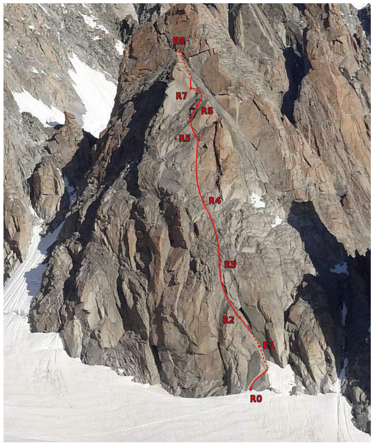 Fig. 5. Technical photo of the route.
2.2. Technical characteristics of route sections
Fig. 5. Technical photo of the route.
2.2. Technical characteristics of route sections
| Section # | Length | Section characteristics | Category | Number of pitons |
|---|---|---|---|---|
| R0–R1 | 20 m | rock slab — 60° | IV | 4 |
| R1–R2 | 30 m | rock slab, crack — 50–70° | V (5 m) III+ (25 m) | 5 |
| R2–R3 | 35 m | rock slab, crack — 60–70° | IV | 5 |
| R3–R4 | 35 m | slabs — 60° | IV (5 m) III (30 m) | 4 |
| R4–R5 | 30 m | crack, inner corner — 70° | V (15 m) IV (15 m) | 6 |
| R5–R6 | 30 m | narrow chimney, rock rib 40–50° | IV+ (6 m) III (24 m) | 2 |
| R6–R7 | 20 m | rock rib 30° | II | — |
| R7–R8 | 30 m | wall, crack — 60–70° | IV–V | 7 |
Route scheme in UIAA symbols
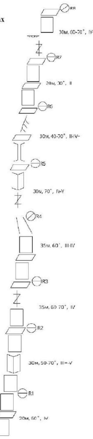 R8 30 m, 60–70°, IV–V
R7 20 m, 30°, II
R6 30 m, 40–70°, III–IV+
R5 30 m, 70°, IV–V
R4 35 m, 60°, III–IV
R3 35 m, 60–70°, IV
R2 30 m, 50–70°, III–V
R1 20 m, 50°, IV
R0
R8 30 m, 60–70°, IV–V
R7 20 m, 30°, II
R6 30 m, 40–70°, III–IV+
R5 30 m, 70°, IV–V
R4 35 m, 60°, III–IV
R3 35 m, 60–70°, IV
R2 30 m, 50–70°, III–V
R1 20 m, 50°, IV
R0
- Team Actions Characteristics
3.1. Approach from overnight stay on Glacier du Géant:
The overnight stay is located on a gentle section of Glacier du Géant between Tour Ronde and Grand Capucin, near the route start. Move across the closed glacier (in rope teams), orienting towards the overhanging slab, to the route start. In summer, a path leads to the route start. The approach takes 15 minutes.
R0–R1. Ascend the crack in the left part of the inclined slab under the overhang, bypassing it on the right. Then ascend the wall to the belay station. The station is on drilled pitons.
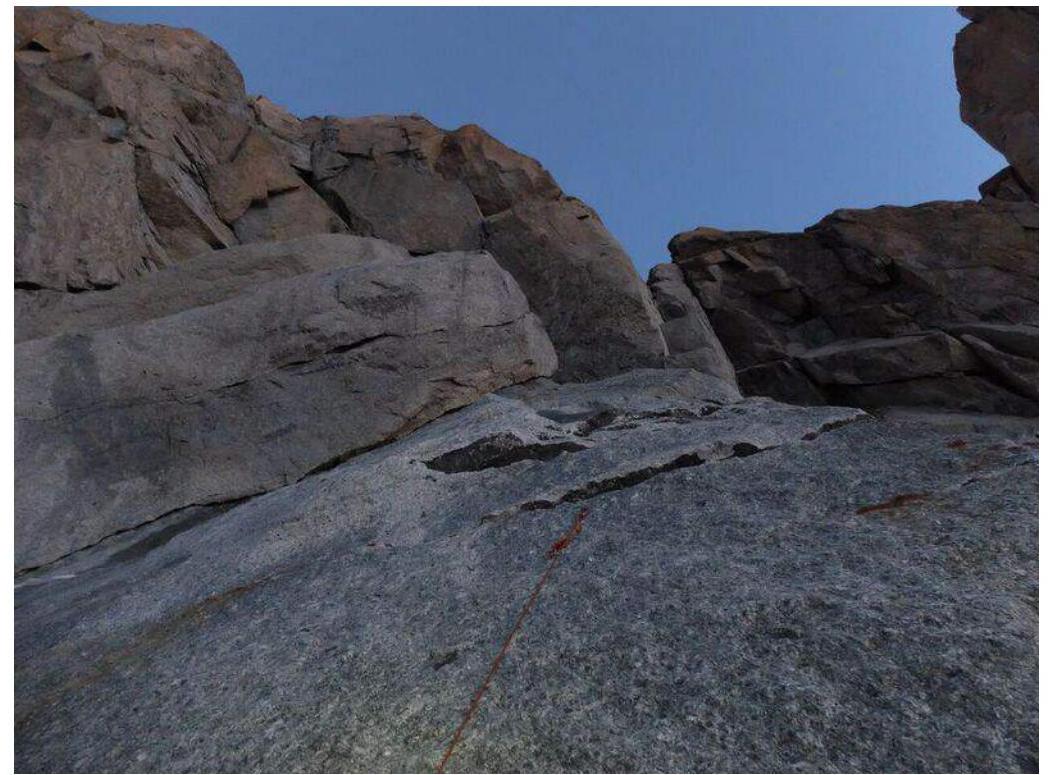 Fig. 6. R0–R1. Initial part of the section. The crack in the left part of the slab and the orange rope — route start guideline are visible.
R1–R2.
- Reach the base of the inner corner.
- Ascend the crack and then up and left across the wall (drilled pitons) to the belay station.
- From R1 station, it's also possible to continue ascending the wall without entering the inner corner (drilled pitons available). (IV category, limited protection).
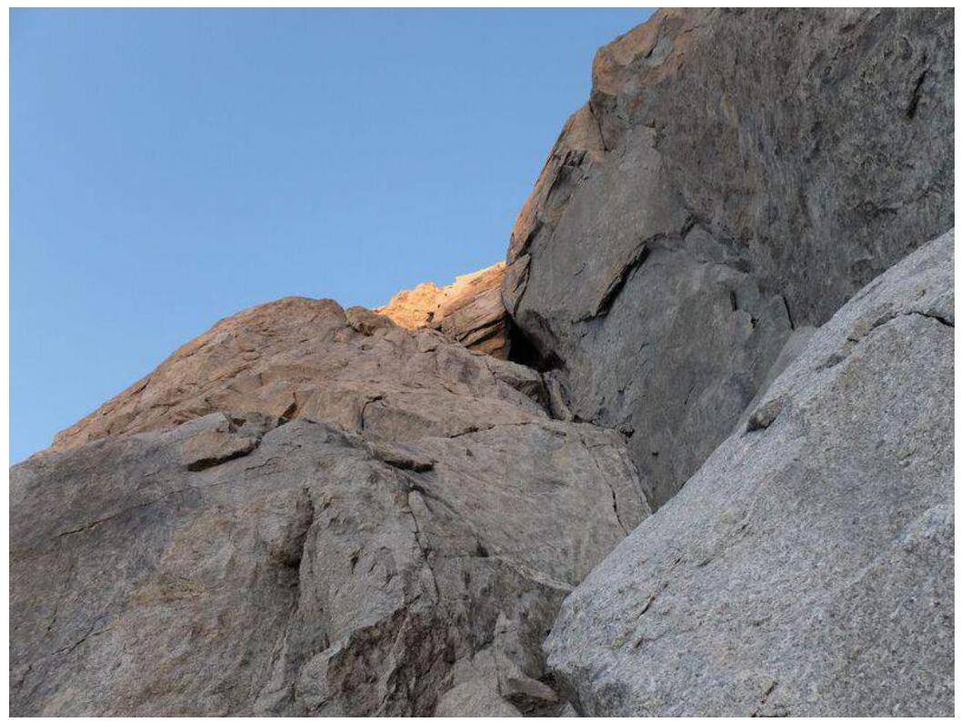 Fig. 7. R1–R2. View from section R0–R1.
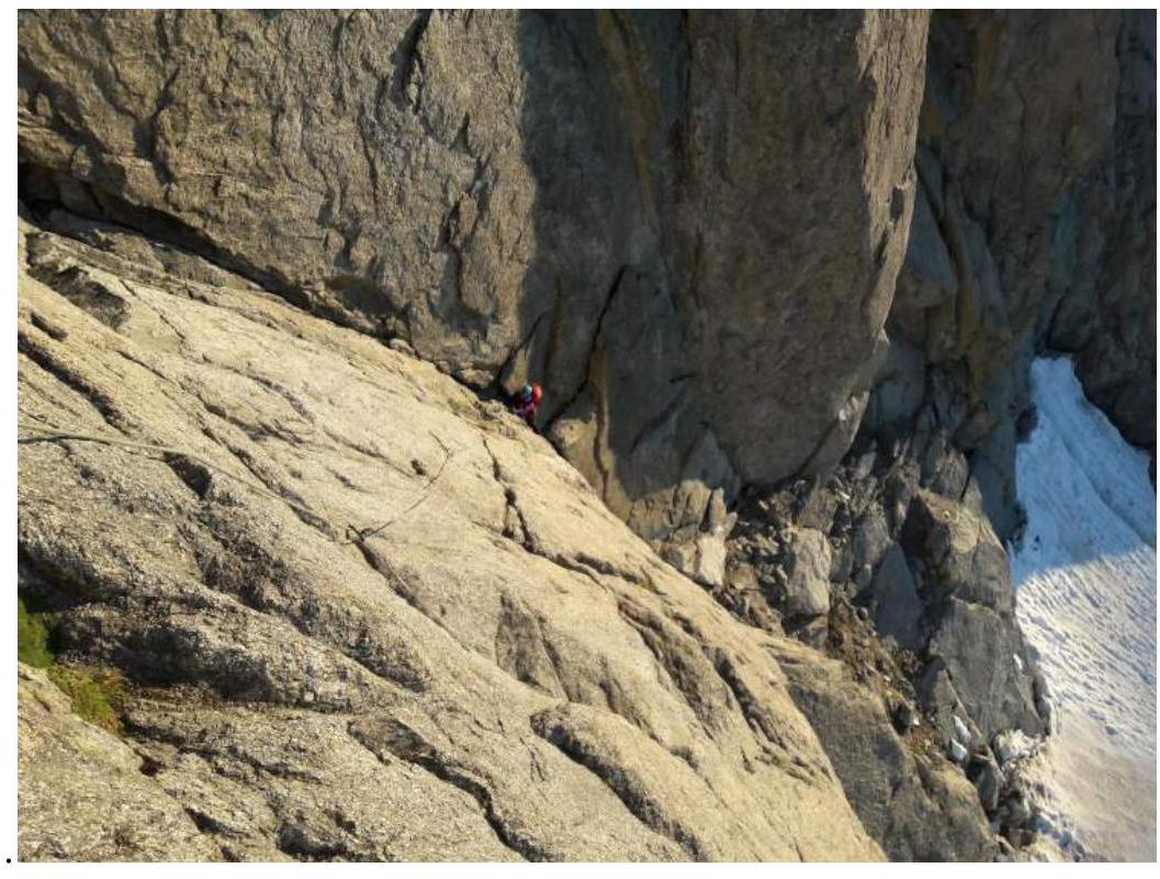 Fig. 8. R1–R2. View from R2.
R2–R3. Ascend the wall, then reach a steep wide crack. Ascend the crack to the belay station on a ledge.
Fig. 8. R1–R2. View from R2.
R2–R3. Ascend the wall, then reach a steep wide crack. Ascend the crack to the belay station on a ledge.
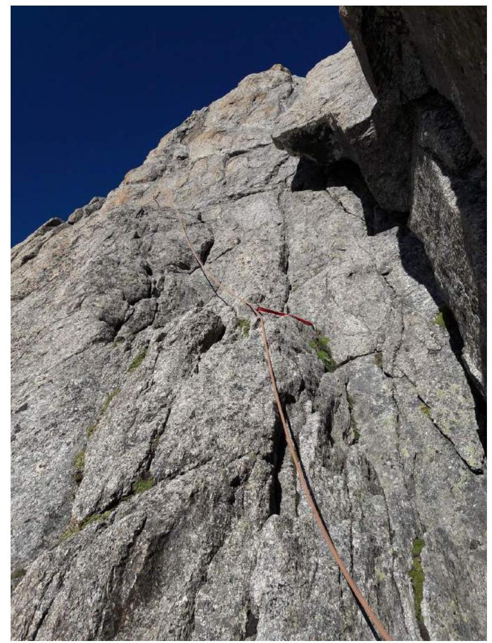 Fig. 9. R2–R3. Lower part of the section.
R3–R4. Ascend the slabs with cracks and a simple couloir to the belay station at the base of a long inner corner left of a large rusty rock.
R4–R5. Crux. Ascend the crack and inner corner (a piton is visible before the overhang on Fig. 10) to the belay station on a ledge slightly right of the narrow chimney base.
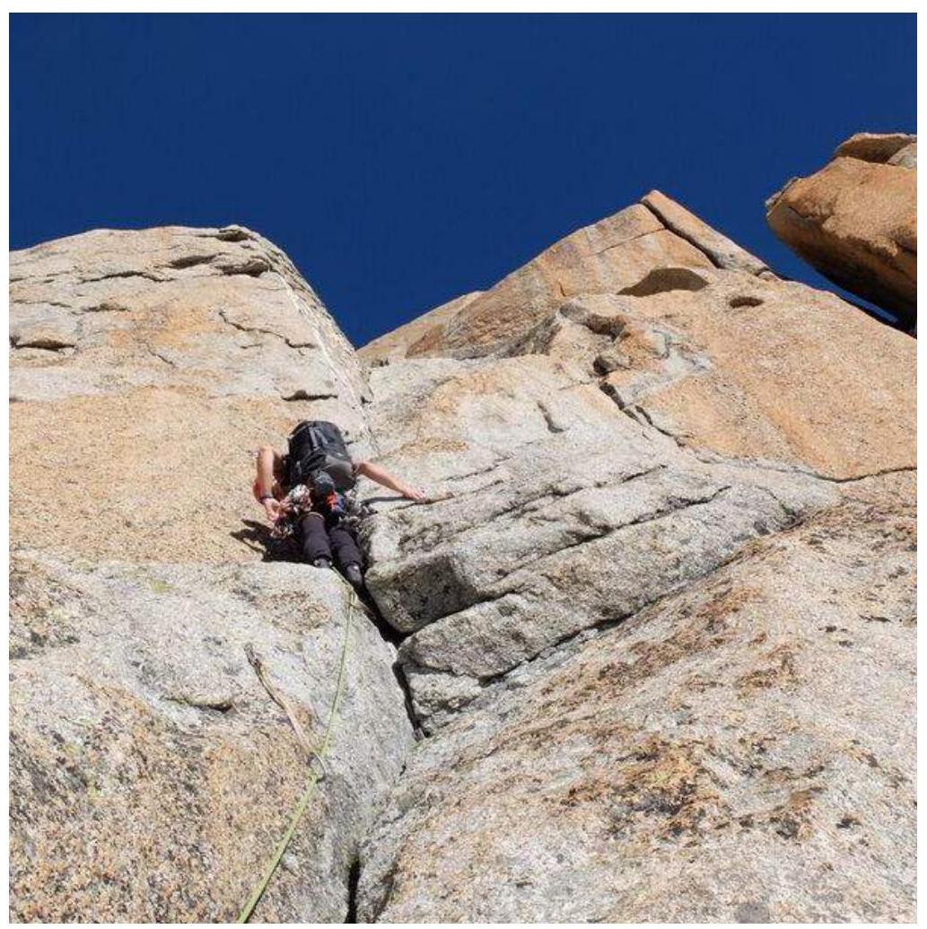 Fig. 10. R4–R5.
R5–R6. Enter the chimney (piton on the left wall) and ascend it to a simple rock rib (6 m, IV+). It's more convenient to pass the chimney without a backpack. Then ascend the rib to the belay station on a large boulder. It's possible to bypass the chimney section on the right via a ledge and then ascend simple broken rocks (III+).
R6–R7. Ascend simple rocks to the base of the Roi de Siam summit tower. A convenient belay station is on pitons on a wide ledge on the left.
R7–R8. Crux. Ascend the crack, then under the overhang. Bypass it on the right and continue ascending via good holds to the Roi de Siam summit.
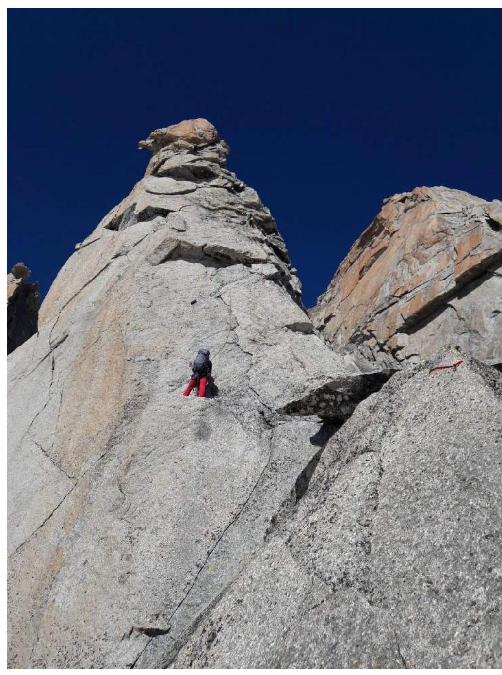 Fig. 11. R7–R8.
3.2. Team photo on the summit.
Fig. 11. R7–R8.
3.2. Team photo on the summit.
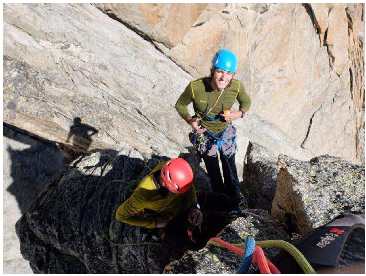 Fig. 12. Team on Petit Capucin (Roi de Siam) summit. July 29, 2018.
3.3. The route is safe. The terrain is monolithic, allowing for reliable protection throughout the route. In areas where protection is challenging, the route is drilled with pitons. Recommended equipment: 2 ropes 50–60 m, standard set of cams and nuts, 8–10 quickdraws, rock shoes. Leave ice gear and crampons below the route. Mobile phone signal is available on the route.
Descent from the summit is via rappelling on the ascent route. To the route start, there are 5.5 rappels (with 60 m ropes — 5 rappels), then across the closed glacier (in rope teams) back to the tents.