
Report
On the ascent of the Demchenko CSKA team to the summit of Monciar (3544 m) via the NE ridge, category 1B–2A. Graian Alps, Valsavaranche, Valle d'Aosta, Gran Paradiso National Park
Leader: E.V. Korol
Senior coach: E.V. Kuznetsova
Ascent Details
- Italy. Graian Alps, Valsavaranche, Valle d'Aosta, Gran Paradiso National Park. Section No. 10.3 (according to KGBM 2011)
- Monciar (Beca di Monciair) summit, 3544 m via the NE ridge (E. Boyer, C. Carrezzana, A. Weber, 1902)
- Proposed category: 1B–2A
- Route type: combined
- Route elevation gain: 600 m
Route length: 1500 m.
Section lengths:
- Category V: ______ m.
- Category VI: ______ m.
Average slope: main part of the route — 30°; entire route — 23°.
-
Pitons left (used) on the route: total 2; including bolted pitons —
-
Team's climbing hours: 8 hours (excluding descent)
-
Leader: Korol Evgeny, Master of Sports
Participants:
- Atrushkevich Dmitry 3rd category
- Gakharia Anna 3rd category
- Sokolova Tatyana 3rd category
- Son Igor 3rd category
- Khvalkovsky Nikolai 3rd category
- Coach: Kuznetsova Elena
- Departure from Base Camp: 03:40, June 29, 2012 Route started: 05:00, June 29, 2012 Summit reached: 13:00, June 29, 2012 Return to Base Camp: 17:15, June 29, 2012 Descent from the summit: via the ascent route
- Organization: Demchenko CSKA Training Center (Moscow)
- Report responsible: Khvalkovsky N., Yurkin A.V.
Email: n.khvalkovskiy@gmail.com
Overall Summit Photo
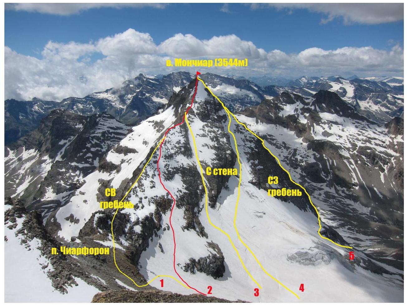
Photo of Monciar (Beca di Monciair) summit from the NW ridge of Ciarforon. July 2012.
Annotations on the photo:
- Route via the NE ridge, category 1B–2A [PD category (Italian)] (G. Frasca and G. Blanchetti, 1881)
- Route variation via the NE ridge, category 1B–2A [PD category (Italian)] (E. Boyer, C. Carrezzana, A. Weber, 1902)
- Route via the N face and NE ridge ("via the couloir through the gendarme" (Italian)), category 2A [PD category (Italian)]
- Route via the N face, category 3B [AD category (Italian)] (E. Barisone, S. Gallo, and M. Strumia, 1920)
- Route via the NW ridge [AD+ category (Italian)] (G. Yeld, F. and S. Pession, 1897)
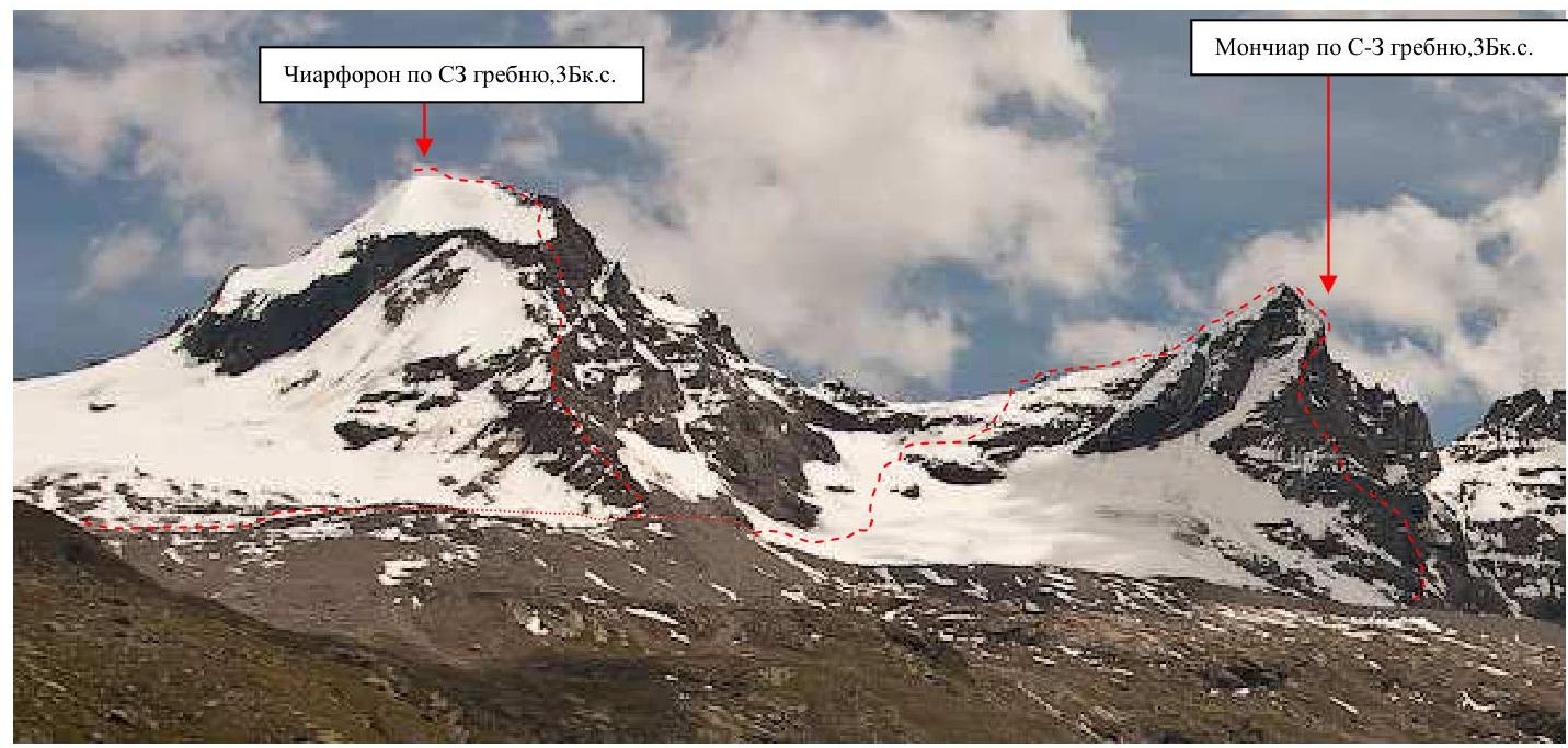
Monciar via the NW ridge, category 3B. Ciarforon via the NW ridge, category 3B.
Photo of the route profile
Area Photopanorama
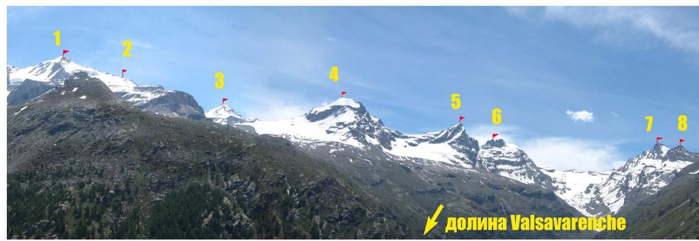
Annotations for the photo:
- Gran Paradiso summit, 4061 m
- Becca di Moncorvè summit, 3875 m
- La Tresenta summit, 3609 m
- Ciarforon summit, 3642 m
- Becca di Monciair summit, 3544 m
- Denti del Broglio summit, 3454 m
- Mare Pércia summit, 3385 m
- Punta Fourà summit, 3411 m
Area Map
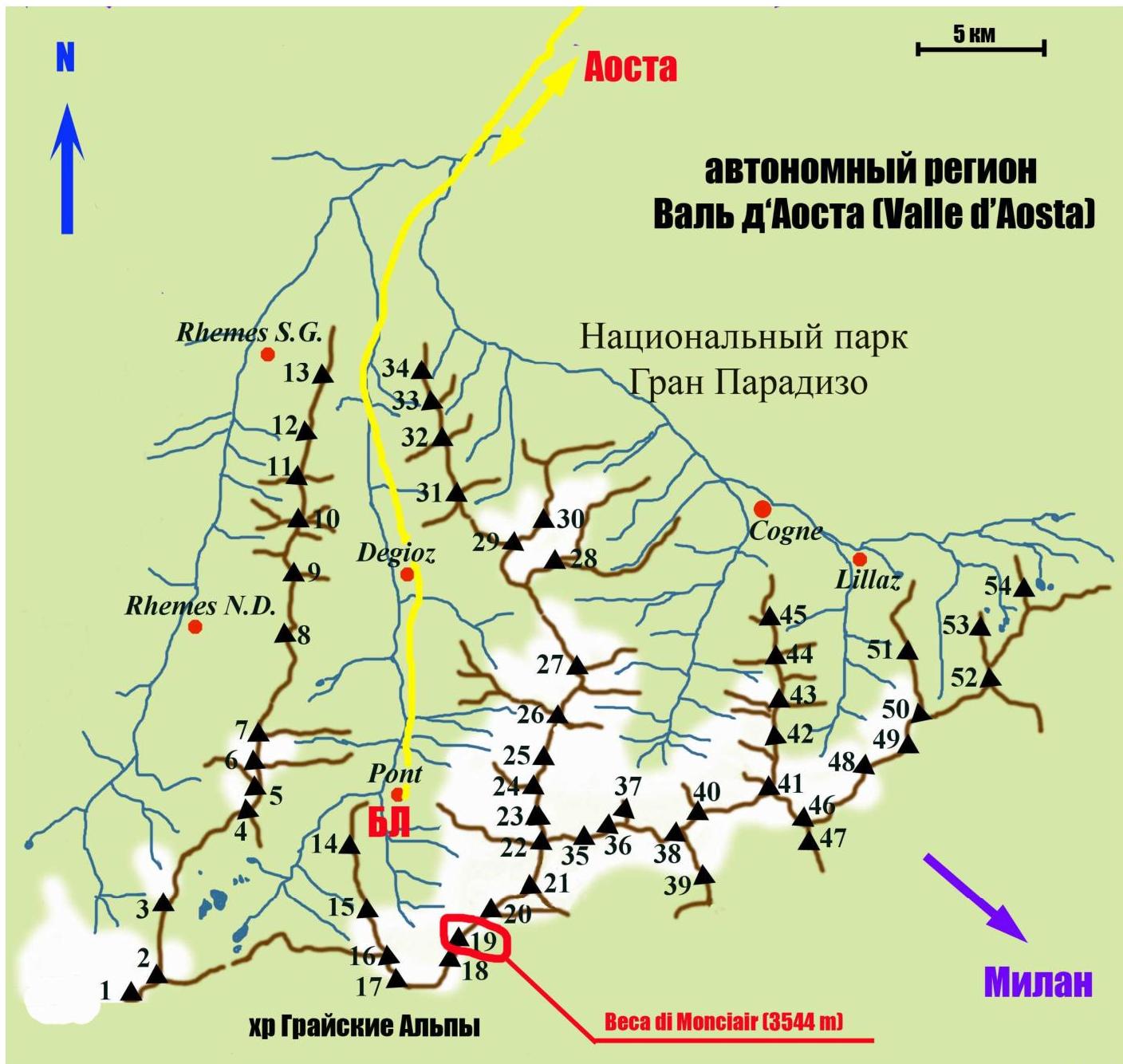
| Peak annotations (with elevations) on the map: | |
|---|---|
| 1 Punta Galisia 3346 m | 28 Punta Rossa della Grivola 3630 m |
| 2 Punta Basei 3338 m | 29 La Grivola 3969 m |
| 3 Punta Gran Vaudala 3272 m | 30 Grivoletta 3514 m |
| 4 Taou Blanc 3438 m | 31 Gran Nomenon 3488 m |
| 5 Aouillé 3440 m | 32 Mont Favret 3173 m |
| 6 Cima di Entrelor 3430 m | 33 Punta Valletta 2793 m |
| 7 Punta Percià 3227 m | 34 Becca Piana 2271 m |
| 8 La Roletta 3384 m | 35 Punta Ceresole 3777 m |
| 9 Punta Bianca 3427 m | 36 Testa della Tribolazione 3642 m |
| 10 Punta Bioula 3414 m | 37 Testa di Valnontey 3562 m |
| 11 Punta del Ran 3272 m | 38 Becca di Gay 3621 m |
| 12 Punta Chamoussière 2942 m | 39 Becco Meridionale della Tribolazione 3360 m |
| 13 Monte Paillasse 2414 m | 40 Roccia Viva 3650 m |
| 14 Cima dell'Arolley 2996 m | 41 Torre del Gran San Pietro 3692 m |
| 15 Cima di Seiva 3075 m | 42 Punte Patri 3581 m |
| 16 Punta Fourà 3411 m | 43 Punta Valletta 3356 m |
| 17 Mare Pércia 3385 m | 44 Punta di Valmiana 3244 m |
| 18 Denti del Broglio 3454 m | 45 Punta Fenilia 3053 m |
| 19 Becca di Monciair 3544 m | 46 Punta d'Ondezana 3452 m |
| 20 Ciarforon 3642 m | 47 Becco di Valsoera 3369 m |
| 21 La Tresenta 3609 m | 48 Punta delle Sengie 3408 m |
| 22 Becca di Moncorvè 3875 m | 49 Monveso di Forzo 3322 m |
| 23 Gran Paradiso 4061 m | 50 Grande Arolla 3246 m |
| 24 Piccolo Paradiso 3923 m | 51 Punta della Tsesère 3117 m |
| 25 Becca di Montandayné 3838 m | 52 Torre di Lavina 3308 m |
| 26 Herbetet 3778 m | 53 Punta di Acque Rosse 2952 m |
| 27 La Gran Serra 3552 m | 54 Punta Nera 3064 m |
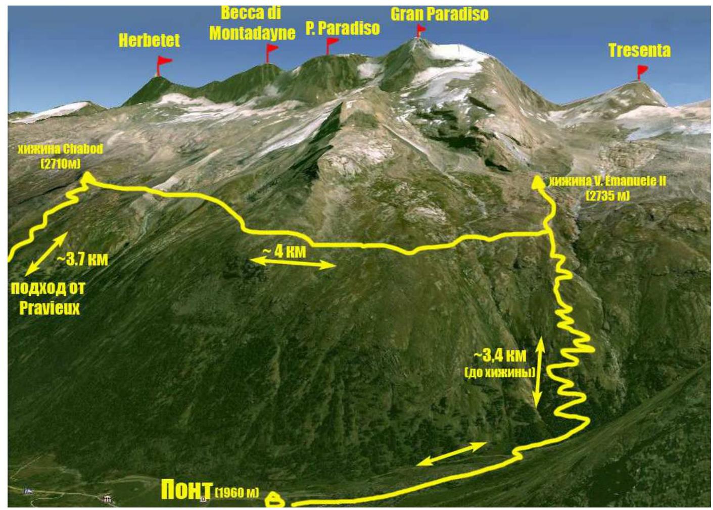
Approach route from Base Camp (Pont campsite) to Vittorio Emanuele II hut.
The Monciar (Beca di Monciair) summit, 3544 m, is located in the Gran Paradiso National Park area. The park is situated in the Graian Alps, Valle d'Aosta autonomous region, northern Italy.
The highest point in the Gran Paradiso area is 4061 m, making it the seventh highest peak in the Alps (Mont Blanc being the first).
The Valle d'Aosta region is densely mountainous, featuring some of the most iconic Italian and Alpine peaks such as Monte Bianco (Mont Blanc), Gran Jorasses, Cervino (Matterhorn), and Gran Paradiso.
Most interesting mountaineering routes are found in the Gran Paradiso ridge, with peaks ranging from 3500 to 4000 m, offering a variety of terrain including rock, ice, and snow. Many combined routes exist, mostly categorized 1–4, with some category 5 routes.
The ascent to Monciar was part of the Demchenko CSKA training camp (Moscow) in June – early July 2012.
The Base Camp was set up in the Pont campsite, the highest and last settlement in the Valsavaranche valley, at an elevation of 1950–2000 m.
The approach to the route started from the Vittorio Emanuele II hut, located at the foot of Gran Paradiso at 2732 m. The approach from Pont takes about 2 hours via a comfortable trail.
The route via the NE ridge (PD category Italian classification) was first ascended by G. Frasca and G. Blanchetti on July 14, 1881, which was also the first ascent of the summit. The lower part of the route was completed by the team led by Evgeny Korol via the 1902 variation (E. Boyer, C. Carrezzana, A. Weber).
Monciar is situated in the ridge between Ciarforon (3642 m) and Denti del Broglio (3454 m), with the Ciarforon pass (3317 m) between them. The geographical coordinates of Monciar are: 45°29'5.16"N, 7°14'9.14"E.
Route Difficulty Description
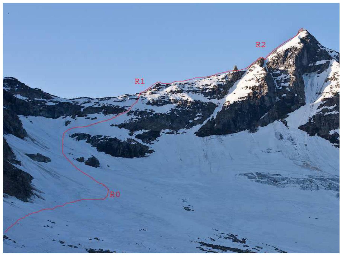
| Section | Length | Slope | Terrain Characteristics | Category | Number of Pitons |
|---|---|---|---|---|---|
| R0 | 900 m | 15–40° | Snow, firn, ice | 2 | 0 |
| R1 | 300 m | 10–20° | Rocky- scree ridge, partially snow-covered | 1 | 0 |
| R2 | 300 m | 30° | Rocky-scree ridge | 2 | 2 |
Technical photo of the route
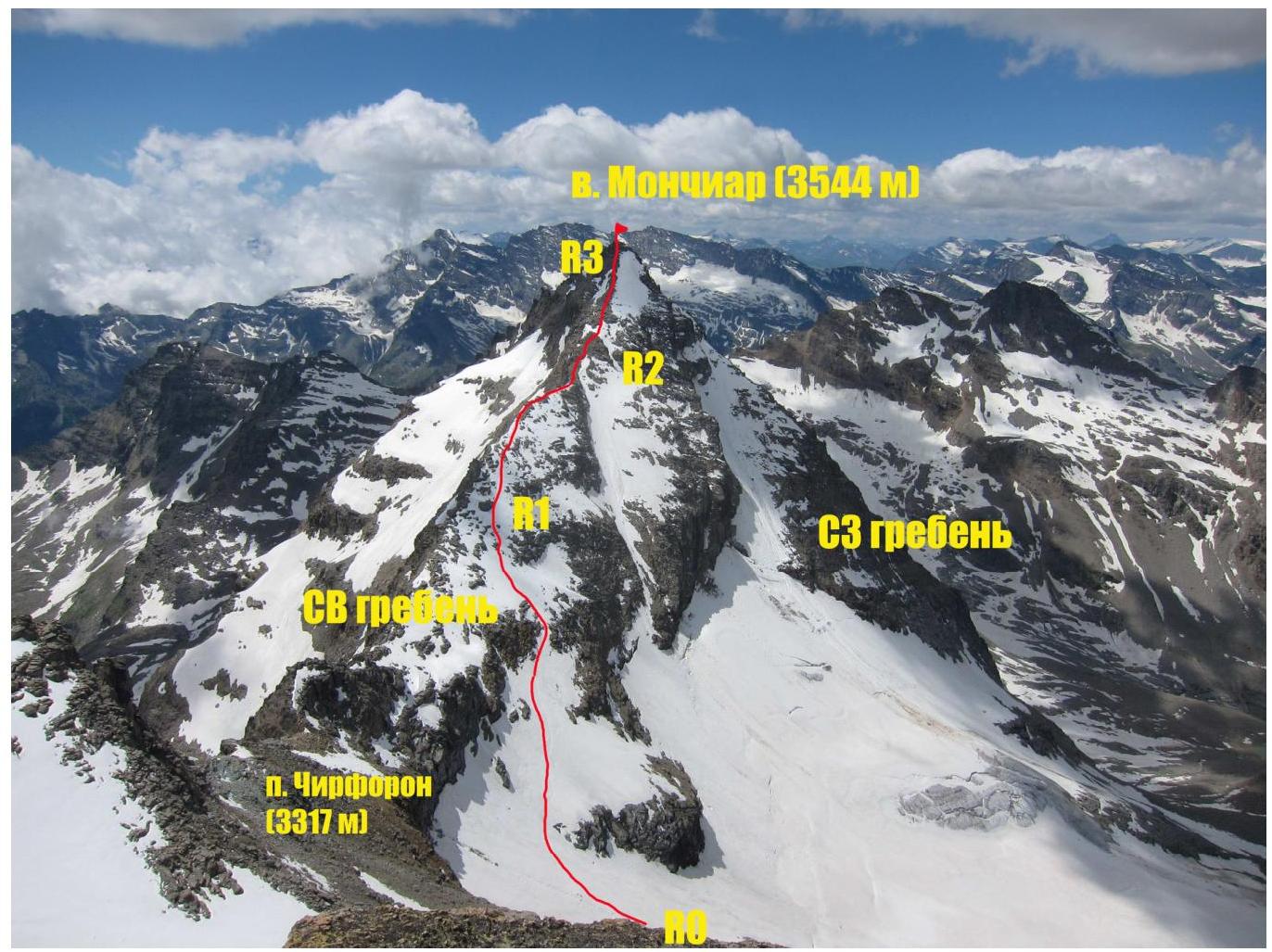
Photo from the NW ridge of Ciarforon.
Brief Description of the Route Ascent
The approach to the route starts from the Vittorio Emanuele II hut, traversing moraine fields towards the moraine ridge branching off from the NW ridge of Ciarforon. A faint trail is marked with cairns. Reach a small saddle on the moraine ridge. To the left along the ridge, a good trail leads down to a saddle between the moraine ridge and the NW ridge of Ciarforon. From the saddle, traverse to the snow-ice slope leading to the col between Ciarforon and Monciar (400 m) — the start of the route. The approach from the hut takes 1.5–2 hours.
Ascend the snow-ice slope (20–30°) directly upwards for 400 m, avoiding rock outcrops on the left. Higher up, move right-upwards towards a passage in the rocky belt at the top of the slope (snow-ice slope up to 40° for 400 m). Then ascend directly to the ridge for 100 m up to 50°, with possible rock outcrops. Continue along the gentle rocky ridge. A high reddish gendarme is bypassed on the right — a good spot for a group gathering. To the summit, 300 m of rocky-scree ridge at 30–40°, with rock sections of category 2–3.
The summit is rocky-scree with a spot for a group gathering.
Descent is via the ascent route.
! After snowfall, the snow-ice slope may be avalanche-prone.
! Traversing under the rocky belt may require belaying (alternate) in poor snow conditions.
Photo Illustrations
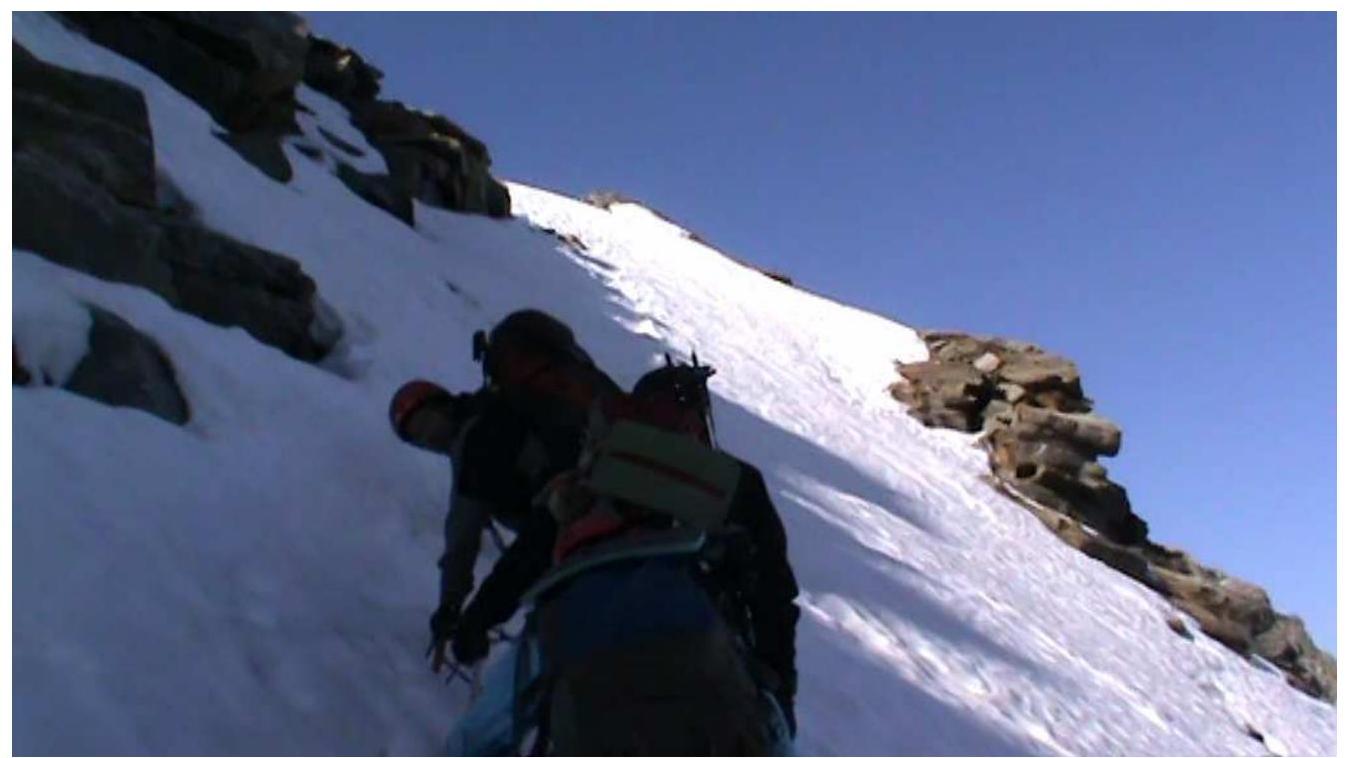
Photo 1. Upper section R0–R1

Photo 2. Upper section R0–R1

Photo 3. Descent into the ridge depression via a rocky ledge
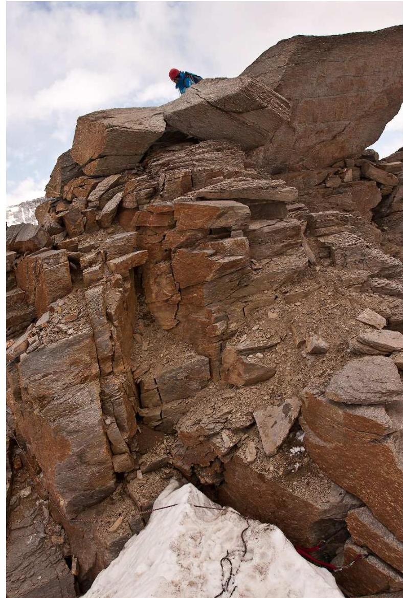
Photo 4. Alternative descent – "directly"
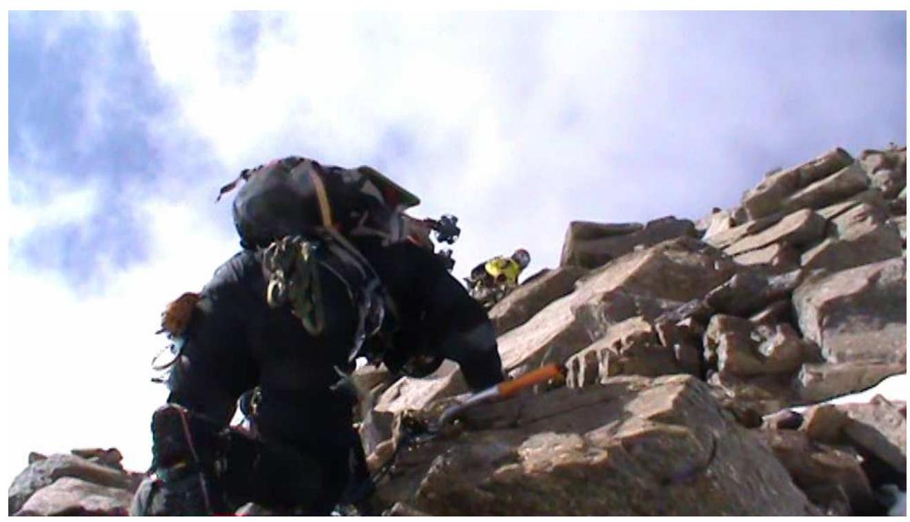
Photo 5. R1–R2 rocky section
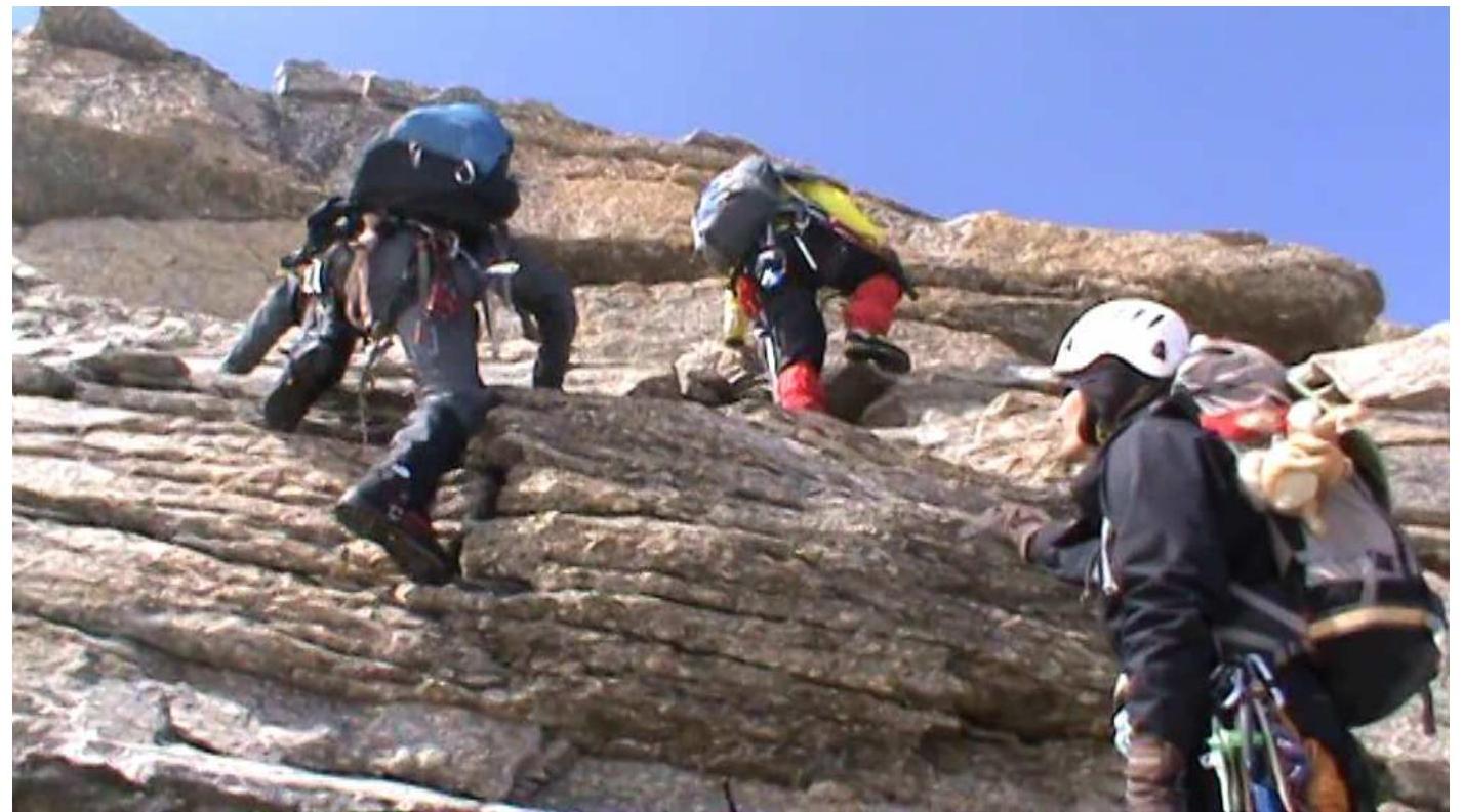
Photo 6. R2–R3 rocky section
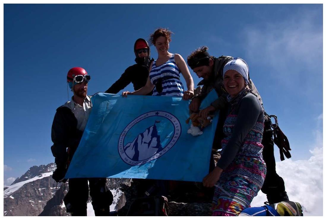
Photo 7. At the summit of Monciar