REPORT
On the ascent to the summit of Clocher de planpraz via the southeastern spur, category 2B, by group №7 of the University Tourist Section of FASPb at the "Polytechnic" Alpine Club on August 4, 2018
I. ASCENT DOCUMENTATION
| № | 1. General Information | |
|---|---|---|
| 1.1 | Full name, sports rank of the leader | Kovalev Alexander Nikolaevich, CMS |
| 1.2 | Full name, sports rank of participants | Andronov Kirill Sergeevich unranked, Kaminskaya Victoria Evgenievna unranked, Grabko Ilya Olegovich unranked, Khlopin Dmitry Mikhailovich unranked |
| 1.3 | Full name of coach | Molodozhen V.A. |
| 1.4 | Organization | Alpine Club "Polytechnic", St. Petersburg |
| 2. Characteristics of the ascent object | ||
| 2.1 | Region | Alps. Chamonix. France. |
| 2.2 | Valley | Aiguilles Rouges |
| 2.3 | Number according to the 2013 classification table | Section according to KMGV 2013 — 10.3. |
| 2.4 | Name and height of the summit | Clocher de planpraz 2428 meters |
| 2.5 | Geographical coordinates of the summit | 45°56′46.4″N 6°50′47.6″E |
| 3. Characteristics of the route | ||
| 3.1 | Name of the route | Label Virginie |
| 3.2 | Proposed category of difficulty | 2B |
| 3.3 | Degree of route development | - |
| 3.4 | Nature of the route terrain | Rock. |
| :--: | :--: | :--: |
| 3.5 | Elevation gain of the route | 260 m |
| 3.6 | Length of the route | 200 m |
| 3.7 | Technical elements of the route | III category difficulty rocks — 25 m IV category difficulty rocks — 110 m V category difficulty rocks — 40 m Rappelling from the summit — 30 m |
| 3.8 | Descent from the summit | Rappelling to the southwest under the summit tower of Clocher de Planpraz, then simple climbing down the slope to the trail towards the cable car |
| 3.9 | Additional route characteristics | No water sources on the route |
| 4. Characteristics of the team's actions | ||
| 4.1 | Time of movement (team's walking hours, indicated in hours and days) | 5 hours |
| 4.2 | Overnights | - |
| 4.3 | Start of the route | 9:00 August 4, 2018 |
| 4.4 | Reaching the summit | 14:00 August 4, 2018 |
| 4.5 | Return to the base | 15:00 August 4, 2018 |
| 5. Person responsible for the report | ||
| 5.1 | Full name, e-mail | Andronov K.S. vdohnovenen@inbox.ru |
II. ASCENT DESCRIPTION
1. Characteristics of the ascent object
1.1. General photo of the summit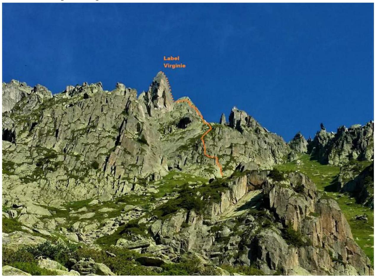 1.3.
Panoramic photo of the area
1.3.
Panoramic photo of the area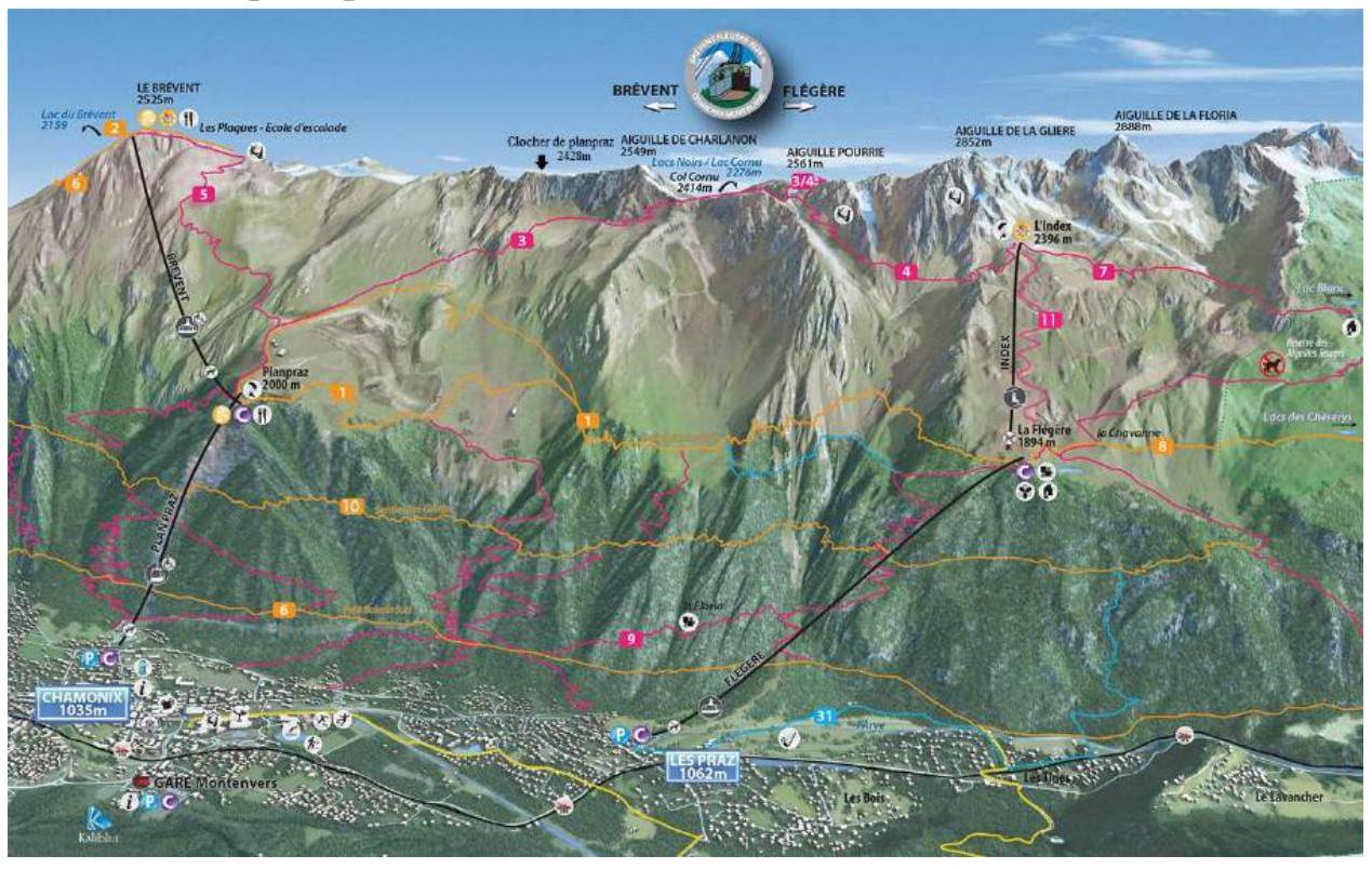 1.4.
Map of the area
1.4.
Map of the area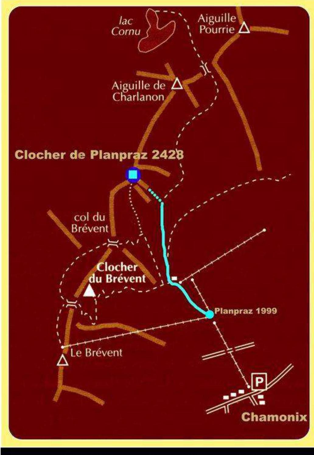
2. Characteristics of the route
2.1. Technical photograph of the route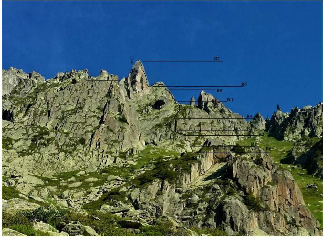
2.2. Section numbers on the technical photograph correspond to the section numbers in paragraph 2.3.
2.3. Technical characteristics of the route sections
| Section № | Terrain type | Category of difficulty | Length, m |
|---|---|---|---|
| R1 | rocky | 3 | 25 |
| R2 | rocky | 4 | 30 |
| R3 | rocky | 4 | 25 |
| R4 | rocky | 4 | 30 |
| W1 | grassy | 1 | 60 |
| R5 | rocky | 5 | 40 |
| R6 | rocky | 2 | 25 |
| R7 | rocky | 4 | 25 |
| D1 | rocky | rappel | 40 |
3. Characteristics of the team's actions
3.1
| Section № | Description |
|---|---|
| R1 | Bypass a small wall on the left via a wide crack, then through a grassy ledge to a chimney and a piton below it. Station on a piton and a flake. |
| R2 | From the piton, move right up the chimney for 5 meters, then up the wall to the left and onto a grassy ledge. Station on two pitons. |
| R3 | Traverse left along a wet, grassy ledge to a small wall, then move left and up to two pitons. Station on two pitons. |
| R4 | From the station, move up the walls with pitons. Station on two pitons. |
| W1 | Move left and up a large grassy ledge. Reach the outer corner, then move right along the wall to two pitons. Simultaneous movement, relief belay. Station on two pitons. |
| R5 | Key rope. Pleasant, technical climbing. From the station, move up the walls and cracks under an overhang, bypass the cornice on the left and continue to a comfortable ledge with two pitons. Station on two pitons. |
| R6 | From the station, move up the left side of the ridge for two pitons. Distance between pitons is about 7 meters. Then traverse left to a bridge. Station on rock flakes. |
| R7 | The most beautiful rope on the route. From the station, move up the ridge. Climb around a large boulder on the right, then along small rock ledges to a sharp ridge, then up the sharp ridge to the summit. Station on a large steel ring. |
| D1 | Rappelling under the summit tower. Then easy climbing down large rocks until a clear trail appears. Descent along the trail towards the cable car. |
Photo №1: Section R0–R2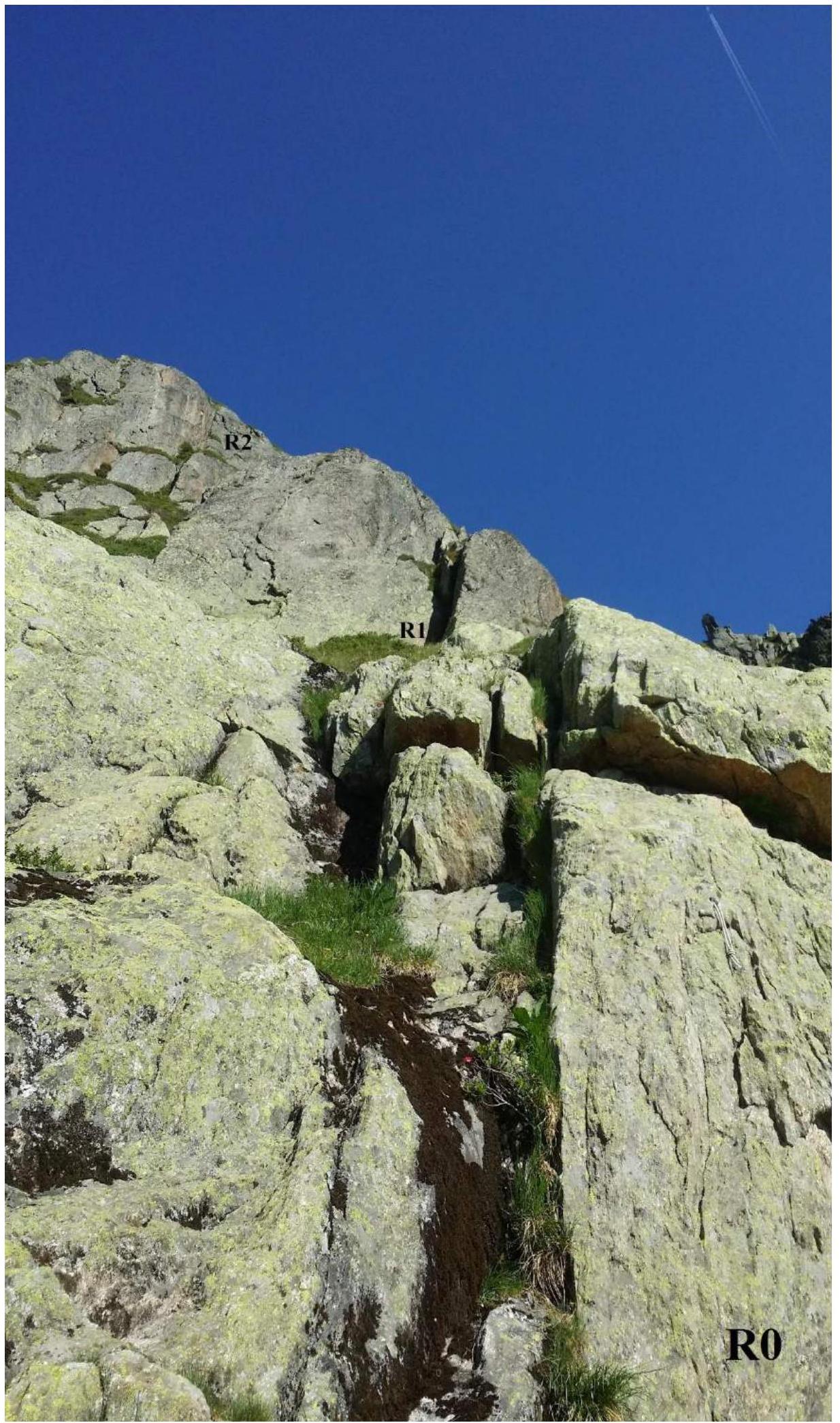 Photo
№2: Section R1–R2
Photo
№2: Section R1–R2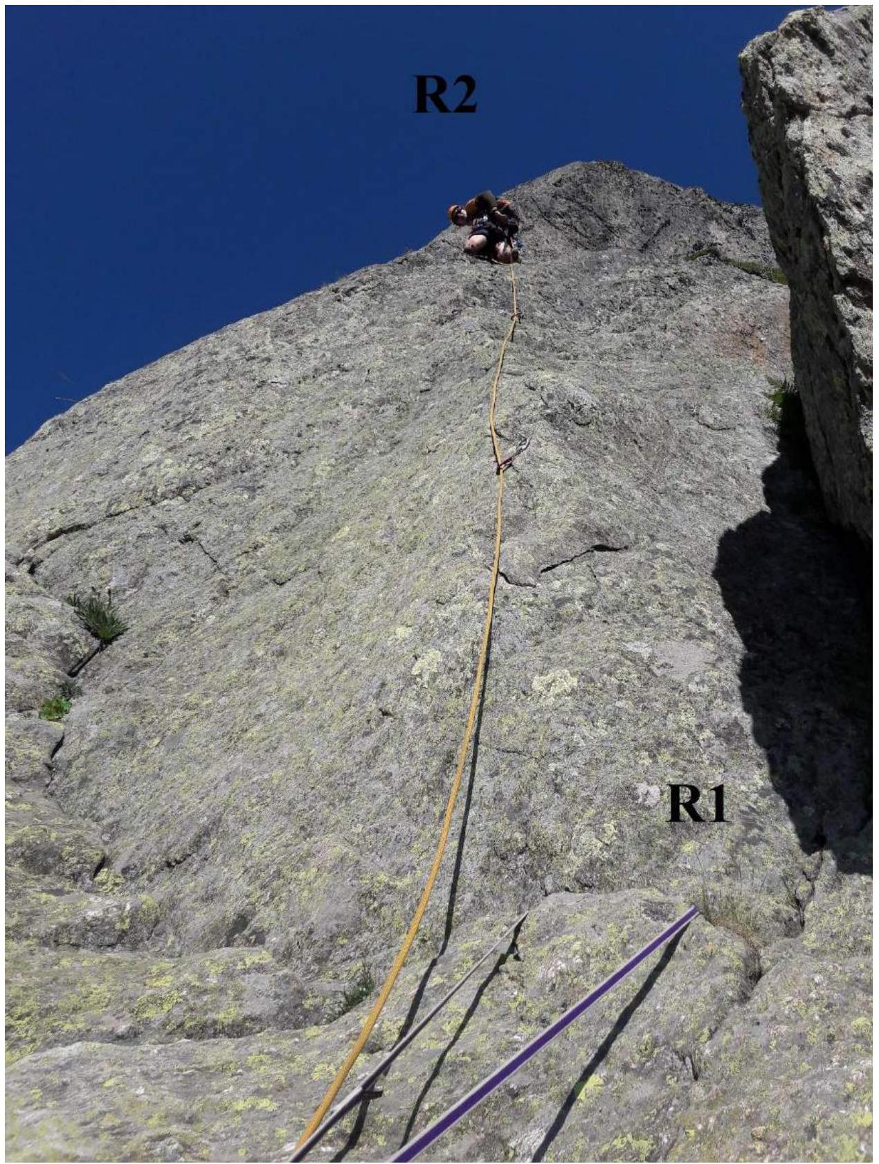 Photo
№3: Section R2–R4
Photo
№3: Section R2–R4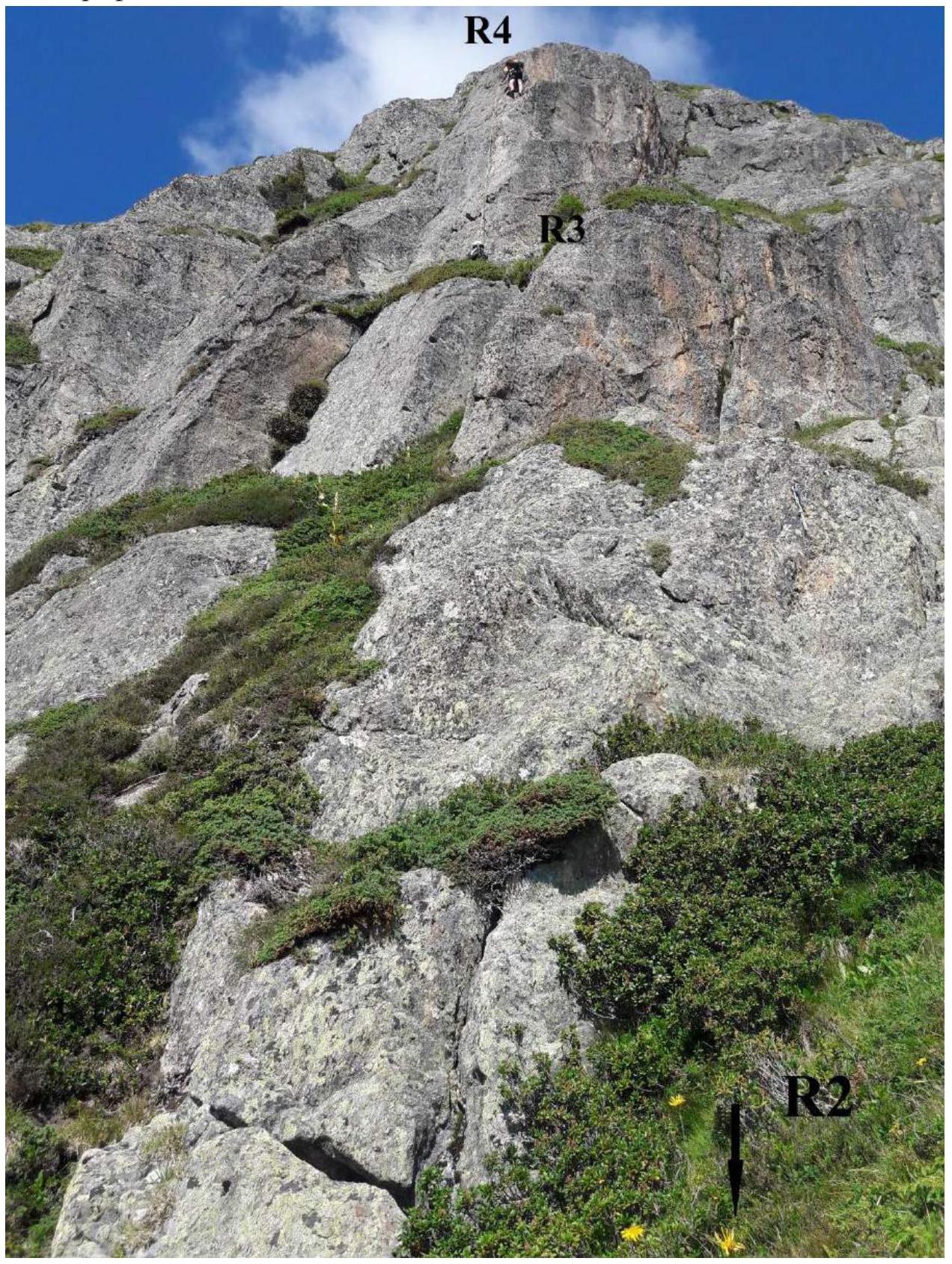 Photo
№4: Sections R1–W1–R5
Photo
№4: Sections R1–W1–R5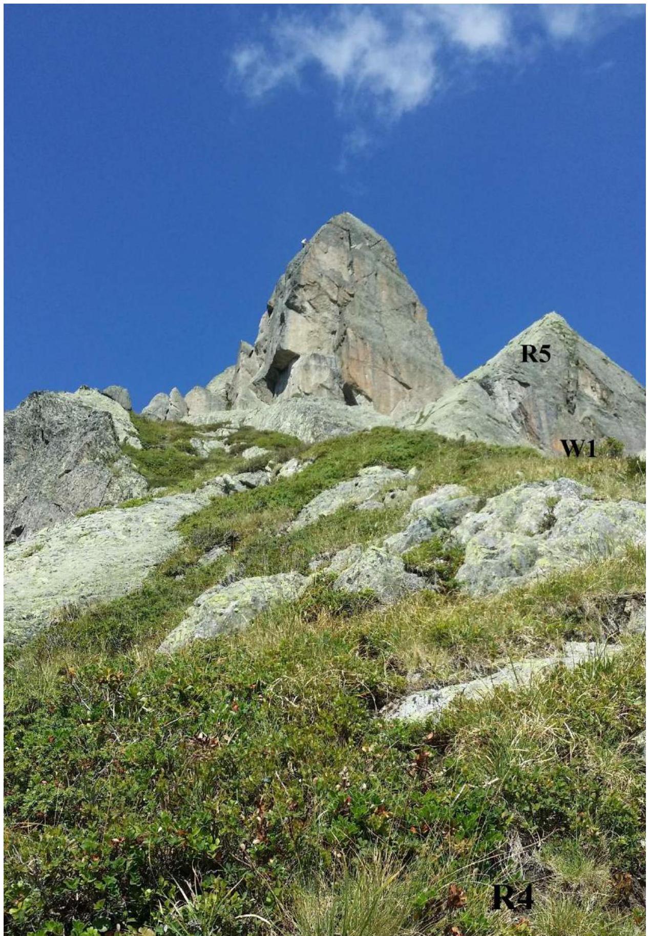 Photo
№5: Sections W1–R5
Photo
№5: Sections W1–R5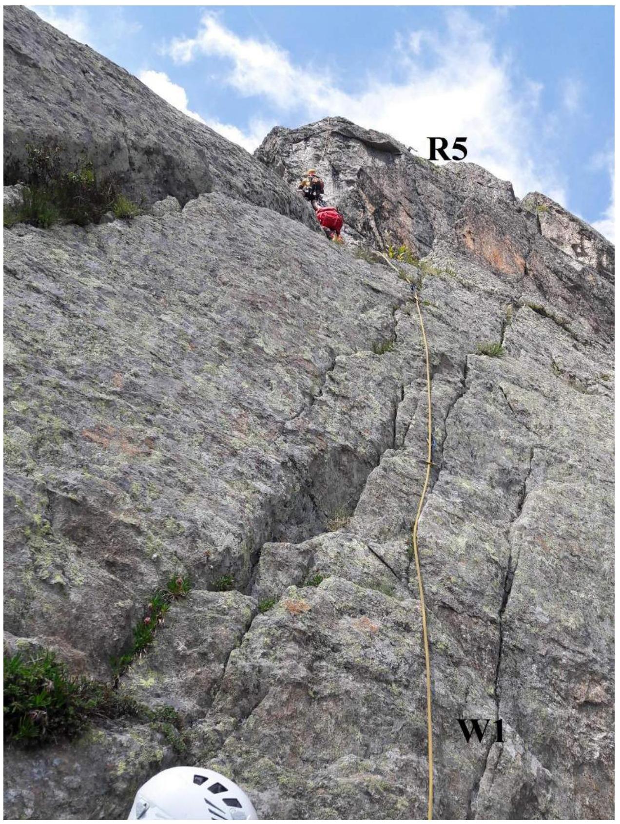 Photo
№6: Sections R5–R6
Photo
№6: Sections R5–R6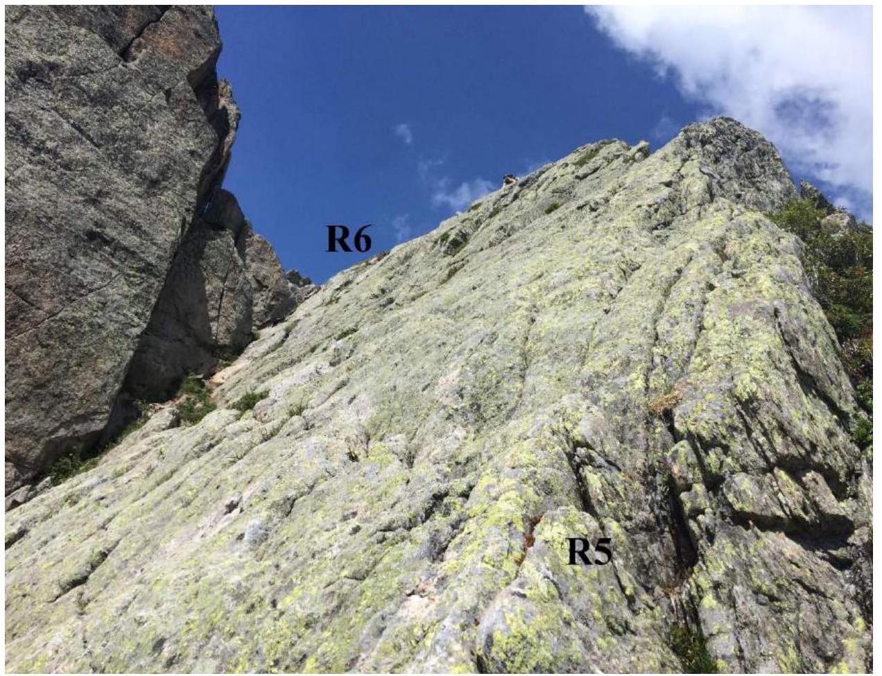 Photo
№7: Sections R6–R7
Photo
№7: Sections R6–R7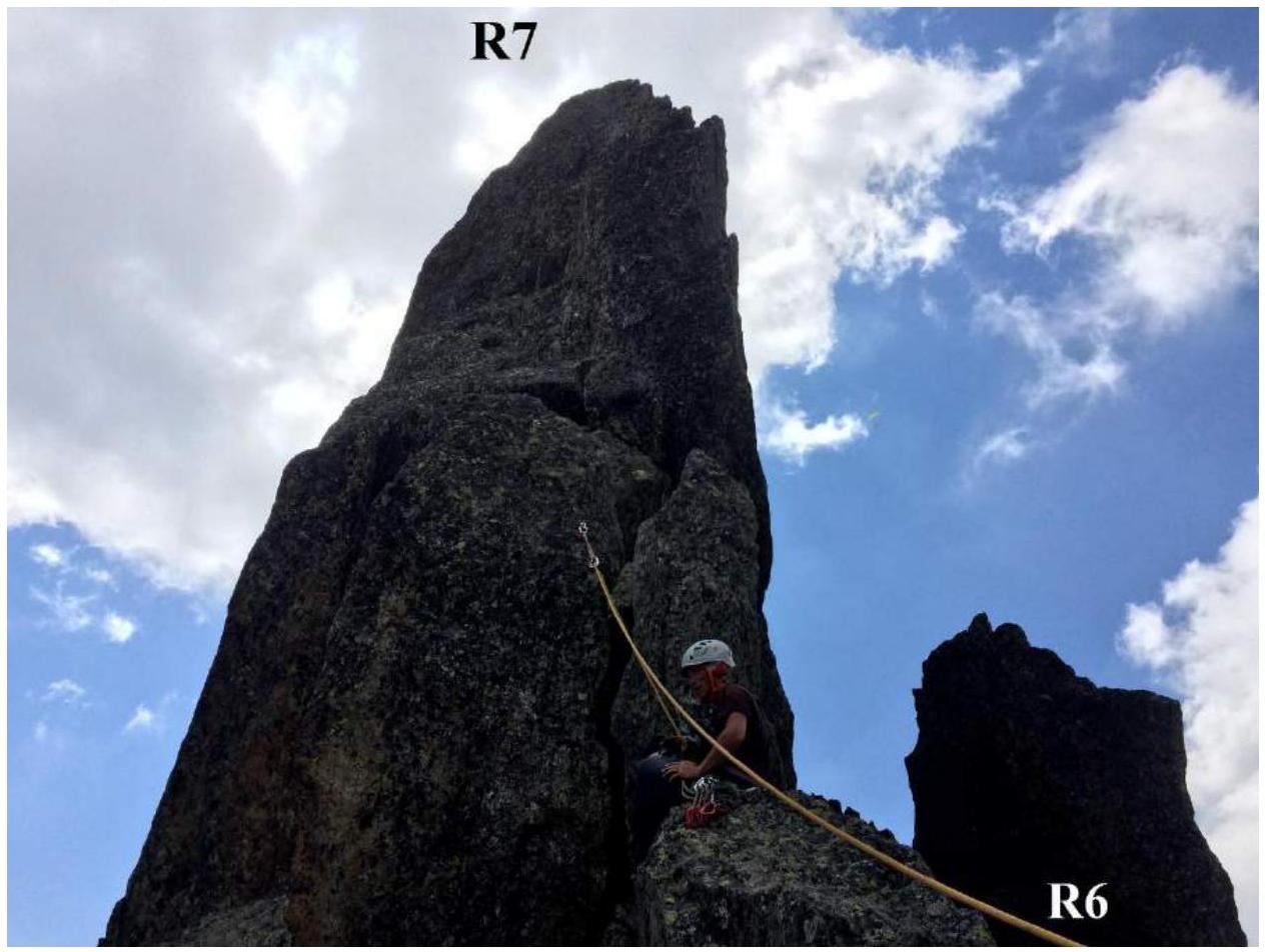 Photo
№7: Sections R7–D1
Photo
№7: Sections R7–D1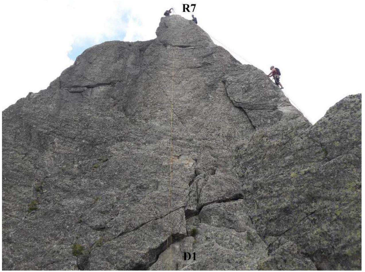
3.2. Photo of the team at the summit.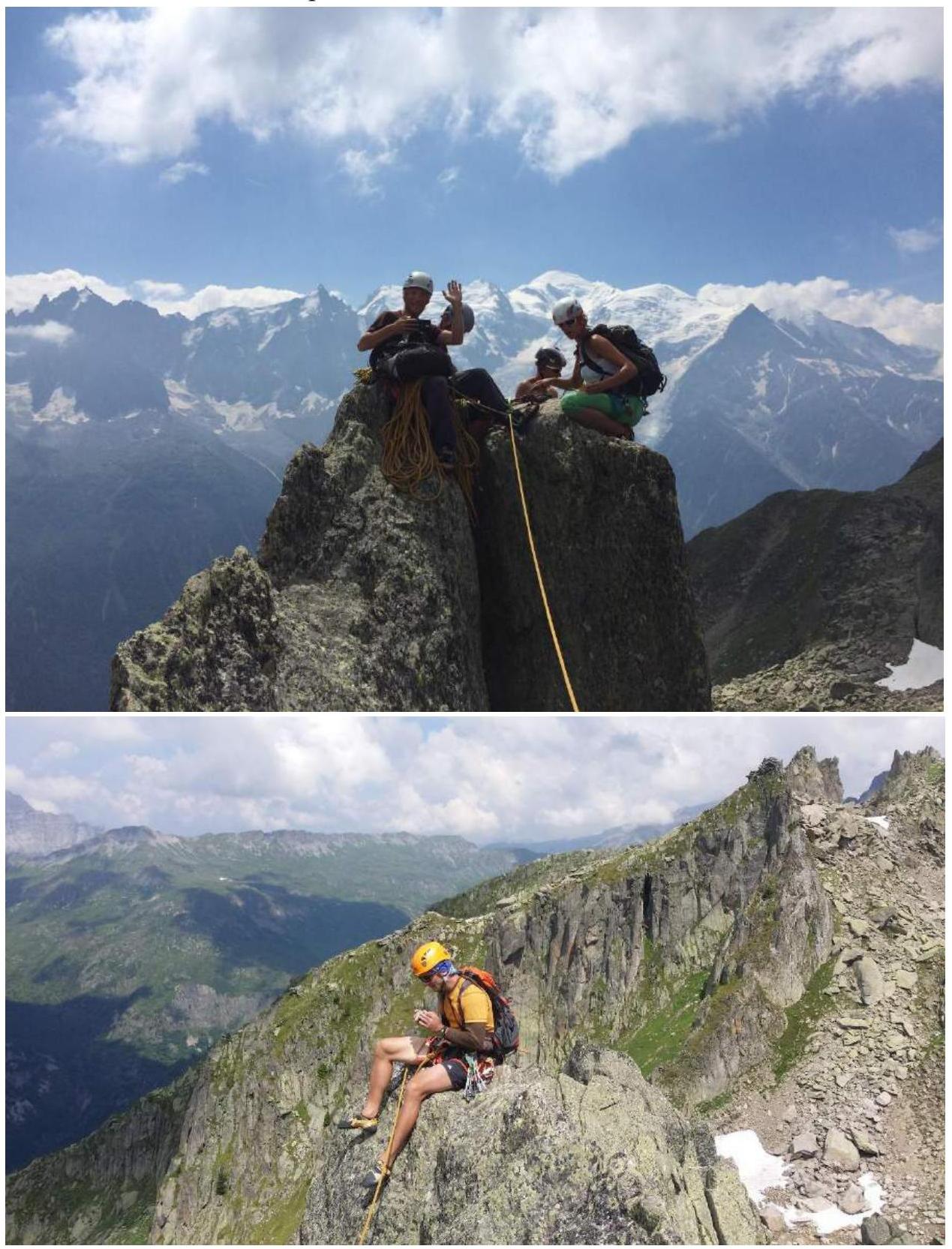
3.3. The route cannot be considered rockfall-prone, but loose rocks are present. The route is within cellular coverage.
The Clocher de planpraz summit is quite small, only one rope team can comfortably be there. It is also worth being prepared for the fact that there is a much more popular route, Cocher-Cochon, on this summit, which many groups ascend, and there is only one rappel from the summit.
The rappel goes along a vertical wall to a large, visible ledge.
Compared to classified routes of the same category of difficulty, this route is:
- more accessible in terms of convenience and approach time,
- technically more challenging for ascent.
Considering the height of the ascent, we preliminarily assess the route as 2B.


