REPORT
ON ASCENDING GROSSGLOCKNER PEAK (Alps, Austria) VIA KLEINGLOCKNER TRAVERSE ROUTE (“Classic”) CATEGORY 2A ROUTE BY CSKA im Demchenko TEAM (Moscow) ON 15.08.2018
I. Climbing Report
| № | 1. General Information | |
|---|---|---|
| 1.1 | Full name, sports rank of the leader | Yurkin A.V. MS, instructor 2nd category |
| 1.2 | Full name, sports rank of participants | Mrdulash P. badge |
| 1.3 | Full name of coach | Yurkin A.V. |
| 1.4 | Organization | CSKA im Demchenko, Moscow |
| 2. Characteristics of the Climbing Object | ||
| 2.1 | Region | Austria, Alps |
| 2.2 | Valley | |
| 2.3 | Section number according to the 2013 classification table | 10.3 |
| 2.4 | Name and height of the peak | Grossglockner 3798 m |
| 2.5 | Geographical coordinates of the peak (latitude/longitude), GPS coordinates | 47.07453° N / 12.69389° E |
| 3. Characteristics of the Route | ||
| 3.1 | Route name | |
| 3.2 | Proposed category of difficulty | 2A |
| 3.3 | Degree of route development | First ascent on 28.07.1800 by Martin Reicher, Mathias Hautzendorfer |
| 3.4 | Character of the route terrain | combined |
| 3.5 | Elevation gain of the route (data from altimeter or GPS) | Elevation gain from Stüdlhütte hut: 996 m |
| 3.6 | Route length (in meters) | 3000 m to Erzherzog-Johann-Hütte hut, 730 m from Erzherzog-Johann-Hütte hut to the peak. Total length 3730 m |
| 3.7 | Technical elements of the route (total length of sections with different difficulty categories and terrain type: ice-snow, rock) | Category I: ice/rock/combination – 3500 m. Including 1500 m of closed glacier travel. Category II: ice/rock/combination – 195 m. Category III: ice/rock/combination – 15 m. Category IV: ice/rock/combination – 20 m. |
| 3.8 | Descent from the peak | Same route as ascent |
| 3.9 | Additional route characteristics | Water is present on the route |
| 4. Characteristics of Team Actions | ||
| 4.1 | Time taken (team's walking hours, in hours and days) | 6 hours ascent, 4 hours descent to the hut |
| 4.2 | Overnight stays | Stüdlhütte hut (2802 m) |
| 4.3 | Start of the route | 05:30 15.08.2018 |
| 4.4 | Reaching the peak | 11:30 15.08.2018 |
| 4.5 | Return to base camp | 15:30 at the hut on 15.08.2018 |
| 5. Person Responsible for the Report | ||
| 5.1 | Full name, e-mail | Yurkin A.V. S2_aleks@mail.ru |
II. Climbing Description
1. Characteristics of the Climbing Object
1.1. General photo of the peak.
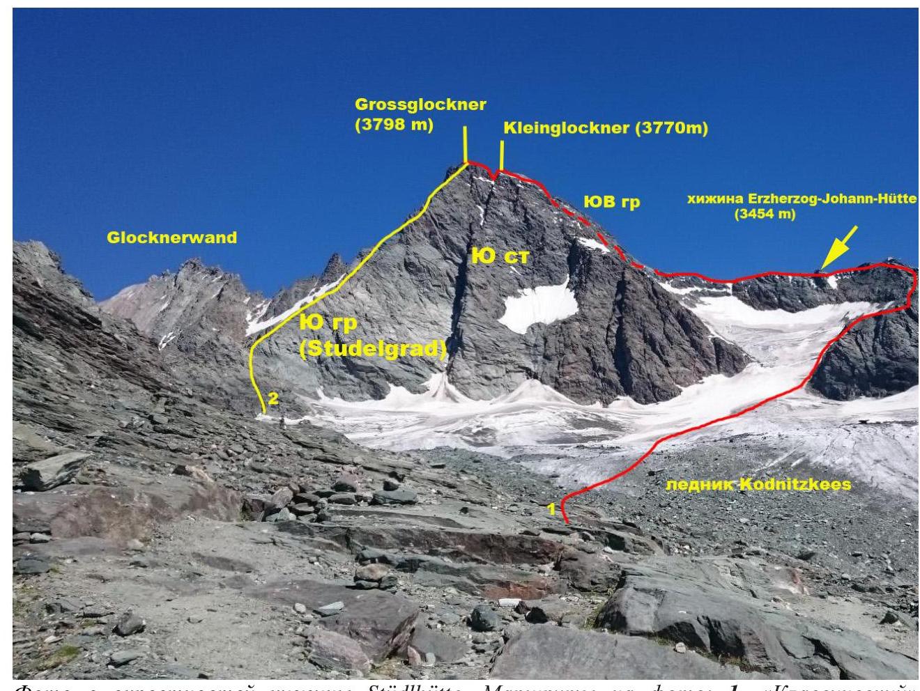
Photo from the vicinity of Stüdlhütte hut. Routes in the photo: 1. "Classic" route to Grossglockner via Kleinglockner 2A, 2. Route via South Ridge (Studelgrad) 3A–3B.
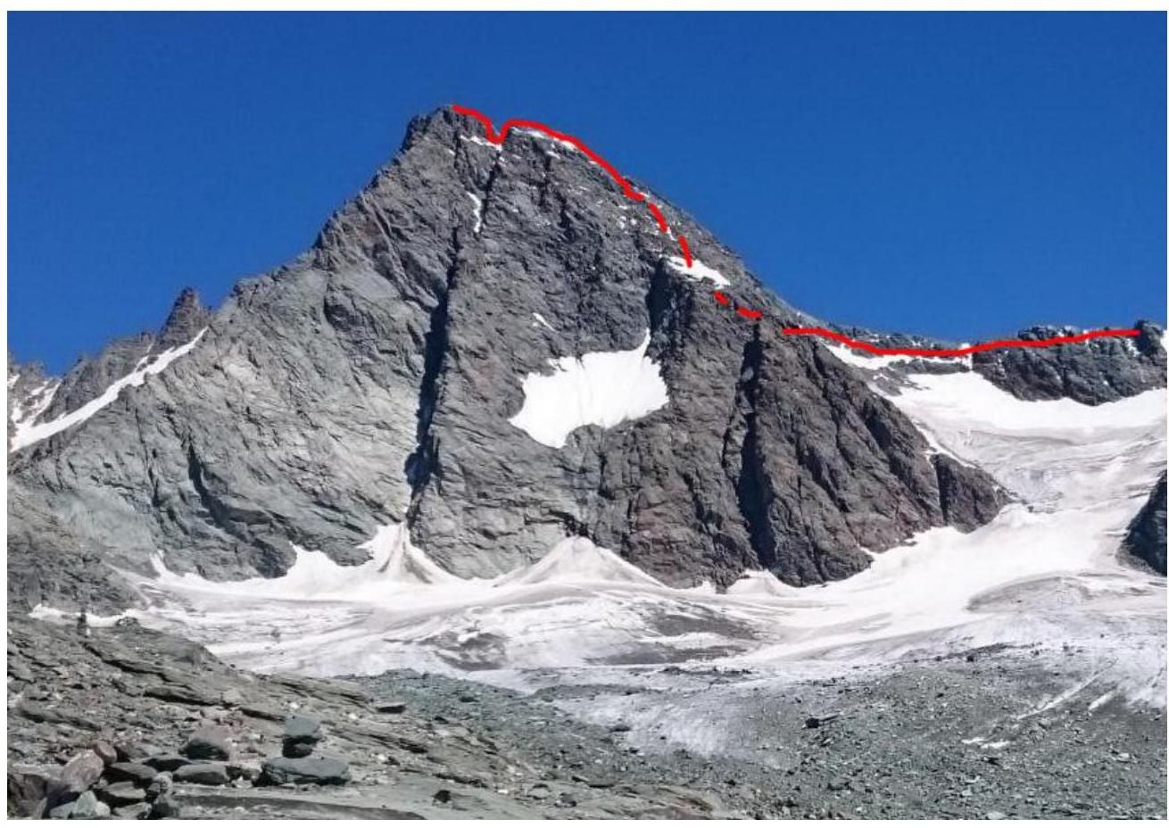
1.2. Photo of the route profile (upper part)
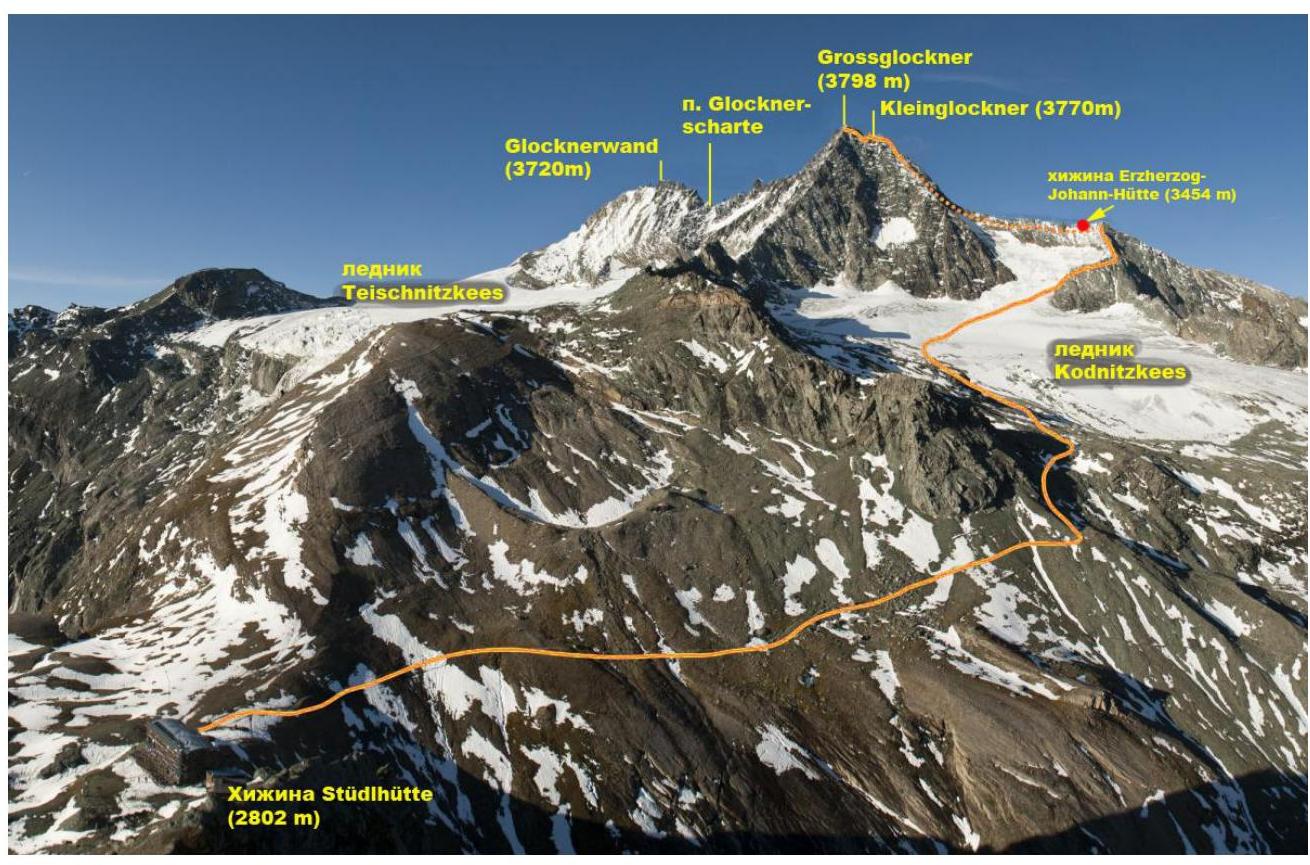
1.3. Panoramic photo of the area
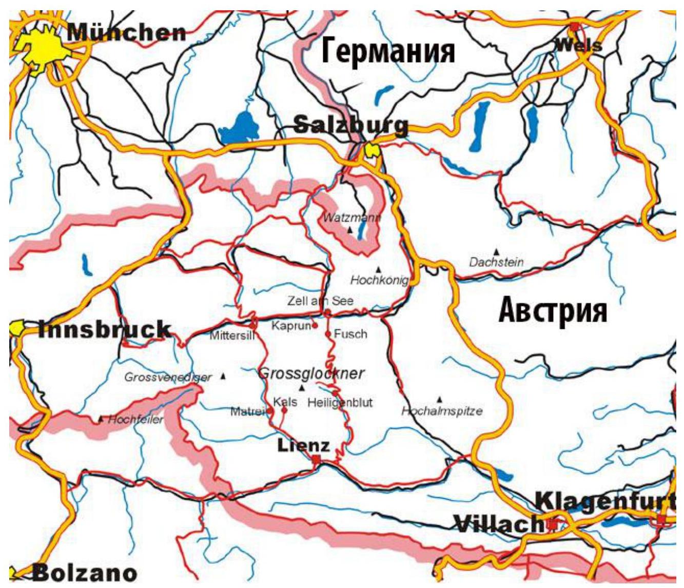
1.4. Map of the area
Approach Description
The ascent to Austria's highest peak began from Stüdlhütte hut (2802 m). To reach the hut, we started from the village of Kals. From the parking lot near the hotels, we walked up the valley along a dirt road to Luckerhütte hut (2241 m), then followed a well-marked trail to Stüdlhütte hut (3 hours).
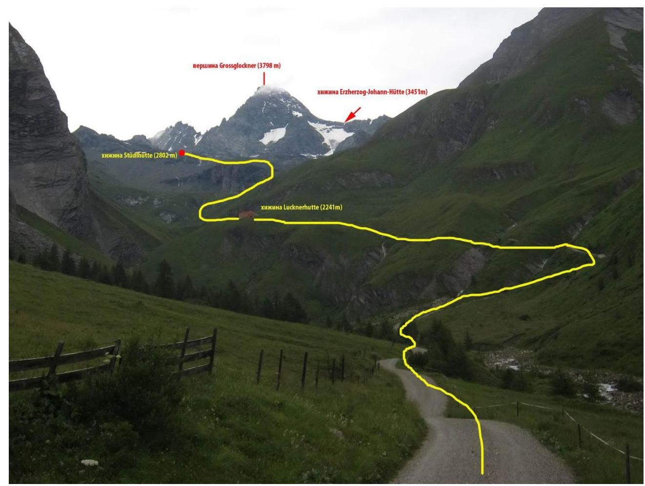
Approach to Stüdlhütte hut
2. Characteristics of the Route
2.1. Technical photo of the route
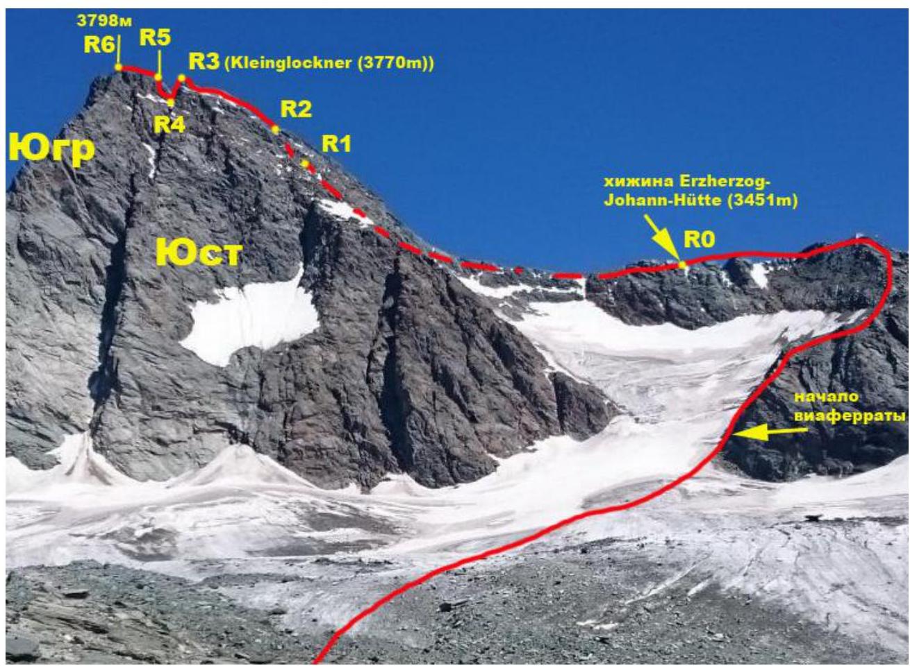
Technical photo of the route. Photo taken from the South.
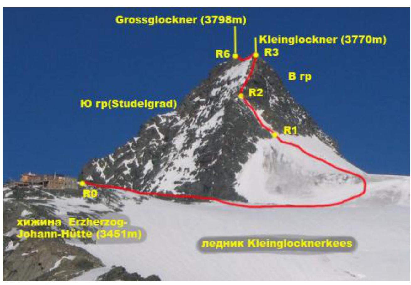
Technical photo of the route. Photo taken from the East.
2.3. Technical characteristics of route sections
From the hut, we moved upwards towards Kodnitzkees glacier along a good trail to the beginning of the moraine (1 km). Then we traversed the glacier to the "leg" of Grossglockner's Southeast Ridge. Caution! Crevasses! We approached the rocks at the start of the via ferrata. The transition from the glacier to the rocks may be challenging due to a randkluft. We followed the via ferrata (500 m) upwards to the ridge and then to Erzherzog-Johann-Hütte hut. 2.5–3 hours (3 km from hut to hut).
| Section № | Terrain type | Difficulty category | Length, m | Type and number of anchors |
|---|---|---|---|---|
| R0–R1 | Snow-ice | I | 500 | Self-arrest with ice axes in the upper part |
| R1–R2 | Rocks-snow-ice | II | 70 | Simultaneous movement, possible belay with ice axe and anchors in the upper part |
| R2–R3 | Rocks | II | 100 | Simultaneous movement, some sections with alternate belay, anchors and rock features for protection |
| R3–R4 | Rocks | III | 15 | Alternate belay, anchors and rock features for protection |
| R4–R5 | Rocks | IV | 20 | Alternate belay, anchors, and rock features for protection |
| R5–R6 | Rocks | II | 25 | Alternate belay with anchors |
3. Characteristics of Team Actions
3.1. Brief description of route completion.
From the hut, we moved upwards towards Kodnitzkees glacier along a good trail to the beginning of the moraine (20 minutes). Then we traversed the glacier to the "leg" of Grossglockner's Southeast Ridge. Caution! Crevasses! We approached the rocks at the start of the via ferrata. The transition from the glacier to the rocks may be challenging due to a randkluft. We followed the via ferrata (500 m) upwards to the ridge and then to Erzherzog-Johann-Hütte hut. 2.5–3 hours, 3 km from hut to hut.
| Section № | Description | Photo № |
|---|---|---|
| R0–R1 | From Erzherzog-Johann-Hütte hut, move along the right side of the ridge and then towards a large snow-filled couloir. Snow-ice II 500 m 45° | |
| R1–R2 | Up the couloir to a ridge saddle. Metal anchors for protection in the upper part. Snow-ice II 70 m 50° | |
| R2–R3 | From the ridge saddle, move up diagonal slabs towards Kleinglockner peak (3770 m) II 100 m 35° | |
| R3–R4 | Descend from the peak to the saddle towards Grossglockner. III 15 m 60° | |
| R4–R5 | From the saddle, ascend the wall. Anchors for protection. IV 20 m 60° | |
| R5–R6 | Along the ridge to the peak via easy rocks. Large cross on the summit. II 25 m 30° |
3.2. Photo of the team on the peak with a control tour.
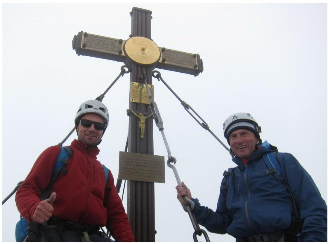
Photo on the peak.
3.3. Safety assessment of the route.
The route is very popular in the area. Therefore, during the season, there are many people, which creates some difficulties for passage – congestion and the risk of rockfall from preceding groups. The glacier has both open and closed crevasses. Otherwise, the route is relatively safe. The presence of Erzherzog-Johann-Hütte hut (3451 m) under the route and good cellular coverage positively impact safety. If there is snow and ice on the rocks, movement is often done in crampons.
The route can also be climbed from the other side of Grossglockner, from the Pasterze glacier side.
During the season, it is recommended to book huts in advance.
Photo Report
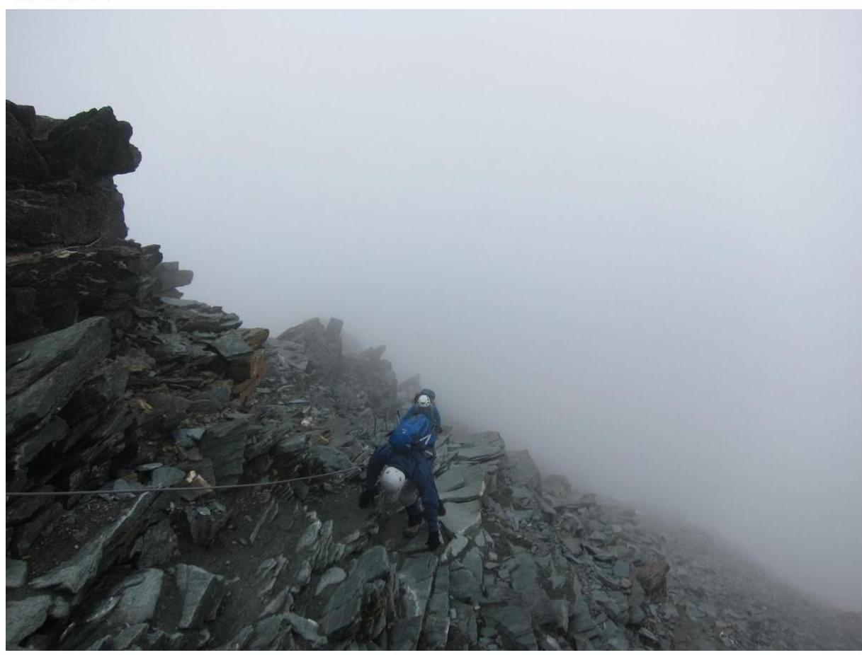
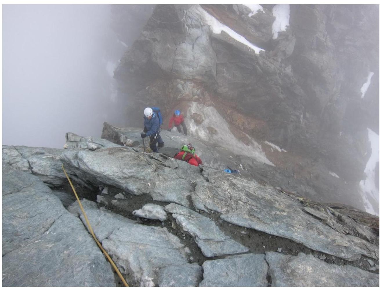
Via ferrata on the approach to Erzherzog-Johann-Hütte hut.
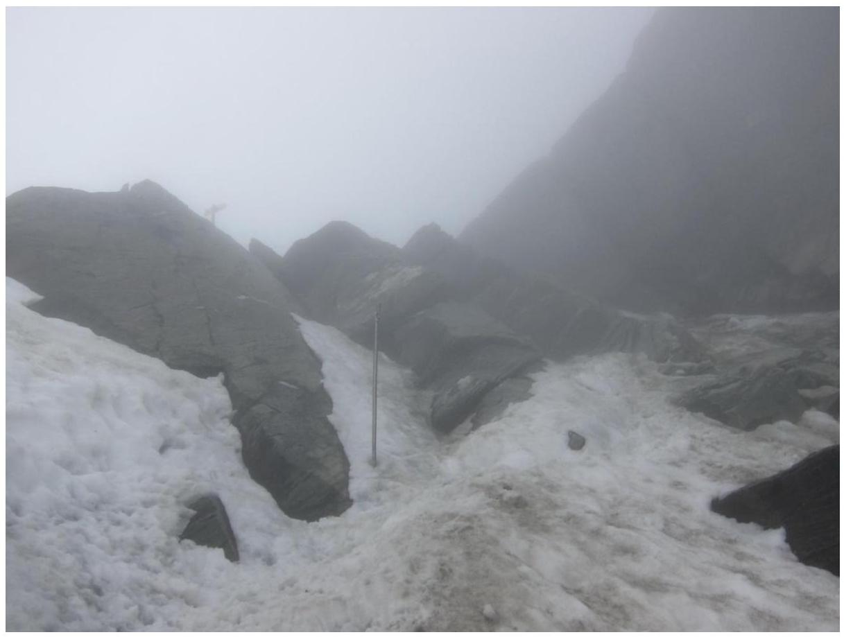
Upper part of the couloir and exit to the ridge (sign visible on the ridge) section R1–R2.
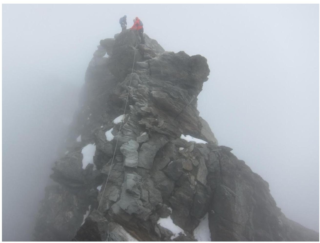
On Kleinglockner peak (section R3–R4). Photo taken from Grossglockner.
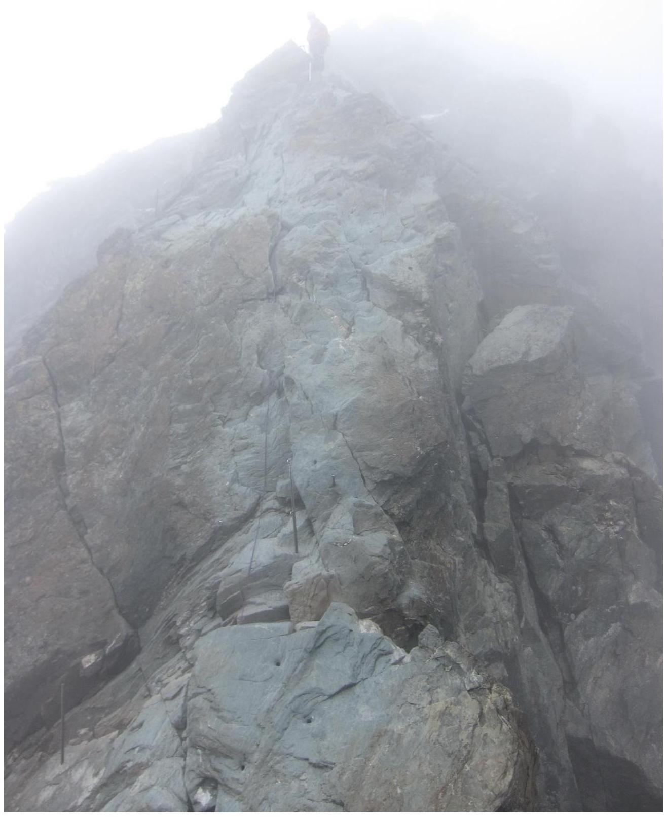
Section R4–R5. Key section of the route. Photo taken from Kleinglockner peak.
Section R4–R5. Photo taken from the middle of the section looking down. The saddle between Gross and Kleinglockner visible.
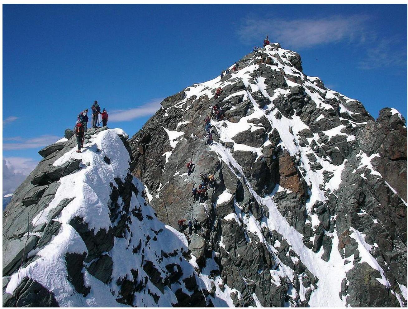
Internet photo. Kleinglockner in the foreground, followed by the saddle and ridge to Grossglockner. A cross is visible on the peak.