Ascent Record
-
Region — Karakoram, Pakistan.
-
Peak — Great Trango Tower 6150 m, via the right part of the NW wall.
-
Claimed grade — 6B, first ascent.
-
Route characteristic — rock.
-
Route description:
- wall section height difference — 1820 m
- route length — 2100 m
- length of 6th category sections — 850 m, 5th category — 1025 m
- average steepness of the entire route — 70°
-
Equipment left on the route: total left on descent — 40 pitons, including 6 bolts. Used: 6 stationary bolts (on descent). Including for ITO — 0, removable bolts — 0. Total ITO used: — 150 pitons and chocks + about 200 "fif" ITO.
-
Climbing hours — 66. Days — 6. Total climbing hours: ascent — 66, descent — 12.
-
Team leader: Aleksandr Ivanovich Mikhalitsin (MS). Team members: Evgeny Valerievich Belyaev (CMS), Igor Aleksandrovich Loginov (CMS), Alexey Sergeevich Komissarov (CMS).
-
Team coaches:
- Valery Viktorovich Balezin (MCMK)
- Nikolai Nikolaevich Zakharov (MCMK, ZTR)
-
Departure date:
- On the route — at 5:00 on July 7, 2007.
- On the summit — at 10:00 on July 12, 2007.
- Return to Base Camp — at 22:00 on July 12, 2007.
-
Ascent organized by — Agency for Physical Culture and Sports of the Krasnoyarsk Krai Administration.
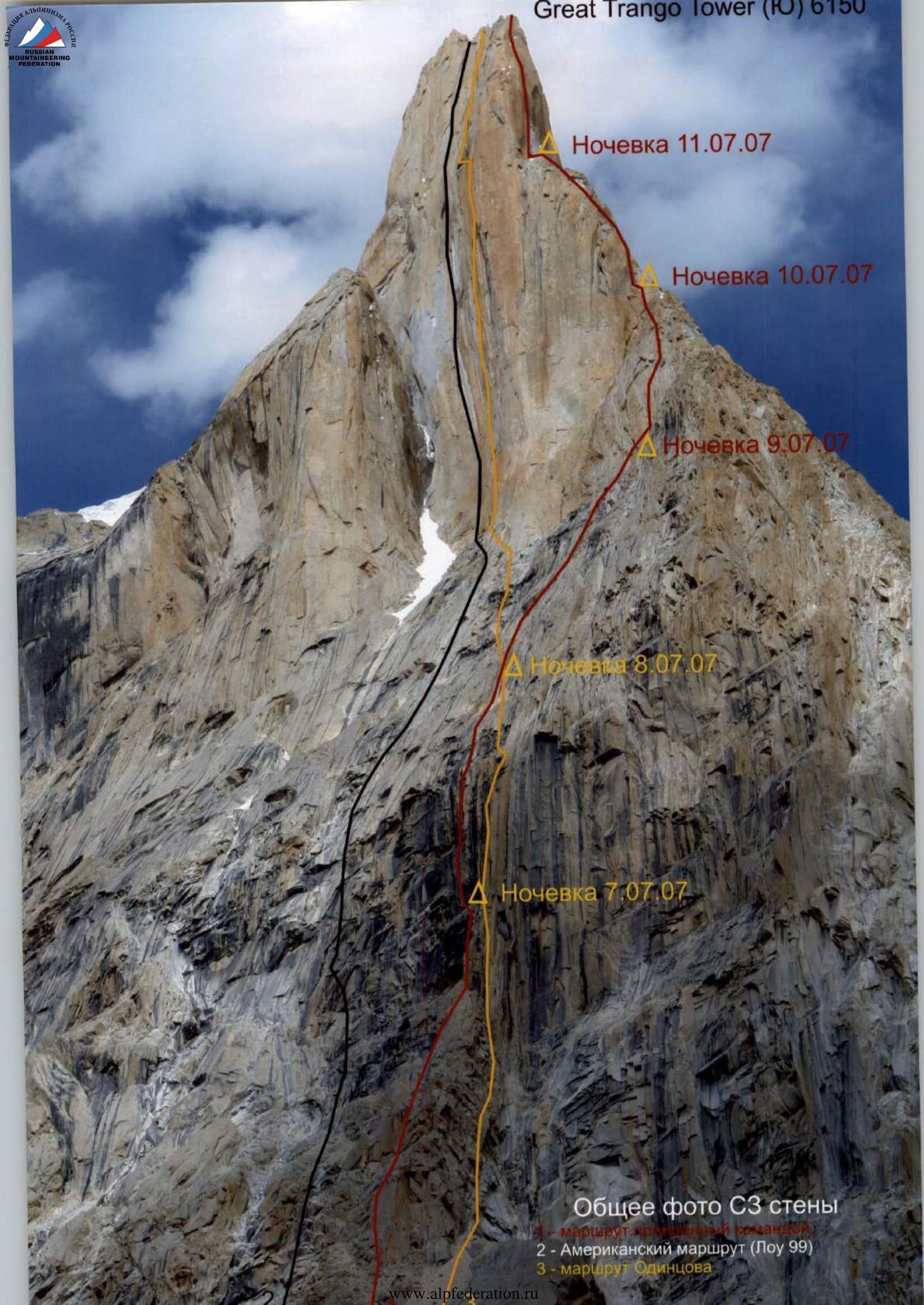
General Information about the Route on Great Trango Tower (S) 6150 m
Overall photo of the NW wall:
- American route (Lowe 99)
- Odintsov's route
View of the route from the left. Iss. 19 Route 1988. Trango Great Tower. In the photo: Trango Great Tower, Trango Little Tower, Nameless Tower, Trango Ri, Monk.
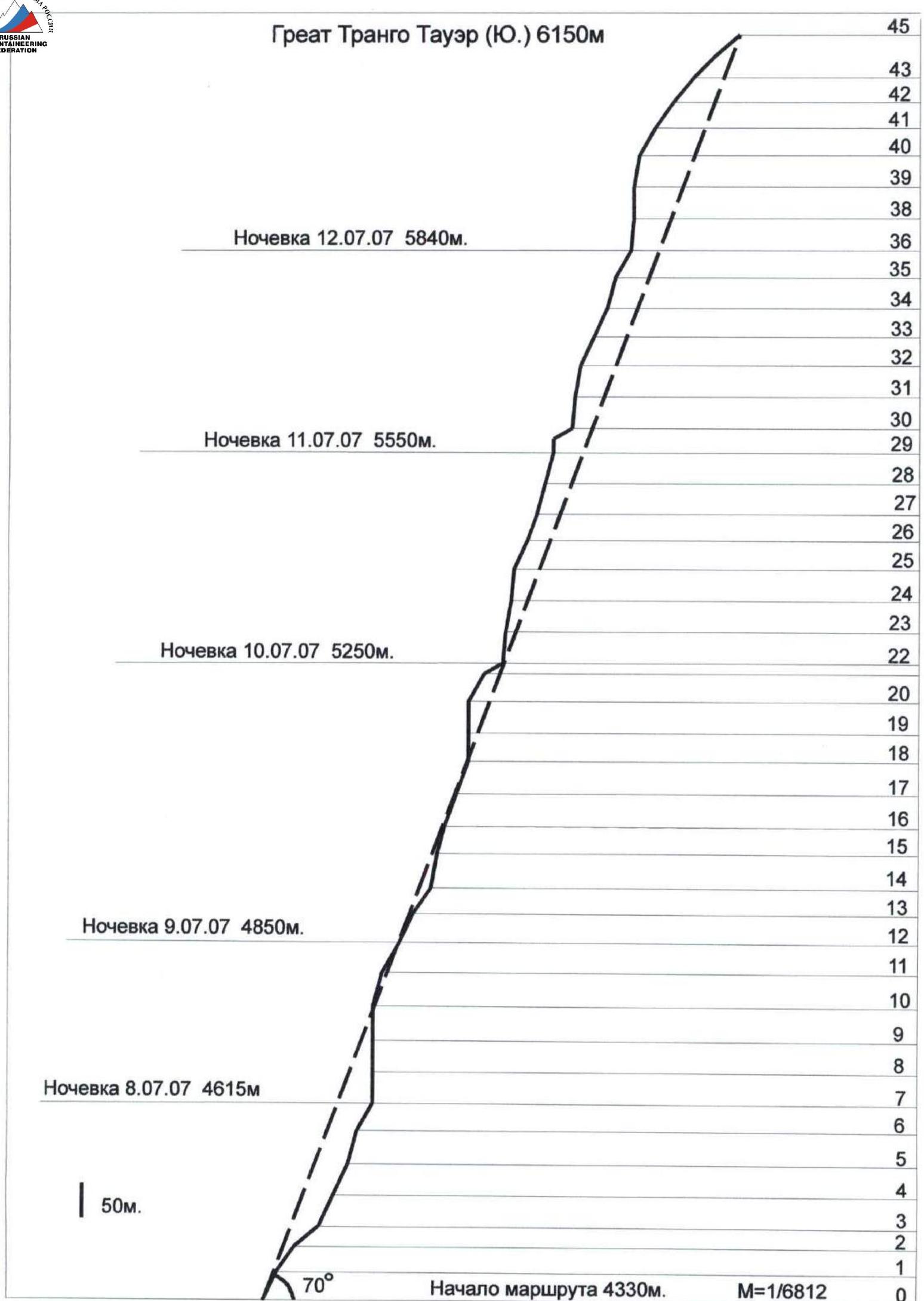


Overnight stay on July 12, 2007, 5840 m. Overnight stay on July 11, 2007, 5550 m. Overnight stay on July 10, 2007, 5250 m. Overnight stay on July 9, 2007, 4850 m. Overnight stay on July 8, 2007, 4615 m. Overnight stay on July 7, 2007, 4615 m. Start of the route, 4330 m. Ascent graph. Total climbing hours: ascent — 66, descent — 12.
Route Diagram
| Pitch # | Chocks | Pitons (anchors) | Fif | Section | Description / Category (difficulty) | Length (m) | Steepness (°) |
|---|---|---|---|---|---|---|---|
| R12 | Overnight stay on a platform | ||||||
| 11 | 4 | 1 | R11 | 5 | 50 | 60 | |
| 10 | 4 | 4 | 4 | R10 | 5+ | 50 | 75 |
| 9 | 8 | 5 | 8 | R9 | Wet chimney, 6, A3 | 50 | 90 |
| 8 | 8 | 5 | 6 | R8 | 6, A2 | 45 | 90 |
| 7 | 11 | 4 | 8 | R7 | 6, A2 | 45 | 90 |
| Overnight stay on a platform | 30 | 45 | |||||
| 6 | 5 | 2 | 4 | R6 | 6, A1 | 15 | 80 |
| 5 | 7 | 3 | 3 | R5 | 5+ | 50 | 75 |
| 4 | 6 | 2 | R4 | 5 | 50 | 65 | |
| 3 | 3 | 3 | R3 | 5 | 50 | 65 | |
| 2 | R2 | 2 | 45 | 40 | |||
| 1 | 1 | 1 | R1 | 4 | 45 | 55 | |
| 0 | 3 | 1 | R0 | 5 | 45 | 65 | |
| 23 | 9 | 8 | 6 | R24 | 6 | 45 | 80 |
| 22 | 8 | 5 | 6 | R23 | 6 | 45 | 85 |
| 21 | 1 | 11 | R22 | Large comfortable ledge for overnight stay, 1 | 30 | 30 | |
| 20 | 4 | 6 | R21 | 5 | 45 | 60 | |
| 19 | 8 | 11 | 10 | R20 | 6, A2 | 45 | 90 |
| 18 | 13 | 5 | 14 | R19 | 6, A3 | 45 | 90 |
| 17 | 3 | 3 | R18 | 5 | 50 | 70 | |
| 16 | 6 | 3 | 4 | R17 | 5+ | 50 | 70 |
| 15 | 7 | 6 | 8 | R16 | 6 | 40 | 75 |
| 14 | 4 | 3 | 2 | R15 | 5+ | 50 | 80 |
| 13 | 2 | 1 | R14 | 4 | 45 | 55 | |
| 12 | 3 | 2 | R13 | 5 | 45 | 65 | |
| R36 | Ledge for a tent | ||||||
| 35 | 11 | 1 | R35 | 5+ | 45 | 60 | |
| 34 | 11 | 2 | 4 | R34 | 6 | 45 | 75 |
| 33 | 8 | 1 | 6 | R33 | 5, A0 | 45 | 65 |
| 32 | 8 | 2 | 11 | R32 | 5+, A1 | 45 | 65 |
| 31 | 11 | 2 | 4 | R31 | 6 | 45 | 80 |
| 30 | 12 | 5 | 4 | R30 | 6, A1 | 45 | 85 |
| 29 | 3 | 7 | 6 | R29 | Ledge for a tent, 6 | 20 | 90 |
| 28 | 12 | 4 | 11 | R28 | 6, A1 | 45 | 75 |
| 27 | 6 | 3 | 4 | R27 | 5+ | 45 | 75 |
| 26 | 6 | 3 | R26 | 5 | 40 | 70 | |
| 25 | 10 | R25 | 5 | 45 | 65 | ||
| 24 | 12 | 3 | 11 | R24 | 6, A2 | 45 | 85 |
| 44 | 3 | R45 | 4 | 45 | 40 | ||
| 43 | 5 | 1 | R44 | 5– | 45 | 45 | |
| 42 | 5 | 1 | R43 | 5 | 45 | 50 | |
| 41 | 5 | 1 | R42 | 5 | 45 | 55 | |
| 40 | 7 | 1 | 9 | R41 | 5+, A1 | 45 | 60 |
| 39 | 24 | 2 | 9 | R40 | 6, A2 | 45 | 80 |
| 38 | 24 | 17 | 15 | R39 | 6, A3 | 45 | 90 |
| 37 | 19 | 14 | 16 | R38 | 6, A3 | 45 | 85 |
| 36 | R37 | 5 | 45 | 65 | |||
| Total: chocks — 304, pitons (anchors) — 157, fif, skyhooks — 206. | |||||||
| Descent with traverse to the left under the crack. |
Photos of Route Sections
Technical photo of the route. Start of the route, 4330 m.
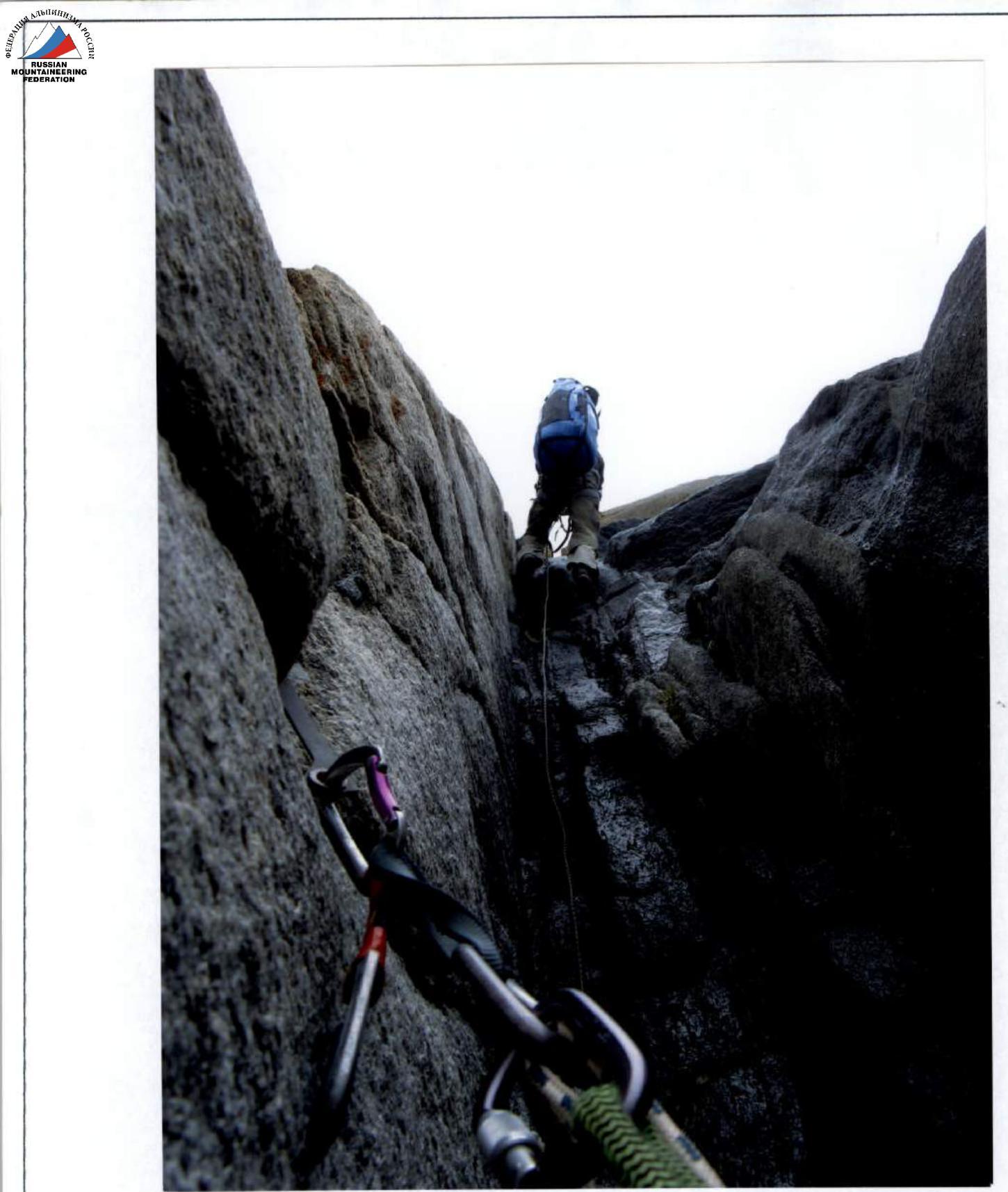
Start of section R5–R6.
Start of section R7–R8.
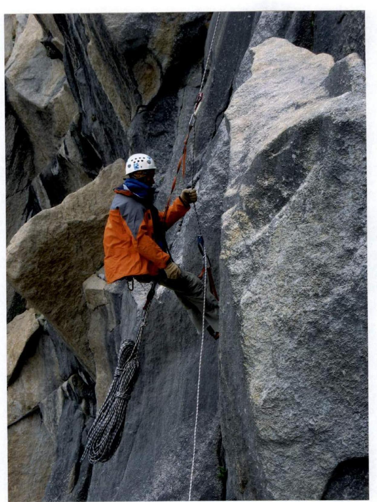
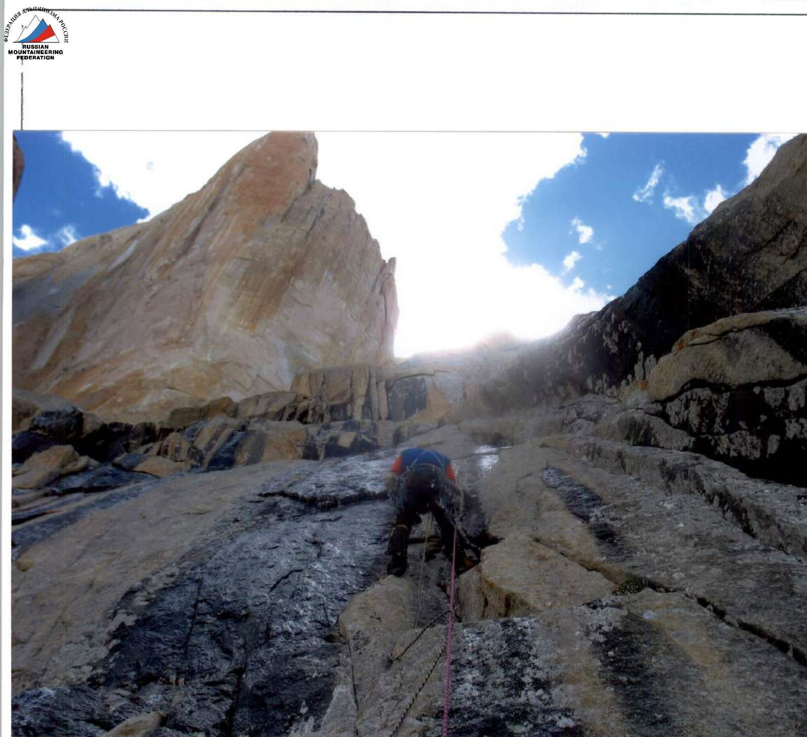
View from above on section R7–R8.
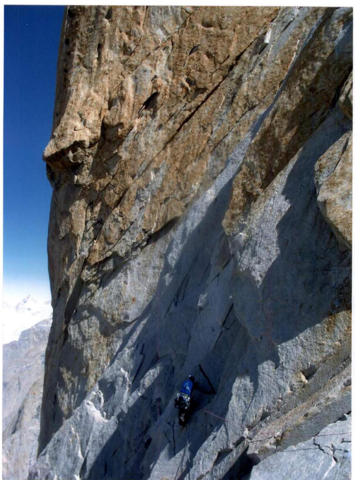
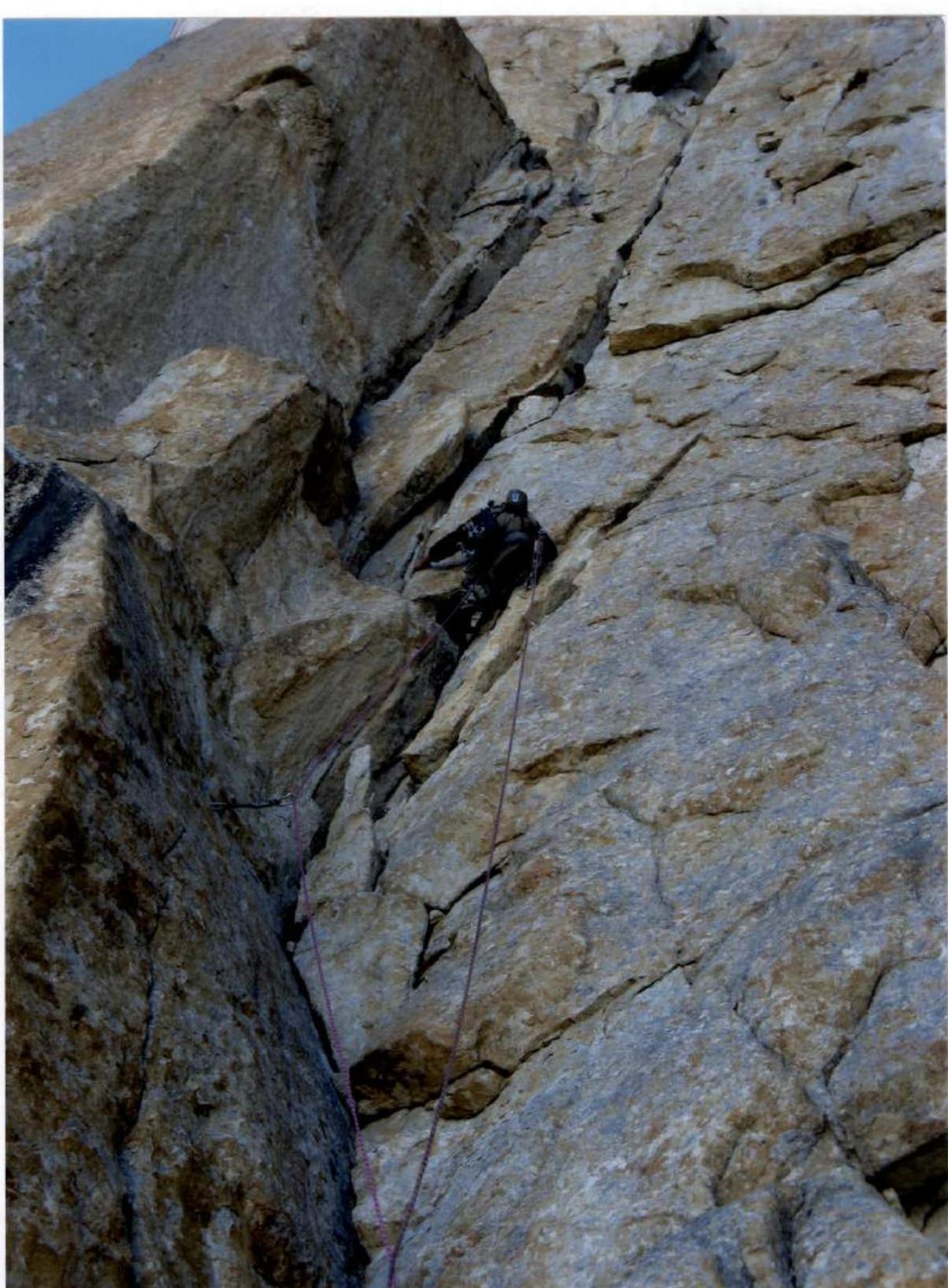
Section R8–R9.
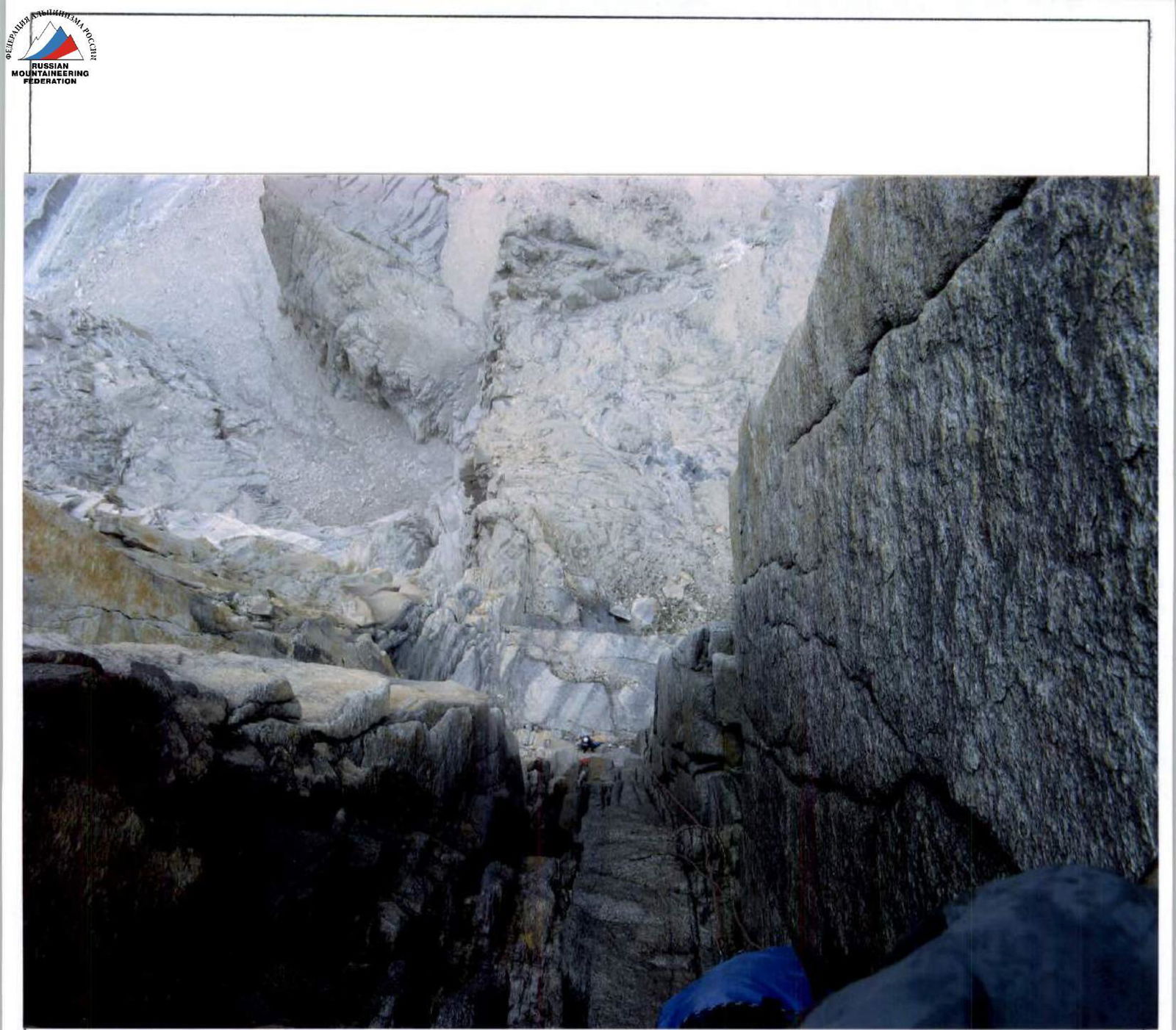
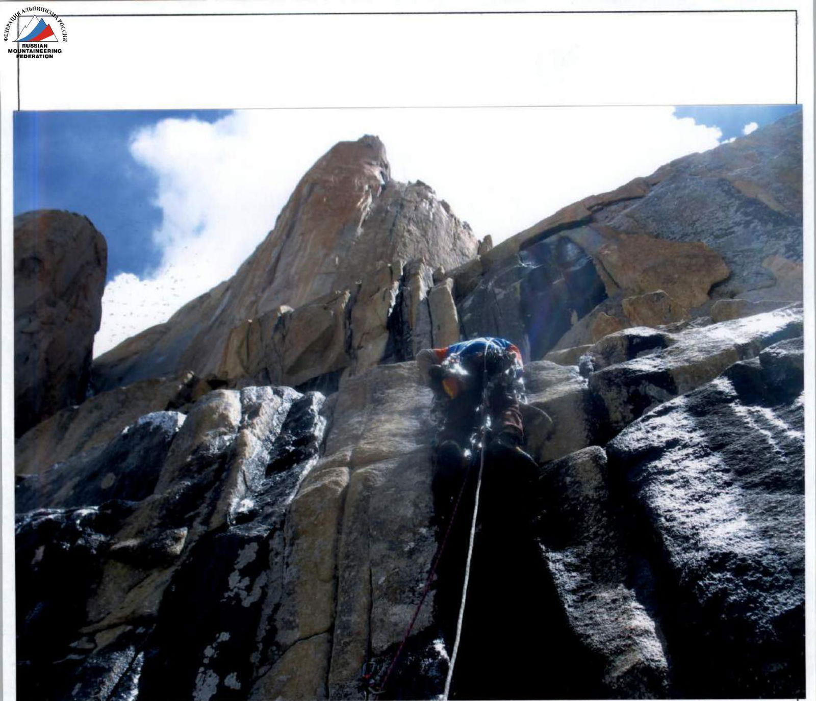
Entering the chimney — section R9–R10 (shot from below with a telephoto lens).
Upper part of section R9–R10.
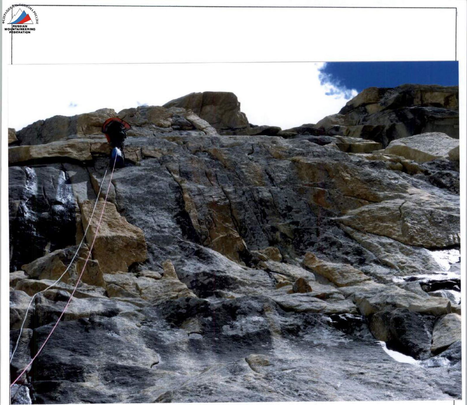
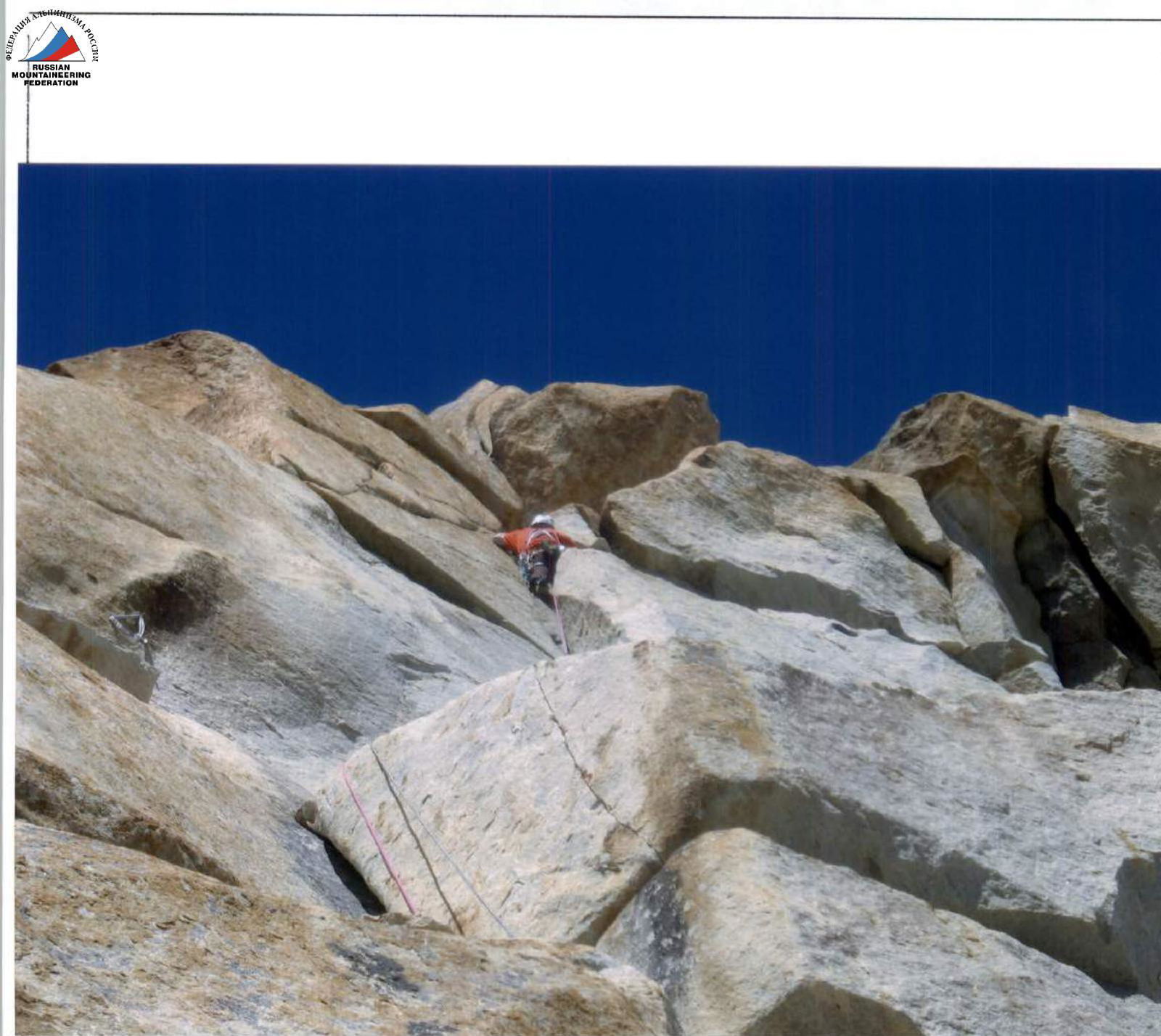
Section R13–R14.
Section R15–R16.
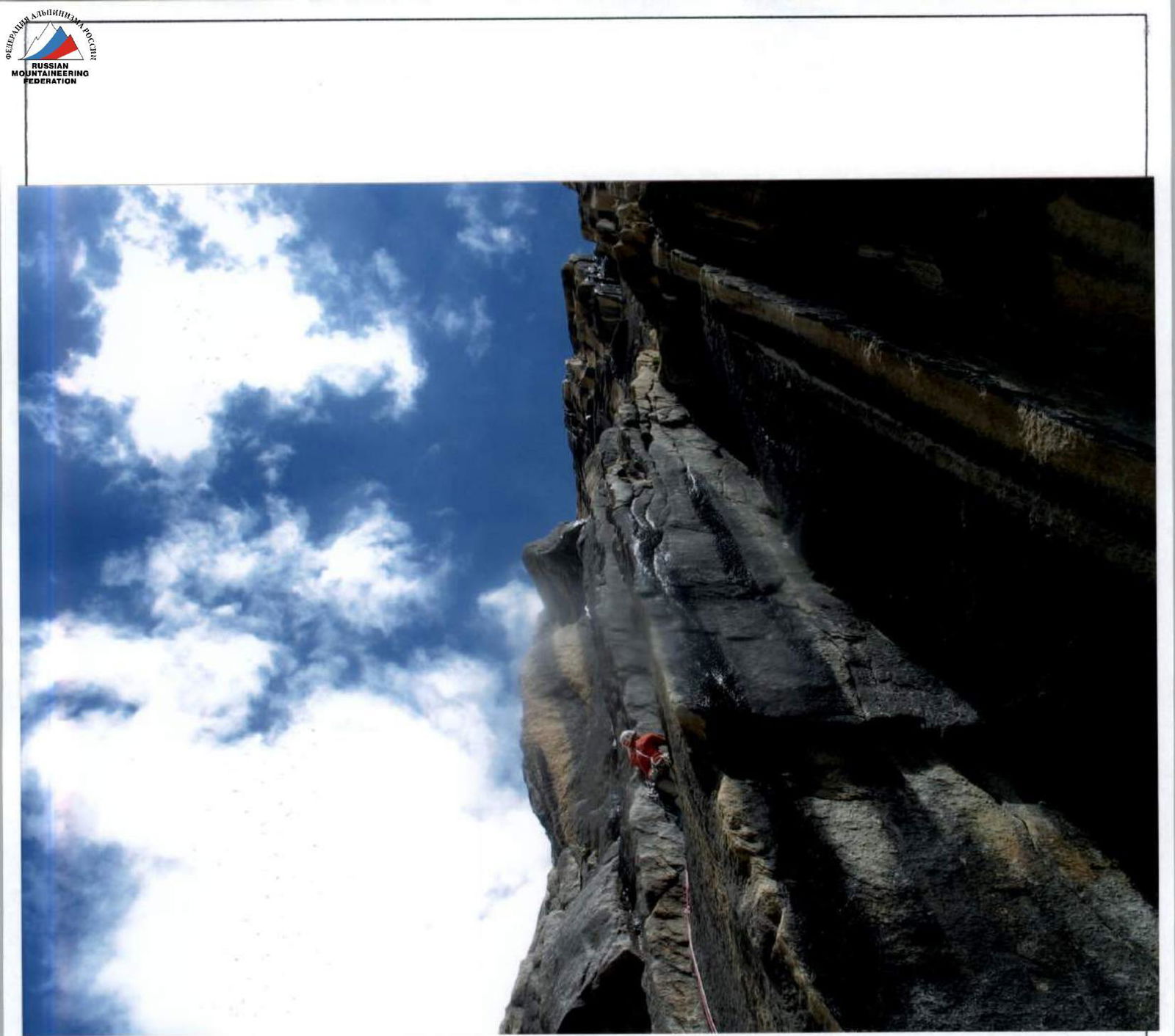
Movement on fixed ropes on section R18–R19.
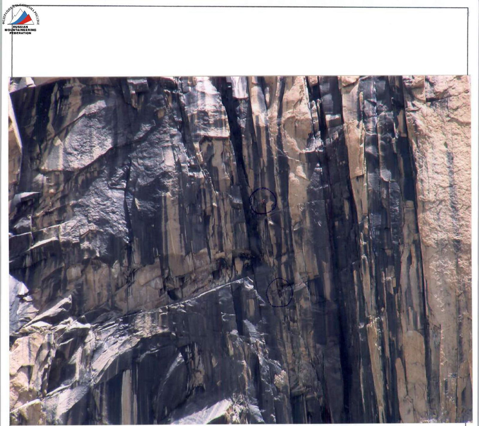
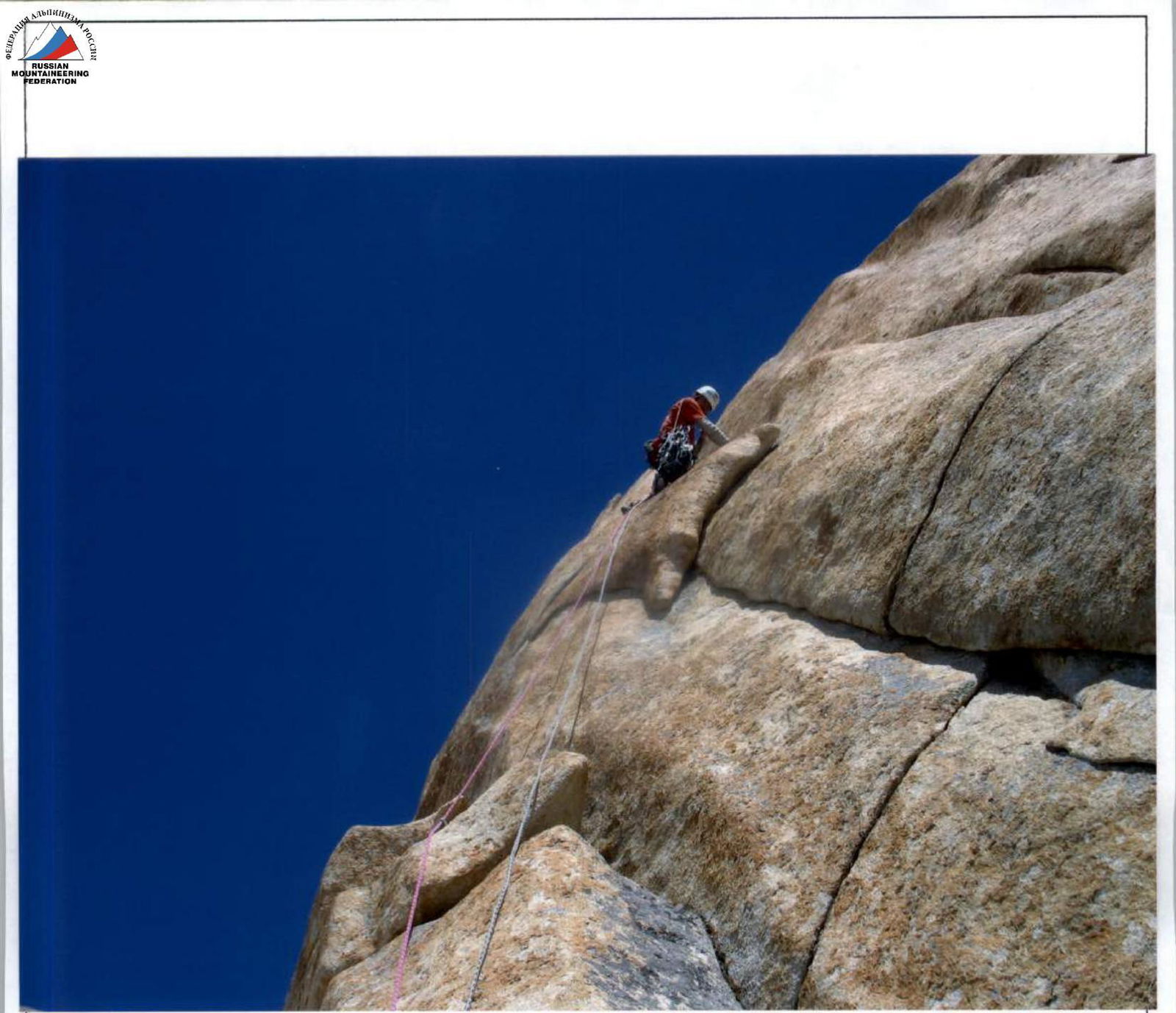
Start of section R22–R23.
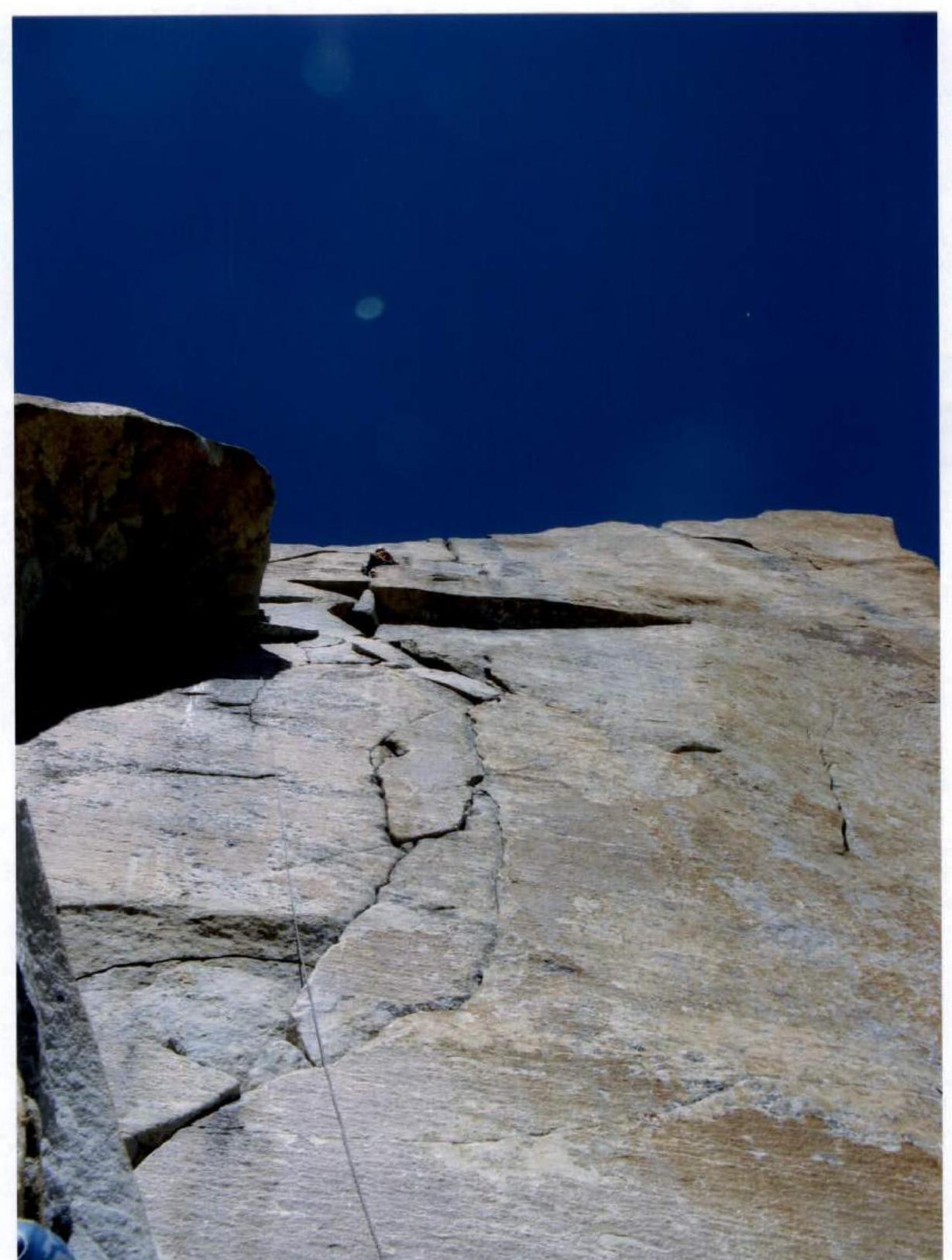
Section R27–R28.
Section R28–R29, exit to overnight stay.
Section R30–R31.
Section R31–R32.
Section R36–R37. Traverse to the left under the crack.