
Russian Championship. High-altitude class.
Report
on the ascent to Latok III (6949 m)
Route on the left part of the SW wall. 6B cat. diff.
Ascent Passport
-
Region 10.2 Karakoram mountains.
-
Latok III 6949 m, via left part of SW wall.
-
6B complexity category.
-
Route type: combined.
-
Route characteristics:
elevation gain — 2390 m, wall section elevation gain — 2200 m, route length — 2690 m, wall section length — 2390 m, average steepness of the wall section — 70°. Section lengths by category:
- 5th cat. diff. — 1545 m
- 6th cat. diff. — 815 m
-
Equipment used on the route:
rock anchors (protection gear, ice screws, piton anchors): 369 (rock), 176 (protection), 65 (ice), 8 (piton). Previously left rock anchors — 4 (3 removed), piton anchors — 8. No personal gear was left behind.
-
Climbing hours — 124 h.
-
Overnight stays: all on platforms.
-
Group composition:
| Role | Name | Rank |
|---|---|---|
| 1. leader | Odintsov A.N. | ISMC |
| 2. participant | Dmitrenko E.V. | MC |
| 3. participant | Lonchinsky A.S. | MC |
| 4. participant | Dождев I.V. | CMS |
-
Coach: Odintsov A.N.
-
Approach to the route — June 10, 2011.
Summit — June 25, 2011. Return to base camp — June 27, 2011.
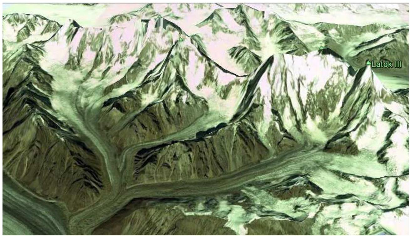
Geographic Description of the Region
The Latok group is a small cluster of steep mountain peaks in the Panmah Muztagh range, part of the Karakoram mountain system in Pakistan. They are located east of the Ogre group, with Baintha Brak (Ogre) being the highest peak. Directly south of the Latok peaks lies the Baintha Lukpar glacier, a small tributary of the Biafo glacier, one of the largest glaciers in the Karakoram. To the north lies the Choktoi glacier. The group consists of four main peaks:
- Latok I, north-central, 7145 m, first ascent 1979.
- Latok II, west, 7108 m, first ascent 1977.
- Latok III, east, 6949 m, first ascent 1979.
- Latok IV, southeast, 6456 m, first ascent 1980.
Route profile.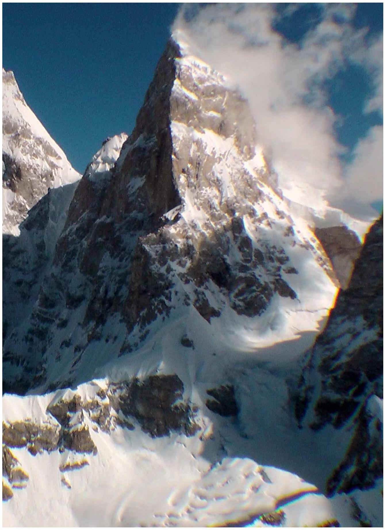
Profile of the route.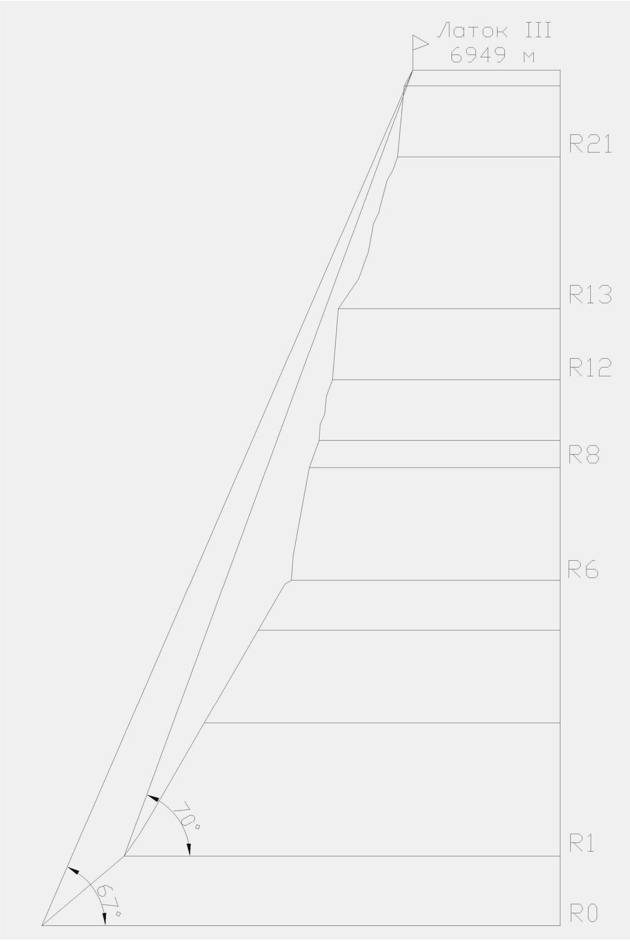
Route thread.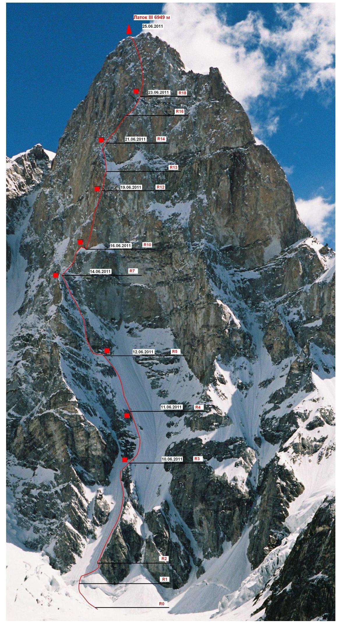
Route Description
R0–R1: Moving up on firm snow until it levels out under the bergschrund. 300 m. II cat. diff. 45°.
R1–R2: Overcoming the bergschrund directly. Then, moving up and to the right, we proceed along a wide couloir under the overhanging bastion. Ice, firn. 90 m. IV–V cat. diff. 50–60°.
R2–R3: Moving along snow and ice beside the rock bastion, with protection and stations on rock. 500 m. V cat. diff. 55–65°.
R3–R4: Entering a wider couloir in the center of the wall. Moving on ice and firn, with protection and stations on ice screws. 400 m. V cat. diff. 55–65°.
R4–R5: Moving towards a distinctive "tiger cub" rock. Ice, firn, sometimes mixed terrain on rock. 200 m. V cat. diff. 55–65°.
R5–R6: Traversing along an inclined rock shelf, along a rock slab, to the entrance of the right part of the couloir. 20 m. II cat. diff. 30°. Up the right side of the couloir, moving up via internal corners and small walls. Movement is challenging due to thin, unreliable ice and snow cornices. 80 m. V–VI+ cat. diff., A2, 80–90°.
R6–R7: Up a frozen vertical wall to the right until the couloir levels out. 40 m. VI cat. diff., A2, 90°. Then, on ice and firn, exiting onto the ridge, with protection on ice screws and rock. 300 m. V cat. diff. 60–75°.
R7–R8: Along the ridge, up and to the right, under a rock wall. 100 m. V cat. diff. 60–75°.
R8–R9: Passing the rock wall directly and reaching a snow-ice slope below the left "tent". 45 m. VI cat. diff., A2, 85°.
R9–R10: Up the snow-ice slope to the top of the left "tent". 45 m. V cat. diff. 65°.
R10–R11: From the top of the "tent", rapelling 30 m to the right, to the start of an internal corner. Up the corner, sometimes transitioning to the wall on the left, to a small ledge. 50 m. VI cat. diff., A2, 85°.
R11–R12: Further up the wall to a frozen chimney. Exiting the chimney onto a comfortable ledge. 50 m. VI cat. diff., A2, 85°.
R12–R13: Along the ledge, 5 m to the right. Then, up and to the right via a series of walls, exiting onto a snow patch "tomahawk". 200 m. VI cat. diff., A2, 85°.
R13–R14: Moving along the snow patch, along rocks, to the mixed terrain at the top of the patch. 140 m. V cat. diff. 50–60°.
R14–R15: Up snow-covered vertical rocks, moving towards abandoned anchors and a platform, then to the right to an internal corner. 80 m. V+, 70°.
R15–R16: Up the internal corner. Then, via a wall and chimney, exiting onto another snow patch on its right side. 80 m. VI cat. diff., A2, 80°.
R16–R17: Traversing the snowfield up and to the right, under a logical rock wall. 45 m. V cat. diff. 55°.
R17–R18: Up the wall via broken rocks to a vertical internal corner. 60 m. V+, 75°.
R18–R19: Up the internal corner 45 m. VI, A2, 75°. Under the base of the internal corner lies a small ledge.
R19–R20: Further up a rock slab 30 m. VI, A2, 60°.
R20–R21: Up an internal corner, moving up and slightly to the right 40 m. VI, A2, 70°.
R21–R22: Then, via a series of frozen walls, slightly to the right and up 300 m. VI, A2, 80–85°.
R22–R23: 70 m up to the summit via a relatively easy snow slope.
Technical and Tactical Actions of the Team
The trip to Pakistan was planned for late spring to early summer, as the Latok wall is considered safer during this period compared to the summer. Thus, we flew to Pakistan in mid-May to acclimatize upon arrival at the base camp under Latok and start the ascent in early June.
The weather was unstable; we had to stay in platforms for a day, and for another three days, we could barely manage to process one to one and a half ropes per day.
June 7, 2011: Equipment cache under the overhang of the right bastion (R2) and descent to base camp to wait for a weather window. June 9, 2011: Departure to ABC at 16:00. Rest before an early start. June 10, 2011: Rising at 2:00. Departure at 3:00. Passing the couloir (ice, firn) and reaching the overnight stay at 15:00. Snow was soggy, and sometimes thawed rocks passed by. Safe overnight stay at the upper point of the bastion (R3). June 11, 2011: Another early rise and start of movement at dawn. Reaching a safe overhanging rock section by 14:00 (R4). June 12, 2011: Reaching the couloir and setting up camp to the right in a safe location. Managed to process 1.5 ropes above. June 13, 2011: Bad weather. Another 25 m processed. June 14, 2011: Early morning bad weather, but improving by 8:00, deciding to move the camp higher, to the exit from the couloir. Working until dark, having passed 8 ropes (R7). June 15, 2011: Start at 12:00. Hanging 3 ropes to the "tents", preparing a place for the night. June 16, 2011: Moving to the "tents" and processing 2 ropes above (R10). June 17, 2011: Bad weather. Rest proved beneficial; the previous days were eventful. June 18, 2011: Hanging another 4 ropes. Total of 6 ropes above the "tents". June 19, 2011: Moving under the snow patch "tomahawk" (R12). Processing one rope to the exit onto the snow patch. June 20, 2011: Processing the "tomahawk". Hanging 6 ropes. Overnight stay at the same location. June 21, 2011: Moving to the next overnight stay above the "tomahawk". June 22, 2011: Hanging 4 ropes from the overnight stay. June 23, 2011: Bad weather. Moving to the final overnight stay. June 24, 2011: Hanging 5.5 ropes above the overnight stay. June 25, 2011: Breaking away and reaching the summit. June 26, 2011: Beginning descent. Descent to the "tents" (R10). June 27, 2011: Descent. Arrival at ABC at 18:00. Arrival at base camp at 20:00.
Ascent schedule.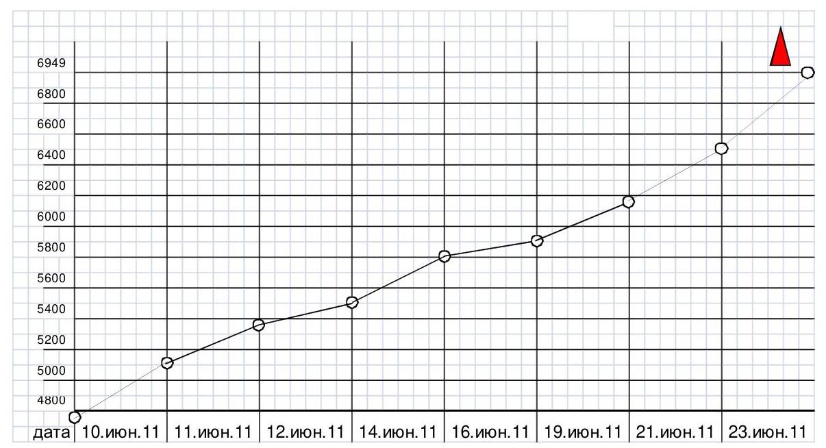
UIAA scheme.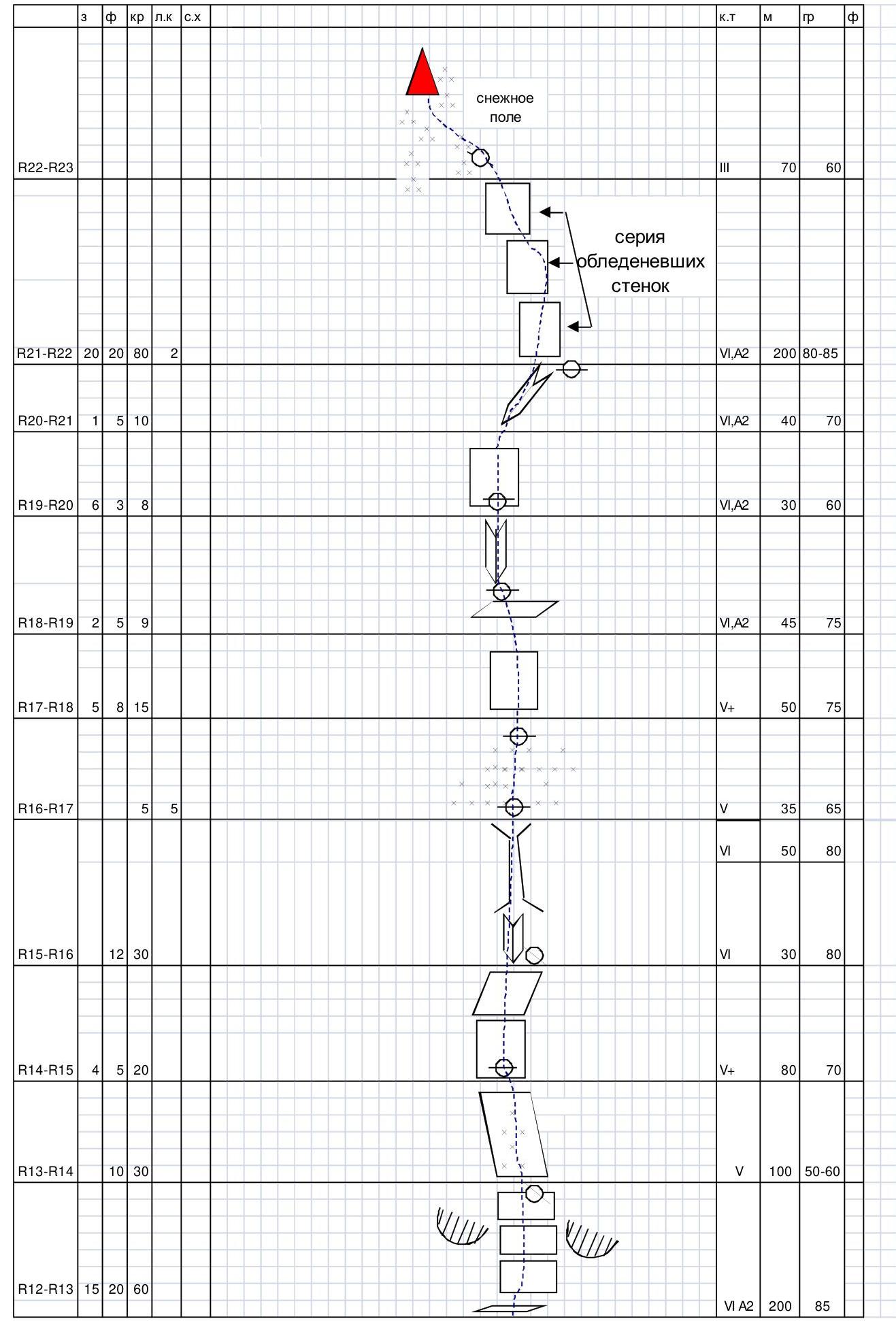
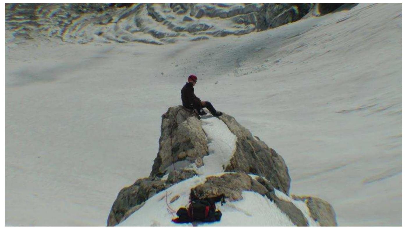
Photo 1. First overnight stay on the route (R3).
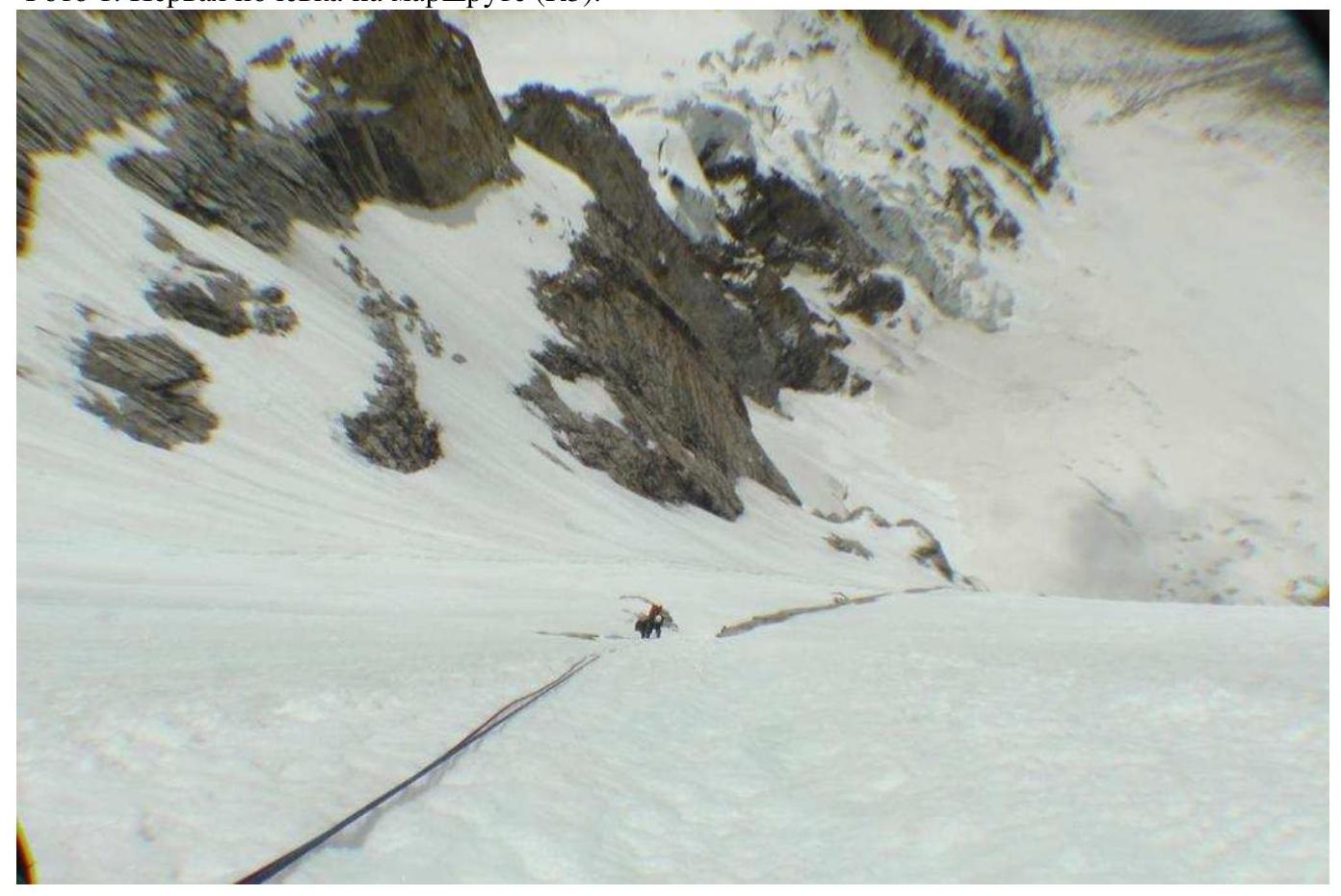
Photo 2. Movement on the section (R4).
Photo 3. Work in the couloir (R5–R6).
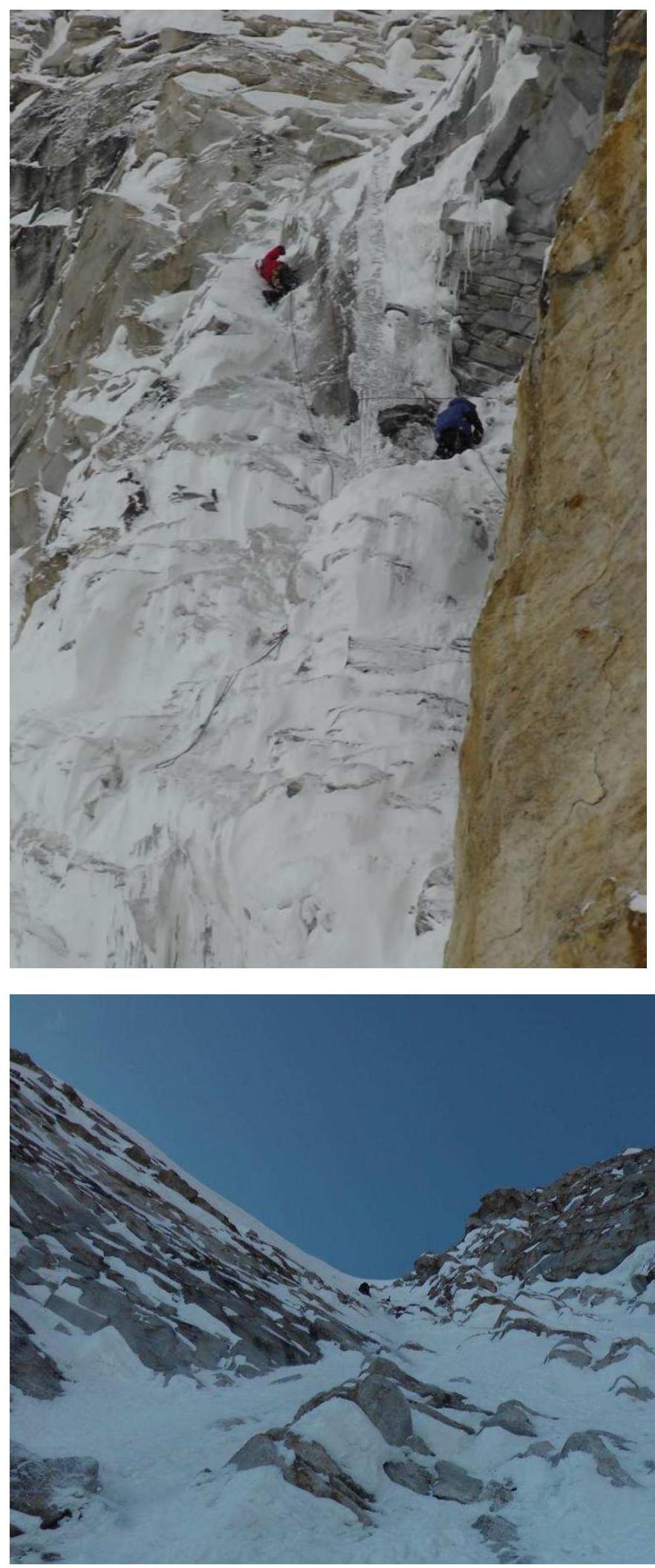
Photo 4. At the exit from the couloir (R6–R7).
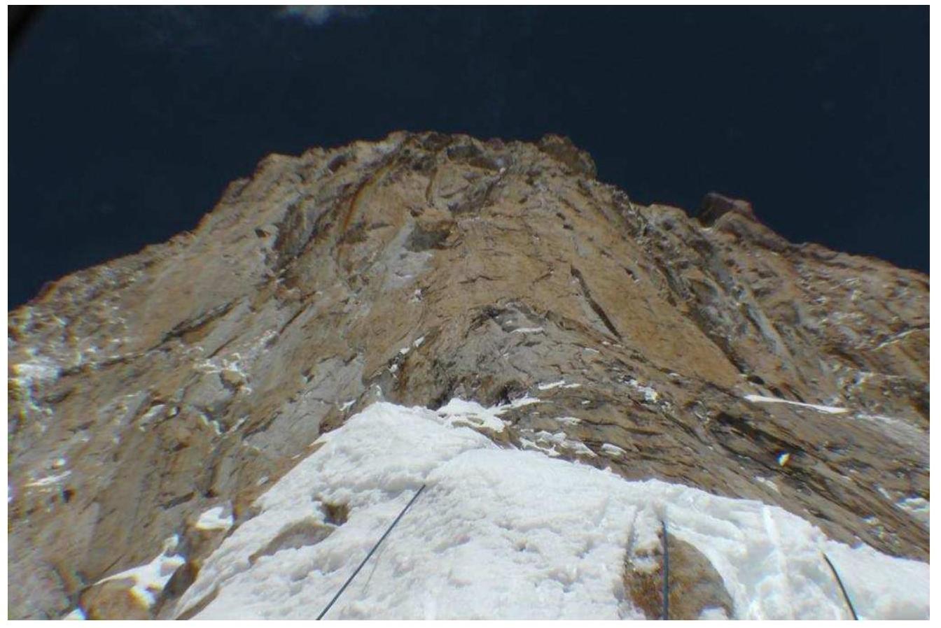
Photo 5. View of the rock wall under the tomahawk from R8.
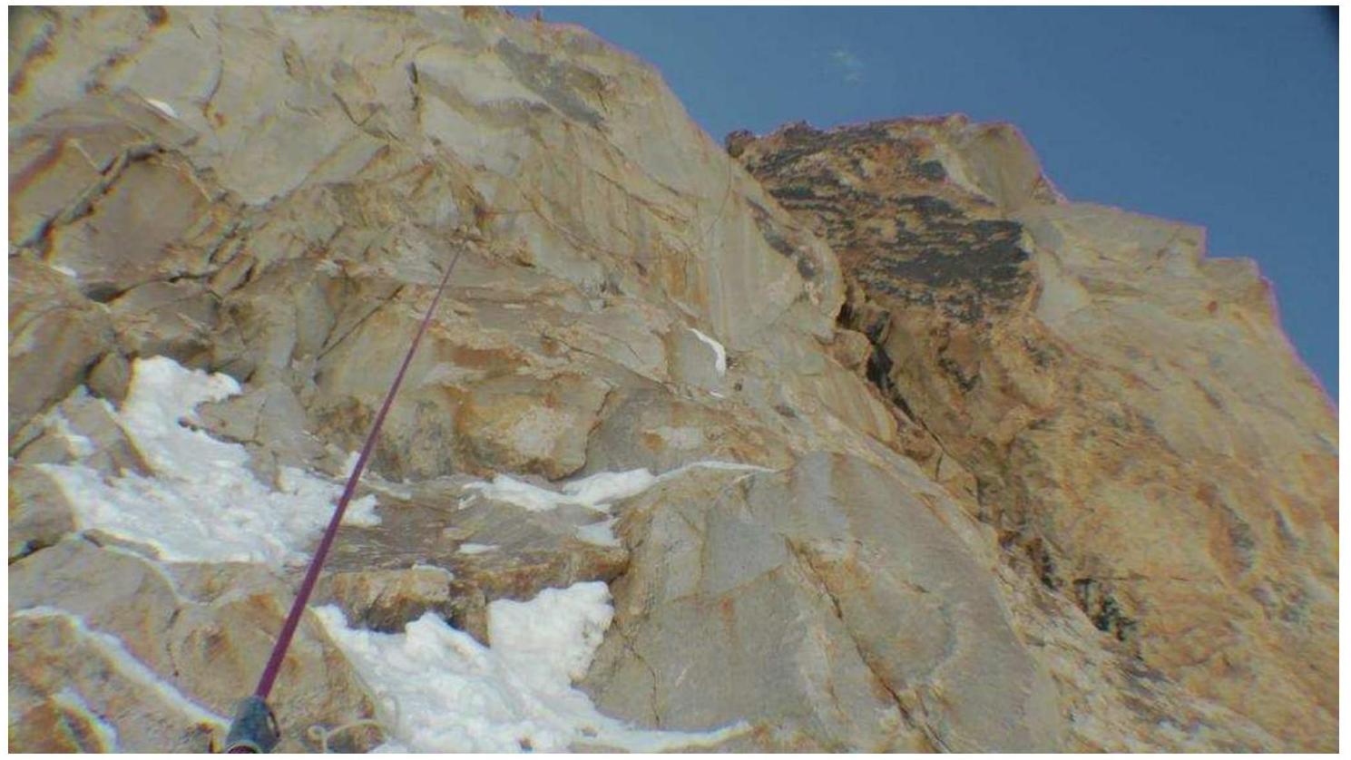
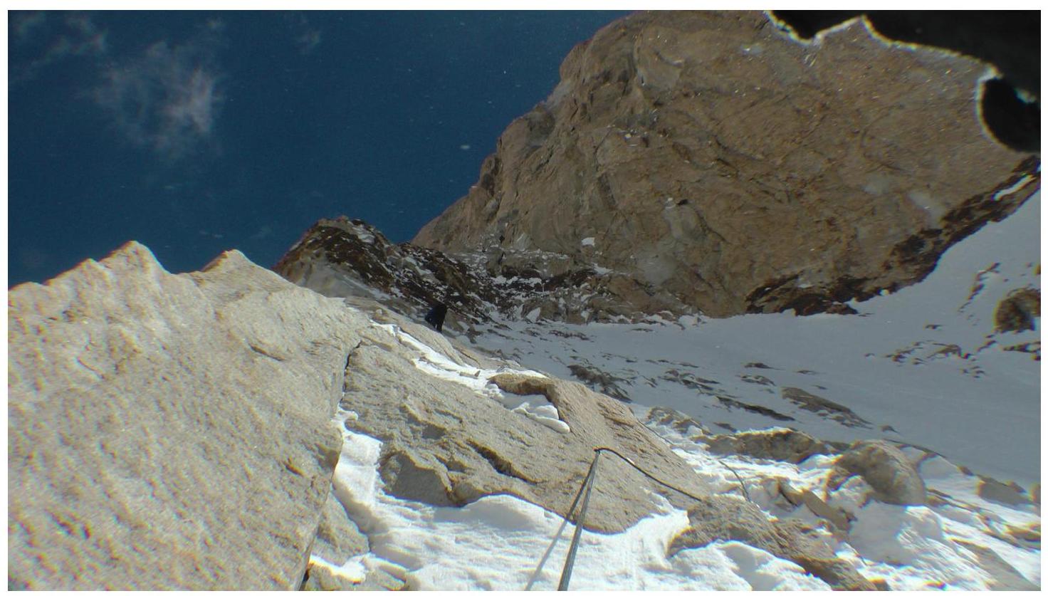
Photo 6. Exit onto the tomahawk R12.
Photo 7. Movement on the tomahawk R13.

Photo 8. Internal corner on R15.
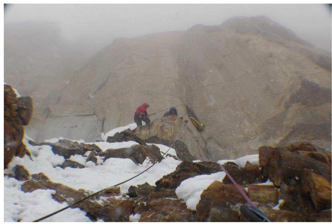
Photo 9. View of the final overnight stay R18.

Photo 10. View from the summit R23.
Comments
Sign in to leave a comment