Ascent Passport
- Himalayas, Main Himalayan Range, section 10.1.
- Lhotse Middle Peak, 8414 m via the East Ridge
- Assumed 6B cat. diff., first ascent
- Route type: combined
- Route elevation gain: 3100 m.
Route length: 10550 m.
Length of sections with 5–6B cat. diff.: 210 m.
Average slope:
- Main part of the route — 29°
- Entire route — 17°
-
Pitons left on the route: total 209, including no piton placements Pitons used on the route: stationary piton placements — no, including no artificial aid points, removable piton placements — no, including no artificial aid points. Total artificial aid points used — none.
-
Team's man-hours: Kuznetsov P., Bolotov A. — 64 h, 7 days; Timofeev S., Vinogradsky E. — 55 h, 6 days; Zhilin N., Koshelenko Yu., Sokolov G. — 42 h, 5 days; Yanochkin V., Volodin V. — 44 h, 5 days
-
Team leader: Timofeev Sergey Vladimirovich — MS
Team members:
- Vinogradsky Evgeny Mikhailovich — ZMS
- Bolotov Alexey Vasilievich — MS
- Kuznetsov Pyotr Valentinovich — MS
- Koshelenko Yuri Nikolaevich — MS
- Zhilin Nikolai Fedorovich — MS
- Sokolov Gleb Anatolievich — MS
- Yanochkin Vladimir Ivanovich — MS
- Volodin Viktor Gennadievich — MS

-
Coaches: Timofeev Sergey Vladimirovich, Cherny Nikolai Dmitrievich
| Departure to the route | Arrival at the summit | Return to base camp | |
|---|---|---|---|
| Kuznetsov P., Bolotov A. | 9:00, May 18, 2001 | 15:30, May 23, 2001 | 19:00, May 24, 2001 |
| Timofeev S., Vinogradsky E. | 9:00, May 19, 2001 | 15:30, May 23, 2001 | 19:00, May 24, 2001 |
| Zhilin N., Koshelenko Yu., Sokolov G. | 9:00, May 21, 2001 | 12:00, May 24, 2001 | 17:00, May 25, 2001 |
| Yanochkin V., Volodin V. | 9:00, May 24, 2001 | 12:00, May 27, 2001 | 17:00, May 28, 2001 |
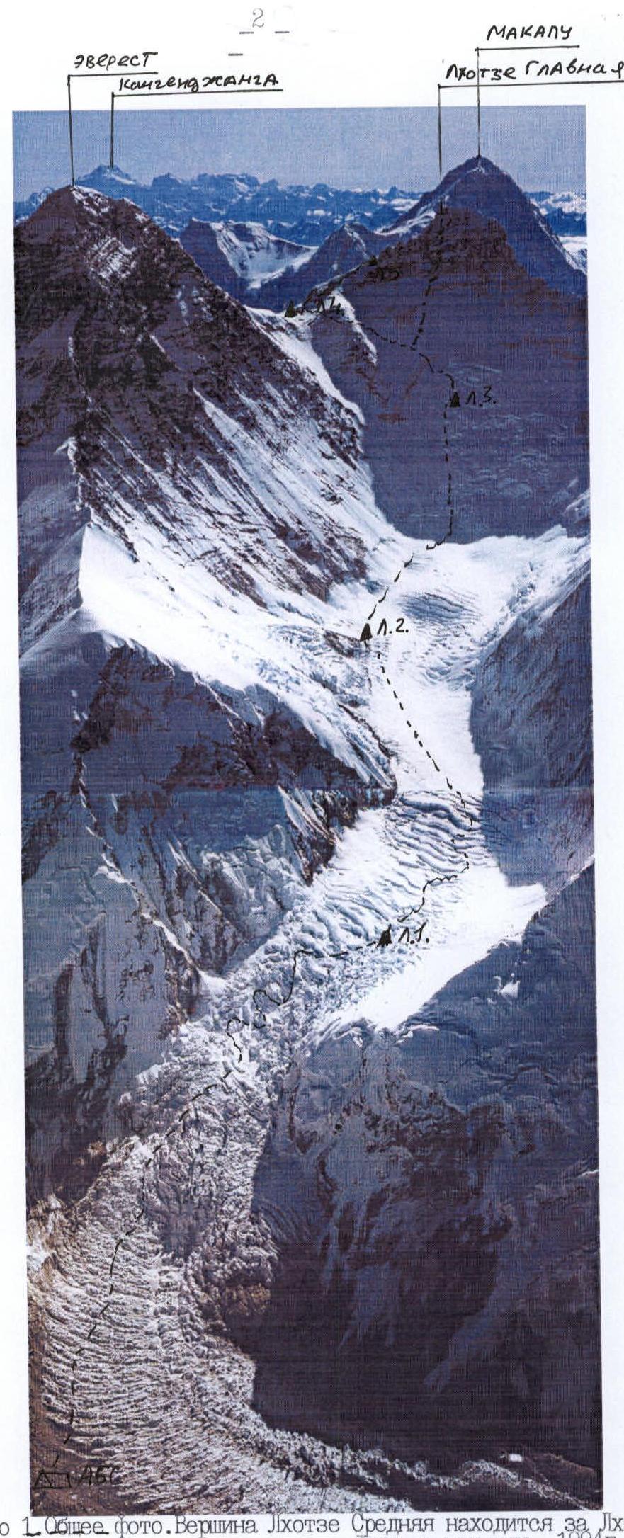
Photo 1. Group photo. Lhotse Middle Peak is behind Lhotse Main. Photo taken from a plane, 1994.
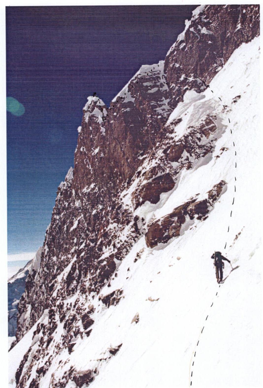
Photo 2. Profile of the right wall.
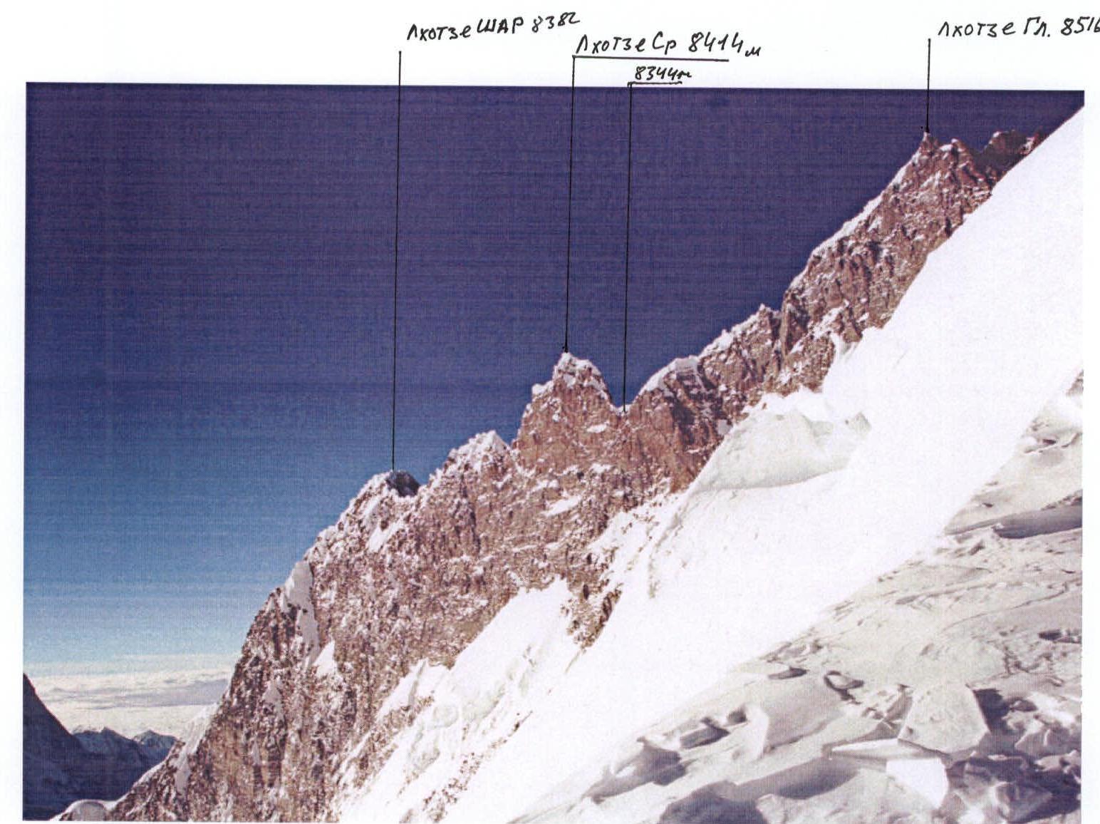
Photo 3. Photopanorama of the area.

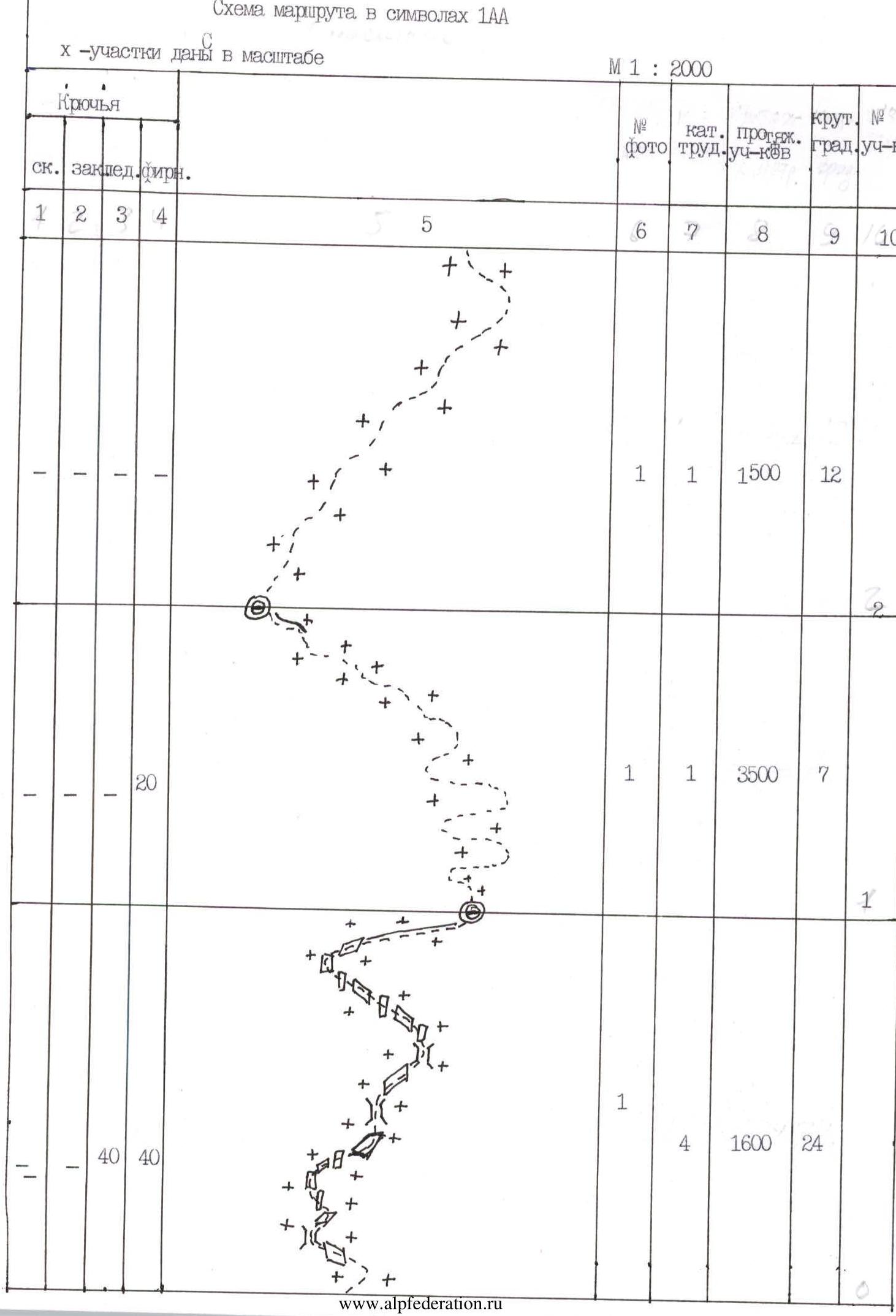
Route diagram in 1AA symbols
x – sections are to scale
M 1 : 2000
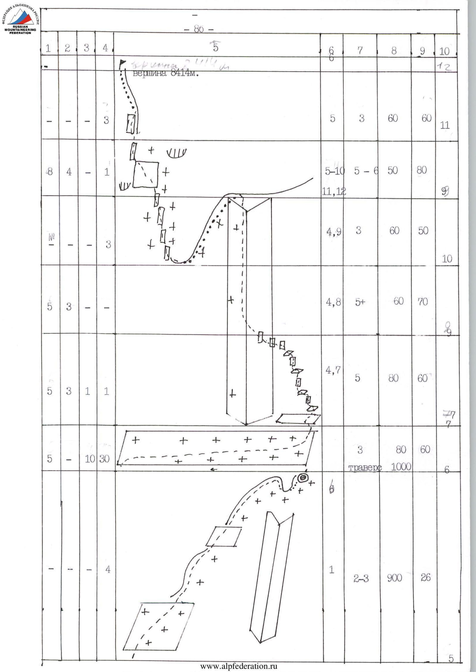
Route Description by Sections
R0–R1. Khumbu Icefall. Series of crevasses up to 7 m wide, ice walls up to 90°, internal corners up to 90°. Represents a significant hazard due to movement at 1–2 m per day. Convenient bivouac sites at 6480 m.
R1–R2. Gentle glacier with a series of crevasses up to 7 m wide. Orientation is difficult in bad weather. Convenient bivouac sites at 6480 m.
R2–R3. Relatively gentle glacier with a series of small closed crevasses.
R3–R4. Steep ice slope with several ice walls up to 85°. Small number of crevasses in the upper part. Rockfall possible in the lower part. Avalanches and snow slabs possible in the upper part. Bivouac can be carved into the snow-ice slope. Route is chosen to the right of the ice gully.
R4–R5. Snow-ice slope of average steepness. Traverse of an avalanche-prone snow-ice gully. Series of small walls up to 80° (marble rock, pitons do not hold well). Traverse under the base of the Geneva Spur. Exit onto the spur via a series of rock walls of average steepness. Movement along the left slope of the Geneva Spur to the north saddle between Mt. Everest and Mt. Lhotse. Convenient bivouac sites on the saddle. Hurricane-force winds possible.
R5–R6. Snow-covered rocks of average steepness. Further exit onto the ridge leading to Mt. Lhotse Main. Under the right-hand pinnacle — departure left from the ridge onto a snow-ice slope. Good bivouac site under the first pinnacle at 8250 m.
R6–R7. Traverse left along the ridge leading to Mt. Lhotse Main. Very steep and avalanche-prone snow slope with small outcrops of firn. At the end — traverse along snow-covered rocks into the base of an internal corner leading to the ridge between Lhotse Main and Lhotse Middle, slightly above and to the right of the col between these peaks.
R7–R8. Series of steep walls and inclined ledges, snow-covered rocks on the right side of the internal corner. Rock with blind cracks.
R8–R9. Exit into the center of the internal corner. Movement along its left part. Snow-covered rocks. Blind cracks. At the end — a snow cornice and exit onto a very steep snow ridge.
R9–R10. Movement along the back side of the ridge down a very steep snow slope onto the col between Lhotse Main and Lhotse Middle.
R10–R11. Pre-summit tower. Very steep rocks, partially snow-covered. In the center of the section — 10 m sheer wall with no protection. Holds are mostly loose. Cornices on the right and left. Exit onto a steep snow wall.
R11–R12. Up the steep snow wall under the summit cornices. Exit onto the summit through snow cornices.
Photo 4. Technical photograph of the route.

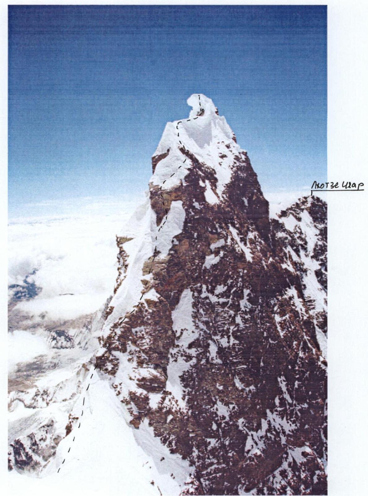
Photo 5. Summit tower, sections 10–12.
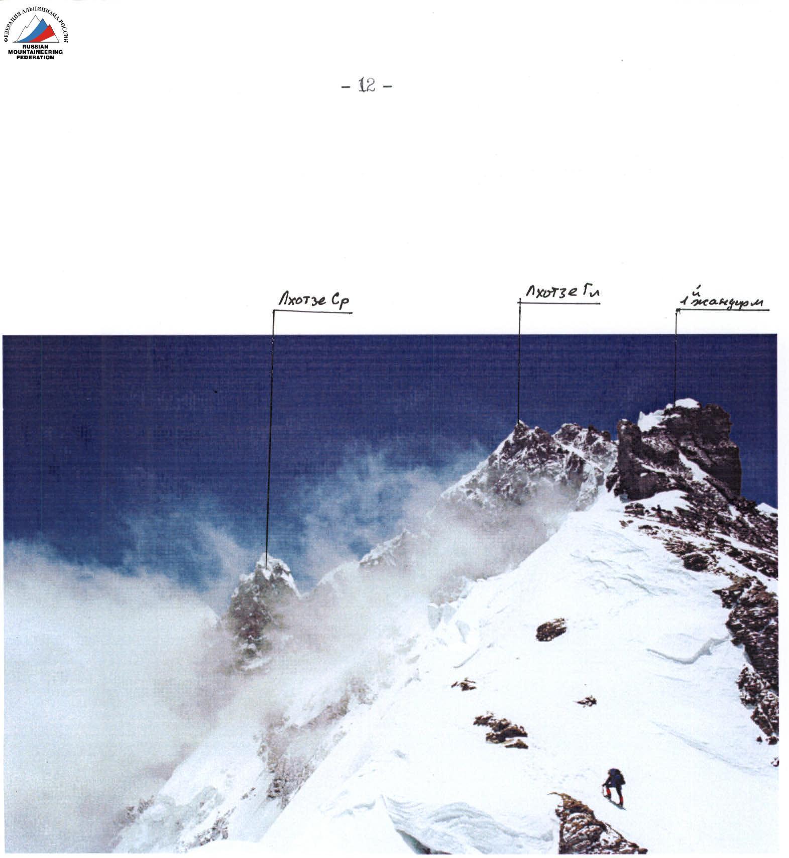
Photo 6. Approach to Camp 5, sections 5–6.
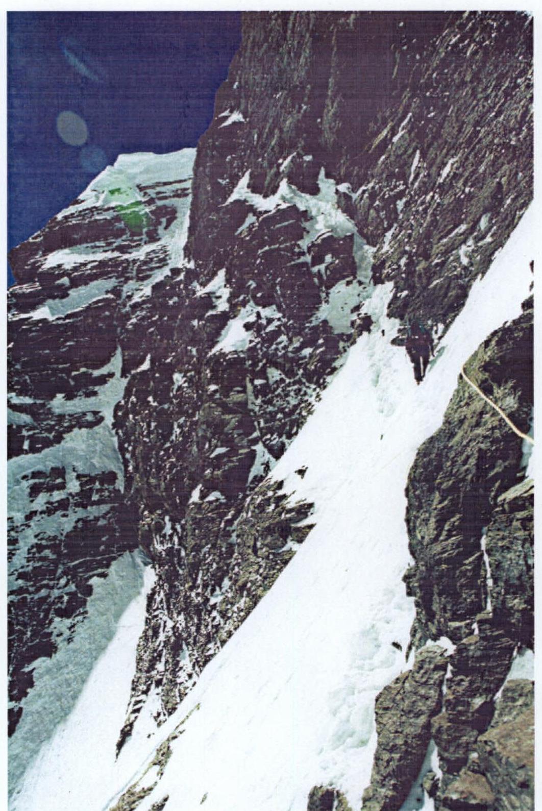
Photo 7. Section 7–9.
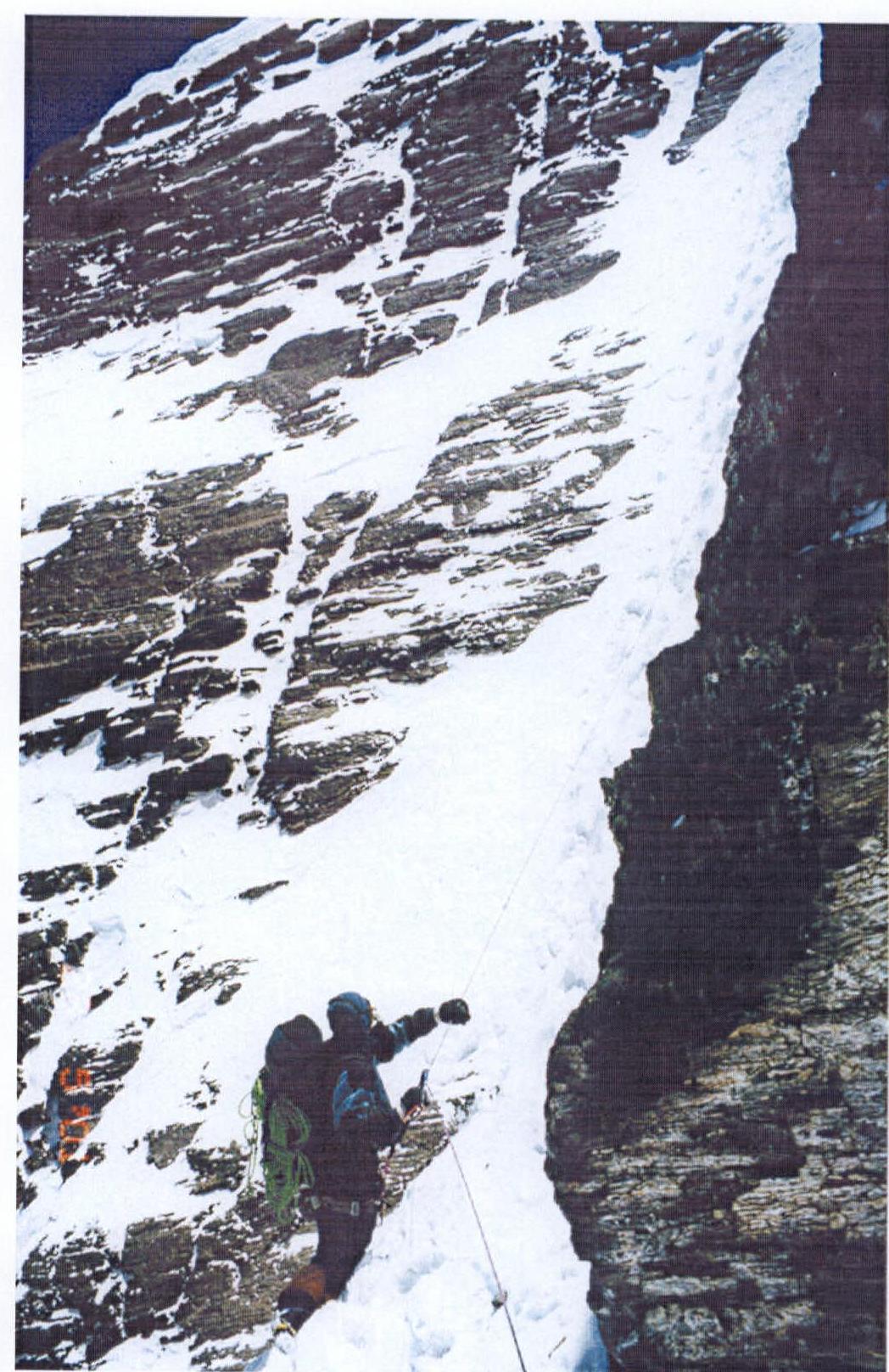
Photo 8. Section 8–9.

Photo 10. Passage of section 10–11.

Photo 11. Continuation of section 10–11.
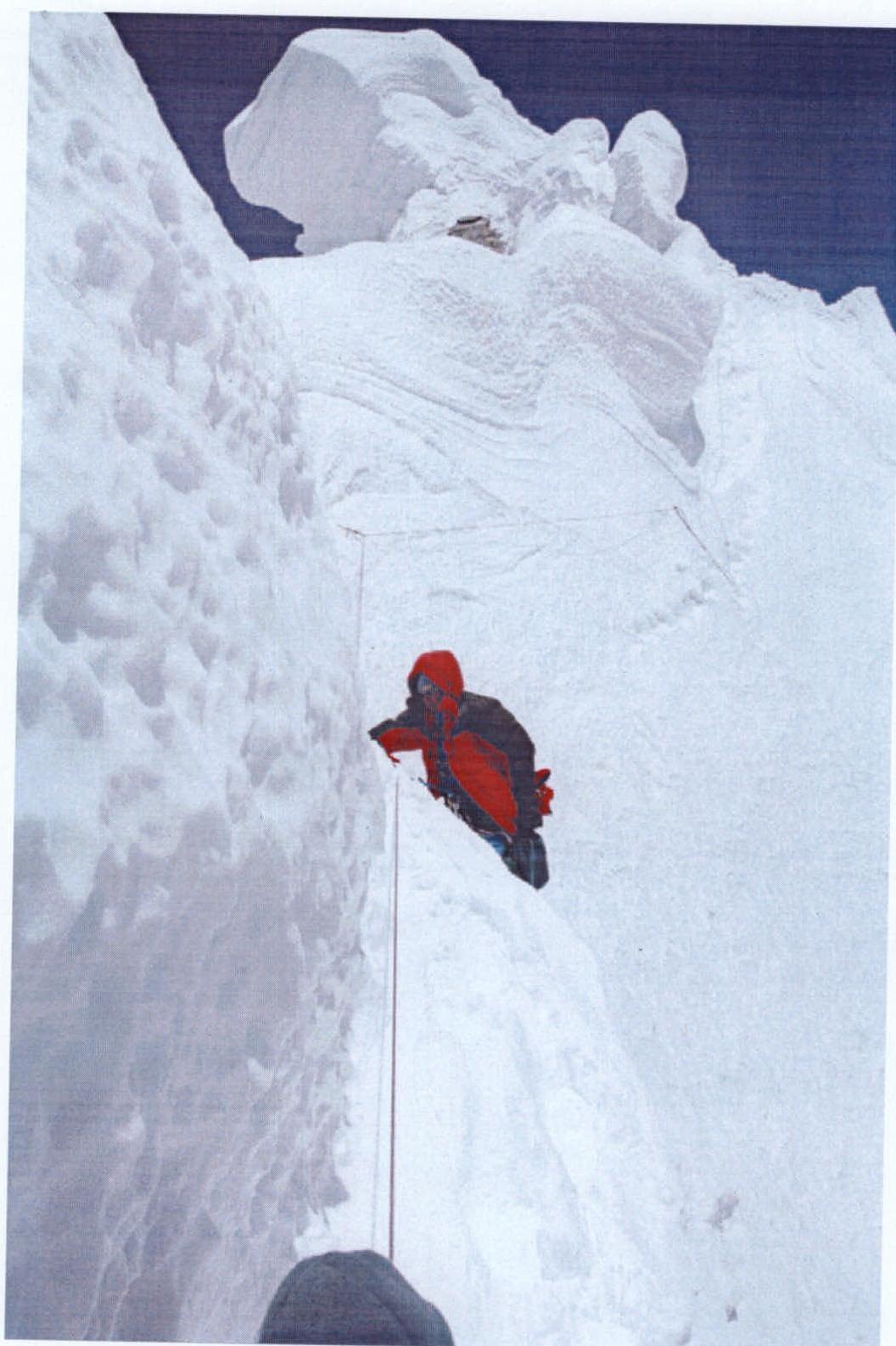
Photo 13. Passage of section 11–12.

Photo 17. View from the summit onto Lhotse Main peak.