
Climbing Passport
-
High-altitude technical class.
-
Himalayas.
-
Dhaulagiri I — 8167 m, via the Northeast Ridge.
-
Proposed category — 5B.
-
Elevation gain — 3400 m (by altimeter); length — 7100 m.
Length of sections with 5th category difficulty — 2500 m; Average steepness:
- main part of the route — 35°
- entire route — 30°.
-
Pitons driven:
Left on the route for the Austrian team (at the captain's request):
- rock pitons — 10
- ice screws — 15
- snow anchors — 40
-
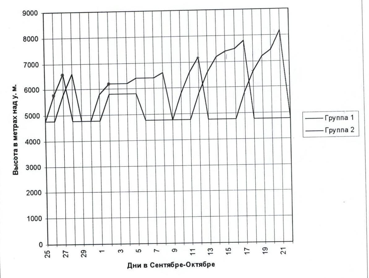
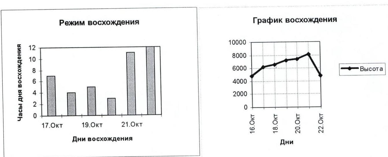
Climbing hours Base Camp–Summit–Base Camp — 42 and days — 6.
-
Overnights: 1st in a cave at 6200 m, 2nd in a cave at 6600 m, 3rd in a tent on a snow-firn slope at 7200 m; 4th in a tent on a snow-firn slope at 7450 m.
-
Team:
attained height
- Moshchnikov Anatoly ZMS — expedition leader — summit.
- Shustrov Nikolay MS — deputy leader — 7500 m.
- Sergeev Dmitry MS — 7500 m.
- Gavrilov Mikhail MS — 7500 m.
- Mayorov Evgeny MS — 8000 m.
- Stepanov Viktor CMS — 7500 m.
- Shevelev Alexey CMS — 6600 m.
- Astanin Konstantin CMS — 8000 m.
- Pimkin Nikolay MS — 7500 m.
- Shustrov Alexey MS — 7500 m.
- Ivanov Stanislav MS — 7500 m.
- Kripaite Ruta CMS — 7200 m.
-
Coach — Moshchnikov Anatoly Ivanovich — 198329, St. Petersburg, Dobrovoltsev 6–2–7.
-
Route entry: summit on October 21, 1996, return to base camp — October 22, 1996.
-
Organization name — CET "NEVA", 193024, St. Petersburg, Nevsky 135–38.

Ascent graph.
You can get additional information by phone 277 50 66
Tactical Actions of the Team
The team worked in two groups of 6 people. The gap between the groups was 1–2 days, which allowed for rational work on route establishment, rope installation, and use of abandoned equipment, as well as providing mutual insurance on the route. Radio communication was carried out 3 times a day according to the schedule and as necessary between the groups and with the base camp for relay. Ropes for crossing snow bridges were fixed on rock, ice, and snow anchors. When passing dangerous areas without ropes, main ropes of 30–40 m were used.
The following high-altitude camps were established:
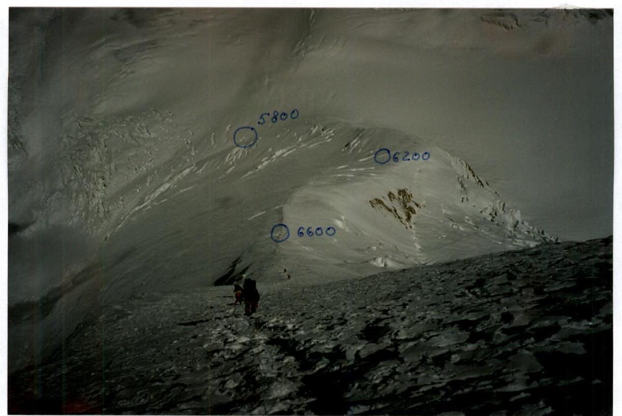
- 1st — on the ridge at 5800 m between Tukuche and Dhaulagiri — 2 tents were set up, and after bad weather, a snow cave for 4 people was dug;
- 2nd — intermediate camp at 6200 m — 3 caves for 12 people;
- 3rd — on a snow-firn slope, 2 tents were set up, but after bad weather, one was restored, and a cave for 6 people was dug;
- 4th — 2 tents on a steep snow slope under the cover of a rock island;
- 5th — a snow cave, which was then blown away, and a tent was set up in its place.
Oxygen was not used during the ascent but was available for medical purposes in the base camp and at an altitude of 7400 m. Above 7300 m, ropes were not installed; a main rope and self-arrest with an ice axe were used.
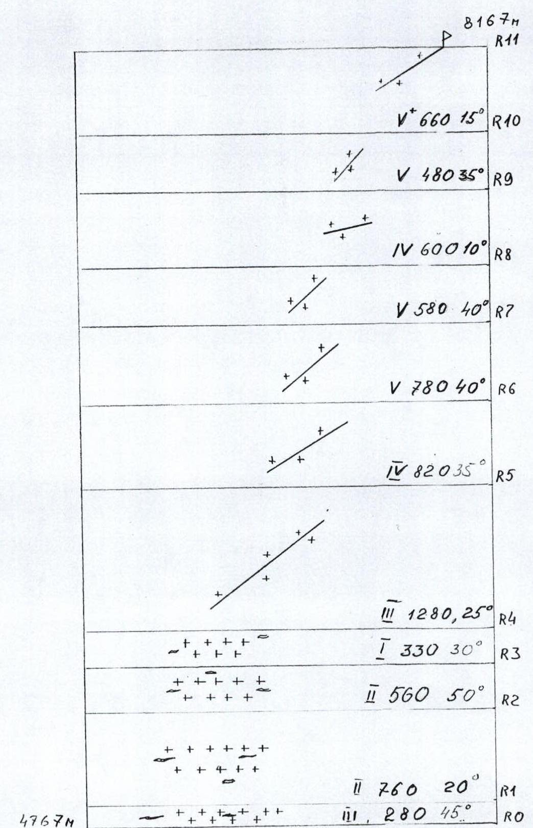
Route diagram in M1:30000 symbols
Route Description by Sections
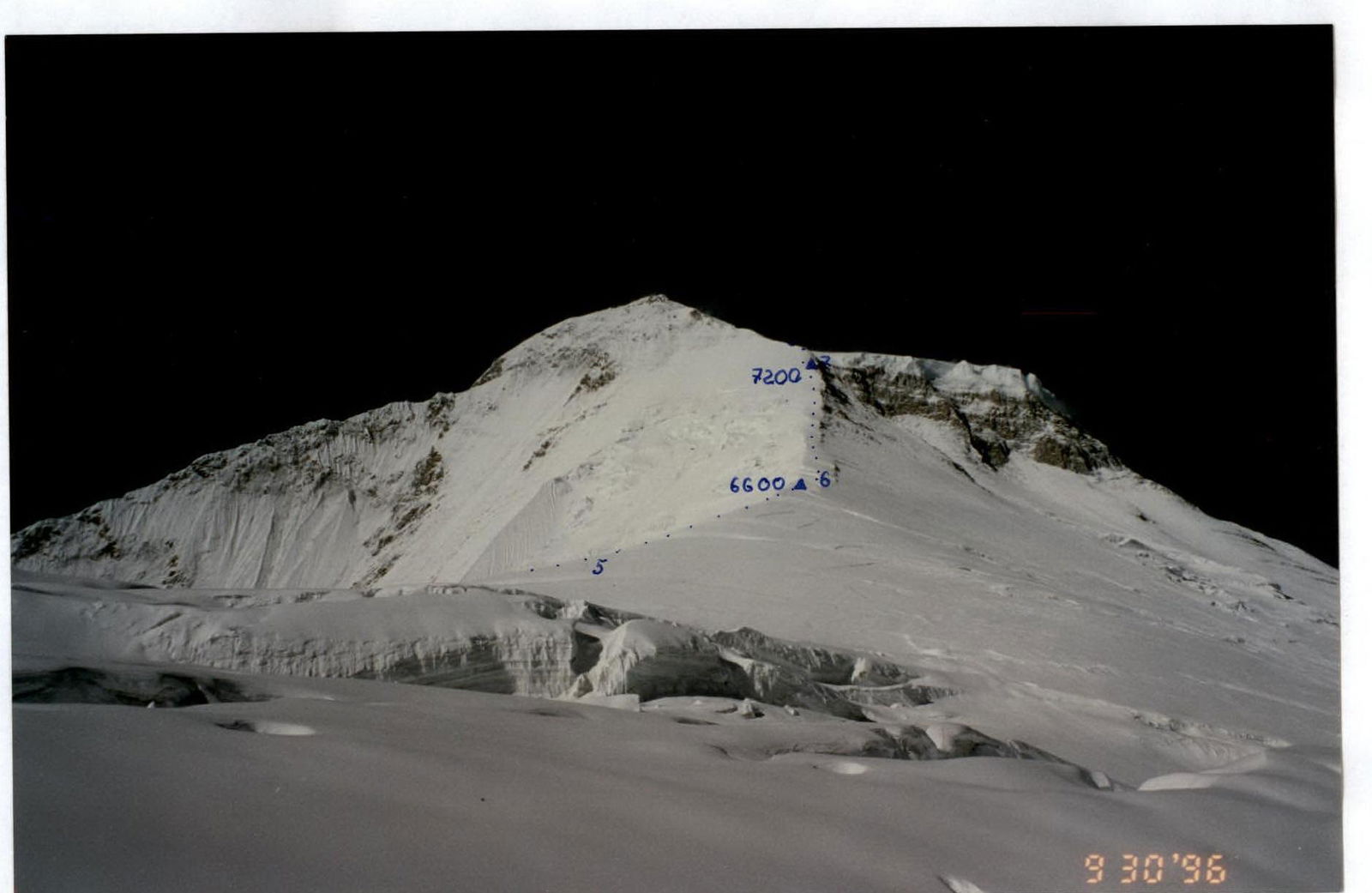
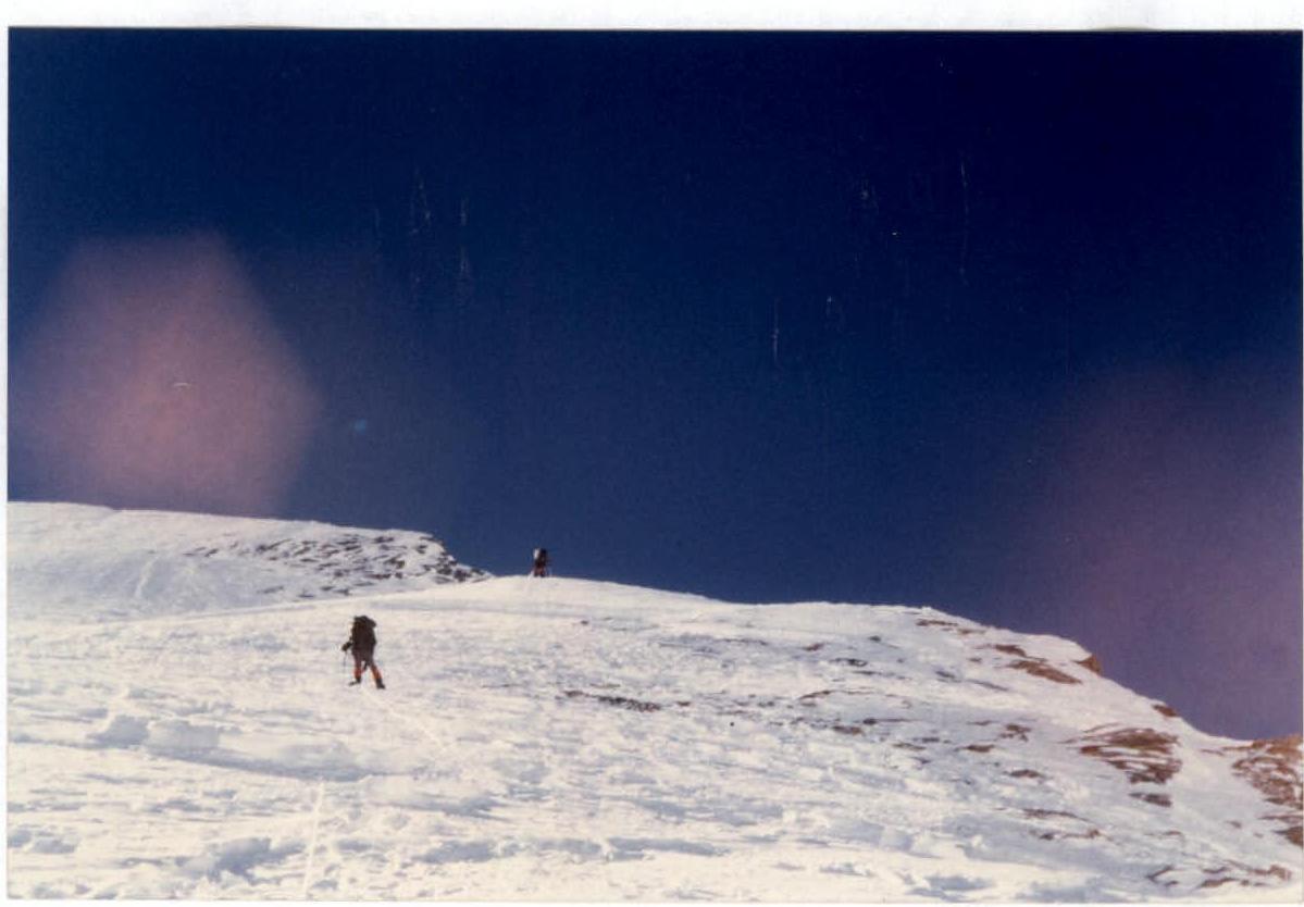
R0–R1 — snow-firn slope, ascent under a rock bastion to exit onto the glacier; R1–R2 — passage through avalanche cones to the middle of the glacier, many snow bridges over crevasses; R2–R3 — steep ascent along the glacier, avoiding crevasses; R3–R4 — exit onto the ridge at 5800 m between Tukuche and Dhaulagiri; R4–R5 — ascent along the NE ridge, a simple snow ridge; R5–R6 — continuation of the ascent along the snow NE ridge, avalanche-prone after snowfall up to 6600 m; R6–R7 — firn section, местами изрезан трещинами, requires rope installation; R7–R8 — steep ice-firn slope leading to the northern ridge, with rock outcrops; R8–R9 — gentle snow shelf leading to a giant snow-firn field; R9–R10 — snow-firn field, prone to snow "boards"; R10–R11 — summit ridge, местами карнизы.
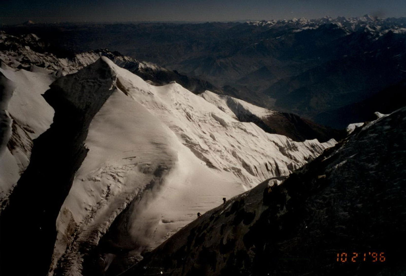
Technical photograph of the route

Section R6–R7.
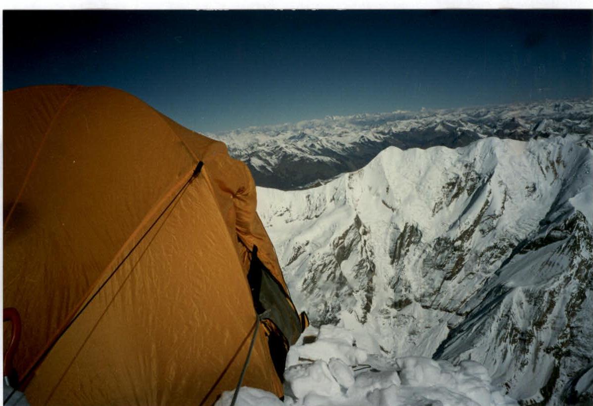
High-altitude camp №3 — 7200 m.
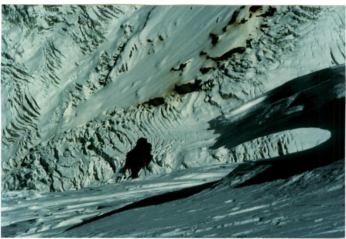
Section R7–R8.
Section R7–R8.

Summit photograph.
Coach and captain:

Comments
Sign in to leave a comment