
Report
On the first ascent of Golets Babkha via the eastern ridge, approximately 2A category of difficulty, by the Baikal Alpine School team on May 31, 2020. 2020 Irkutsk
I. Ascent Report
| # | General Information | |
|---|---|---|
| 1.1 | Full name, sports rank of the team leader | Afanasiev A.E. — Master of Sports |
| 1.2 | Full name, sports rank of the participants | Cherepanov A.V. — Candidate Master of Sports |
| 1.3 | Full name of the coach | Afanasiev A.E. — Master of Sports |
| 1.4 | Organization | Baikal Alpine School |
| 2. Characteristics of the ascent object | ||
| 2.1 | Region | Baikal Highland, Khamar-Daban Range |
| 2.2 | Valley | Porozhiste |
| 2.3 | Section number according to the 2013 classification table | 9.16. |
| 2.4 | Name and height of the peak | Golets Babkha, 2061 m |
| 2.5 | Geographic coordinates of the peak (latitude/longitude), GPS coordinates | 51.5328; 104.0867 |
| 3. Route characteristics | ||
| 3.1 | Route name | To the SE summit via the ridge |
| 3.2 | Proposed category of difficulty | 2A |
| 3.3 | Degree of route development | First ascent |
| 3.4 | Relief characteristics of the route | Combined |
| 3.5 | Elevation gain of the route (altimeter or GPS data) | 320 |
| 3.6 | Route length (in meters) | 1339 |
| 3.7 | Technical elements of the route (total length of sections with different categories of difficulty and relief characteristics) | Category I combination – 1170 m Category II combination – 125 m Category III combination – 20 m Category IV combination – 24 m Rappelling (on descent) – no |
| 3.8 | Descent from the summit | Along the SE ridge to the saddle and left down the E slope |
| 3.9 | Additional route characteristics, water availability | Snow on the northern side of the ridge in the middle section and on the sub-summit |
| 4. Team actions characteristics | ||
| 4.1 | Time on the move (team's walking hours, in hours and days) | 6 h 40 min; 1 day |
| 4.2 | Overnights | no |
| 4.3 | Start of the route | 11:00 May 31, 2020 |
| 4.4 | Reaching the summit | 17:40 May 31, 2020 |
| 4.5 | Return to the base camp | 19:50 May 31, 2020 |
| 5. Responsible for the report | ||
| 5.1 | Full name, e-mail | Afanasiev A.E. anevg09@mail.ru |
II. Ascent Description
1. Characteristics of the Ascent Object
1.1. General Photo of the Summit
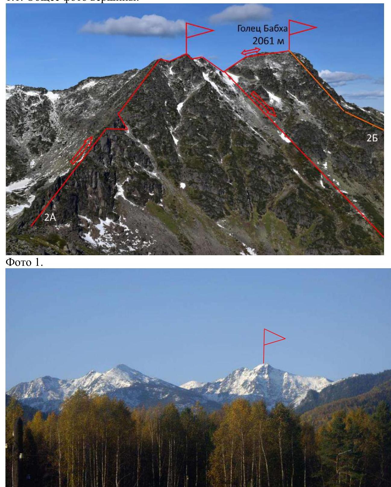
Photo 1.
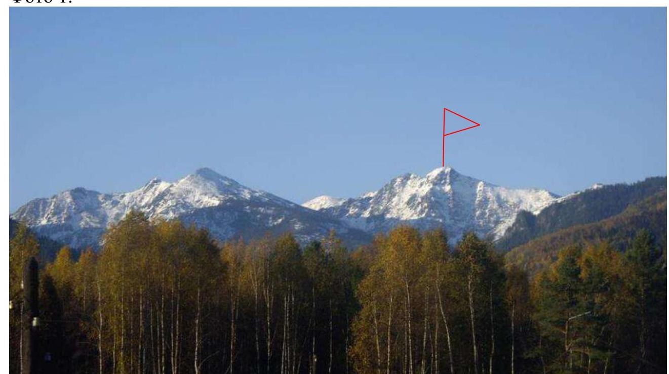
Photo 1a. View from the shore of Lake Baikal.
1.2. Photo of the Route Profile
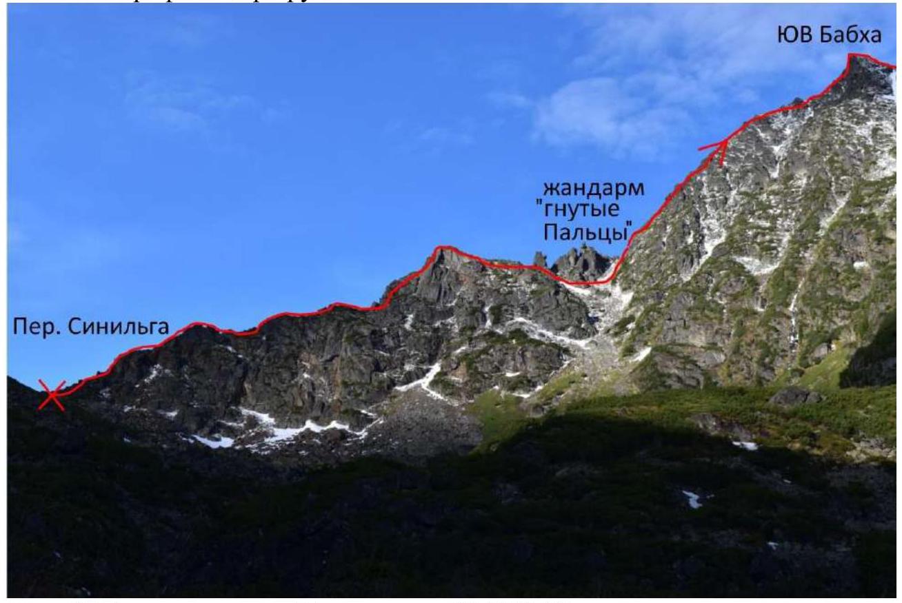
Photo 2. Taken from the Porozhiste valley. May 31, 2020.
1.3. Photopanorama of the Area

Photo 3. Taken from Ochkarikov Mountain.
1.4. Map of the Area
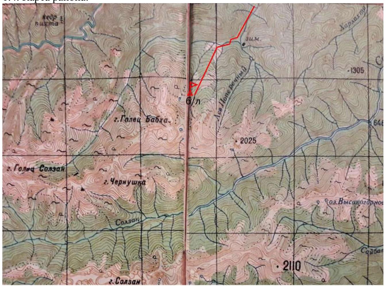
Photo 4.
1.4a. Route Map

Photo 4a. The Khamar-Daban Range is a unique and interesting area to visit. It is not well-developed for mountaineering due to the small number of alpine-type peaks, their remoteness from each other, and the relative difficulty and distance of approaches. At the same time, the Sayan Mountains nearby have extensive, compact, and convenient forms of relief suitable for alpine routes of various difficulty categories.
Geographically, the Khamar-Daban Range belongs to the mountain system of Southern Siberia and the Baikal Mountain Country. It is located on the southern edge of Lake Baikal's shore. Other ranges on the Baikal coast, such as the Primorsky and Baikal ranges on the western shore, and the Khamar-Daban, Ulan-Burgasy, and Barguzinsky ranges on the southeastern shore, are also considered part of the Baikal Highland. The Baikal and Barguzinsky ranges have classified routes and potential for alpine development. The Primorsky and Ulan-Burgasy ranges are not of sporting interest due to their low elevation and smoothed relief forms covered with forest. The Baikal Highland should be considered a separate area, as it is not part of the Eastern Sayan or the Stanovoy Highlands, but is located between these mountain formations. The Baikal Alpine School turned its attention to Khamar-Daban due to the 2020 pandemic and the closure of the Buryat Republic.
A characteristic feature and attractiveness of the area are its unique landscapes, celebrated in songs. In the sixties, a song by an unknown author appeared, sung in city courtyards and at taiga campfires: "Geolog here has not been, the scientific world has long forgotten about the wild country of Khamar-Daban." Vizbor also noted this area in one of his songs: "And underfoot, through the fog, the Khamar-Daban Range cracks." Yuri Iosifovich, flying over Khamar-Daban, inspiredly remarked: "Irkutsk rises to meet us, apparently drunk." And indeed, when you emerge from the Khamar-Daban ordeals, everything around seems drunk.
Due to the relatively warm and humid summer, fir and cedar dominate the forest zone. In some areas of Siberia, this combination is called dark taiga. Those who traveled along the Trans-Siberian Railway from start to finish, did not get drunk, and conscientiously stared out the window, likely noticed that the most wonderful landscapes are on the stretch from Slyudyanka to almost Mysovaya, and the described places are nearby. In addition to the main tree species, there are various other trees, such as pine, spruce, larch, poplar, aspen, birch, as well as rowan, cherry, willow, and alder, which can lie across a poor trail. Branches of alder, cherry, raspberry, currant, Labrador tea, fir branches, and stems and leaves of various herbs also obstruct the path. The difficulties of deadwood and vegetation are only a prelude to the appearance of thickets of cedar elfinwood. Khamar-Daban is the western edge of the elfinwood habitat. Here, due to more favorable conditions, it is a chaotic sprawl of cedar trunks with persistent, "tin" branches over the ground. When it is encountered on the route, it creates additional difficulties and local color for mountaineering in Khamar-Daban. The difficulty of climbing through elfinwood was not considered when assessing the category of difficulty of the proposed routes. That is, when, God forbid, hordes of Irkutsk climbers tramp paths in the elfinwood on the routes, the attractiveness of ascents will wane, but the category of difficulty will not suffer.
It is better to make ascents on the proposed routes and others that are potentially available in the summer time - from May 15 to October 15. In winter, up to one and a half meters of snow falls here, and with snowdrifting, even more in some places, leading to increased avalanche danger. On May 3, 1985, 17 people died in an avalanche on Golets Babkha, most of whom were female students from the Irkutsk Pedagogical Institute. The approach with a load from the bridge on the highway to the base camp takes 8 hours. The base camp is located on the Porozhisty stream (according to the geographical map), which looks more like a river due to its water content. The approach from the base camp to the route takes 2 hours. The route begins at the Sinilga pass.
2. Route Characteristics
2.1. Technical Photograph of the Route
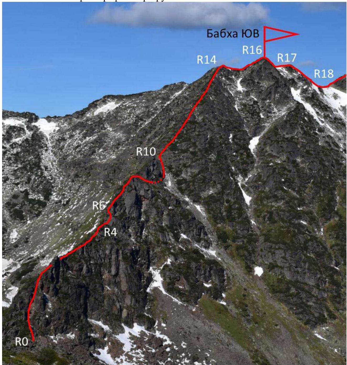
Photo 5.
2.3. Technical Characteristics of Route Sections
| Section # | Relief Characteristics | Category of Difficulty | Length, m, Steepness ° | Number of Pitons |
|---|---|---|---|---|
| R0–R1 | Rocky ridge | 1 | 50.5 | |
| R1–R2 | Left of the ridge through elfinwood | 1 | 100.5 | |
| R2–R3 | Right of the ridge | 1 | 25.0 | |
| R3–R4 | Ridge, elfinwood | 1 | 15.0 | |
| R4–R5 | Large crack | 4 | 9.7 | 2 |
| R5–R6 | Under the cornice to the left | 4 | 15.8 | 3 |
| R6–R7 | Ridge, elfinwood | 2 | 20.45 | |
| R7–R8 | Ridge right, left. Passage through a hole in the rock under "bent fingers" | 2 | 20.5 | |
| R8–R9 | Gendarme to the right via a rock ledge | 1 | 80 | |
| R9–R10 | Couloir. Exit to the saddle between the gendarme and the slope | 1 | 100.4 | |
| R10–R11 | Slope | 2 | 30.55 | |
| R11–R12 | Rocky outcrop | 3 | 10.6 | 2 |
| R12–R13 | Slope, elfinwood | 2 | 55.5 | |
| R13–R14 | Wide ridge. Exit to the sub-summit | 1 | 200.35 | |
| R14–R15 | Ridge slightly down | 1 | 30 | |
| R15–R16 | Barely noticeable trail. Exit to the SE summit | 1 | 70 | |
| R16–R17 | Rappelling. Anchoring to a trunk | 3 | 10 | |
| R17–R18 | Descent along the ridge to the saddle | 1 | 150 | |
| R18–R19 | Ridge | 1 | 150 | |
| R19–R20 | Ridge. Exit to the summit | 1 | 200 |
3. Characteristics of Team Actions
3.1. Brief Description of the Route Passage
The approach from the base camp to the Sinilga pass takes 2 hours. The route begins at an altitude of 1740 m.
| Section # | Description | Photo # |
|---|---|---|
| R0–R1 | Rocky ridge | |
| R1–R2 | Left of the ridge through elfinwood | |
| R2–R3 | Right of the ridge | |
| R3–R4 | Ridge, elfinwood | |
| R4–R5 | Large crack | 6 |
| R5–R6 | Under the cornice to the left | 7 |
| R6–R7 | Ridge, elfinwood | |
| R7–R8 | Ridge right, left. Passage through a hole in the rock under the gendarme "Bent Fingers" | 8 |
| R8–R9 | Gendarme to the right via a rock ledge | 9 |
| R9–R10 | Couloir. Exit to the saddle between the gendarme and the slope | 10 |
| R10–R11 | Slope | 11 |
| R11–R12 | Rocky outcrop | 12 |
| R12–R13 | Slope, elfinwood | |
| R13–R14 | Wide ridge. Exit to the sub-summit | |
| R14–13 | Ridge slightly down | |
| R15–R16 | Barely noticeable trail. Exit to the SE summit | |
| R16–R17 | Rappelling. Anchoring to a trunk | 13 |
| R17–R18 | Descent along the ridge to the saddle | |
| R18–R19 | Ridge | |
| R19–R20 | Ridge. Exit to the summit | 14 |
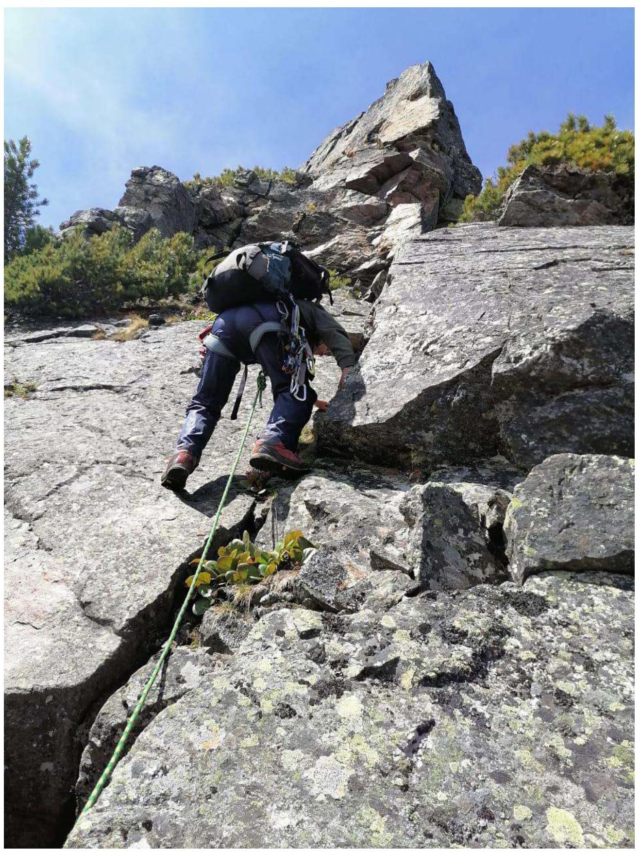
Photo 6. Section R4–R5.
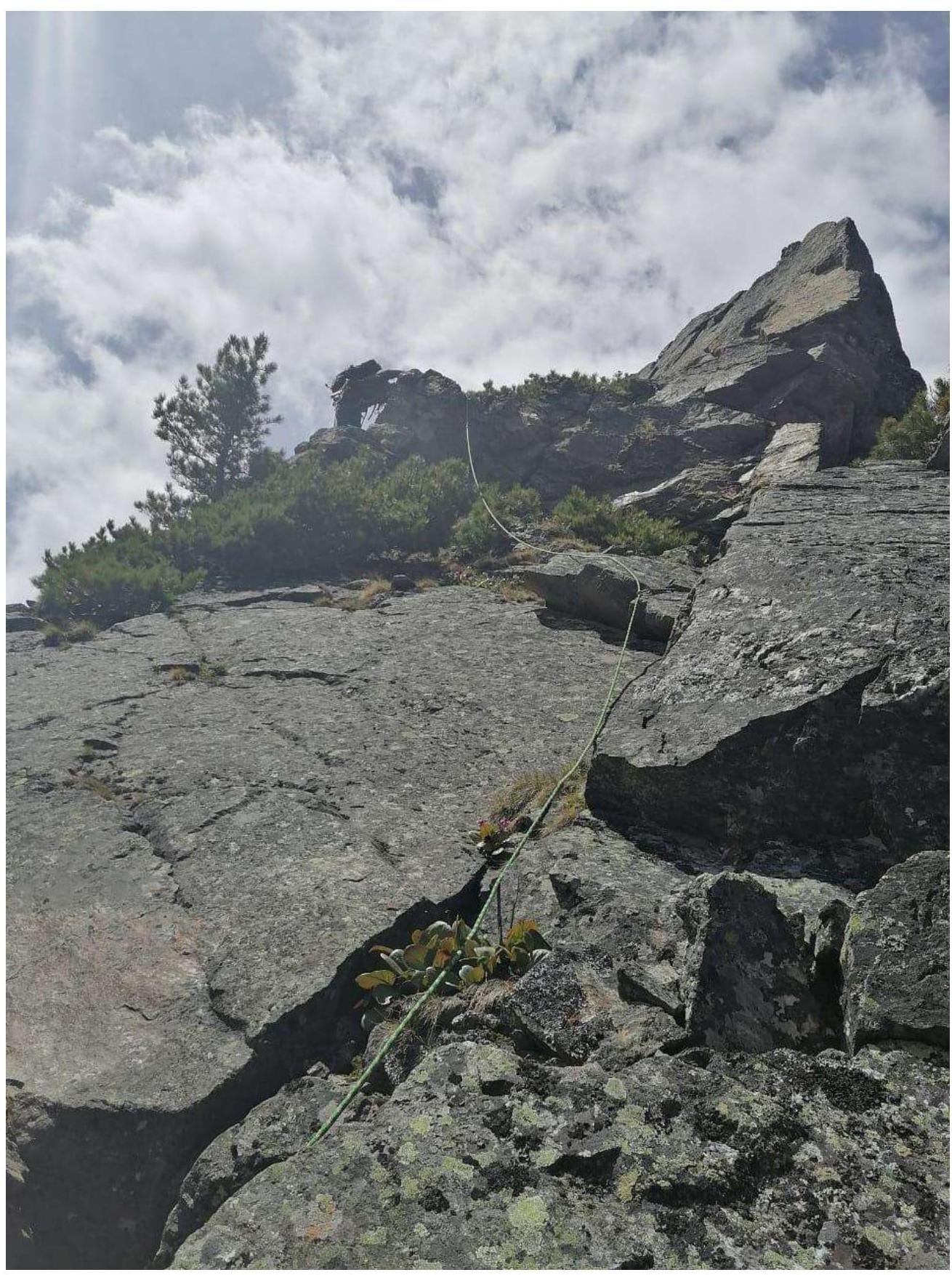
Photo 7. On section R6.
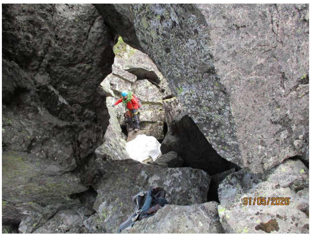
Photo 8. On section R8.
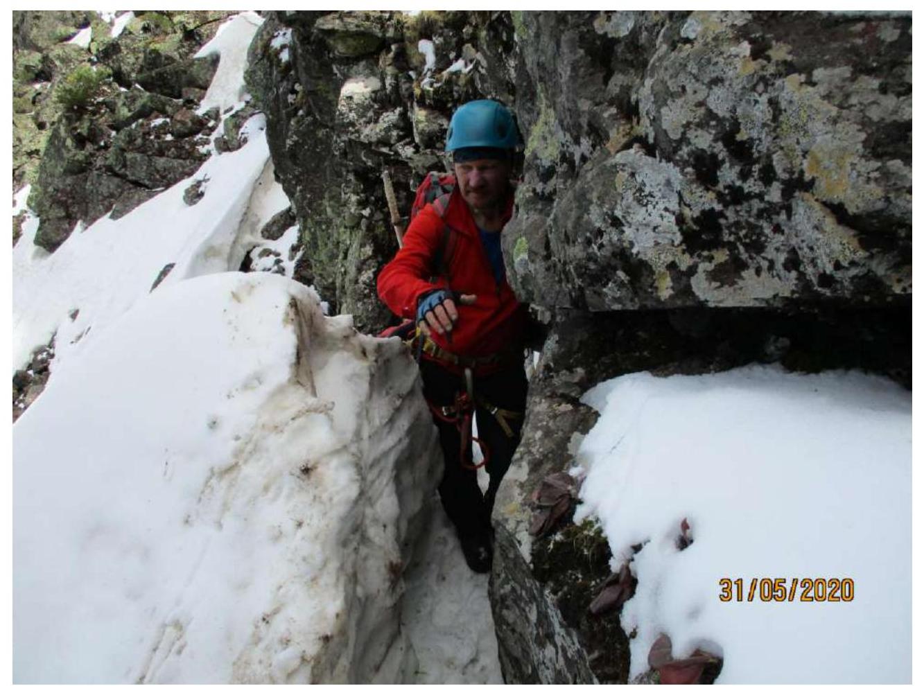
Photo 9. On section R8–R9.
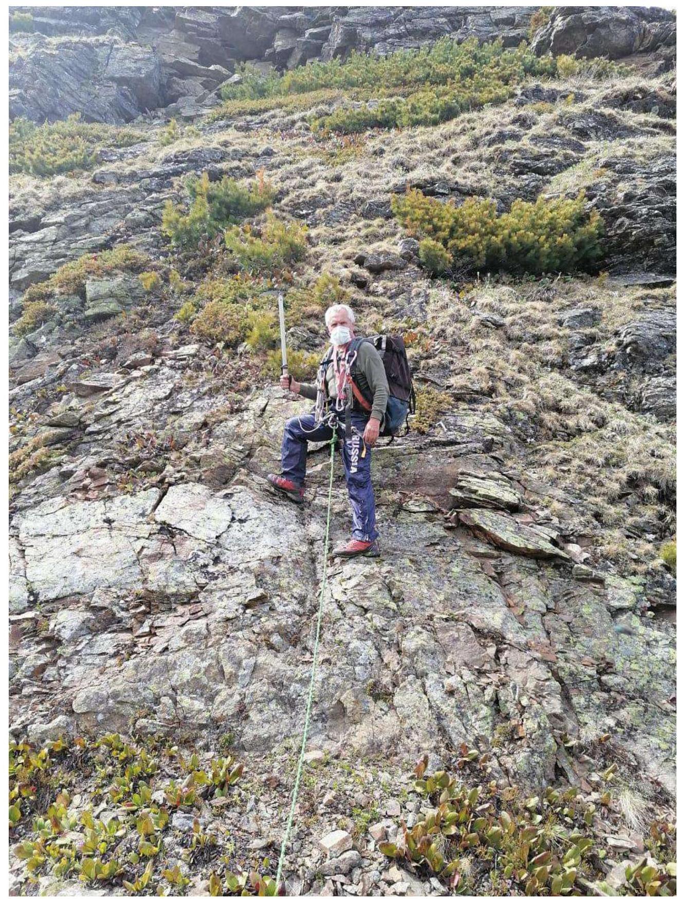
Photo 10. On section R10.
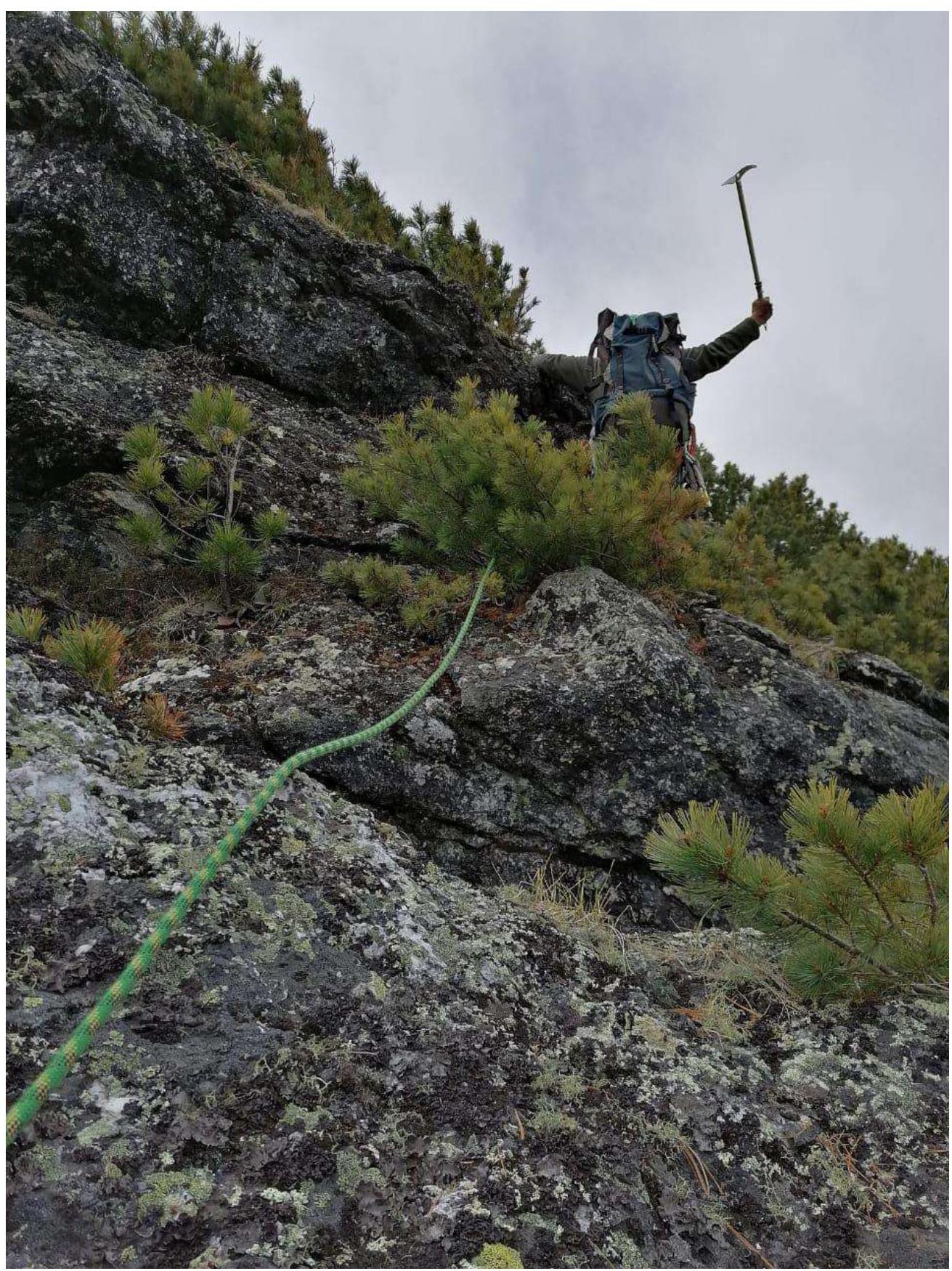
Photo 11. On section R11.
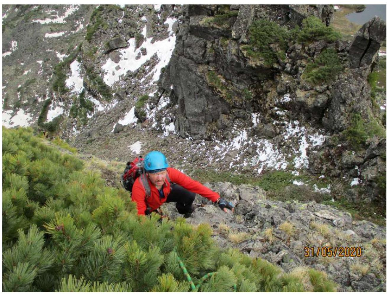
Photo 12. On section R11–R12.

Photo 13. On section R16–R17.
3.2. Photo of the Team on the Summit
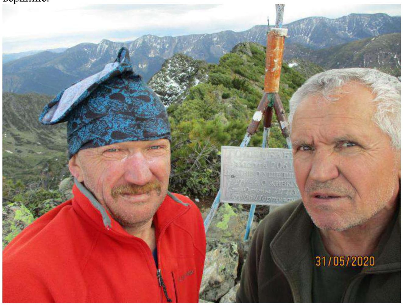
Photo 14.
3.3. The Route is Safe
There is cell phone coverage in some places on the ridge and summit. The first team member, in addition to the standard equipment for the second category, should have an ice axe. An ice axe is convenient for hooking onto elfinwood trunks when pushing through the branches.
Descent from the summit:
- back to the saddle between the Main and Southeast peaks,
- then left onto the Eastern slope,
- down through boulder fields and thickets to the base camp on the clearing by the Porozhistaya River (on maps - Porozhisty stream).
In snowy conditions, it is better to descend:
- along the NW ridge,
- then along an arc under the rocks.
Both descent options can be avalanche-prone. The route corresponds to the proposed category, although it is a bit long for training groups. In winter, it will be slightly more complicated but will remain within the 2A category.
Comments
Sign in to leave a comment