
REPORT
ON THE FIRST ASCENT TO THE PEAK ELEV. 1811 («G. DZYUBA-ZAPADNAYA») VIA THE CENTRAL RIDGE OF THE NORTHERN SLOPE, CATEGORY 1B DIFFICULTY, BY THE TEAM OF KHABAROVSK REGIONAL ORGANIZATION «KHABAROVSK REGIONAL FEDERATION OF ALPINISM» ON JUNE 24, 2018
I. ASCENT DOCUMENTATION
| № | 1. General Information | |
|---|---|---|
| 1.1 | Full name, sports rank of the team leader | Krasnolutsky Alexander Vyacheslavovich, CMS |
| 1.2 | Full name, sports rank of the participants | Kurdyukov Vasily Vladimirovich, 2nd sports rank, Antonov Anton Igorevich, AR, Gorokhov Kirill Gennadievich, AR, Ermolina Alena Evgenievna, AR, Lairova Elena Vladimirovna, AR, Muzychishin Oleg Anatolyevich, AR, Kochegarova Elena Vladimirovna, no rank, Chebanov Pavel Vladimirovich, no rank |
| 1.3 | Full name of the coach | Krasnolutsky Alexander Vyacheslavovich, CMS |
| 1.4 | Organization | Khabarovsk Regional Public Organization «Khabarovsk Regional Federation of Alpinism» |
| 2. Characteristics of the Ascent Object | ||
| 2.1 | Region | Khabarovsk Krai, Nanai Municipal District. Sikhote-Alin Ridge |
| 2.2 | Valley | Valley of the Working Stream |
| 2.3 | Section number according to the 2013 Classification Table | 9.9 |
| 2.4 | Name and height of the peak | Elev. 1811. Local unofficial name «g. Dzyuba» |
| 2.5 | Geographical coordinates of the peak (latitude/longitude), GPS coordinates *(1) | 48°43′58″ N, 138°19′57″ E |
| 3. Characteristics of the Route | ||
| 3.1 | Name of the route | Via the central ridge of the northern slope |
| 3.2 | Proposed category of difficulty | 1B |
| 3.3 | Degree of route development | First ascent; date of the first ascent unknown |
| 3.4 | Character of the route relief | Rocky |
| 3.5 | Height difference of the route (data from altimeter or GPS) | 350 m |
| 3.6 | Route length (in meters) | 840 m |
| 3.7 | Technical elements of the route (total length of sections with different categories of difficulty, indicating the nature of the relief (ice-snow, rocky)) | Category 1 difficulty, rocky – 250 m. Category 1-2 difficulty, rocky – 65 m. Category 2 difficulty, rocky – 50 m. Descent via rappel (on descent) – 1 rope 50 m |
| 3.8 | Descent from the peak | N/ category difficulty, down to the valley of the Working Stream |
| 3.9 | Additional characteristics of the route | Approach to the start of the route through pathless forest, approximately 2 km |
| 4. Characteristics of the Team's Actions | ||
| 4.1 | Time of movement (team's walking hours, in hours and days) | 10 hours |
| 4.2 | Overnights | - |
| 4.3 | Start of the route | 7:00 on June 24, 2018, beginning of work on the route at 10:40 |
| 4.4 | Reaching the peak | 12:50 on June 24, 2018 |
| 4.5 | Return to the base camp | 17:20 on June 24, 2018 |
| 5. Responsible for the Report | ||
| 5.1 | Full name, e-mail | Gorokhov Kirill Gennadievich gokigenn@mail.ru |
II. DESCRIPTION OF THE ASCENT
1. Characteristics of the Ascent Object
1.1. General photo of the peak
Photo from the archive of the participants of the project «Planet Taiga» (https://vk.com/planetataiga ↗); taken from the valley of the Working Stream, November 2016. Own general photo is not available due to heavy cloudiness in the morning and evening on the day of the ascent.
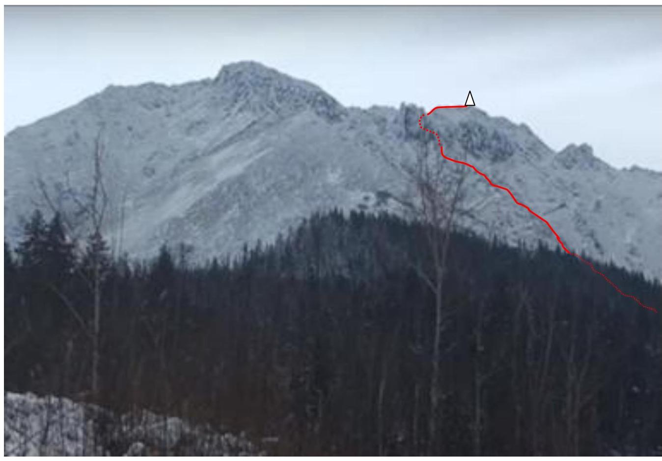
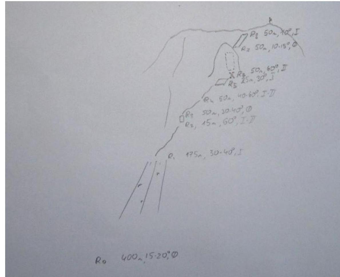
1.2. Photo of the route profile
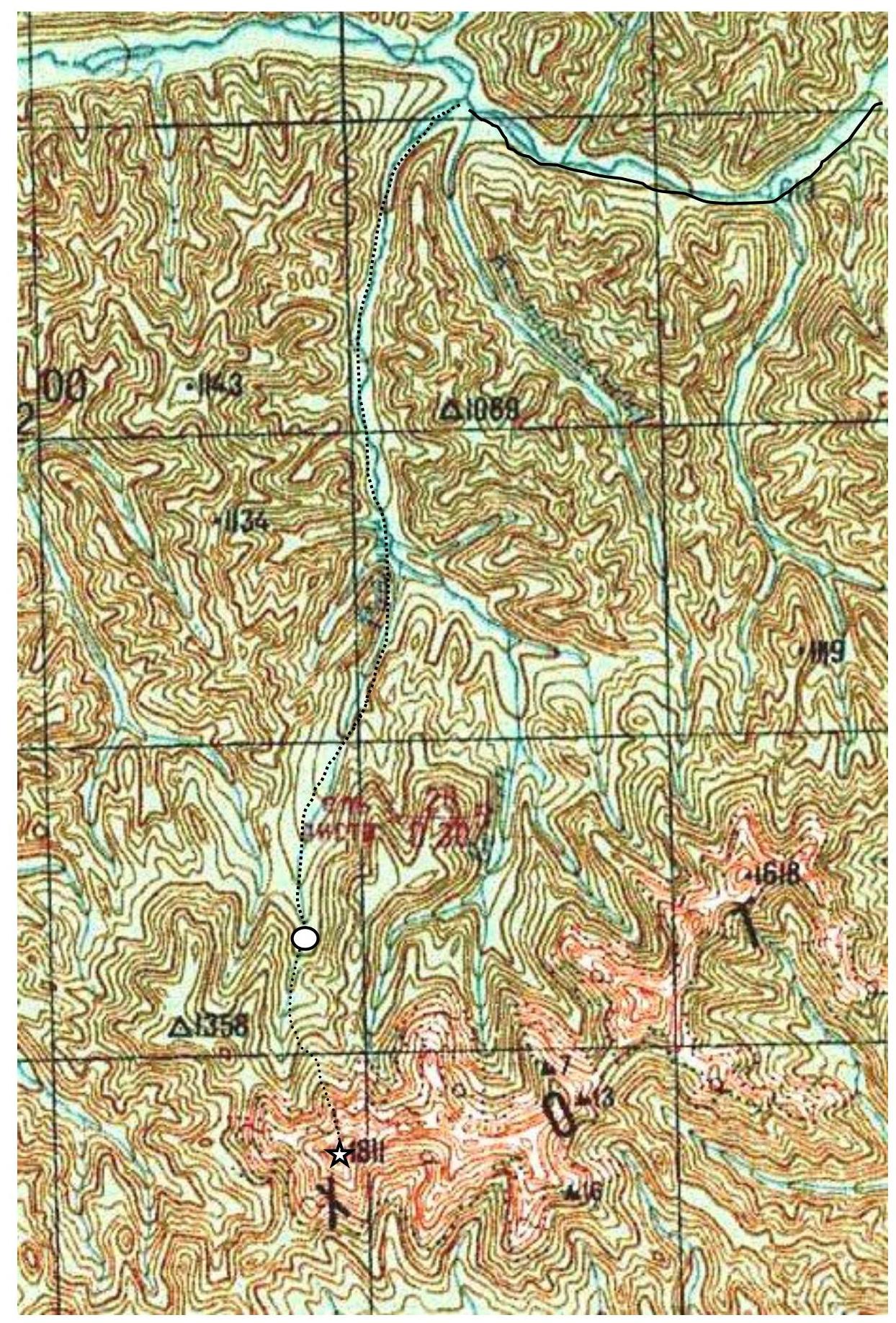
Due to heavy cloudiness in the morning and afternoon on the day of the ascent, a series of photos is presented, reflecting various sections of the profile (date: June 24, 2018, photos by the ascent participants). See also section 3 of this report.
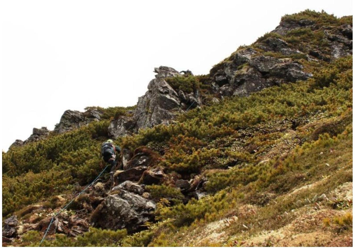
Photo 1. End of section R0–R1 and beginning of section R1–R2
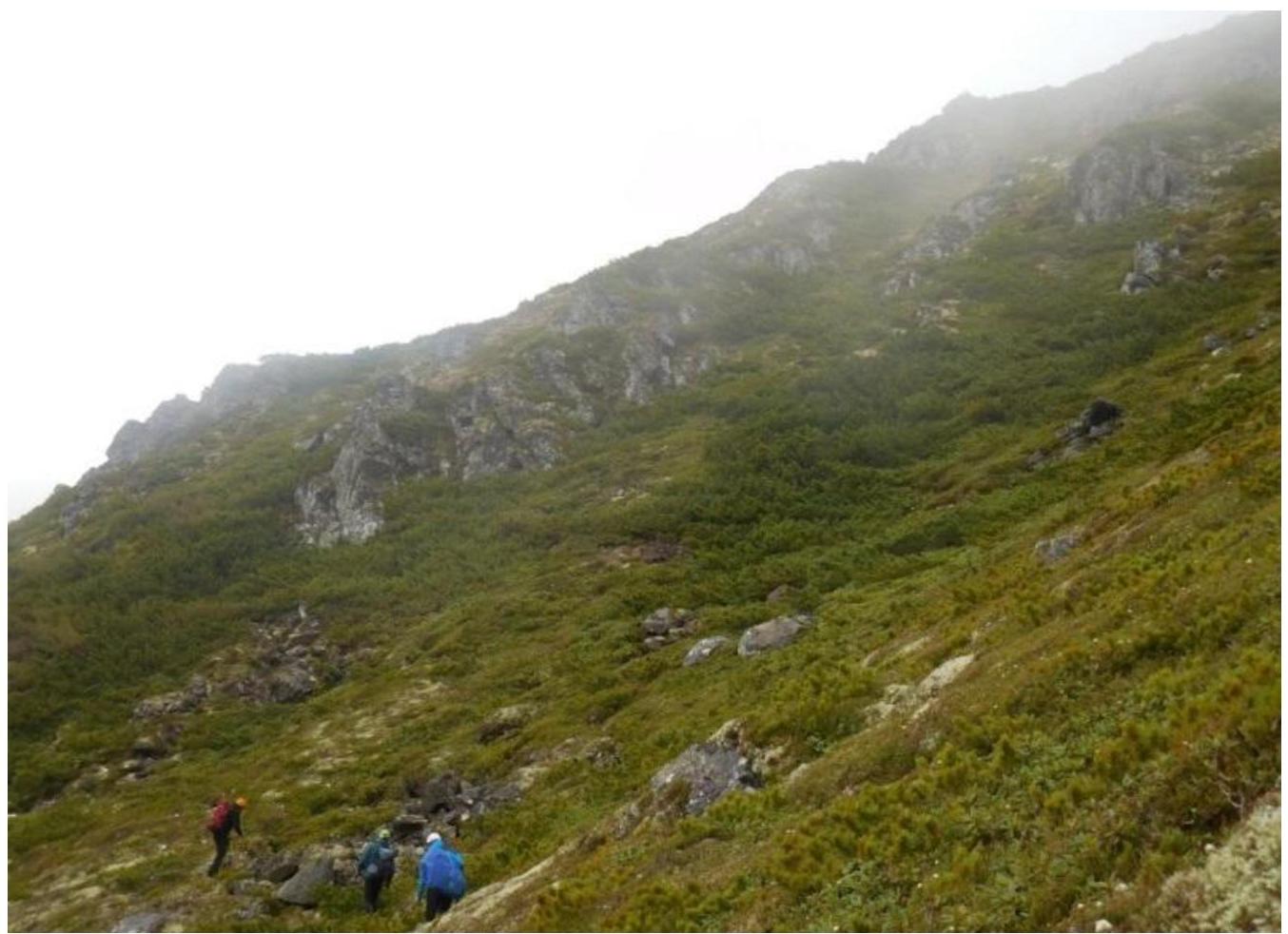
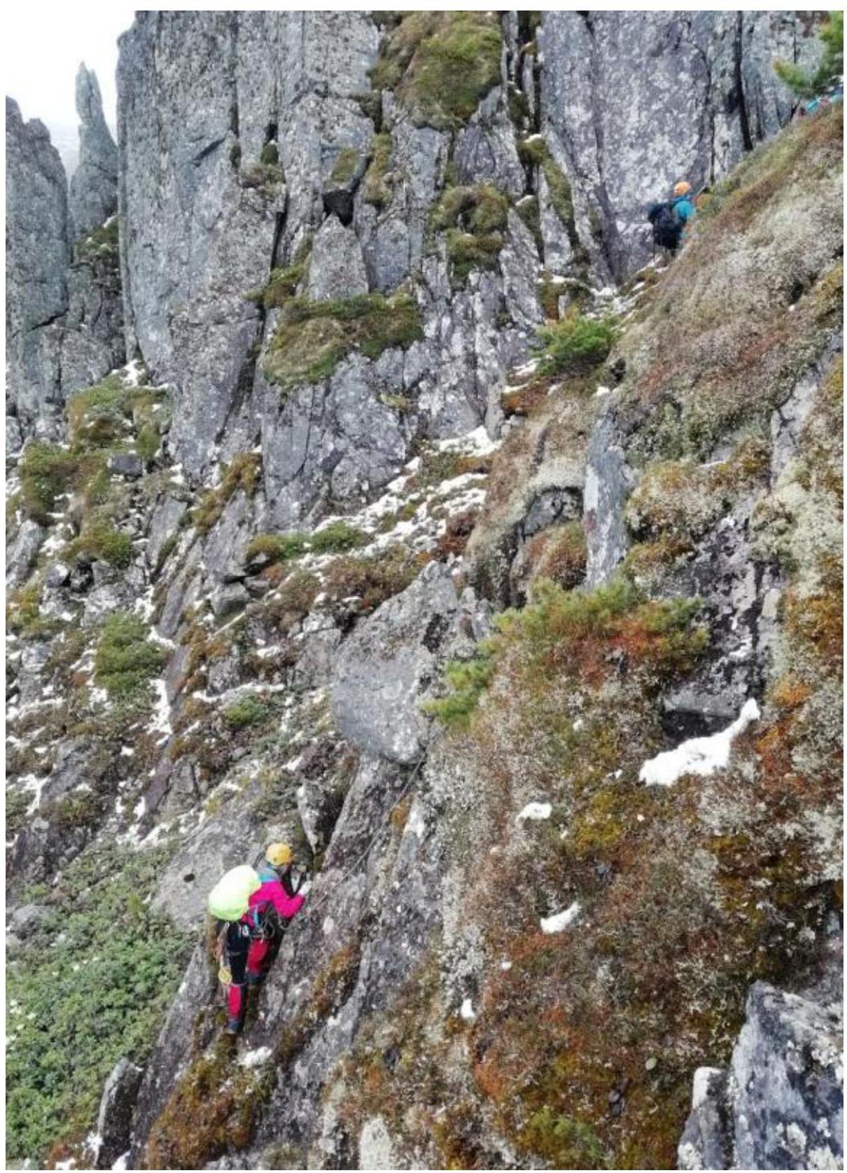
Photo 2. Sections R3–R5 (up to the bastion), R5–R6 (to the right along the bastion)
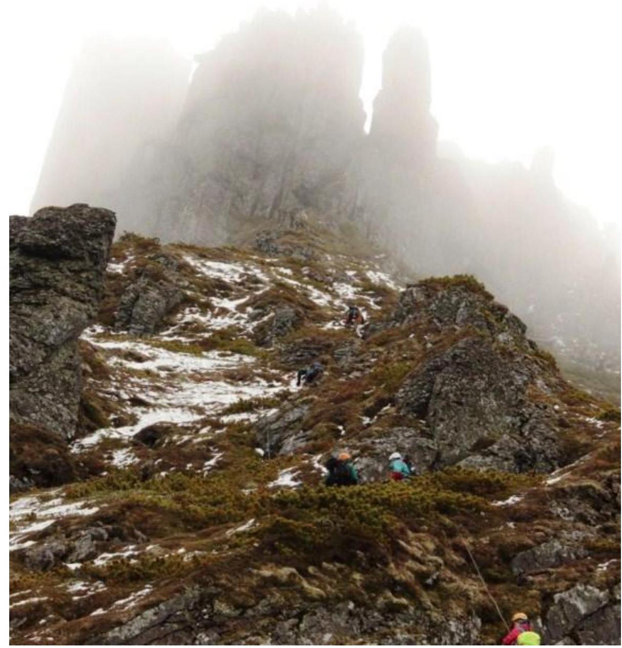
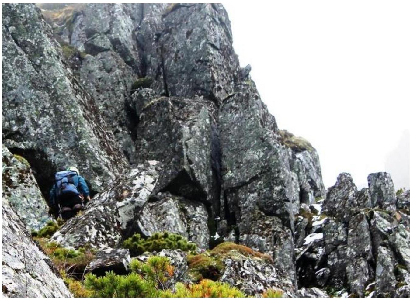
Photo 3. Sections R7–R9.
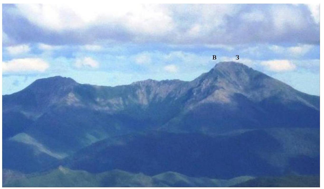
1.3. Photopanorama of the area.
The area represents a separate massif within the Sikhote-Alin mountain system. There are no categorized peaks or passes as of the current date. The photo was taken from the peak of Tordoki-Yani (2090 m above sea level), the highest point of the Sikhote-Alin Ridge (taken in August 2017, by Gorokhov K.G.). The eastern and western shoulders of the peak are marked with the letters V and Z, respectively.
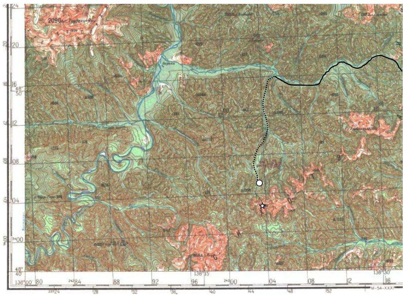
1.4. Map of the area.
The routes to the area are marked (solid black line), the approach route (black dashed line), the location of the base camp (circle), and the peak (asterisk). The second photo is an enlarged fragment of the map.
The mountain is located in the southeastern part of the Nanai Municipal District of Khabarovsk Krai, in the northern part of the Sikhote-Alin Ridge, in the watershed of the right bank of the Anyui River. The distance from the nearest populated area, Vanino settlement, to the base camp is 245 km, including 165 km of asphalt roads, 70 km of dirt roads («Arkaim» forestry section), and 10 km of forest footpaths (overgrown and destroyed logging roads in the valley of the Working Stream); the distance from the base camp to the start of the ascent through pathless forest is 2 km.
2. Characteristics of the Route
2.1. Technical photograph showing the main relief is not available due to cloudiness on the day of the ascent. A photo from section 1.1 of this report is used instead. See section 3.1 for more details.
2.3. Technical characteristics of the route sections
| Section № | Character of the relief | Category of difficulty | Length, m | Type and number of hooks |
|---|---|---|---|---|
| R0–R1 | Grassy-stony slope. 15–20°. | 0 | 400 | |
| R1–R2 | Narrow rocky ridge, partially covered with dwarf pine and moss, easily detachable from the rock (risk of falling!). 30–40°. | 1 | 175 | 2 friends, loop around relief, laying rope around relief. |
| R2–R3 | Small wall leading to the continuation of the ridge. 60°. | 1–2 | 15 | 2 friends. Base – loop on a stone. |
| R3–R4 | Wide grassy ridge leading to the start of the rocky bastion. 30–40° | 0 | 50 | Insurance around relief. |
| R4–R5 | Rocky ridge, partially covered with small bushes and moss, easily detachable from the rock (risk of falling!). 40–60°. | 1–2 | 50 | Cam, friend, insurance around relief. Base – loop on a stone. |
| R5–R6 | Movement traversing to the right along the base of the rocky bastion to the «caliber» formed by a very large fallen stone slab. 30°. | 1 | 25 | Cam, insurance around relief. Base – loop on a stone. |
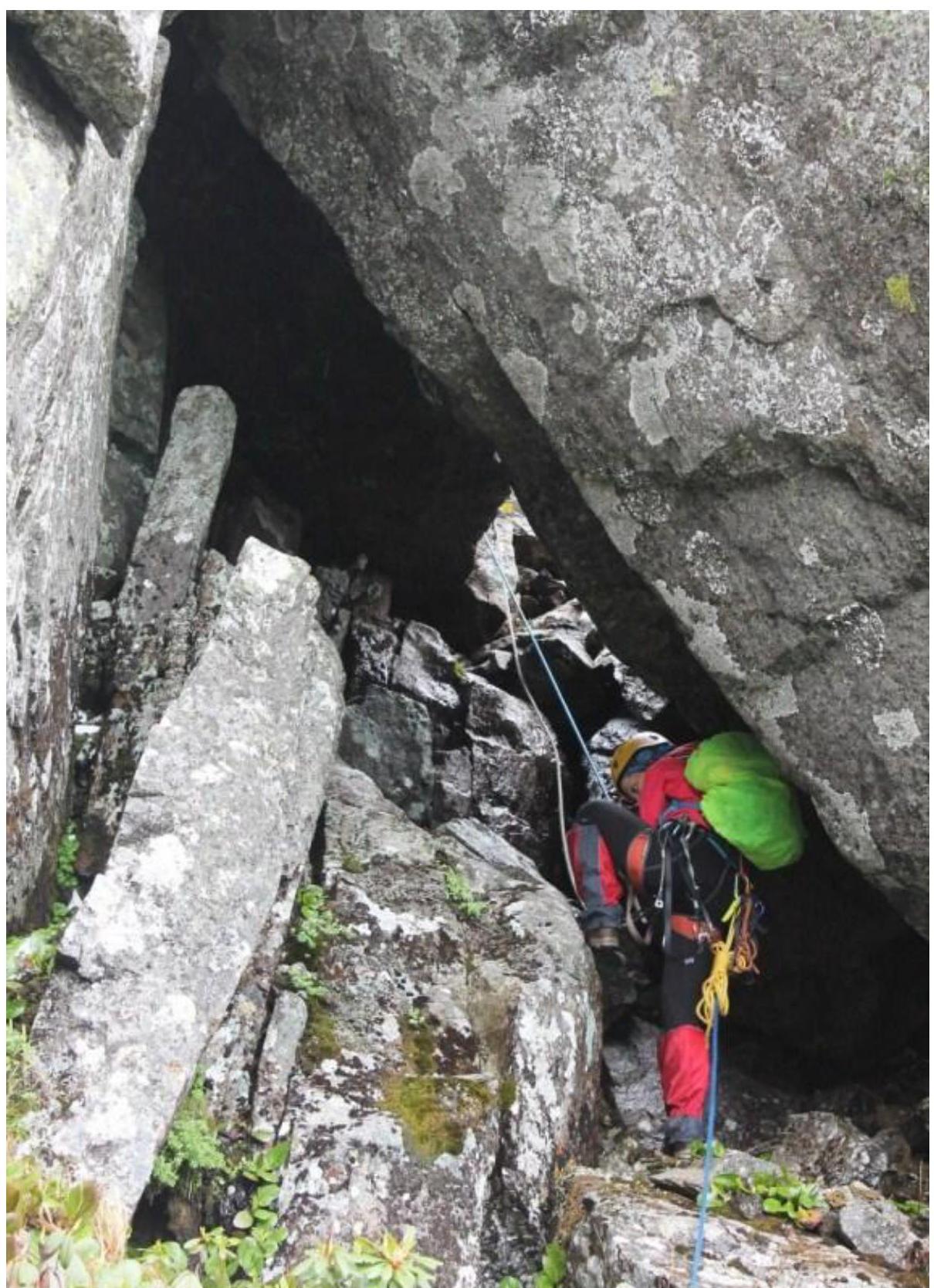
| R6–R7 | Movement through the «caliber» and further along the wall leading to the summit ridge. 60°. | 2 | 50 | 2 cams, friend, insurance around relief. Base – loop on a stone. |
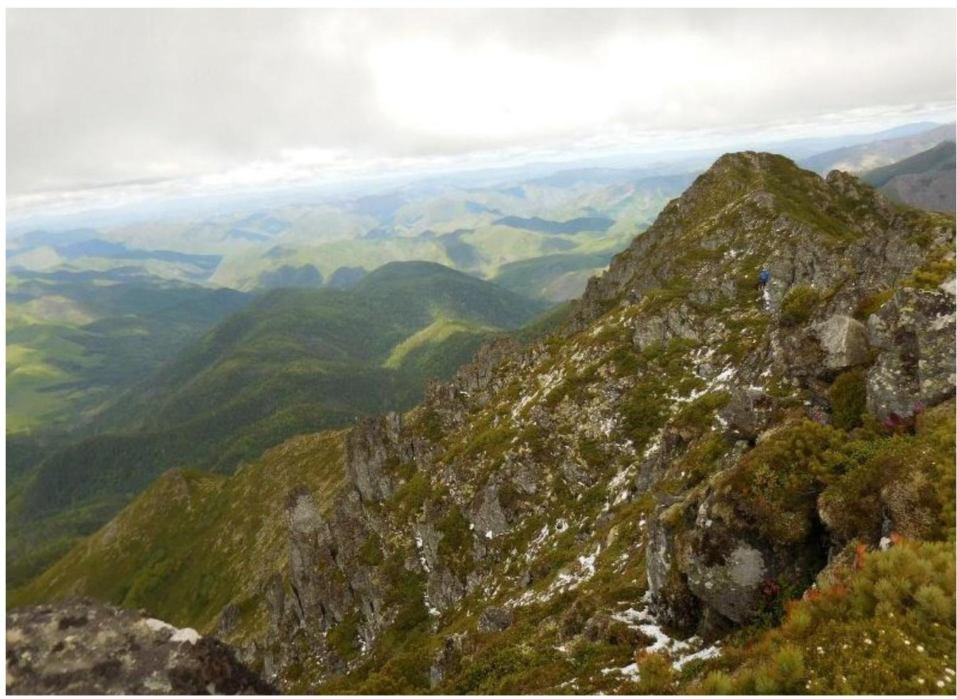
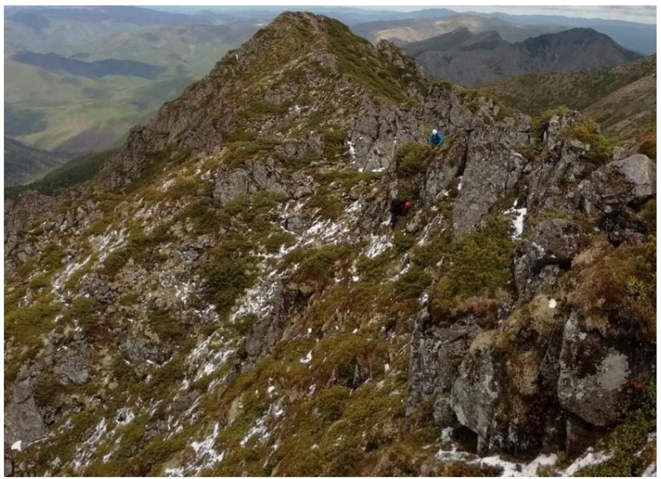
| R7–R8 | Moving to the right onto the saddle of the peak along a slope covered with sparse small rocks and overgrown with grass. 10–15°. | 0 | 50 | Insurance around relief. |
| R8–R9 | Movement to the right along the partially destroyed ridge. Exit to the peak. 10°. | 1 | 50 | 2 loops on stones, insurance around relief. |
3. Characteristics of the Team's Actions
3.1. Brief description of the route passage.
| Section № | Description | Photo № |
|---|---|---|
| R0–R1 | Grassy-stony slope going up from the strip of dwarf pine. 15–20°. Simultaneous movement. Use of ice axe and trekking poles as support on individual sections. | Photo 1 |
| R1–R2 | Narrow rocky ridge, partially covered with dwarf pine and moss, easily detachable from the rock (risk of falling!). 30–40°. Simultaneous movement. 2 friends, loop around relief, laying rope around relief. | Photo 2 |
| R2–R3 | Small wall leading to the continuation of the ridge. 60°. Alternating movement. 2 friends. Base – loop on a stone. | |
| R3–R4 | Wide grassy ridge leading to the start of the rocky bastion. 30–40°. Simultaneous movement. Insurance around relief. | |
| R4–R5 | Rocky ridge, partially covered with small bushes and moss, easily detachable from the rock (risk of falling!). 40–60°. Alternating movement, for prepared groups – simultaneous movement. Approach to the center of the rocky bastion. Cam, friend, insurance around relief. Base – loop on a stone. | Photo 3 |
| R5–R6 | Movement traversing to the right along the base of the bastion to the «caliber» formed by a very large fallen stone slab. 30°. Cam, insurance around relief. Base – loop on a stone. | Photo 4 |
| R6–R7 | Movement through the «caliber» (in the photo) and further along the wall leading to the summit ridge, moving slightly to the left along the more monolithic part. 60°. Ropes. 2 cams, friend, insurance around relief. Base – loop on a stone. | Photo 5 |
| R7–R8 | Moving to the right onto the saddle of the peak along a slope covered with sparse small rocks and overgrown with grass. 10–15°. Simultaneous movement, with exit to the saddle. Insurance around relief. | Photo 6 |
| R8–R9 | Movement to the right, to the western shoulder of the peak, along the partially destroyed ridge. Exit to the peak. 10°. Simultaneous movement. 2 loops on stones, insurance around relief. | Photo 6 |
Photos:

3.2. Photo of the team at the peak with the control tour.
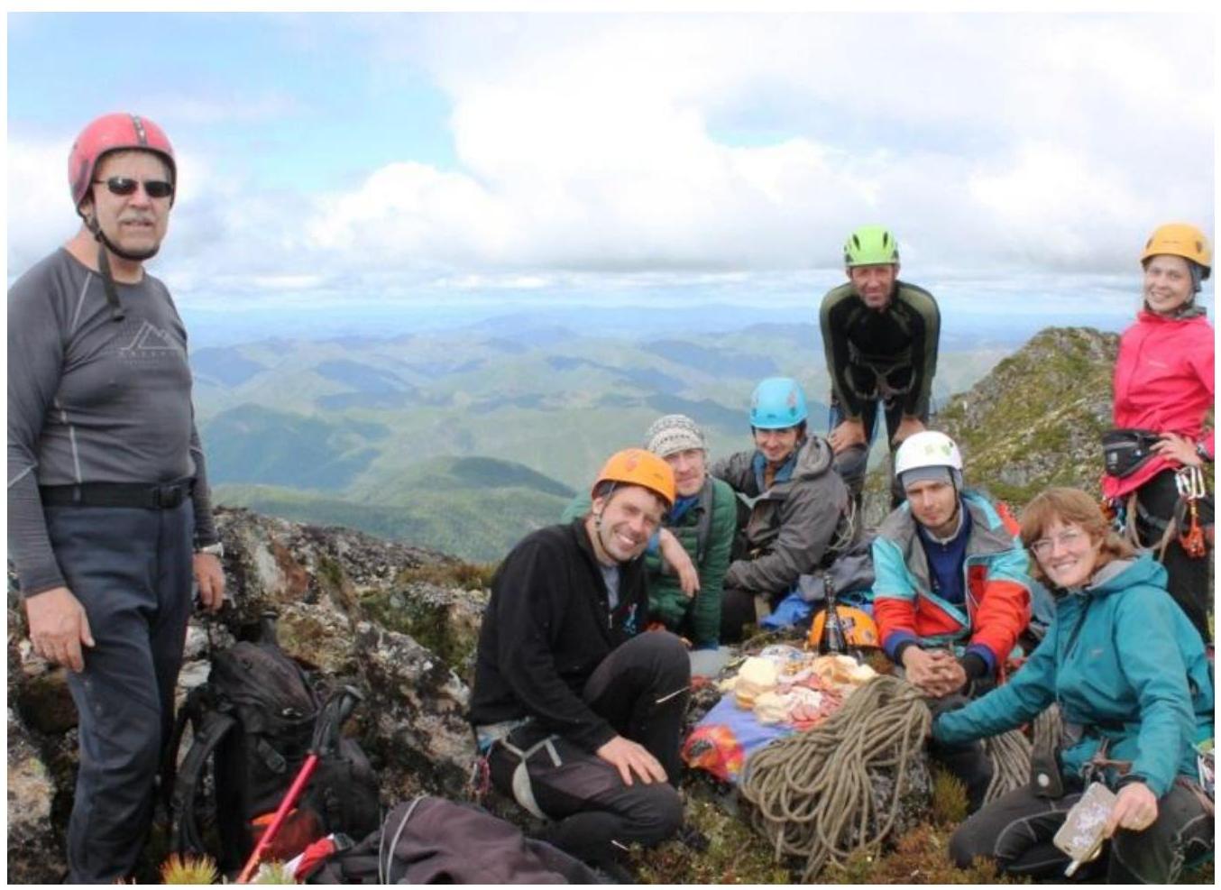
From left to right:
- Kurdyukov Vasily Vladimirovich, 2nd sports rank
- Gorokhov Kirill Gennadievich, AR
- Muzychishin Oleg Anatolyevich, AR
- Antonov Anton Igorevich, AR
- Krasnolutsky Alexander Vyacheslavovich, CMS
- Chebanov Pavel Vladimirovich, no rank
- Kochegarova Elena Vladimirovna, no rank
- Lairova Elena Vladimirovna, AR
- Out of frame, taking the photo: Ermolina Alena Evgenievna, AR
3.3. Safety assessment of the route. Options for communication on the route. Recommendations for subsequent climbers.
The route is generally not difficult, logical, fairly safe, and has low rockfall risk, making it suitable for Category 1B difficulty for obtaining the «Alpinist of Russia» badge.
Care should be taken on grassy slopes, especially in wet conditions, as the turf can easily detach from the rock (recommended to move with an ice axe), which can affect the category of difficulty of these sections (1–2).
The descent from the peak occurs into the hollow between the central (ascent route) and western ridges of the northern slope of the mountain. The first section of the descent is recommended to be done with the organization of ropes due to significant steepness; further descent can be done without the use of ropes and insurance points, moving simultaneously to the R1 point.
Comments
Sign in to leave a comment