
Report on the First Ascent to the Peak Mechta via the "Der fliegende Hollander" Route on the First Bastion of the Western Wall of the Southern Ridge, Category 6A, by the Team "Невозможно – это не навсегда..." from July 12, 2020, to July 12, 2020
I. Climbing Report
| 1. General Information | ||
|---|---|---|
| 1.1 | Full Name, Sports Rank of the Leader | Glazunov Evgeny Vladimirovich, Master of Sports |
| 1.2 | Full Name, Sports Rank of Participants | Syshchikov Anatoly, Master of Sports, Panova Alena Mikhailovna, Candidate for Master of Sports |
| 1.3 | Full Name of Coach | Glazunov Evgeny Vladimirovich |
| 1.4 | Organization | Club "Gory Baikala", project "Невозможно – это не навсегда..." |
| 2. Characteristics of the Climbing Object | ||
| 2.1 | Region | South-Muya Range |
| 2.2 | Valley | Rivers Levy Ukuolkit |
| 2.3 | Section Number according to the 2013 Classification Table | 9.11 |
| 2.4 | Name and Height of the Peak | Mechta, 2590 m |
| 2.5 | Geographical Coordinates of the Peak (Latitude/Longitude), GPS Coordinates *(1) | 55°30′35.4″ N 112°39′16.7″ E |
| 3. Characteristics of the Route | ||
| 3.1 | Name of the Route | "Der fliegende Hollander" on the first bastion of the Western wall of the Southern ridge |
| 3.2 | Proposed Category of Complexity | 6A |
| 3.3 | Degree of Route Exploration | First Ascent |
| 3.4 | Nature of the Route Terrain | Rock |
| 3.5 | Height Difference of the Route (altimeter or GPS data) | 800 m |
| 3.6 | Route Length (in meters) | 1110 m |
| 3.7 | Technical Elements of the Route (total length of sections with different categories of complexity, indicating the nature of the terrain (ice-snow, rock)) | 1 cat. complexity rocks – 0 m. 2 cat. complexity rocks – 50 m. 3 cat. complexity rocks – 55 m. 4 cat. complexity rocks – 90 m. 5 cat. complexity rocks – 415 m. 6 cat. complexity rocks – 445 m. (6A – 135 m, 6B–6B+ – 270 m, 6C – 40 m) |
| 3.8 | Average Steepness of the Route, (°) | 71° |
| 3.9 | Average Steepness of the Main Part of the Route, (°) | 81° |
| 3.10 | Descent from the Summit | North along the couloir, then traverse left to the bivouac |
| 3.11 | Additional Characteristics of the Route | Wet corners after rain. |
| 4. Characteristics of Team Actions | ||
| :--: | :--: | :--: |
| 4.1 | Time of Movement (team's marching hours, in hours and days) | 10 h 50 min, 1 day |
| 4.2 | Overnight Stays | - |
| 4.3 | Time of Route Preparation | - |
| 4.4 | Start of the Route | 5:00, July 12, 2020 |
| 4.5 | Reaching the Summit | 16:40, July 12, 2020 |
| 4.6 | Return to the Base Camp | 19:30, July 12, 2020 |
| 5. Weather Conditions | ||
| 5.1 | Temperature, °C | |
| 5.2 | Wind Speed, m/s | |
| 5.3 | Precipitation | 10–20 mm, 30 min, thunderstorm |
| 5.4 | Visibility, m | |
| 6. Responsible for the Report | ||
| 6.1 | Full Name, e-mail | Panova Alena Mikhailovna, aljonchik1905@mail.ru 8-999-686-20-78 |
II. Climbing Description
1. Characteristics of the Climbing Object
1.1. General Photo of the Peak
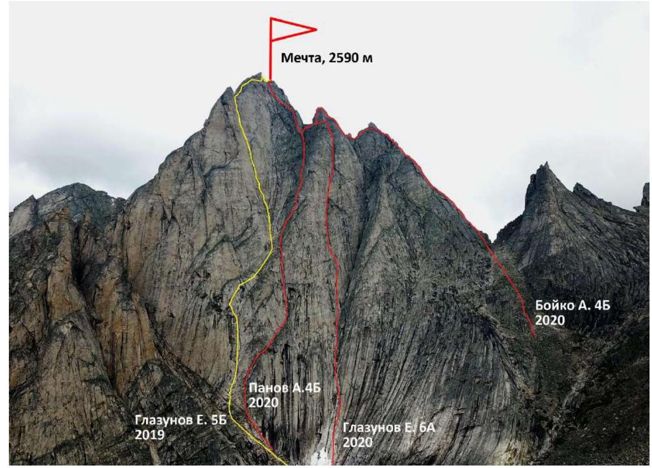
Photo 1. Taken on July 11, 2020, from the river Levy Ukuolkit.
1.2. Photo of the Route Profile
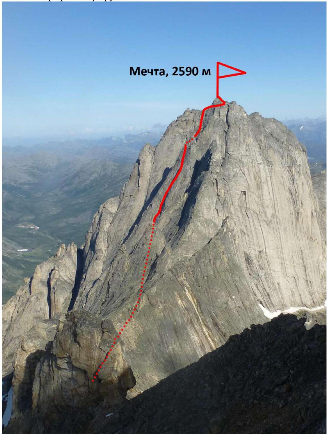
Photo 2. Taken on July 15, 2020, from the ascent along the Southern ridge to peak Chudovishche.
1.3. Drawn Profile of the Route
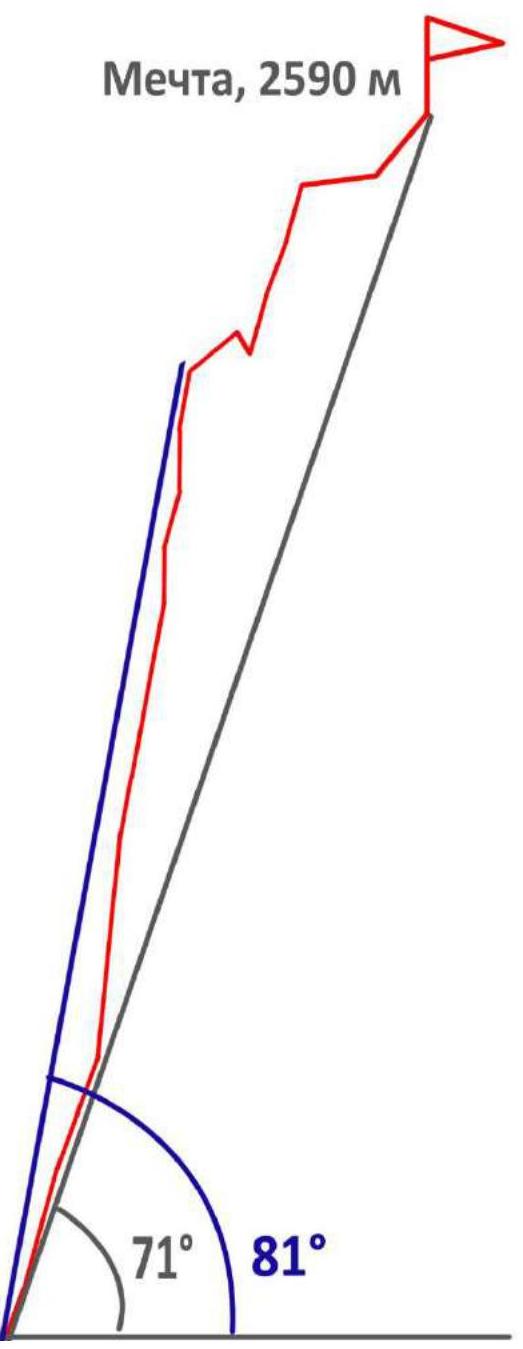
Photo 3.
1.4. Photo Panorama of the Area
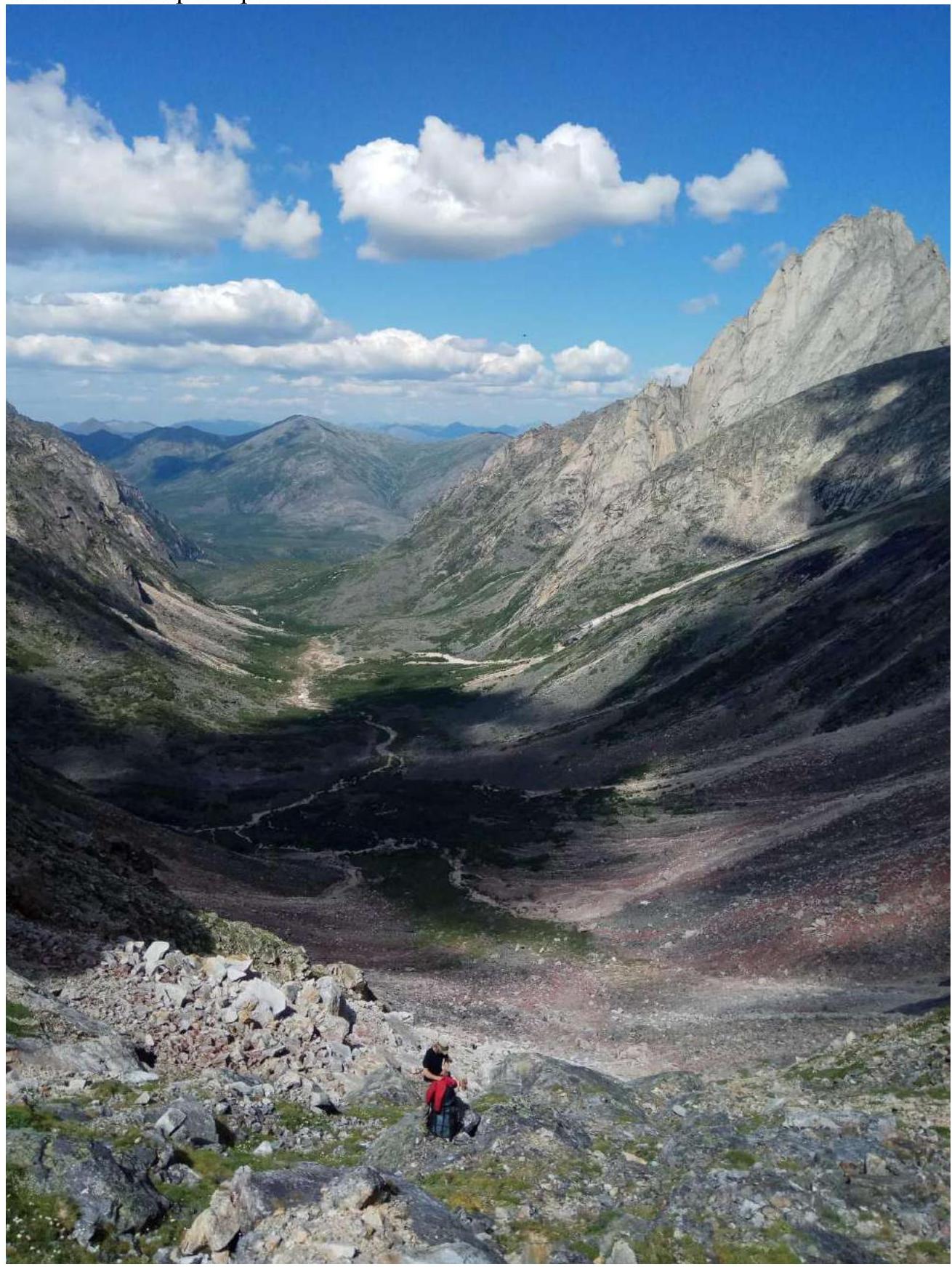
Photo 4. Panorama of the valley under the western wall of peak Mechta, taken from pass Alenka. July 2019.
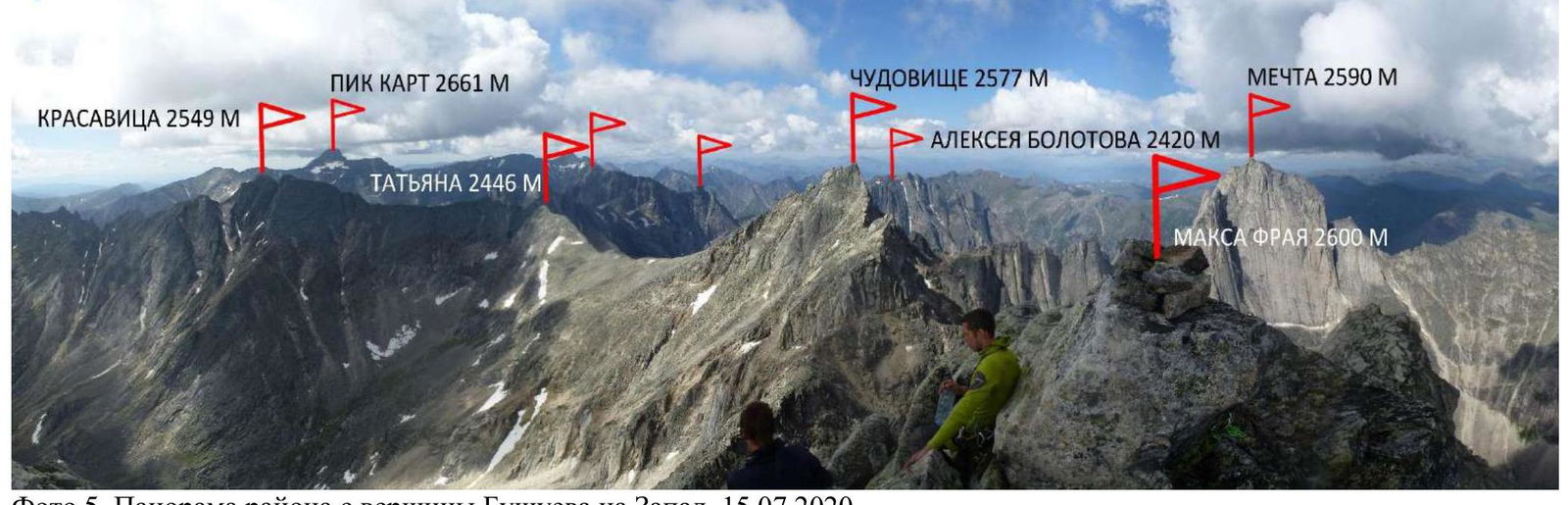
Photo 5. Panorama of the area from the summit of Bushueva to the West. July 15, 2020.
1.5. Map of the Area.
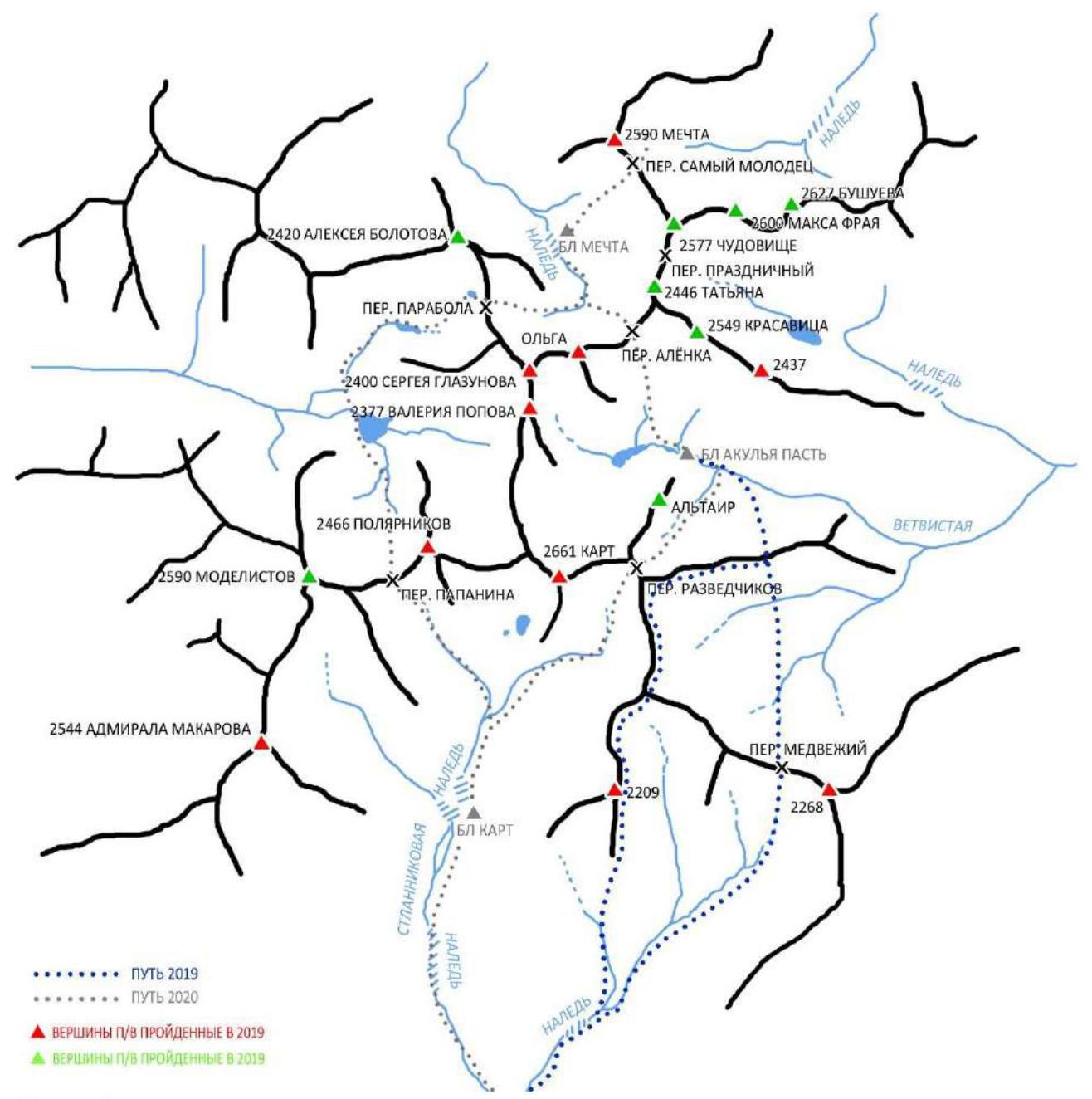
Photo 6.
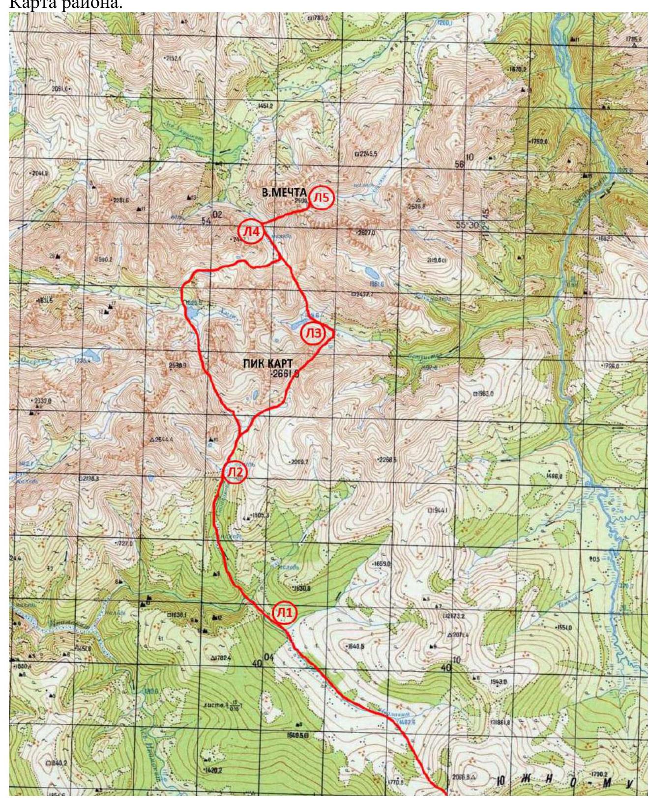
Photo 7. Path of the 2020 expedition. The ascent was made from camp L4. Peak Mechta is located in the southwestern part of the South-Muya Range in the upper reaches of the valley of the river Levy Ukuolkit. Currently, 4 routes have been laid to the peak by the team of the project "Невозможно – это не навсегда" from category 4B to 6A inclusive.
The nearest settlement is Baunt, located 400 km north of Chita, 120 km from Bagdarin. Baunt is a small village where you can find overnight accommodation on the way, there:// is a store. There is no cellular connection.
From Baunt, head north towards the river Ayan and further along Maly Ayan for about 20 km. This section can be traveled by all-terrain vehicle, and at the end of the all-terrain vehicle access, the main base is organized with supplies of provisions and tents, as well as equipment for charging devices in the conditions of the expedition.
From the base, move to the upper reaches of the river Maly Ayan and further up to the non-category pass, 1900 m. From here, views open up to the southwestern part of the South-Muya Range. From the pass, descend to the river Inamakikit and move along its right bank until the confluence of the river Stlanikovaya. Then ascend along Stlanikovaya to its upper reaches. It is convenient to organize a camp in the forest zone, not reaching the second aufeis (on the map L2, on the diagram BL Kart). The nature of the terrain on the approach is complex. On the ascent and descent from the pass – scree. The upper reaches of Inamakikit are swampy, further along the bank there is an animal trail. The ascent along Stlanikovaya is mainly along the riverbed, along the stones, choosing a more convenient path along the banks. Two aufeis are encountered – ice masses formed as a result of layer-by-layer freezing of river waters. Further approach to Mechta (to camp L4) through pass Razvedchikov – Akulya Pasty – pass Alenka (shown on the map).
2. Characteristics of the Route
2.1. Technical Photograph of the Route
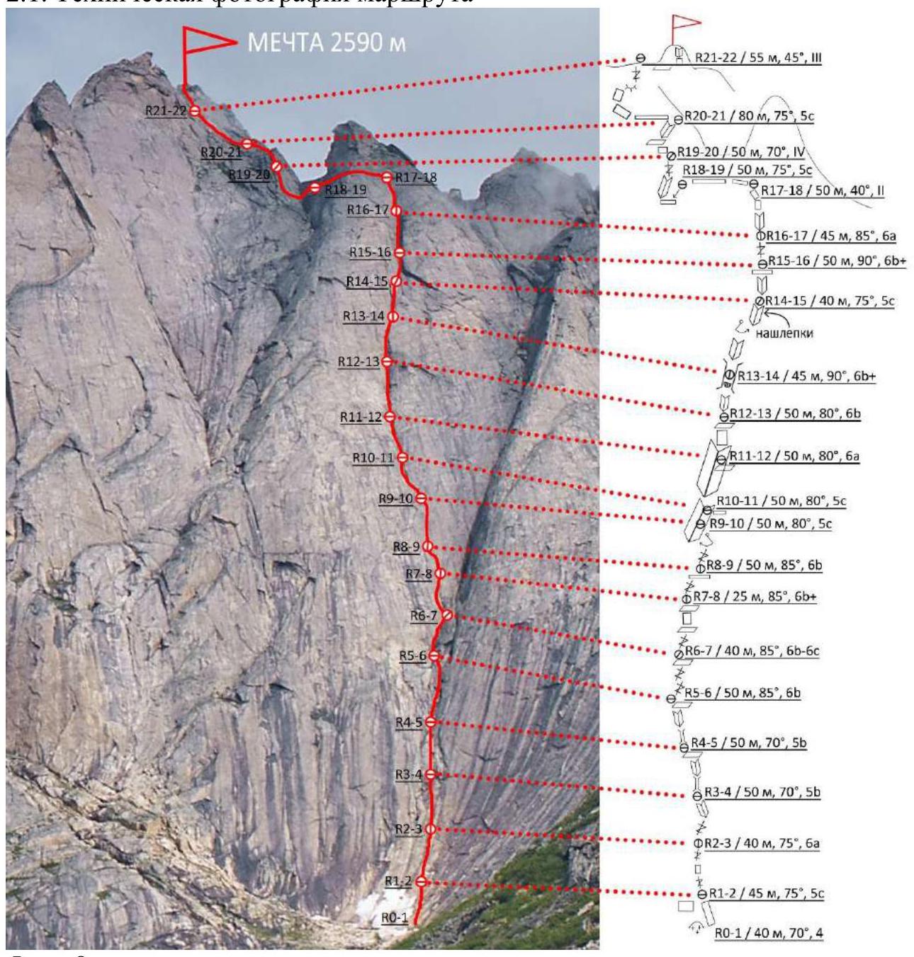
Photo 8.
The numbers of the sections on the technical photograph correspond to the numbers of the sections on the route diagram in UIAA symbols.
2.3. Route Diagram in UIAA Symbols
The team set a goal to pass the route entirely with free climbing, did not take equipment for IT, and did not wear crab claws. The climbing level is given according to the French system.
| Section Number | Route Line in UIAA Symbols | Complexity of the Section in UIAA Symbols | Length of the Section, m | Steepness, ° |
|---|---|---|---|---|
| 21-22 | Mechta, 2590 m | |||
| R21–R22/55 m, 45°, III | ||||
| 20-21 | R20–R21/80 m, 75°, 5c | |||
| 19-20 | R19–R20/50 m, 70°, IV | |||
| 18-19 | R18–R19/50 m, 75°, 5c | |||
| 17-18 | R17–R18/50 m, 40°, II | |||
| 16-17 | R16–R17/45 m, 85°, 6a | |||
| 15-16 | R15–R16/50 m, 90°, 6b+ | |||
| 14-15 | R14–R15/40 m, 75°, 5c | |||
| 13-14 | ledges | |||
| R13–R14/45 m, 90°, 6b+ | ||||
| 12-13 | R12–R13/50 m, 80°, 6b | |||
| 11-12 | R11–R12/50 m, 80°, 6a | |||
| 10-11 | R10–R11/50 m, 80°, 5c | |||
| 9-10 | R9–R10/50 m, 80°, 5c | |||
| 8-9 | R8–R9/50 m, 85°, 6b | |||
| 7-8 | R7–R8/25 m, 85°, 6b+ | |||
| 6-7 | R6–R7/40 m, 85°, 6b-6c | |||
| 5-6 | R5–R6/50 m, 85°, 6b | |||
| 4-5 | R4–R5/50 m, 70°, 5b | |||
| 3-4 | R3–R4/50 m, 70°, 5b | |||
| 2-3 | R2–R3/40 m, 75°, 6a | |||
| 1-2 | R1–R2/45 m, 75°, 5c | |||
| 0-1 | R0–R1/40 m, 70°, 4 |
3. Characteristics of Team Actions
3.1. Brief Description of the Route Passage.
The general direction on the route is towards two consecutive corners on the bastion, clearly visible from any distance.
| Section Number | Description | Photo Number |
|---|---|---|
| R0–R1 | Slabs with a series of cracks. Move left, up, left. Station on a small ledge. | |
| R1–R2 | Up the slabs with ledges, insurance is difficult, cracks are mostly blind. | 10 |
| R2–R3 | Up the crack into the wet corner. | 11 |
| R3–R4 | Up the wet chimney and corner – exit to a ledge. | 12 |
| R4–R5 | Up the slabs with a series of cracks towards the main landmark – the corners. | 13 |
| R5–R6 | Up the slabs with a series of cracks towards the main landmark. | |
| R6–R7 | Up the slabs with a series of cracks towards the main landmark. | |
| R7–R8 | Up the slabs with a series of cracks towards the main landmark. | 14 |
| R8–R9 | Up the crack (slit) upwards, pendulum move left into the base of the first large corner. | 15 |
| R9–R10 | Up the corner. | 16 |
| R10–R11 | Up the corner. | 17 |
| R11–R12 | Logically upwards. | |
| R12–R13 | Logically upwards, station above a small corniche. | 18 |
| R13–R14 | Up the corner, pendulum move right into the second large internal corner. | 19 |
| R14–R15 | Up the corner, station on a convenient ledge. | 20 |
| R15–R16 | Up the crack in the internal corner. | 21 |
| R16–R17 | Up the corner and slabs, exit to a ledge under the bastion. | |
| R17–R18 | Left along gentle ledges, bypassing the bastion. | |
| R18–R19 | Ledges lead to a slab – descend about 5 m left to bypass to the terrain: up the corner and crack, station on a sloping ledge. | 22 |
| R19–R20 | Up the walls and corner, exit to the ridge. | 23 |
| R20–R21 | Along the ledges along the ridge to a series of walls, then upwards to the ridge. | 24 |
| R21–R22 | Along the ridge to the right towards the summit. The tower is bypassed on the right. | 25 |
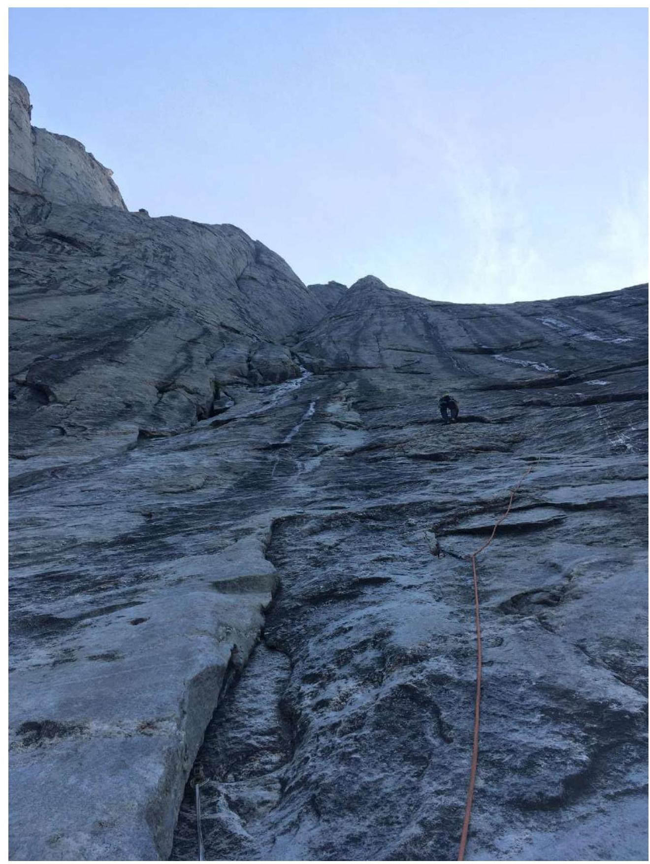
Photo 10. Section R1–R2. View from the station.
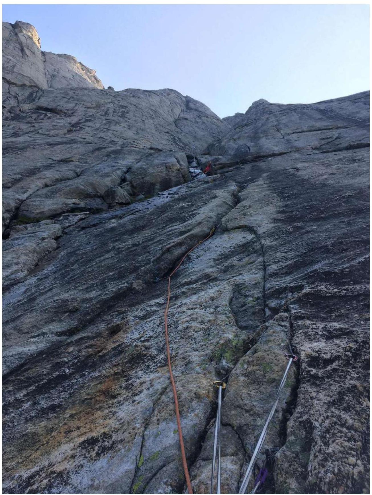
Photo 11. Section R2–R3.

Photo 12. Section R3–R4. Above the working person is the landmark – two consecutive corners.

Photo 13. Anatoly belays Evgeny on section R4–R5.

Photo 14. View from the station on section R7–R8. The leader is on the station at the end of the section.
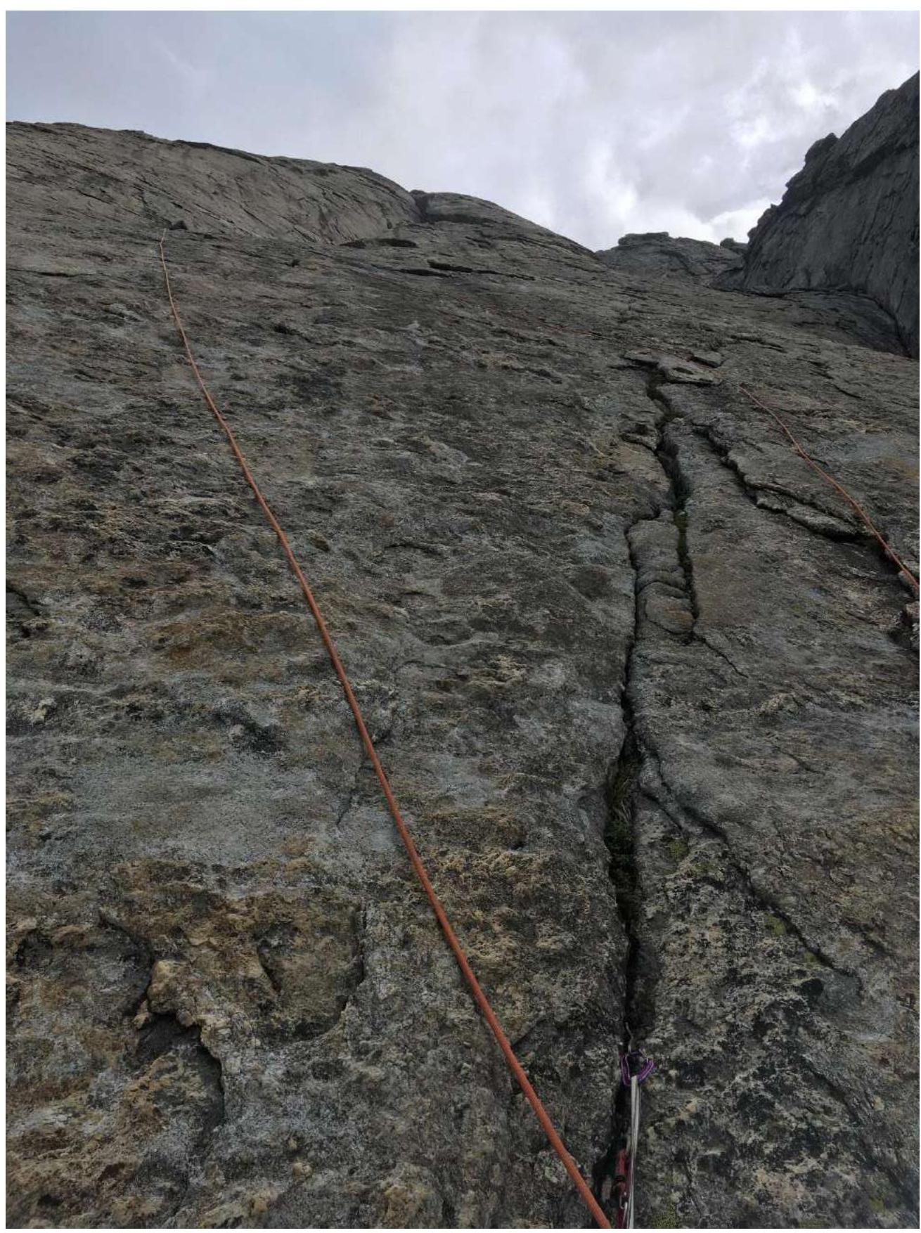
Photo 15. Pendulum move left. Section R8–R9.
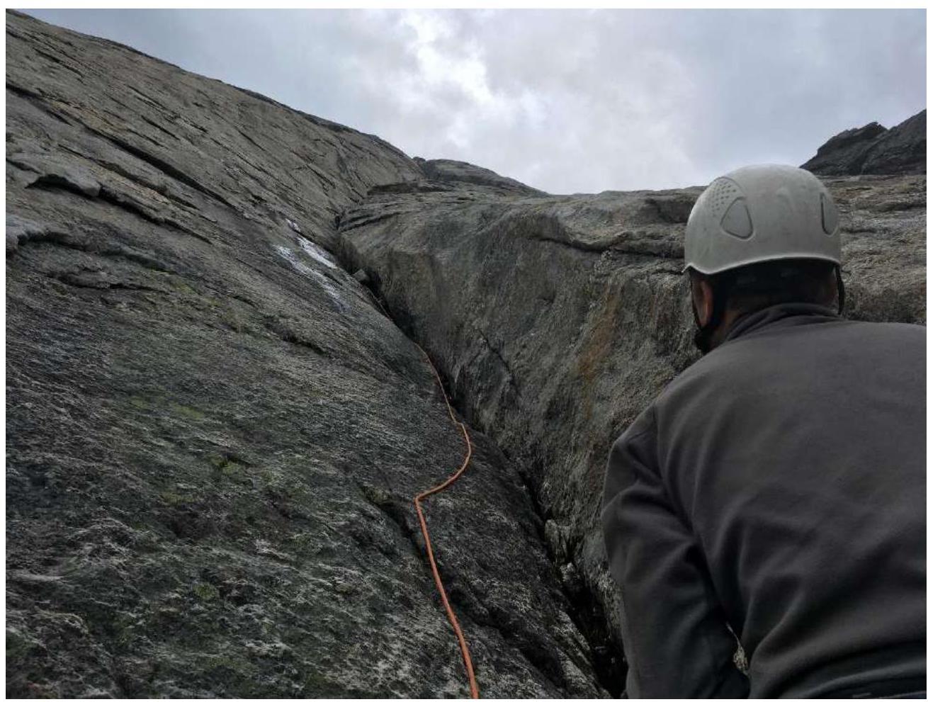
Photo 16. Beginning of the first large internal corner. Section R9–R10.
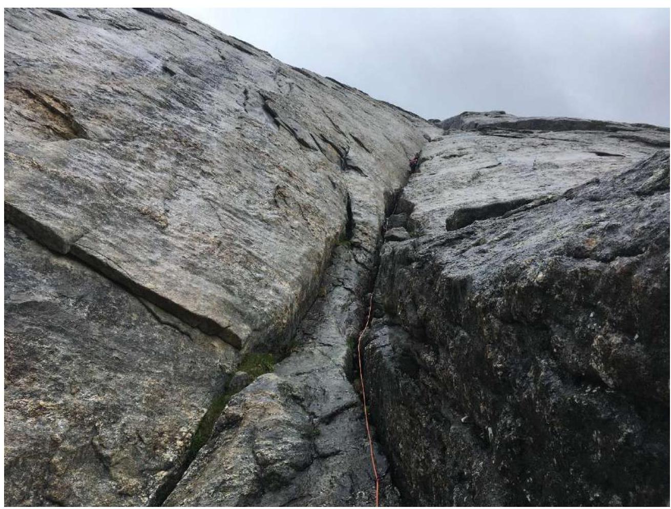
Photo 17. Section R10–R11.
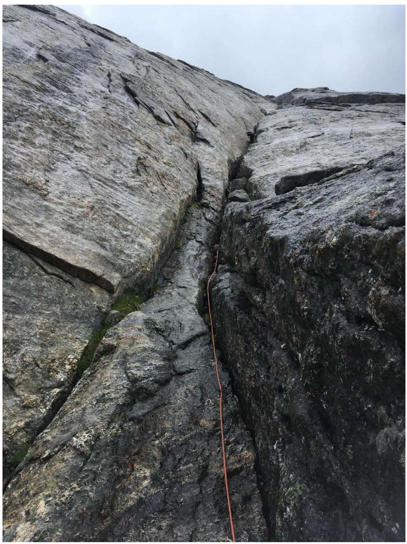
Photo 18. Section R12–R13.
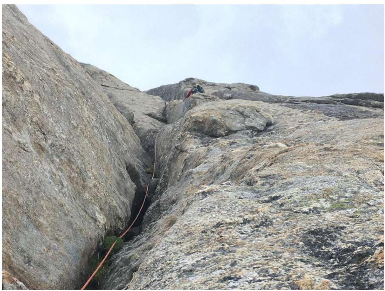
Photo 19. Section R13–R14.

Photo 20. View from the station on section R14–R15.

Photo 21. Beginning of section R15–R16. Rocks are wet after rain.
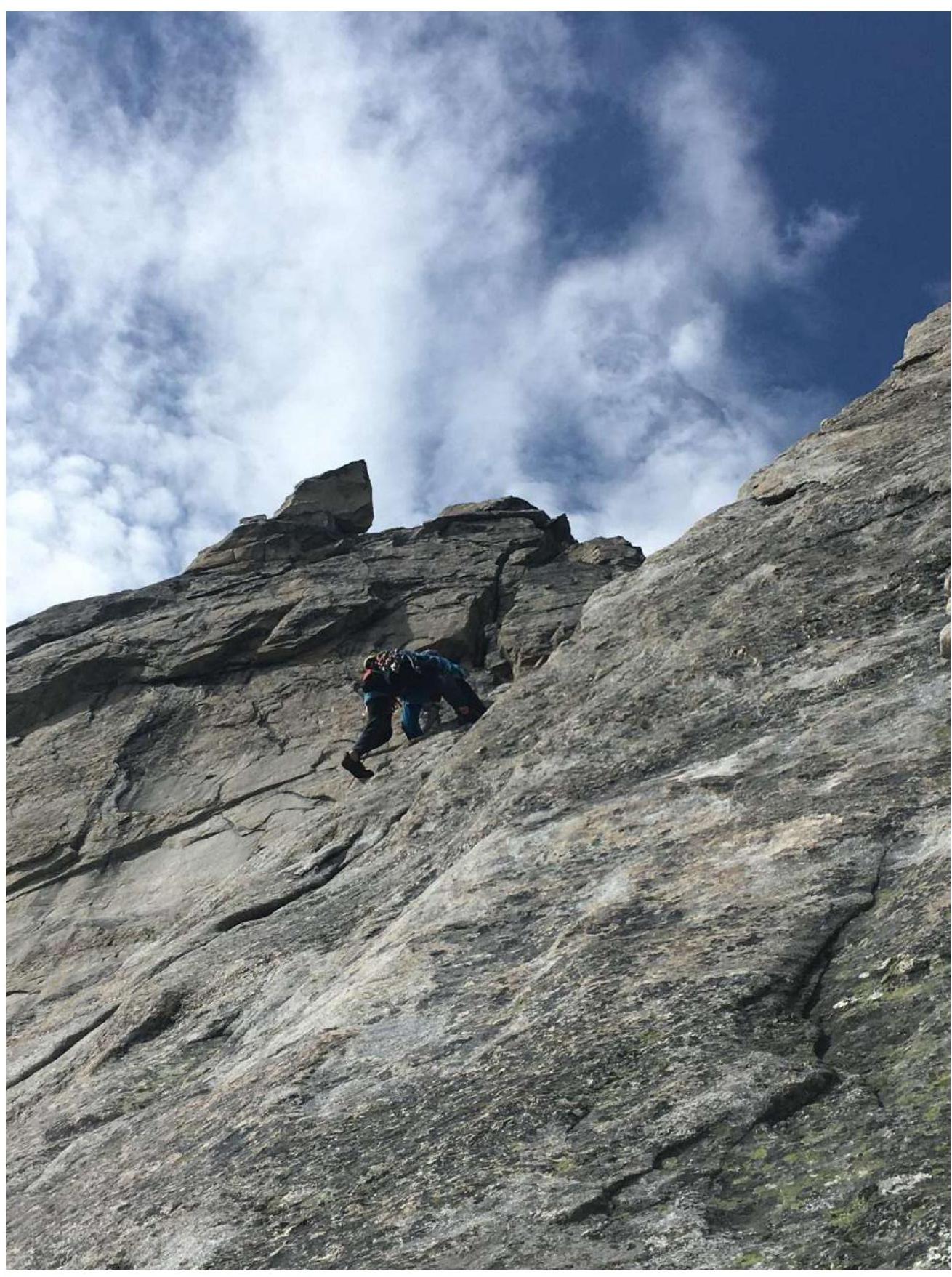
Photo 22. Section R18–R19. The leader descended and bypassed the slab on the left along the corner.
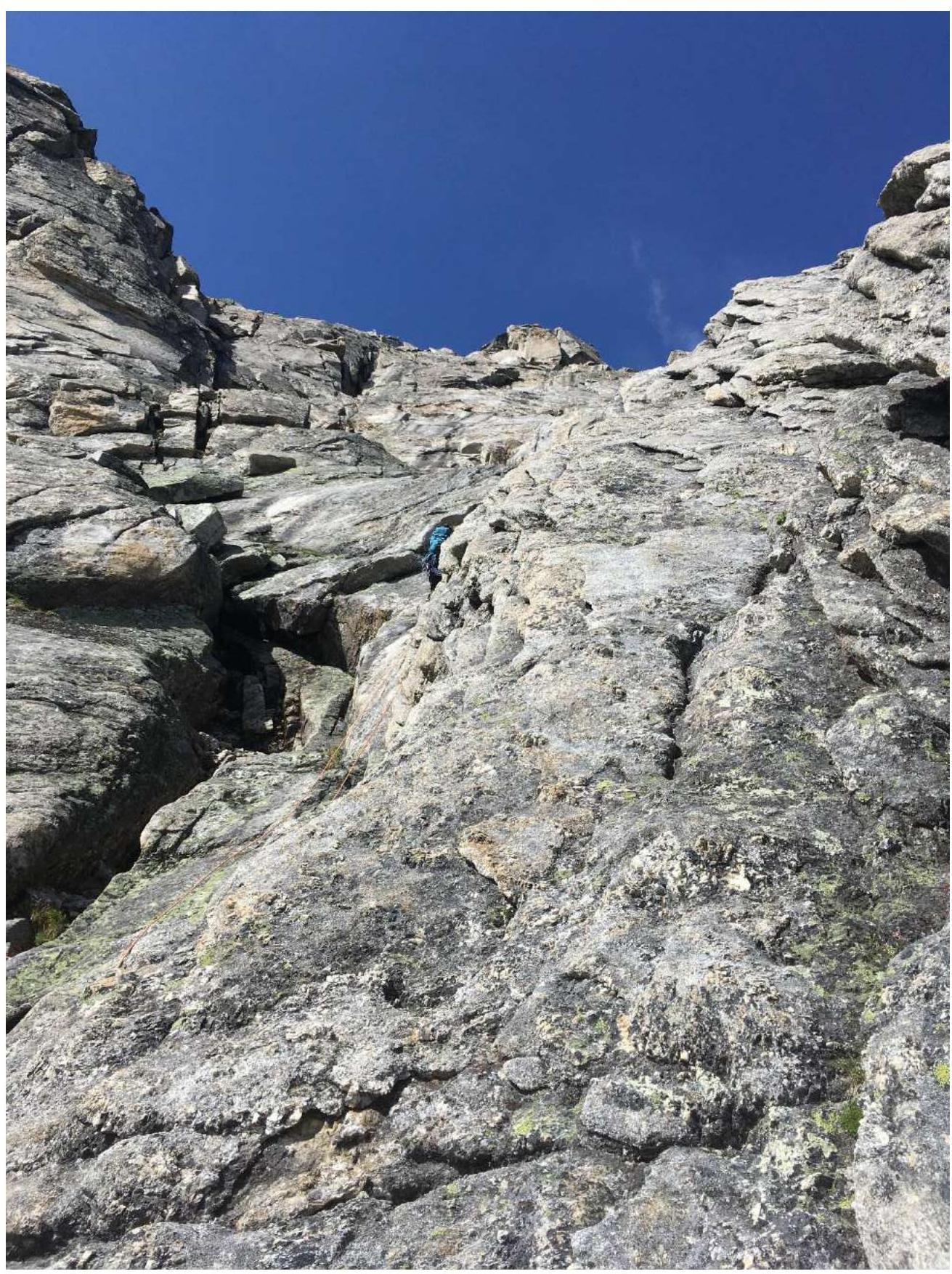
Photo 23. Section R19–R20.
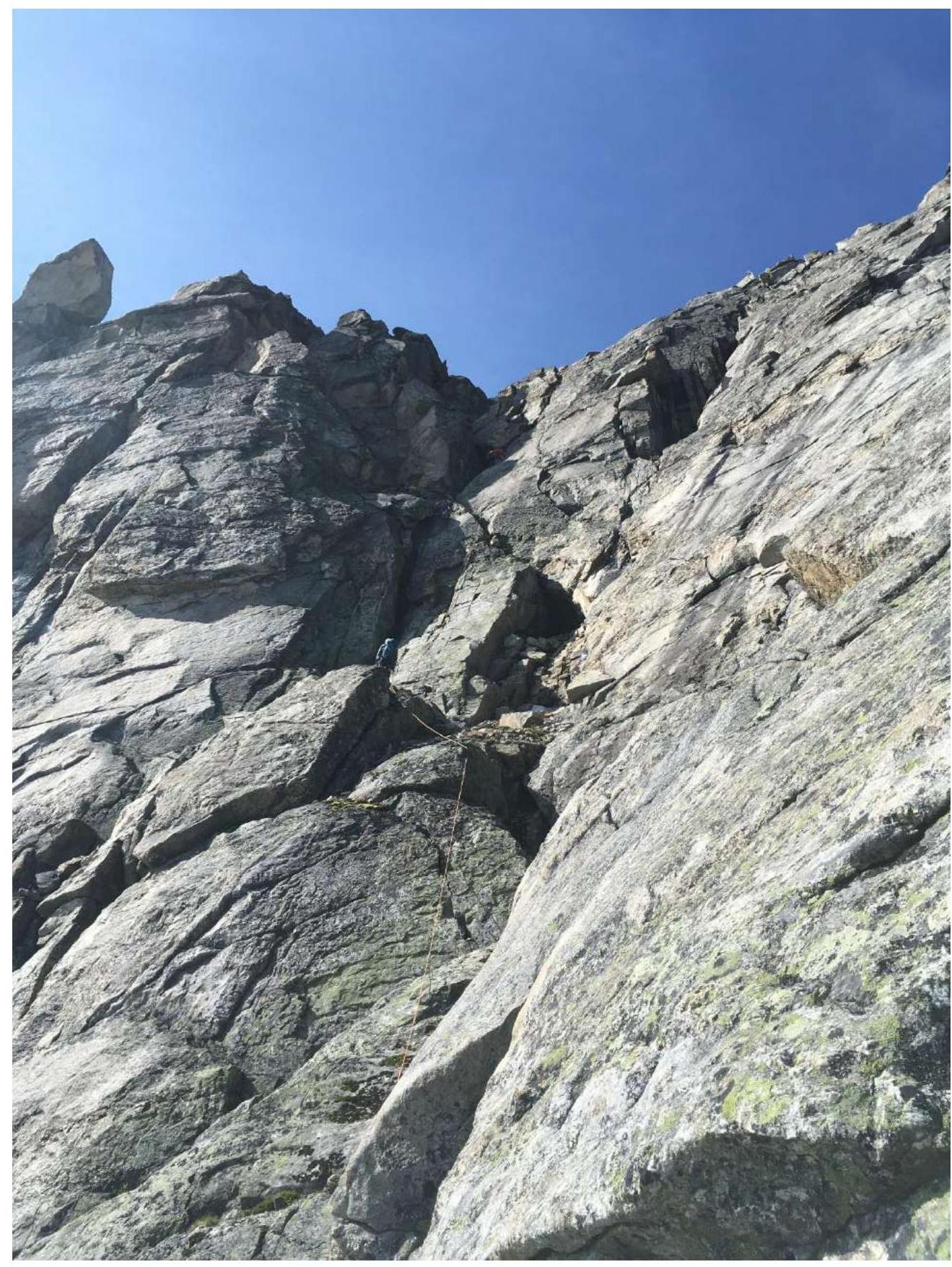
Photo 24. Section R20–R21. Along the ledges along the ridge, then onto the slabs.

Photo 25. Summit tower, bypassed on the right according to the movement and up the simple rocks.
3.2. Photo of the Team on the Summit with the Control Tour
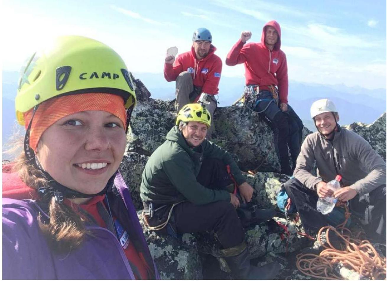
Photo 26. From left to right, top to bottom:
- Panova Alena
- Tkachenko Pavel
- Glazunov Evgeny
- Boyko Alexey
- Syshchikov Anatoly
The team met on the summit with Alexey Boyko and Pavel Tkachenko, who made the first ascent along the Southern ridge, category 4B.
3.3. Safety Assessment of the Route: The route is logical, clearly tied to the terrain, and monolithic. Insurance is sometimes difficult due to blind cracks, stations are of average reliability in half of the cases.
Options for communication on the route: with the base camp under the Western wall of peak Mechta – direct visibility, communication by radio.
Descent in the northern direction about 50 m to a narrow saddle, then along the northwest couloir, which is scree in the upper part and snow-ice in the lower. The first rope length of the couloir was descended by climbing, it is possible to organize a rappel. The terrain is very destroyed, rockfall hazard. Then two rappels (60 m each) along the snow and ice to the slabs on the left side of the couloir. From here, it is possible to descend by climbing or another rappel to the scree.
Then traverse along the scree slopes through the saddle in the northwest ridge to enter a small scree cirque, traverse it, and through the shoulder, descend into the valley under the western wall.
4. Characteristics of Weather Conditions *(10)
4.1. Confirmation of the data specified in the Climbing Report, with screenshots of weather forecasts from websites:
Comments
Sign in to leave a comment