
Report
on the first ascent to the summit Mechta 2590 m via the South-West wall, approximately 6A category of difficulty.
for the period from July 25, 2019 to July 25, 2019
I. Ascent Passport
| 1. General Information | ||
|---|---|---|
| 1.1 | Full name, sports rank of the leader | Glazunov Evgeny Vladimirovich, Master of Sports |
| 1.2 | Full name, sports rank of participants | Oleneva Nadezhda Alexandrovna, Candidate for Master of Sports, Tkachenko Pavel Valentinovich, 1st sports rank |
| 1.3 | Full name of the coach | Glazunov Evgeny Vladimirovich (Master of Sports) |
| 1.4 | Organization | FASIL St. Petersburg Active Recreation and Climbing Club "Gory Baikala", project "Nevozmozhno - eto ne navsegda" |
| 2. Characteristics of the Ascent Object | ||
| 2.1 | Region | South-Muya Range |
| 2.2 | Valley | River Levyy Ukuolkit |
| 2.3 | Number according to the 2013 classification table | 9.11 |
| 2.4 | Name and height of the summit | Mechta, 2590 m |
| 2.5 | Geographic coordinates of the summit (latitude/longitude), GPS coordinates | 55°30′35.4″ N 112°39′16.7″ E |
| 3. Route Characteristics | ||
| 3.1 | Route name | Via the South-West wall |
| 3.2 | Proposed category of difficulty | 6A |
| 3.3 | Degree of route exploration | First ascent |
| 3.4 | Relief characteristics of the route | Rock |
| 3.5 | Height difference of the route (altimeter or GPS data) | 800 m |
| 3.6 | Route length (in meters) | 1205 m |
| 3.7 | Technical elements of the route (total length of sections with different categories of difficulty and relief characteristics) | Rock I–II category - 360 m. Rock III category - 165 m. Rock IV category - 155 m. Rock V category - 115 m. Rock VI category - 410 m. Rock VI, A1 - 5 m. Rock VI, A2 - 3 m. |
| 3.8 | Descent from the summit | Descent in the northern direction about 50 m to a narrow saddle, then down the north-west couloir, scree in the upper part and snow-ice in the lower part. Then traverse along the scree slopes through the saddle in the north-west ridge to a small scree cirque, traverse it and through a shoulder |
| descend into the valley under the western wall | ||
| :--: | :--: | :--: |
| 3.9 | Additional route characteristics | There is water on the first half of the route |
| 4. Characteristics of the Team's Actions | ||
| 4.1 | Time of movement (team's working hours) | 9 h 15 min |
| 4.2 | Overnights | No |
| 4.3 | Time at control points | Exit from the base camp under the south-west wall of Mechta peak - 4:00 Start on R0 - 5:00 Summit - 14:15 Return to BC - 19:00 |
| 5. Weather Conditions | ||
| 5 | Clear, no precipitation, temperature approximately +15 °C. | |
| 6. Person Responsible for the Report | ||
| 6.1 | Full name, e-mail | Glazunov Evgeny Vladimirovich Evgenii-glazunov@mail.ru +7 950 084 33 41 |
II. Ascent Description
1. Characteristics of the Ascent Object
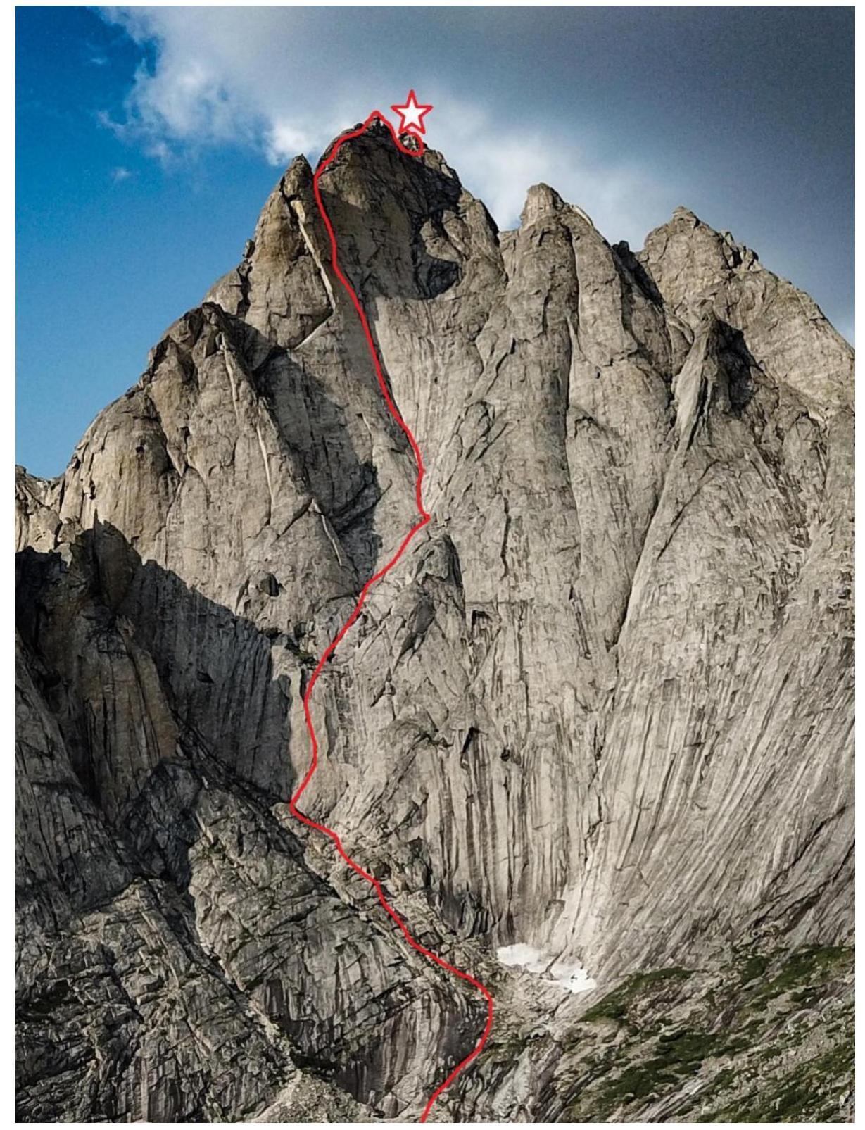
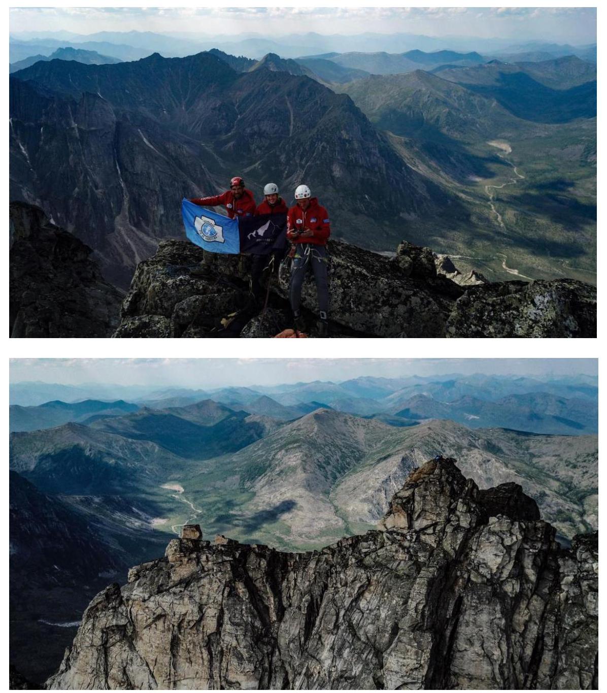
1.1. General photo of the South-West wall of Mechta peak.
Taken with DJI Mavic Pro drone
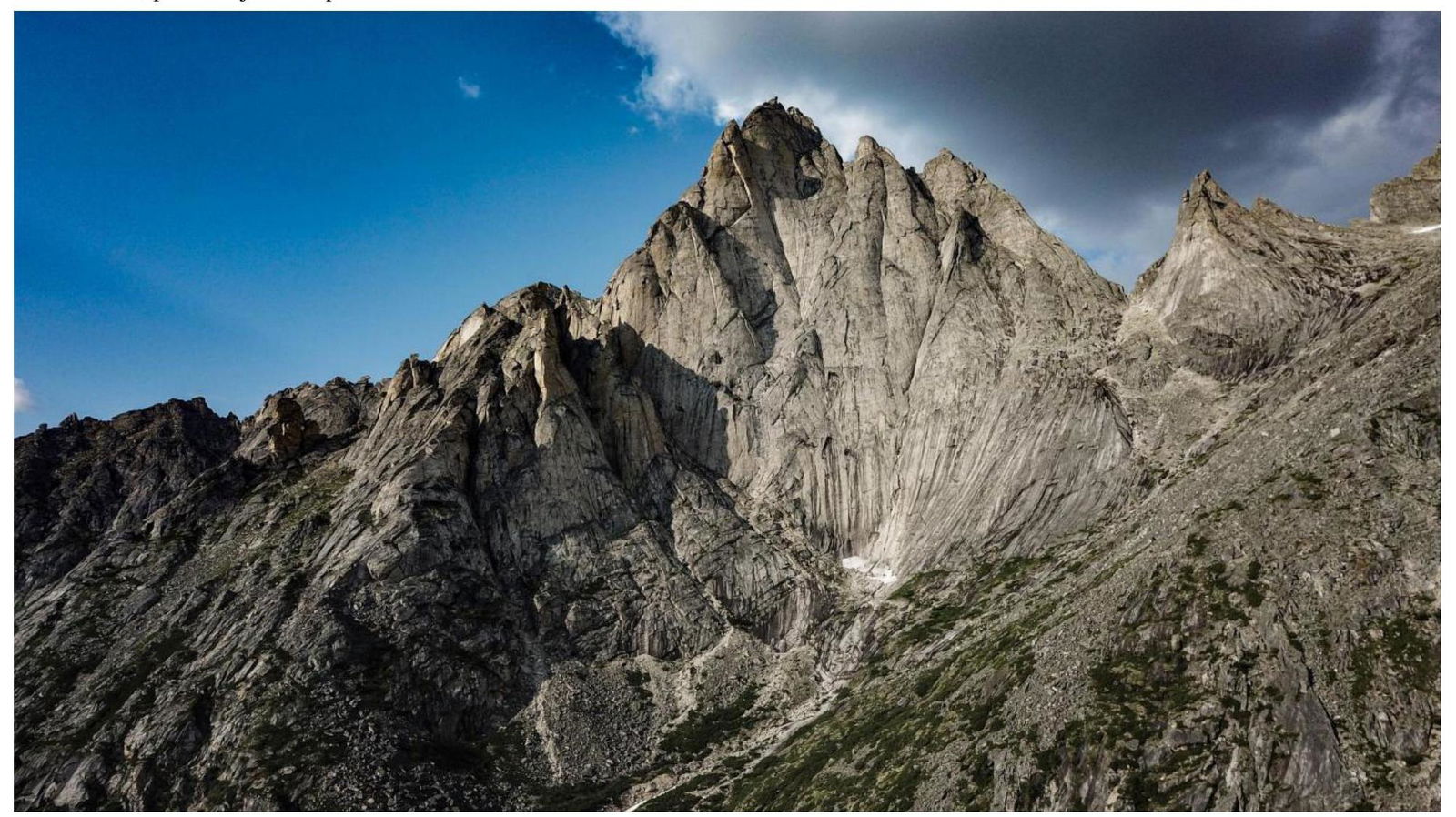
Mechta peak of Kart peak.
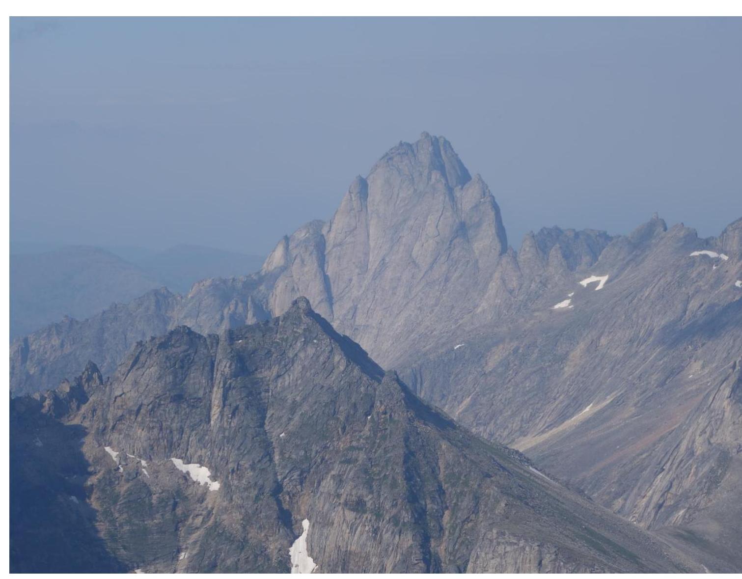
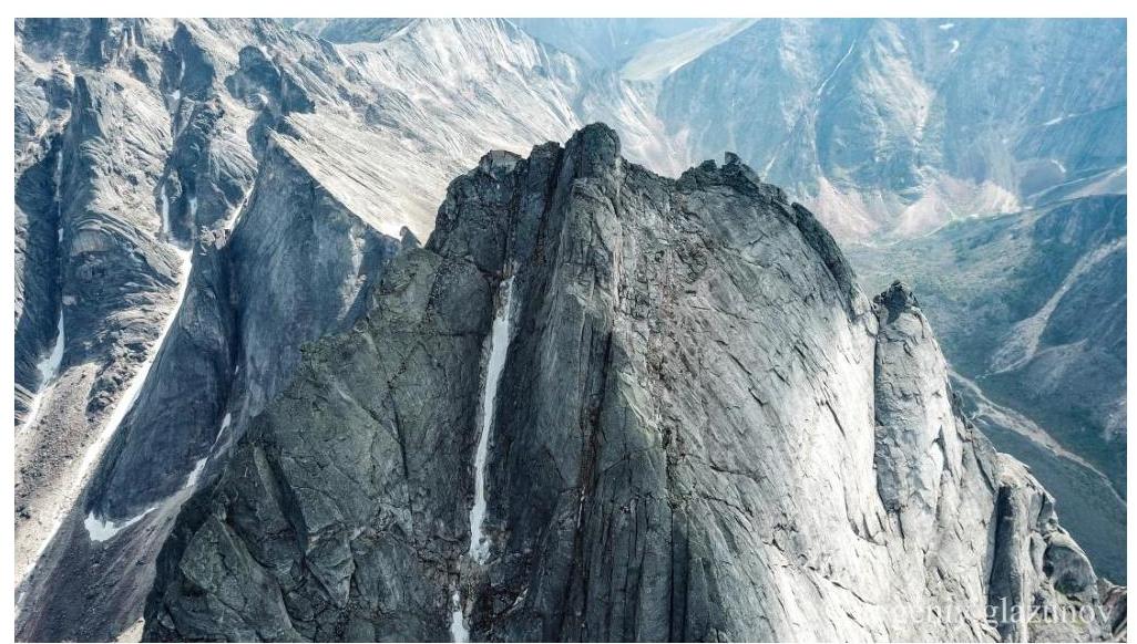
1.2. Profile photo of the western wall of Mechta peak
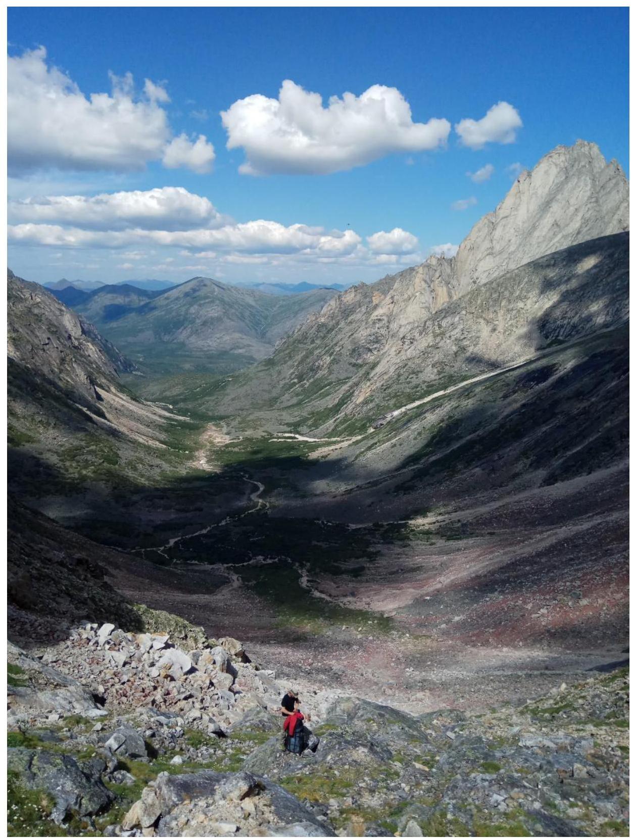
1.3. Photopanorama of the valley under the western wall of Mechta peak, taken from Alenka pass
1.4. Map of the area
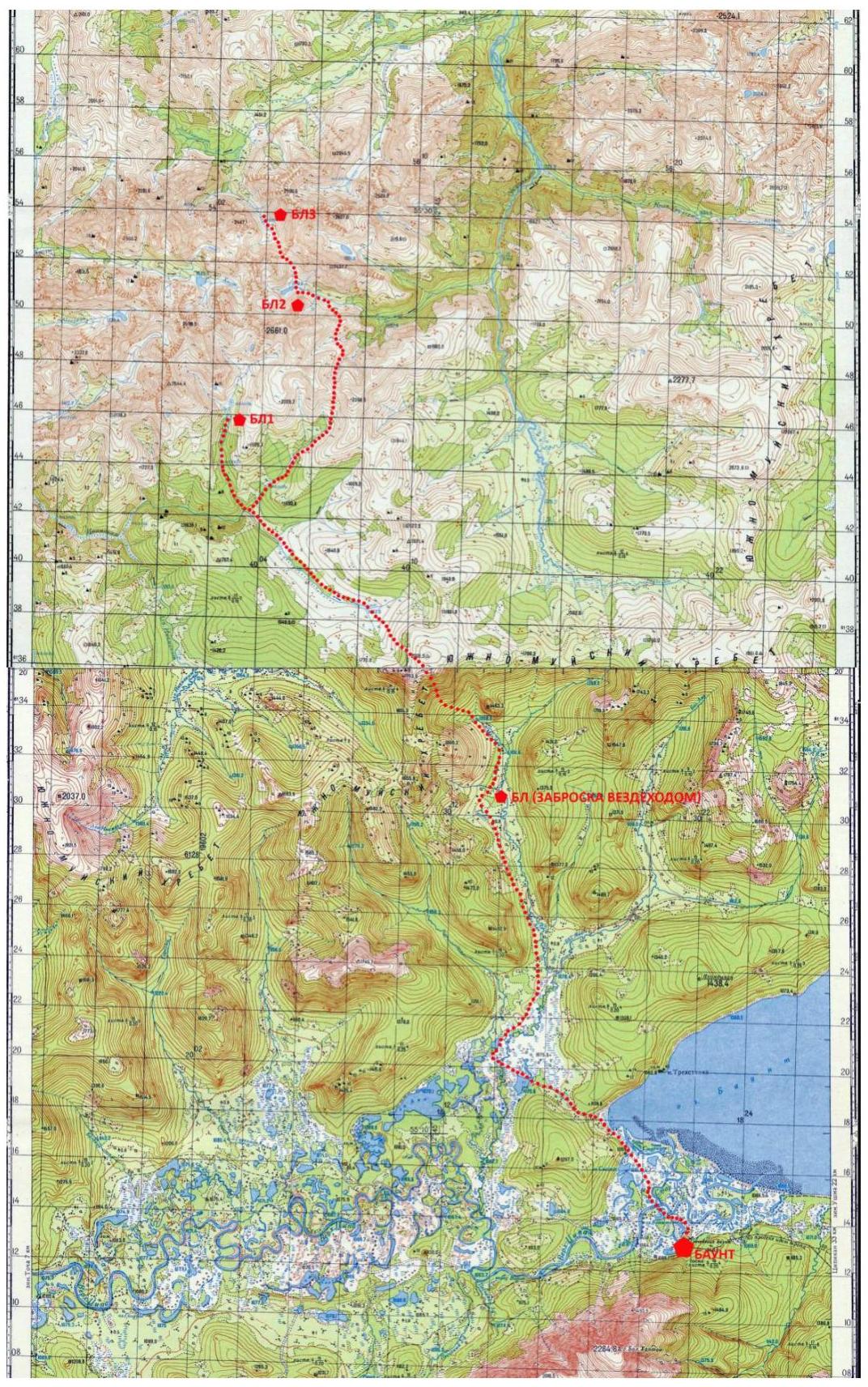
2019 expedition route.
2019 expedition route. South-Muya Range (SMR) is a mountain range in the central part of Transbaikalia, stretching across the territory of the Severo-Baykalsky, Muysky, and Bauntovsky Evenki districts of Buryatia and the Kalarsky district of Zabaykalsky Krai.
The South-Muya The ridge is located in the south-western part of the Baikal-Stanovoy region. It stretches from west to east for nearly 400 km from the Barguzin depression to the upper reaches of the Chara river. In the eastern part, it reaches its maximum width of 80 km. The ridge is bounded by the Muya depression to the north, the Bauntovskaya depression to the south, and the rivers Bambuyka and Vitim to the east.
The highest point of the ridge is Muysky Gigant peak (3067 m), which has several routes laid on it, is located 50 km east of the 2019 expedition area.
The western part of the SMR is practically undeveloped in terms of mountaineering and represents a new area for making first ascents.
Difficult approaches across rugged uninhabited terrain, with a complete absence of roads and trails, give all alpine events in the region an expeditionary character. For example, to approach under the wall of Mechta peak, we had to overcome 4 mountain passes, two of which were categorized, and travel about 45 km one way. The expedition cargo was carried on our backs. Therefore, the team could not afford an ascent in the BIG WALL style with the use of heavy platforms, a large amount of equipment, etc. All 2019 ascents on the walls of SMR were made by us in the lightest possible style:
- without overnight stays;
- without route processing;
- with a high percentage of free climbing.
The team operated completely autonomously, having a minimal supply of food and fuel, maintaining communication with the "outside world" via a satellite phone.
Mechta peak is a beautiful summit with sheer walls with a height difference of 650–850 m. The rock is mainly monolithic granite. It is located in the south-western part of the South-Muya Range in the upper reaches of the valley of the river Levyy Ukuolkit. There are no established routes on its walls, despite the fact that the variety of relief in combination with the steepness and length, as well as the monolithic nature of the rock, allow for first ascents up to category 6 inclusive. There is no data on an ascent to its summit. Since it does not have simple paths used by tourists making rare trips across SMR, we did not find any signs of human presence on the summit, which allows us to confirm that we made a first ascent. We left a control cairn and a note.
The nearest settlement is Baunt, located 400 km north of Chita, 120 km from Bагдарин. Baunt is a small village where you can find accommodation for a drop-off, and there is a store. There is no cellular connection.
To the north, the nearest major railway stations on the Baikal-Amur Mainline are:
- Novy Uoiyan - 80 km;
- Taksimo - 120 km.
From Baunt, head north towards the river Ayan and then along the Maly Ayan river for about 20 km. This section can be traversed by a tracked all-terrain vehicle, which we did. At the end of the all-terrain vehicle drop-off, we organized a large base camp with:
- food supplies;
- batteries for charging equipment;
- a spare tent.
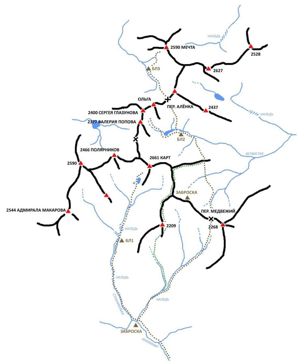
From the base, move to the upper reaches of the Maly Ayan river and then climb to a non-categorized pass, 1900 m. From here, you can see the south-western part of the South-Muya Range. Descend from the pass to the Inamakit river and move along its right bank. Before reaching the Stlanikova river, turn into the previous valley and ascend along the river (unnamed) to the upper reaches of the valley to the Medvediy pass (1B category). Then descend from the pass and traverse along the slopes to the ridge - a pass into the valley of the Vetvistaya river. Ascend along the valley to the lakes, then through the Alenka pass (1B category) to the valley under the western wall of Mechta peak. It is convenient to organize a camp after the ice on the riverbank (marked as BC 3 on the map). The terrain on the approach is complex:
- the upper reaches of the Inamakit are swampy;
- there are animal trails along the banks;
- the ascent to the Medvediy pass is mainly along the riverbed, across stones, choosing a more convenient path along the banks;
- there are ice fields - large ice masses formed as a result of layered freezing of river waters.
The transition from the Medvediy pass to the Vetvistaya river valley is complex:
- slopes are covered with thickets of difficult-to-pass dwarf pine;
- there are some animal trails.
The Medvediy and Alenka passes have steep slopes and rubble.
The chosen line on the western wall is beautiful and the most logical. The route follows a clearly defined internal corner from the foot to the exit onto the western ridge. The approach to the route from the base camp takes about 1 hour.
According to the team's assessment, the route corresponds to the declared category. In terms of its characteristics, it resembles the Balezin route on the 6th tower of Korona peak in Ala-Archa. The route was completed 95 percent with free climbing, excluding 5 m of artificial climbing on a wet crack on the R1–R2 section, and 3 m on a wet overgrown crevice on the R9–R10 section.
2. Route Characteristics
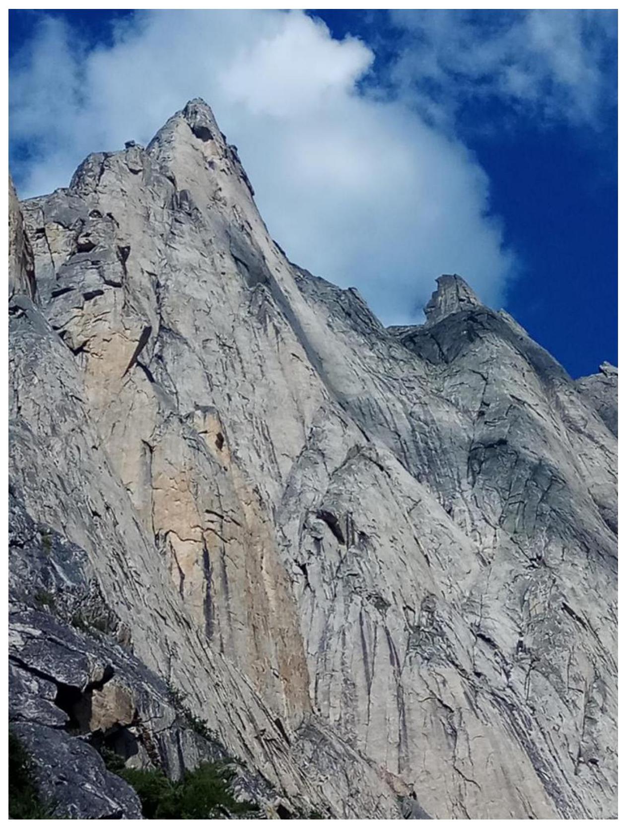
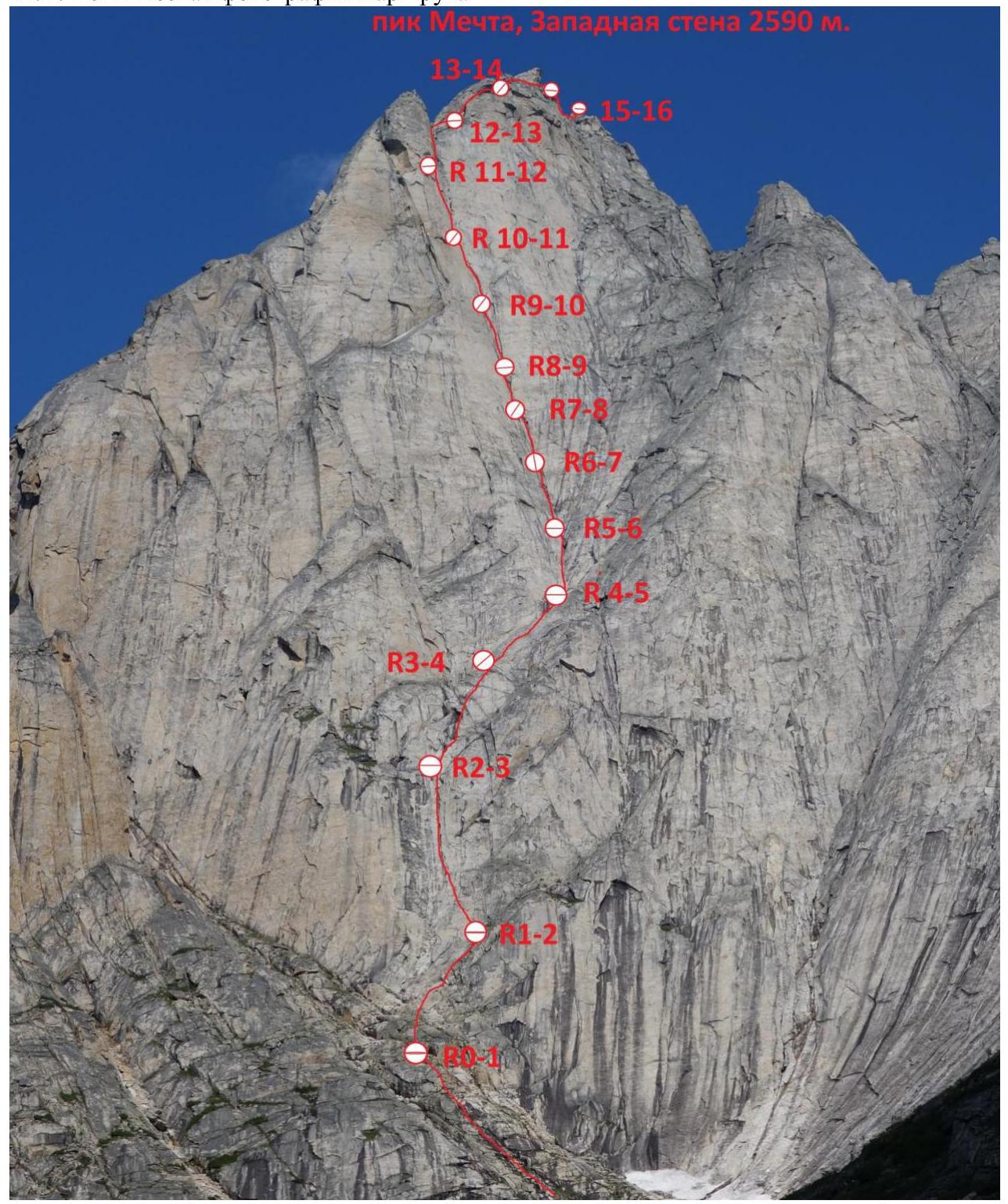
2.1. Technical photograph of the route
Digitized by Google
2.2. Route diagram in UIAA symbols.
| Section | Length, m | Steepness, ° | Difficulty |
|---|---|---|---|
| R8–R9 | 50 | 85–90 | VI |
| R7–R8 | 60 | 85 | VI |
| R6–R7 | 50 | 80 | V |
| R5–R6 | 50 | 60 | III |
| R4–R5 | 45, 10 | 60, 80 | IV–V |
| R3–R4 | 55 | 65 | IV |
| R2–R3 | 50 | 75–80 | VI A0 |
| R1–R2 | 60 | 60 | III |
| R0–R1 | 300 | 40 | I–II |
3. Characteristics of the Team's Actions
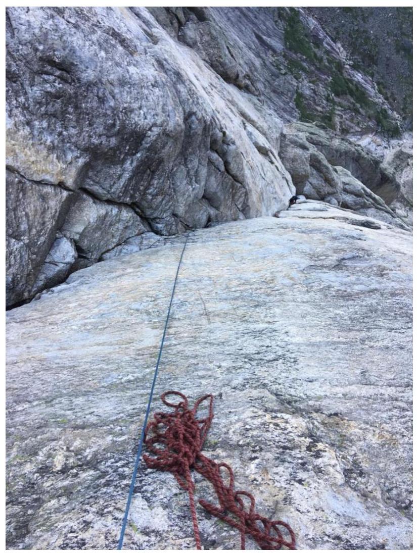
3.1. The approach to the western wall of Mechta peak from the base camp takes 1 hour. From the camp, ascend towards the wall to the upper terrace. Traverse left, avoiding thickets of dwarf pine, and cross the stream flowing from under the wall. Then, along the left bank of the stream, first along the riverbed and then across rocks, ascend to a large terrace with a snowpatch. This is the start of the route.
R0–R1. Across simple rocks, upwards and left, oriented towards a large internal corner in the center of the wall. 300 m, 40°, I–II.
R1–R2. Upwards and slightly right, choosing the most logical path through a series of ledges and walls, approach a vertical wall with a pronounced crack. 60 m, 60°, III.
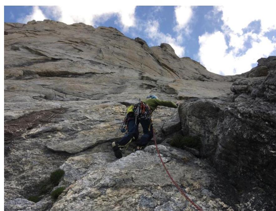
R2–R3. Left and upwards through a slab with cracks to a crevice, then out onto a ledge, belay station. 50 m, 75–80°, VI A0.
R3–R4. Across inclined slabs, move upwards, bearing right. Handholds are small, relief is sparse. 55 m, 65°, V.
R4–R5. A long, gentle internal corner, move along its right part - a ridge. Climbing is not difficult, but there are few places for protection. The ridge ends on a ledge, from which a short wall with an inclined crack leads to another ledge, belay station. 45 m, 60°, IV; 10 m, 80°, V.
R5–R6. Straight up a wide internal corner-chimney. Water flows along this and the next section's corner. Where the corner becomes vertical, a belay station is on a small ledge to the right. 50 m, 60°, IV.
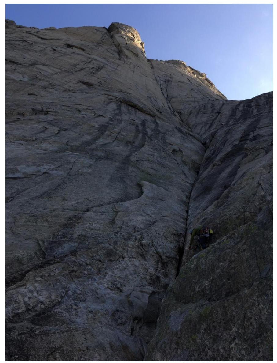
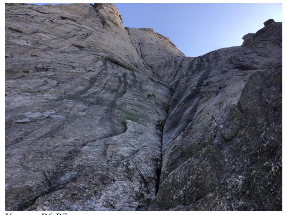
R6–R7. From the station, upwards and right around a small corner, then left into an internal corner. Move upwards along the internal corner. Water flows along the corner. Belay station on a flake with a crevice to the left of the internal corner. 50 m, 80°, V.
R7–R8. Return to the internal corner and continue moving along it; it widens into a chimney. Belay station on friends in a crevice of the chimney. 60 m, 85°, VI.
R8–R9. Upwards along the chimney, following the internal corner. Exit right onto a large flake. Belay station on the flake. 50 m, 85–90°, VI.
R9–R10. From the flake, upwards into an internal corner-crevice, initially with good handholds. At the top, the crevice narrows into an off-width, climbing is difficult; there is a possibility to place a piton at the start of the off-width. After the off-width, exit left onto a wall with good handholds, then onto a ledge, belay station. 45 m, 90°, VI A2.
R10–R11. A system of crevices and cracks of various sizes - general direction upwards, following the macro-relief. The first meters involve a small wet overhang, passable with free climbing. Belay station on a small ledge with anchors. 45 m, 85–90°, VI.
R11–R12. Upwards, slightly left, into a system of internal corners with small overhangs, through them to a narrow chimney with a belay station on a ledge. Free climbing. 55 m, 85–90°, VI.
R12–R13. From the station, upwards, then slightly left, transitioning under a loose block (flake) into a monolithic internal corner with a thin crevice. Then upwards along the crevice - difficult climbing (6c+, 7A fr 10 m) - to exit into a crevice left of the flake. The crevice ends on a large comfortable ledge 25 m from the exit onto the ridge. 50 m, 85–90°, VI.
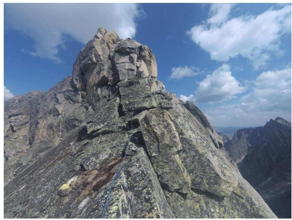
R13–R14. From the ledge, across the left part of the wall, exit through a vertical wall onto a slab with good handholds, then onto the ridge. Further movement is rightwards through a system of walls and ledges along the ridge to a large stone at the base of an internal corner, belay station on the stone. 55 m, 85–90°, V–VI.
R14–R15. From the station, move upwards along a crevice, then along the right side of the ridge to a narrow internal corner with a crevice. The corner slightly overhangs at the top. Exit onto a ledge-terrace. At the end of the ledge, a belay station on placed protection. 55 m, 85–90°, V.
R15–R16. Move to a saddle in the ridge, then along a crevice through a wall to exit onto the ridge. To the end of the ridge, before descending - a belay station on natural features. 55 m, 70°, IV.
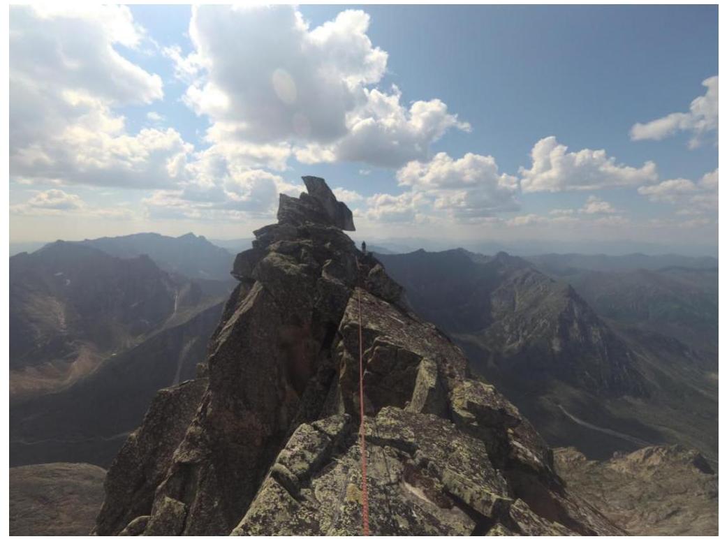
R16–R17. Then simultaneous movement along the ridge under the summit tower. 60 m, 45°, II.
R17–R18. Bypass the summit tower on the right, ascending small walls to reach the summit. 55 m, 70°, III.
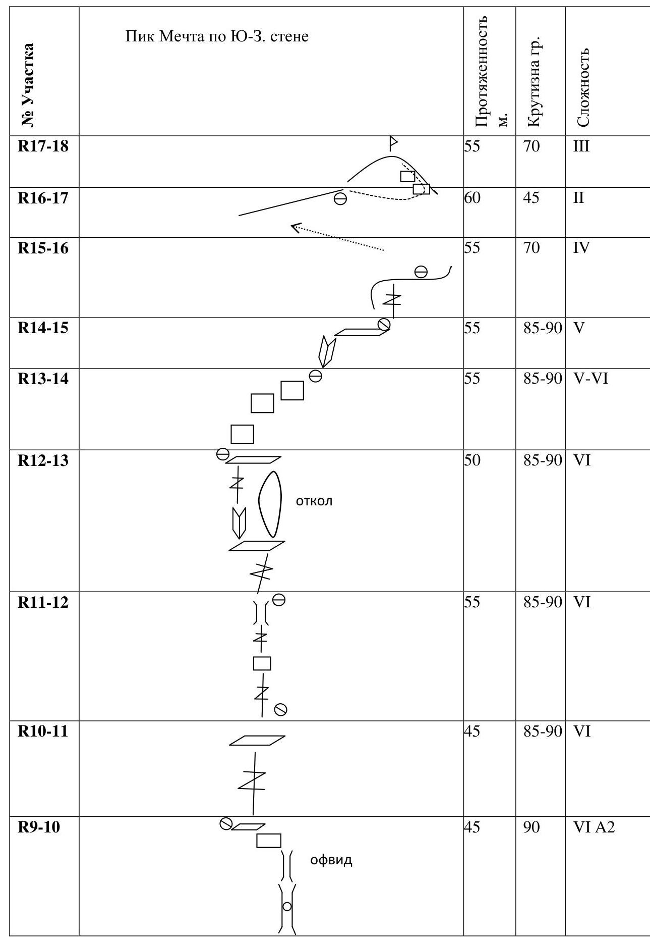
3.2. Team photo on the summit
Taken with DJI Mavic Pro drone
3.3. Descent from the summit
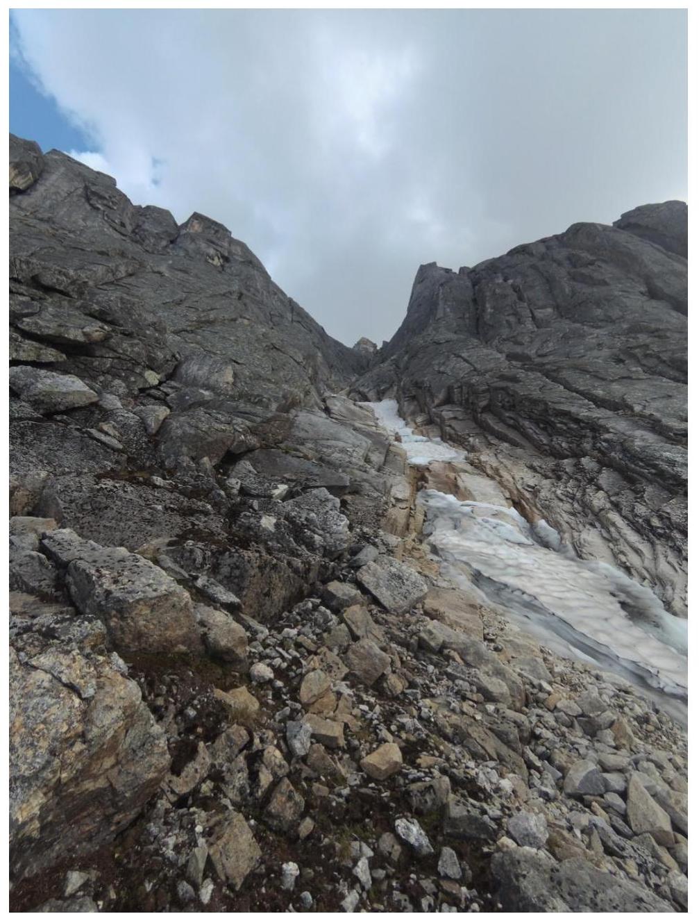
Descent in the northern direction about 50 m to a narrow saddle, then down the north-west couloir, scree in the upper part and snow-ice in the lower part. The first rope length of the couloir was descended by climbing; a rappel can be organized. The terrain is very broken and prone to rockfall. Then two rappels (60 m each) down snow and ice to slabs on the left side of the couloir. From here, one can descend by climbing or another rappel to the scree. Then traverse along the scree slopes through a saddle in the north-west ridge to enter a small scree cirque, traverse it, and through a shoulder descend into the valley under the western wall.
Descent couloir. Taken with DJI Mavic Pro drone
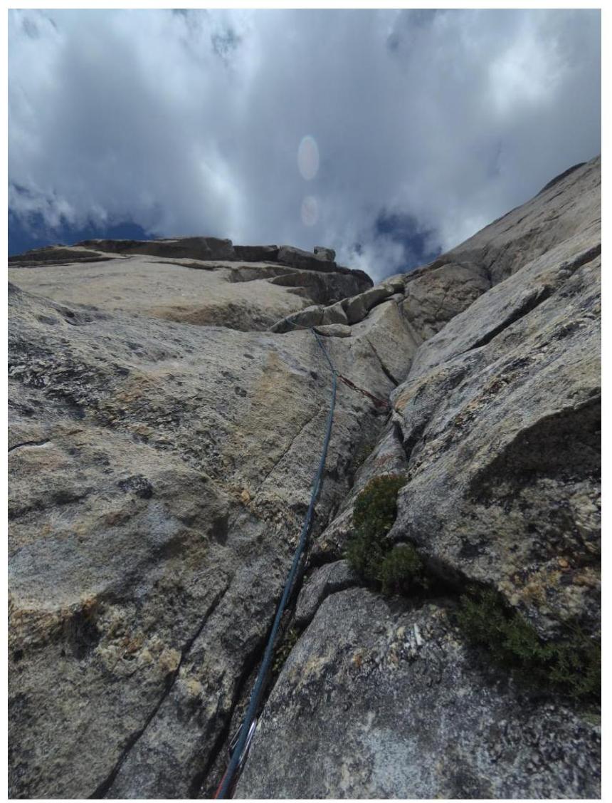
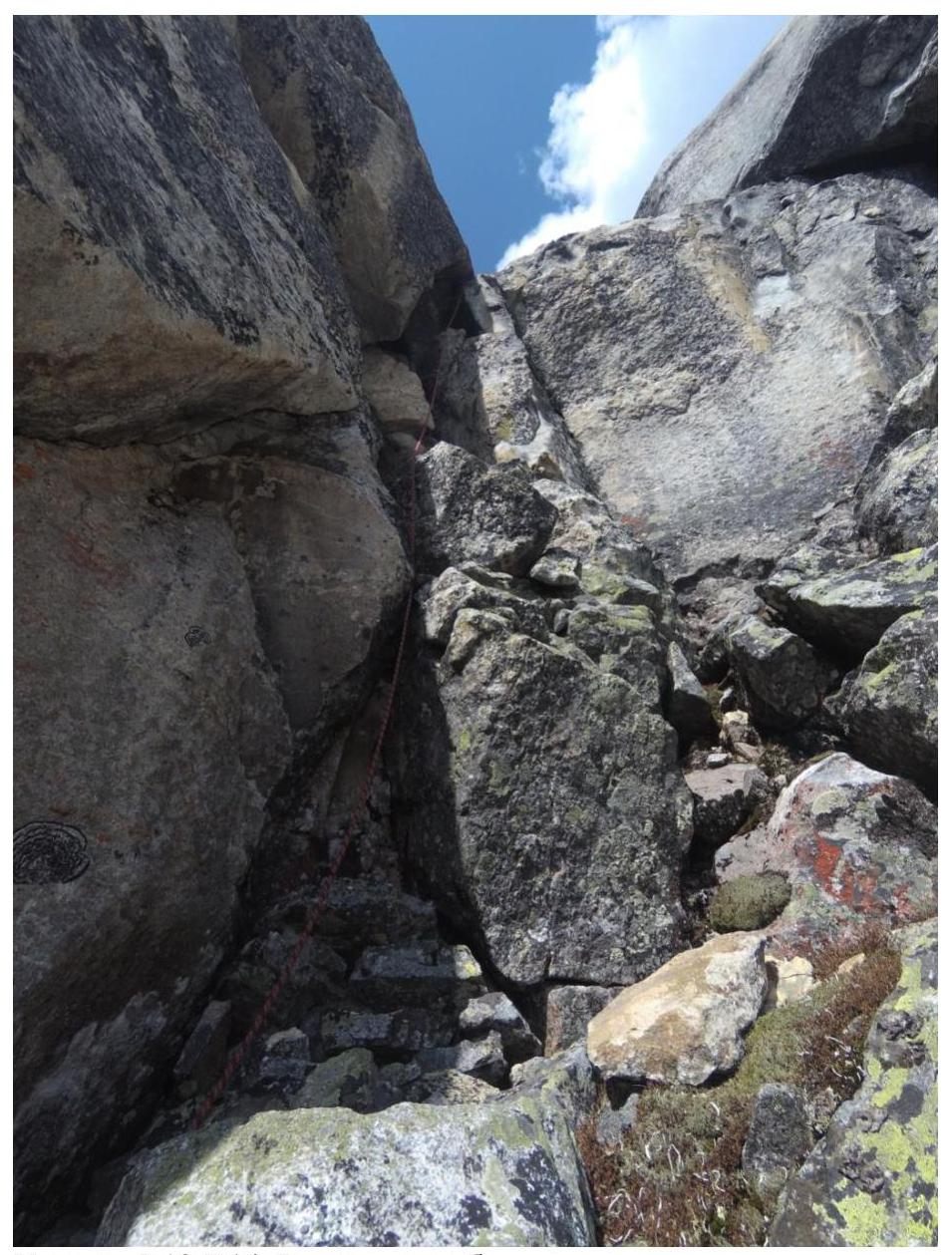
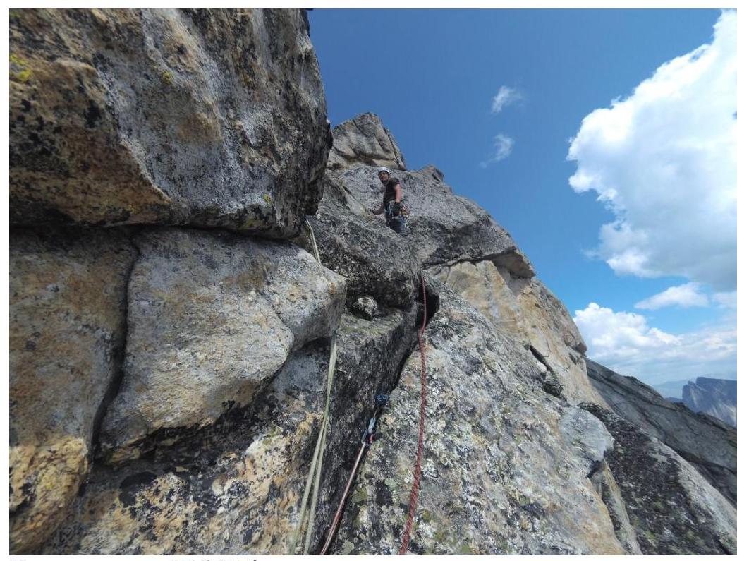
3.4. Photo report by sections
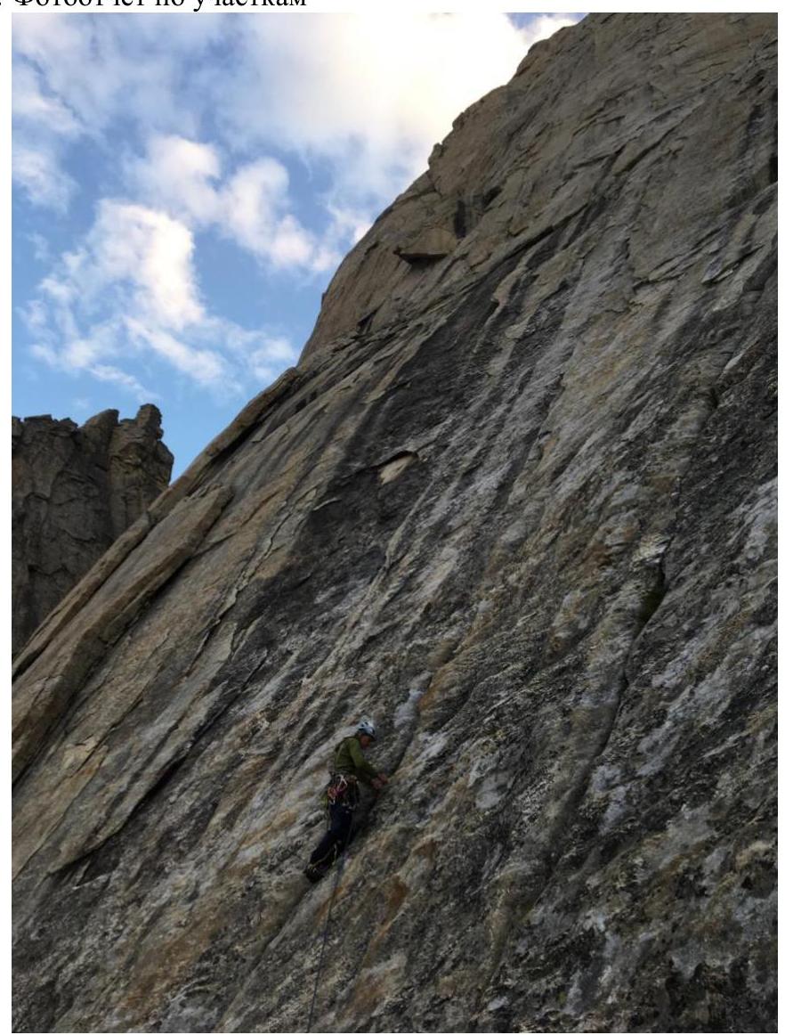
Section R2–R3
Start of section R3–R4
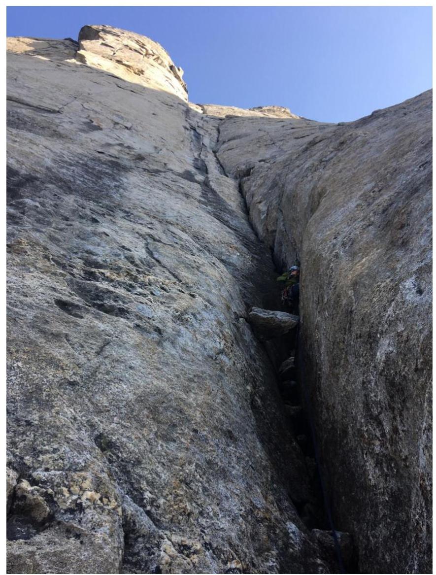
Transition into the internal corner on section R6–R7
Section R6–R7
View of section R6–R7 from station R7
Chimney on station R8. View of sections R8–R9, R9–R10
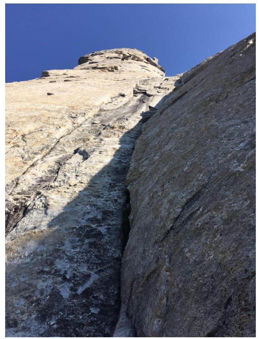
Start of section R9–R10
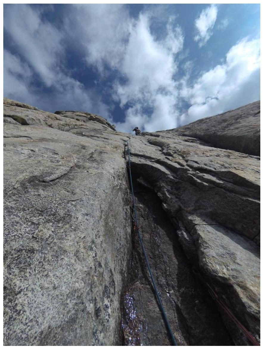
Start of section R10–R11
Start of section R11–R12
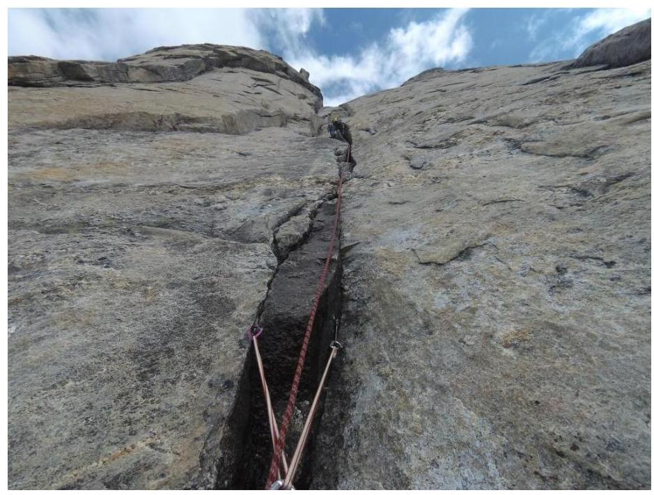
Start of section R12–R13
Section R13–R14. Exit onto the ridge
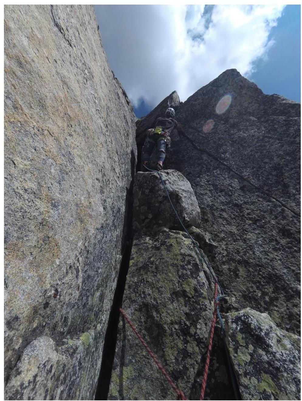
Section R14–R15. Ridge
Start of section R15–R16
Ridge R16–R17
Summit tower from section R16–R17
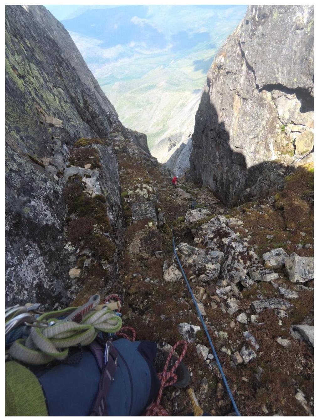
Start of descent couloir
View of descent couloir from scree
Comments
Sign in to leave a comment