ASCENT DOCUMENT
- Climbing category — rock climbing
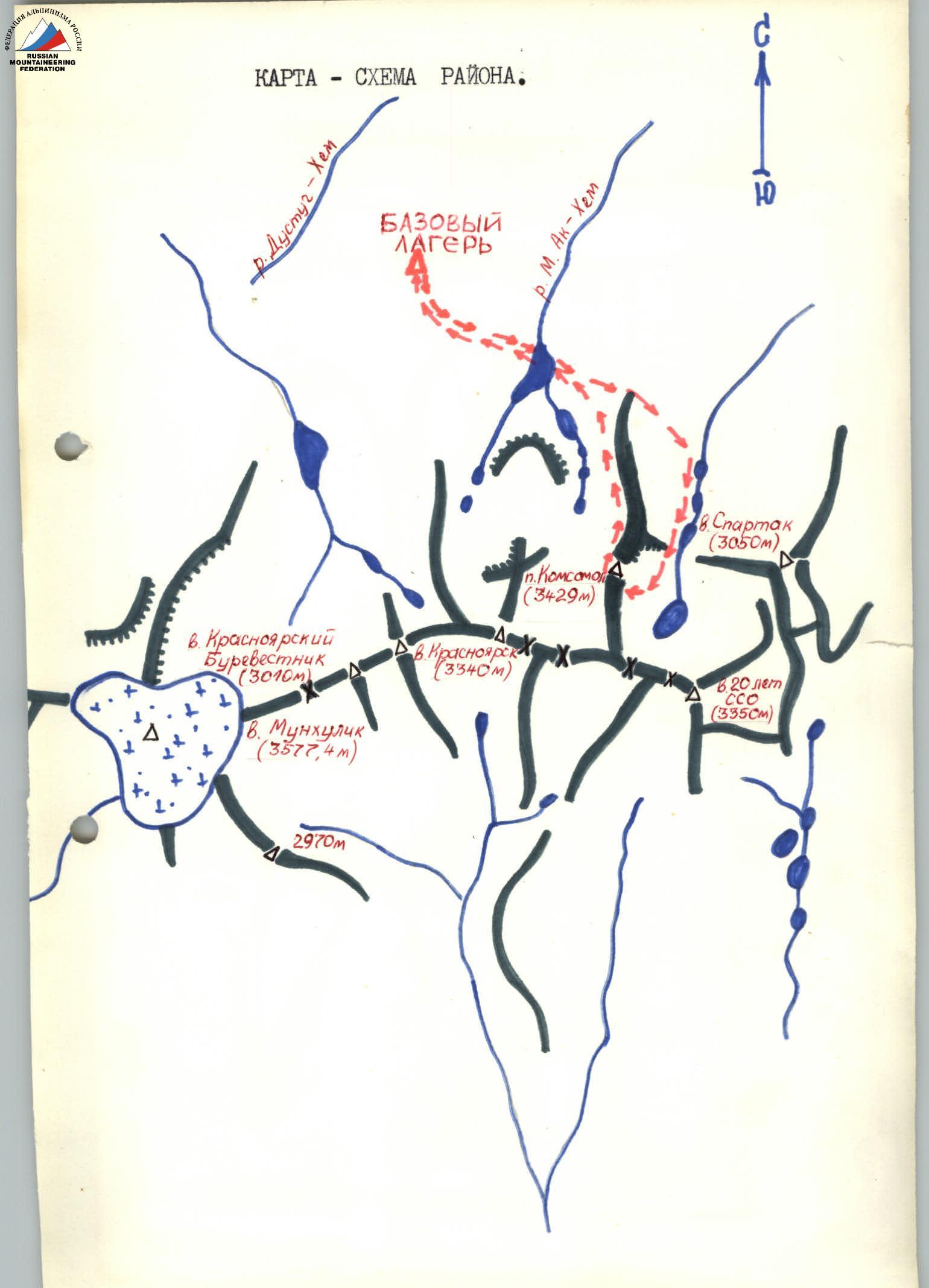
- Climbing area — Tuvinian ASSR, Western Sayan, Tsagan-Shibetu ridge
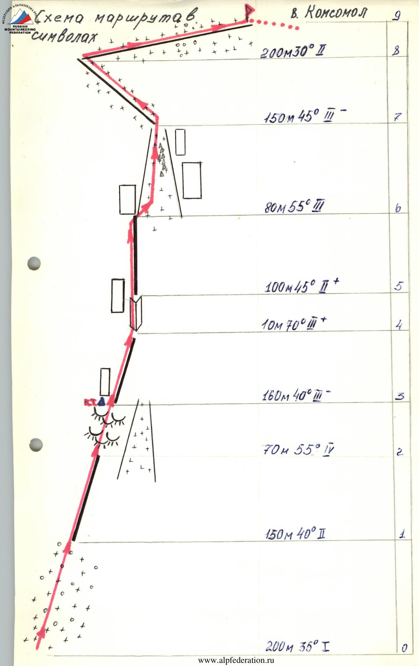
- Peak — Komsomol peak (3429 m), via the central counterfort
- Proposed category of difficulty — 3A category
- Route characteristics: height difference — 730 m, length of sections with III–IV category of difficulty — 310 m, average steepness — 40°–45°.
- Pitons hammered for belaying:
- rock: 8/0;
- ice: 9/0;
- bolt: 0/0;
- protection gear: 6/0.
- Number of climbing hours: 2 hours.
- Number of nights and their characteristics: none.
- Leader — Kudrin A.V., 1st sports category.
Team members:
- Pakhomov G.N., 1st sports category
- Thissen A.P., 2nd sports category
- Mogilenko V.V., 2nd sports category
- Anufrieva T.G., 2nd sports category
- Team coach — Miller (Davydova) Irina Petrovna.
- Date of departure for the route — May 1, 1988. Date of return — May 1, 1988.
- Ascent organized by Krasnoyarsk regional alpinade.
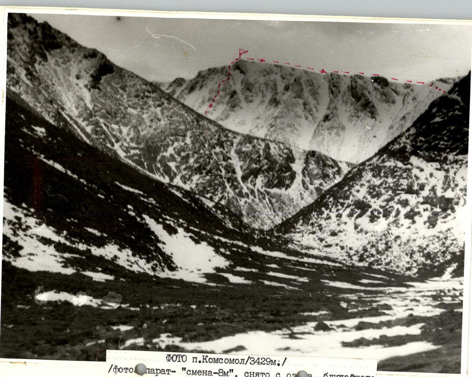 Photo of Komsomol peak (3429 m). "Smena-8M" camera, taken from the lake closest to the saddle between Spartak peak and the ridge of Komsomol peak.
Approach to the route
From the base camp, we head south and ascend to the plateau (1 hour). Then we move along the plateau in a southeast direction towards the beginning of the Komsomol peak ridge. We cross the ridge in its lower gentle part and descend along the moraine to the lakes (1 hour 30 minutes). We approach the saddle between Spartak peak (approximate name) and the Komsomol peak ridge via the lakes, and after crossing the saddle, we approach the route (1 hour 30 minutes). At the beginning of the route, there is a guiding cairn.
Brief description of the ascent route
After the guiding cairn, we move along snow and talus (200 m). Then we proceed along easy rocks (150 m) on a wide ridge, followed by an ascent to the "sheep's foreheads" (60–70 m). At the time of ascent, the "sheep's foreheads" were snow-covered — movement with organization of rope belay. Then we move along moderately difficult rocks towards a 5–6 m high wall, before which a control cairn is built (to the right of the path, a large gendarme is located in a couloir). The wall is bypassed to the right, and we proceed along несложным, разрушенным скалам to an internal corner — 10 m (rope belay), which leads to a разрушенный гребень (100 m), and along it to a rock wall with an overhang (15 m, 85°–90°). The wall is bypassed:
- to the right via a snow-ice couloir (80–90 m, rope belay);
- movement along the couloir is to the left of rock islands (strongly разрушены);
- the couloir leads to a snowy ridge (150 m), with rope or alternate belay via an ice axe;
- along it, we reach the pre-summit snowy ridge (200–250 m) and then along the ridge to the summit.
The ascent from the guiding cairn to the summit took 4 hours. Descent from the summit is via the 1B category route.
Route diagram in symbols for Komsomol peak
Area map diagram