
Alpinism and Rock Climbing Federation of the Republic of Sakha-Yakutia
Report
On the ascent to the summit of Semyon Mostakhov (proposed by the Yakut branch of the Russian Geographical Society) 2162 m, via the South-Eastern ridge, made during the training camp in Yakutsk in July 2016.
July 2016
Table of Contents
- Ascent Passport
- Photograph of the summit
- Map of the area
- Brief description of the area
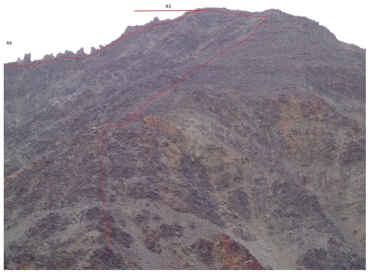
- Technical photo of the route
- Route description 7–8. Photo illustrations with sections of the route
- Table of technical sections of the route
Ascent Passport
- Ascent category: rock climbing.
- Ascent area: Buordakh massif, Chersky Ridge.
- Peak, route: Semyon Mostakhov Peak (proposed by the Yakut branch of the Russian Geographical Society) 2162 m, route via the SE ridge, first ascent. Coordinates of the summit 65°10′888″ N, 146°08′827″ E according to GPS.
- Assessed category of difficulty: 1B.
- Route characteristics: height difference 750 m; total length 1440 m; average steepness 36°. Length of sections: 1st cat. diff. — 1050 m, 2nd cat. diff. — 300 m, 3rd cat. diff. — 90 m.
- Number of travel hours to the summit: 4.
- Leader: Ivan Ivanov, Candidate Master of Sports. Participants: Valery Bogomolov, 1st class; Igor Shtele, Candidate Master of Sports.
- Coach: Ivan Ivanov, Candidate Master of Sports, instructor 2nd category No. 72.
- Date of departure and return: July 16, 2016.
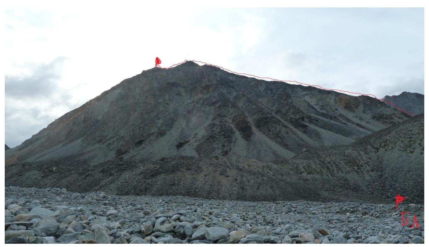
Photograph of the summit from the base camp on the Kureter River.
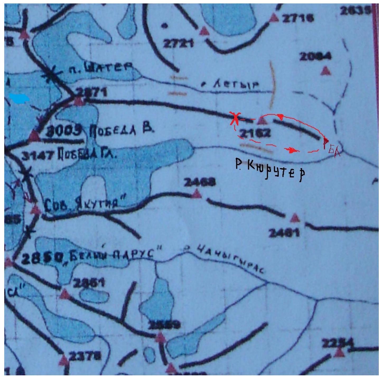
Map of the area.
Brief geographical description of the area
The Buordakh massif is the most mountainous part of the Chersky Ridge and all of northeastern mainland Asia.
The main peak of the area — Pobeda Peak — has an absolute elevation of 3003 m. The watershed spurs of the massif are characterized by steep slopes and typically terminate in narrow ridges, crowned with pointed peaks and obelisks.
The massif has significant glaciation. Glaciers cover all peaks above 2400 m and their slopes; in the valleys, the lower boundary of the glaciers is at an altitude of 1700–1800 m. One of the main glaciers is the Obruchev Glacier. Two tongues of the glacier extend east into the valleys of the Kureter and Leger rivers, and two others — northwest along the main course of the Lyunkyude River.
The Buordakh massif is approximately 100 km from the "cold pole" in the Oymyakon region, which determines the harsh climatic conditions here. This area is characterized by:
- low temperatures;
- high precipitation.
Climbing conditions in the area
The Buordakh massif of the Chersky Ridge is one of the least populated areas of the Republic of Sakha-Yakutia. Roads and trails are virtually non-existent. The least expensive approach is:
- by car;
- on horseback through the Kureter River gorge.
The most convenient location for a base camp is a green clearing at the confluence of the Kureter and Leger rivers.
Route to Semyon Mostakhov Peak (2162 m) via the SE ridge, category 1B (orientation), first ascent.
Route description
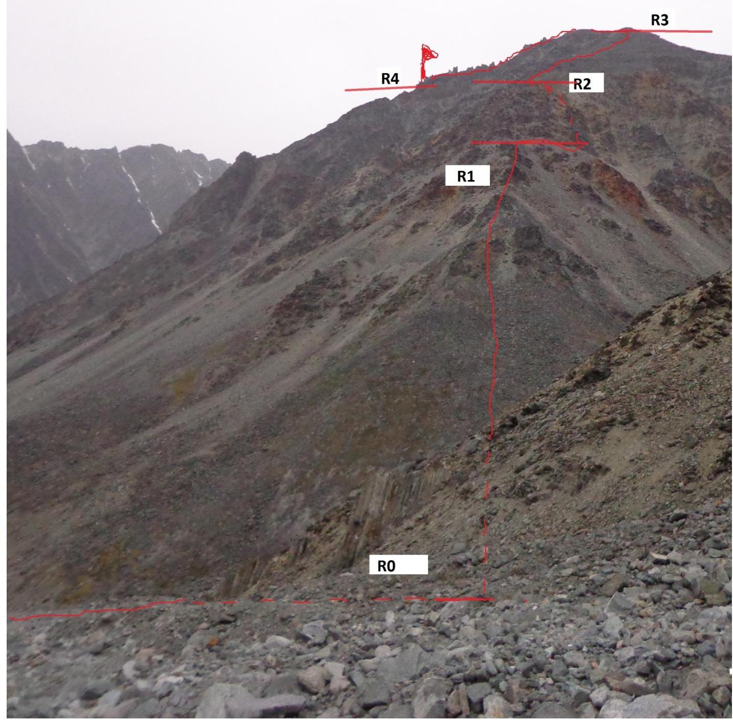
From the base camp (green clearing at the confluence of the Kureter and Leger rivers), proceed along the right bank of the Leger River to the start of the route (30 minutes from the camp). Coordinates 65°10′634″ N, 146°10′161″ E according to GPS. Elevation 1410 m. Then move upwards along the medium scree in the direction of the gendarme (section R0–R1). The gendarme is bypassed on the right via a couloir (fixed rope 90 m). Belays through ledges. Ropes were secured to rock blocks. Be cautious at the exit (live rocks, section R1–R2). After bypassing the gendarme, the route follows a broad ridge composed of large blocks (section R2–R3). We approach a narrow, destroyed ridge and continue to the summit (300 m, section R3–R4). Coordinates 65°10′881″ N, 146°08′827″ E. The descent from the summit is straightforward. We continue in the direction of the pass and descend to the left along the fine scree to the Kureter River and return to camp. Total time to the summit — 4 hours. Descent to the pass — 30 minutes. Descent from the pass to the base camp — 1.5 hours.
View from section R0–R1
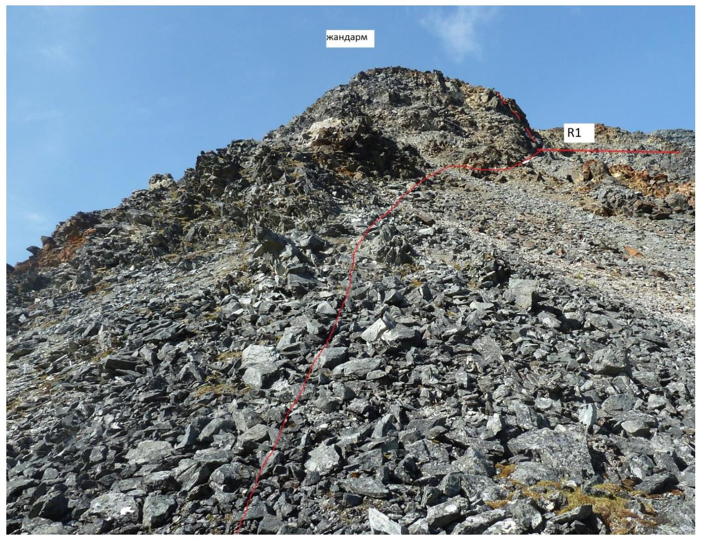
Section R2–R4
Section R2–R3
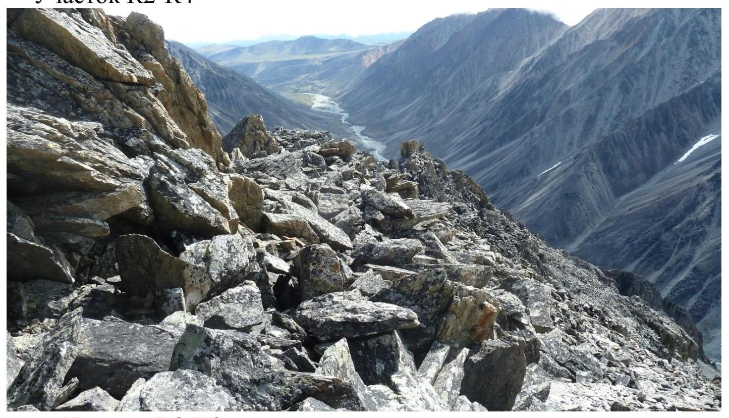
Table of technical sections of the route
| Date | Designation | Average steepness in degrees | Length in m | Terrain characteristics | Difficulty | Condition | Weather conditions |
|---|---|---|---|---|---|---|---|
| July 16, 2016 | R0–R1 | 40 | 450 | Medium scree | 1 | Dense | Clear |
| R1–R2 | 50 | 90 | Couloir | 3 | Destroyed rocks | Clear | |
| R2–R3 | 35 | 580 | Ridge | 1 | Large blocks | Clear | |
| R3–R4 | 25 | 300 | Ridge | 2 | Destroyed | Clear |
Comments
Sign in to leave a comment