
Report on the First Ascent to the Summit of Otdelnaya via the 2A Category Route by Orlov's Team on October 29, 2023
I. Object Passport
| № | 1. General Information | |
|---|---|---|
| 1.1 | Full Name, Sports Rank of the Team Leader | Dmitry Sergeyevich Orlov, 2nd sports rank in alpinism |
| 1.2 | Full Name, Sports Rank of the Participants | Dmitry Leonidovich Menshikov, 3rd sports rank in alpinism |
| 1.3 | Coach's Full Name | Mikhail Mikhailovich Stukalov |
| 1.4 | Organization | |
| 2. Characteristics of the Ascent Object | ||
| 2.1 | Area | Putorana Plateau |
| 2.2 | Valley | Kharalakh Mountains |
| 2.3 | Section Number according to the 2013 Classification Table | 9 |
| 2.4 | Name and Height of the Summit | Gora Otdelnaya 607 m |
| 2.5 | Geographic Coordinates of the Summit (Latitude/Longitude), GPS Coordinates | Latitude 069.50741°N, Longitude 088.47802°E |
| 3. Route Characteristics | ||
| 3.1 | Route Name | Orlov's route via the Northwest couloir |
| 3.2 | Proposed Category of Difficulty | 2A winter |
| 3.3 | Degree of Route Exploration | First ascent |
| 3.4 | Relief Character of the Route | Ice and snow |
| 3.5 | Height Difference of the Route (according to altimeter or GPS data) | 601 m according to the altimeter (measurements taken with Suunto 9 Baro altimeter) |
| 3.6 | Route Length (in meters) | 2115 |
| 3.7 | Technical Elements of the Route (total length of sections of various difficulty categories with indication of relief character) | 1st cat. diff. — ice and snow — 195 m. 2nd cat. diff. — ice and snow — 340 m. 3rd cat. diff. — ice and snow — 66 m. |
| 3.8 | Descent from the Summit | Via the neighboring large couloir |
| 3.9 | Additional Route Characteristics | |
| 4. Characteristics of the Team's Actions | ||
| 4.1 | Travel Time (team's walking hours, in hours and days) | 3 h 52 min (from the starting point to the same point) |
| :--: | :----------------------------------------------------------------------------------------------------: | :--------------------------------: |
| 4.2 | Overnight Stays | Without overnight stay |
| 4.3 | Route Entry | October 29, 2023 8:30 |
| 4.4 | Summit Ascent | October 29, 2023 10:42 |
| 4.5 | Return to Base Camp | October 29, 2023 12:22 |
| 5. Responsible for the Report | ||
| 5.1 | Full Name, e-mail | Dmitry Sergeyevich Orlov, mr.dmitriiorlov@yandex.ru |
II. Ascent Description
1. Characteristics of the Ascent Object
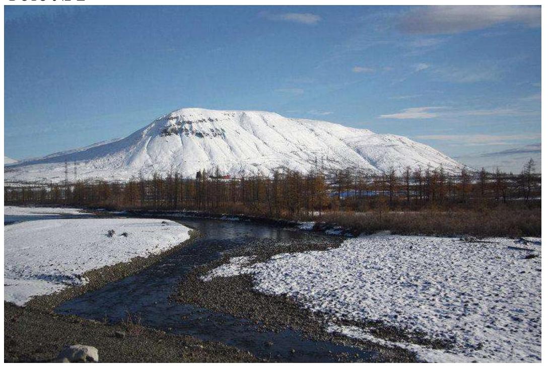
1.1. General Photo of the Summit
Photo № 9
1.2. Profile Photo
Photo № 1
1.3. Photopanorama
Photo № 2
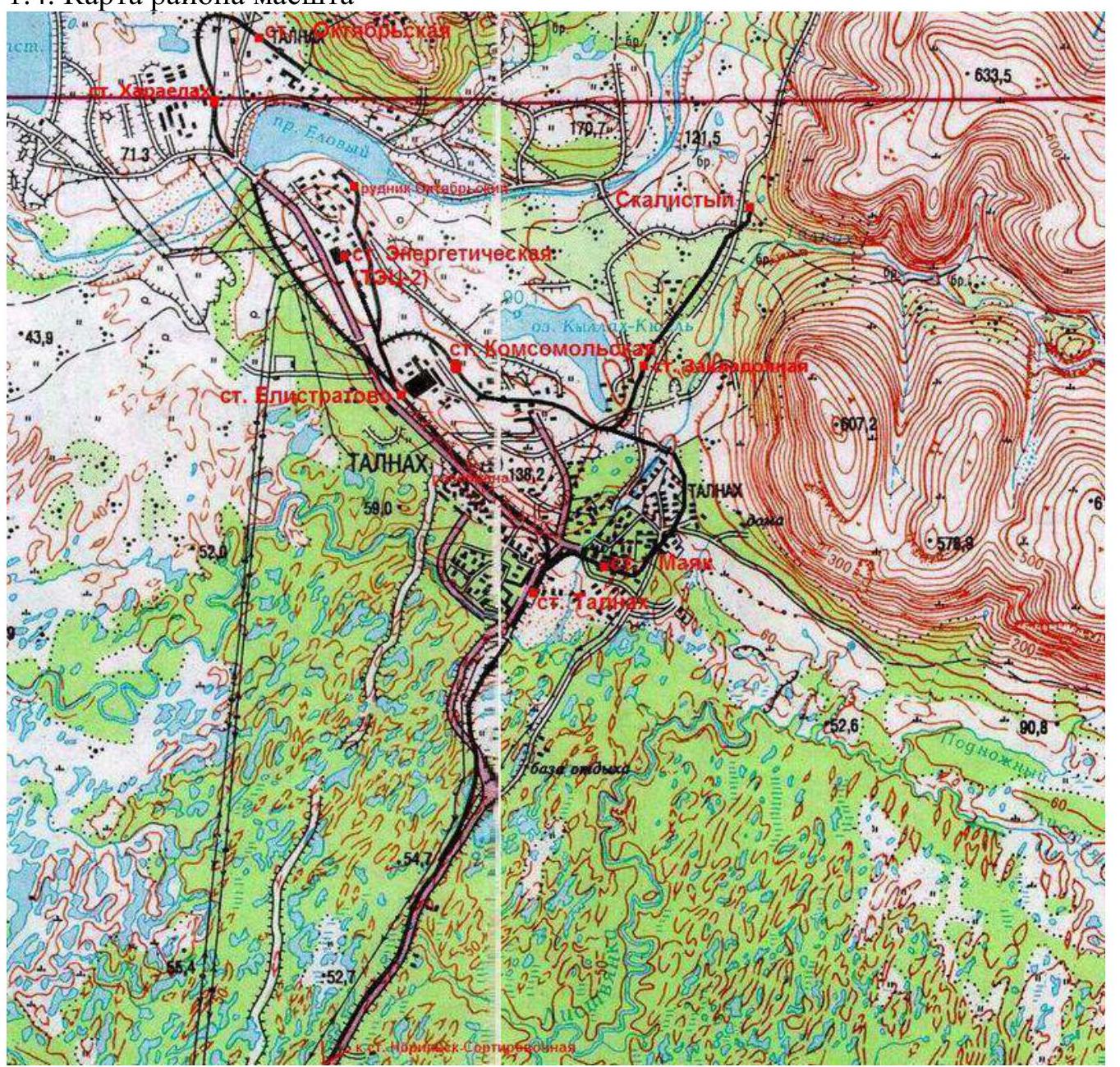
1.4. Area Map Scale
2. Route Characteristics
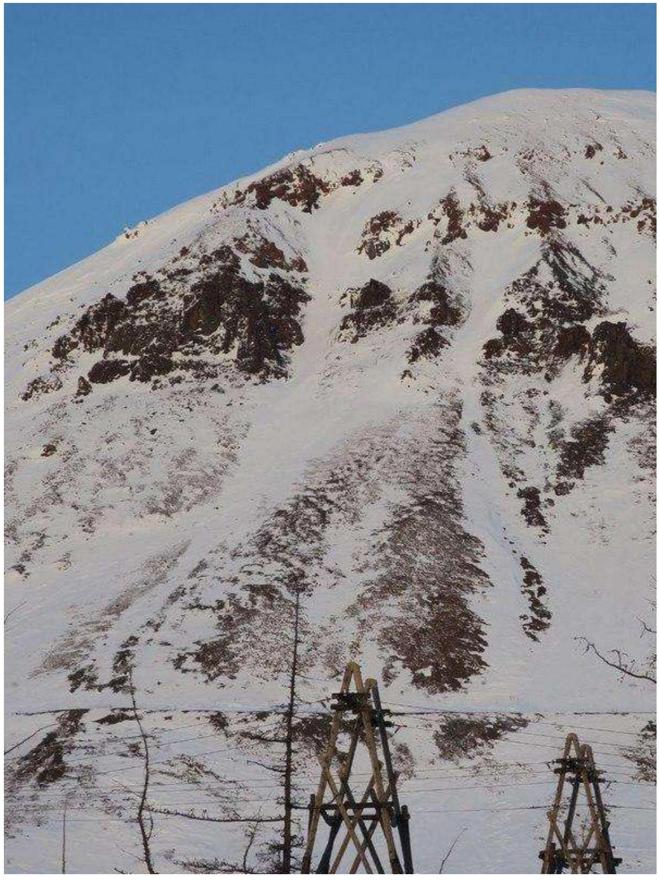
2.1. Technical Photograph of the Route
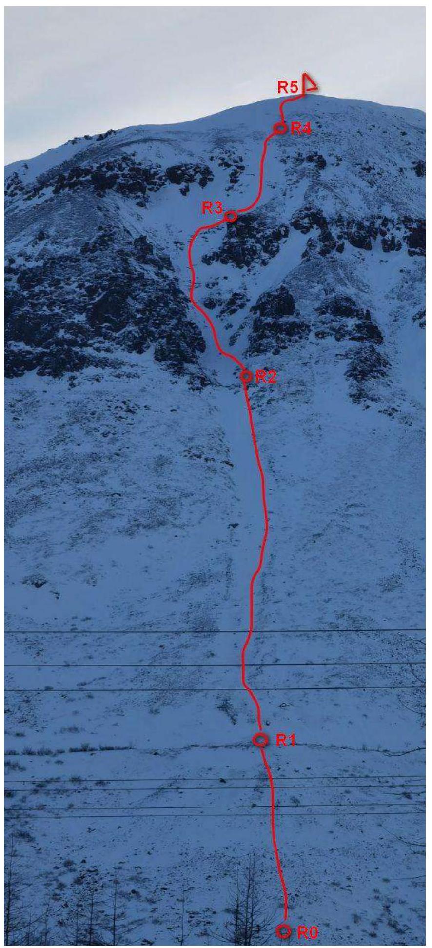
2.2. Participant Numbers on the Technical Photograph
Photo № 4.
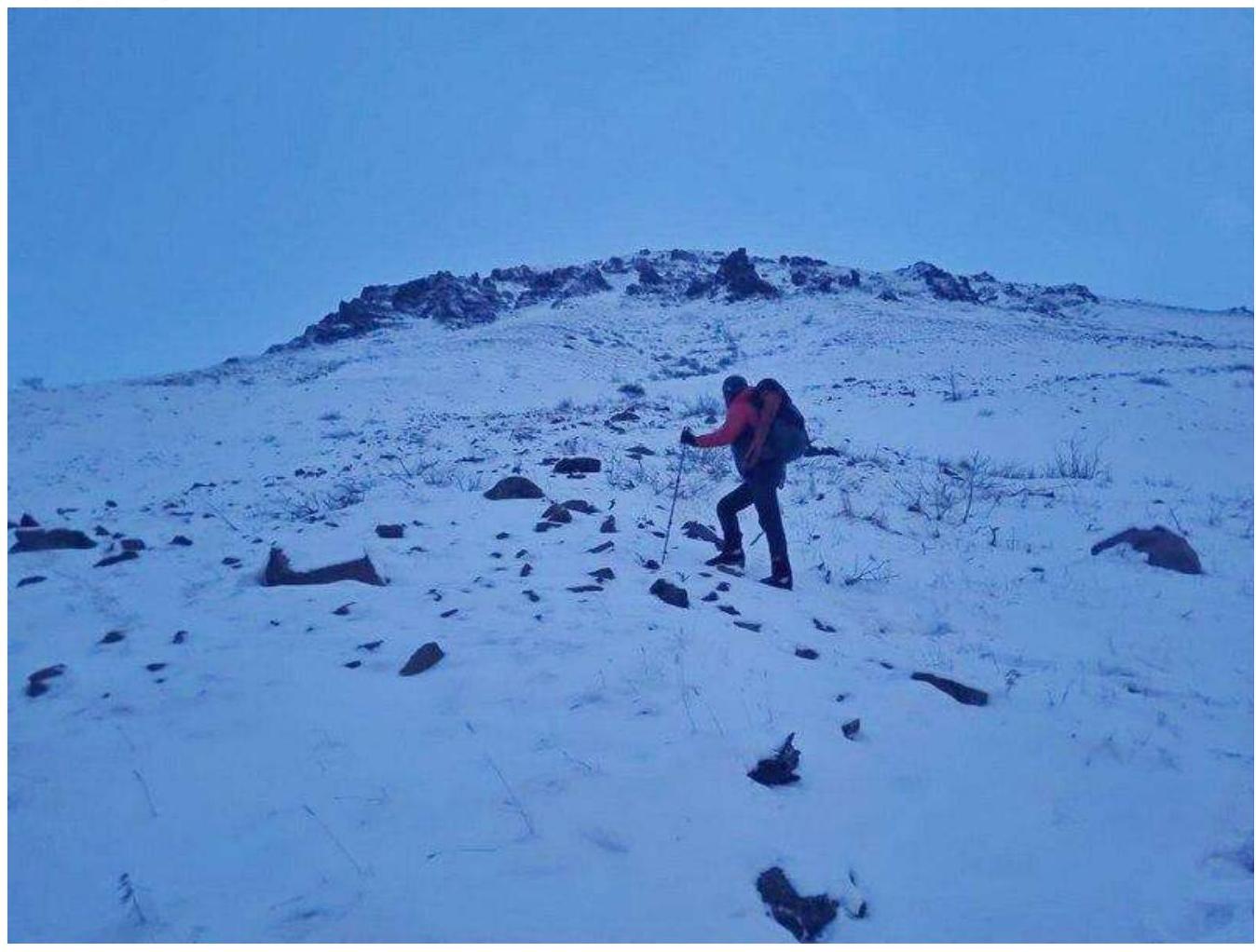
Participant № 1 on R0–R1 on the scree slope at the beginning of the route.
Photo № 5
Participant № 1 on the R1–R2 section moving on snow.
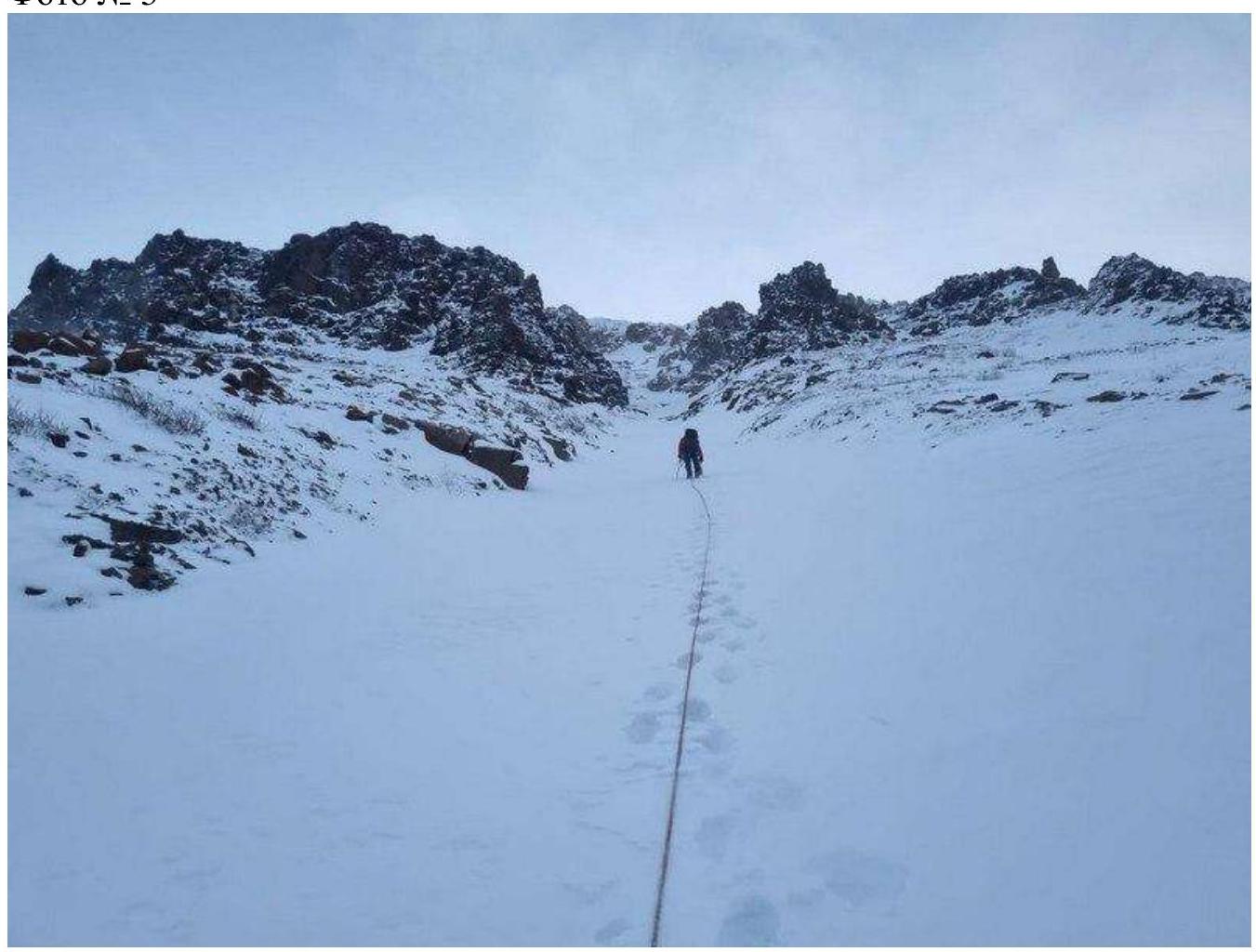
Photo № 6
Participant № 1 on the R2–R3 section moving on "ram's foreheads" with ice.
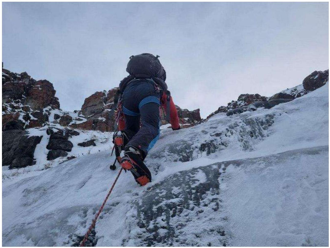
Photo № 7
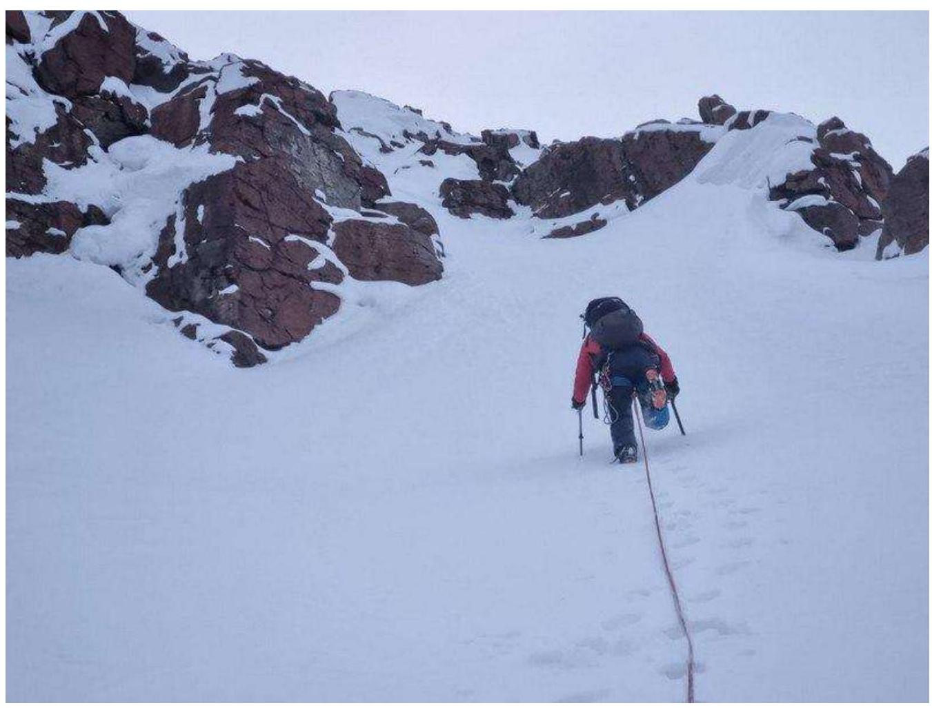
Participant № 1 on the R3–R4 section approaching the key section of the route.
Photo № 8
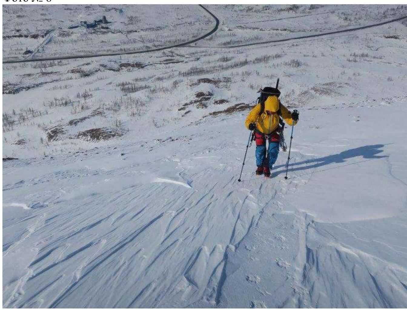
Participant № 1 on the R4–R5 section before reaching the summit.
2.3. Technical Characteristics of Route Sections
| Section | Relief Character | Category of Difficulty | Length, m | Type and Number of Pitons |
|---|---|---|---|---|
| R0–R1 | Ice and snow | 1 | 135 | none |
| R1–R2 | Ice and snow | 2 | 158 | none |
| R2–R3 | Ice and snow | 2 | 162 | none |
| R3–R4 | Ice and snow | 3 | 66 | Snow anchor |
| R4–R5 | Ice and snow | 2 | 80 | none |
3. Character of the Team's Actions
3.1. Brief Description of the Route Passage
| Section | Description | Photo Number |
|---|---|---|
| R0–R1 | Firm snow, small scree, slope angle from 20° to 30°, simultaneous insurance, movement in crampons with ice axes. We reach a clearly defined ledge. | № 4 |
| R1–R2 | Firm snow, slope angle 30°. Simultaneous insurance. | № 5 |
| R2–R3 | Firm snow, "ram's foreheads" covered with ice. Slope angle 35–40°. Simultaneous insurance. | № 6 |
| R3–R4 | We move along the couloir, bearing right on the firn, the path is obvious. Slope angle 45–60°, alternating insurance, station on an ice axe, using a snow anchor as an intermediate point. The key section of the route is characterized by a sharp change in the angle of ascent between the rocks. | № 7 |
| R4–R5 | We continue moving on the firn towards the summit, slope angle 25°. Simultaneous insurance. The slope angle measurements were taken with a Pieps 30 Plus XT inclinometer. | № 8 |
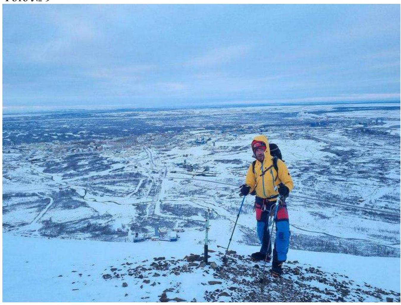
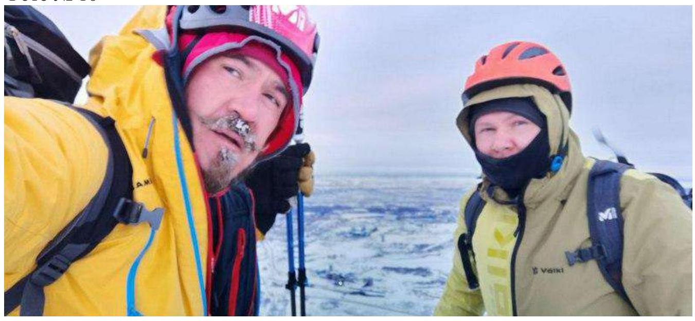
3.2. Team Photo at the Summit
Photo № 10
3.3. Route Safety Assessment
The route is well visible and logical in terms of orientation. Due to the northern orientation of the slope and strong Norilsk winds, it becomes very firm and relatively safe from avalanches. It is very good for developing moral and volitional qualities. It belongs to ice and snow educational and sports routes of 2A category. Allows working out movement on snowy and icy mountain relief with a training group. This route requires good preparation for movement on snowy and icy relief.
The Talnakh mountains are the foothills of the Putorana Plateau, at the foot of which Talnakh is located. On modern maps, the ridge is called the Kharalakh Mountains (on some maps, Kharyllakh Mountains), which translates from Dolgan as "fir stone". The mountains began to be called Talnakh in the 1960s, after the discovery of the Talnakh copper-nickel deposit and the beginning of Talnakh's active construction.
How to Reach the Route
From the Talnakh district bus station, take public transport to the "Tрест" stop, which is located in the 5th microdistrict of Talnakh. From the stop, walk towards Gora Otdelnaya, to the site of the Komsomolsky mine's airfield. You can also get there by taxi from the bus station. You can put on your gear right there.
Route
The route begins with an ascent along the small scree towards the Northwest couloir. The couloir is clearly visible, and the ascent begins immediately from the airfield, with a gain in height to the left. From the area with trees, we ascend along the scree slope to the cut ledge under the couloir (previously, this was a road for mountain equipment). From the cut ledge, we move along the line of water flow towards the rocks. Between the rocks, depending on the snow cover, there are "ram's foreheads" covered with ice, which do not pose significant technical difficulty for those confident in crampons. After passing between the rocks, we bear to the right along the obvious path. Further, the angle of ascent becomes steeper, and it is preferable to move in three steps. As an intermediate point, you can set a snow anchor or an ice axe. After passing the steepest section, the angle becomes gentler, and we move simultaneously to the summit, which is marked by a protruding pipe.
The descent from the summit is via the neighboring couloir, which is located to the left (when looking down from the summit) of the couloir used for the ascent. On some sections of the descent, it is possible to hang rappel lines on ledges.
Comments
Sign in to leave a comment