
Report
ON THE FIRST ASCENT TO THE SUMMIT OF VERSHININA EASTERN (3450 m) VIA THE EASTERN RIDGE 4A category of complexity BY THE TEAM FROM BAIKALSKAYA ALPINISM SCHOOL July 5, 2021
Irkutsk, 2022
I. Ascent Report
| № | 1. General Information | |
|---|---|---|
| 1.1 | Full name, sports rank of the team leader | Afanasyev A.E. — Master of Sports |
| 1.2 | Full name, sports rank of the participants | Kobets Yu.M. — 1st sports rank, Mishkov A.V. — Candidate for Master of Sports, Salin A.V. — Candidate for Master of Sports |
| 1.3 | Full name of the coach | Afanasyev A.E. — Master of Sports |
| 1.4 | Organization | Baikal Alpine School |
| 2. Characteristics of the Ascent Object | ||
| 2.1 | Region | Chikhachev Ridge, Altai |
| 2.2 | Valley | Pravaya Boguty |
| 2.3 | Number of the section according to the 2013 classification table | 1.8 |
| 2.4 | Name and height of the summit | Mt. Vershinin Eastern, 3449 m |
| 2.5 | Geographical coordinates of the summit (latitude/longitude), GPS coordinates (1) | N (49.791019) 49°47′27.668″, E (89.607697) 89°36′27.709″ (1) |
| 3. Characteristics of the Route | ||
| 3.1 | Name of the route | Eastern Ridge |
| 3.2 | Proposed category of complexity | 4A |
| 3.3 | Degree of route exploration | First ascent |
| 3.4 | Relief characteristics of the route | Combined |
| 3.5 | Height difference of the route (altimeter or GPS data) | Start 3200 m. Summit 3449 m. Height difference 250 m. |
| 3.6 | Route length (in meters) | 510 m |
| 3.7 | Technical elements of the route (total length of sections of various complexity categories with relief characteristics) | Category I rocks — 115 m. Category II rocks — 100 m. Category III rocks — 160 m. Category IV rocks — 70 m. Category V rocks — 65 m. |
| 3.8 | Descent from the summit | Via the ascent route |
| 3.9 | Additional route characteristics | The route includes snowfields with ice on the ridge and in the couloir. |
| 4.1 | Time of movement (team's total climbing hours, in hours and days) | 14 hours 30 minutes, 1 day |
| 4.2 | Overnights | none |
| 4.3 | Departure to the route | 6:00 July 5, 2021 |
| 4.4 | Summit ascent | 14:37 July 5, 2021 |
| 4.5 | Return to the base camp | 20:30 July 5, 2021 |
| 5. Person responsible for the report | ||
| 5.1 | Full name, e-mail | Afanasyev A.E. [email protected] |
II. Ascent Description
1. Characteristics of the Ascent Object
1.1. General Photo of the Summit
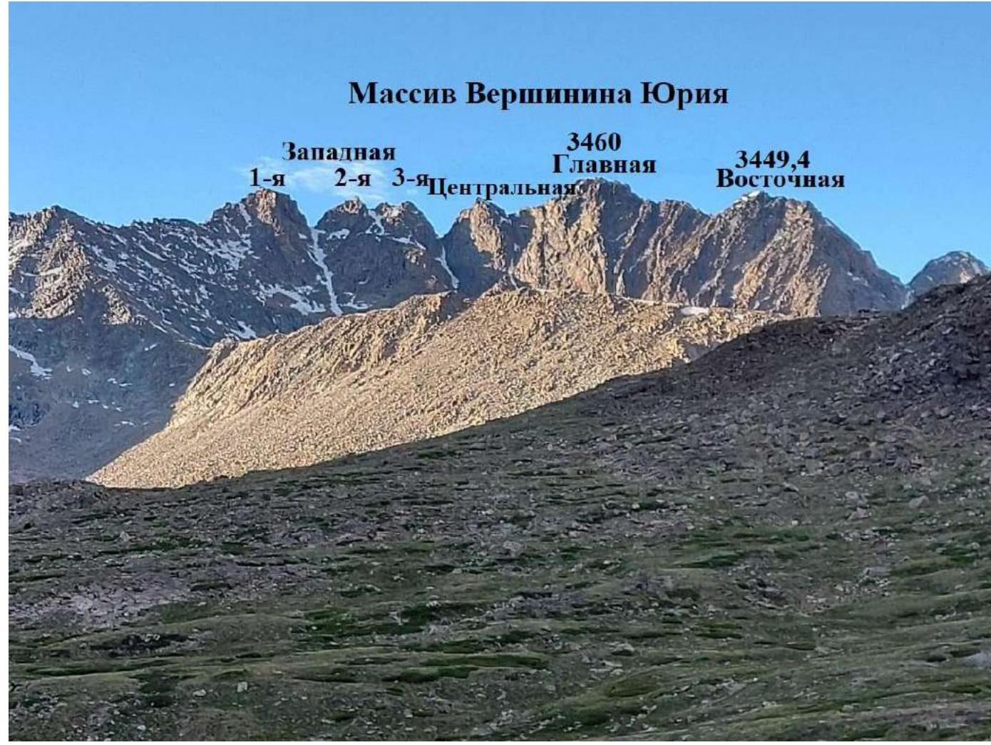
Photo 1. July 4, 2021. Taken from the Pravaya Boguty valley.
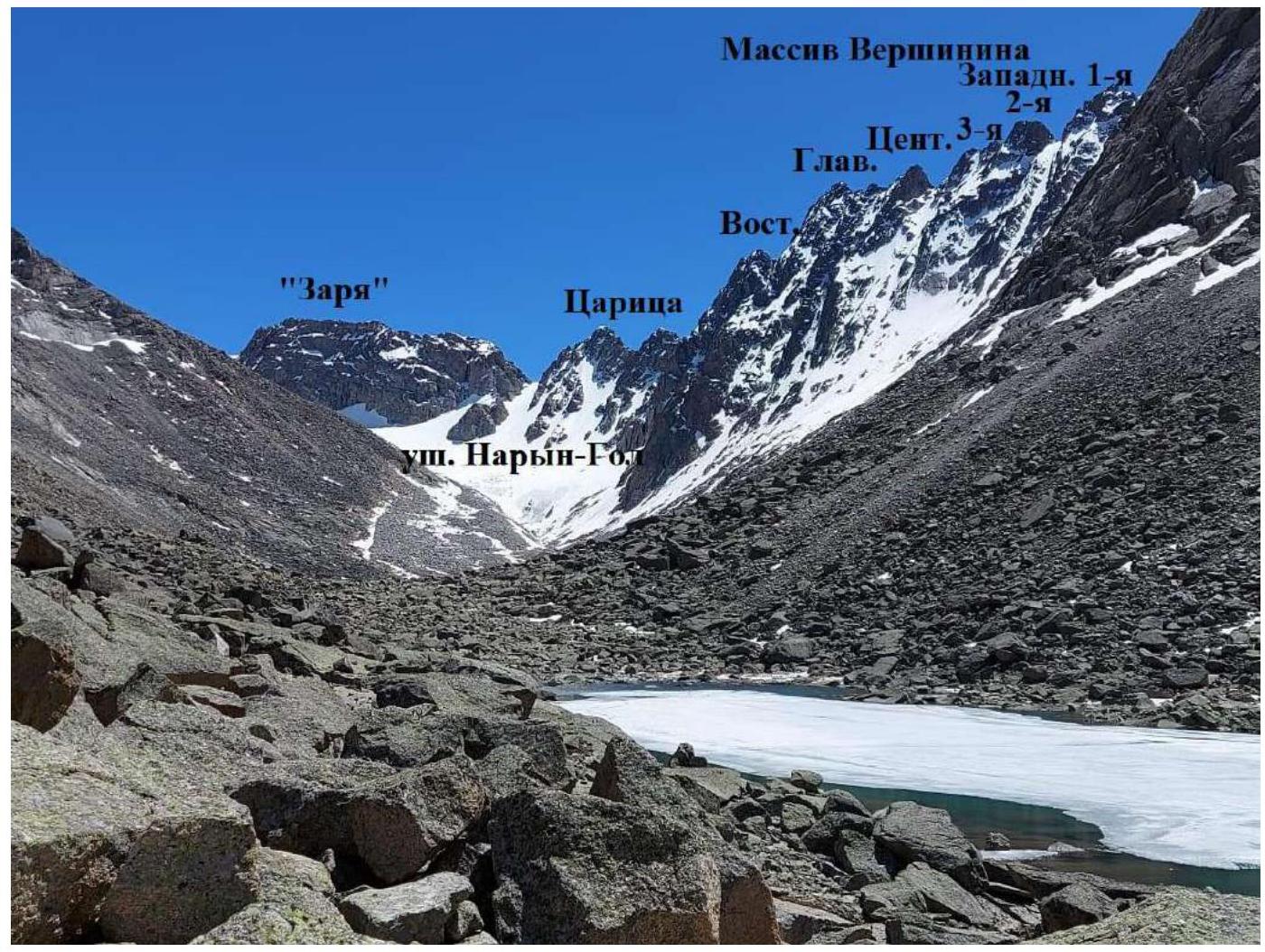
Photo 2. July 1, 2021. Mt. Vershinin, northern side. Taken from the Naryn-Gol valley.
1.2. Route Profile Photo
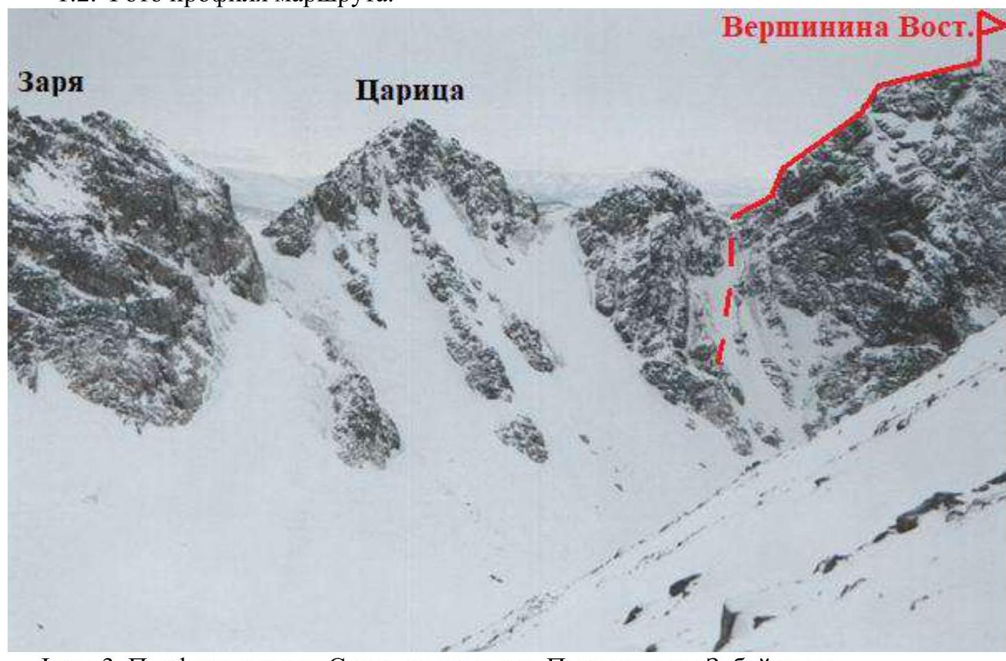
Photo 3. Profile on the right. Taken from the slope of Mt. Pogranichnik Zabaykalya.
1.3. Photopanorama
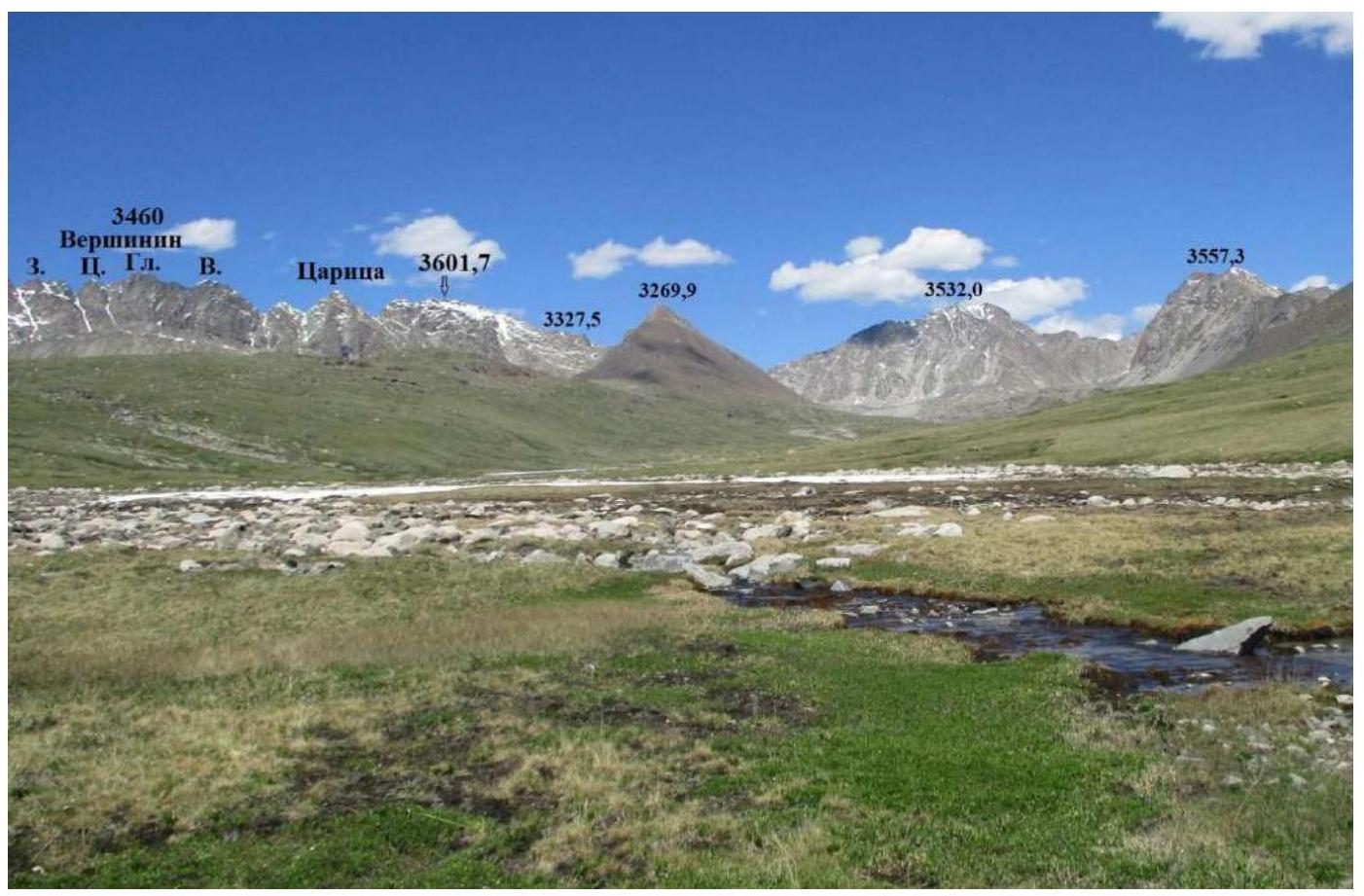
Photo 4. Photopanorama of the Boguty Pravaya valley. Taken on July 3, 2021.
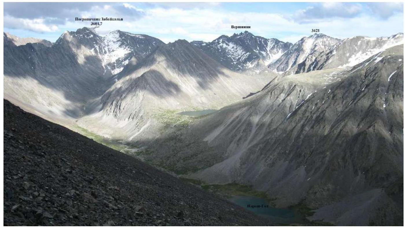
Photo 5. Photopanorama of the Naryn-Gol valley.
1.4. Map of the Area
The Chikhachev Ridge is located in the southeastern part of the Altai Mountains, stretching submeridionally. The northern part borders Tuva, and the middle part forms the border with Mongolia to the east. The southern part, with the highest point of the ridge, Mt. Turgen-Ula (also known as Turgeni-Ekhin-Ula on some maps) at 4029 m, is located in Mongolia. From the Russian side, alpine-type peaks are accessible from the Naryn-Gol, Pravaya Boguty, and Levaya Boguty valleys. The Vershinin massif is situated in the western spur of the ridge, branching off from Mt. Pogranichnik Zabaykalya (named so because the entire Mongolian border during the Soviet era was guarded by units and outposts of the Trans-Baikal Border District). The massif consists of two blocks: the main rocky block, which includes the Central, Main, and Eastern peaks, and a secondary block — the 1st, 2nd, and 3rd Western peaks (from left to right). The Western peaks are aligned strictly by latitude, while the main peaks are slightly shifted southward on their eastern edge.
All five peaks of Vershinin can be ascended:
- from the north — from the Naryn-Gol valley (there is glaciation, and the routes will be combined),
- from the south — from the Pravaya Boguty valley (rocky routes).
The traverse of the Western peaks was completed back in 1978 by a group of climbers from the Biysk club "Zarya" — friends of Yuri Vershinin.
— Yuri Vershinin, our friend from the "Zarya" alpine club, died in 1974 in his laboratory at ANIIKhT after an explosion of an experimental thermite composition in his hands. In honor of Yuri, city competitions in rock climbing were held for a long time, followed by a visit to his grave. — The Eastern peak was ascended in 2021 by climbers from the former "Zarya" club in Biysk. The Central and Main peaks await their first ascenders.
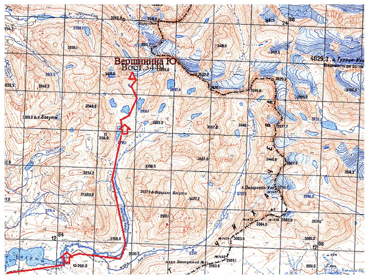
Photo 6. Map of the area.
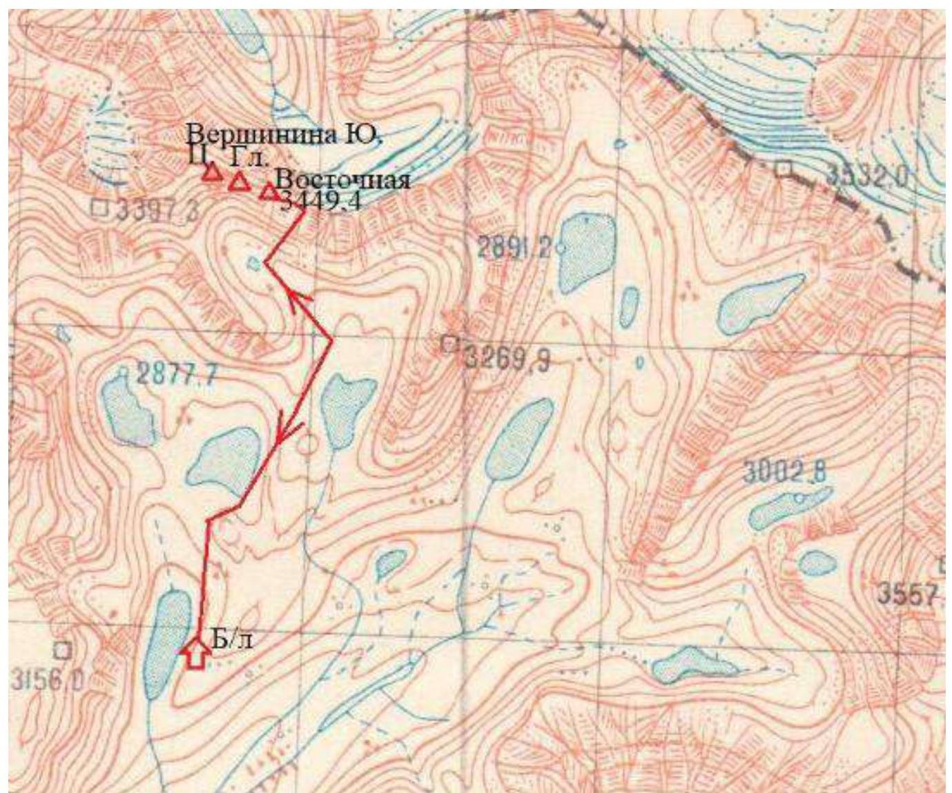
Photo 7. Map of the route to Mt. Vershinin Yuri Eastern via the Eastern ridge, 4A category of complexity.
2. Characteristics of the Route
2.1. Technical Photo of the Route
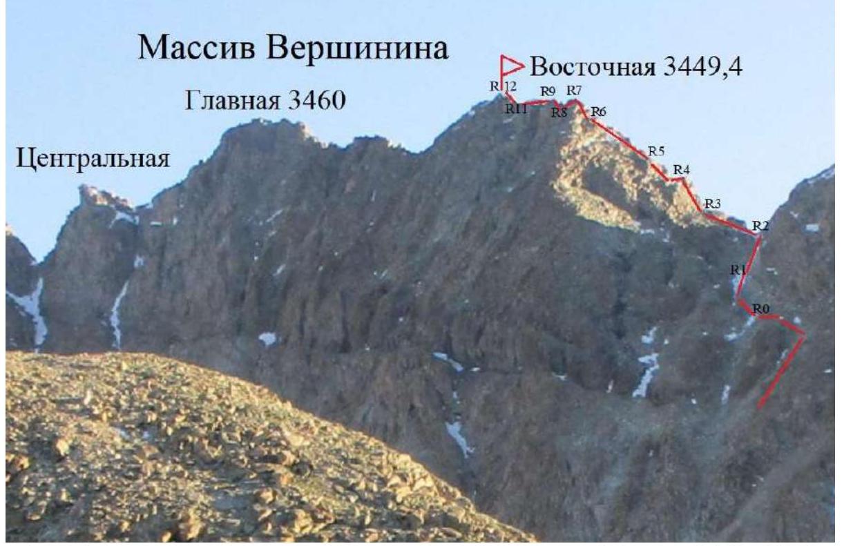
Photo 8. Technical photo taken from the Pravaya Boguty valley on July 5, 2021.
2.3. Technical Characteristics of Route Sections
| Section № | Relief Characteristics | Number of pitons |
|---|---|---|
| 0-1 | 100 m, 45° 1. Steep rocky couloir-gully with an icy stream at the bottom and rocky sides. Climbed with crampons. At the top, the gully meets an overhanging wall below the pass. | |
| 1-2 | 60 m, 55° 3. Along the side of the gully, bypassing the overhang to the right. Exit to the Otkrytiy pass (from a tourist note). One can bypass the pass and start ascending slightly below the overhang along the left side of the gully, i.e., the southern slope of the Eastern ridge. 70 m, 50° 2, in the middle part 10 m, 80° 5. Exit to the ridge slightly above the pass. | |
| 2-3 | 50 m, 45° 2. From the pass along the ledges and slabs of the ridge. | |
| 3-4 | 40 m, 75° 5. Left-sided chimney (the right side overhangs) to the left of the ridge. Exit to the ridge. | 5 |
| 4-5 | 80 m, 50° 3. Large blocks and slabs along the left part of the ridge. | 2 |
| 5-6 | 40 m, 2. To the left of the ridge along the fractures of the 40° slope. | |
| 6-7 | 30 m, 70° 4. Inner corner. Exit to the sub-summit. | 3 |
| 7-8 | 10 m, 2. Along the ridge and descent 5 m under the left part of the ridge wall. | |
| 8-9 | 25 m, 80° 5. Inner corner. | 4 |
| 9-10 | 20 m, 55° 3. To the left along an inclined slab. | 2 |
| 10-11 | 15 m, 5° 1. Large blocky rocks on the ridge. Up and down with a slight ascent. | |
| 11-12 | 20 m, 60° 4. Ascent to the summit of Vershinin Eastern 3449 m according to GPS at 14:37. To the west, through a gap about two hundred meters away, the Main peak of Vershinin Yuri 3460 m above sea level is visible. | 3 |
3. Characteristics of the Team's Actions
| Section № | Description | Photo № |
|---|---|---|
| 0-1 | 100 m, 45° 1. Steep rocky couloir-gully with an icy stream at the bottom and rocky sides. Climbed with crampons. At the top, the gully meets an overhanging wall below the pass. | 9 |
| 1-2 | 60 m, 55° 3. Along the side of the gully, bypassing the overhang to the right. Exit to the Otkrytiy pass (from a tourist note). One can bypass the pass and start ascending slightly below the overhang along the left side of the gully, i.e., the southern slope of the Eastern ridge. 70 m, 50° 2, in the middle part 10 m, 80° 5. Exit to the ridge slightly above the pass. | |
| 2-3 | 50 m, 45° 2. From the pass along the ledges and slabs of the ridge. | 10 |
| 3-4 | 40 m, 75° 5. Left-sided chimney (the right side overhangs) to the left of the ridge. Exit to the ridge. | 11 |
| 4-5 | 80 m, 50° 3. Large blocks and slabs along the left part of the ridge. | |
| 5-6 | 40 m, 2. To the left of the ridge along the fractures of the 40° slope. | 12 |
| 6-7 | 30 m, 70° 4. Inner corner. Exit to the sub-summit. | 13 |
| 7-8 | 10 m, 2. Along the ridge and descent 5 m under the left part of the ridge wall. | 14 |
| 8-9 | 25 m, 80° 5. Inner corner. | |
| 9-10 | 20 m, 55° 3. To the left along an inclined slab. | 15 |
| 10-11 | 15 m, 5° 1. Large blocky rocks on the ridge. Up and down with a slight ascent. | |
| 11-12 | 20 m, 60° 4. Ascent to the summit of Vershinin Eastern 3449 m according to GPS at 14:37. To the west, through a gap about two hundred meters away, the Main peak of Vershinin Yuri 3460 m above sea level is visible. | 16 |
3.3. Photos at Route Sections
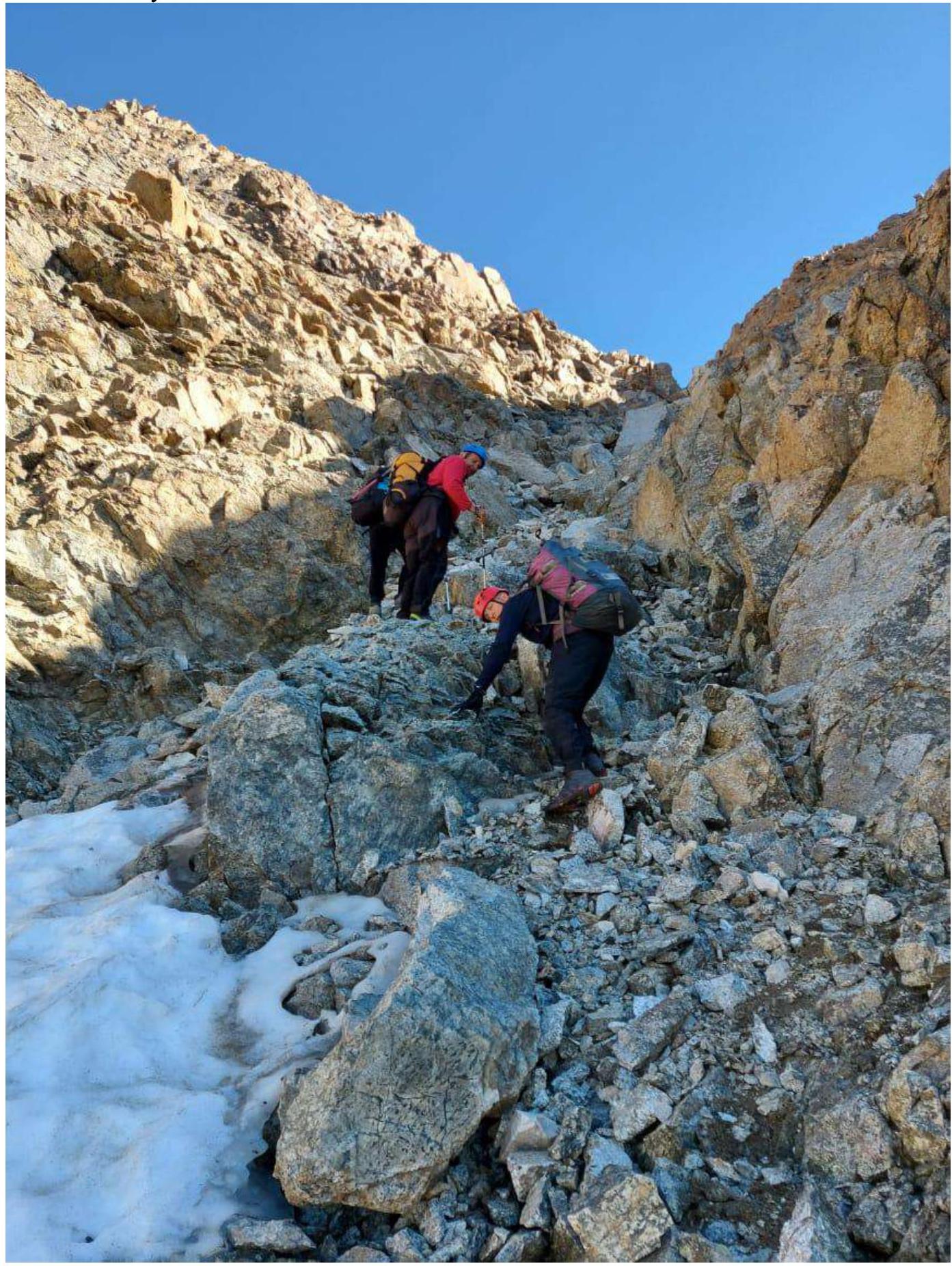
Photo 9. Section R0–R1.
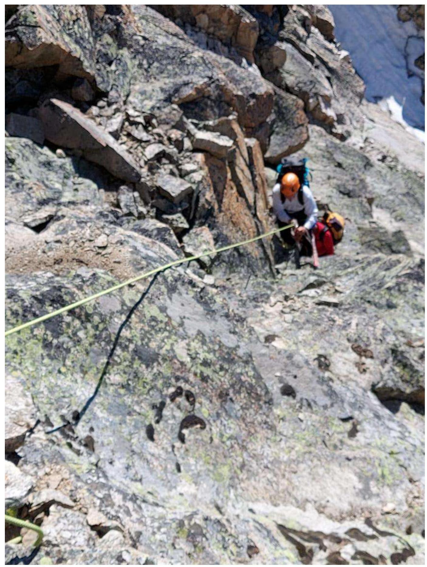
Photo 10. Section R2–R3.
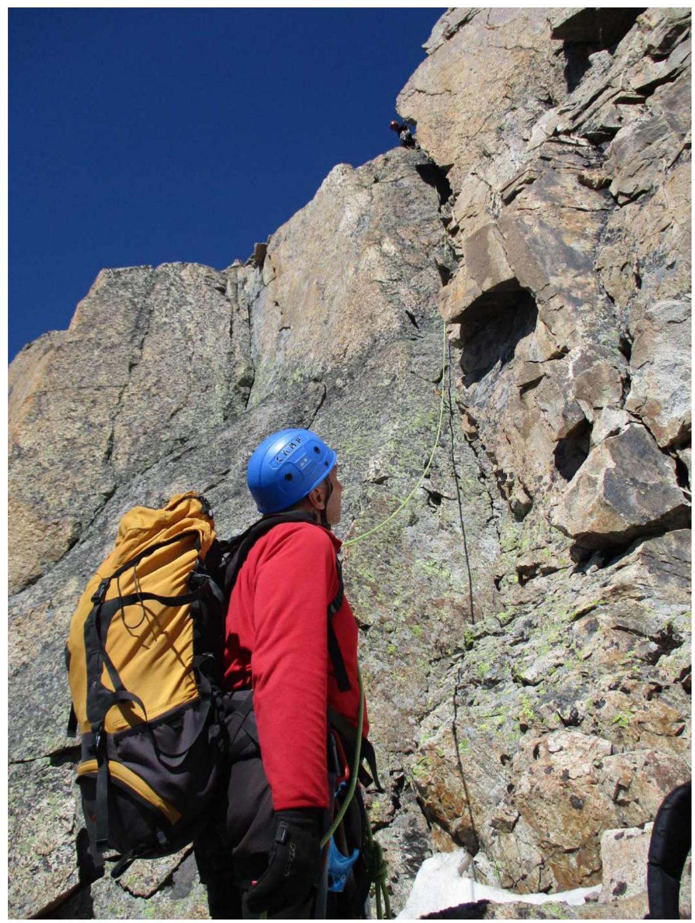
Photo 11. Section R3–R4.
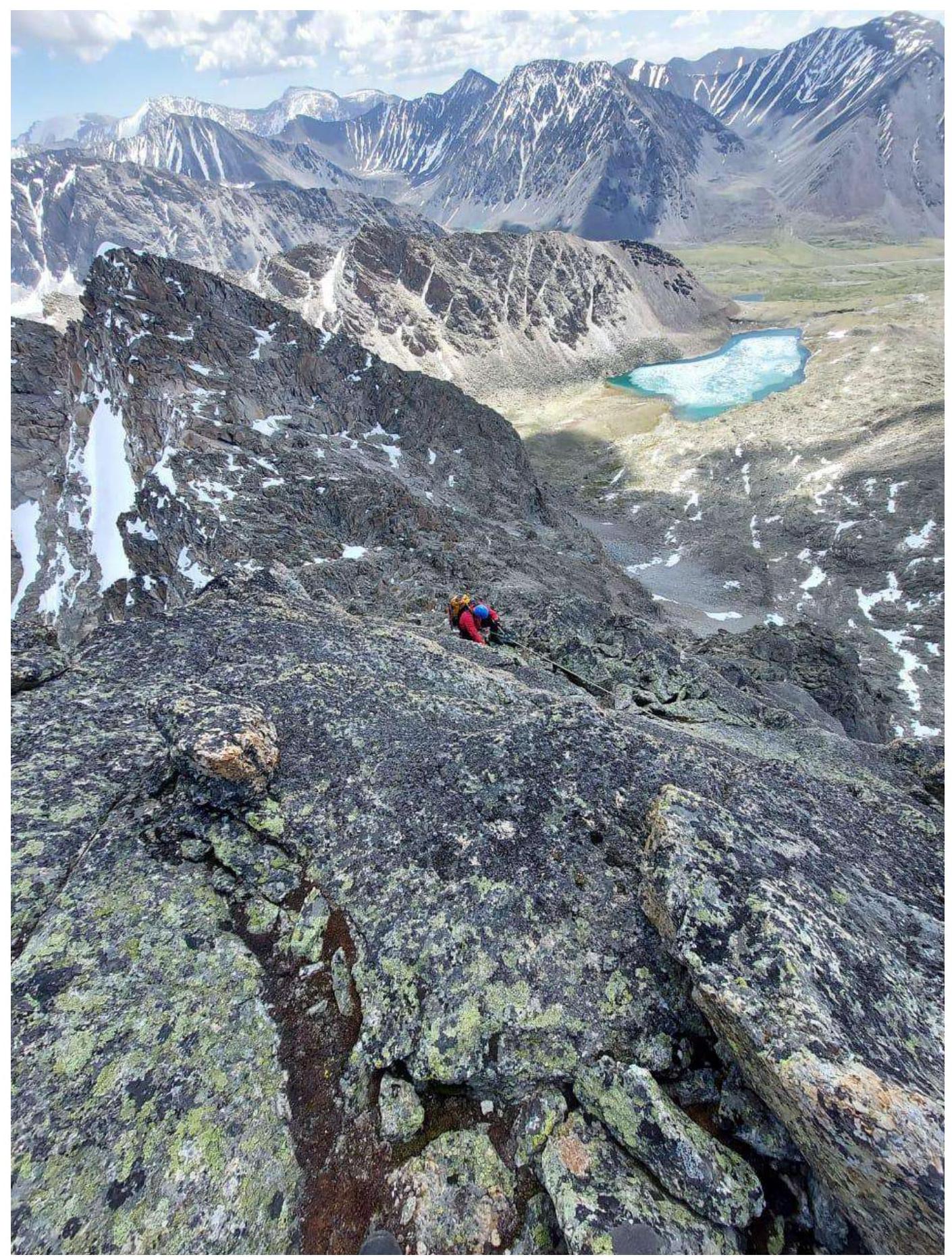
Photo 12. Section R5–R6.
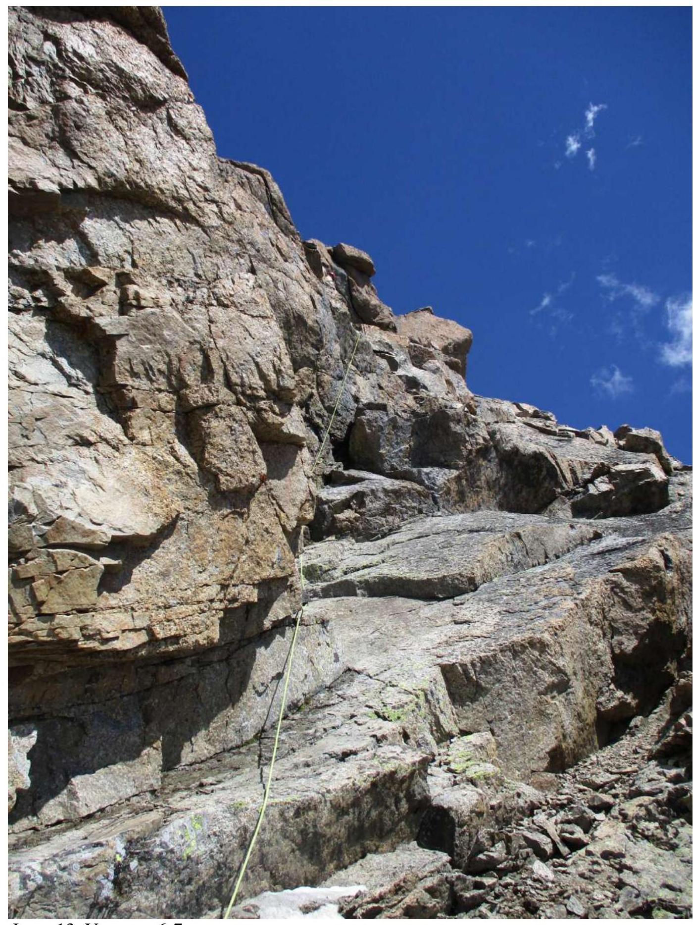
Photo 13. Section R6–R7.
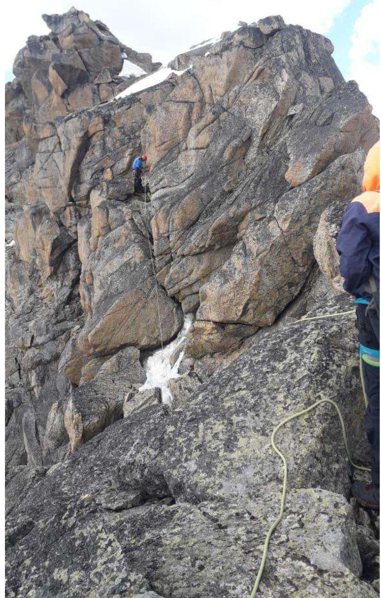
Photo 14. Section R7–R8–R9. The summit is visible on the left.
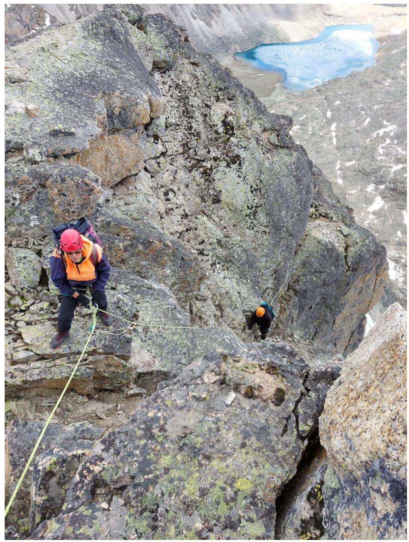
Photo 15. Section R9–R10.
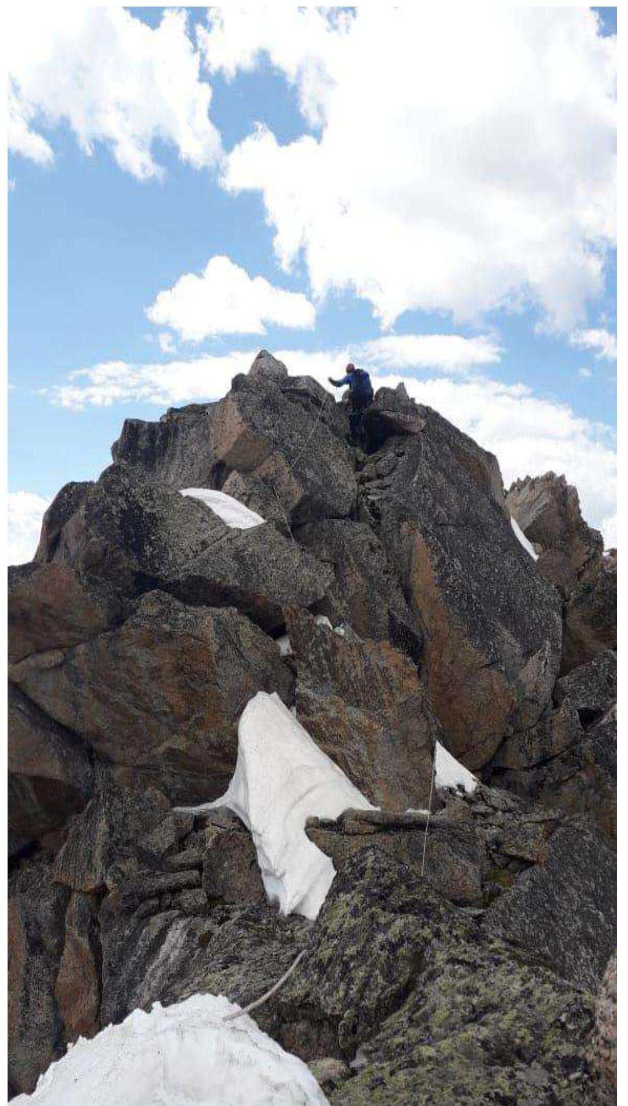
Photo 16. Ascent to the summit. Section R11–R12.
3.2. Photos at the Summit
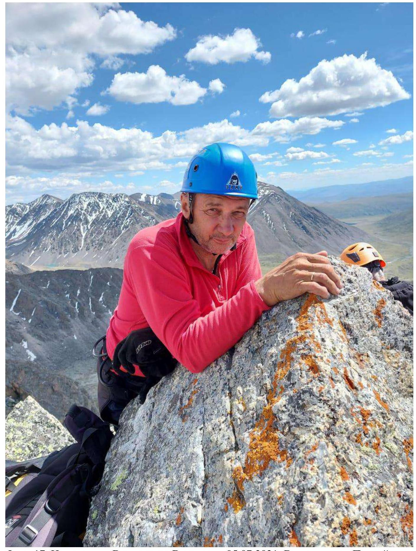
Photo 17. At the summit of Vershinin Eastern on July 5, 2021. View into the Pravaya Boguty valley.
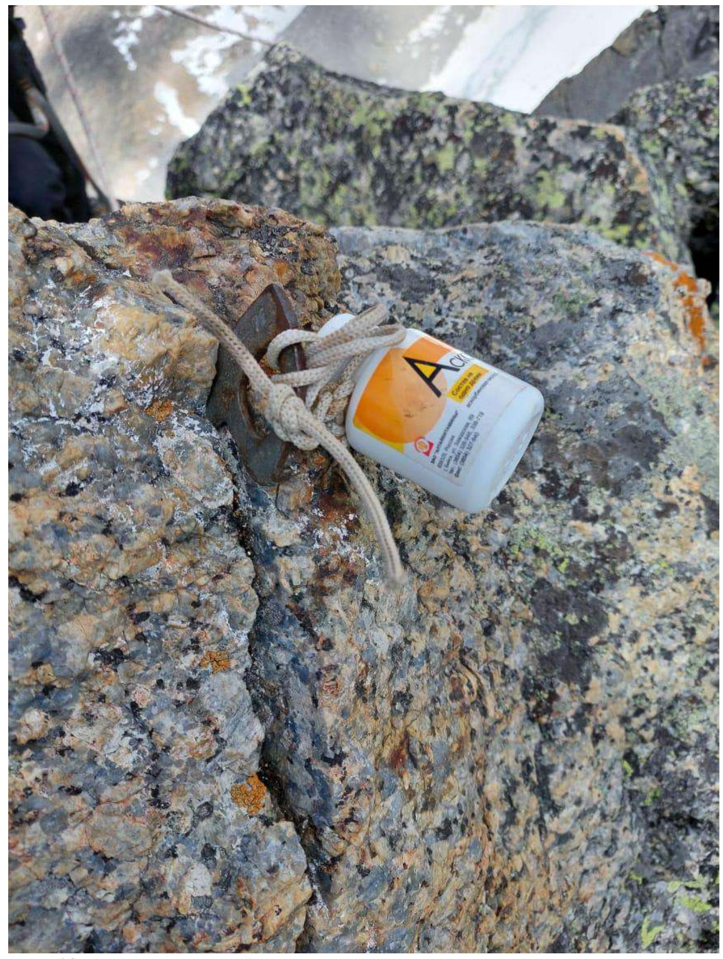
Photo 18. Can with a note at the summit.
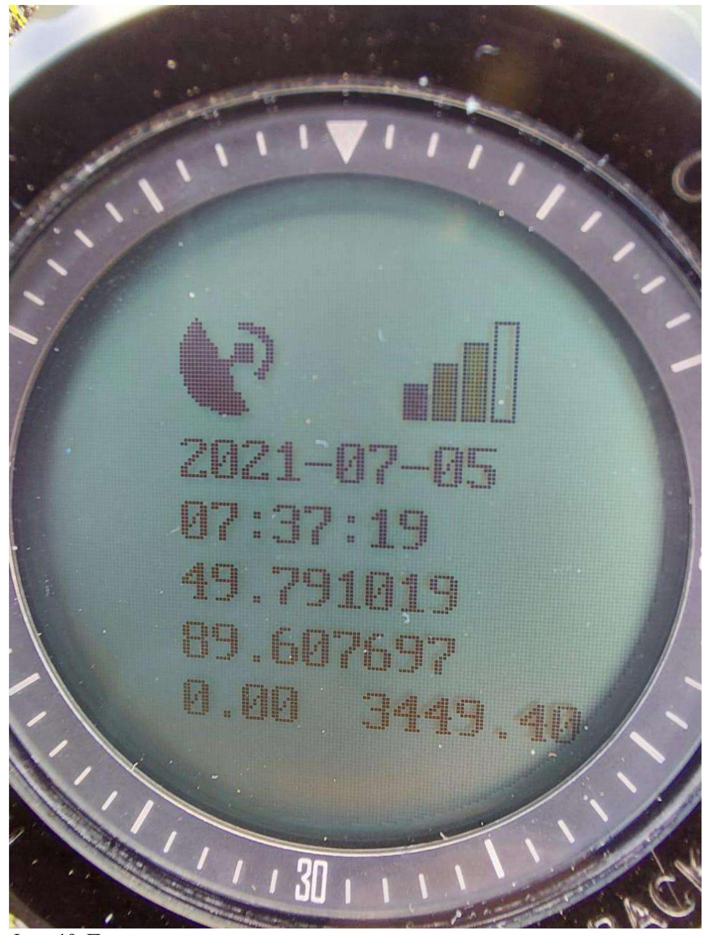
Photo 19. Indicator at the summit.
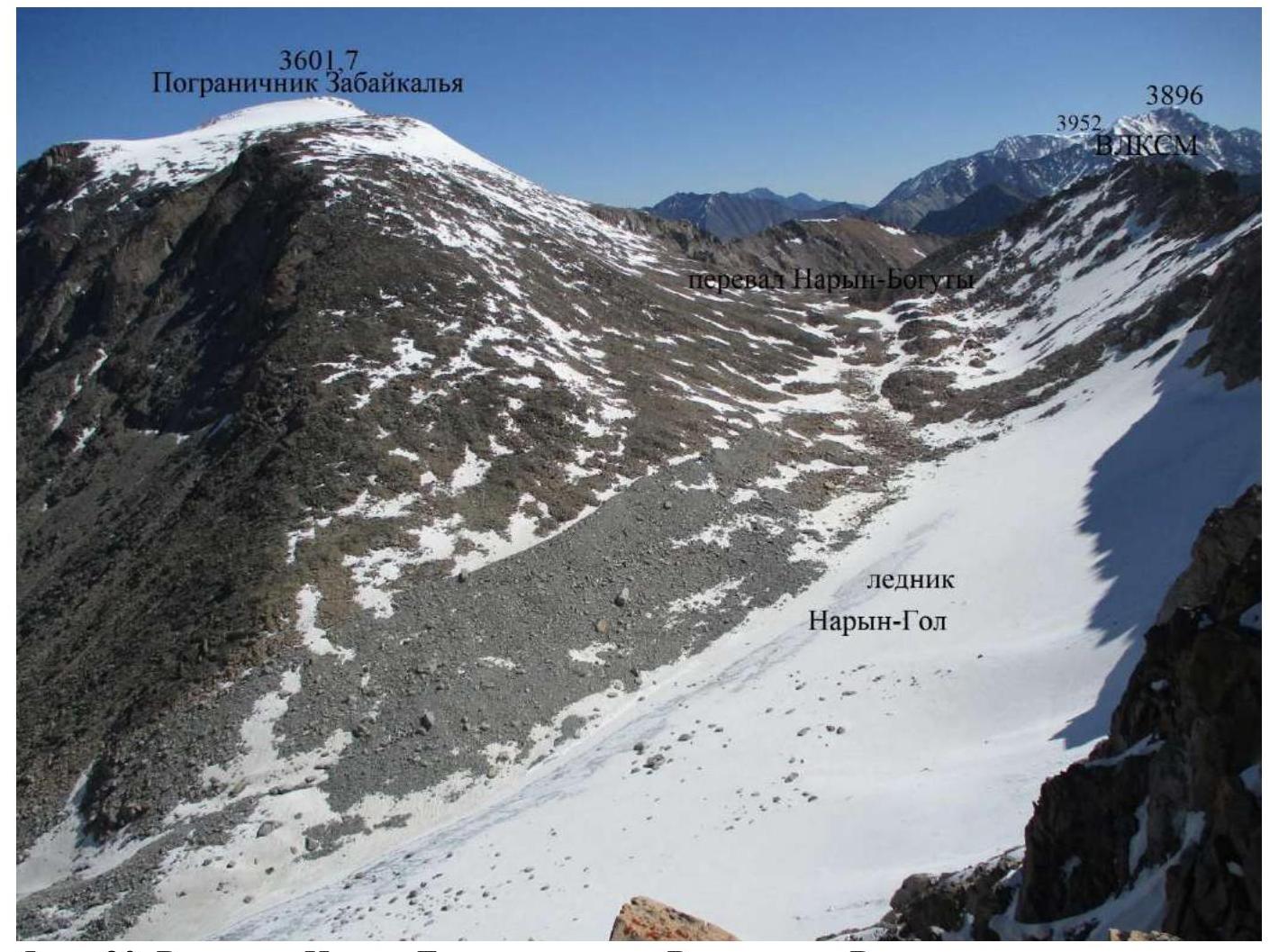
Photo 20. Upper Naryn-Gol from the summit of Vershinin Eastern.
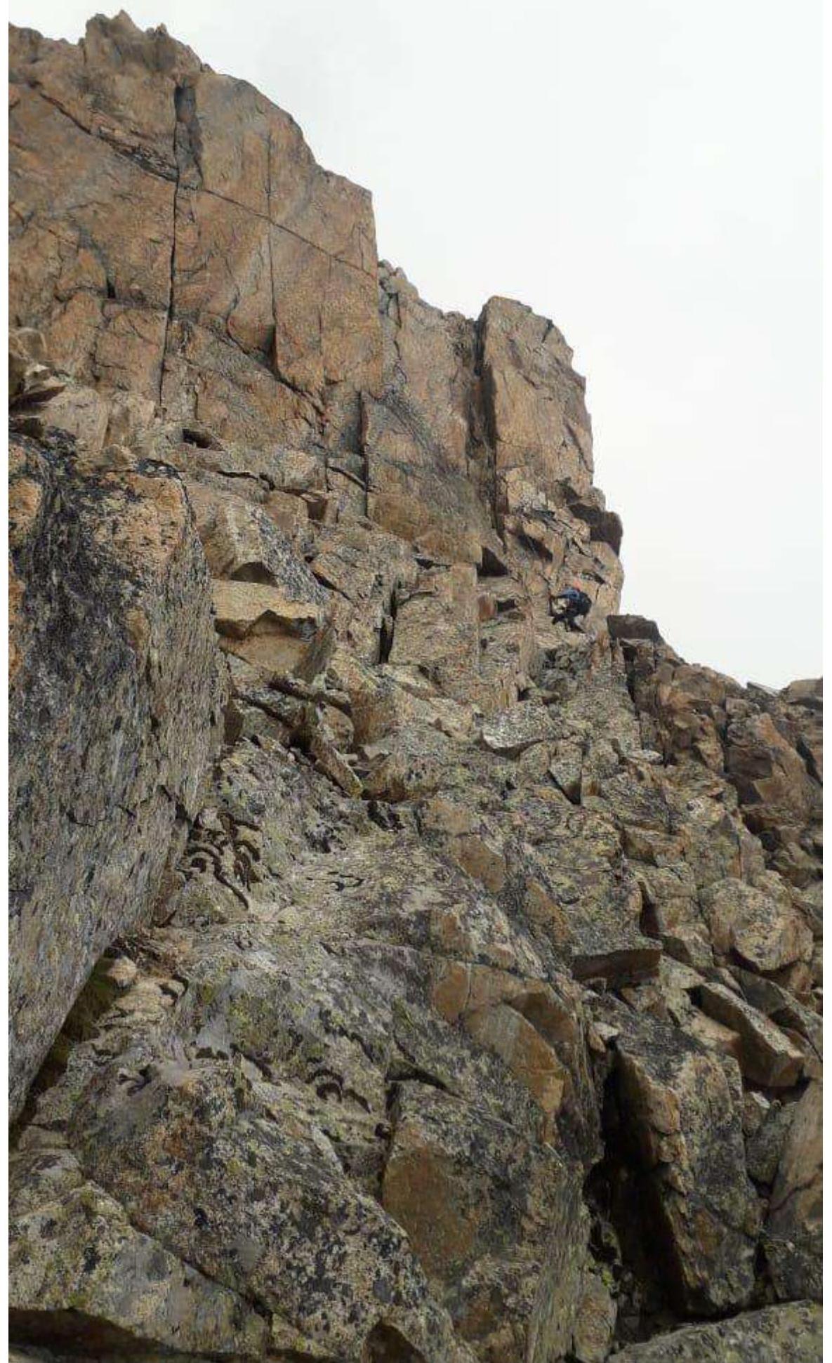
Photo 21. Rappelling on section R3–R4.
3.3. Approach to the Mountain
Departure at 6:00. From the base camp at the Lower Turquoise Lake (2780 m) to the foot of the mountain (3050 m), the approach takes 2 hours. From the foot, there is a talus slope, sometimes with fine scree, to the saddle in the rocky ridge before the gully with a strip of glacial ice between the rocks. Here begins the route. Height 3200 m. Required:
- crampons
- ice axes

Comments
Sign in to leave a comment