Passport
- First ascent
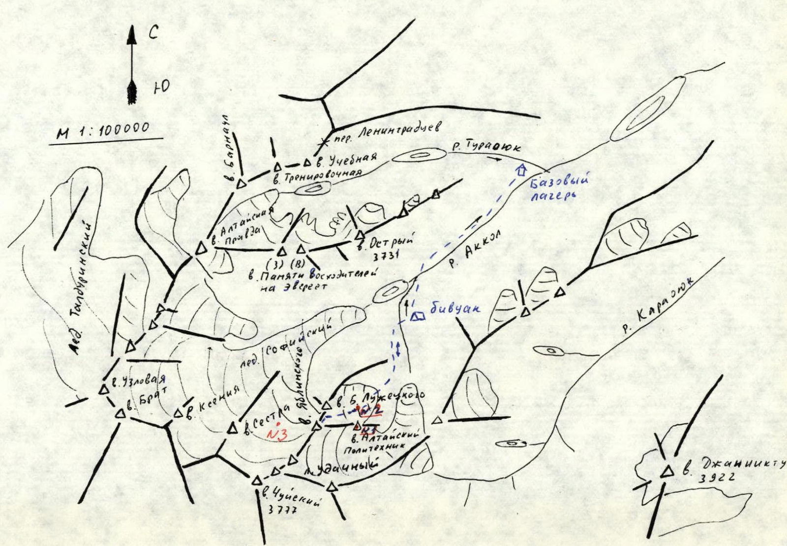
- Altai. South Chuya Ridge, Akkol river gorge
- Mt. Yablinsky V. via E slope of N ridge
- Proposed category 3A, complexity level 2B
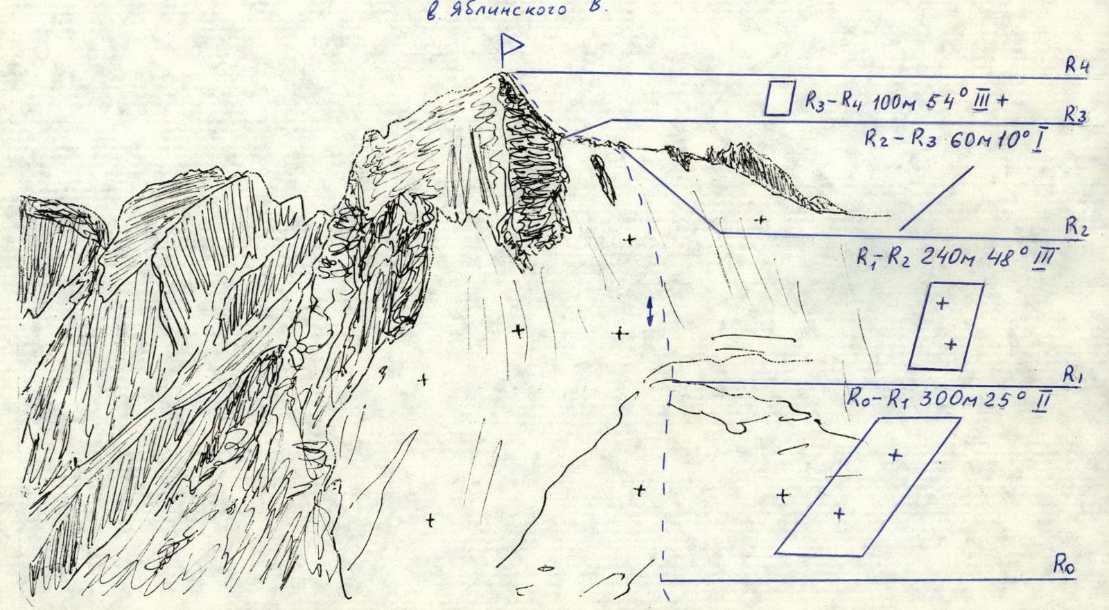
- Height 3650 m, elevation gain 400 m, distance 700 m
- Pitons: ice screws 12 pcs.
- Climbing hours 10 from bivouac to bivouac 5 h from glacier to glacier
- Overnight stays: not necessary
- As a team of two: Drakin A.V. — Candidate for Master of Sports, Barnov S.I. — 1st sports category
- Coach: Drakin A.V. — 1st category, № 68
- Ascent date: May 5, 2000
- Organization: Altai Krai Alpine Federation.
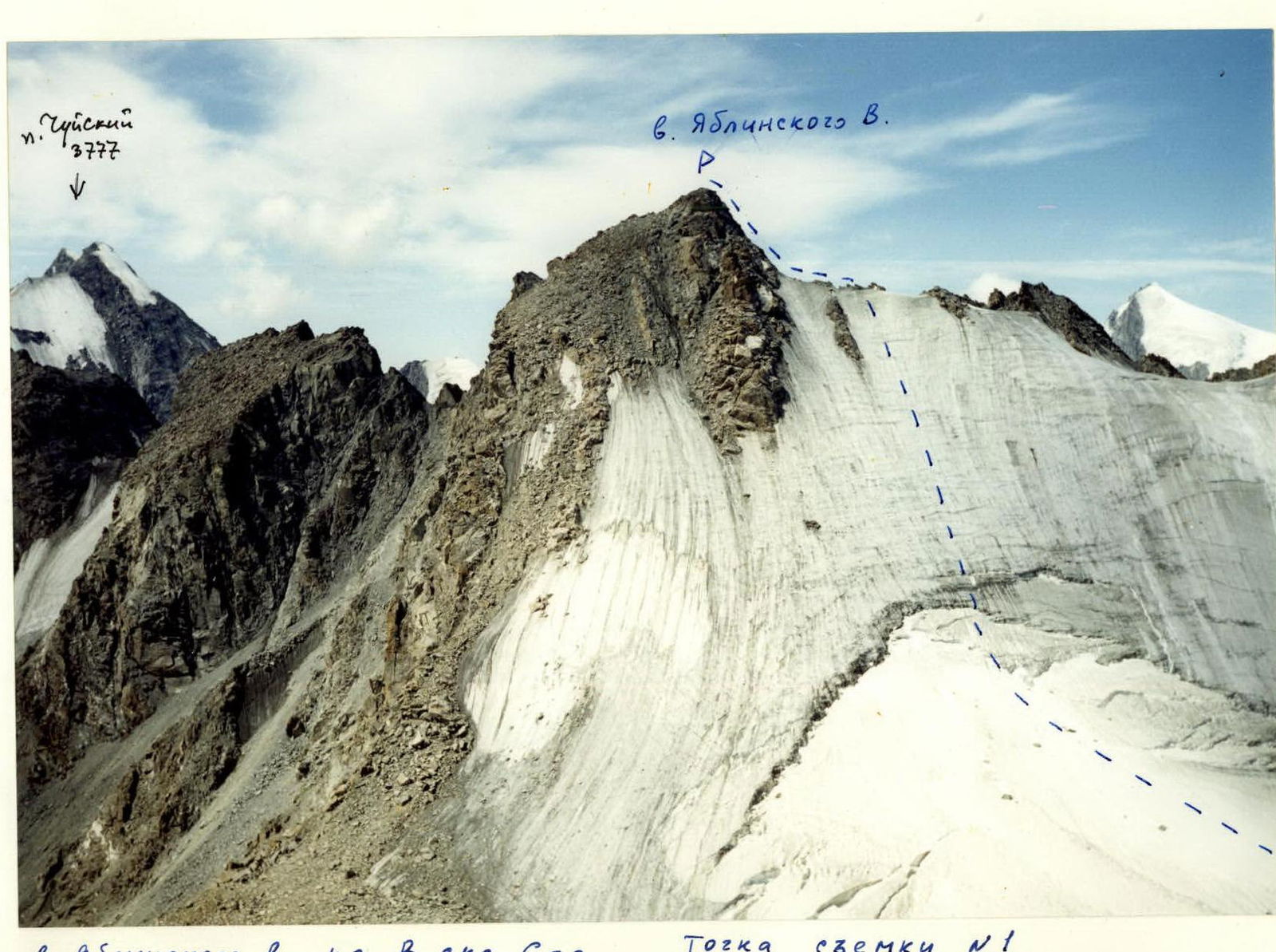
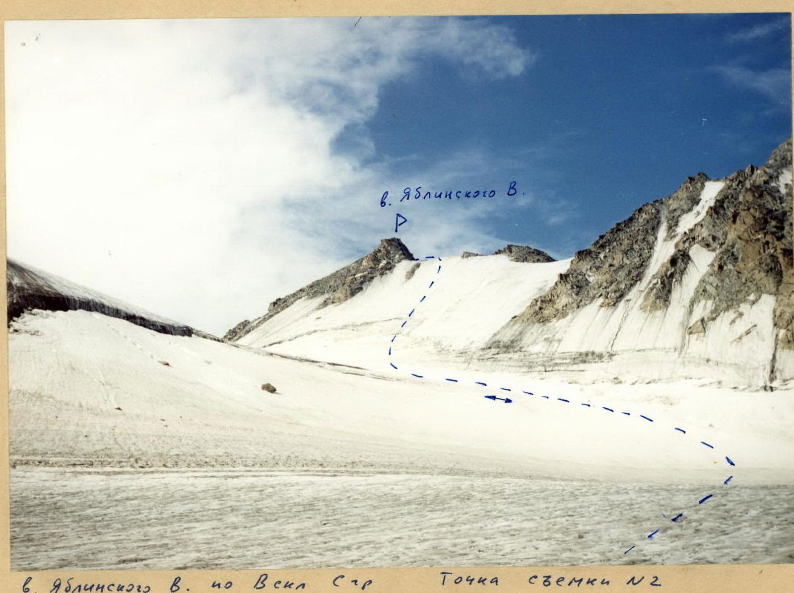
Mt. Yablinsky V.
Mt. Yablinsky V. via E slope of N ridge
Approach Description
From the base camp, located at the confluence of the Turaoyuk river and the Akkol river, move upstream along the Akkol river to the moraine ridge, behind which the river forms a lake. To the left, a stream flows into the Akkol river, descending from the Udachny glacier. Ascend along this stream to the first rise above the Akkol river valley. Organize a bivouac here. Approach time — 3 h.
Route Description
Approach the foot of Mt. Altai Polytechnic via moraine ridges. Via the glacier, flowing between Mt. Altai Polytechnic and the ridge extending from Mt. Luzhetsky B., reach the eastern slope of the northern ridge of Mt. Yablinsky V. The ascent begins on a firn slope, 300 m long, with a slope angle of 25°, which leads to an ice slope. The 240 m ice slope, with a slope angle of 40–50°, is overcome with careful piton protection. Follow a simple ridge to the summit tower, which is reached via a 100-meter gentle slope. Movement is alternating, protection is through rock outcrops and pitons. Ascent time from the glacier to the summit is 3–4 h. Descend via the ascent route.