PASSPORT
- Category of first ascents.
- Altai, South Chuya Ridge, Sofiyskiy Glacier area.
- Pik Chuyskiy 3rd slope.
- Proposed 4B category of difficulty for the first ascent.
- Height 3777 m. Elevation gain 460 m. Length 680 m.
- Pitons: 29 ice screws for belay.
- Climbing hours: 14.
- Overnight stays: not necessary.
- Leader: Andrey V. Drakin, Candidate Master of Sports.
Team members: Sergey I. Barnov, 1st category; Irina N. Okhtimenko, 2nd category.
- Coach: Andrey V. Drakin, 1st category, #68.
- Date of ascent: August 2, 1998.
- Organization: Altai Krai Alpine Federation.
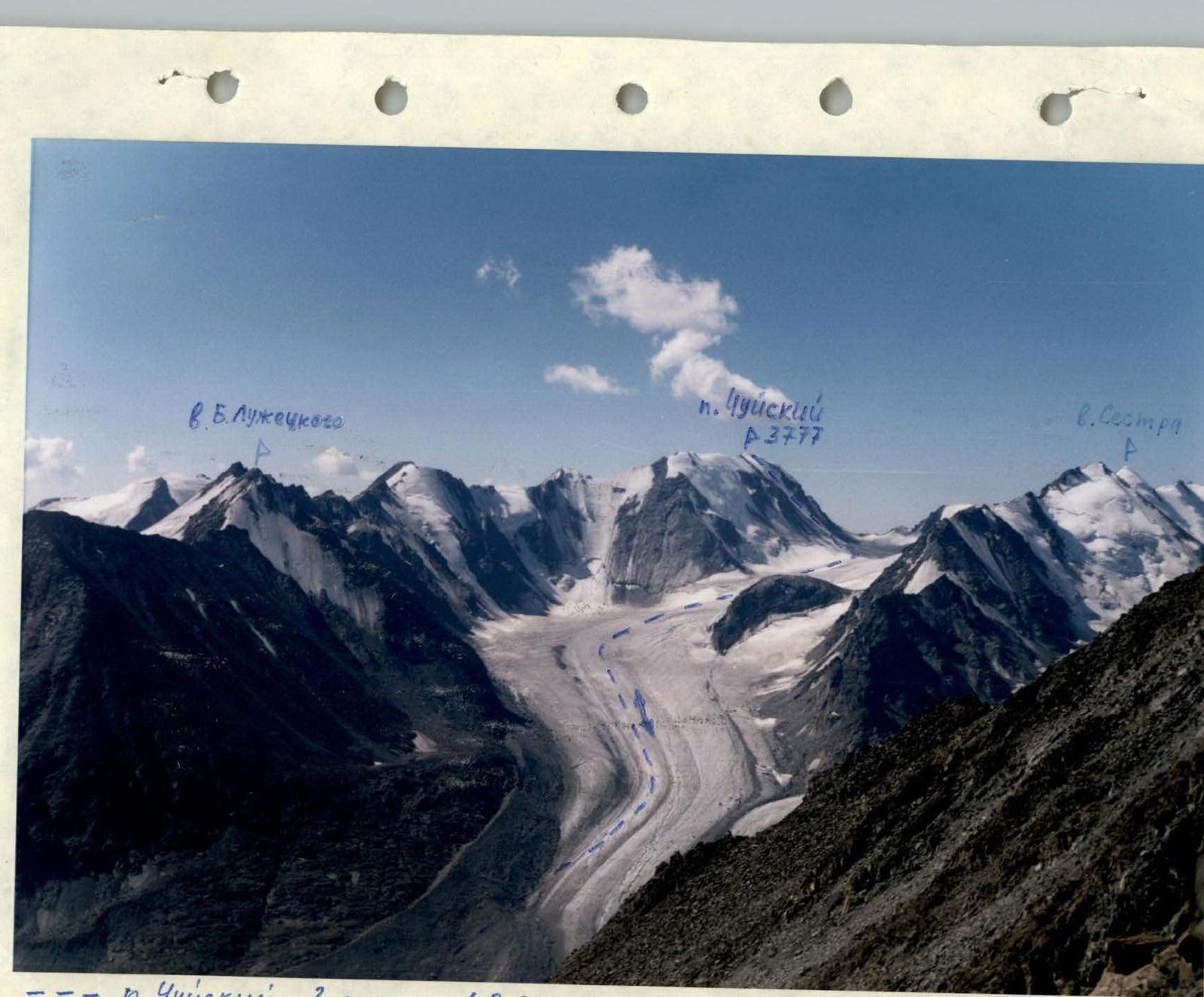
--- Pik Chuyskiy 3rd slope 4B (landmark). Taken from the saddle of v. V. gr. peak Pamyati voskhodyaschey na Everest. Camera "Smena 8m", lens Lomo T-43 4/40.
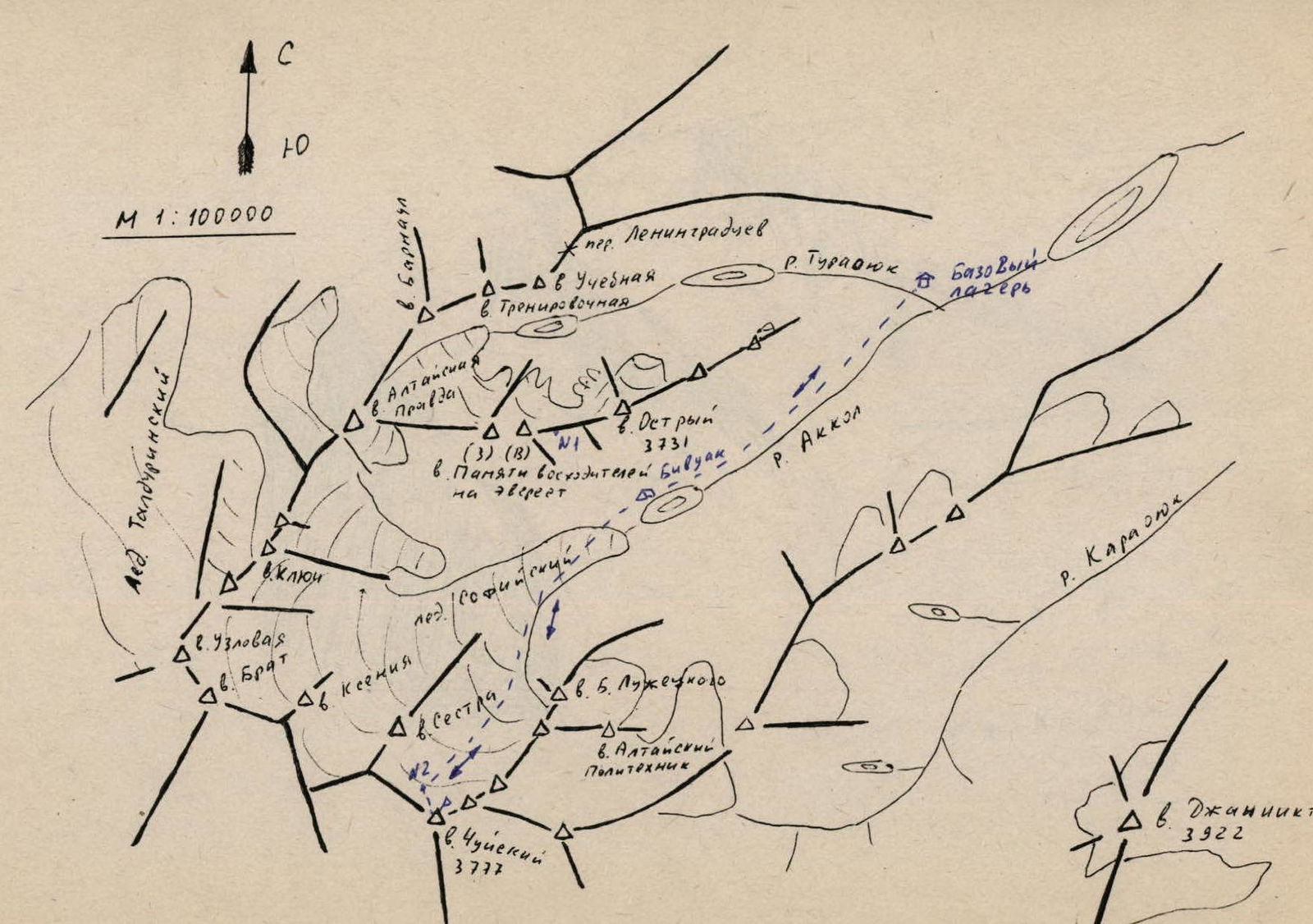
Approach Description
From the base camp, ford the Turasyuk River and move along a faint trail along the Akkol River:
— initially through marshy slopes, — then through scree, — along lakes.
On the shore in the upper part of the lake, there are small ghost lakes. This is a convenient place for a bivouac. Travel time from the base camp is 2–2.5 hours.
Route Description
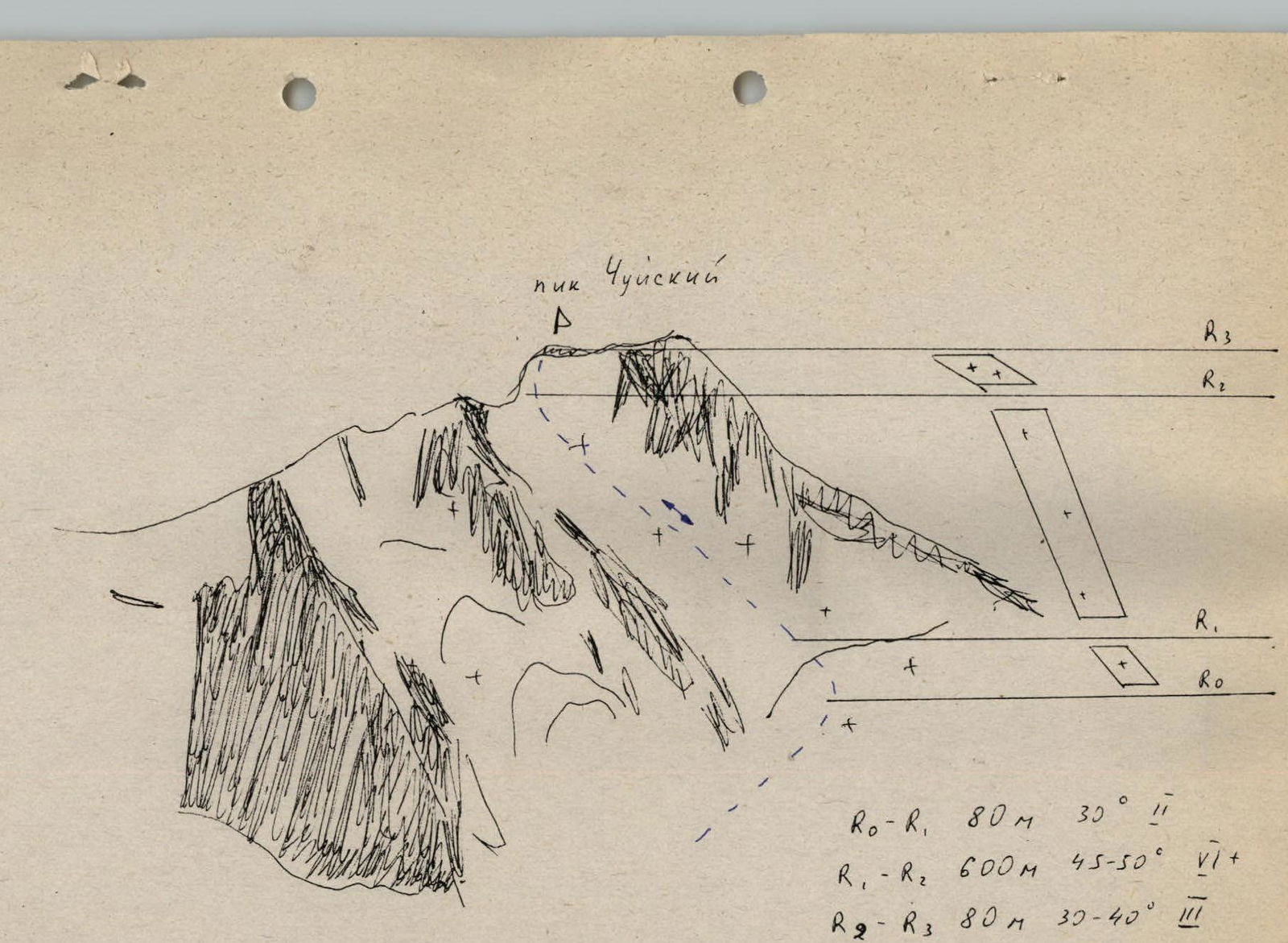
From the bivouac, along the Akkol River, approach the tongue of the Sofiyskiy Glacier and, wearing crampons, move along the glacier to the left along the tributary branch flowing between the spur coming from Pik Chuyskiy and the ridge of peak Sestra. Cross to this branch via the lateral moraines and approach Pik Chuyskiy. The glacier is open, flat, with crevasses in the upper part that are easily bypassed. Along the massif of Pik Chuyskiy, approach the western snowy slope that leads directly to the summit.
The slope is 680 m long, with a steepness of 45–50°. The two upper ropes are more gentle — 35–40°. Move with careful piton belay.
Warning: the route passes in twilight. With the appearance of the sun, rockfall begins.
Descent from the summit via the ascent route. Descend with a self-arresting ice axe or by descending on the front points with piton belay.
- R0–R1: 80 m, 30°, difficulty category 2.
- R1–R2: 600 m, 45–50°, difficulty category 6.
- R2–R3: 80 m, 30–40°, difficulty category 3.