Passport
- Class of ascents: first ascents
- Altai, South Chuya Ridge, area of Sofiysky glacier.
- Uch. 1–4 traverse S ridge with Kol. Leningradtsev.
- (Uch. 4–1 traverse along S ridge.)
- 2B first ascent is proposed (in both directions).
- Height 3400 m. Height difference 400 m. Length 1450 m.
- 2 cams
- 8 hours
- Leader: Barnov Sergey Ivanovich, 1st sports category.
- Participants:
- Dumayskaya Elena Leonidovna, 1st sports category
- Okhtimenko Irina Nikolaevna, 2nd sports category
- Semenov Sergey Alexandrovich, 3rd sports category
- Coach: Drakin Andrey Valentinovich, 1st cat. sl. No. 68.
- Organization: Altai Krai Alpinism Federation.
- Date of ascent: August 6, 1998
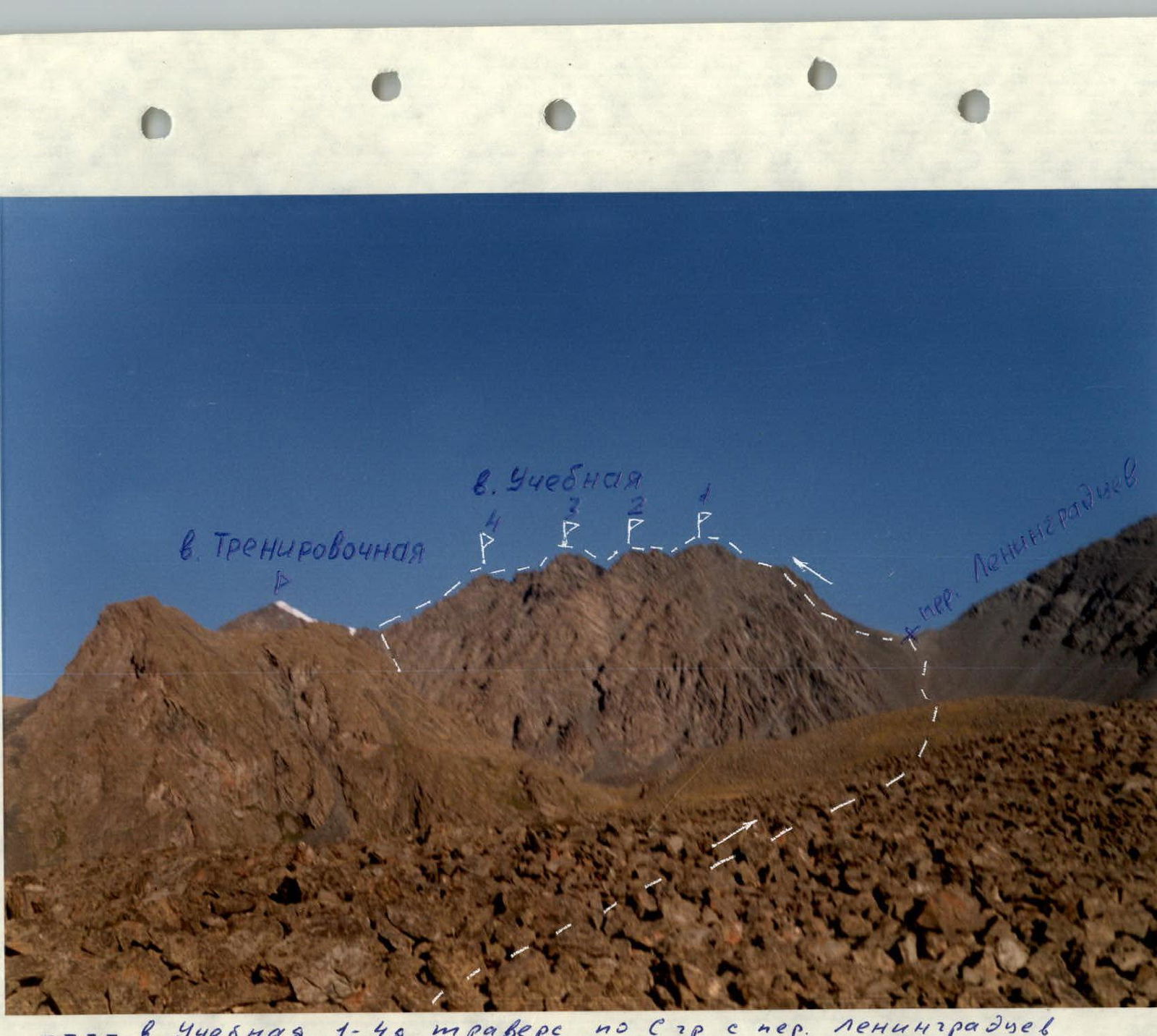
"Uch. 1–4 traverse S ridge with Kol. Leningradtsev. Shooting point No. 1. Camera 'Smena 8m'. Lens LOMO T-43 4/40."
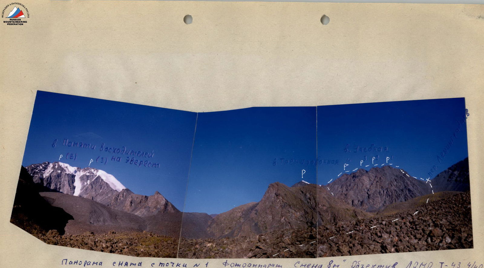
"Panorama shot from point No. 1. Camera 'Smena 8m'. Lens LOMO T-43 4/40. Uch. 1–4 traverse with Kol. Leningradtsev."
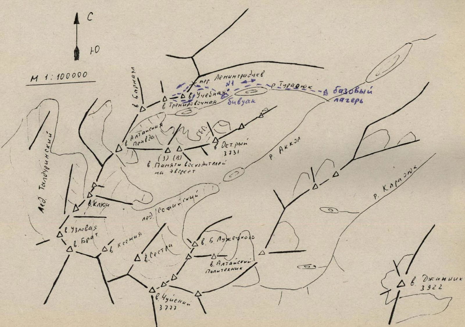
Approach description
From the base camp, located at the confluence of the Turaoyuk river and the Akkol river, move upstream along the Turaoyuk river. The first ascent leads to the marshy bottom of the valley, crossing which, approach the moraine rampart, behind which lies the lower lake. Follow along the marshy shore, pass the lake, and ascend to the next moraine rampart, where a bivouac is set up. Travel time from the base camp is 2–2.5 hours.
Route description
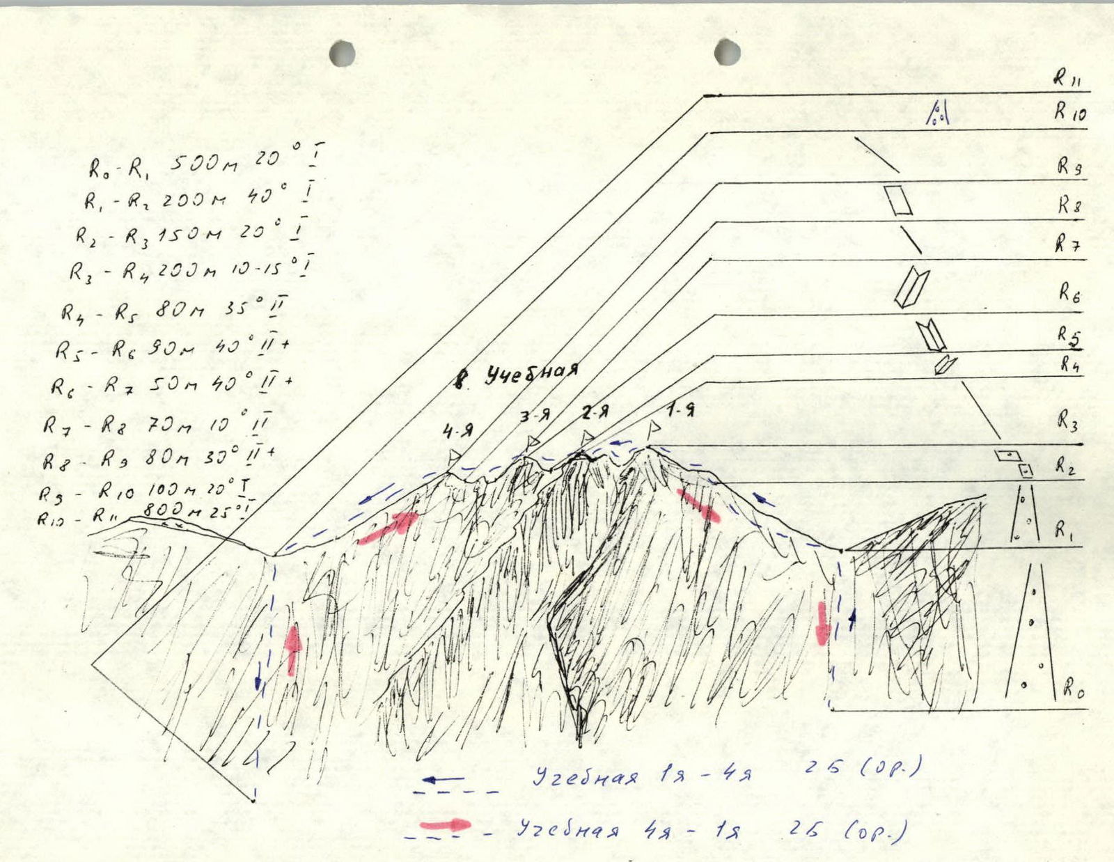
From the bivouac, move along the moraine rampart up to Kol. Leningradtsev. Ascend via a wide scree couloir to the pass. Travel time is 3–4 hours.
From the pass, ascend to the left of the ridge along a 200 m scree couloir simultaneously. Further, 150 m of scree ledges and slabs lead to the first summit. The ridge between the first and second summits is traversed, mainly to the left along ledges, for about 200 m. Descent from the second summit to the saddle is 80 m at 35°, via an inside corner and then along the ridge in turns. Protection is organized through a protrusion.
Ascent to the third summit:
- in turns, 40 m via an inside corner;
- then 50 m along the ridge.
Overall steepness is 40–50°. Protection is through a protrusion or via pitons.
Descent from the third summit:
- 50 m via an inside corner, 40°, in turns;
- protection through a protrusion.
The ridge between the third and fourth summits is traversed in turns with protection through a protrusion.
Ascent to the fourth summit:
- 80 m wall at 30°;
- traversed in turns.
Descent to the saddle between Uch. and Trenirovochnaya summits is straightforward, 100 m, 20°, simultaneously.
Route travel time is 4–5 hours.
Descent proceeds via a couloir between Uch. and Trenirovochnaya summits, 800 m to the second lake, and further down to the bivouac along the moraine ramparts.
Descent time: 2 hours.
Uch. 4–1.
The ascent is made in the opposite direction.