
Passport
- First Ascent
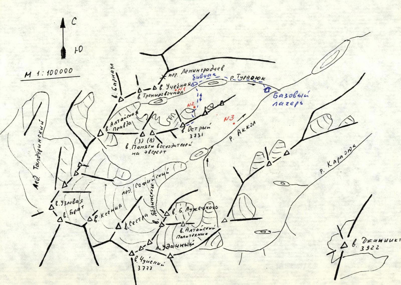
- Altai. South Chuya Ridge, Akkol River valley
- v. Ostyry via NE ridge
- Proposed category 2B
- Height 3731 m, elevation gain 420 m, length 680 m
- Pitons: Ice screws — 8 pcs.
- Total climbing time 12 hours from bivouac to bivouac 7 hours from bergschrund below the ridge to the glacier under S ridge
- Overnight stays: not necessary
- Team of two: Drakin A.V. — Candidate Master of Sports, Barnov S.I. — 1st class
- Coach: Drakin A.V. — 1st cat. sl. No. 68
- Date of ascent: May 3, 2000
- Organization: Altai Krai Alpine Federation
↗
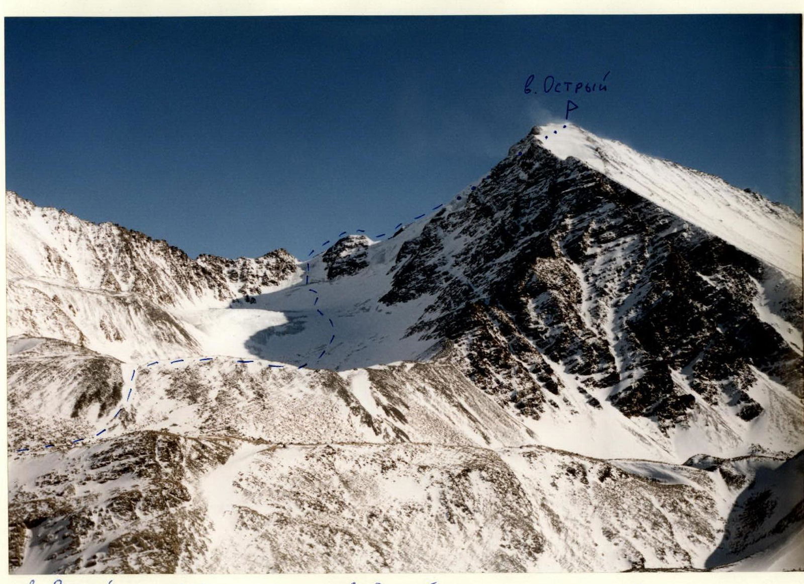
 v. Ostyry via NE ridge. ... visible path. ... not visible path. Shot location No. 1. Camera "Smena 8m". Lens NOMO T-93 4/40.
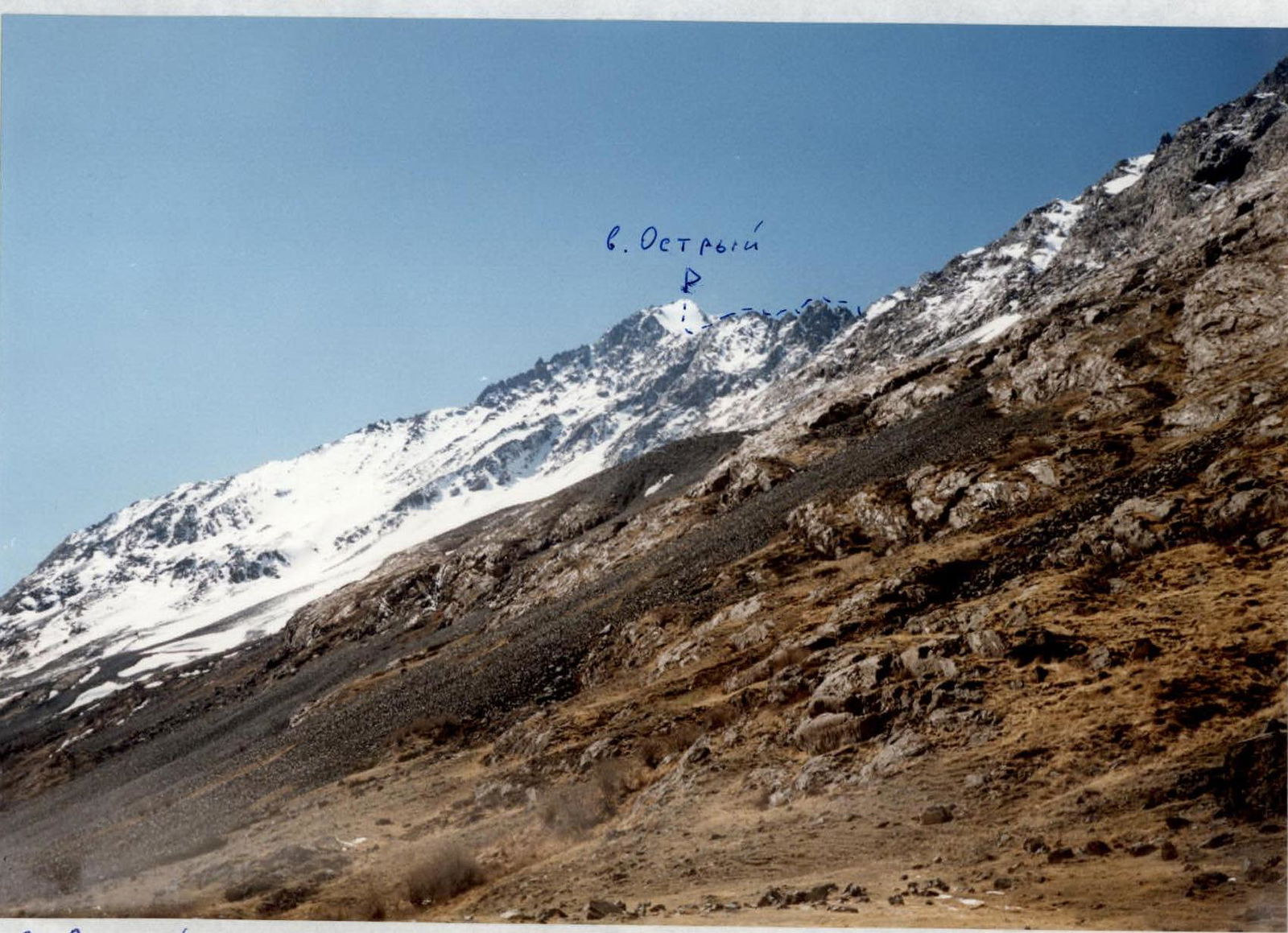
 v. Ostyry via NE ridge. ... visible path. Shot location No. 3. Camera "Smena 8m". Lens LOMO T-43 4/40.

R0–R1 160 m, 45°, 3. R1–R2 200 m, 20°, 2. R2–R3 120 m, 25°, 2. R3–R4 200 m, 35°, 2. Visible path. Not visible path.
v. Ostyry via NE ridge "Approach Description"
From the base camp, located at the confluence of the Turaoyuk River and the Akkol River, move upstream along the Turaoyuk River to the lake. The initial ascent follows a trail, then the movement continues across boggy slopes. A bivouac is set up beyond the lake under a moraine ridge. Approach time: 2–2.5 hours.
"Route Description"
From the bivouac, move up steep talus slopes in the direction of the saddle on the northeast ridge of v. Ostyry. The approach to the ice slope leading to the saddle takes 3 hours.
The ascent to the saddle is over an ice slope. The slope is 160 m long, with a steepness of 40–50°, and is traversed with thorough piton protection. Further movement follows the rocky ridge, sticking to the left side. The rocks are category 2 complexity. Movement is simultaneous and alternating, with protection through outcrops. The rocky ridge leads to a snow-ice slope that leads to the summit. The snow-ice slope is traversed alternately with piton protection. The length is 200 m, with a steepness of 30–40°. The ascent time from the glacier to the summit is 7–8 hours. Descent is via the North ridge, category 1B.
Comments
Sign in to leave a comment