
PASSPORT
- First Ascent
- Altai, South Chuya Ridge
- v. Ostriy via N ridge
- Category 1B difficulty proposed
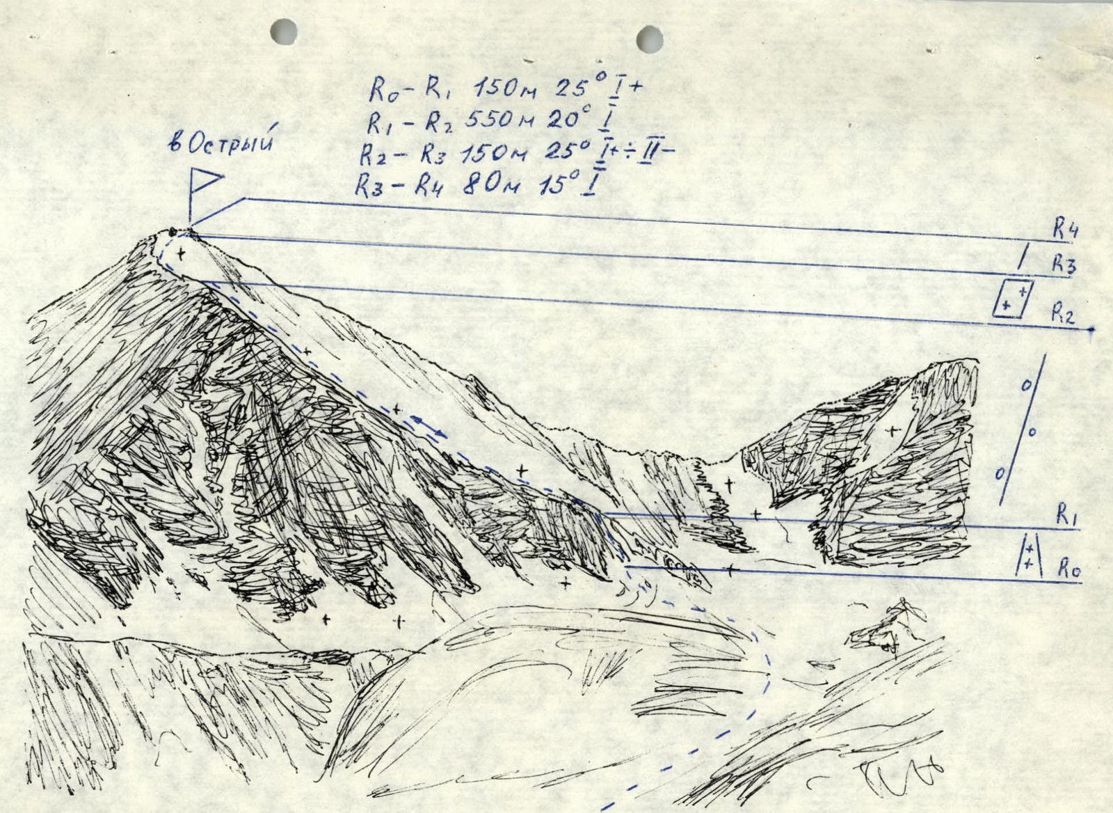
- Height 3751 m, elevation gain 420 m, length 850 m
- Equipment: ice screws — 3 pcs.
- Overnight stays: not required
- Climbing time 10 hours from bivouac to bivouac, 5 hours from glacier to glacier.
- Leader: Barnov S.I. — 1st sports category
Team members:
- Golovina I. — novice
- Zherdeva Yu. — novice
- Mogilev S. — novice
- Popov S. — novice.
-
Coach: Drakin A.V., 1st cat., № 68
-
Climbing date: May 2, 2000
-
Organization: Altai Krai Alpine Federation
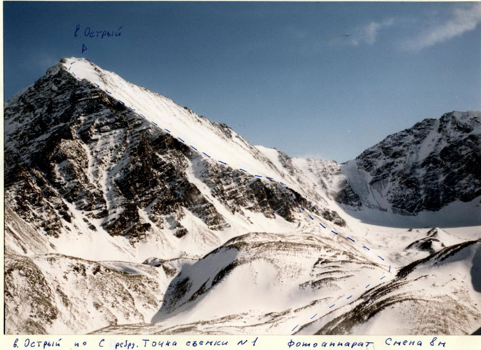
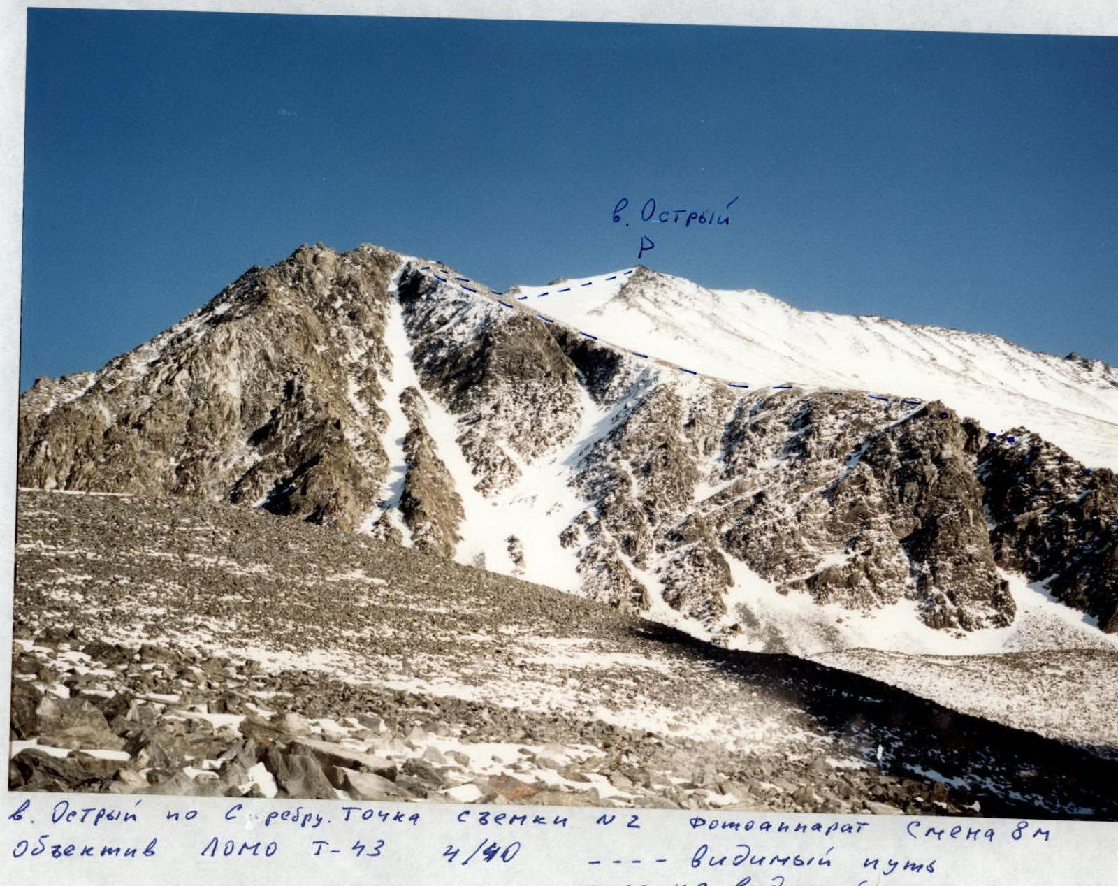

v. Ostriy via N ridge
APPROACH DESCRIPTION
From the base camp, located at the confluence of the Turaoyuk river and the Akkol river, move upstream along the Turaoyuk river and further above the lower lake to the moraine ridge. The slopes after the first ascent are swampy. Organize a bivouac under the moraine ridge above the lake.
ROUTE DESCRIPTION
From the bivouac, move in the direction of the north ridge of v. Ostriy. In the lower part of the ridge, a couloir is visible, leading above the rock falls directly to the ridge crest. The couloir is snow and ice. Further, a simple scree ridge leads towards the summit. This section is long and leads under the ice slopes before the summit. The steepness of the ice is 20–25°, the length is 120–160 m. The section is traversed with piton protection. Further, a simple rocky ridge leads to the summit. A trig point is located at the summit. The name of the summit and its height are indicated on topographic maps.
Descent is via the ascent route.
Comments
Sign in to leave a comment