
Ascent Passport
- Altai, South Chuya Range, classifier section 1.3
- Olga (Eastern — Western), traverse.
- Proposed category: 2A.
- Route type: ice and snow.
- Route elevation gain: 700 m.
Route length: 1970 m. Length of sections with category V: 0, category VI: 0. Average slope: 27°.
- Pitons left on the route
Total: 0, drilled pitons: 0.
- Team's total climbing time: 25 hours, 2 days.
- Team leader: Ivan Yarovoy, Candidate for Master of Sports.
Team members: Viktoria Bobova, honored; Mikhail Bobykyn, honored; Kristina Kolesnikova, honored; Anastasia Likorenko, honored; Dmitriy Nemuschenko, 3rd sports category; Vera Fateeva, honored; Mikhail Yatsenko, 3rd sports category
- Coach: —
- Start of the route from the assault camp
Route started: 8:20 May 7, 2013. Reached Olga (Eastern) summit: 14:30 May 7, 2013. Reached Olga (Western) summit: 19:50 May 7, 2013. Returned to base camp: 16:00 May 8, 2013. Descent from the summit via route 1B.
- Organizing body: Novosibirsk, Federation of Alpinism of Novosibirsk Oblast (FANSO).
- Person responsible for the report: Ivan Yarovoy (email fanso@mail.ru, phone 8 — 913 724 6765)
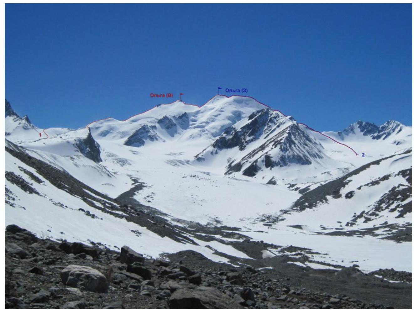
General photo of the summit. Taken from the Talduyra river valley on May 5, 2013.
1 — team's route. 2 — E. Alekseev's route, 1937, category 1B.
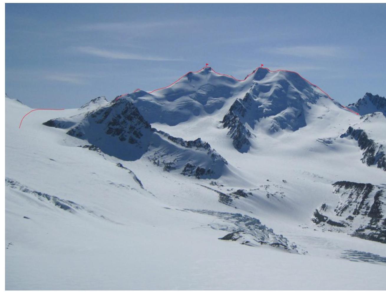
Route profile. Taken from the Nekrasov peak ridge on May 3, 2013.

3936 m
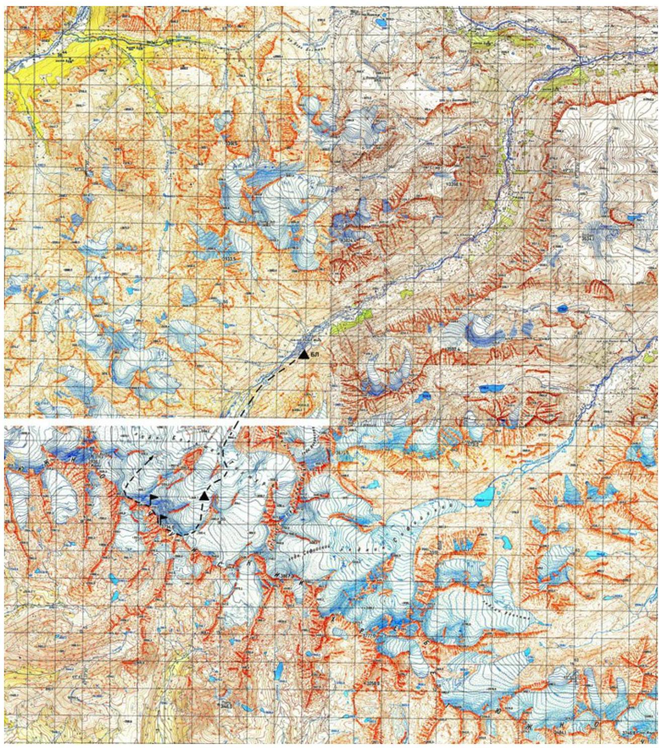
High-clearance transport is required to reach the area. From Kuray village, take the Chuya Highway (M-52) to Chagan-Uzun village or Ortolyk settlement, then take a dirt road through Beltir settlement and further up the Talduyra river valley.
You can drive up to the river headwaters (depending on road conditions and presence of river ice), typically above the Jelou tributary. Travel time from Kuray is about 3 hours.
The hike from here to the base camp location takes 5–6 hours.
Route Description
| Section | Length, m | Angle, degrees | Terrain characteristics | Category | Number of pitons |
|---|---|---|---|---|---|
| R1–R4 | 400 | 30 | Snowy slope. | I | 0 |
| R1–R2 | 250 | 10 | Snowy plateau. | I | 0 |
| R2–R3 | 300 | 35 | Firn slope. | II | 0 |
| R3–R4 | 100 | 15-20 | Descent into a ridge depression. Firn slope. | I | 0 |
| R4–R5 | 300 | 15 to 30 | Firn slope. Upper part has a section of broken rocks. | II | 0 |
| R5–R6 | 100 | 10 | Firn. | I | 0 |
| R6–R7 | 100 | 45 | Firn. | II | 0 |
| R7–R8 | 50 | 40 | Icy slope | II+ | 1 |
| R8–R9 | 170 | 20 | Firn | I | 0 |
| R9–R10 | 200 | 40-45 | Firn | II+ | 0 |
.
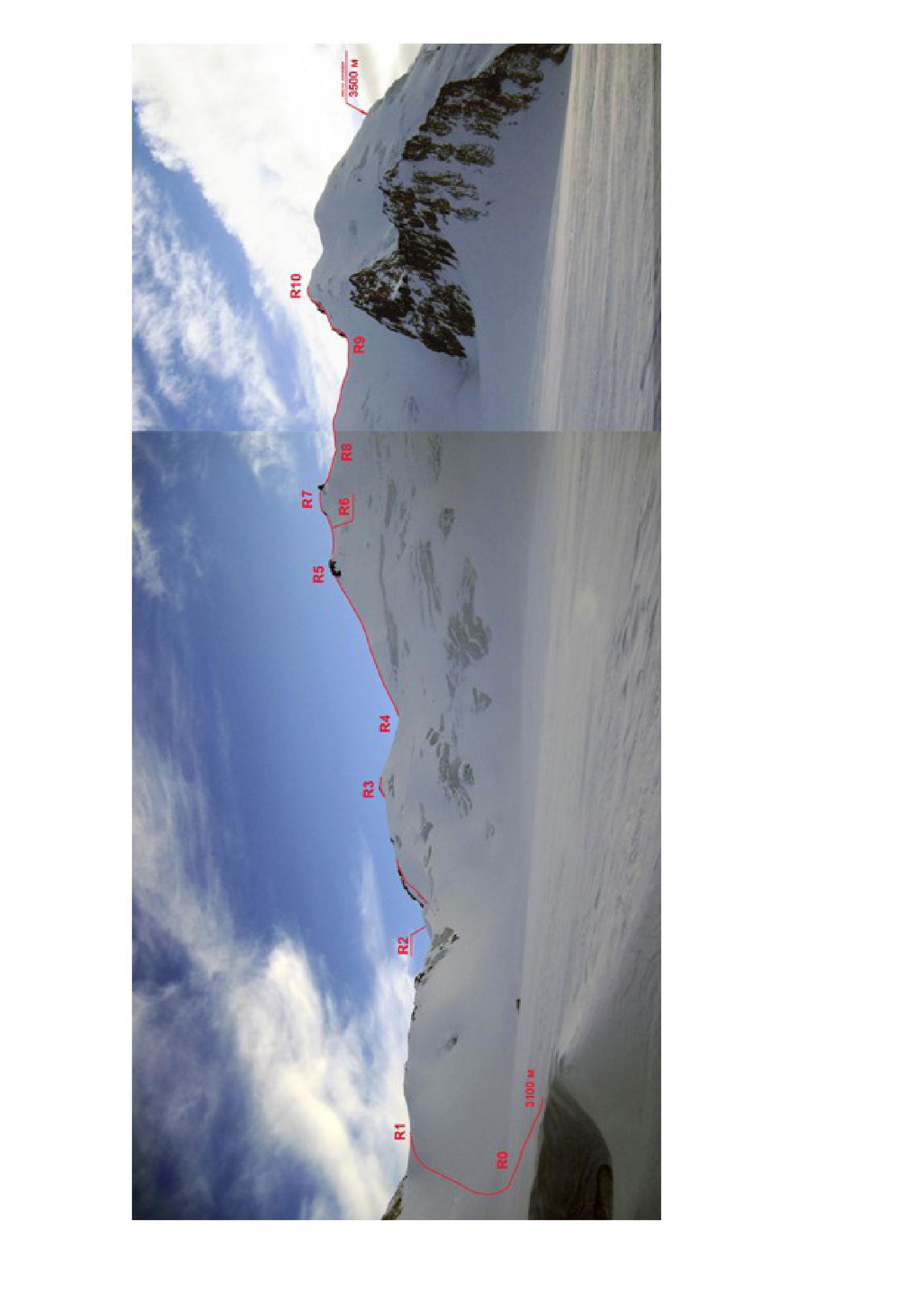
From the base camp, move along the left (in the direction of travel) side of the Talduyra valley. A large rocky island in the middle of the glacier is bypassed on the left. On a gentle section of the glacier between the rocky island and the Sibstrin pass, there is a good place to set up camp (although you can also camp on the wide plateau of the pass itself). The journey from the base camp takes about 6 hours.
From the assault camp on the pass, move in rope teams across the closed glacier. After reaching the pass plateau, move to the right towards the wide ridge leading to Olga (Eastern) summit. Before starting the ascent, put on crampons at the edge of the plateau.
Section R2–R3 is:
- a firn slope,
- in the middle part — a flattening and a huge depression,
- in the upper part — an exit to the right and upwards onto a narrower snowy ridge.
Then — a gentle descent into a ridge depression, also representing a wide depression.
Section R4–R5: a firn slope with variable steepness, with a short section of broken rocks in the upper part.
Further movement:
- along a gentle, and then increasingly steep firn slope
- until reaching Olga (Eastern) summit. The summit drops off towards the saddle with a rocky ledge.
Descent from the summit begins by bypassing the rocks on the left. Below the rocks — a steep icy slope. During the descent, in the middle of the section, we placed an ice screw. Further — a wide, gentle firn slope leading to the saddle between the summits.
Section R9–R10: ascent to Olga (Western) summit. Steep firn slope. During the ascent, in the lower part of this section, the first climber placed a rope on a belay, attached to rocky outcrops. Further movement was simultaneous. Descent from the summit to the west via route 1B. We stopped for the night on the ridge in a wide depression with a frozen lake (elevation 3500 m). The next day, we continued our descent through the Turist pass onto the Talduyrinsky glacier.
A few words regarding the route classification. Currently, the classifier lists only one route to Olga summit — E. Alekseev's route from the west, 1937, category 1B. It is not specified whether the western or eastern summit is intended.
Regarding the summit height, earlier classifier editions listed:
- initially 4000 m,
- then 3800 m.
The 2011 classifier edition lists a height of 3734 m, corresponding to the mark on the map for Olga (Eastern) summit.
We were unable to find a description of this route, but climbers who have been in this area, with whom we were able to communicate, tend to believe that Alekseev's route from the west leads to Olga (Western) summit.
Moreover, after completing the traverse, I would say that the route from the west to Olga (E) (i.e., essentially the traverse) will be more challenging than category 1B.
Thus, we propose:
- To amend the classifier for route 10 in section 1.3: instead of "Olga" summit, write "Olga (3)", and in the "Height" column, replace 3734 with 3723;
- To classify our route to Olga (E) as category 1B.
- To classify our traverse Olga (E — 3) as category 2A.
PHOTO ILLUSTRATIONS
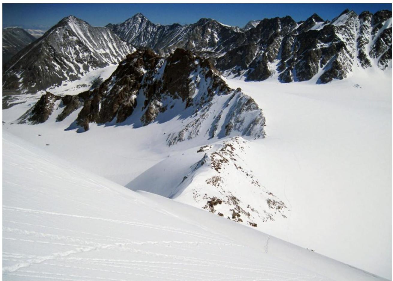
Photo 1. View of Sibstrin pass from the upper part of section
R2–R3.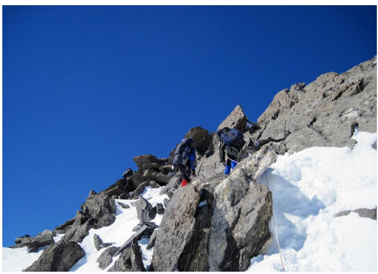
Photo 2. Upper part of section
R4–R5.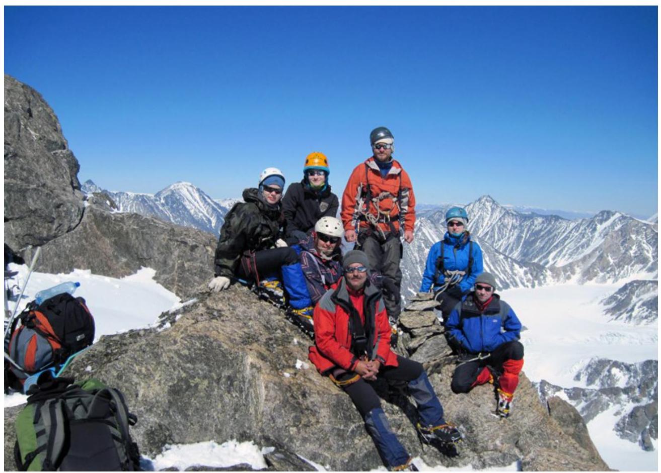
Photo 3. On Olga (Eastern) summit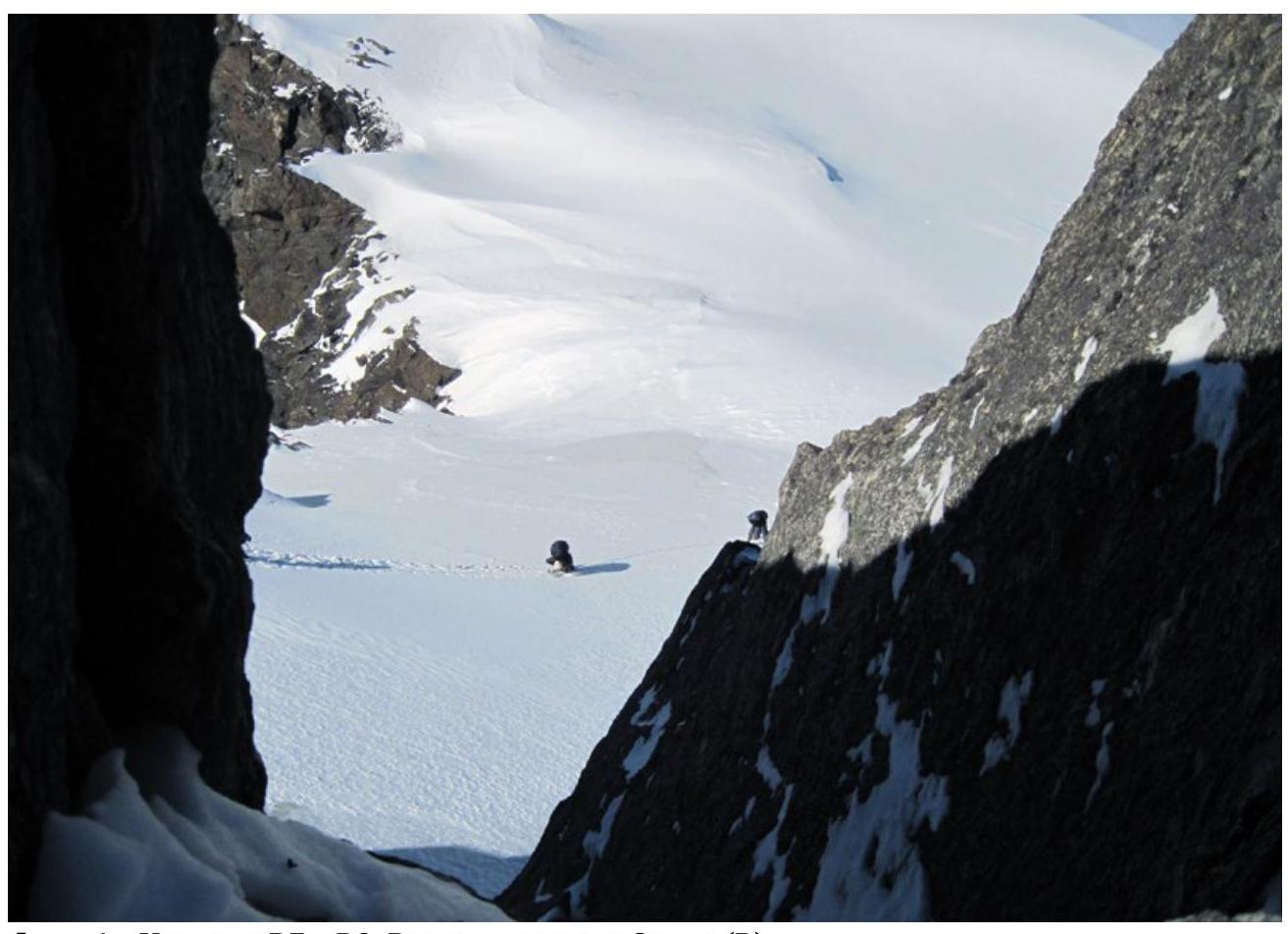
Photo 4. Section R7–R8. View from Olga (E) summit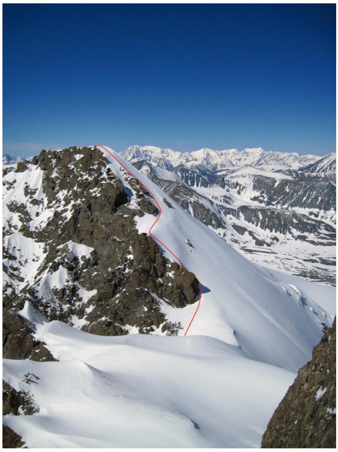
Photo 5. View of section R9–R10 from Olga (E) summit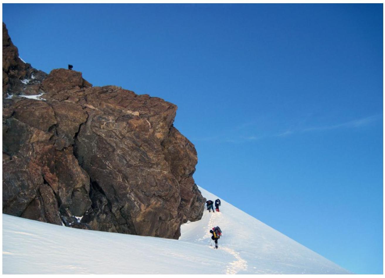
Photo 6. Beginning of section
R9–R10.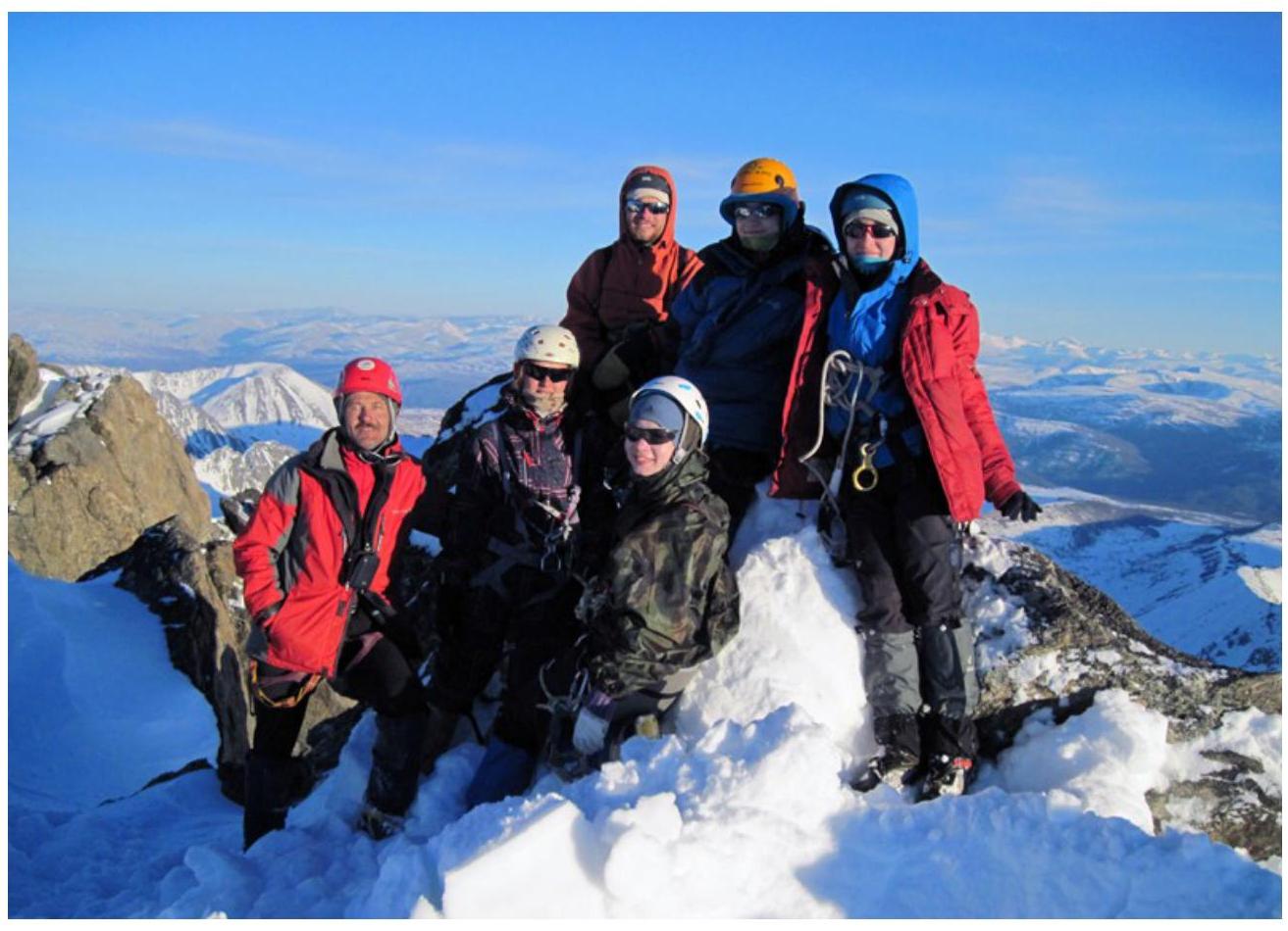
Photo 7. On Olga (3) summit.
Comments
Sign in to leave a comment